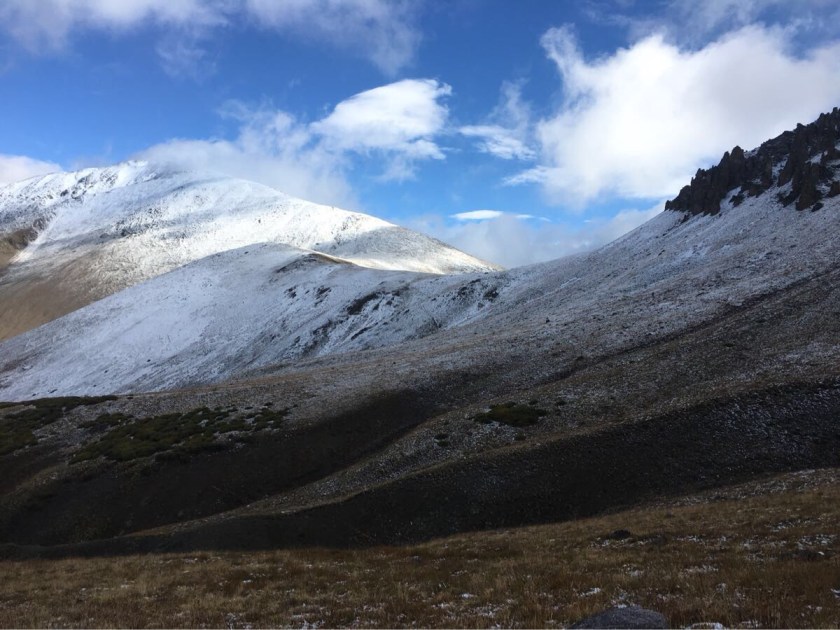
This last section was relatively short – only 55 miles or so but lots of big climbs. I got a ride back to the trail from a retired postal worker named Tom and started hiking in a light drizzle, which pretty much set the tone for this section – lots of rain/hail and snow. And cows. This was definitely the cow-iest section…
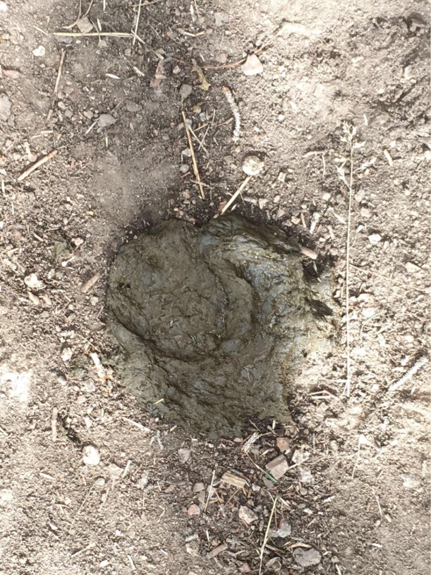
Yeah…. I’m watching you…Just Impy and the cows…. and the trail heading off into the distance.Hmmmm…. I’m guessing cow. And why exactly to I have to bury MY poop?
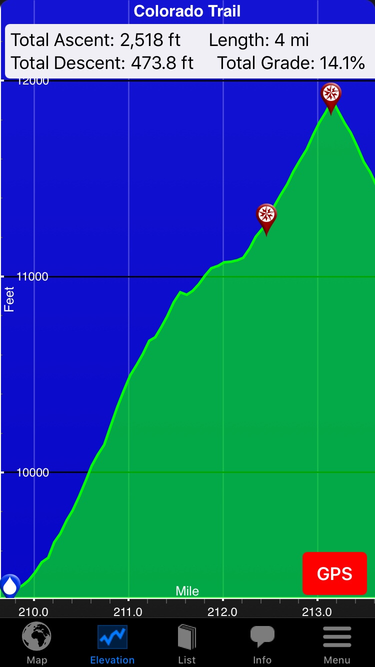
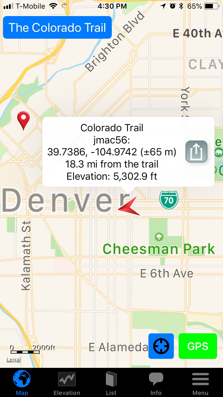
With 128 miles to go, I have climbed 66,500 feet of Colorado Rockies. I have completed 21 of 28 segments (segments are how the Colorado Trail is organised). My shortest (not a town) day was in this section, 12.5 miles but over 4,000′ of climbing which completely wiped me out. Turns out stopping early (2:00 PM) was smart because the rain/hail started about 30 minutes after I got my tent up.
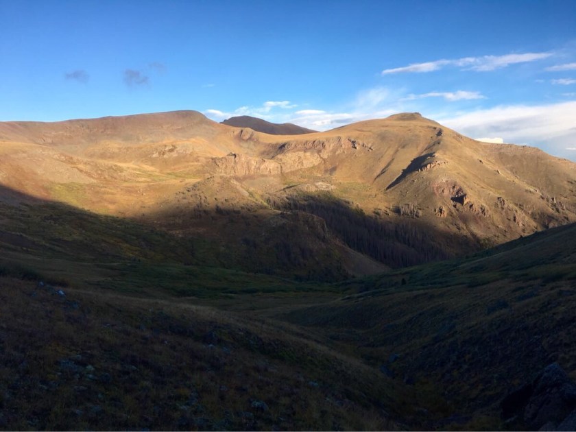
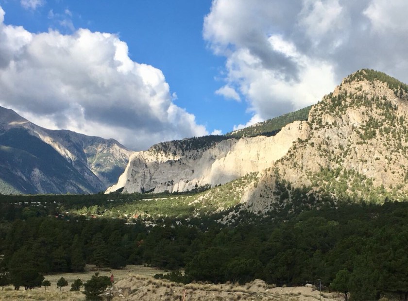
This was also the most scenic section so far, when the sun was out!
And my first brush (literally) with snow (thank God my wool socks still insulate when soaking wet!).
A cold, wet Impy going over San Luis Pass.San Luis Pass (Mt San Luis behind). Not a good day for Impy to summit San Luis!Snow on the trail. Cold, wet snow.
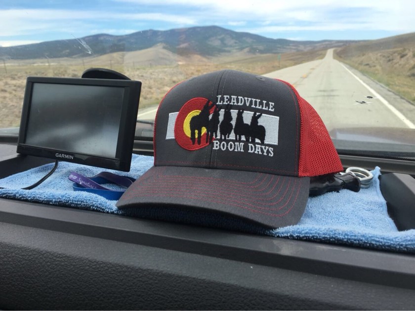
But I am currently cozy in Lake City planning the next section, to Silverton, another relatively short section (~ 55 miles).
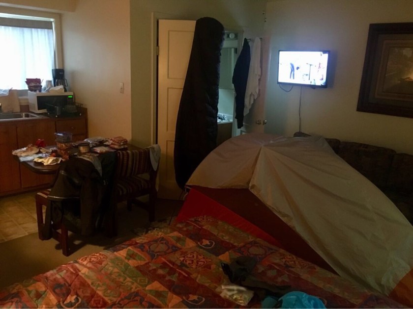
Hiker hotel room…. everything out for cleaning/drying. Hotels LOVE hikers!
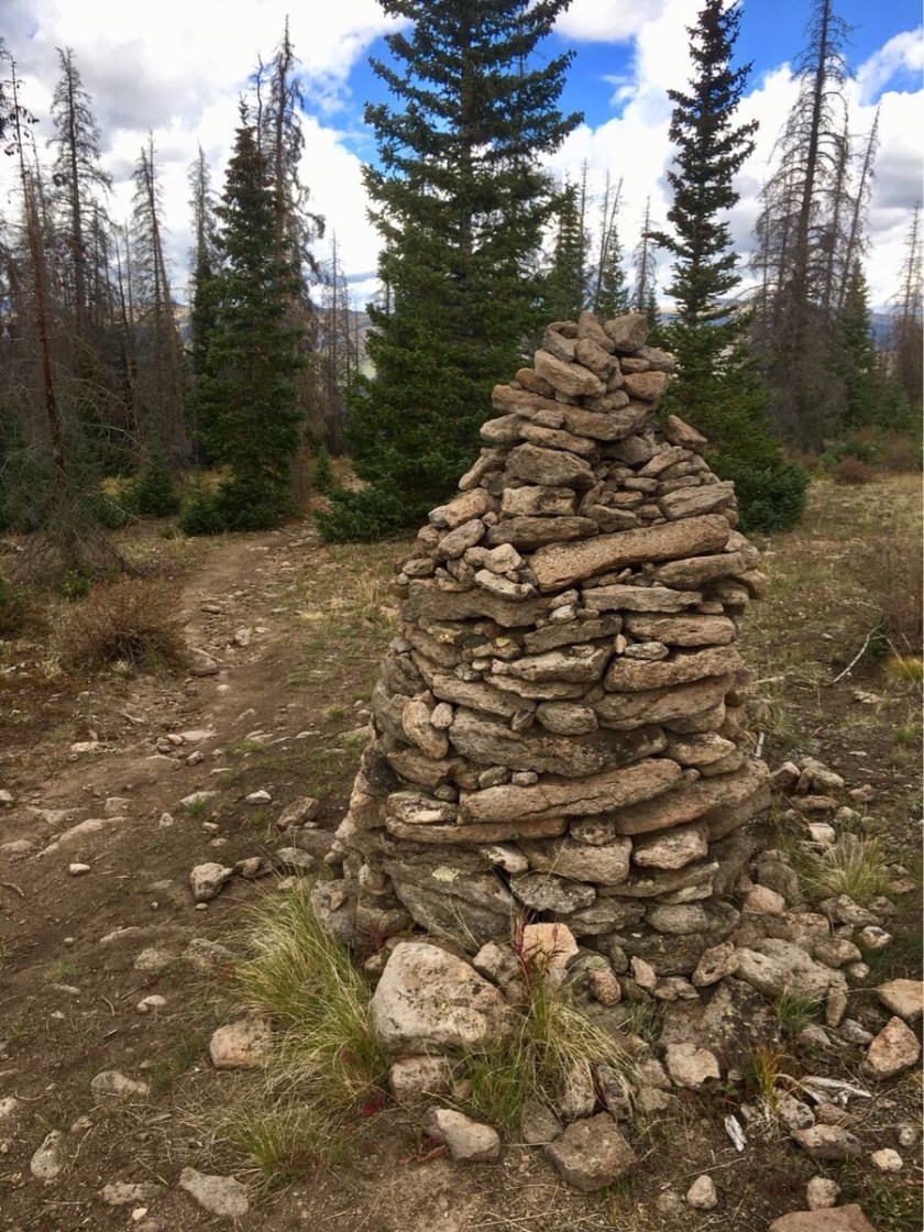
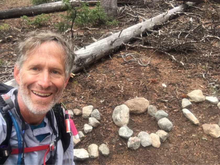
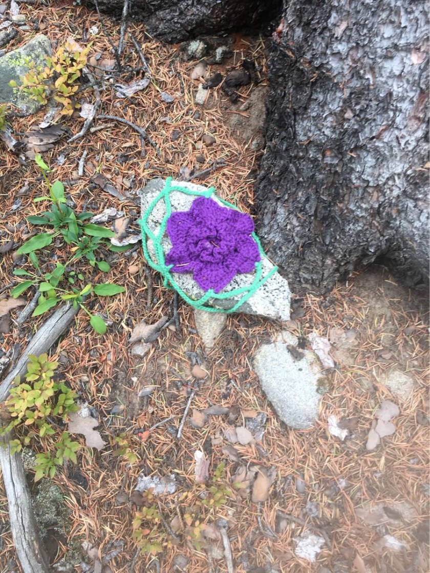
And the biggest cairn I’ve ever seen!
Not sure what the point of a 7’ cairn is but….impressive!
The hitch into Gunnison (where I am now, CT 302) was tough. After about an hour I got picked up by Dave, 68, from Wisconsin. He was headed to Gunnison for a blind date and spent the entire trip (38 miles) talking about his passion, pack burro racing. The official summer sport of Colorado. Seriously. YouTube has some videos – it’s a real sport.
Dave’s dashboard…. Pack Burro Racing!!Impy trying to hitch to Gunnison…. tough!
This was my second hitch (I got a short hitch out of Mount Princeton Hot Springs on a road with NO shoulder) and both guys were from Wisconsin. Weird.
This section was tough, steep climbs and outstanding views. And, after 300 miles, some of my equipment is starting to show some wear. I’ve lost one hiking pole tip, have one broken tent pole and my Crocs have almost no tread anymore.
Stunning views…
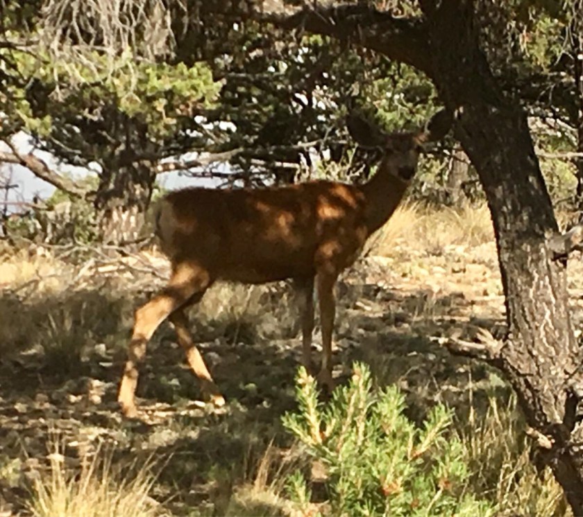
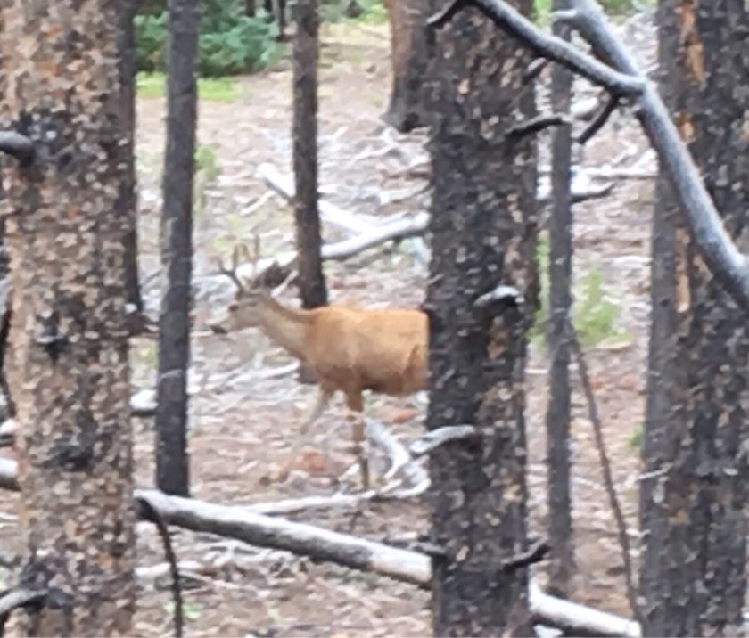
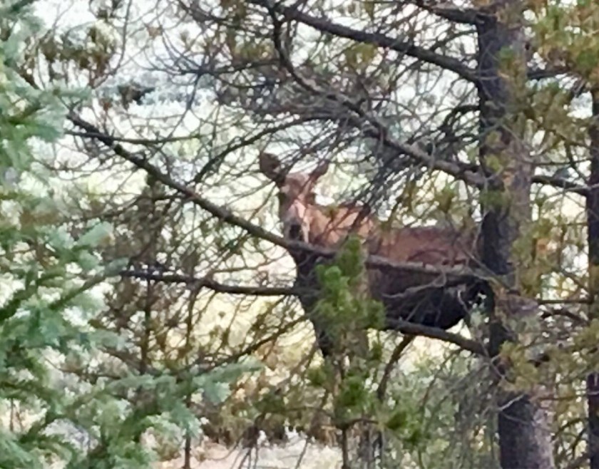
And saw the usual wildlife. Still no bears…
Probably the most common animal on the trail…. cows.
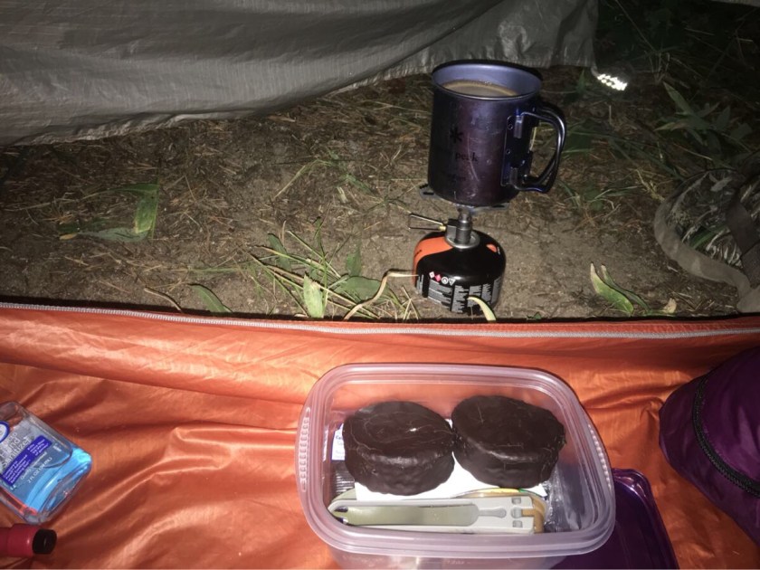
And here’s a window into a typical morning…. breakfast in bed (well, sleeping bag), coffee and ding dongs!
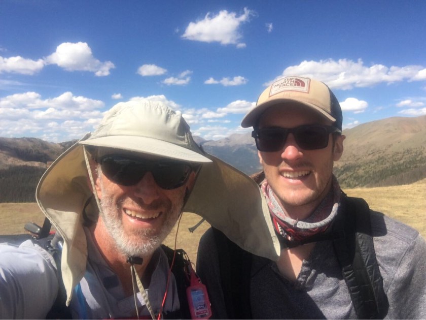
And I met more hikers, Garrett, a northbound CT hiker, Blue Suit, my first CDT (Continental Divide Trail) hiker and Siesta, another southbound CT hiker.
Impy and Garrett at the pass where the Collegiate East and West trails rejoin.
My next trail town is Lake City after a relatively short section (~60 miles) which is also supposed to be a tough hitch. Of course.
I have hiked 302 miles, finished 17 of 26 segments, and climbed more than 56,000 feet. Hiking in Crocs has gotten me a lot of stares but has eliminated my blisters. And hiker hunger has kicked in. I finished off a large pizza last night. By myself.
Got a ride from Connie (one of the California ladies I met in Twin Lakes) back to the trail (skipping a road walk). There followed two very tough (4,000′ ascent) days. The picture below shows a fairly typical climb on the CT.
Typical gift from the CT.
The second day out I ran into Bobby, another southbound thru-hiker. We camped together one night but Bobby is doing 19-20 miles a day and hikes just a bit faster than me so he is probably another 10 miles more up the trail now.
Impy and Bobby
I am typing this at Mount Princeton Hot Springs Resort (CT 230), where I stopped for a night to pick up a few needed supplies at the little store and a hot shower and a warm bed. Most hikers bypass this place because they do not have laundry service and it is pricey. Speaking of laundry…
Doing laundry, thru-hiker style.
I attempted Mt Yale on day 3 of this section, another 14er you can reach from the CT but it did not work out. I camped at the saddle and started up in the morning but, while it was clear, the wind was blowing very hard and the trail was more of a climb than a hike so, after about 1/4 of the way up I turned back. This was also my first experience with a Class 2 14er (Mt Elbert was a Class 1) and it was noticeably harder.
The saddle where I camped the night before attempting Mt Yale (just behind).
Big surprise on my second section (from CT 104 to CT 177). Emerson showed up! He drove up from Houston, climbed Mt Massive (a 14er) and met me (around CT 164) and we hiked for a day. It was a very nice surprise.
Emerson! At about mile CT 164. Just hanging out waiting for me.
Emerson and I hiked to where the North Mt Elbert trail intersects the CT and camped for the night. The next morning Emerson took his stuff and some of my heavy stuff and headed back to his car at the Mt Massive trailhead while I headed up Mt Elbert. Mt Elbert is the highest mountain in Colorado at 14,425′ (60′ lower than Mt Whitney). I went up the North Trail and down the South Trail and then into Twin Lakes for a much needed zero. Unfortunately the mountain was socked in so not much in the way of views.
The North and South Mt Elbert Trials (red) from the CT (blue).Mt Elbert as seen from Leadville
This section was about 75 miles and took me 5 days. It started with a hike out of Frisco, up the Peaks Trail back to the CT. Just after joining the trail I ran into a solo hiker, Mary Poppins, who I saw several times during the morning as we both climbed up 10 Mile Ridge in driving rain. A big climb, over 3,000′. Mary is trying to do the CT in 16 days, with 30-35 miles per day. She made it from Denver to Breckenridge in 4 days. It took me 7. Crazy! Coming down from the ridge I bumped into Mary again just outside of Copper Mountain Resort and we both decided the climb merited a burger for a late lunch. And a beer.
Impy and Mary Poppins
And she gave me my new trial name, Impy. Which is short for impatient which, I guess, is sorta appropriate. I guess. Anyway I am now Impy.
And saw more animals on this section….but no bears!
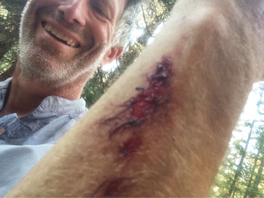
And met more hikers – my first north bound thru-hiker, a couple of guys (both named John) in their 70’s doing the CT in 3-4 day segments, and a hiker that surprised me into falling and cutting my arm.
Blood! That officially makes this an adventure!
Twin Lakes is my second zero and it was nice having Emerson here (plus damn handy since he took me to Leadville and the Safeway!). Twin Lakes is protected by “Woody” who ensures that everyone obeys the 30 mph speed limit.
“Woody” protects Twin Lakes
And the icing on the cake? We arrived on Martini Night (i.e. Wednesday) and Twin Lakes has a real bar!
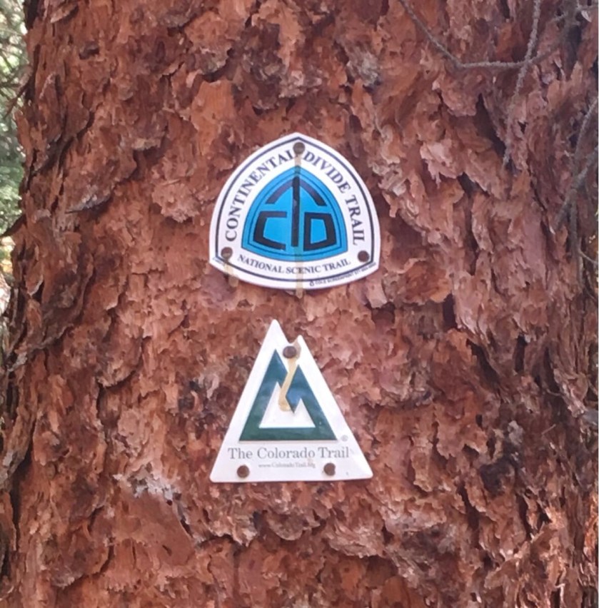
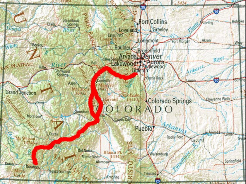
The Colorado and Continental Divide Trails are coincident for 300 odd miles
104 miles and 7 days later I have arrived in Frisco/Breckenridge. This completes what the Colorado Trail Organization calls Segments 1-6 (out of 28).
The trail comes out onto the road between the two and there is a free shuttle bus that runs every 30 minutes. I picked Frisco for my zero day because it is more compact and I have never been here before. It is a very nice little tourist town (with a great pizza place!).
I hiked and camped solo all week. Met just a few hikers. One, Greg from Tulsa, was headed north when I ran into him. We stopped and talked. When I asked him about his hike he said he had started just a few miles back and was headed to Breckenridge. Silence. He looked around and said “I’m going the wrong way, aren’t I?” Yep. I turned him around and we had a nice visit for a mile or so.
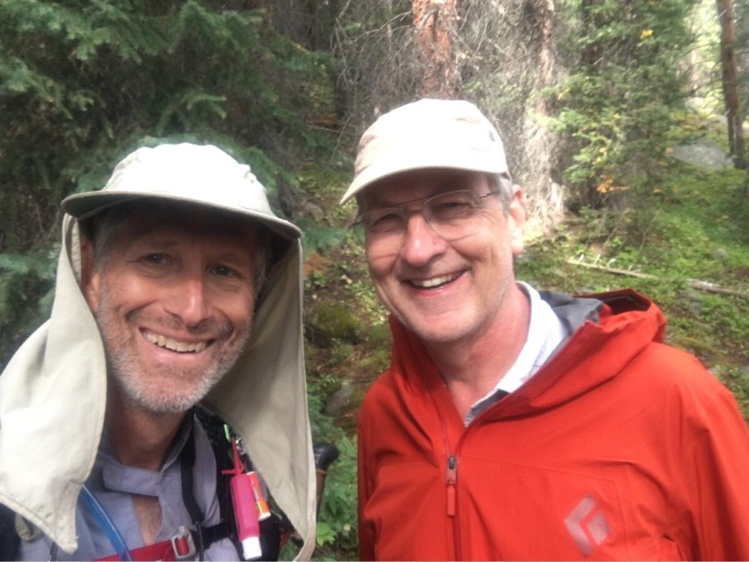
Me and Steve!
But my favorite was Steve, from Albuquerque. Bumped into Steve about 3 miles from Frisco and we visited all the way in. Steve retired at 47 and he and his wife sailed around the world for seven years. He has done 29 14ers and is planning on doing several more. A real nice, interesting young (61!) guy.
Now for some statistics! I averaged just over 16 miles a day (not including the last half day). I climbed up around 18,000 feet (though it felt like a lot more). I started at 6,000 feet and topped out just under 12,000 feet. Most of the time was over 10,000 feet.
Bighorn Sheep inWaterton Canyon
I saw two moose, some Bighorn Sheep, a river otter, and about 1000 ground squirrels. No bears.
Bears!!!!
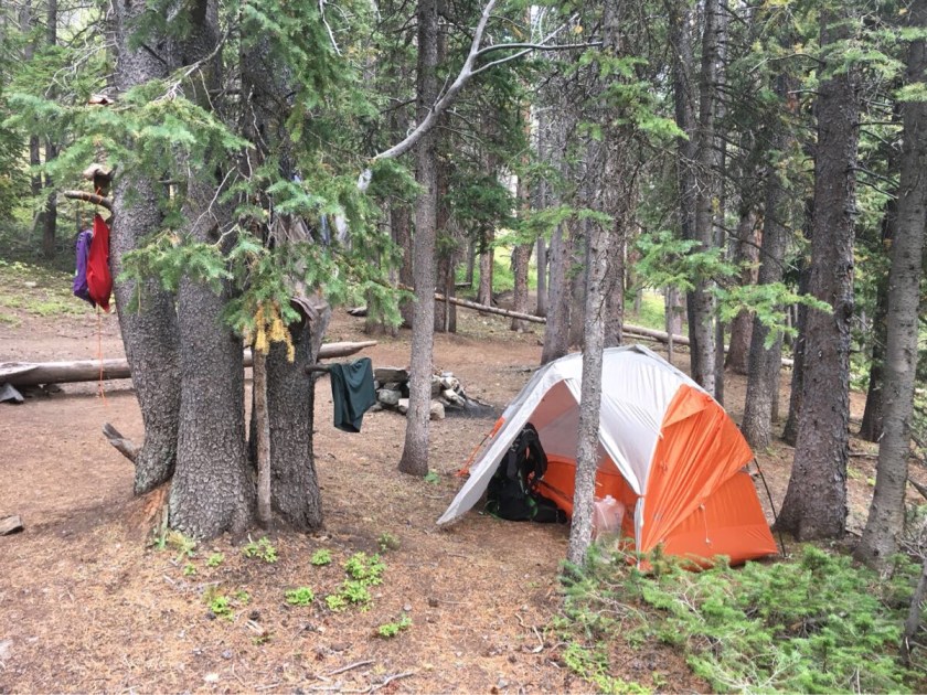
I camped by myself all six nights and only had one dry camp. Most of the time I was next to a pretty little mountain stream or creek.
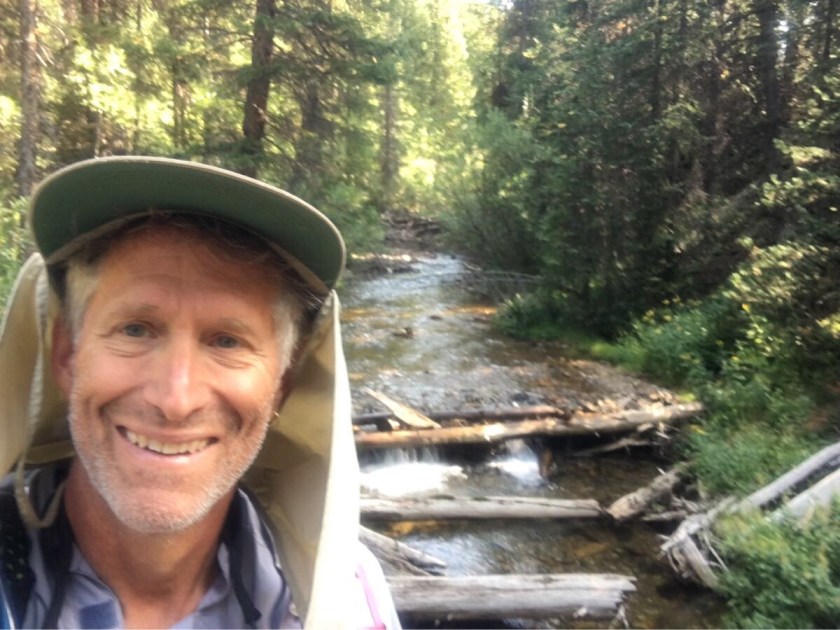
Typical camp on the CTTypical mountain stream and some random hiker.
And, of course, I have had my usual foot problems. I gave up on my trail runners on the second day and have been hiking in my Crocs. I tossed my trail runners at Kenosha Pass and am planning on doing the the rest of the trail in the Crocs. I get some funny looks but you have to do what works.
A gift from my trail runners.
I head out tomorrow (with a big climb of course!) after a rest day. Next stop is Twin Lakes in five days.
Arrived in Denver this afternoon (Aug 8) after a two day drive from Houston. Went for a walk with Roberta and got a little short of breath which is NOT a good sign. Oh well. I have one more full day before I start on the trail.
Pack Weight
My final pack weight is 28.3 lbs for everything but water. I plan on starting with 2L (4.4 lbs), so 32.7 lb starting weight. About 2 lbs heavier than I wanted but 7 days of food makes it tough.
Food
Speaking of food – here is my first weeks budget:
Dinner:
6 freeze dried meals
6 tortillas
Breakfast
12 Pop Tarts
Coffee
Lunch
7 tortillas
4 salmon foils
3 Peanut butter cups
6 Laughing Cows
1 box Cheese nips
Snacks:
14 Kind Bars
Which will give me about 2100 calories/day which is only 1000 calories or so less than I will be burning but…. food is HEAVY.
Cell Coverage
Did a little research on T-Mobile coverage on the trail and it looks pretty good for the first half but gets pretty sketchy after that.
Getting read for my little jaunt in the Colorado mountains…..
The Colorado Trial is a ~485 mile long trail that starts just southwest of Denver and moves mostly along the continental divide to end north of Durango. Going southbound (the way I plan to attempt it) the trail starts at about 6,000 feet and climbs to 10,000 feet over the first few days (40-60 miles). After that it pretty much stays between 10,000 and 13,000 feet for the next 400 miles.
I plan to do the trail in seven “legs”, the longest being the first, 104 miles from Denver to Breckenridge, taking a rest or zero day in all of my resupply towns (except Twin lakes). I may opt to drop one of the zero days since 5 for this distance is a lot.
This works out to 34 hiking days, averaging a little over 14 miles a day, but with a lot of 16-17 mile days. This is an easier schedule than I had on the PCT but it is a lot higher and there are lots of very steep days. Total elevation gain is 89,000 feet which means my average daily climb will be just over 2,600 feet. Okay, I’m starting to scare myself. It’s just walking after all.
Start
Miles
Start Day
# Days
Town
0.0
104.1
10-Aug
7
Frisco
104.1
71.6
18-Aug
5
Twin Lakes
175.7
40.7
24-Aug
3
Buena Vista
216.4
86.4
28-Aug
5
Gunnison
302.8
55.0
3-Sep
4
Lake City
357.8
53.3
8-Sep
4
Silverton
411.1
73.9
13-Sep
5
Durango
My base pack weight is about 16.5 lbs which is heavier than I would like but I am a little worried about the weather turning cold in September in the mountains so I have a little more warm stuff. My starting pack weight will be 16.5 (base) + 10.0 (food) + 4.4 (2L water) + 0.5 (fuel) = 31.4 lbs. The good news is after the first leg I will never need more than 5 days food so my weight leaving all the other resupply points should be under 30 lbs.
I plan to post from each of my resupply points (assuming I have cell coverage). Wish me luck!
Guanacos! We saw these guys nearly every day we were not in the mountains. They look a lot like llamas and are a favorite food source for the top predator in these parts, the puma.
Guanocos
On our last hiking day we got lucky and saw two pumas. We were in the van on the way back to the Eco Camp and saw some cars parked and guys with spotting scopes. They were about 100 m away, guarding a guanaco kill. It was definitely one of the highlights of the trip (thanks Roberto!)
Puma (with a point and shoot camera from 100 m or so)
We saw lots of birds, probably the coolest were the condors (which we saw several times) and the red-headed woodpecker.
Blurry Condor shot.
And we saw a fox (actually saw a couple of foxes) near the trailhead on our last hike in El Chalten.
After four days in El Chalten, Argentina we headed south back to El Calafate for one night before proceeding on a van trip further south and west, crossing the border into Chile and on to the Parque Nacional Torres del Paine.
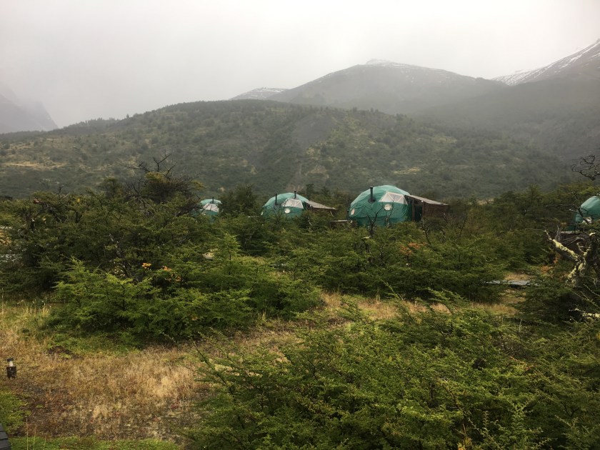
The Eco Camp and our home for our first night in Torres del Paine
The weather was decidedly worse here in Chile, a lot more rain and colder. But we saw more wildlife and some stunning views.
Map showing the areas in Patagonia we visited
3/12 (Mon)
We did three hikes starting with the iconic Valle Ascencio hike which was probably the hardest. Unfortunately Roberta was not feeling well so did not join us. And Mark and Debra slept it and also missed the hike! We left about 8:00 and were back at the Eco Camp by 5:00.
3/13 (Tue)
Took a van to a boat ride across Lago Pehoe to Refugio Paine Grande (a very impressive “hut”) where we dropped our dry bags and started on the Valle Frances hike. Roberta is feeling better and Mark and Debra managed to wake up in time so we have all our group today.
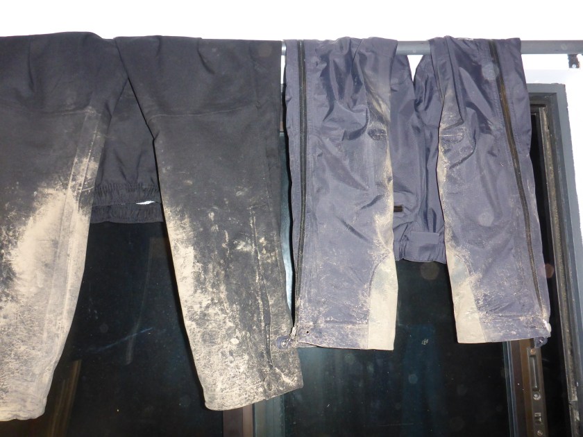
Back to the hut by about 4:30 – this is where we are spending the night, 6 to a room in three bunk beds. Another rainy day and our rain gear is starting look pretty nasty.
Rain pants hanging up to dry. Nasty!
3/14 (Wed)
Last day of hiking! A short one to Glacier Grey and, again, rainy and cold but she very impressive views.
Overlooking Lago Grey and Glacier Grey
We ended the day with a boat ride across Lago Grey to a van that took us back to the Eco Camp and our last night in the park.
After a brief hike (about 5 miles round trip) to a spot with a view of the town we began three days of hiking in Los Glaciares National Park, returning each night to our hotel in El Chatlen.
Had to modify my boots – the high tops were bugging me. Thank god for duct tape!
New lo-rise boots!
Wed (3/7)
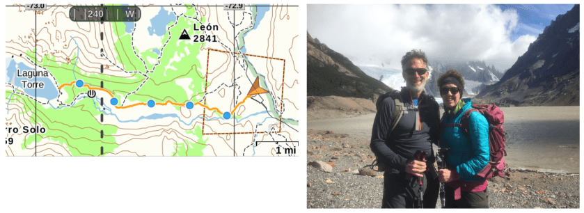
Up for our first big hike to Laguna Torre – ~11 miles round trip (out and back) but pretty flat – 1200 foot of climbing. It was a beautiful day, sunny and not too windy (which is saying something!). Left about 9:00 and back to the hotel by 4:30. Laguna Torre is a glacier terminus lake.
Laguna Torre
Thu (3/8)
Up earlier – catching a van to take us to the trail head then we hike back. Earlier start – on the van at 8:00 and hiking by 8:30. Long hard day. Two of our group did not to the climb to Laguna de Los Tres. The climb was brutal – well over 1000 feet in less than a mile. 14.5 miles total and well over 3,000 feet. The weather was not great. We ended up putting on all of our rain gear in a shelter just before the climb to the Los Tres. It was rainy and cloudy pretty much all day. Snowing at the top – which was pretty cool.
Fri (3/9)
Another early start (8:00). Cold (31 degrees!) but looks to be clearing when we start. Fortunately it cleared and we had sunny and clear weather almost all day but it was very windy at the top. Kept us from doing the final climb to Pliegue Tombado which knocked off about 800 of climbing. Still a long day. At the lookout before the final climb it was blowing 30 mph and cold. So Jose and Rodrigo (our guides) decided we would not go.
3,000 foot day (1200 to 4200 feet) even without the final climb and 15 miles round trip. Left at 8:00 and back by 3:30. Very short lunch at the viewpoint because of the wind
Approaching the top of our hike. Fitz Roy in the background.
We had stunning views of the Fitz Roy massive throughout the day (the first time we have been able to see it).