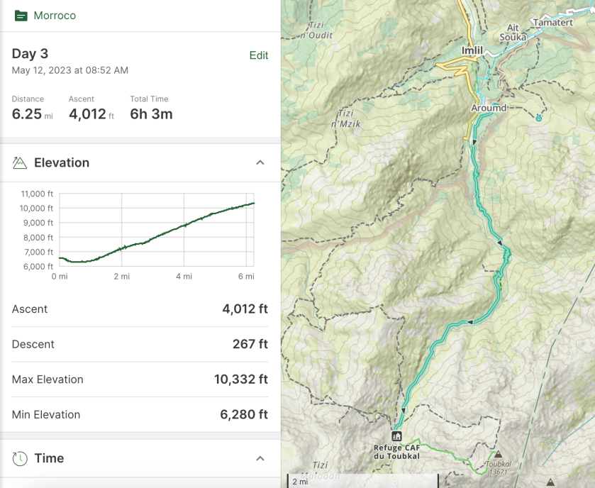
Refuge (10,330’) to Jbel Toubkal (13,665′) to Imlil (6,000′)
Up very early, 3:30 for breakfast at 4:00 and on the trail by 4:30. We start in the dark so everyone has headlamps on.
Steep, cold, slippery and dark.
The trail quickly comes to a snow traverse that is slippery and very steep. Wishing we had crampons! This short traverse was the scariest part of the day for me.
A quick stop in the dark.
After the traverse we began a steep rock scramble that seemed to go on forever. The trail is crowded and we pass several large, slow moving groups.
Sun is starting to come up. Lot of folks ahead of us on the trail.
The trail leveled out a bit as headed up towards the saddle.
Heading toward the saddle.
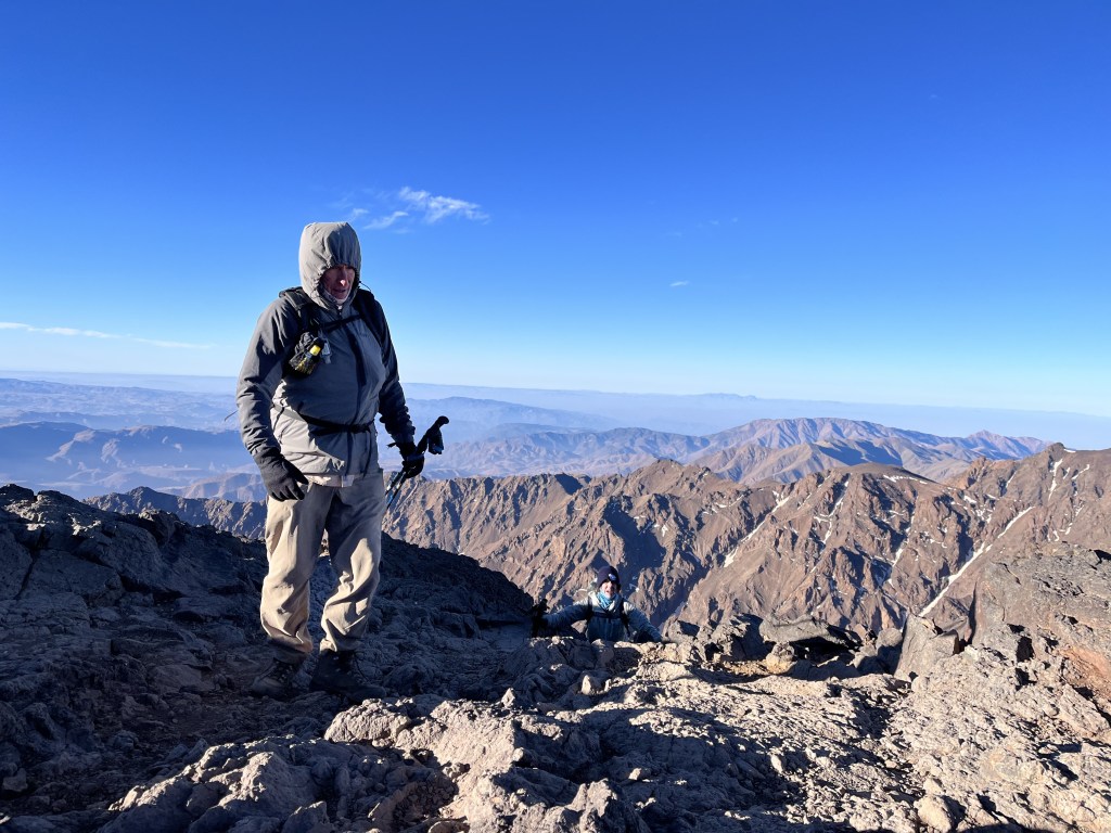
We reached the saddle around 7:15. Only 300′ to go but it is very rough.
At the saddle!
We never stopped for very long because, with the wind, it is very cold.
Nearly there!
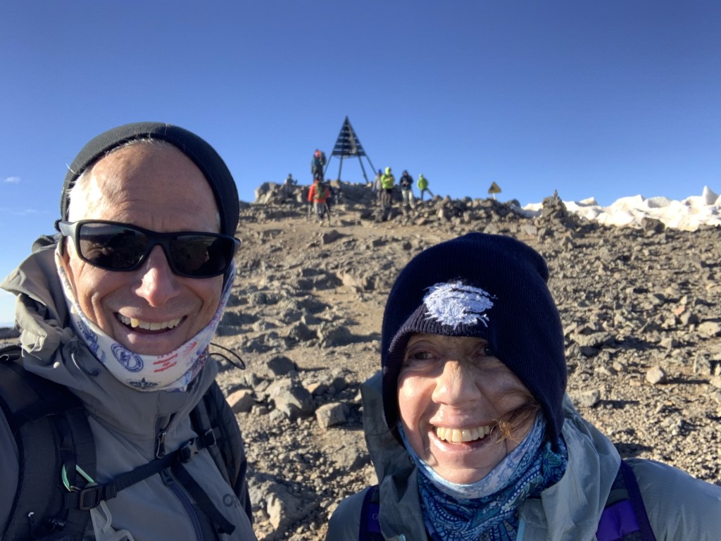
And finally, around 8:15 we reached the top.
At the top!
We don’t hang around long at the top because of the cold but the views are stunning.
Summit viewSummit panorama. At the top!
Then we began the long, 7,500′ hike back to Imlil, stopping for an hour at the refuge to pack up our sleeping bags and have a quick lunch.
Heading down.
We got to our hostel in Imlil at 4:30 PM, a 12 hour day.
May 12, Arumd (6,600’) to Refuge du Toubkal (10,330’)
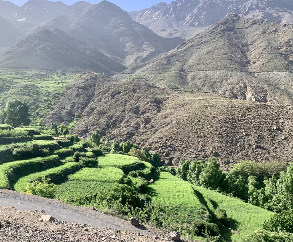
Big day as we climb to the refuge for the climb tomorrow to the summit. This is a 4,000′ day. We started at 9:00 with a couple hundred foot drop to the valley floor just south of Imlil then we started up.
Heading up! Toubkal is not visible but it is in those big mountains at the head of the valley.
The trail today is pretty good, rocky but not too steep. We very quickly re-entered the national park.
Back in the park.
We have a view of the big mountains pretty much all day.
Our guide Ibrahim.
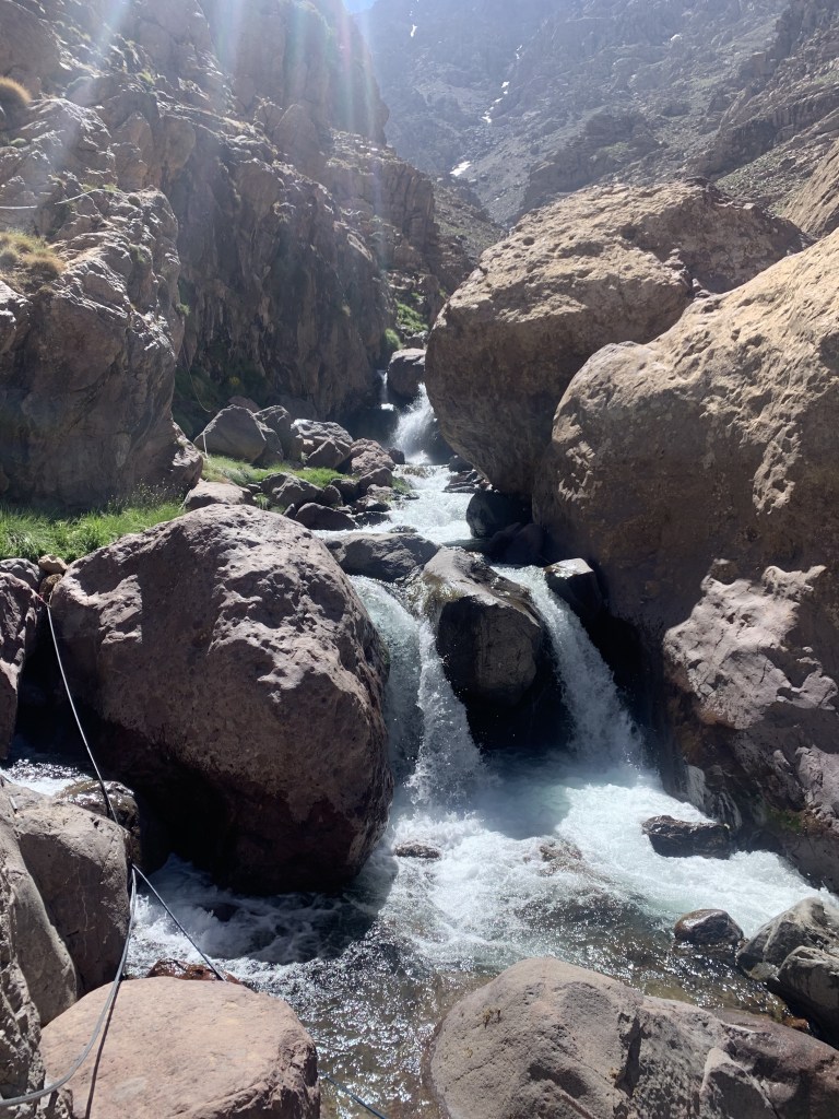
We stopped a couple of times along the way, once at a pretty stream crossing.
The only trail obstacles were the mules. We’ve learned that the mules always have right of way!
Our fellow mammal hikers. Rest stop
At our lunch stop, as we were leaving, Ibrahim realized that one of the hikers coming down had accidently grabbed his pack! He had to race down to catch him. How could somebody not know their own pack?
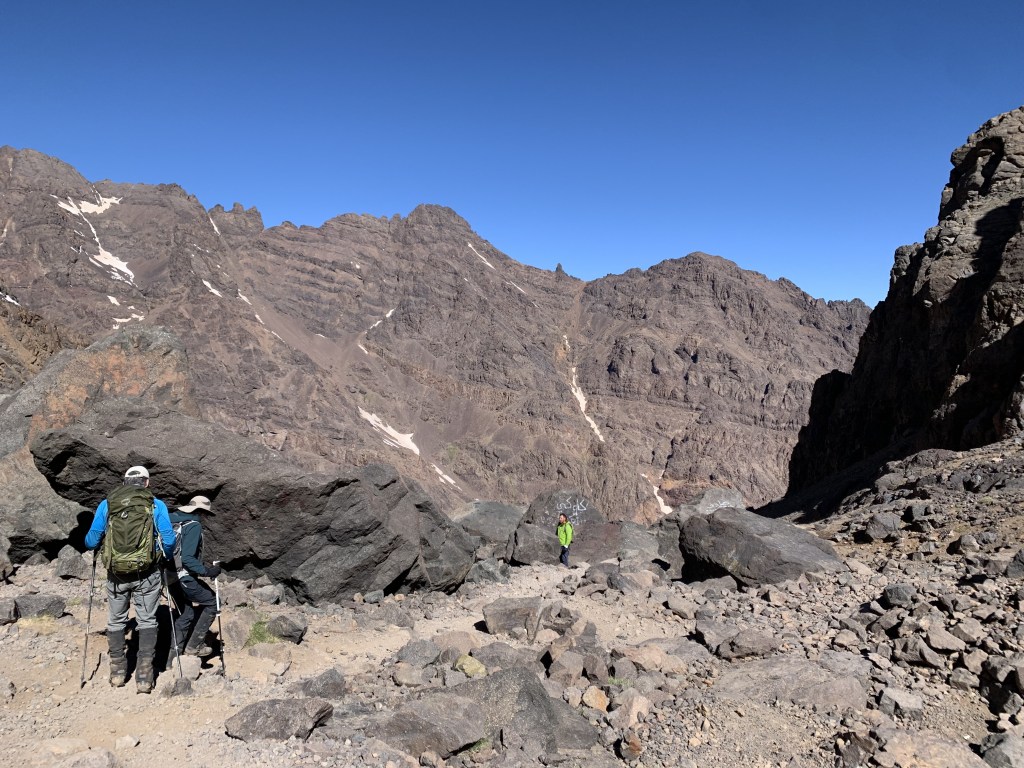
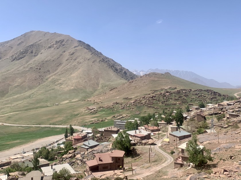
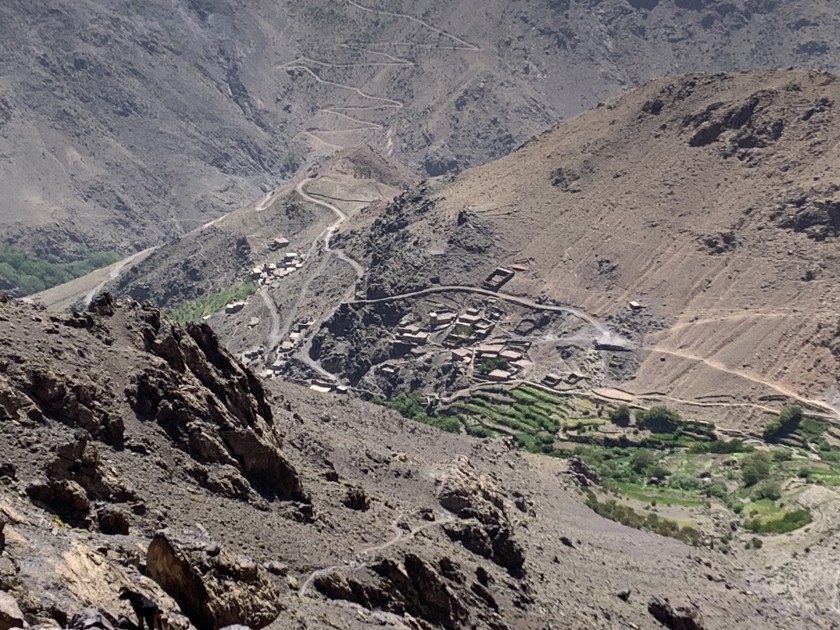
Approaching the refuge (middle of the picture). Toubkal is in the background.
We got to the refuge about 3:00 PM and there were few people there but that changed as the afternoon wore on.
At the refuge!!
By dinner (6:30) the refuge was packed with hikers. Our guide gave us the option of sleeping in the refuge or in tents and we elected the tents.
Putting up our tents (orange and green ones).And fishing is forbidden! Just in case you were thinking of it.
Started with a road walk out of Tacheddirt and then trails/dirt roads the rest of the day heading for our mountain pass of the day.
Hiking down a very pretty river valley
The trail today is much nicer, a nice mix of mountain trails and gravel roads as we move from one mountain valley to the next.
Crossing a stream on a nice wooden bridge.Today’s view of Toubkal… a little closer? Maybe?
We could see Toubkal a few times today and it looks bigger than ever. Arumd is a small town perched on a hill above Imlil. The place is nice but busy with hikers and noisy. We arrive about 3:30 and have our usual tea/popcorn at 5:00 and dinner (the ubiquitous veggie tagine) at 7:30. Joe is paying the price for hiking with vegetarians.
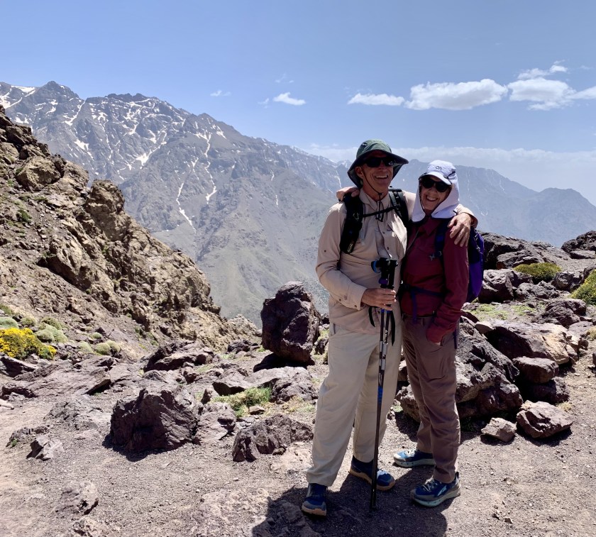
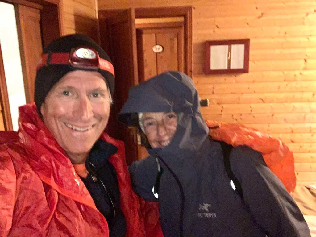
Today’s selfie! Why are these people smiling? There’s a mountain to climb!
May 10, Oukaimeden (8 ,600’) – Tacheddirt (7,600’)
Mohamed, the tour owner met us at 9:00 at the hotel and helped us load into our shuttle for the ride to the ski resort of Oukaimeden where we would start our trek. After a 90 minute (very curvy) ride we got to Oukaimeden where we met Ibrahim (our guide) and the two Hassan’s (mule drivers, cooks).
Day 1: Oukaimeden to Tacheddirt
We started up out of Oukaimeden about 11:00, circling the ski valley, stopping after a couple of hours for a picnic lunch.
Hiking out of Oukaimeden Hot picnic lunch
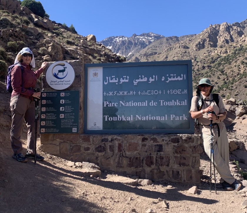
We got to the top of today’s pass (just under 10,000′) just before 3:00 after passing the sign saying we were in the national park.
We are in the park.
We are feeling the first day at altitude but everyone is moving well.
High point today. And that mountain over my right shoulder is where we are heading!
After that we began a very steep, rough descent to Tacheddirt.
Steep descent to TacheddirtTacheddirt, our destination for the evening.
We got to our hostel about 4:30, a very quiet place with few other hikers.
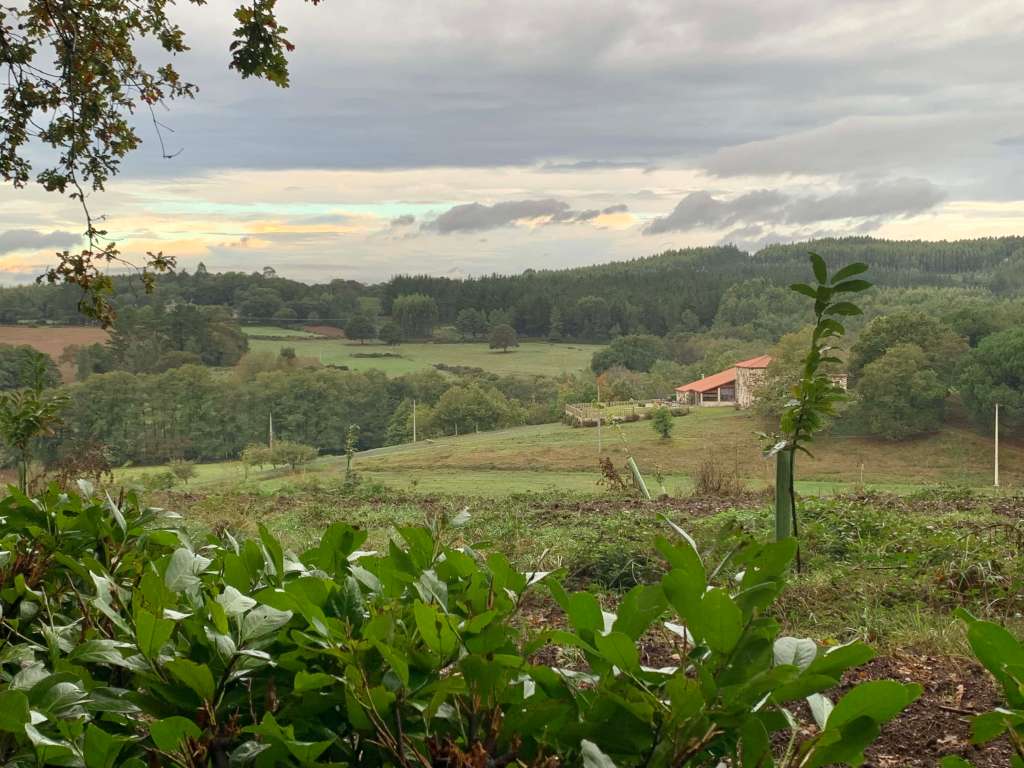
View from our hostel
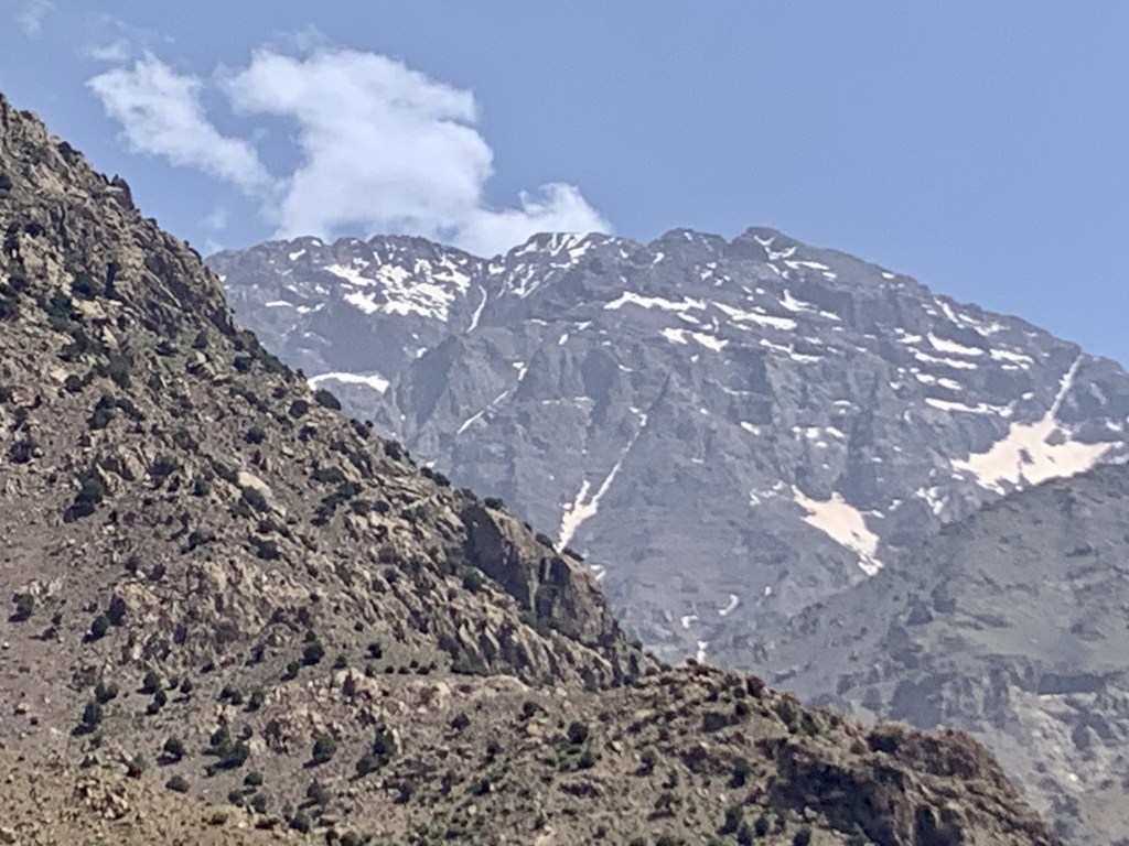
We got a couple of views today of where we are heading and it’s hard to believe we will be up there in a few days.
Mt Toubkal is one of those big peaks behind me. Very exciting!
Day 34 (Oct 19): A Rúa to Santiago de Compostela, 20 km, 782 km
Our 34th and last day on the trail started with rain which continued off and on for most of the day.
Rain!
Leigh Ann is still experiencing a lot of pain in her right shin but…. after 33 days we have decided we will stay together all day. But we are moving much slower on this 12.5 mile day so decide to not stop till we get to the cathedral in Santiago.
Wet hikers coming into Santiago
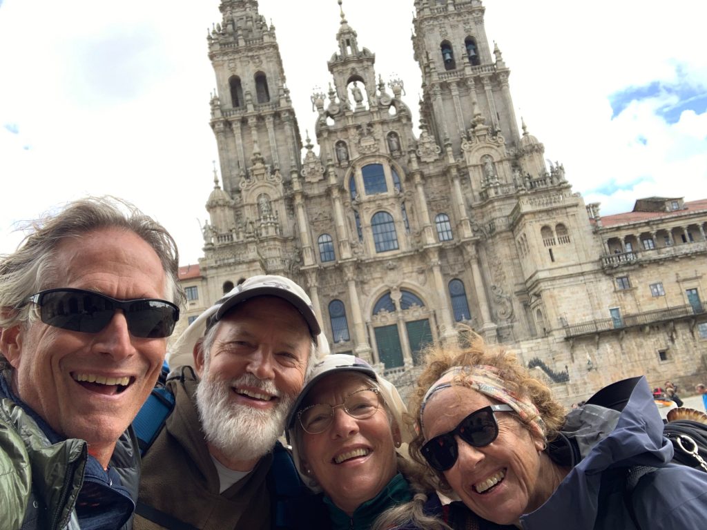
There are a lot of hikers on the trail today, not only the long-haulers like us and the folks who started in Saria doing the last 100 km but people who started just out of town. And we are all headed for the same place…. the Cathedral of Santiago de Compostela!
We did it!
And a view of the cathedral with pilgrims arrayed on the plaza… and the rain has stopped (briefly).
Pilgrims and the cathedral.
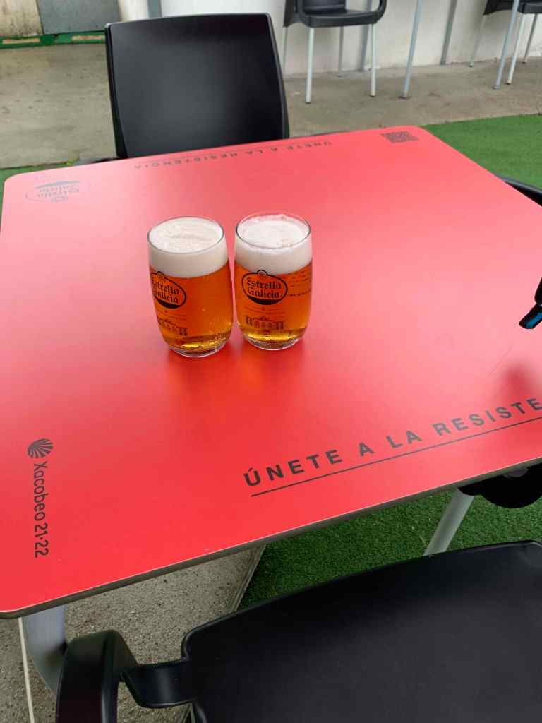
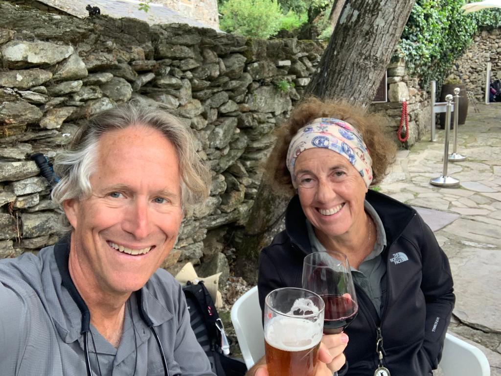
After toasting finishing with some large beers…
Celebratory beers.
… we headed to the Pilgrims Office to get our official completion certificates (our Compostelas ).
It’s official.
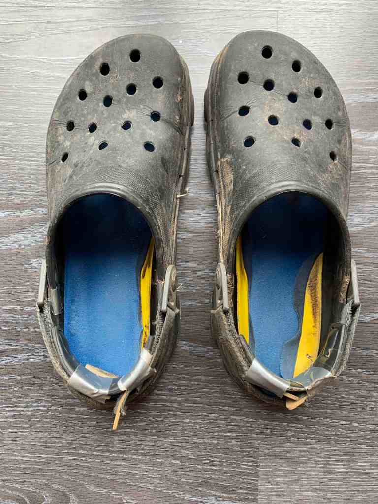
So… after 780 km (485 miles), 34 days, countless sore muscles, blisters, “pilgrim” menus, supportive fellow pilgrims, great travelling companions, countless churches and helpful townspeople is over it is time to say goodbye to my trusty crocs.
Day 31 (Oct 16): Portomarin to Palas de Rei, 24 km, 714 km
We left in the dark in an attempt to beat the crowds of “pelegrinitos” (i.e. the hikers who are just doing the last 100Km) but it was futile. Still had a lovely day with some great scenery.
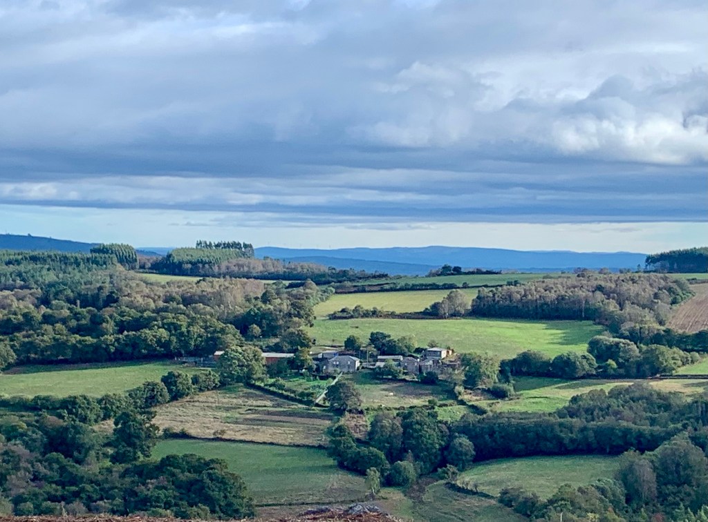
Another pretty Galician view
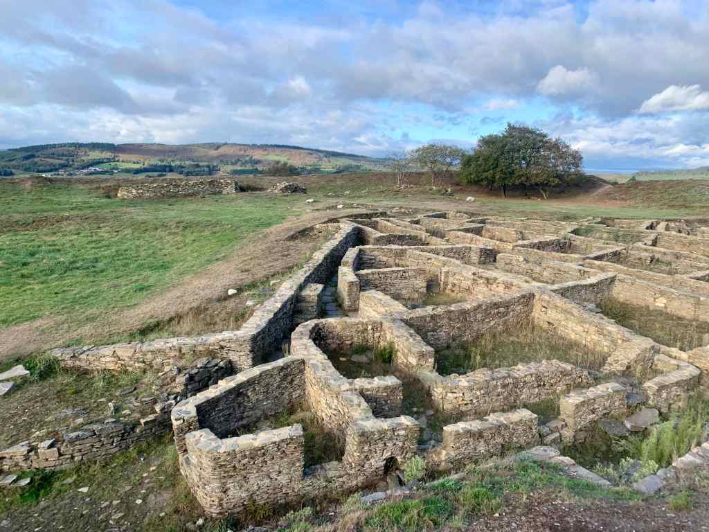
About 7 miles into today’s hike we passed a very cool archaeological site (the Castro de Castromaior) just a little ways off the trail.
Along the way we stopped in a small chapel built from the remains of a 13th century Templar pilgrim’s hospital where we got a stamp from a blind custodian.
And we saw the usual assortment of interesting and curious things along the trail.
Today’s hike was about 15 miles and while rain threatened most of the day it never happened. Tomorrow is our last long day (~30Km, ~19 miles) and promises to be rainy most of the day but… we will see.
Day 32 (Oct 17): Palas de Rei to Arzua, 30 km, 744 km
Our last big day started with a pouring rain at breakfast. The forecast called for rain all day but…. as we left the hotel the rain stopped and we had no more than a light drizzle the rest of the day.
Geared up for the rain…. that never came.
And, as the rain cleared and sun came up, we had some nice views.
Rain-free view.
In the last 100 Km you are supposed to get at least two stamps a day. For the 100Km people this is not an issue but for us long-haulers we have to be careful as our passports are filling up. We still had room for a stamp at a pretty little church we passed in the morning.
Little church were we got a stamp.
We got separated today. Leigh Ann is having shin pain so Jim, Bert and Leigh Ann were moving slower and I went ahead. Around 10:15 Leigh Ann fell (a real face plant according to Bert) that required some doctoring. After the fall they seemed to be moving well. Jim and Leigh Ann elected to stop in Melide for lunch around noon. Bert kept coming and caught me at a little lunch spot about 13 miles from the start.
LunchThe food is defintely getting better!
After lunch we learned that Leigh Ann was in too much pain to continue and decided to catch a cab to our hotel in Arzua. We continued on with Jim following a couple of hours behind.
On the road to Azura!
We arrived in Arzua around 3:30 after a long, 18.5 mile day.
Arzua!
We are in a lovely boutique hotel which served one of the best meals on the trip. We all agree that the food has improved significantly since we entered Galicia.
Day 33 (Oct 18): Arzua to A Rúa, 18 km, 762 km
Our penultimate day! And good news, Leigh Ann is feeling good enough (with pain killers) to hike. We decide to split up so she doesn’t feel pressure to hike faster than she is comfortable with. Bert and I head out in the dark around 8:15 watching the sun slowly rise behind us.
Sunrize on day 33.
Today is an easy day, only a bit over 11 miles. We stopped around 6 miles at a trail-side cafe with a nice view (there are lots in the last 100 km!) for coffee.
Coffee and a view.
And we finally saw one of the grain storage structures (which are everywhere – we have seen hundreds of them) with actual grain. They usually sit 5-10 feet off the ground and are constructed to prevent rodents from getting in.
We are definitely getting close to the end, there are signs everywhere reminding us that we are nearly there.
Nearly there1
At the end of the day we are only 21 Km from the end of our journey. It doesn’t seem real somehow. And, of course, rain is forecast.
Our accommodations always include breakfast and often dinner. We get the “Pilgrims Menu”. Maybe it’s because we are used to France but we find the food to be rather bland. Too much meat and not enough seasoning.
The wine, on the other hand, is quite nice. A bottle of the local vino tinto is usually included with our meal and we usually have no trouble at all finishing it off. A lot of the hotels have their own label.
Typical “Pilgrim’s Menu”
Meal times are later in Spain than we are used to. They look at you funny if you try to eat lunch before 1:30 and most restaurants don’t open for dinner till 8:00. This makes it tough for early hikers (and early hiking is important to avoid the heat)
Accomodations
Unlike a lot of peregrinos we are not staying in albergues (hostels) but in hotels. They range from 2-4 star hotels and we have been very happy with them. We always have a private room with a bath. The albergues are usually 10-15 euros (but can be less than 10), so they are a very economical choice for many people. We used a service (FollowTheCamino) to book all of our hotels . This is both good and bad. We never worry about getting a room but we are on a fixed schedule.
Laundry
We have only stayed in one hotel with a guest laundry (and we took advantage of it). This is an advantage of the albergues as the almost always have a guest laundry. One of our hotels had an 11€ laundry service (one bag). Most of the time we just wash our hiking clothes in the sink and hang them out a window to dry.
Trail Conditions
They vary … a lot. We have hiked on dirt paths, paved roads and everything in between. A good deal of the Camino is on gravel roads and the shoulders of paved roads. This is completely different from the trails in the US. It has the advantage of not needing to carry a lot of water or food but it is also not quite as bucolic. But overall we have really enjoyed the trails.
Typical Camino trail (on the Meseta)
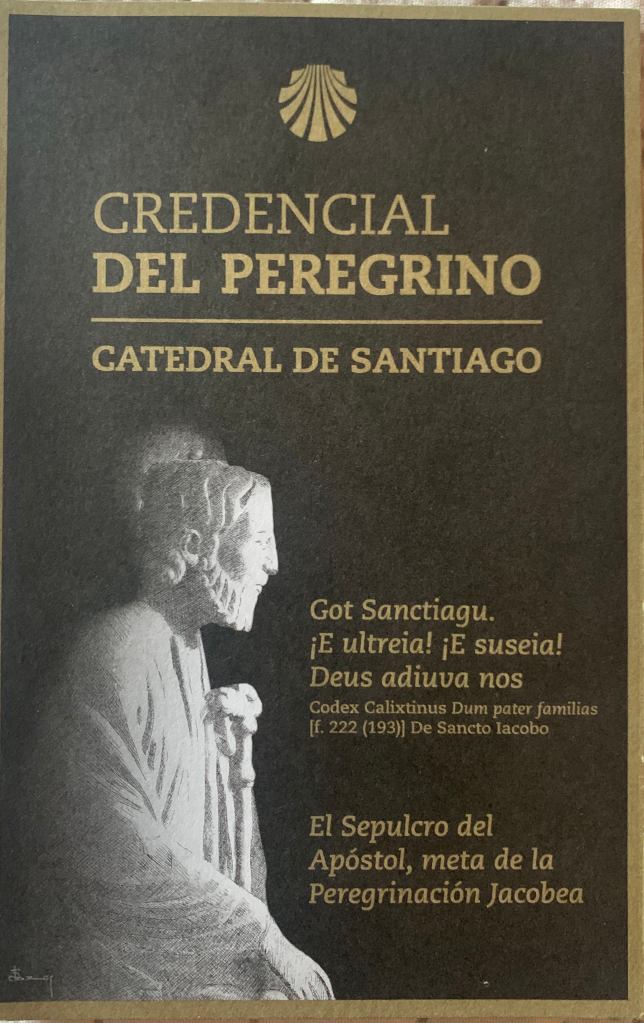
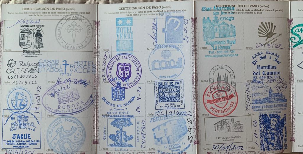
Pilgrims Passport
We all carry a “Pilgrims Passport” (Credencial del Peregrino) to document our progress as we proceed along the trail. You get the passport at the Pilgrims Office at the start and collect stamps (at least one a day) at various places (churches, albergues, hotels, etc.) you pass. The person stamping your passport usually signs and dates it. To receive the “Compostela” in Santiago you must…
…collect the stamps on the “Credencial del Peregrino” from the places you pass through to certify that you have been there. Stamps from churches, hostels, monasteries, cathedrals and all places related to the Way are preferred, but if not they can also be stamped in other institutions: town halls, cafés, etc. You have to stamp the Credencial twice a day at least on the last 100 km (for pilgrims on foot or on horseback) or on the last 200 km (for cyclists pilgrims)..
Toilets
“Facilities” along the Camino are few and far between so, in that respect, the Camino is no different than a wilderness trail. One of the disappointments has been the amount of toilet paper strewn in every likely pee spot. Obviously, the “no trace” ethic has not arrived on the Camino.
TP field
Water
The longest stretch with no potable water has been about 10 miles so there is no need to bring water treatment equipment (filters, pills). After 20 days we have never had to carry more than 1-2L of water. The local water is good, cold and tasty!
What to bring
Below are my recommendations for what you do/don’t need based on our hike. If you elect to do the hike without using a bag transfer service (which can be pricey) you can easily keep your total pack weight under 20 lbs and 15 lbs is doable. The beauty of European hiking over wilderness hiking in the USA is that you have a lot of options for sleeping and food that can make your pack very light.
You DON’T need to bring or carry:
Sleeping bag (though some people bring them) or pad. The albergues (hostels) almost always provide clean bedding.
Tent
Water treatment (filters, pills, etc.). The water is abundant and good.
Food (except for snacks and sometimes lunch). There are places to eat all along the way.
Thermal underwear (at least not in the fall). The coldest temperatures we have seen have been in the low 40’s.
Bug juice. We did not have any mosquito issues. The flies were sometimes annoying near cows.
What you DO need to bring:
Medium lightweight backpack (40-50L is more than enough). Should not weigh more than ~2lbs.
Hiking footwear. I wear crocs. Lots of people wear trail runners. Some people hike in sandals. I saw a lot of people with hiking boots. Remember, you will be lifting each foot over 500,000 times if you do this hike. Think about that before you select footwear that puts 2 lbs on each foot.
Rain coat (and a pack cover). It does rain in Spain and not always on the plain.
Warm layer (micro-puff or fleece).
One set of town clothes.
Hiking poles (though lots of people don’t use them – this is a personal choice).
Two sets of hiking clothes (shorts/pants, socks, shirt).
Buff, wool hat and lightweight gloves.
Suntan lotion. Sunglasses.
A minimum toiletry kit.
First aid kit (analgesics, moleskin, antiseptic cream, bandaids, etc.)
Smartphone (with the FarOut app and maps downloaded), and 220V adapter/charger.
Couple of light water bottles or a hydration pack (2L is more than enough).
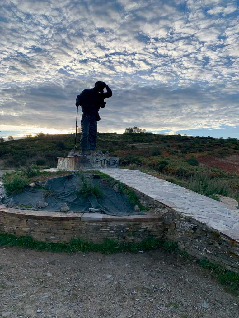
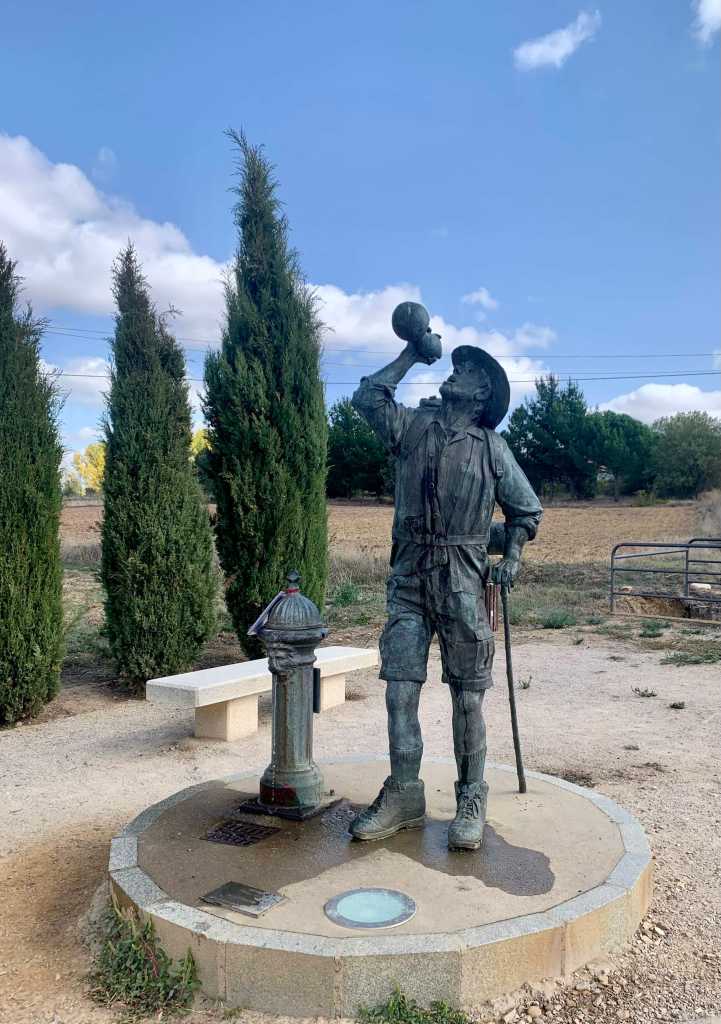
Day 28 (Oct 13): O Cebreri to Tricastela, 21 km, 644 km
A very welcome 13 mile day after the toughest day on the Camino.
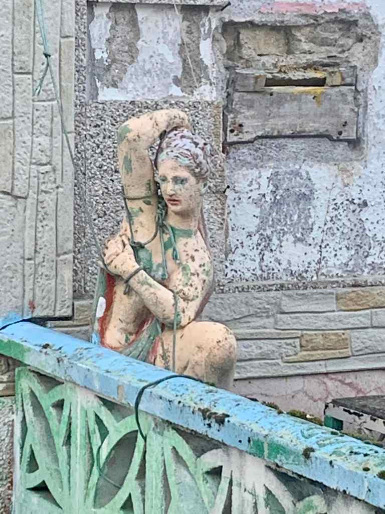
Early morning statue
The sun was not quite up as we started but soon we had some lovely views later in the day.
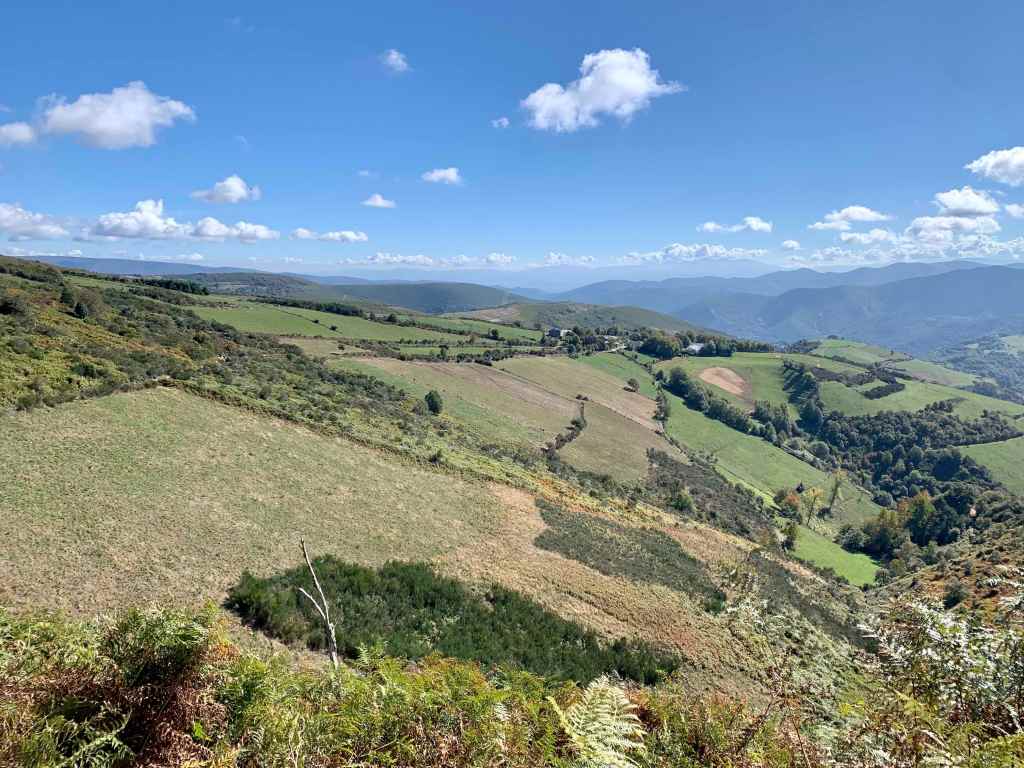
More great views of Galicia
And we found a nice place for coffee after a couple of hours of walking..
Coffee with a view.
And, after 5 hours or so of hiking we came into Tricastela (the three castles no longer exist) passing an amazing chestnut tree.
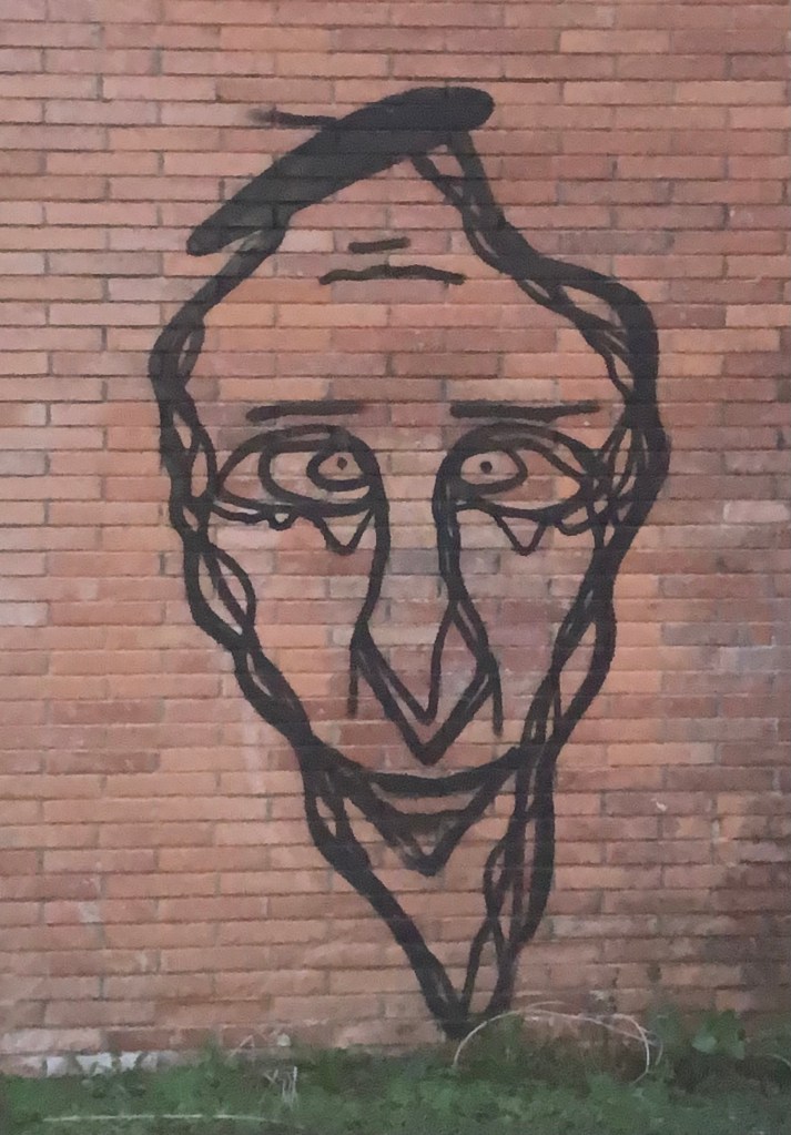
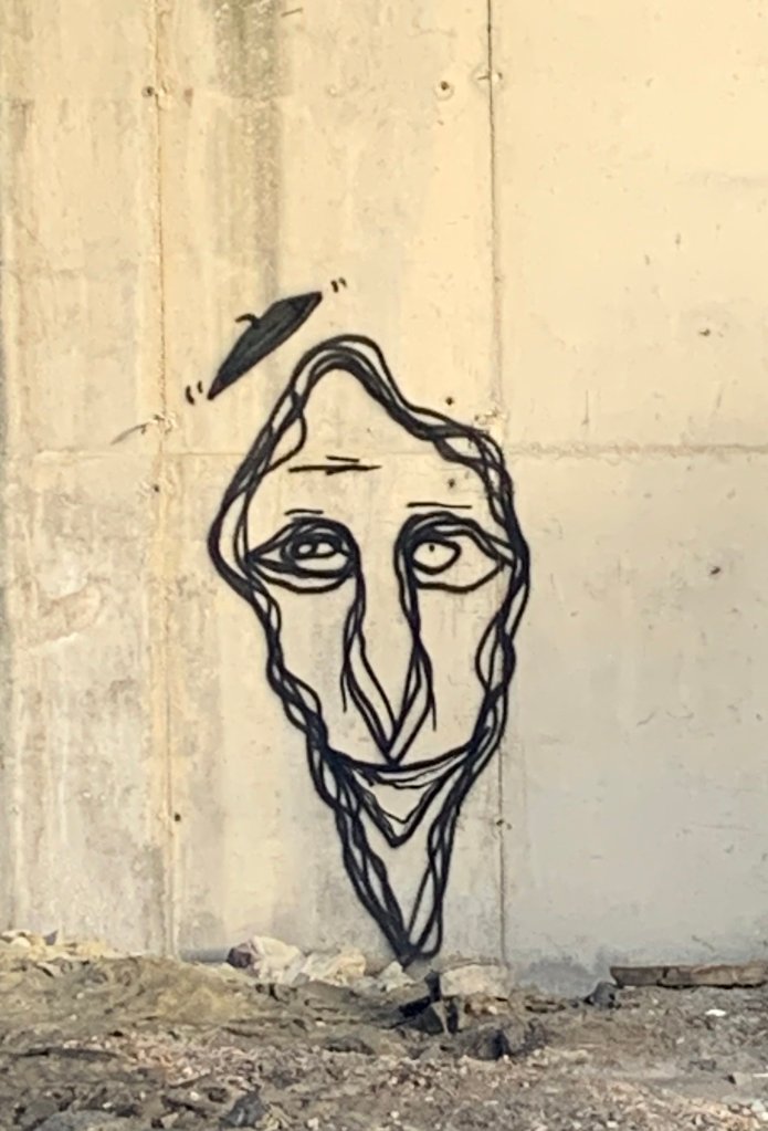
Cool tree… and art!
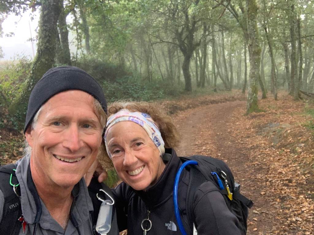
Day 29 (Oct 14): Tricastela to Sarria , 24 km, 668 km
Another easy day. We have been using the FarOut app to navigate so far and today was the first time it let us down. The most popular Camino route from Tricastela to Sarria is not shown in FarOut so today we just followed the signs and the other pilgrims.
Waiting to hike!
We waited for sunrise since we will be navigating the old fashioned way…. by signs!
A typical Camino signpost in Galicia
And unlike most of our starts, we had a very misty, drizzly morning. But is was warm (50’s) so we never used our rain coats.
A wet start to the day.
And the trail was wonderful, packed earth through farmlands and trees.
Happy, mostly dry, hikers.
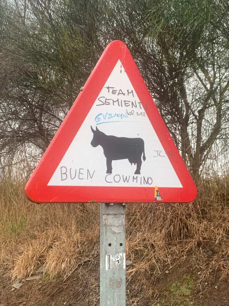
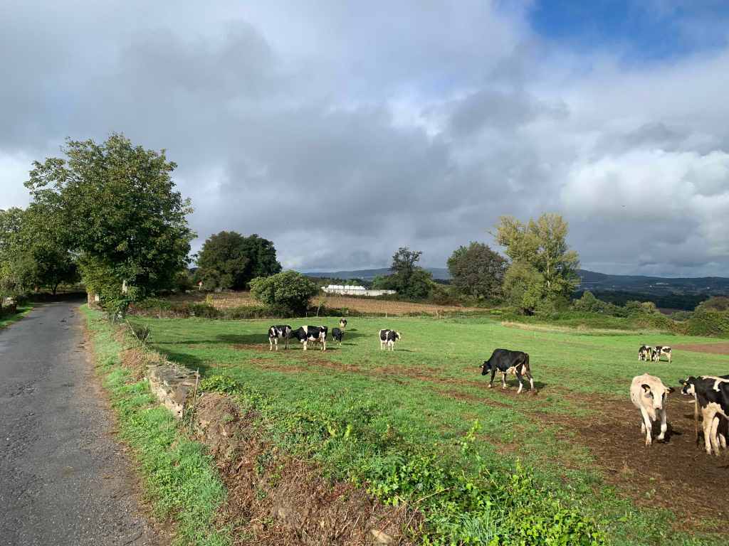
But this is definitely cow country..
And, after four hours or so of hiking our home for the night came into view..
Sarria
The toughest part of navigating the Camino is in the bigger towns as there are lots of competing signs.
Still on the Camino!
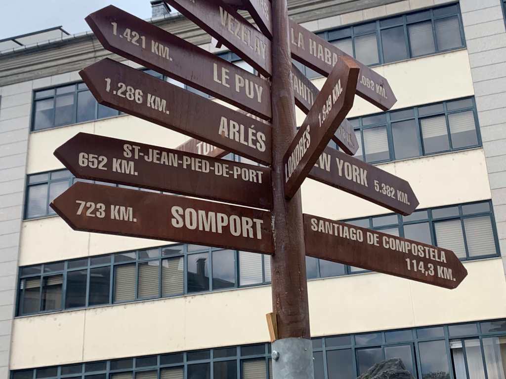
And we are definitely getting closer to Santiago… as the sign shows. 652 Km from where we started (St Jean Pied de Port) and 114 to Santiago.
Day 30 (Oct 15): Sarria to Portomarin, 22.5 km, 690 km
To receive the “Compostela” or pilgrim certificate you have to:
Make the pilgrimage for religious or spiritual reasons, or at least an attitude of search.
Do the last 100 km on foot or horseback, or the last 200 km by bicycle. It is understood that the pilgrimage starts at one point and from there you come to visit the Tomb of St. James.
Collect the stamps on the “Credencial del Peregrino” from the places you pass through to certify that you have been there.
As Sarria is the last town before the 100Km mark, we have been joined by many, many people doing just the last 100 Km.
Crowds in the last 100Km
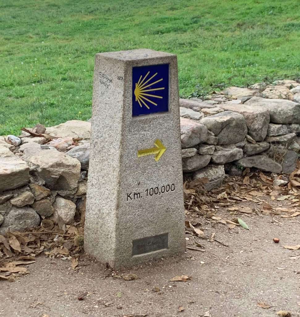
And we saw vans dropping off folks just before the official 100Km marker.
100 Km!
But we had a gorgeous sunrise as we walked out of Sarria so who cares about the newbies!
Sunrise leaving Sarria
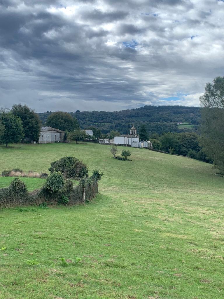
And even though overcast we had some lovely views.
Beautiful Galicia … and more views.
After 14 miles or so we arrived at the Rio Mino and Portomarin.
Rio Mino
Tomorrow we plan on an earlier start to try to miss the new hikers (who don’t even know that you are supposed to say “Buen Camino!” when passing!).
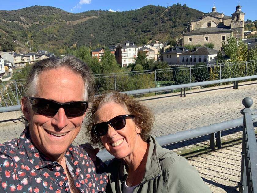
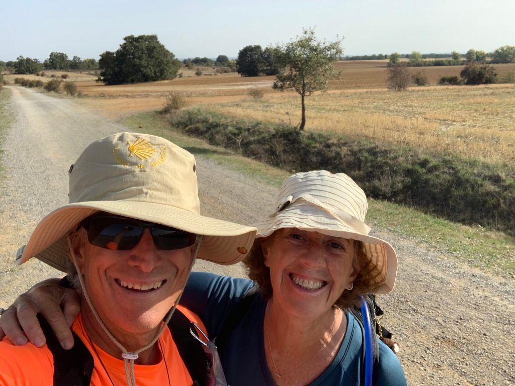
Today’s selfie (at lunch)
We are (finally!) nearing the end…. only four more days and (roughly) 90 km to go.
Day 25 (Oct 10): Rabanal to Ponferrada, 33 km, 568 km (total)
Tough day on the Camino and one of our longest days so far (almost 20 miles). Another pre-dawn start to get a jump on a very long day.
Another pre-dawn start.
And we have definitely entered the mountains. The coastal range which we have seen 50-60 miles to the north for the last three weeks have swung around as we slowly approach the western coast.
Mountains!
We stopped for coffee at 6 miles or so at a Refugio. The coffee was so thick it almost didn’t pour, but no complaints. It was hot and black on a chilly morning. And today was the high point of the entire Camino, the Cruz de Ferro at 4,934′.
The Cruz de Ferro in the morning fog.
And we bumped into Stitch (“Steech”), a puppy doing the Camino on the back of very nice frenchman…
“Steech” and friends.
And we had some lovely views as we hiked higher in the mountains.
Another great view.
And we finally stumbled into our destination town, Ponferrada, a small city of about 65,000 with a 13th century Templar castle, which was unfortunately closed while we were there.
Day 26 (Oct 11):Ponferrada to Villafranca del Bierzo, 25 km, 593 km
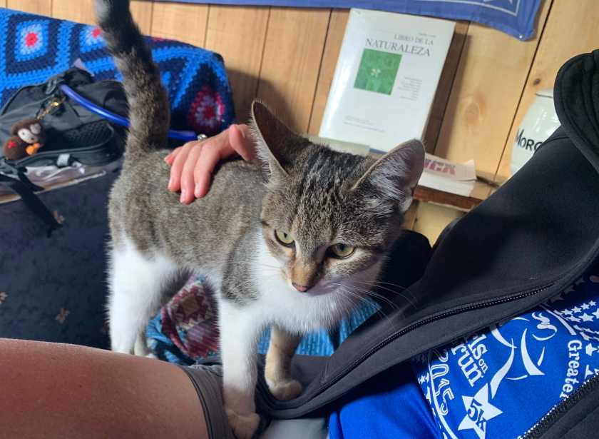
Much easier day between two tough ones, only a bit over 15 miles. We are actually in a valley between mountain ranges today so not a lot of climbing. We stopped for lunch at a litte refugio that had avocado toast (yes!)…
Lunch
…. with a new friend.
… a new friend.
Today was mostly a hot road walk with not great views but we had a few and our destination town was very pretty.
Hills around Villafranca
And we had a new Camino marker to look out for.
Day 27 (Oct 12): Villafranca del Bierzo to O Cebreri, 30 km, 622 km
Tough, tough day on the Camino…. but lots of fun! 18+ mile day with a big 2500 foot climb in the afternoon. Started the day at 1750 and ended it at 4250.
The day started in the dark at 6:30 with our usual 6 mile road walk to get to coffee. Saw some unusual art along the way..
And today was clearly dangerous as we passed a warning sign for…. snowflakes?
Danger ahead!
We had an early lunch at a place that was just opening up (we had to talk them into serving us) in Herrerias. Then …. the big climb… 5 miles of up, up, up but with stunning views near the top.
Stunning views!
And… after many, many days we finally left Castille y Leon and entered Galicia.
Galicia!More stunning views
And, after 7 hours of hiking we rolled into O Cebrerio and a much deserved libation.
Day 22 (Oct 7): Leon to Villar de Mazarife, 20 km, 483 km (total)
Day 22!
Our last easy, 20 km day for a while started at about 8:15 as spent the first hour slowly leaving Leon to the west.
Typical day on the Meseta – flat and hot!
After leaving Leon it was a fairly typical day on the Meseta – gravel roads through rolling farms. We stopped for coffee, as usual, in a little town after 6 miles or so.
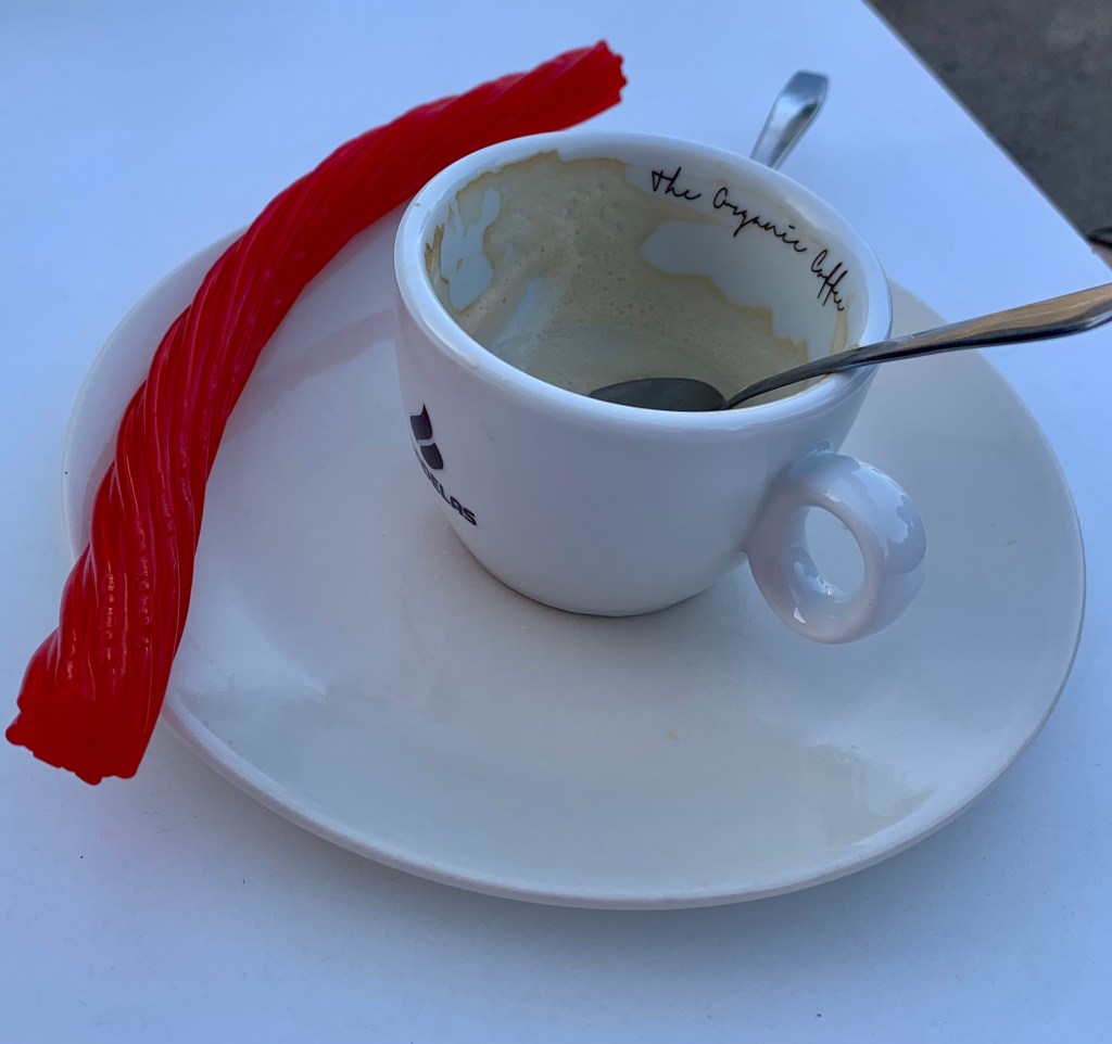
Coffee with a twizzler chaser
The Camino seems to be a big part of the local economy. A lot of these small towns have an albergue or two with a small cafe or two that cater almost exclusively to pilgrims.
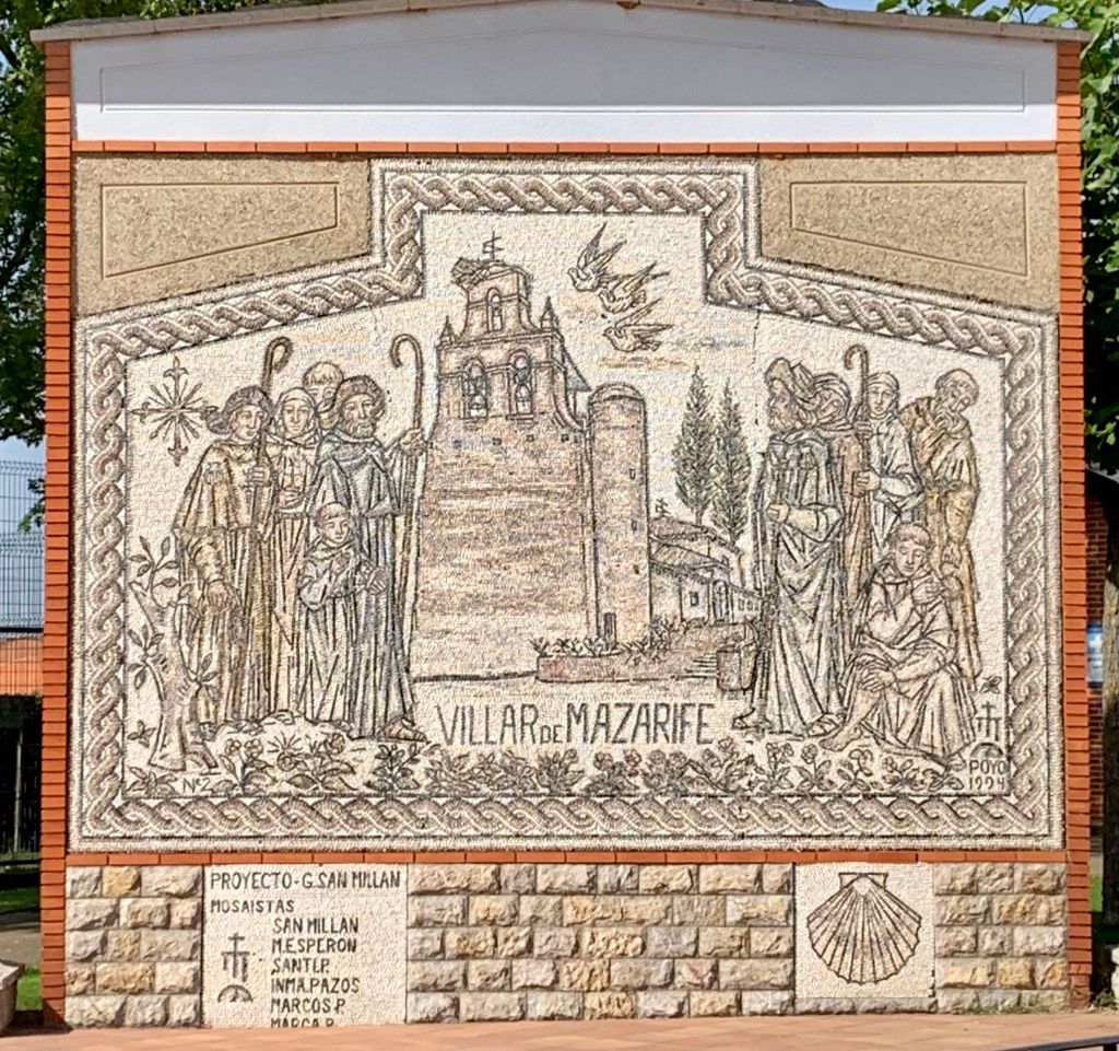
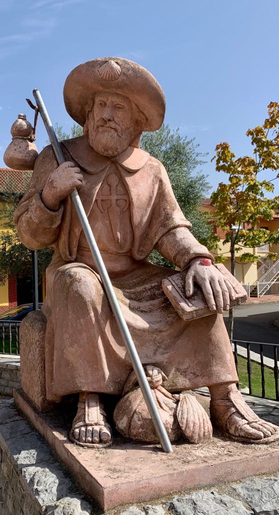
In case you were unsure of the location…
And, around 1:00 we rolled into our home for the night..
Home for the night
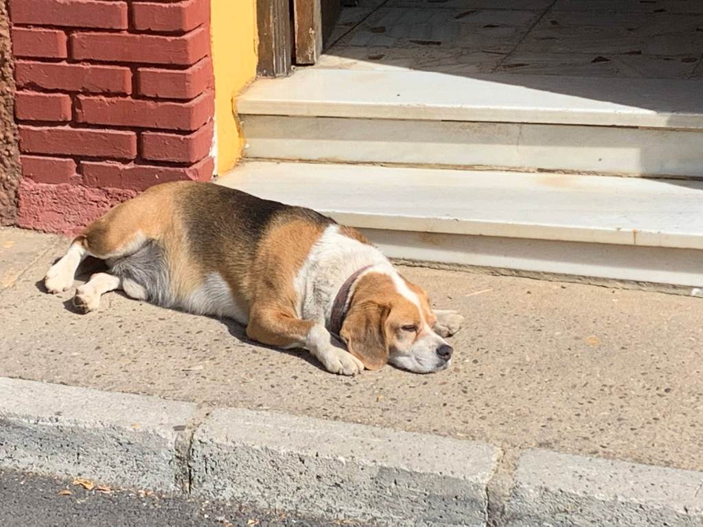
The church is closed but the bar was open…though guarded by a vicious dog.
Day 23 (Oct 8): Villar de Mazarife to Astorga, 31 km, 514 km (total)
After a stretch of relatively easy days today we had a 20 miler. We got an early start leaving our hostal in the dark at 6:30. We walked a paved rural road for two hours with headlights as the sun slowly rose.
Just following the yellow arrows.
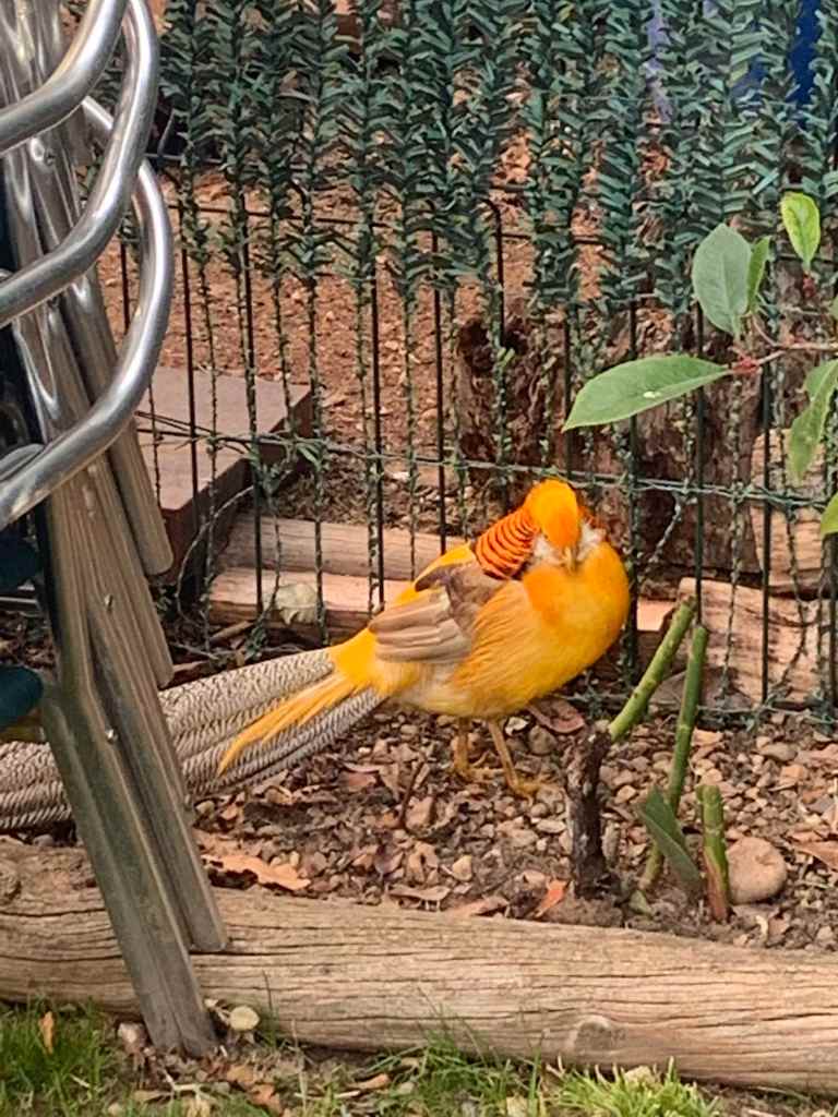
After three hours we stopped in a busy pilgrim town where three trails come together, Puerte de Orbigo, for breakfast (and coffee!). The place had some very interesting birds hanging around.
Leaving Orbigo we passed over the medieval gothic bridge, the Puente de Orbigo.
The Puente de Orbigo
And then more miles….
Miles and miles of miles and miles.
After 15 miles of hiking we stumbled onto a lovely refugio where we had lunch.
The refugios don’t charge for the water, food and shade they provide. They just ask for donations. It is very nice, especially on long stretches with no towns.
Day 24 (Oct 9): Astorga to Rabanal del Camino, 20 km, 535 km
After yesterday’s 20 miler we had a welcome 12.5 mile day. We have definitely left the Meseta, the endless rolling vistas of farmland have given way to a hilly, forested area.
Walking toward more hills.
We stopped in a little town for ….. coffee!
Coffee!
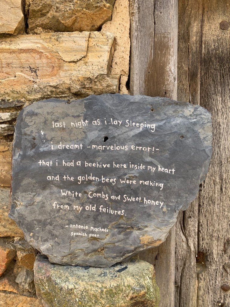
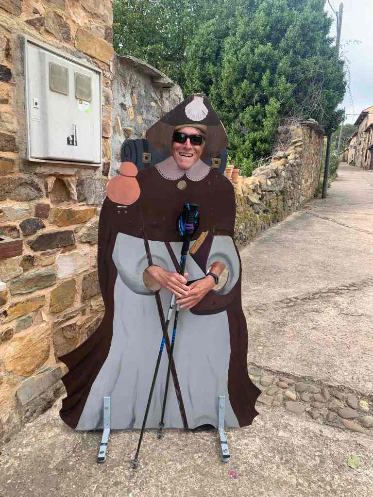
And we ran into a traditionally dressed pilgrim…
A peregrino!
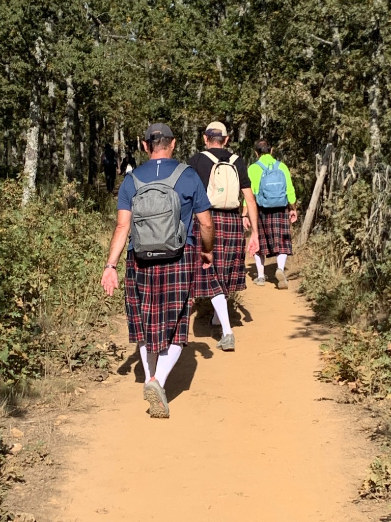
… and some less traditionally dressed pilgrims.
Pilgrims come from everywhere…
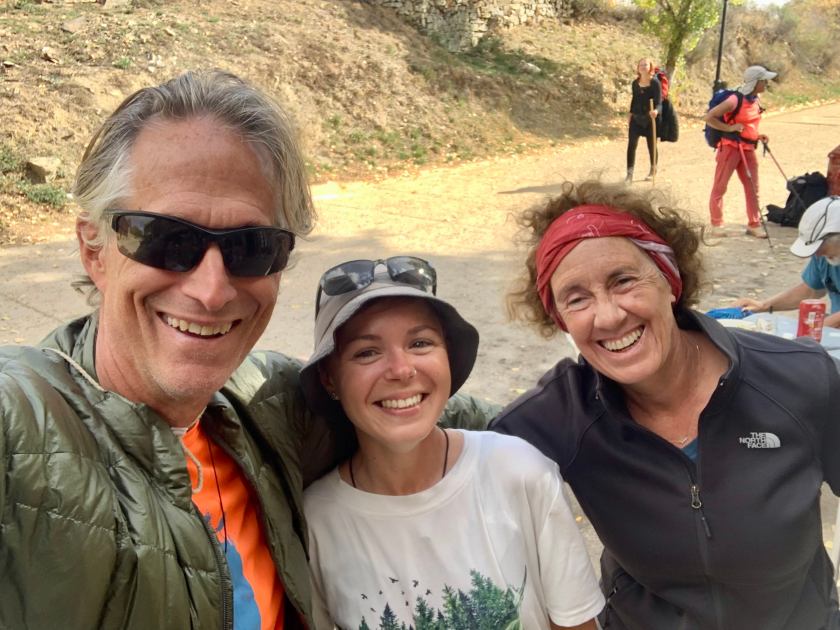
And we got a selfie with one of our favorite trail friends (people we have been bumping into since the beginning).