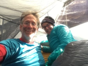
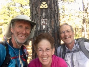
After spending two lovely days in Astoria at the Clementine B&B we headed out on the Trail this morning (Wed, Jun 19). Our hosts at the B&B (Yvonne and Steve) offered to take us the 12 miles or so to Fort Stevens State Park and the start of the trail.
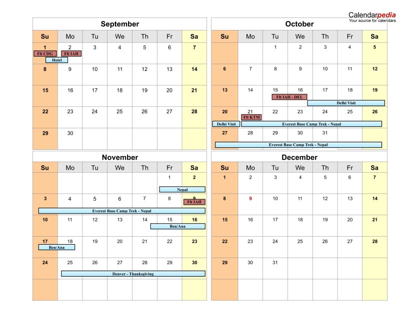
With our B&B host, Steve, ready to start!
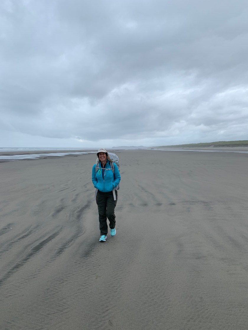
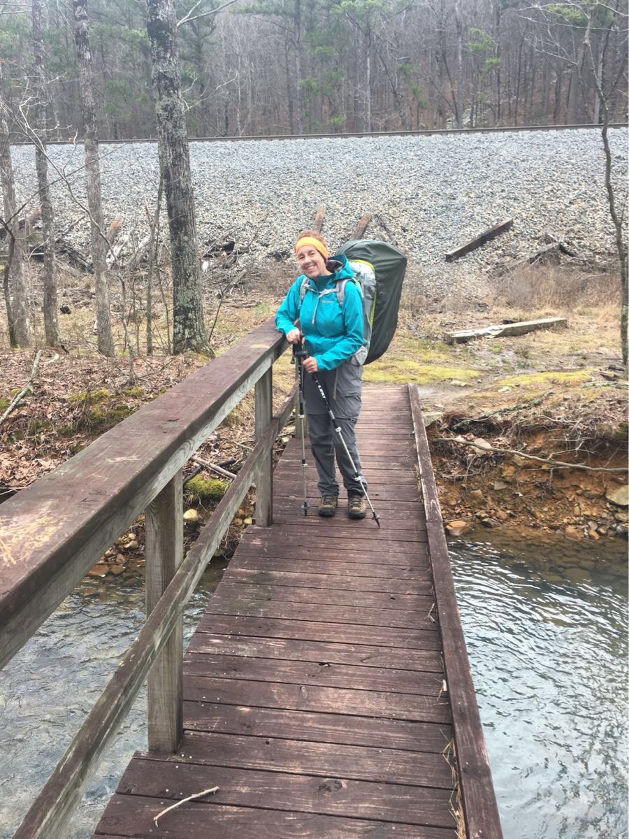
Because we hiked a couple of miles yesterday just to check out the beach we only (only!) had to do 15.5 miles today and it was all flat. The first 13 miles or so were on the beach. A bit chilly to start (55 and windy) but the sun came out after a bit.
Hiking the beach
After a few miles we passed he famous wreck of the Peter Iredale , a four masted British bark that wrecked on the beach in 1906.
The wreck of the Peter Iredale
We saw lots of people clamming and a few fisherman but no other hikers. And cars! This is the only stretch of the coast where cars are allowed and there were quite a few. After 13 miles on the beach we headed inland at Gearhart to get across Neawanna Creek and Seaside.
The dunes at Gearhart
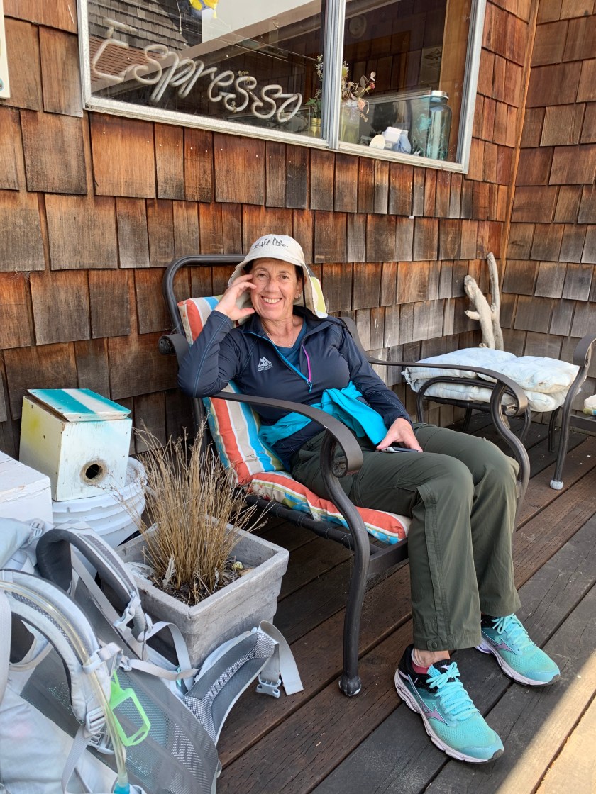
Walking the coast highway (101) for a mile to get into Seaside was the least pleasant part of the trip but getting to the International Hostel in Seaside was definitely nice.
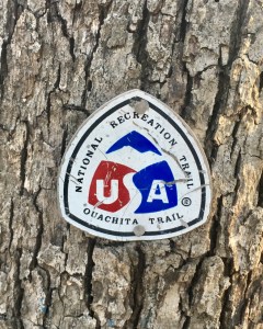
The trail is unlike anything else we have done (Ouachita Trail, Colorado Trail and PCT). It is entirely along the coast with many days of only beach walking. It also passes through many small beach towns (especially in the northern sections).
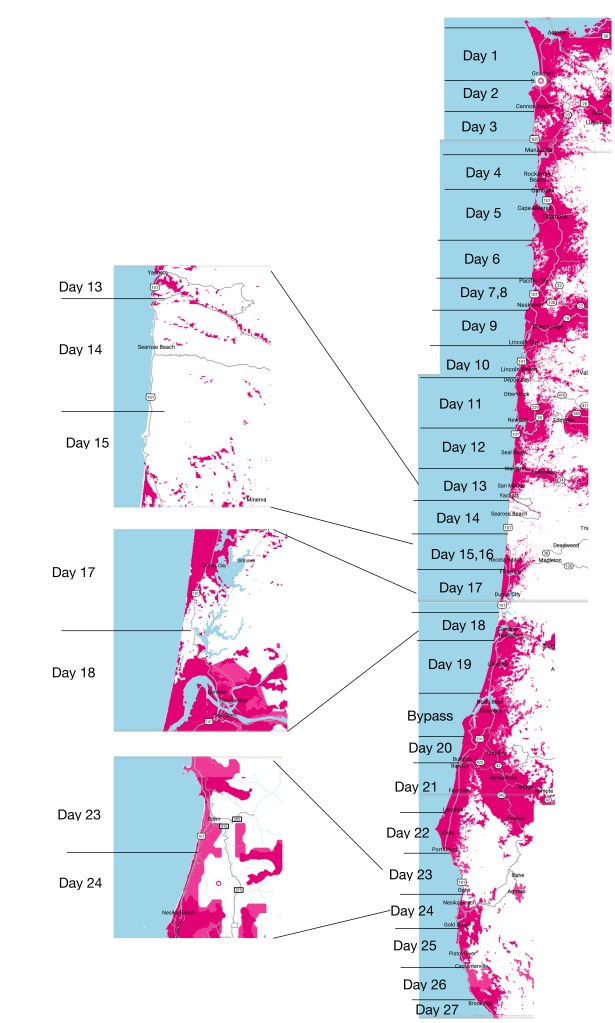
Oregon Coast Trail 2019 Plan
Our plan has us doing it the trail in 27 days (including two rest days). We will start on June 19 and finish (hopefully) on July 15. Of the 27 nights we will stay:
13 nights: hotels/hostels
4 nights: RV parks (i.e. showers, laundry)
10 nights: campgrounds (state or federal parks)
All of my Colorado Trail campsites were undesignated rough sites so this will be completely different.
The trail is (currently) about 50% along the beach, 25% along trails and the rest along rural roads or highway. Maybe 25-35 miles are along the Oregon Coast Highway and there is at least one narrow tunnel (with little shoulder) we have to get through. Will probably end up hitching some of the highway.
We will average just under 15 miles/day. Our longest day is a 20 miler but there is only one of those and we could shorten that one by hitching out of town.
The OCT is not on the Guthook navigation app so I have built my own routes using the GAIA online hiking application.
Weather
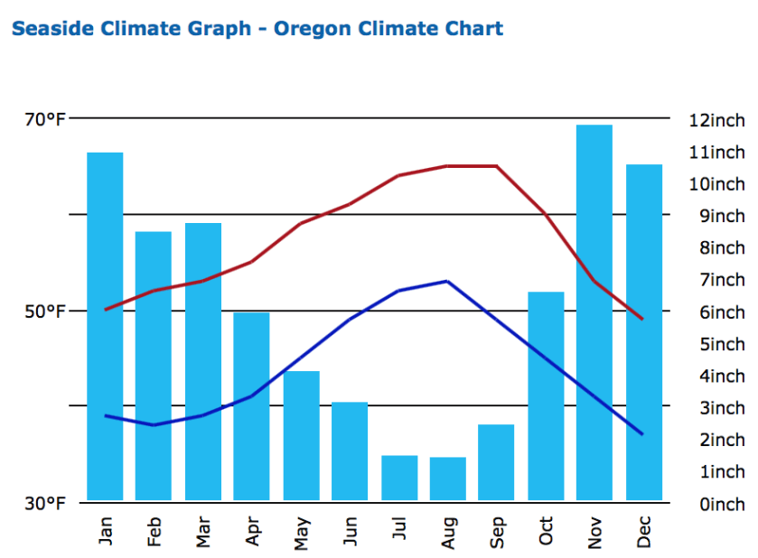
The spring rains start to let up on the Oregon coast in mid-June. This “dry” season lasts through September and makes July and August the most popular months to hike the OCT. The average lows (at night) will be in the low 50’s and with highs in the 60-70 range. The prevailing winds are out of the northwest (which is why most people elect to hike south bound).
Average Weather Stats
Cell Coverage
Cell coverage promises to be pretty good with only a few days with little or not coverage.
We’ve nailed down most of our travel plans for the rest of 2019. There are three more big trips this year:
Oregon Coast Trail
Starting in mid-June we plan to hike the ~450 mile Oregon Coast Trail. The plan (my next post will discuss the plan) has us hiking for roughly 26 days followed by visits to family in the Northwest, returning to Houston the fourth week of July.
France/Scotland
We will be flying to France to spend a week on a boat that we plan to buy. The boat is currently in rental with Locaboat. It is nearly identical to the boat we rented for the summer of 2017. If all goes well we will take possession of the boat in October with plans to spend next summer on her.
After we leave the boat we will travel to Edinburgh (by train – always wanted to take the “Chunnel”!) to Edinburgh to, hopefully, catch some the Fringe Festival. After a few days we will head to Aberdeen to visit old friends before returning to Edinburgh to join the Houston Looking At Art group for a week looking at local art.
India/Nepal
Finally, in mid-October we head to New Dehli where we will spend a few days sight-seeing before flying to Kathmandu for a three week trek with friends in the Himalaya, reaching Everst Base Camp near the end of the third week.
After sitting out an historic weather event that brought cold temperatures, rain and 50 mph winds to the lovely Queen Wilhelmina Lodge (our rest day after seven days on the trail) we set out to complete the final 51.5 miles of the Ouachita Trail under a bright sunny (but cold and windy) sky.
Heading our or the last 50 miles!
Day 9, Thu, Mar 14 (OT 51.5 to OT 38.0)
After yesterday’s windy, rainy day this was a nice surprise. Still windy but sunny as we head out.
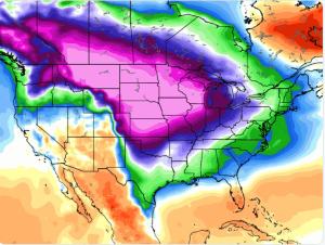
Mid-continent cyclone on our rest day.
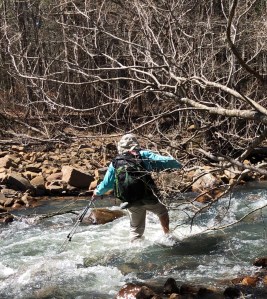
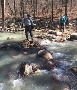
Fantastic weather all day. Trail was wet but significantly better than the other side of the lodge. First five miles followed the scenic byway before heading down to the Kiamichi River. Eight river crossings of the river. Eight! And we got wet on nearly every one.
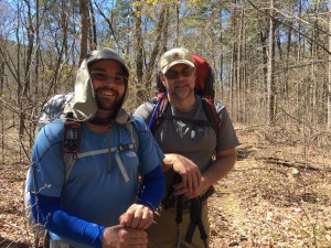
Ran into a couple of east bound hikers, Christopher and Shane. “Hey, You aren’t the people drinking beer in the lodge on Facebook are you?” Yep. They spent the horrible weather day (yesterday) in a shelter.
East bound thru-hikers (Christopher and Shane) that survived the big storm.
Big climb at the end of the day to get to a not so great camp site but everyone is upbeat – three days left! And had some wonderful views today. And we are now in Oklahoma – passed over the state line a few miles back.
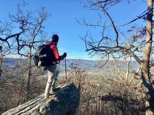
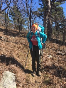
The intrepid hiker.
Day 10, Fri, Mar 15 (OT 38.0 to OT 25.2)
Tough day – not as long as yesterday but lots of vertical – nearly 3,00o feet.
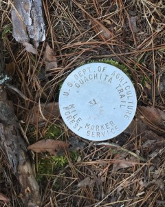
New OT mile markers. Hard to see and harder to read.
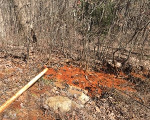
Did the 39 switchback Winding Stair ascent to the Winding Stair Shelter to end the day. Stopped at the aptly names Red Spring for some badly needed (and very iron flavored!) water and lunch.
Aptly named Red Spring
Home!
Already occupied when we got here – Norris (Tampa) and Scott (Broken Arrow). Nice couple of section hikers who gave us Jolly Ranchers! Had one big water crossing that resulted in Emerson going for a swim.Only 25 miles left!
Tired hiker nearing the shelter.
Day 11, Sat, Mar 16 (OT 25.2 to OT 13.2)
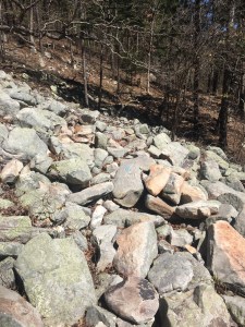
Gorgeous day. Sunny and 50’s and the wind has finally died down. Met lots of day/section hikers (weekend and spring break?). Stopped at Winding Stair CG to dump garbage and use the toilets – no water though. Trail has been generally good but sometimes a bit rocky and steep.
Yes, that is the trail. Note the blue blaze on the middle rock.
Then to Dead Horse Spring for water. But no horse.
Dead Horse Spring and much needed water.
Camped at a lovely rough spot with cell coverage! Used the coverage to called Lori (Blue Bell Cafe)- our car is waiting for us. Nice surprise.
Emerson enjoying camp
Day 12, Sat, Mar 17 (OT 13.2 to OT 0.0)
Another beautiful sunny morning! Last night was a bit warmer – definitely in the high 30’s so will be a bit warmer today.
Decided to stash Bert’s pack and our tents at Deadman’s Pass near our last water cache bear OT 8.0 (Bert is having some problems with her glute and drooping weight should help). Will pick them up on the way back to Mt Ida.
Horizontal hiking!
Met (and passed) four day hikers that are doing the trail in short day sections.
You have to have hair like this to trail blog.
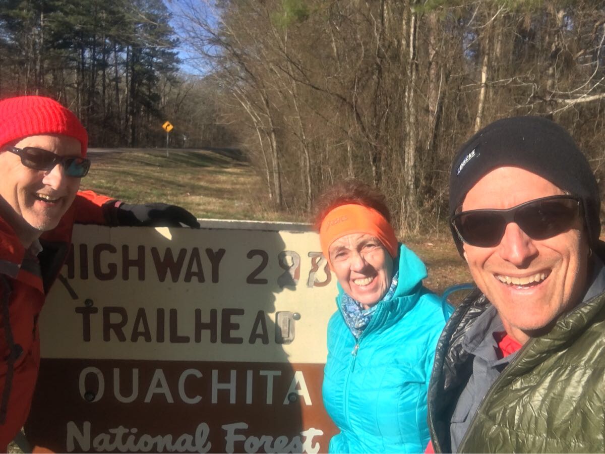
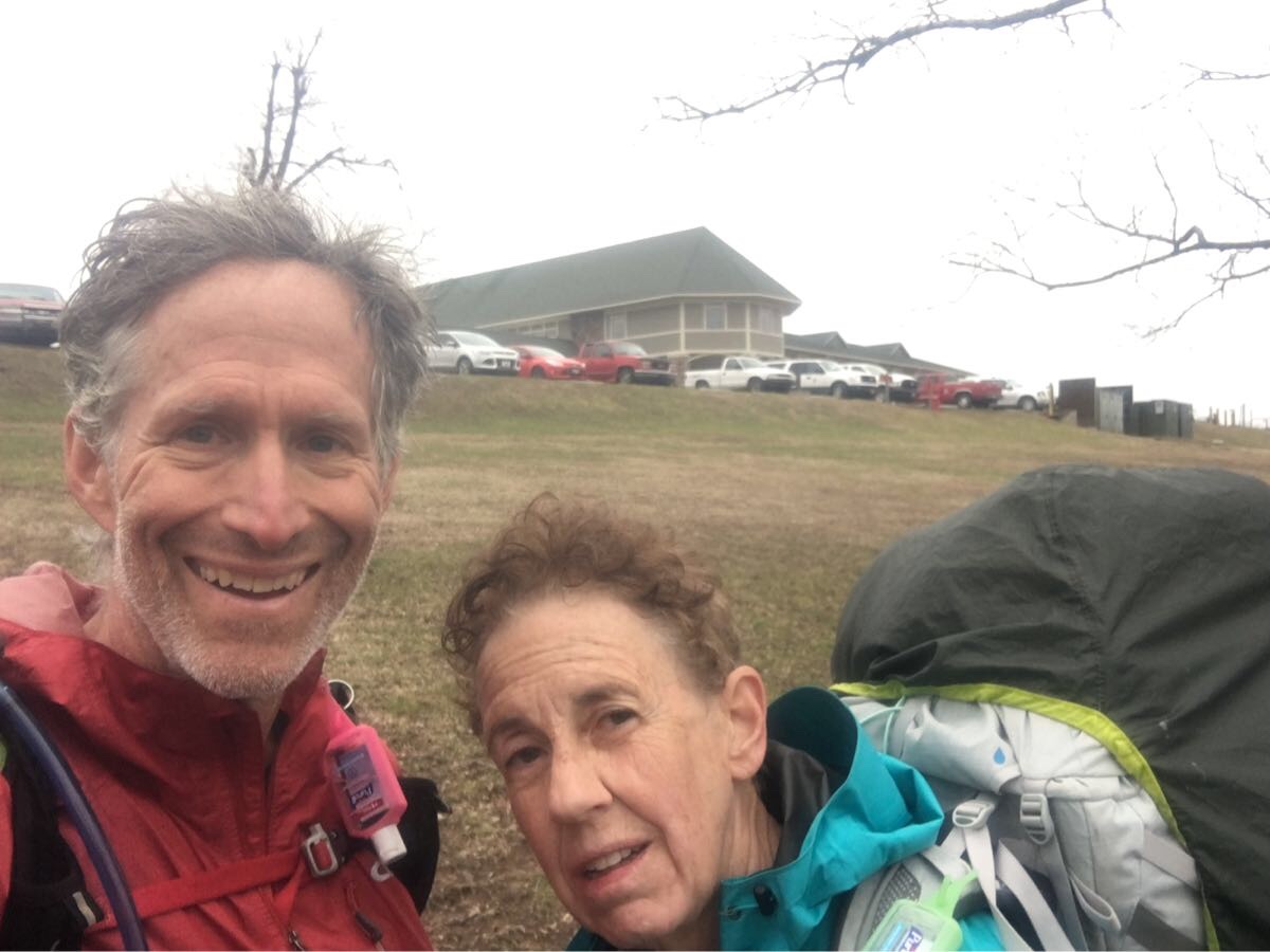
We are definitely ready to finish when we roll into Talimena State Park, the western end of the trail.
Yes!
Waiting for Harold, the park ranger, and our car keys.
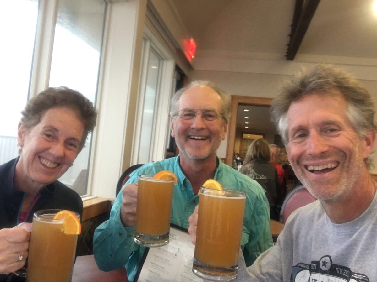
The requisite end-of-trail brew. Looks like Bert may have lost hers?
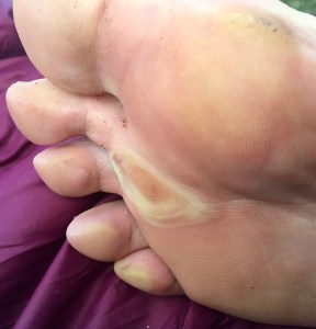
Well, after two years and 223 miles (134.5 this year) we completed the Ouachita Trail. Met some nice people, saw some lovely views, crossed (and re-crossed!) some fine streams and had (at the end) absolutely beautiful weather. We finished tired and happy. Oh… here is the requisite blister pic..
I’m not even sure what that thing in the middle is…
87 miles, 2 thunderstorms and 7 days later, we stumbled up the steps to the QW Lodge under an overcast sky.
Day 1, Wed, Mar 6 (OT 138.5 to OT 127.6)
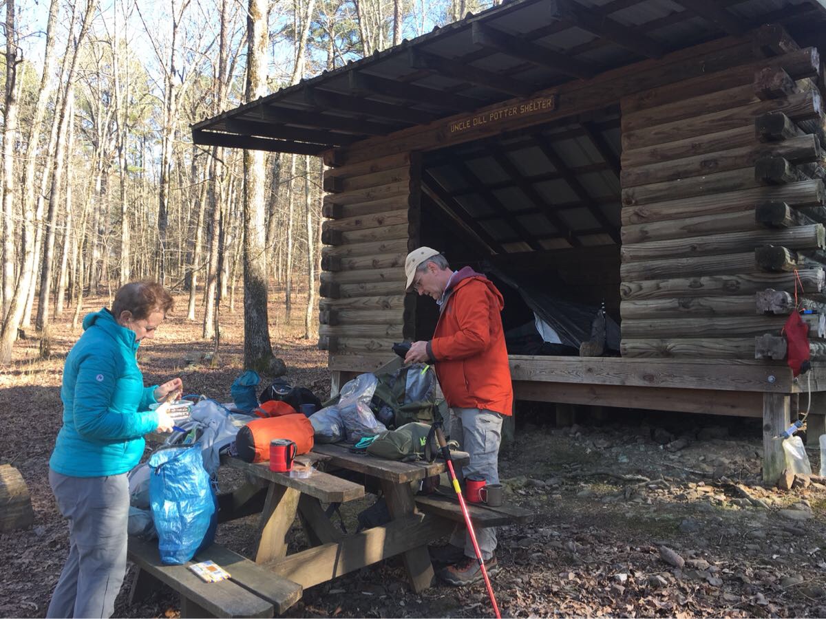
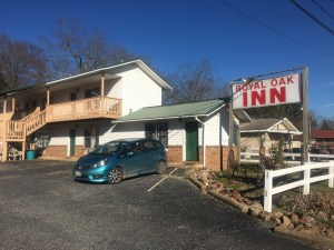
Woke up early at the Royal Oaks Inn (Mt Ida) and drove to the Blue Bell Cafe for breakfast and a ride to the trail from Lori (cafe owner). Cold (~20 degrees) but the sun is out and we had a wonderful first day of hiking in sunshine to our first camp at the Bill Potter Shelter after 11.4 miles.
Off we go..
A cold start!
Lunch!
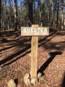
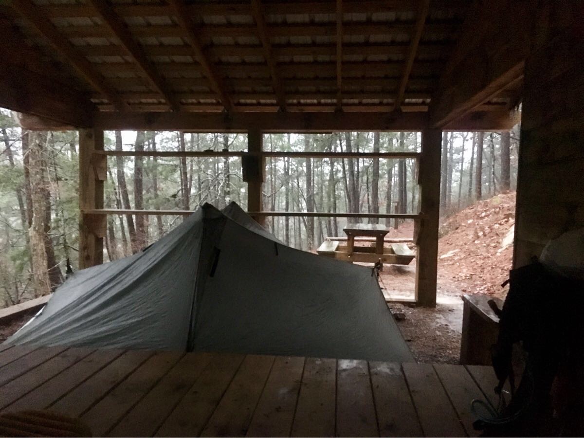
The shelters are wonderful by the way – three sided wood structures with a sleeping platform and (luxury!) a picnic table!
Hikers at a shelter
Day 2, Thu, Mar 7 (OT 127.6 to 116.6)
Slept well in the shelter – there was enough room on the sleeping platform so we were able to set our tent up next to Emerson – made it just a little bit warmer. Not as nice today – in the 40’s and overcast. Had our rain gear on most of the day. Camped at Story Creek Shelter.
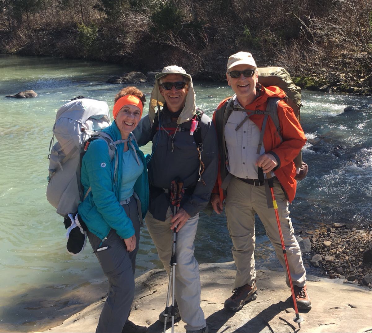
Intrepid Hikers
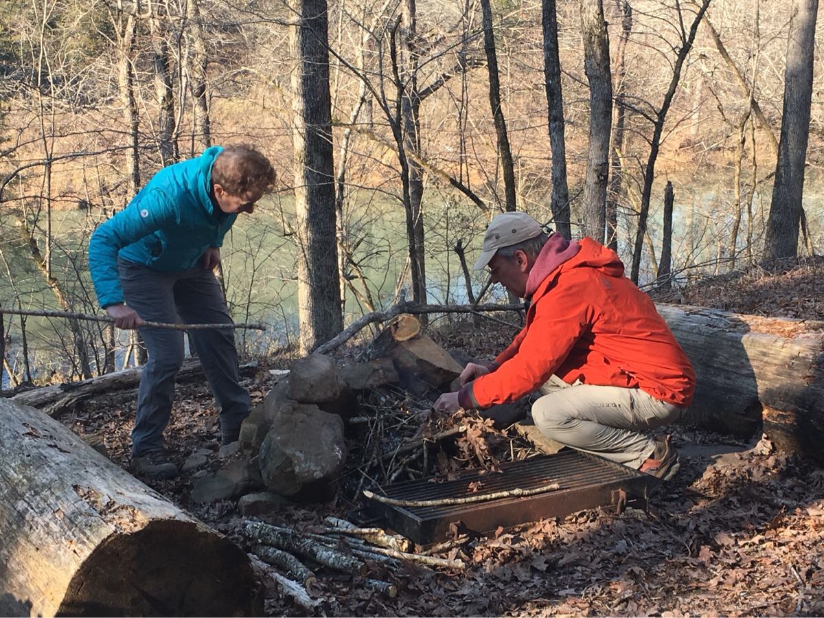
Fire experts at work…
This was another 11.5 mile day – we are starting easy. Met one group of day hikers heading east.
Day 3, Fri, Mar 8 (OT 116.6 to 100.8)
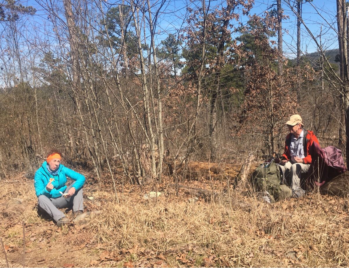
Managed to get cell coverage long enough to get a weather report and a big storm is coming through sometime after Friday afternoon so we elected to go long (nearly 16 miles) today to get to Fiddler Creek shelter. Stopped at Suck Mountain (yes, that is a real name) Shelter for lunch.
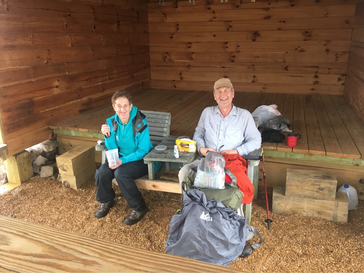
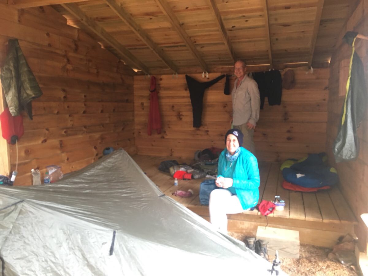
Couple of tired hikers having lunch at a shelter
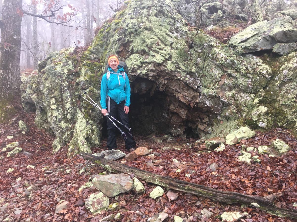
Cool cave on the trail
Met a couple of thru-hikers heating east toward Suck Mt. They were just returning to the trail after getting off for the real cold weather. Haven’t seen any animals yet but a lot of scat. We have done about 37 miles – tomorrow we will pass the half way point of the section.
Everyone is feeling good but pretty tired. Emerson surprised us with a little mini bottle of Jack Daniels – he is today’s hero
Day 4, Sat, Mar 9 (OT 100.8 to 90.5)
Good call pushing to the shelter (kudos to Roberta!) as we woke Saturday morning to a major thunderstorm – lightning, rain, pea-size hail and big winds.
Looking out at the rain from the back of the shelter.
Left the shelter about 9:00 after the rain let up. Pretty short day – only 10 miles after yesterday’s 16. Another shelter night (Brushy Creek Shelter) – fourth in a row! Stopped at Brushy Creek CG for lunch and managed to dry out the tent and wash some pants.
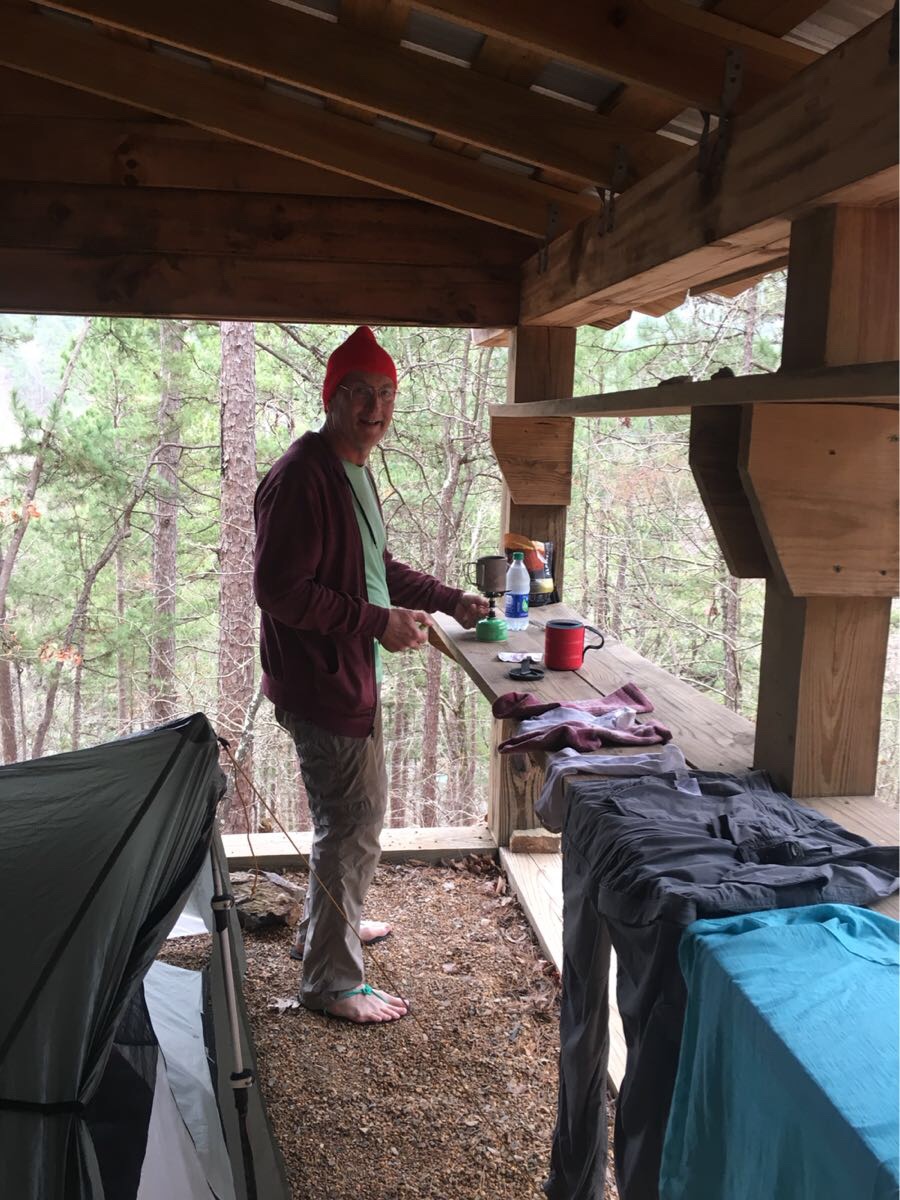
Cooking dinner – so nice in a shelter!
Relaxing at the shelter
Day 5, Sun, Mar 10 (OT 90.5 to 77.2)
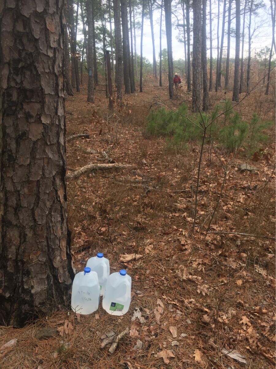
13.3 mile day and finish with a big climb up Blue Mountain where we camped for the night. Picked up our water cache at OT 88.2 (this is supposed to be 20 mile waterless section but with all the rain there is actually some water).
Water cache with Emerson arriving in the distance
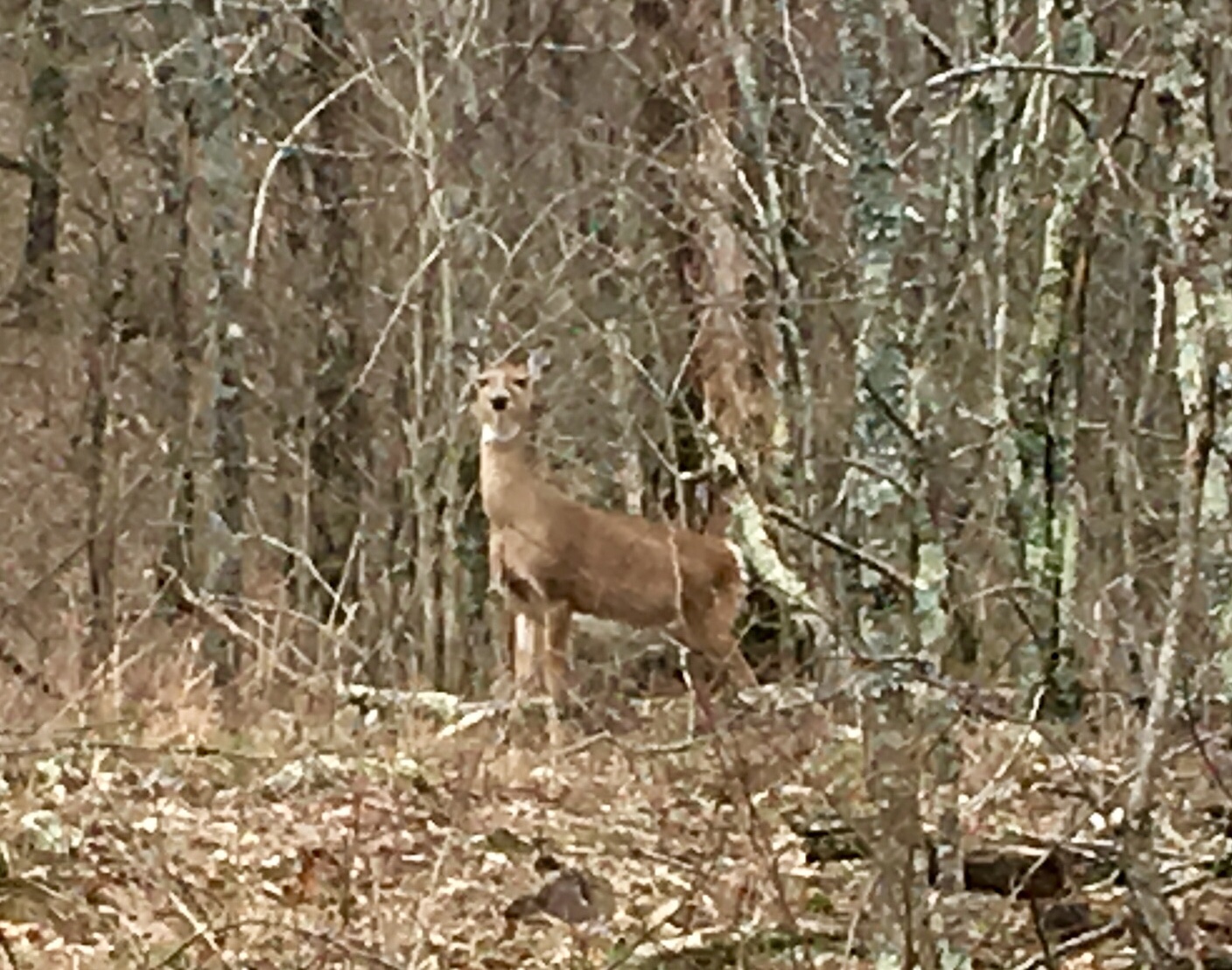
We are all pretty tired at this point and the climb at the end of the day was tough. This is our first rough camping (no shelter). Saw two deer coming up the mountain.
Deer on the trail
Day 6, Mon, Mar 11 (OT 77.2 to 63.9)
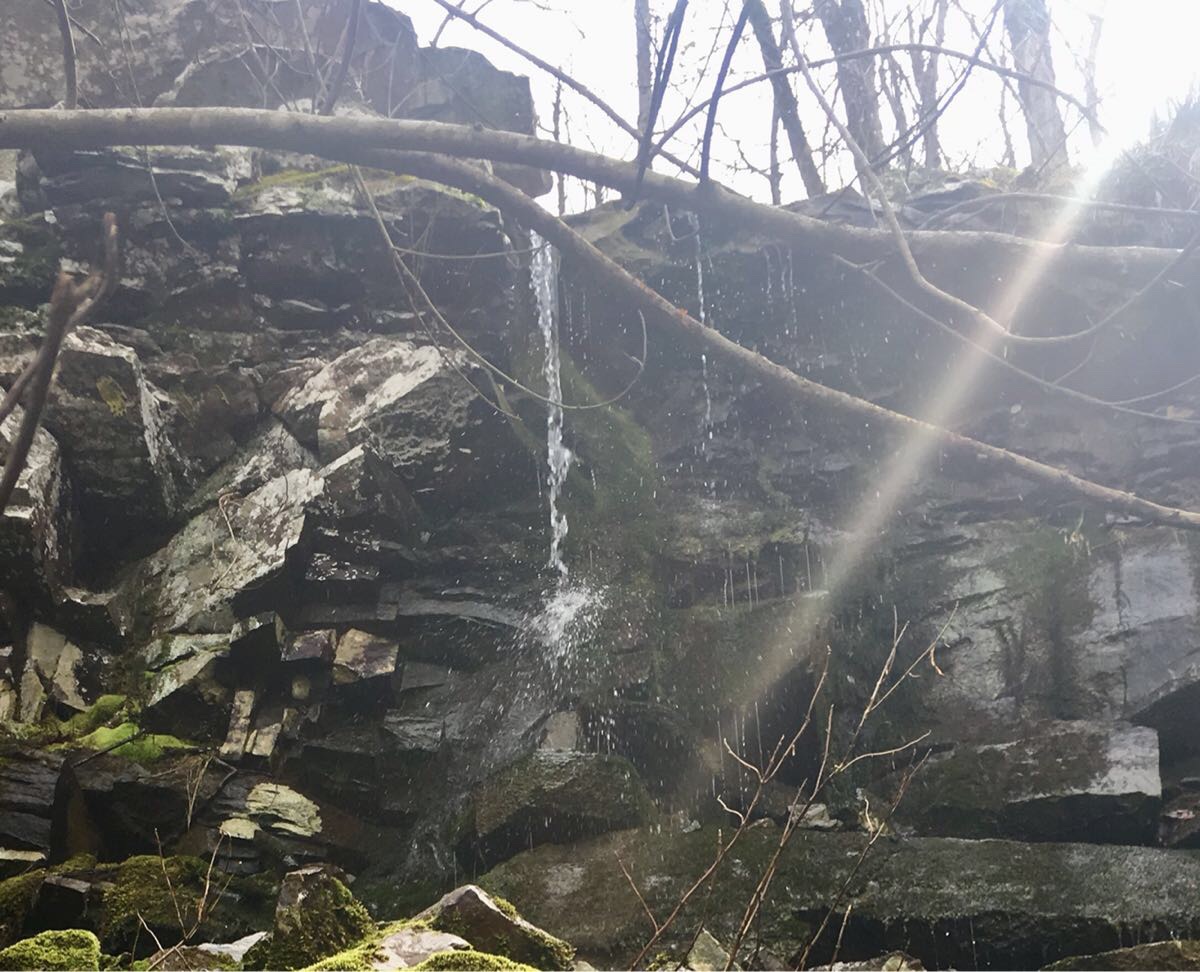
Woke to a light rain which we waited out. Finally stopped around 8:45 and we started hiking. Met three section hikers heading east just past Tan-A-Hill spring. Stopped for lunch at Foran Gap Shelter, drying off our tents. Three east bound thru-hikers from Ft Smith showed up and we visited for a bit. Unfortunately I left my hiking shirt there. Darn! Got water at a pretty little water fall just off the trail. Unfortunately Emerson ended up losing his dirty water bag somewhere around here.
Pretty waterfall (and tasty water!)
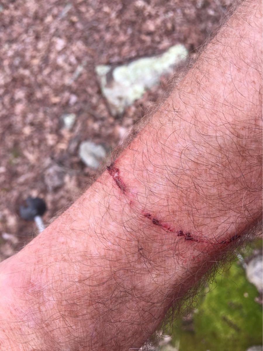
Lovely day weather-wise, hazy sun and 50’s, I ended the day in shorts and tee shirt. Trail was not great the last 5 miles, lots of brambles and trees across the trail.
Bramble souvenir from the OT
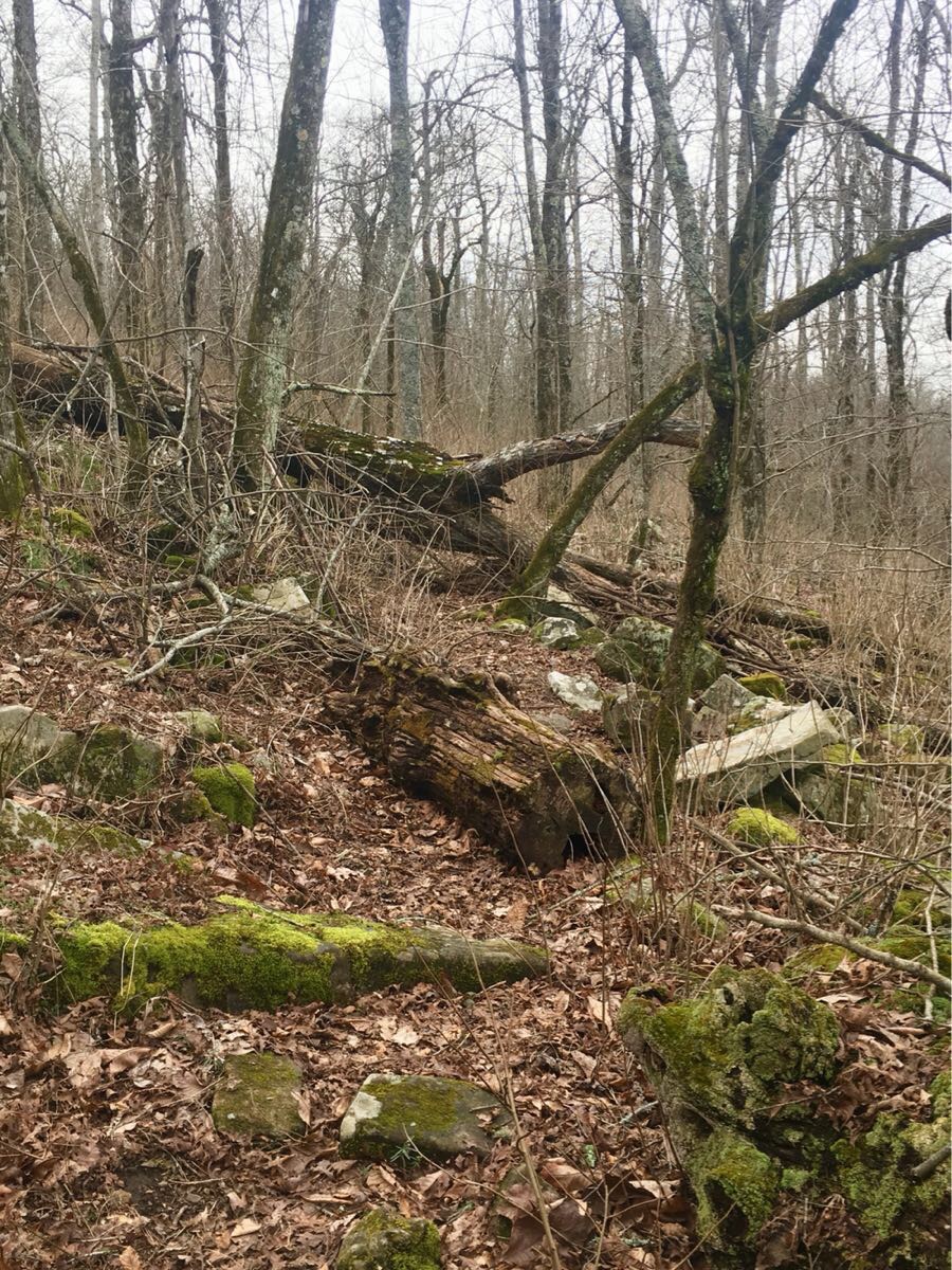
A few trail obstacles – yes, this IS he trail!
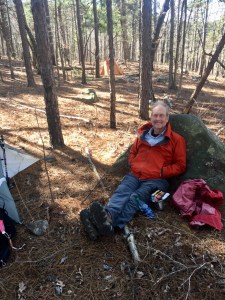
Day 7,Tue, Mar 12 (OT 63.9 to 51.5)
Thunderstorms overnight with some fairly heavy rain. Would have been nice to be in a shelter but our tent did not leak (though Emerson says his did). Waited for Emerson to run back .3 miles to retrieve his lost trekking pole before starting for the lodge and a shower!
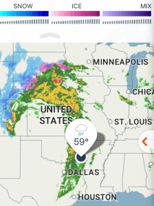
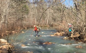
Cute hiker crossing a stream.
The trail was particularly nasty the last 5 miles, rocky, wet and not level but the promise of a warm bed and a hot shower kept us going.
The lodge….finally!
Hiker rewards
Overall it was a very rewarding week of hiking. We had some very iffy weather but always managed to be either in our tents or a shelter when it got really nasty. We hiked in 70 degree sunshine and 40’s wet and windy overcast. Sometimes in the same day.
The shelters were a nice surprise and came in very handy with the rough weather. The trail is mostly good but very rocky and obstructed in a few places. And every one says it gets worse as you head west. And it can be a tough trail. Some of the pitches are very steep.
We picked a good day for a zero. Another major front is causing heavy winds and rain outside as I type this. But it’s all supposed to pass by tomorrow when we plan to head back out.
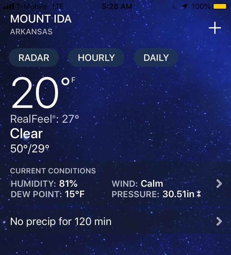
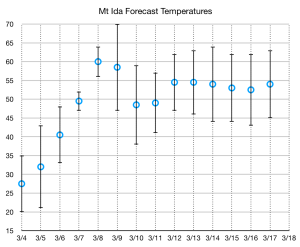
We arrived in Mt Ida early this afternoon after a cold, two day drive from Denver. Last night is was 15 degrees in Tulsa! Tomorrow promises to start cold (16-20 degrees depending on who’s forecast you trust) but should see the beginning of a warming trend that will bring temperatures back to a more normal range by Friday.
We drove the Talimena Scenic Parkway (which parallels the trail for about 60 miles) dropping off a couple of water cache’s and a food cache at the Queen Wilhelmina Lodge.
Our home in Mt Ida!
We will drive to the Blue Bell Cafe in the morning for breakfast and then Lori (the proprietor) has promised us a ride the trail (Mile 138.4, where we exited the trail last February) and we will be off!
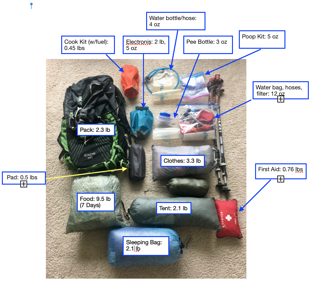
We did a final pack check and weigh-in while waiting for Emerson to show up. These are our final weights – they are a bit lower than expected because we will be wearing a lot of our cold-weather clothing when we start in the morning. This is with 7 days of food and 2L of water.
With the forecast of an unusual late season arctic cold front blowing through the central part of the country on the very day we had planned to start (Mon, Marc 4) we have decided to delay our start by two days. We will now be leaving from OT Mile 138 (about 10 miles east of Story, Arkansas) on Wednesday, Mar 6. As I write this (Sunday morning, Mar 3) it is -1 degrees in Denver and 36 degrees in Mt Ida.
The projections show a 20 degree average temperature rise from Monday to Thursday. After that the temperatures are more typical (40-65) for this time of year. We will probably get some rain but, especially after last year, we don’t want any more sub-20 degree nights.
Getting ready for the trail with two weeks to go. Base weight is coming in at about 15.5 lbs. With 9.5 lbs of food (first 7 days) and 2L of water (4.4 lbs), pack should be just under 30 lbs when we start.
Everything but the water!
Here is the plan:
Drive from Denver – Leave Sat, Mar 2.
Overnight in Tulsa– Sat Mar 2 – long day (10 hour drive) but makes tomorrow much easier.
Drive to Mt Ida – dropping off water at two cache sites – 4-5 hour drive:
Cache #1: Deadman Gap (OT 8.0)
Cache #2: OT 86.0
AND dropping off our food cache at the QW Lodge (OT 51.5)
Overnight at Royal Oak Inn (Sun, Mar 3)
Get Lori (or someone) to get us to the trail on Mon Mar 4, OT138.4
Hike for 7 days, 88 miles,12.6 m/day, arriving at the QW Lodge on Sun, Mar 10. Two nights at the lodge, Sun, Mon, Mar 10-11.
Leave early Tue, Mar 12 for the final 51 miles
Arrive at the TH early Sat, Mar 16 (Sat)
Get a ride from Talimena State Park (Michael, Ouachita Trail Guide) back to Mt Ida.
Spend two night in Mt Ida, Mar 16,17
Head home to Houston on Mar 18.
We have all our food. We plan to share the prepared freeze-dried meals for dinners (what Roberta calls “glop”). I’ll be eating about 2400 calories a day which, for 13-14 mile days is about right.
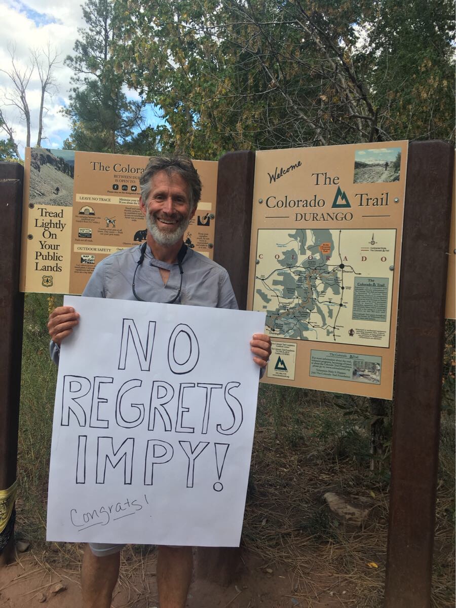
After 34 days of hiking, 5 rest days (zeroes) I reached the Durango Colorado Trail terminus on noon on Monday, September 17 to be met by my lovely wife. I left the northern trailhead on August 10. It feels a bit strange not to be planning for another week of hiking.
Done!
Life on the Trail
The day started around 4:30 when I woke up and left my cozy warm tent to search for the cat hole I had dug the afternoon before to relieve myself. Then back to my tent to brew some coffee, eat some breakfast and do a little reading. Over the next hour or so I would work on my feet (put on band-aids/mole skin where required), put on my hiking clothes and began packing everything up. By 6:00 AM I was out of my sleeping bag and deflating my pad and stuffing my pack. Then out of the tent and taking it down (usually still with my headlamp on as it was still dark). The tent fly was usually wet – either from condensation or from rain so I kept the packed tent on the outside of my pack.
A quick check around then hiking by 6:30 or so. The mornings were usually cold – in the 30s most of the time depending on how high I was, so I usually started with my gloves and wool hat. By 9:00 it had usually warmed up enough to take those off and put on my sun hat. By 9:30 I had usually done 6 miles and stopped for a quick snack and rest. By 11:30 I usually had 10-12 miles in and stopped for 30 minutes or so for lunch. If the sun was out I would lay my tent/fly out to dry.
Hanging the tent out to dry at lunch
If I was doing my usual 16 miles or so I would hike straight to my planned camp site and have my afternoon snack there while putting up my tent. I usually tried to camp near a water source where I would scoop 4L of water into my dirty water bag, hang it on a tree and begin filtering water.
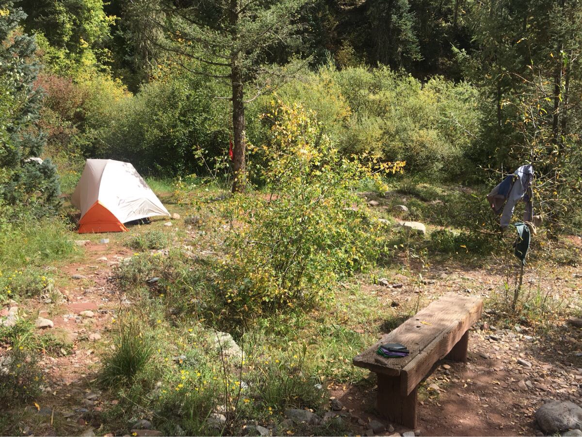
My last camp site near Junction Creek. And a bench!!! Luxury!
After my tent was up and water filtering started, I would do a sponge bath using a bandana and put on my camp clothes (running shorts/t-shirt). If I was not near a water source (dry camp) I would have carried water (not fun!) from the last good water source, and no sponge bath. Sometimes, if there was a good source of water, I would wash some of my hiking clothes and hang them out to dry.
All this usually took an hour or so, then I would rest/read till 5:00 and start cooking dinner. After dinner, I would read till about 7:30 or it started to get dark, then go to sleep.
And with one exception, I camped by myself every night.
Food on the Trail
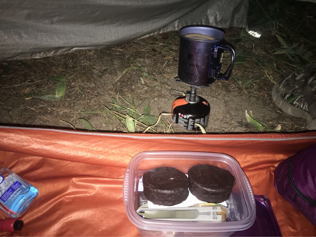
This was a typical day’s food. Breakfast: big cup of coffee with two sugars, two pop-tarts. Snack: Kinde bar or two handfuls of salted almonds. Lunch: Tortilla with salmon foil and cheese wedge accompanied by 1/4 box of Cheez-It crackers. Snack: more nuts. Dinner: Ramen Noodle with a salmon foil and a tortilla.
Breakfast!
People on the Trail
I met lots of other thru-hikers, Mary Poppins, Jabba (the Hutt), Whispering Weasel, Boston, Smiles, and many more. Most were south bound (like me) but I did meet some north bounders. And lots of segment hikers.
Jabba, headed north after completing the CT, attempting to set the unassisted record (9-1/2 days!).
Unlike other trails I have done, the CT allows bikes and I saw probably 30 bikes and bike-packers. They were universally polite, stopping and allowing me to pass. And (the ones going north) they were a good source of current information about the trail ahead.
Statistics
I climbed more than 90,000 feet. The equivalent of climbing from sea level to the top of Everest, three times. I averaged about 3,000 ft/day and my biggest climb day was about 5,000 feet. I was over 10,000′ elevation 80-90% of the time and was over 11,000 feet for days at a time. I climbed one 14er as a side trip, Mt Elbert, the highest mountain in Colorado and the second highest mountain in the contiguous United States.
Above 12,000 feet again!
I walked 485 miles in 34 days. Not counting partial days (going to town days) I averaged just over 16 miles/day. My longest day was 18.5 miles and my shortest was 12.5 miles (on a big climb day).
I almost always started hiking at sunrise, usually around 6:30, when there was enough light to see the trail and was usually done by 3:00. On a good day my pace was 2.5 mph, but on big climb days, this could drop to 2 mph.
I met probably 20-25 other thru-hikers and about the same number of section hikers over the 5-1/2 weeks I was on the trail. I also saw several people on horses and lots of bike-packers.
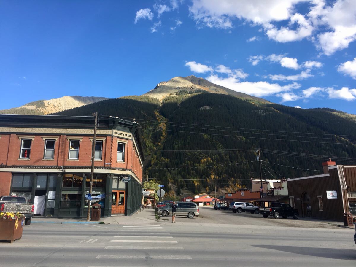
I re-supplied six times and took 5 rest days. My longest section between resupply was 104 miles (6.5 days) and the average was about 70 miles. The six trail towns I stopped in (Frisco, Twin Lakes, Mt Princeton Hot Springs, Gunnison, Lake City, Silverton) were all very nice but my favorite was Silverton.
I only had to hitchhike four times, the rest of the time I either arranged with a shuttle service (Lake City) or took local transit (Frisco) to get to town. My favorite hitch was from Molas Pass to Silverton with an Italian couple on vacation.
I weighed about 174 lbs when I started and weighed 158 lbs at the finish. I calculate I was burning about 4,000 calories/day when I was hiking and eating about 2,500 or so. Even eating like crazy on town days I still was negative about 10,000 calories/week.
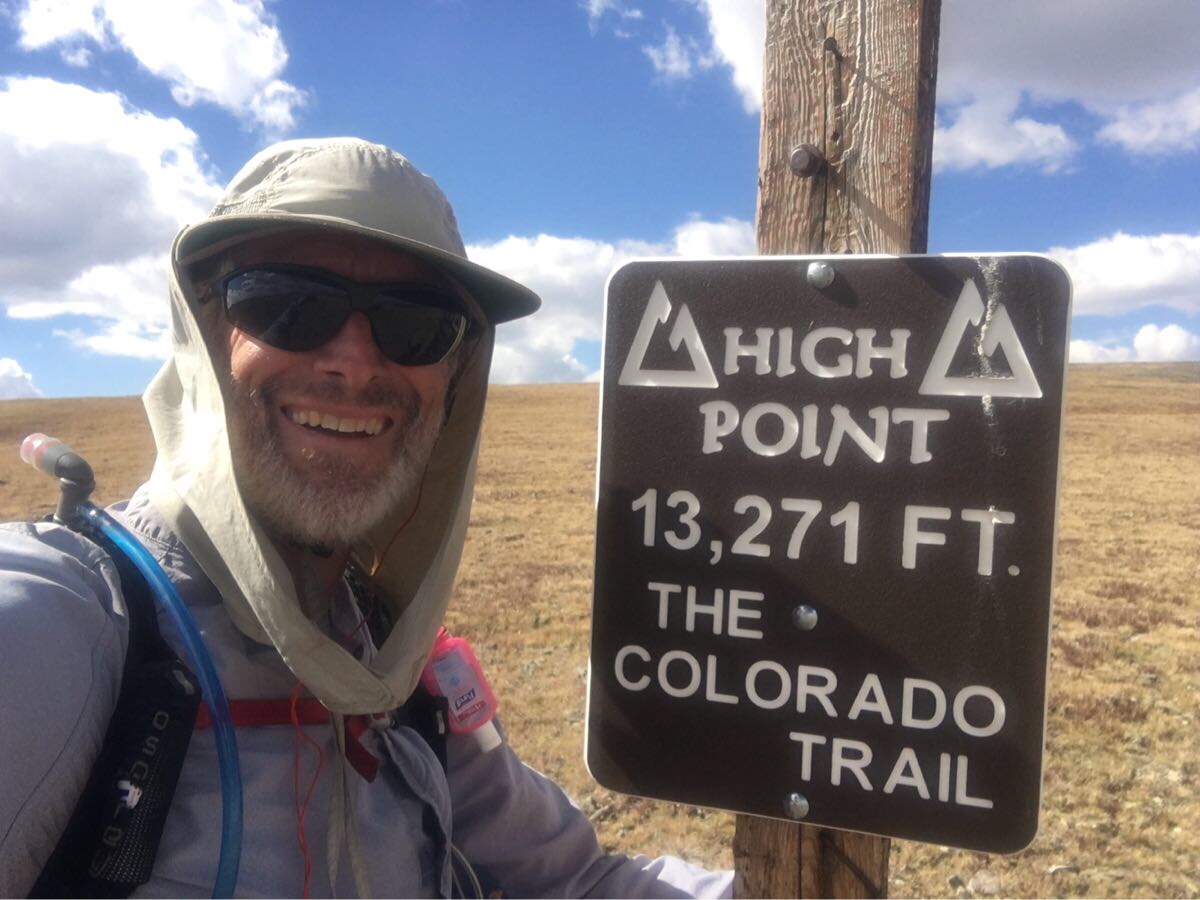
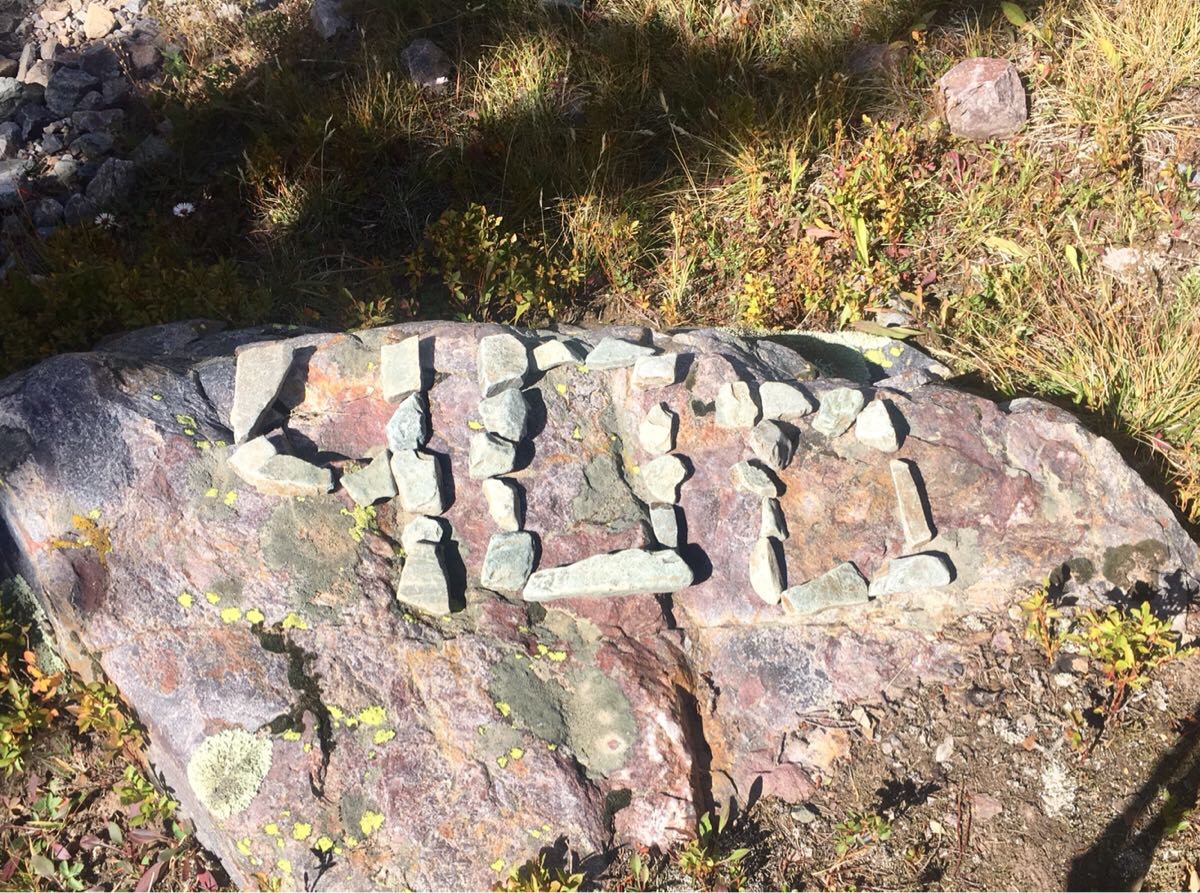
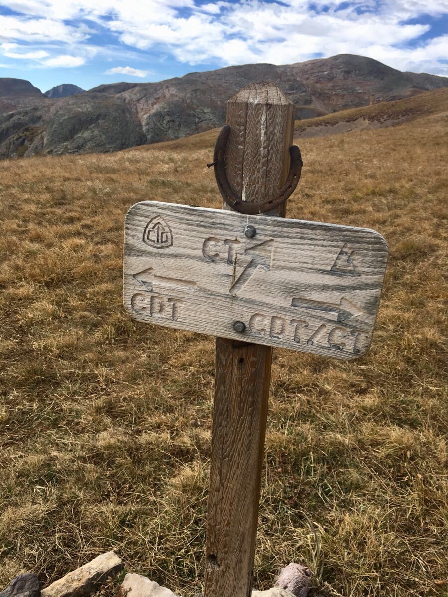
Some big milestones in this last section. I passed the 400 miles mark (currently at CT 411), the high point of the trail (13,271 feet) and, after 300 odd miles of being concurrent with the Continental Divide Trail (CDT), the two parted ways.
The high point of the CT. Yes!
400 Miles! Starting to feel like I might finish this thing.
The CT and CDT part ways.
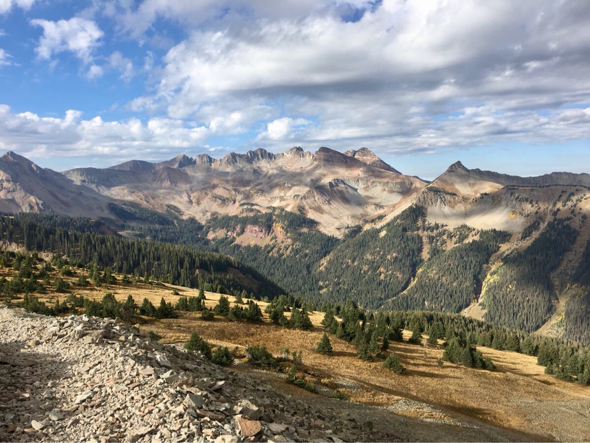
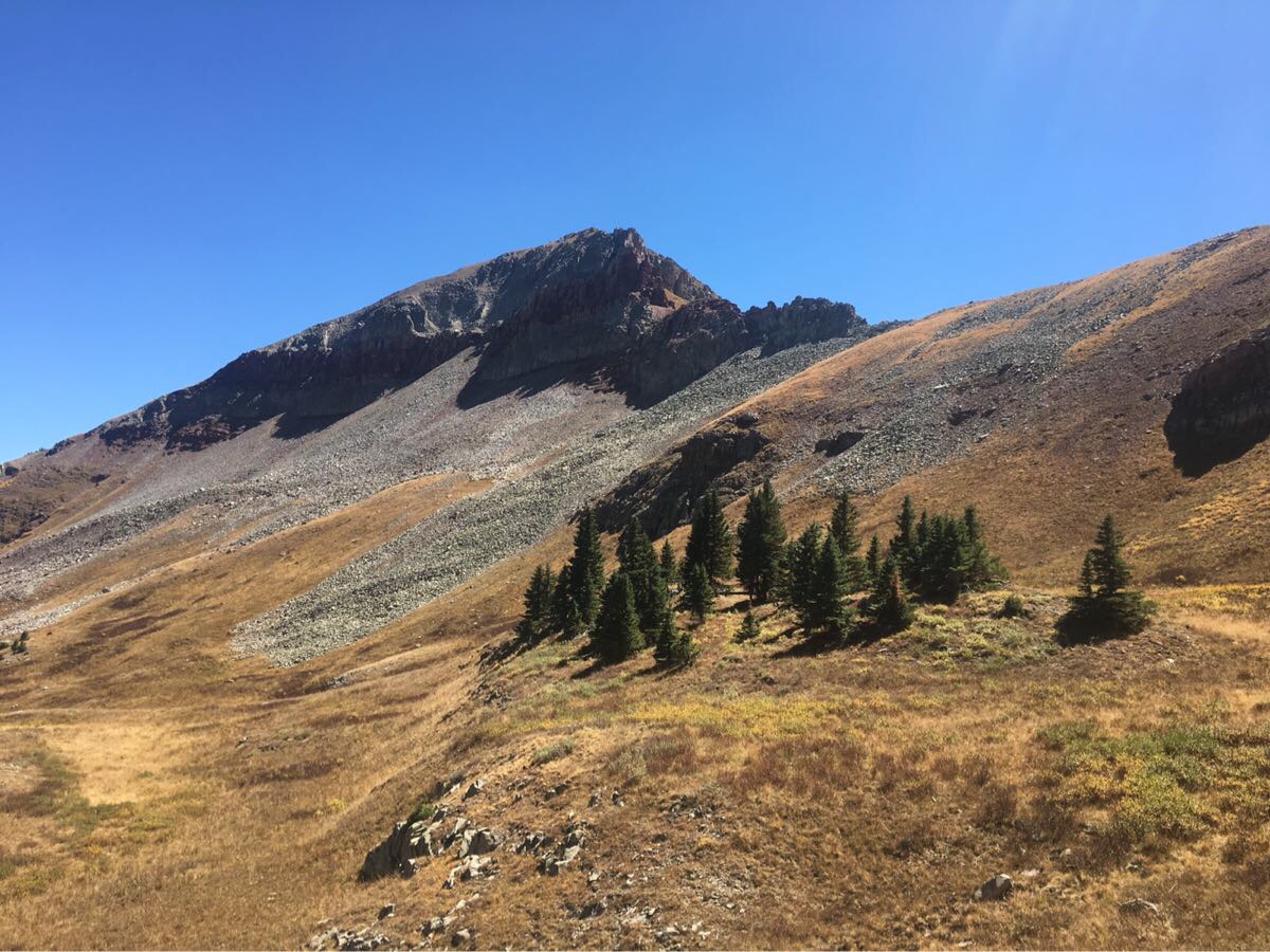
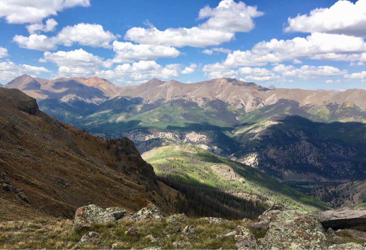
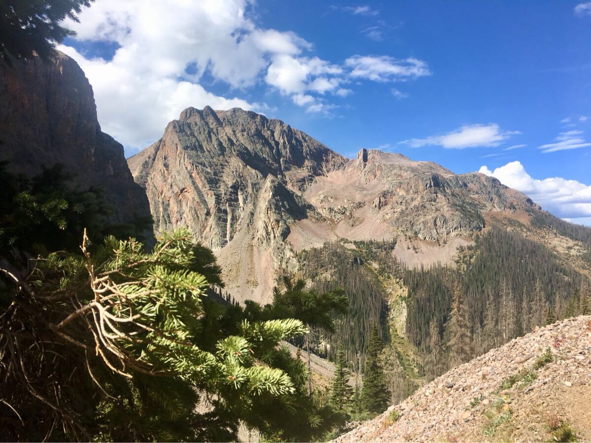
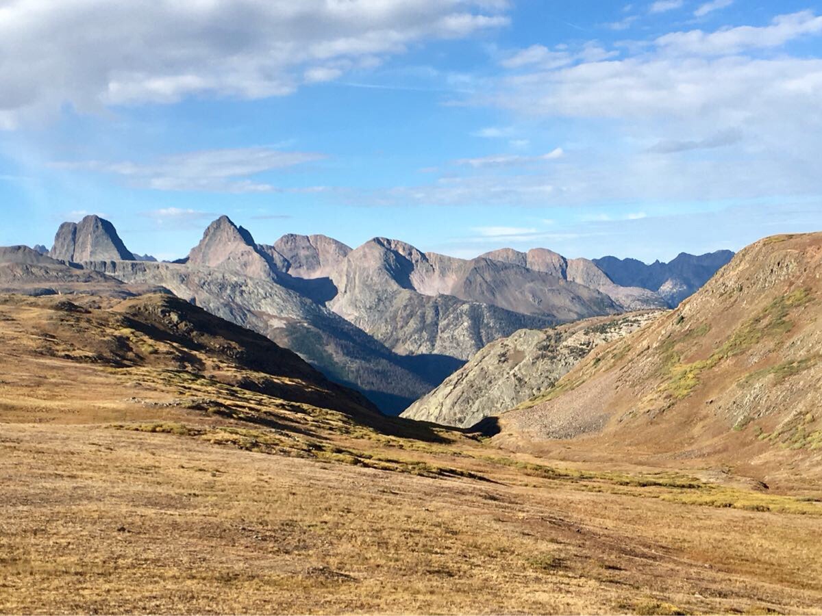
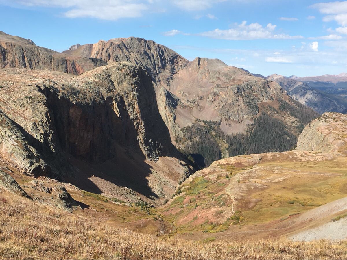
And I know I keep saying this…but… the views in this section were unbelievable. Most of this section was over 12,000 with some seriously tough climbs (I know, I also say that every post).
Just a sampling of the stunning views.
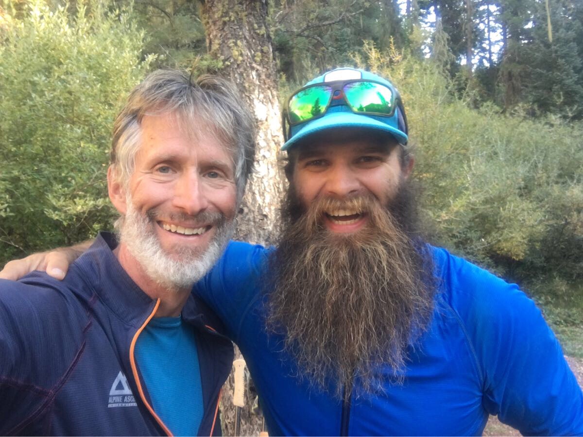
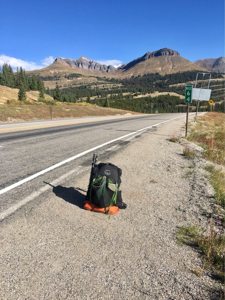
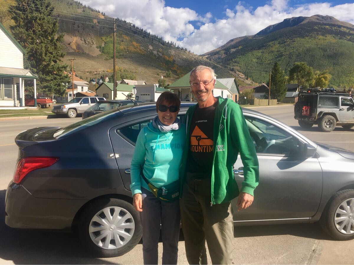
And did not meet any thru-hikers in this section but did meet several nice segment hikers. And a very nice couple that picked me up when I was hitching into Silverton. They were on vacation from Italy.
Pretty place to hitchhike. Molas Pass.
Floral and Fabio from Italy. My ride to Silverton.
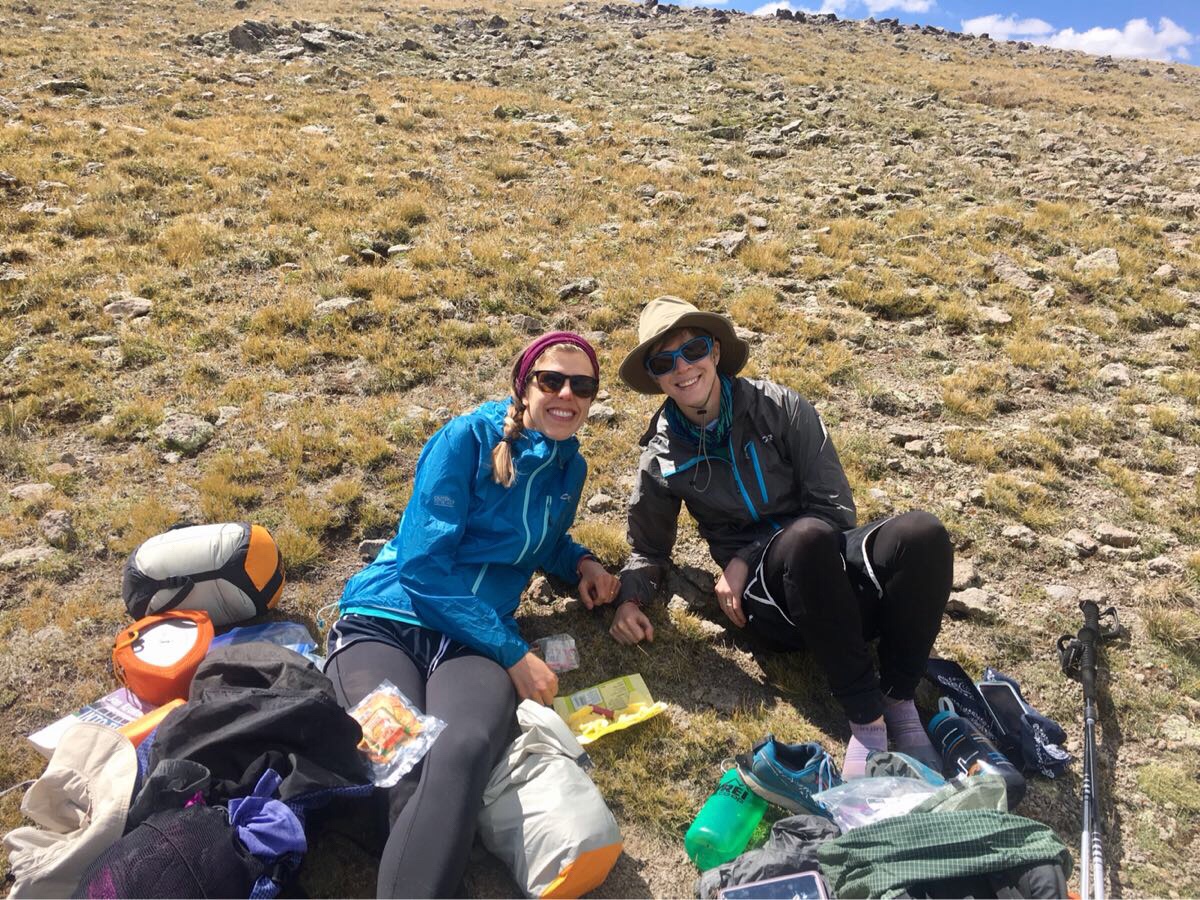
Couple of segment hikers I met at the top of a climb.
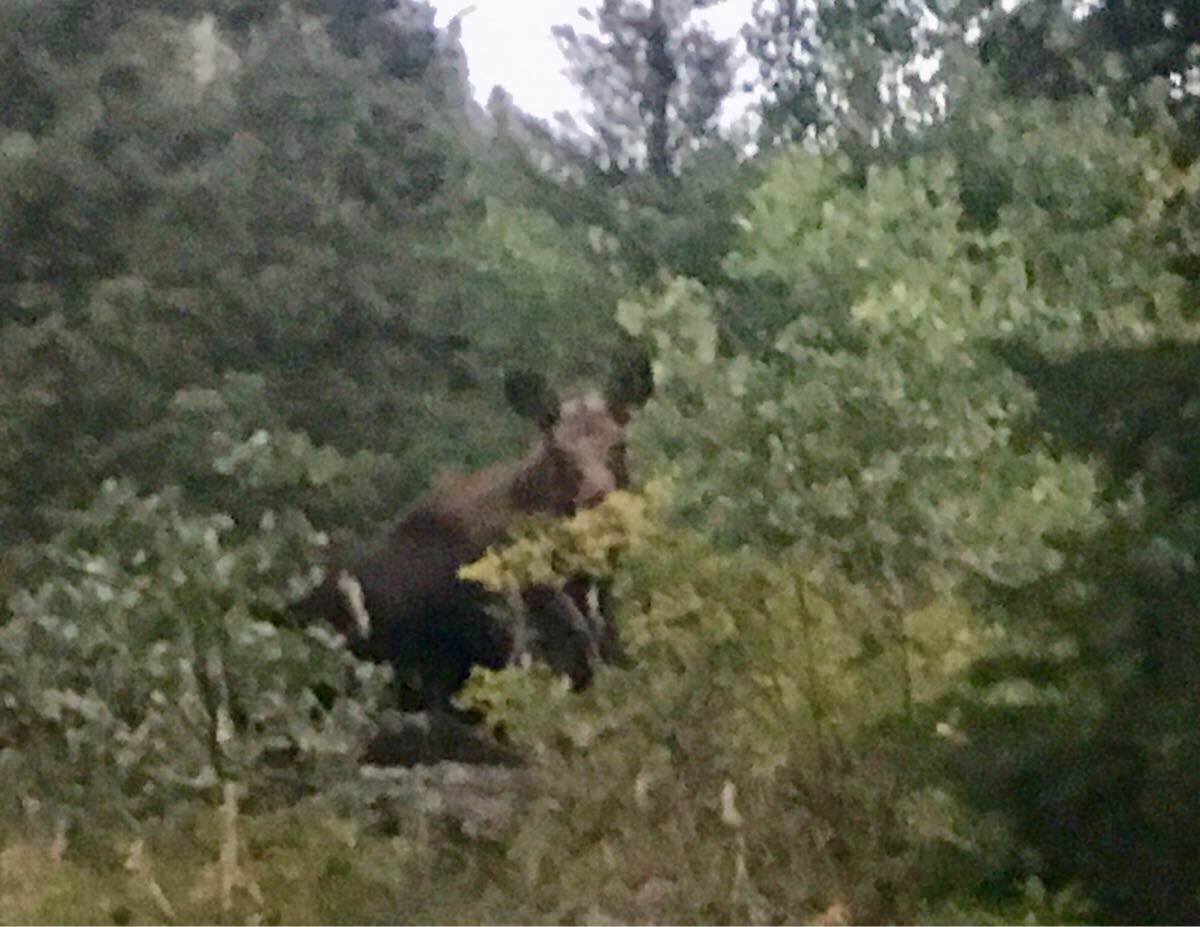
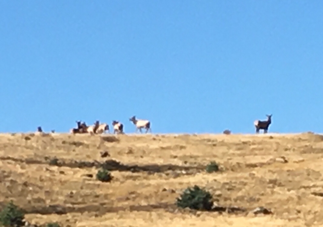
And I saw my first Elk, more Moose and a lots of Marmots (though no pictures of those fat little guys – move too fast!). Though not as many animals because I was above treeline most of this section.
Moose #1
Moose #2
Elk!
Wild sheep! Okay, maybe not wild. This was over 12,000 feet.
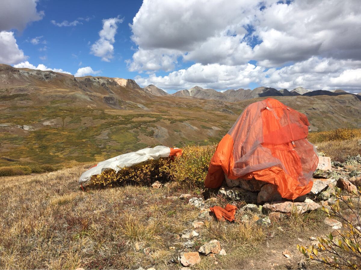
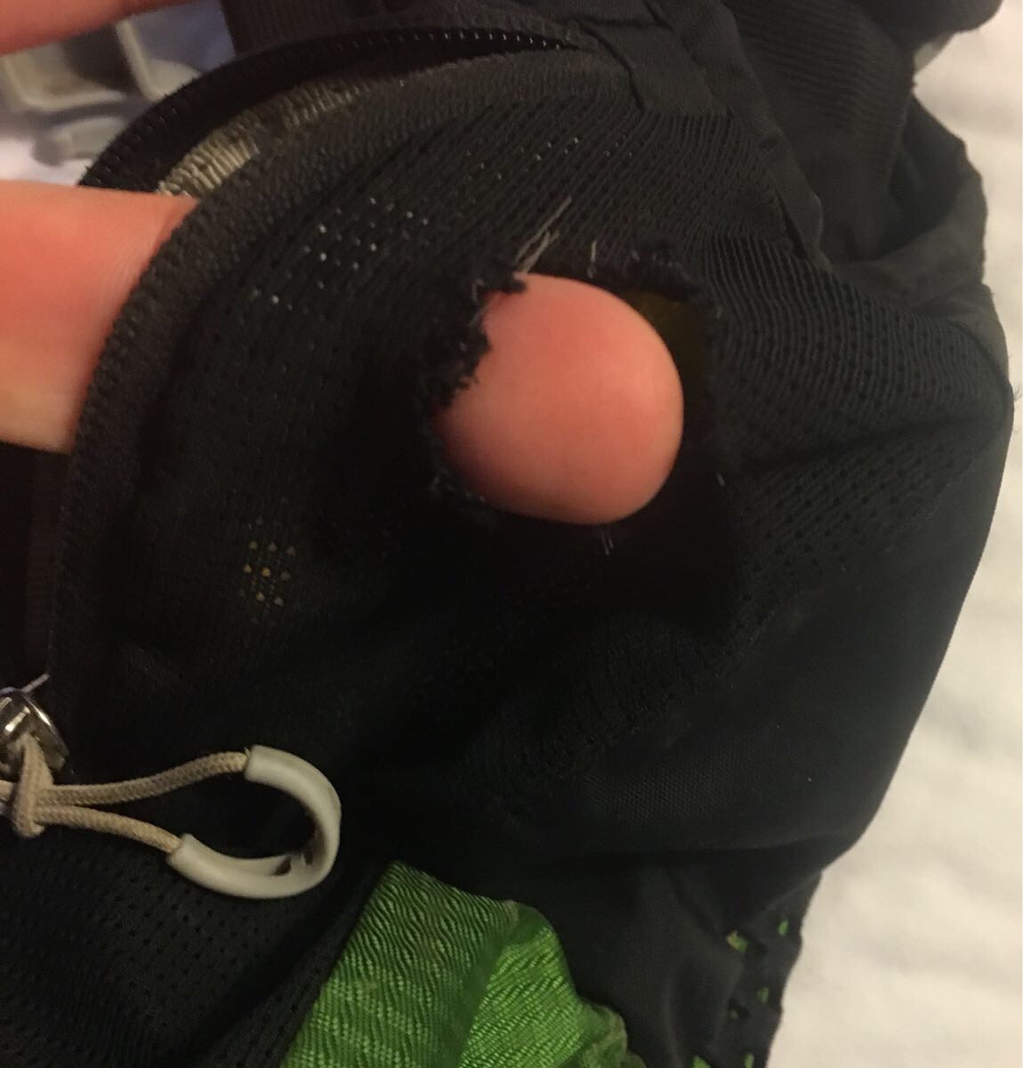
And someone ate through my pack one night.
Currently in Silverton resting and getting ready to start my last section (about 74 miles) to Durango.