

The trail is unlike anything else we have done (Ouachita Trail, Colorado Trail and PCT). It is entirely along the coast with many days of only beach walking. It also passes through many small beach towns (especially in the northern sections).

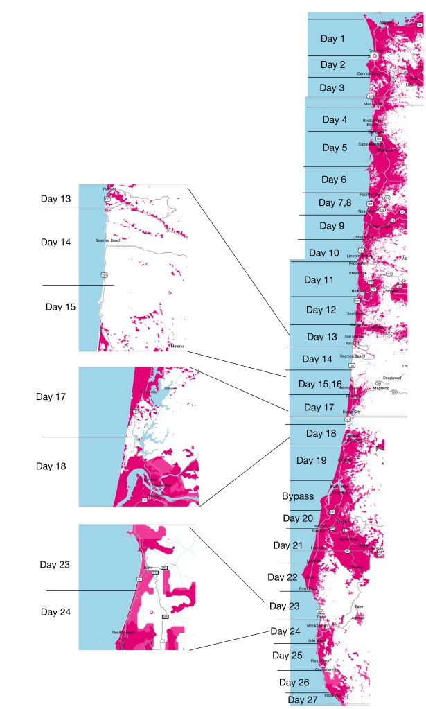
Our plan has us doing it the trail in 27 days (including two rest days). We will start on June 19 and finish (hopefully) on July 15. Of the 27 nights we will stay:
-
- 13 nights: hotels/hostels
- 4 nights: RV parks (i.e. showers, laundry)
- 10 nights: campgrounds (state or federal parks)
All of my Colorado Trail campsites were undesignated rough sites so this will be completely different.
The trail is (currently) about 50% along the beach, 25% along trails and the rest along rural roads or highway. Maybe 25-35 miles are along the Oregon Coast Highway and there is at least one narrow tunnel (with little shoulder) we have to get through. Will probably end up hitching some of the highway.
We will average just under 15 miles/day. Our longest day is a 20 miler but there is only one of those and we could shorten that one by hitching out of town.
Navigation
The OCT is not on the Guthook navigation app so I have built my own routes using the GAIA online hiking application.
Weather
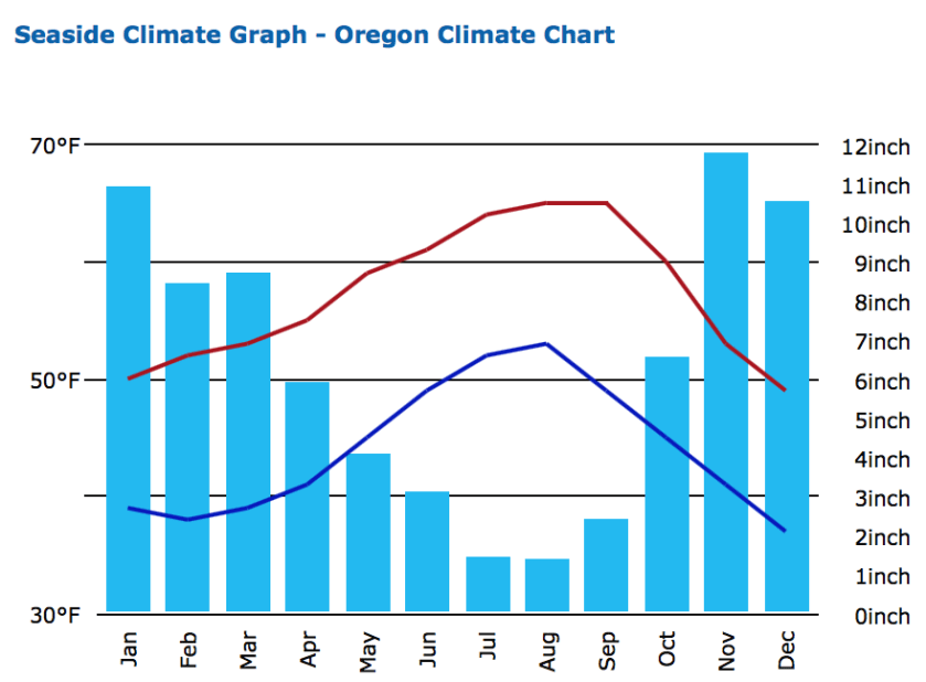
The spring rains start to let up on the Oregon coast in mid-June. This “dry” season lasts through September and makes July and August the most popular months to hike the OCT. The average lows (at night) will be in the low 50’s and with highs in the 60-70 range. The prevailing winds are out of the northwest (which is why most people elect to hike south bound).
Cell Coverage
Cell coverage promises to be pretty good with only a few days with little or not coverage.

One thought on “Oregon Coast Trail Plan”