Oregon Coast Trail Notes

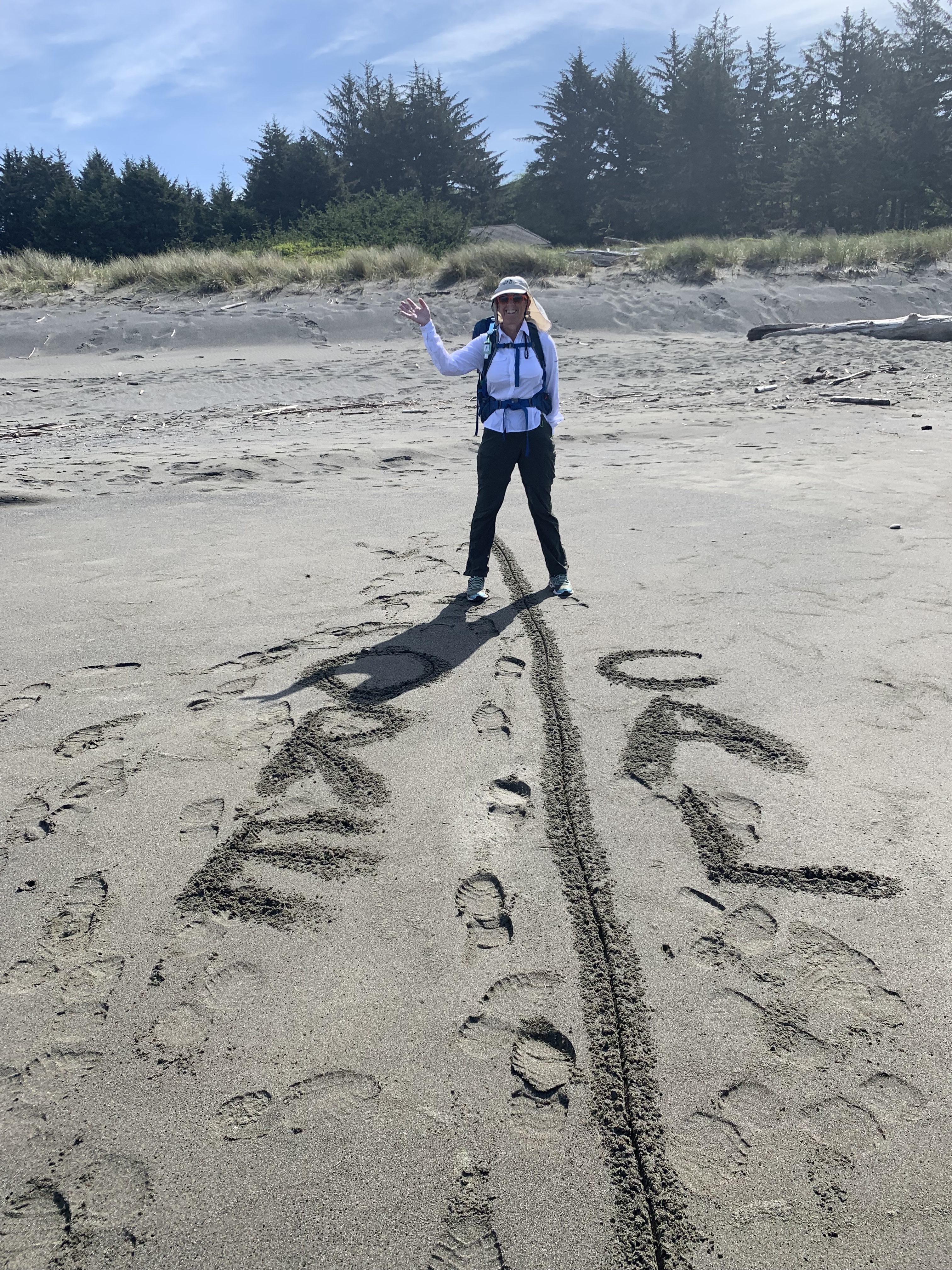
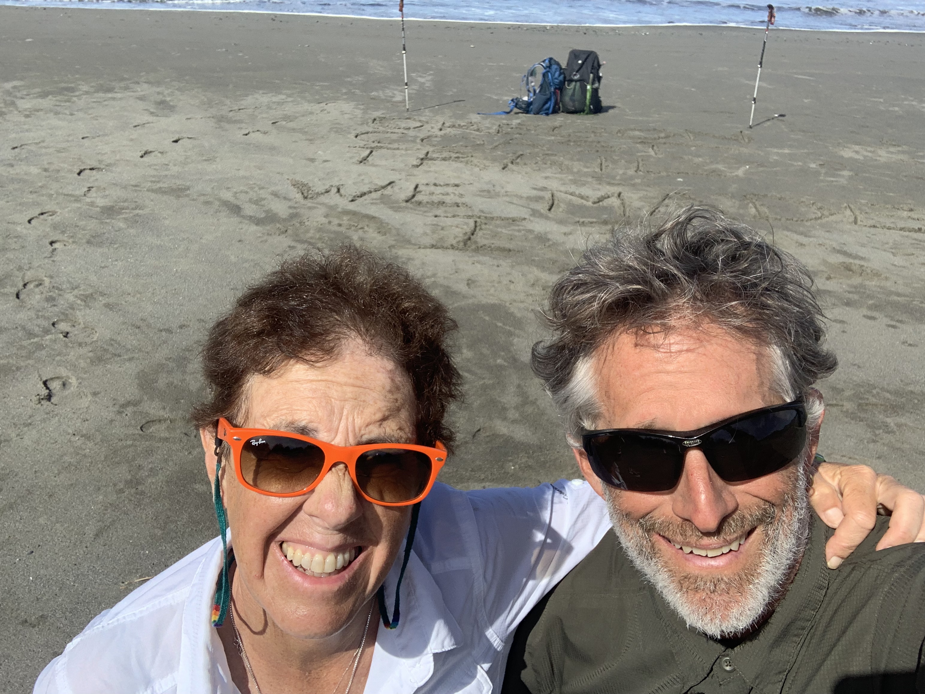
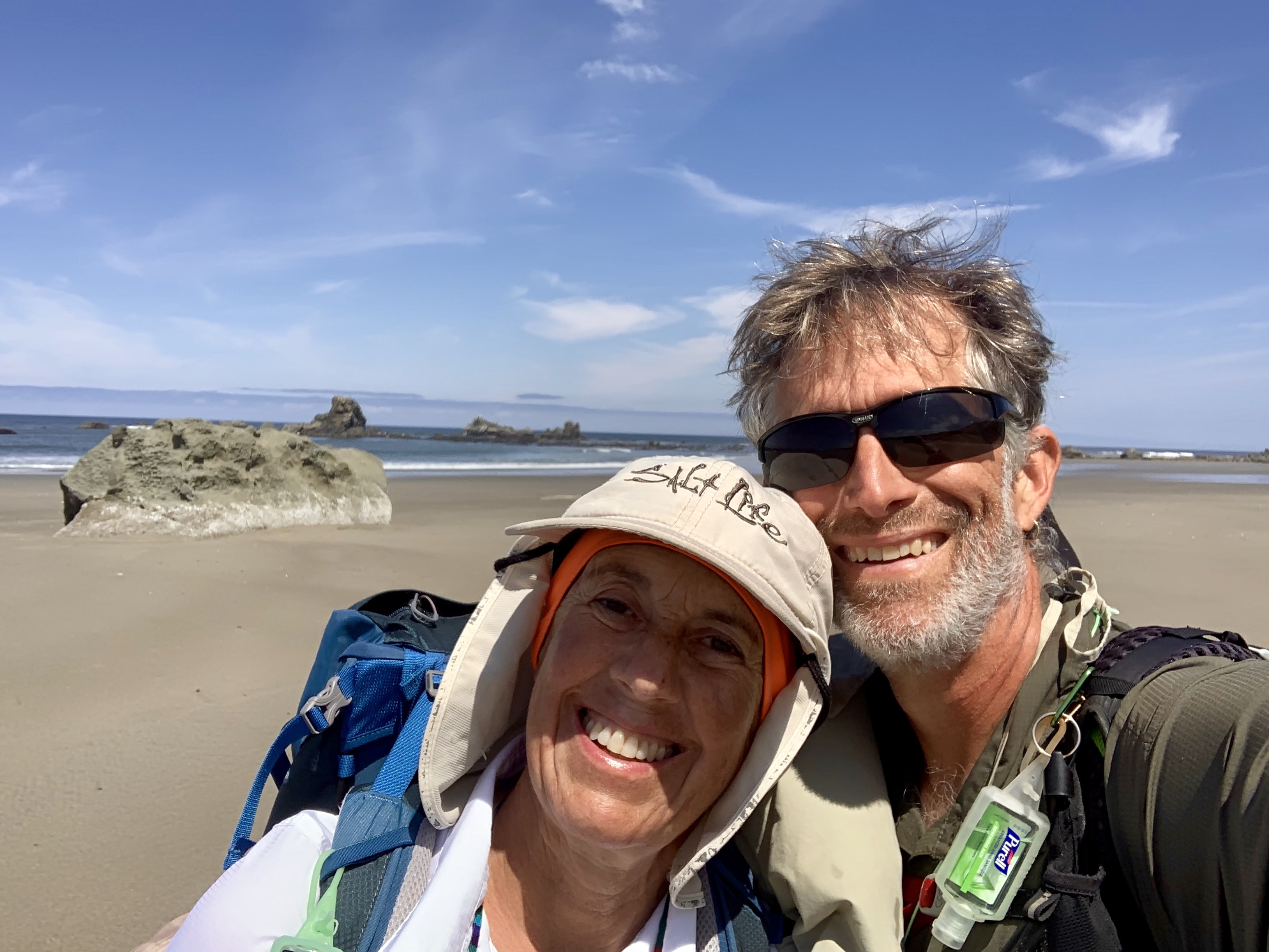
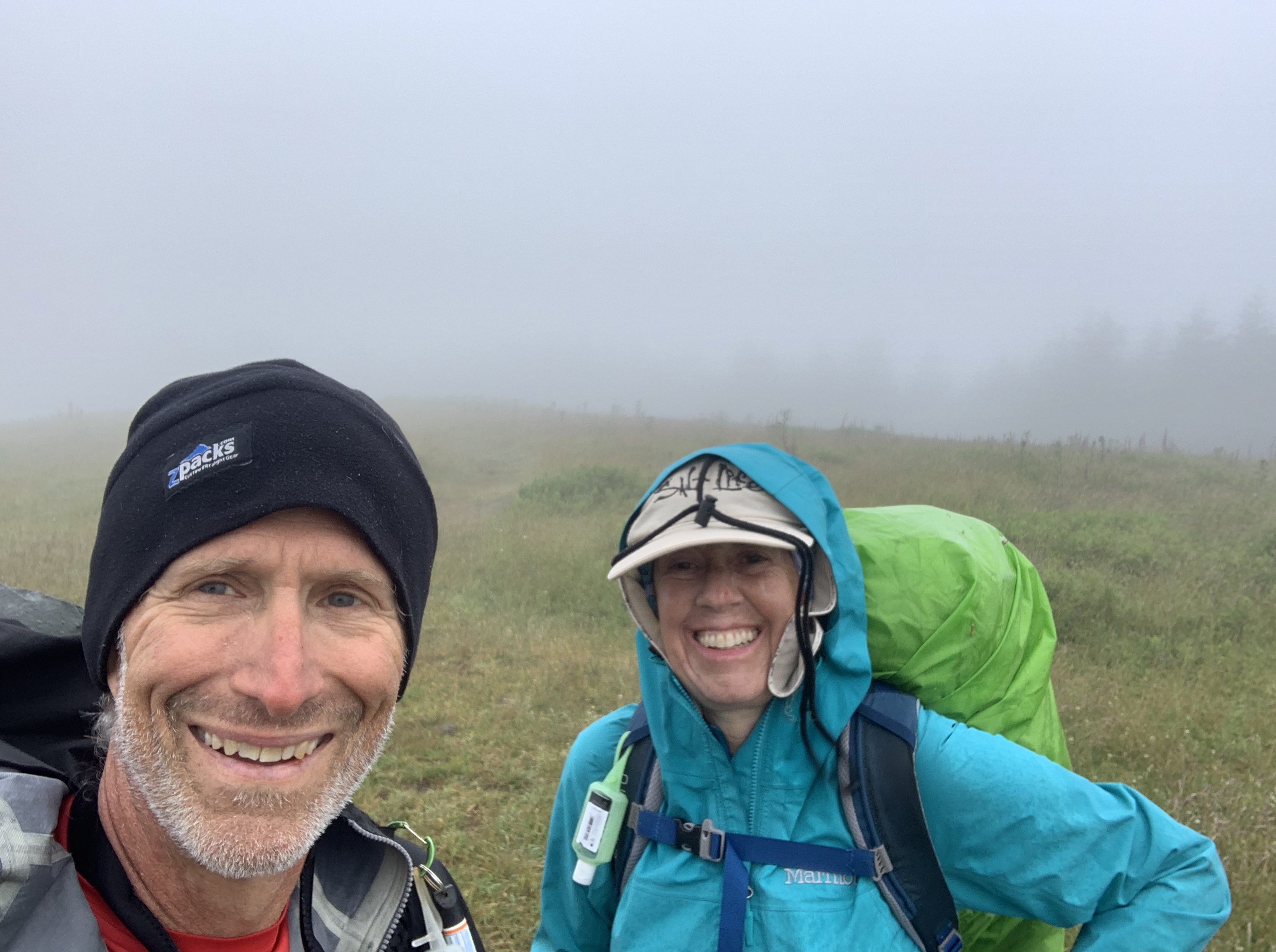
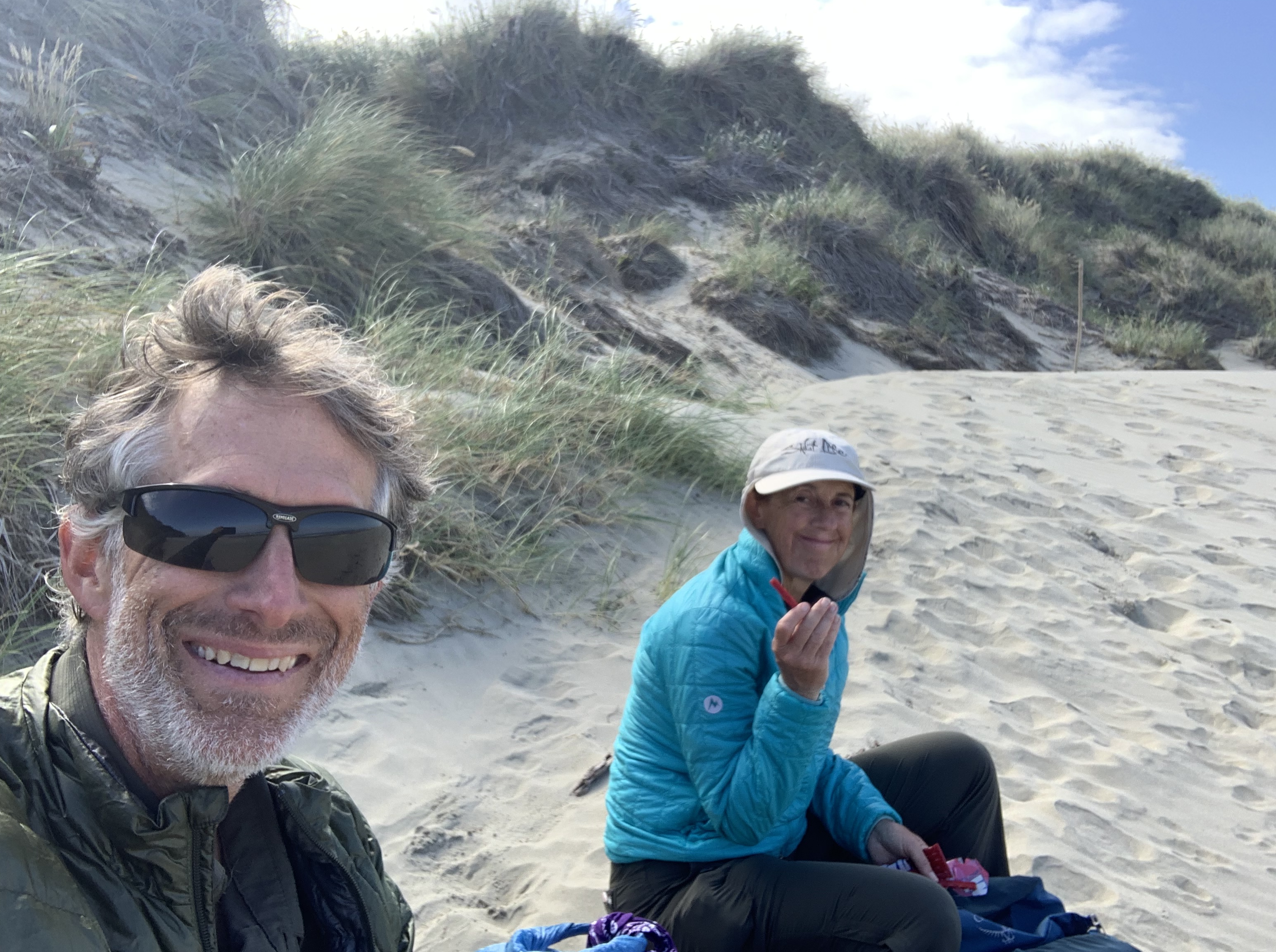
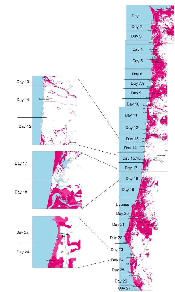
This post is primarily intended for folks who are thinking of doing the OCT. My wife, Roberta, and I started from the northern terminus June 19,2019 and finished 27 days later on July 15. We took three rest days (two planned and one just because).

Our primary navigation tools were Bonnie Henderson’s Day Hiking Oregon Coast: Beaches, Headlands, Oregon Trail and a set of routes I created using he Gaia hiking app.

Some overall comments

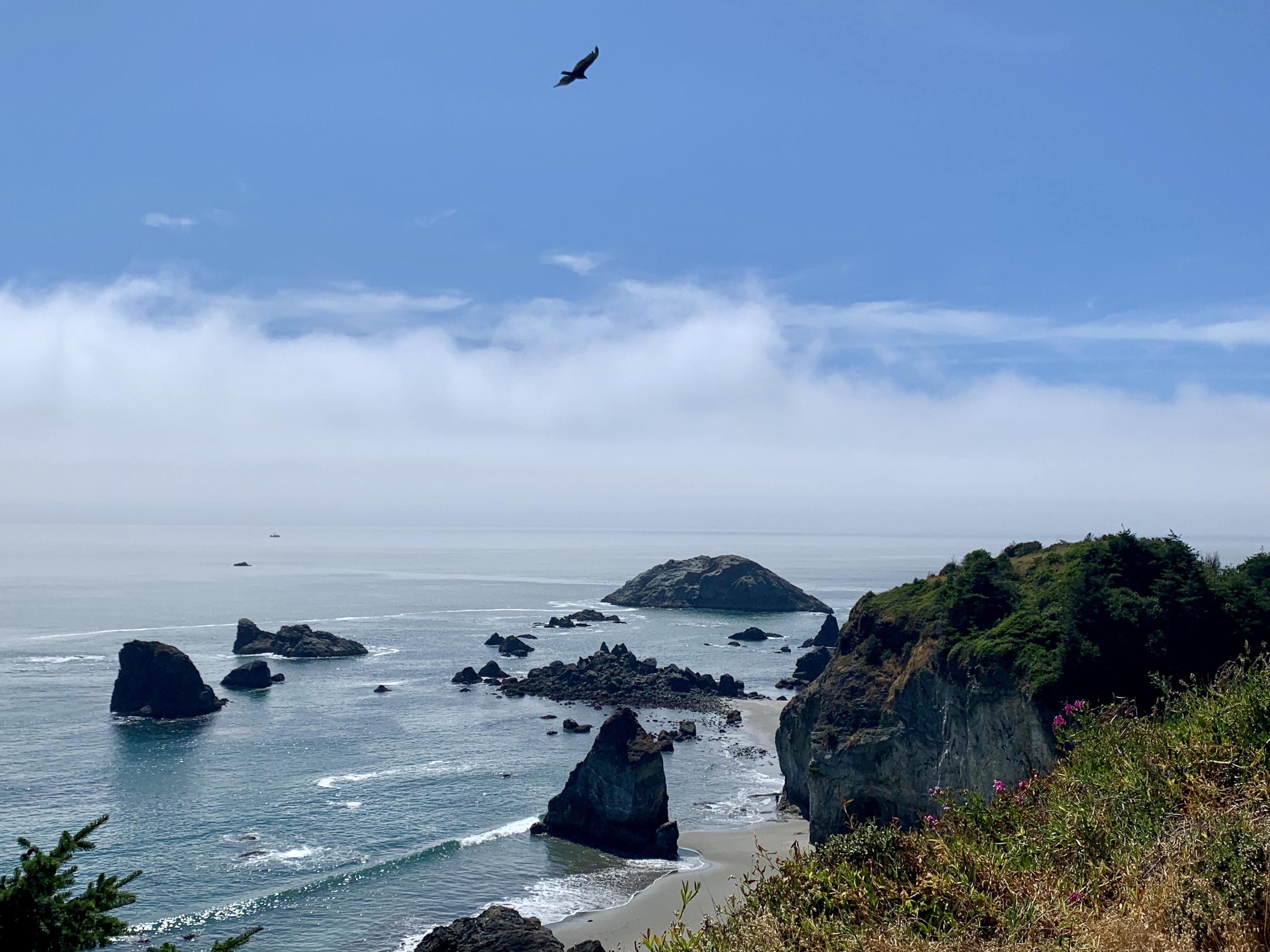
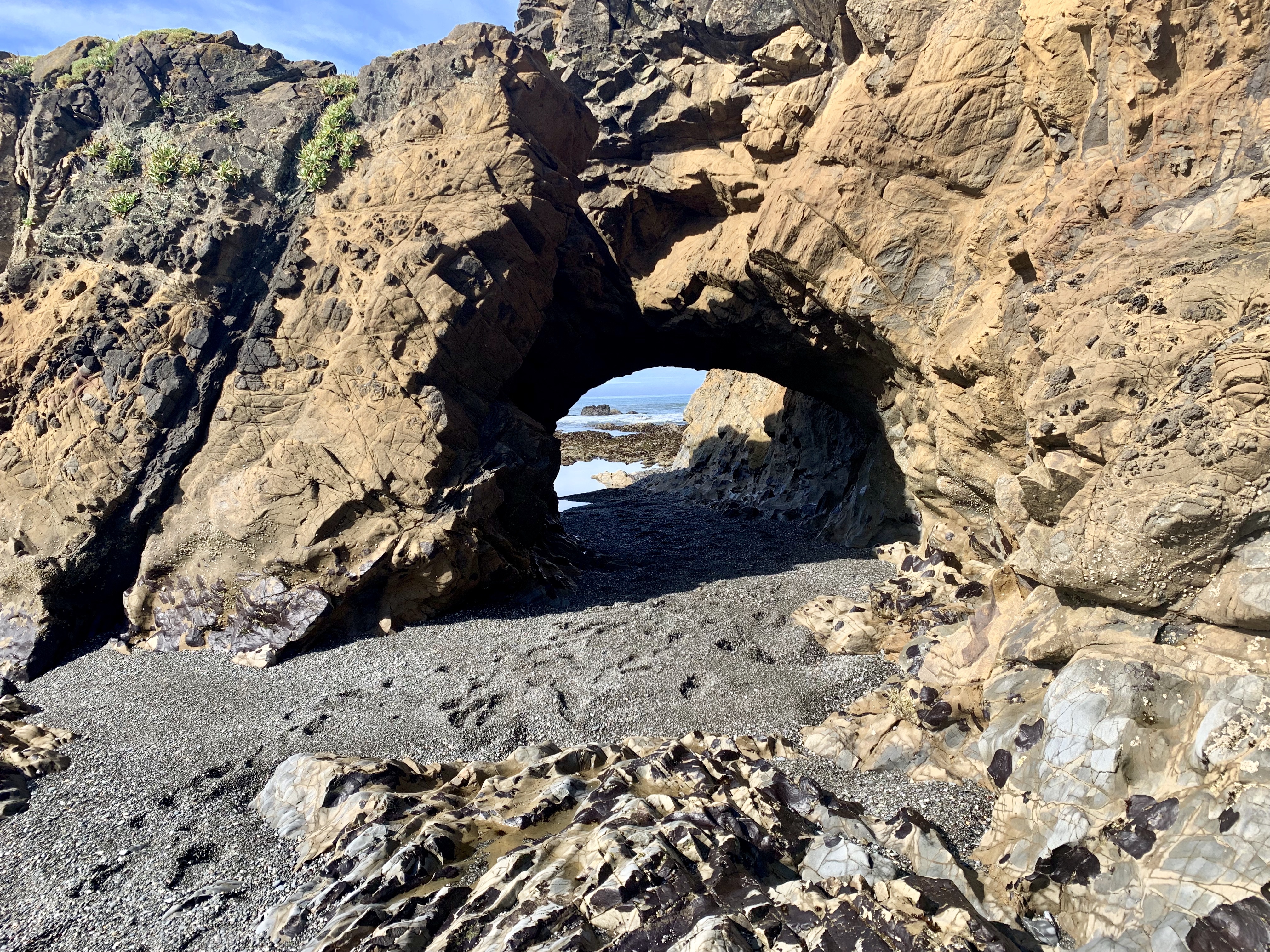
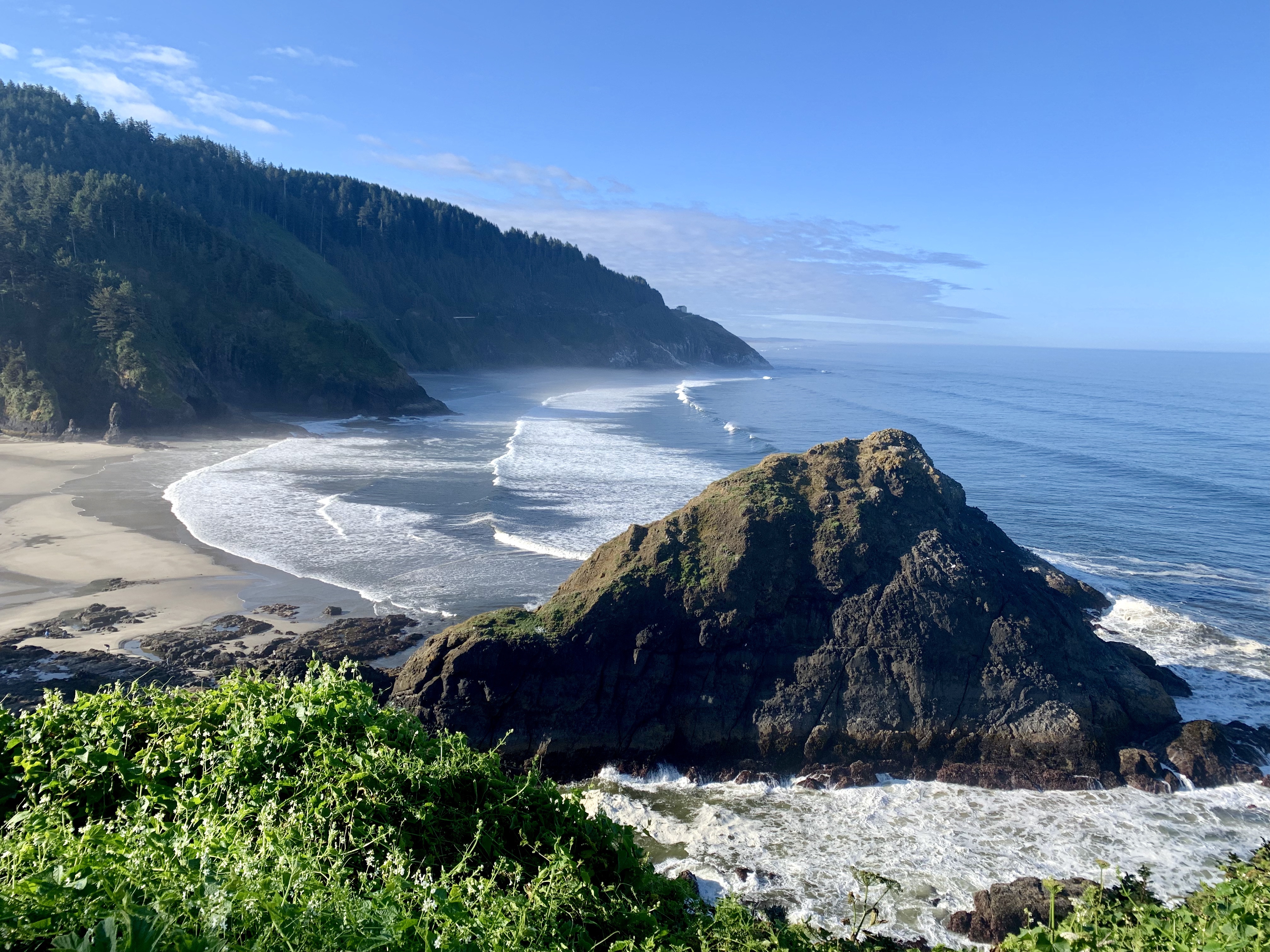
  • The OCT is unlike any other thru-hike I have done (Colorado Trail, PCT, Ouachita Trail).  It is not a true wilderness hike but it is wonderful nonetheless. The views are stunning.
  • You can leave your water filter at home – we never had to treat or filter (though we carried treatment tabs as backup).
  • You can stay in hotels if you like – we did about 50% hotels and 50% RV parks/campgrounds (this was a compromise with my wife). We never rough camped – though you can if you want. However, there are lot of rough-camping restrictions, unlike most other thru-hikes.
  • You can eat at restaurants. We had some lovely dinners and lunches along the way. 
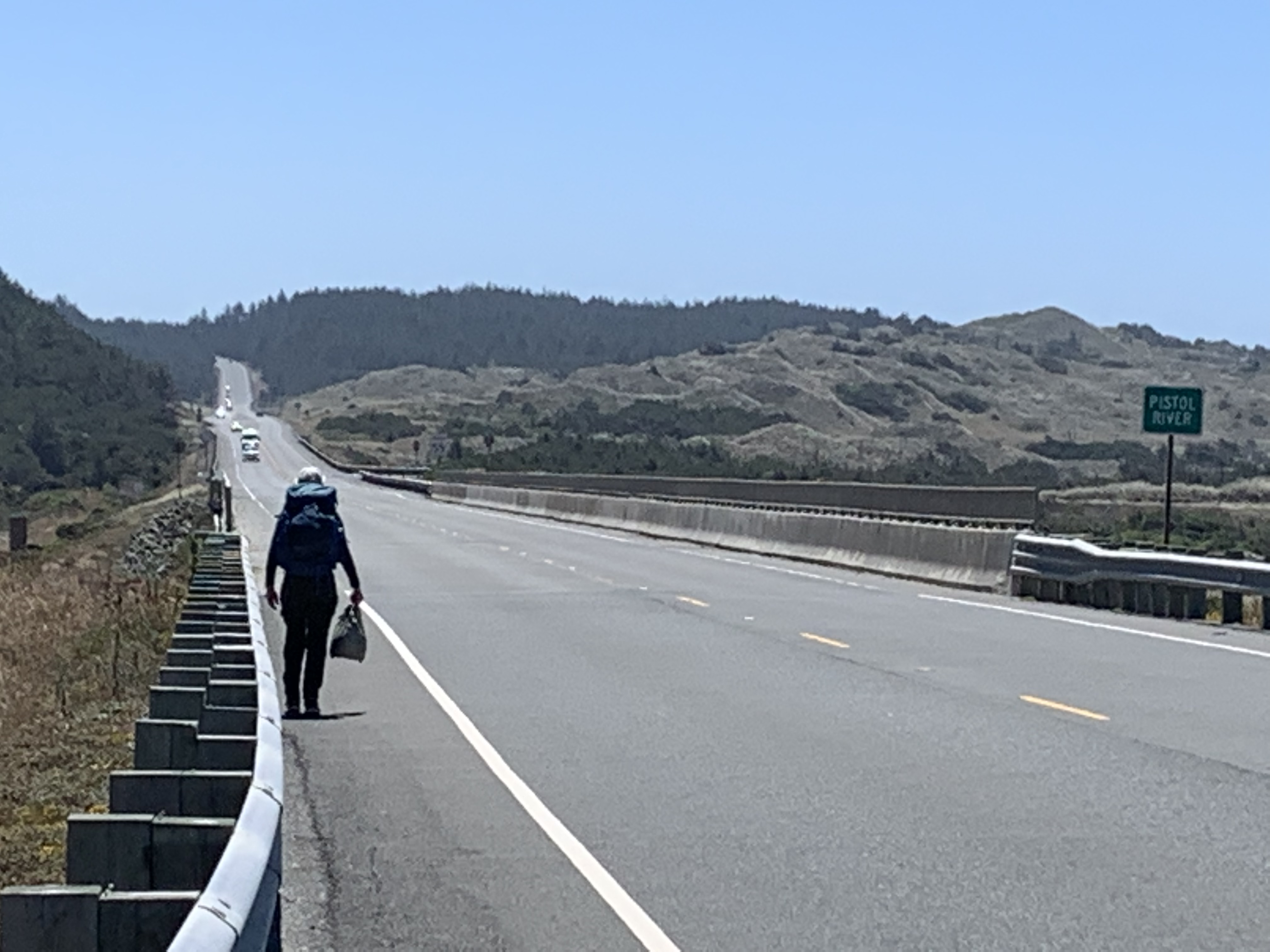
  • Roughly 15% of the hike (55-60 miles) is on Highway 101.
  • Another 12-14% (~50 miles) is on side roads.
  • About half the hike is on the beach (~190 miles)
  • The remainder (~20%, 75 miles) is on traditional trails.
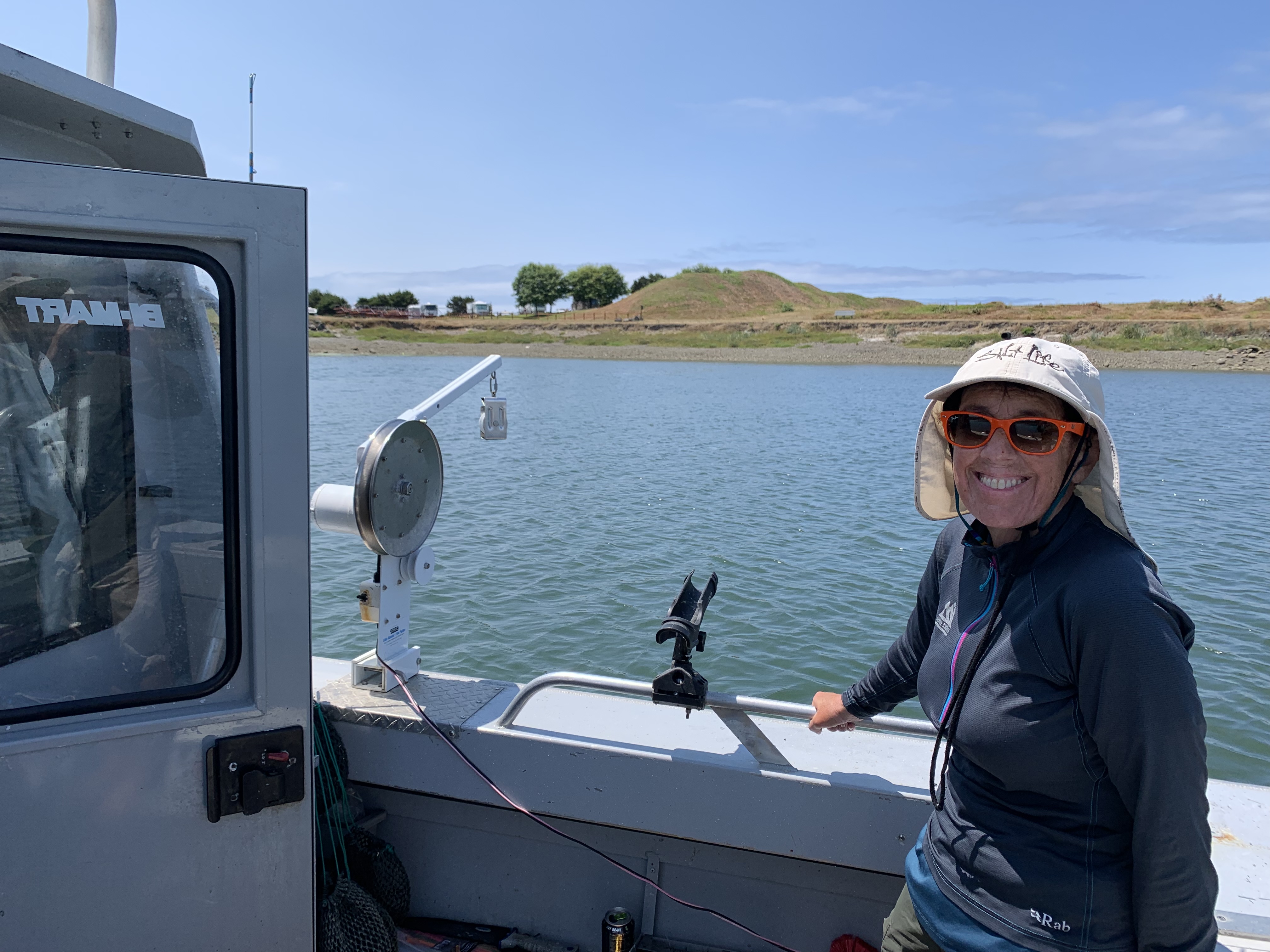
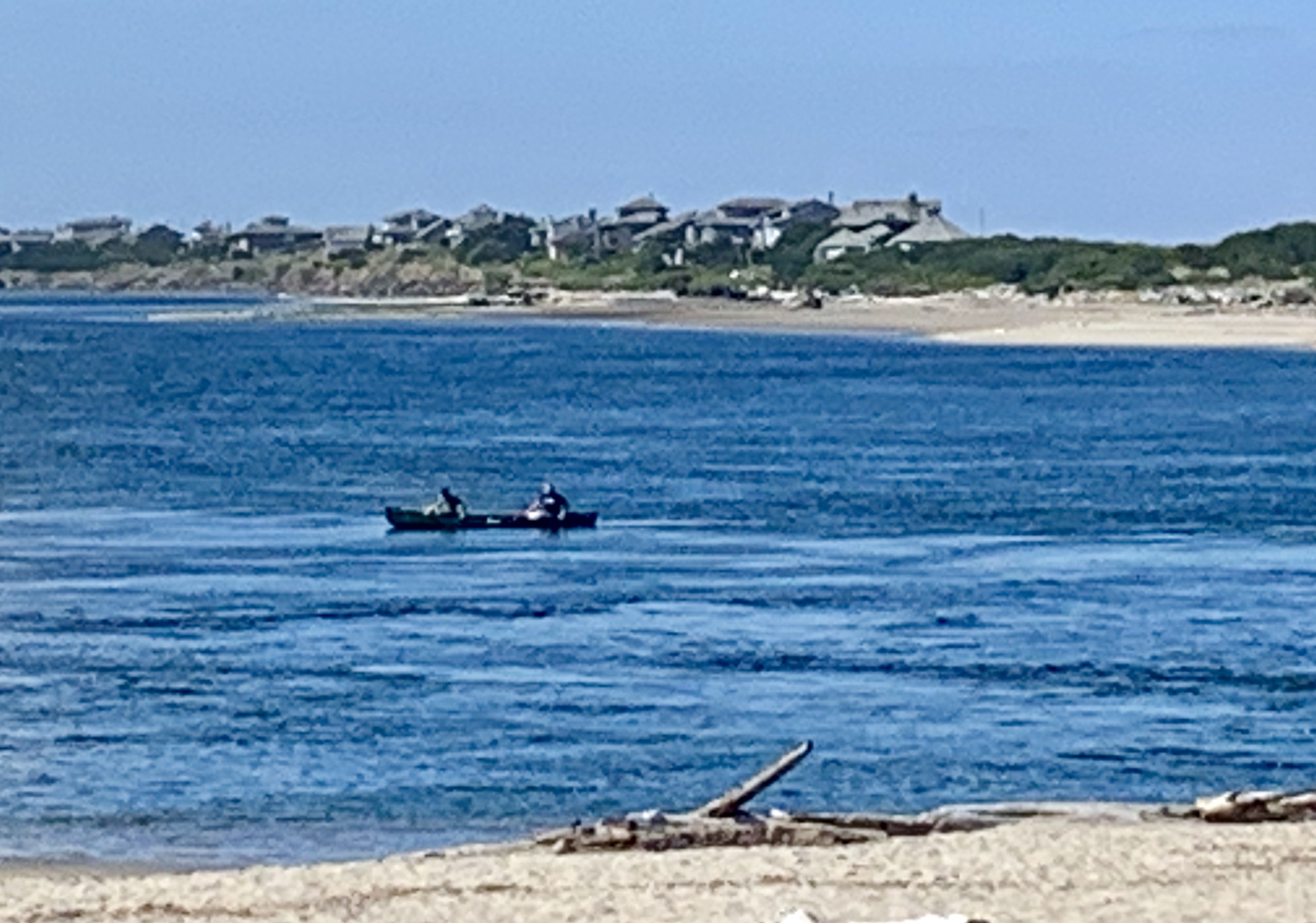
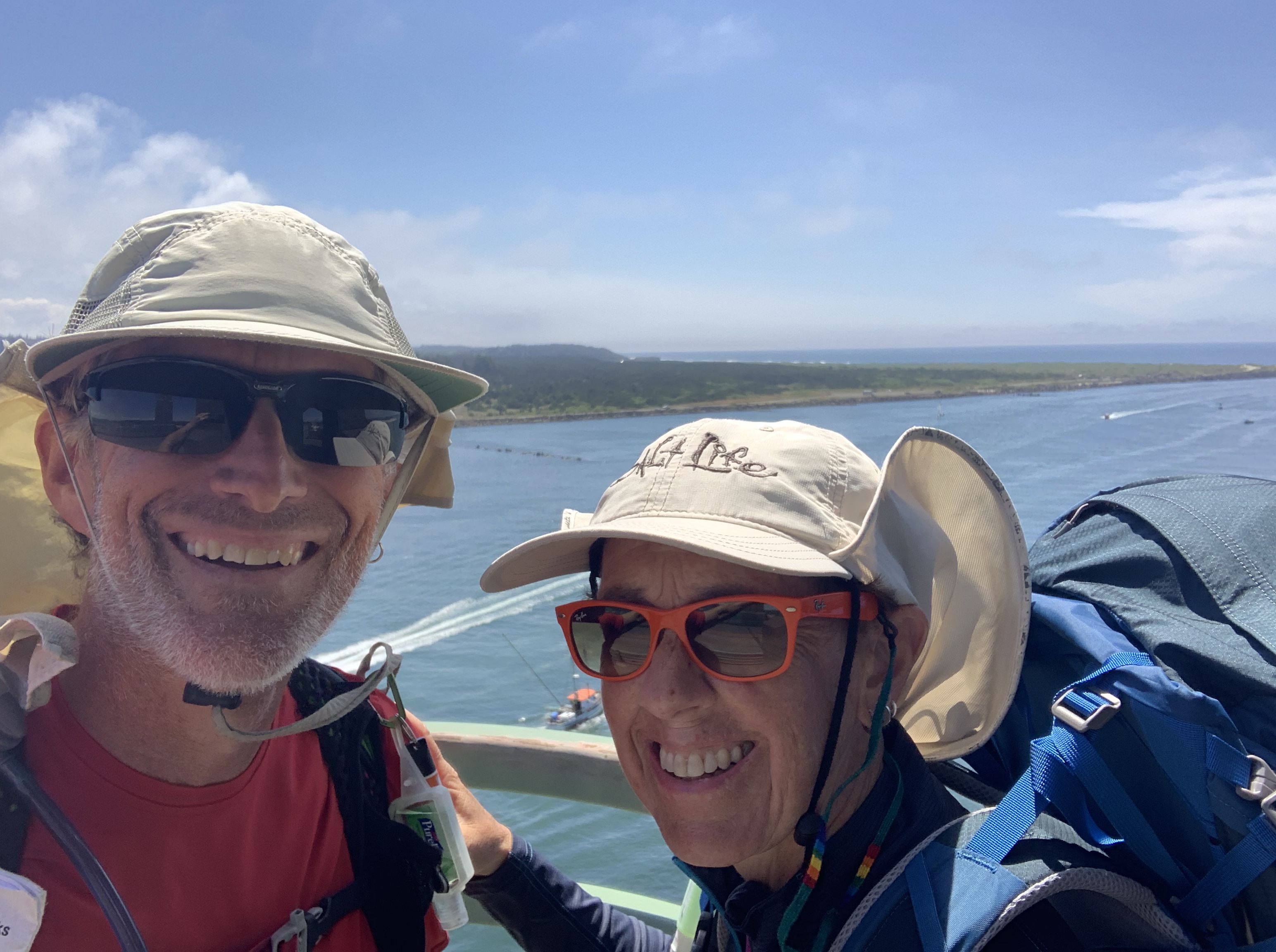
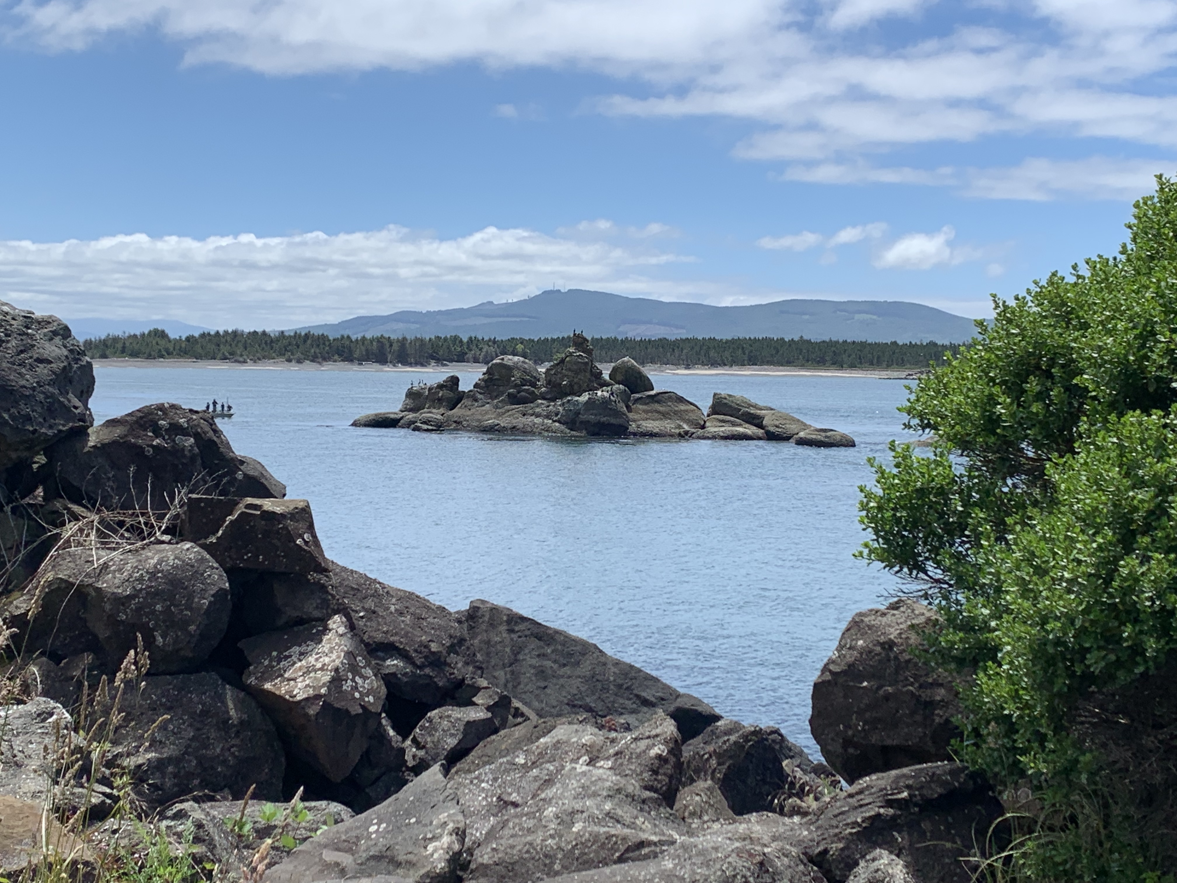
  • You have to do some boat rides to get across some of the bigger bays and rivers. The alternative is a big road walk. The boat rides are fun. We did three and would have done more if we could have.
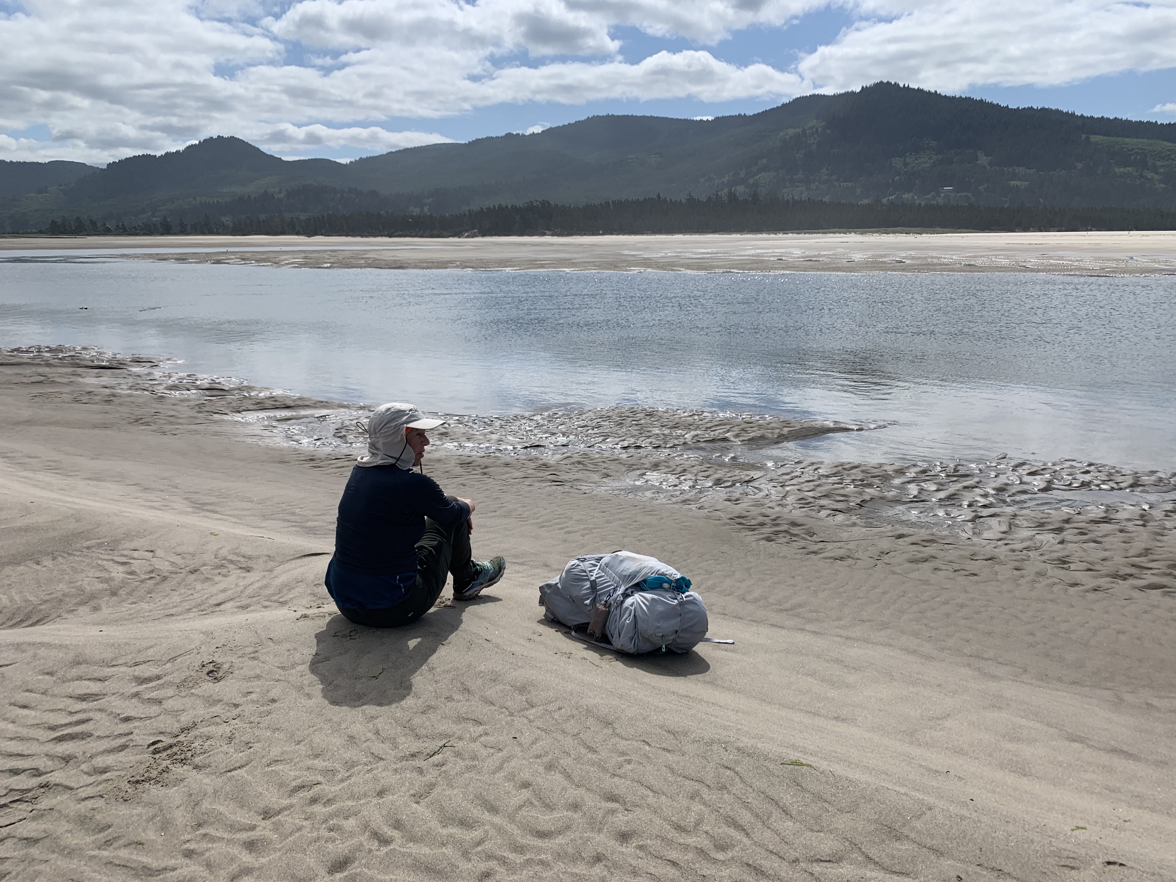
  • You must pay attention to the tides. You can’t get around some points except at low tide. Nor can you cross some rivers. We waded the Sand Lake outlet at exactly low tide and the water reached to just below our waists. It was our hardest crossing
  • We classified the crossings as “jumpers” or “waders.” We had lots of both; both were fun. When we started the trail we would stop at each crossing and discuss it for a while, looking for the best spot. By the end we would barely break stride, stripping off our shoes and socks to cross.
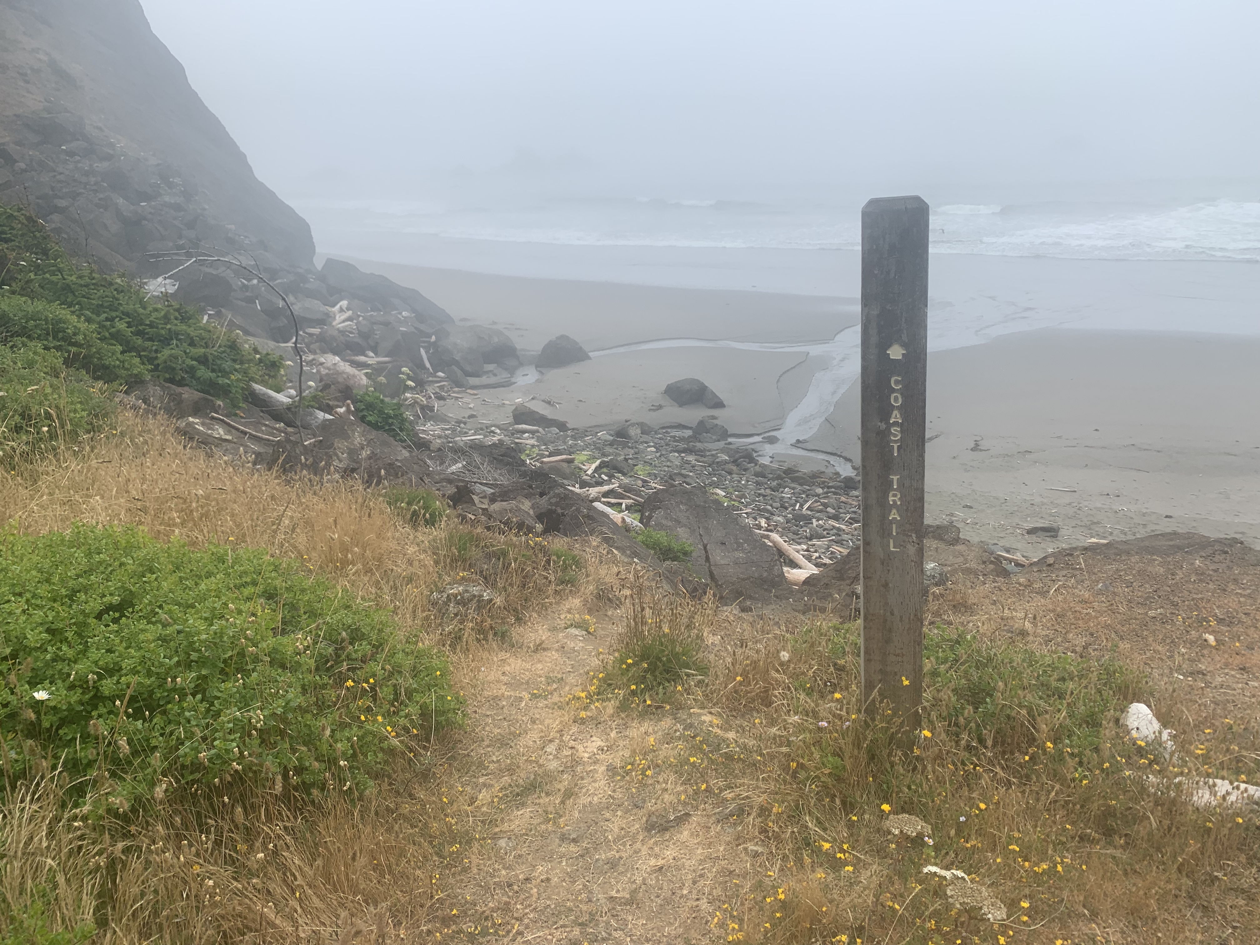
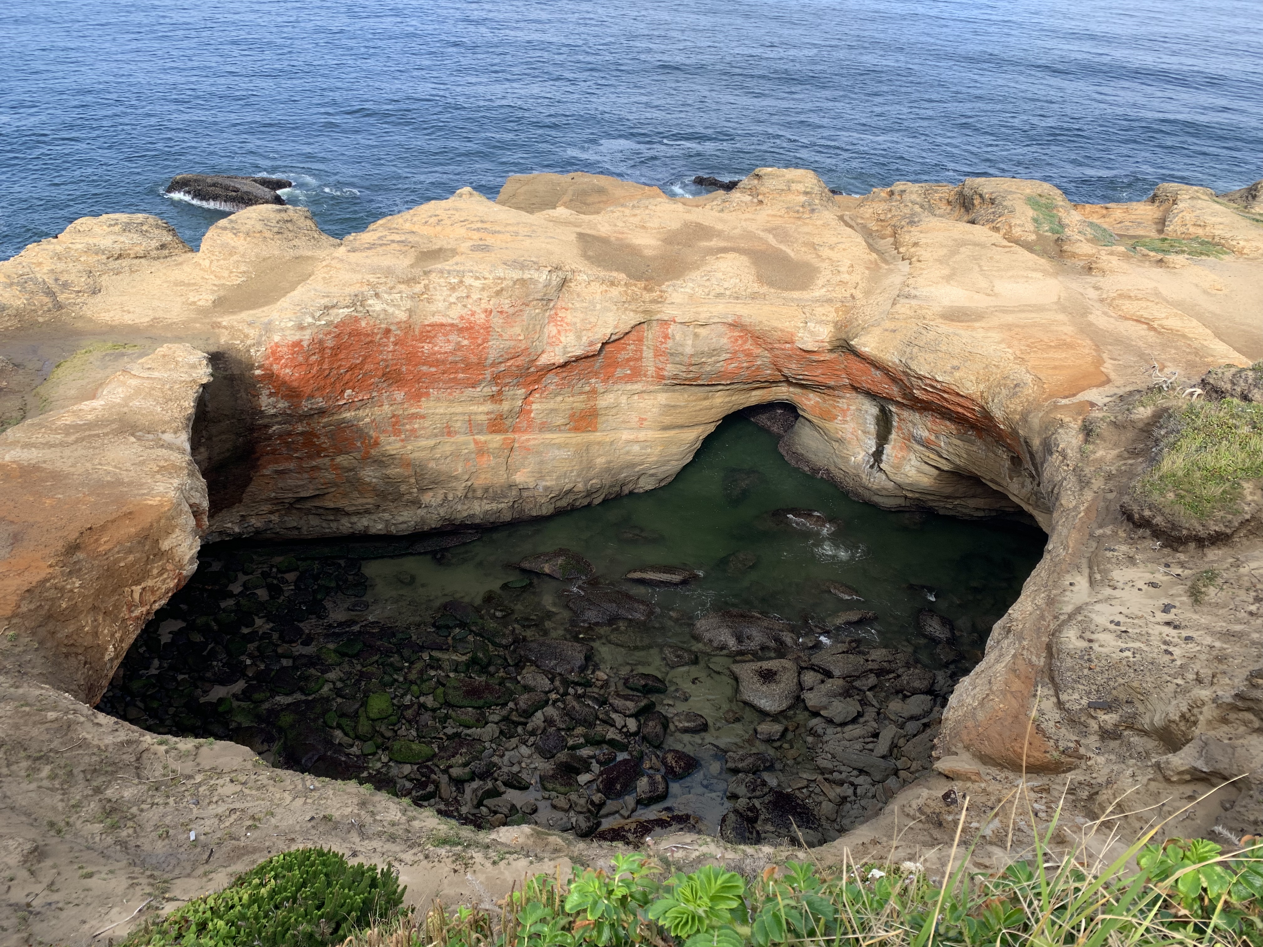
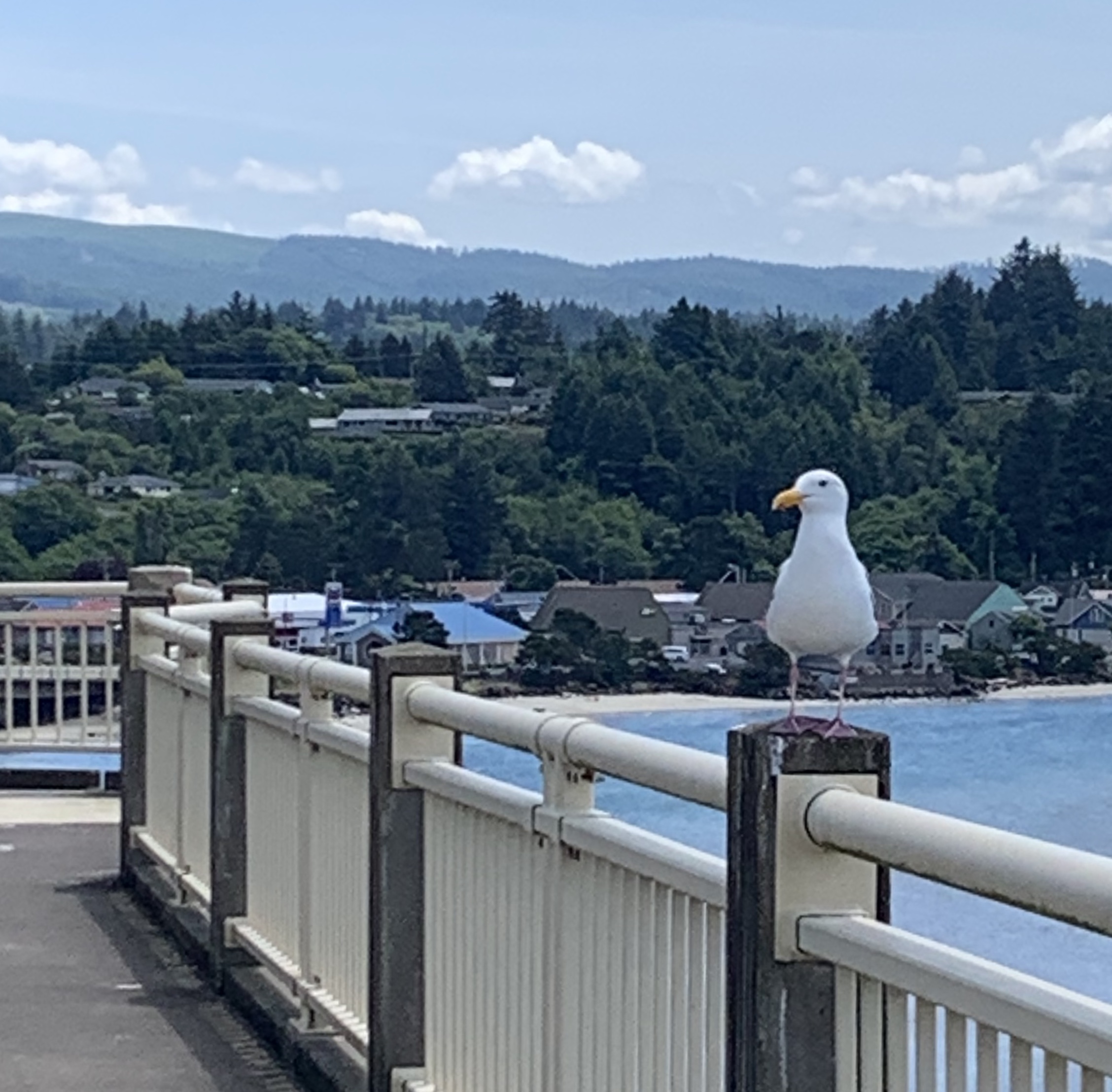
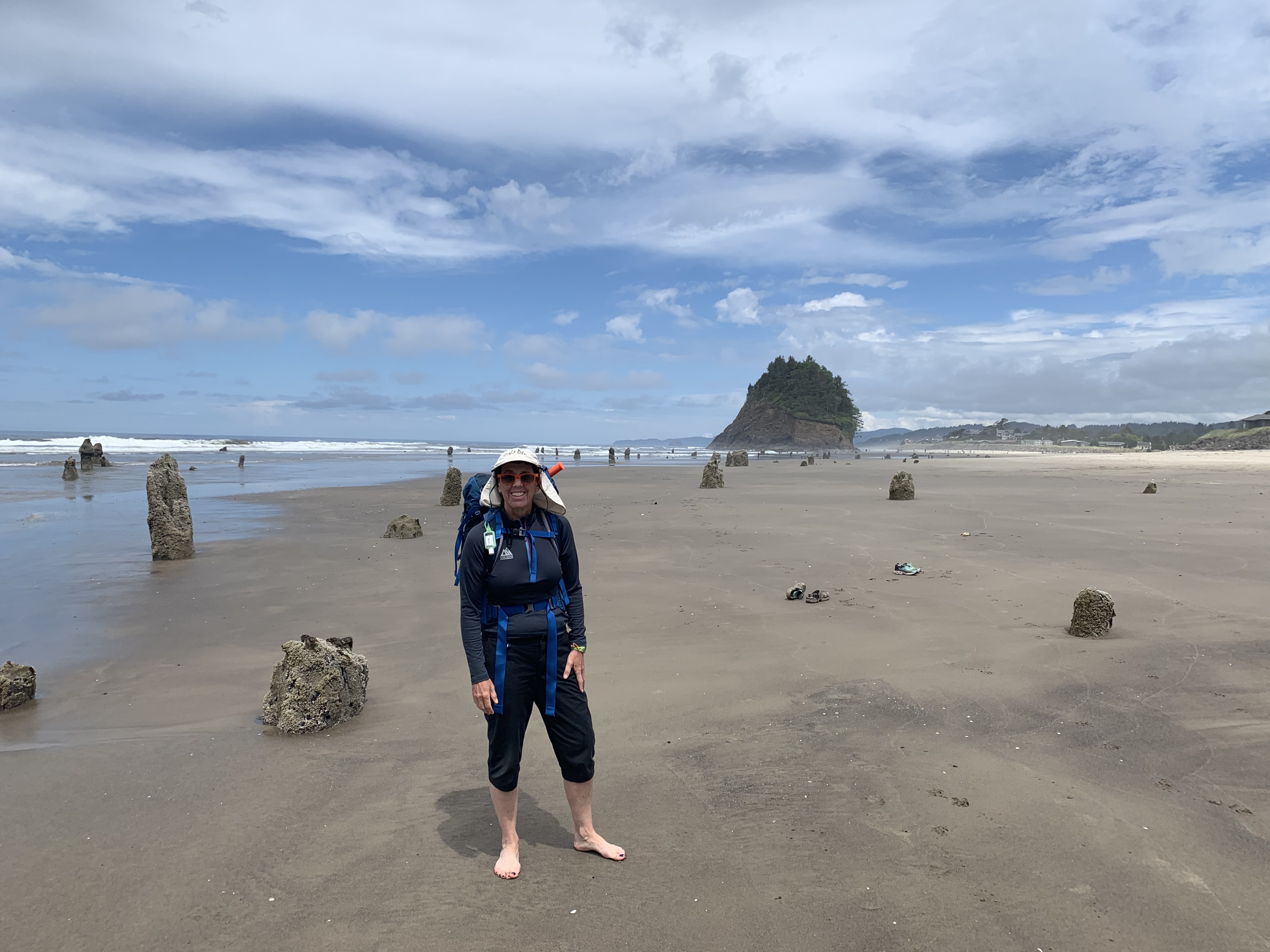
Beach

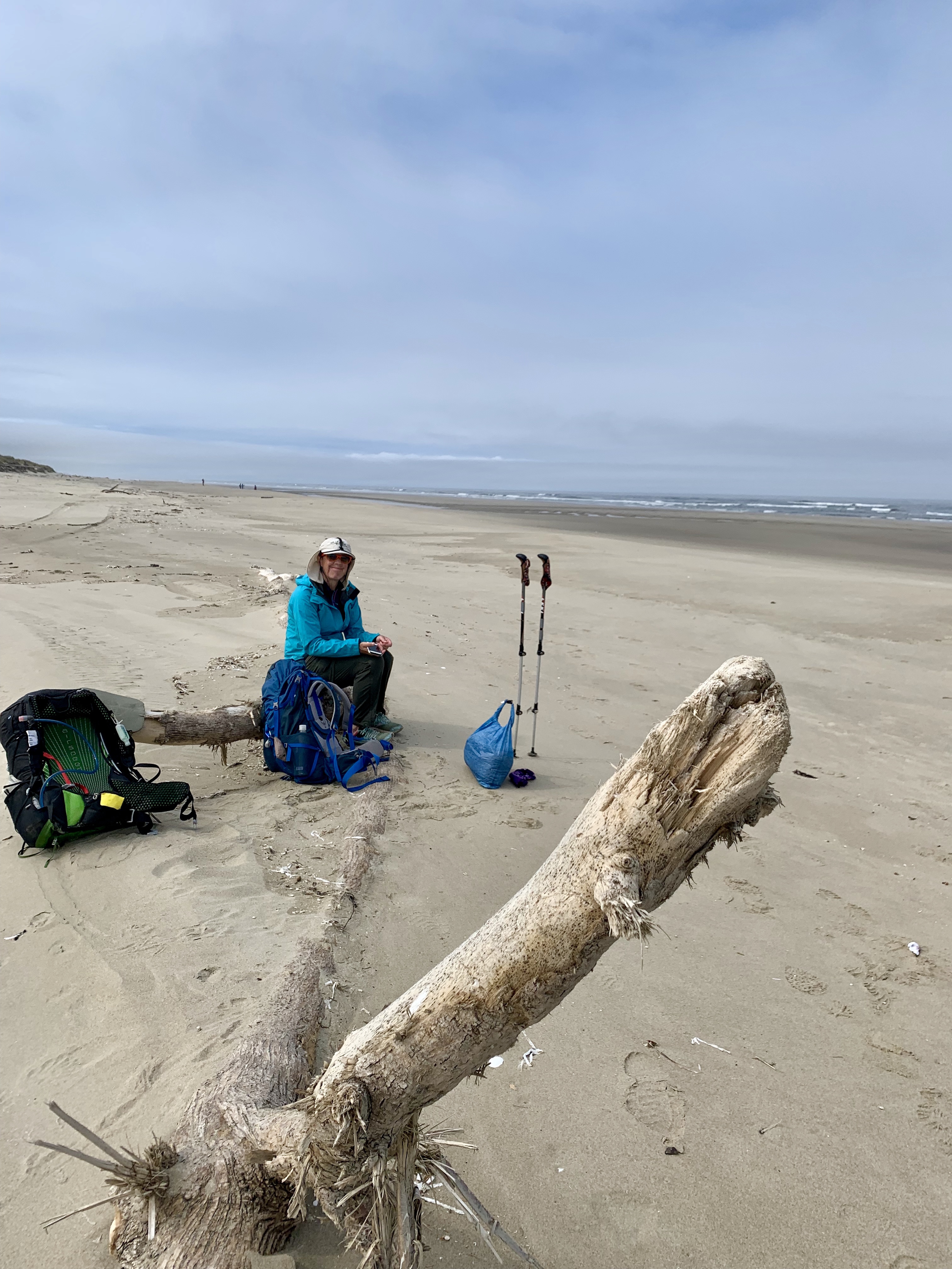
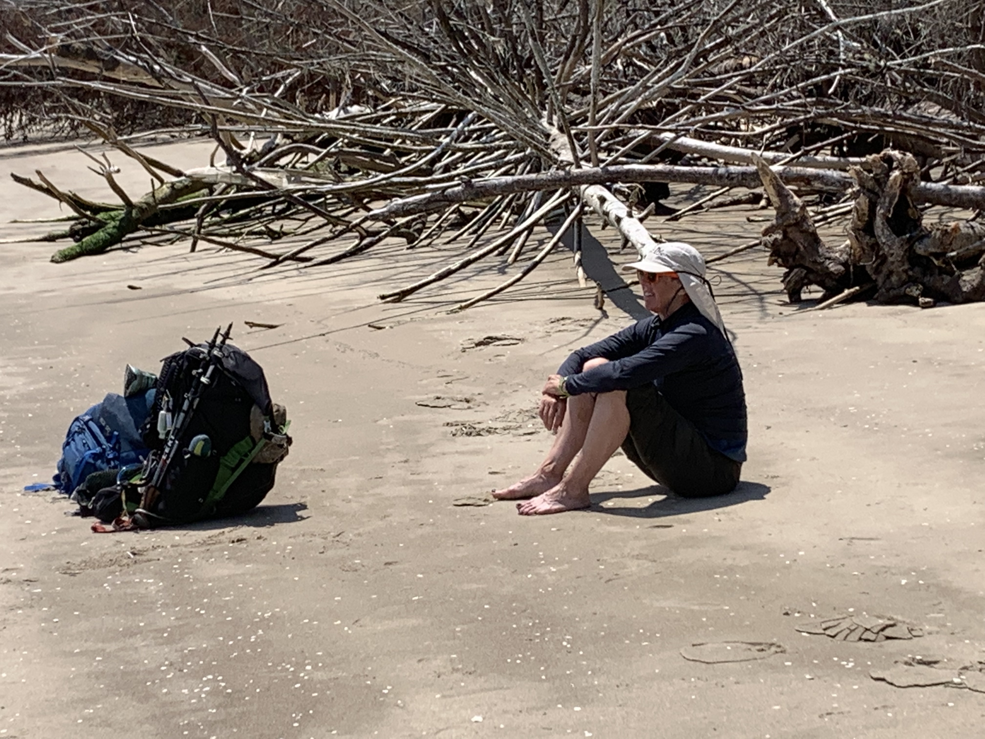
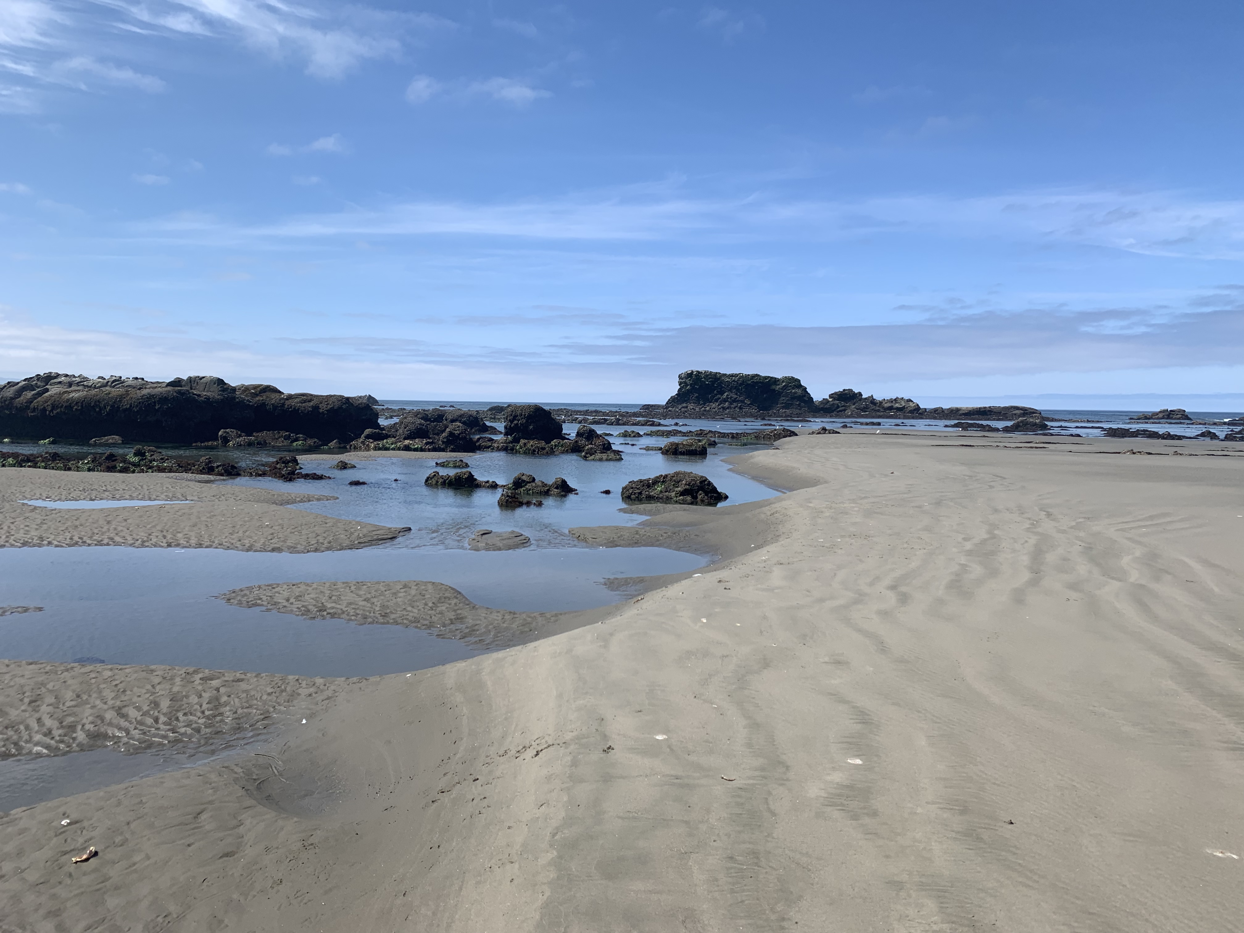
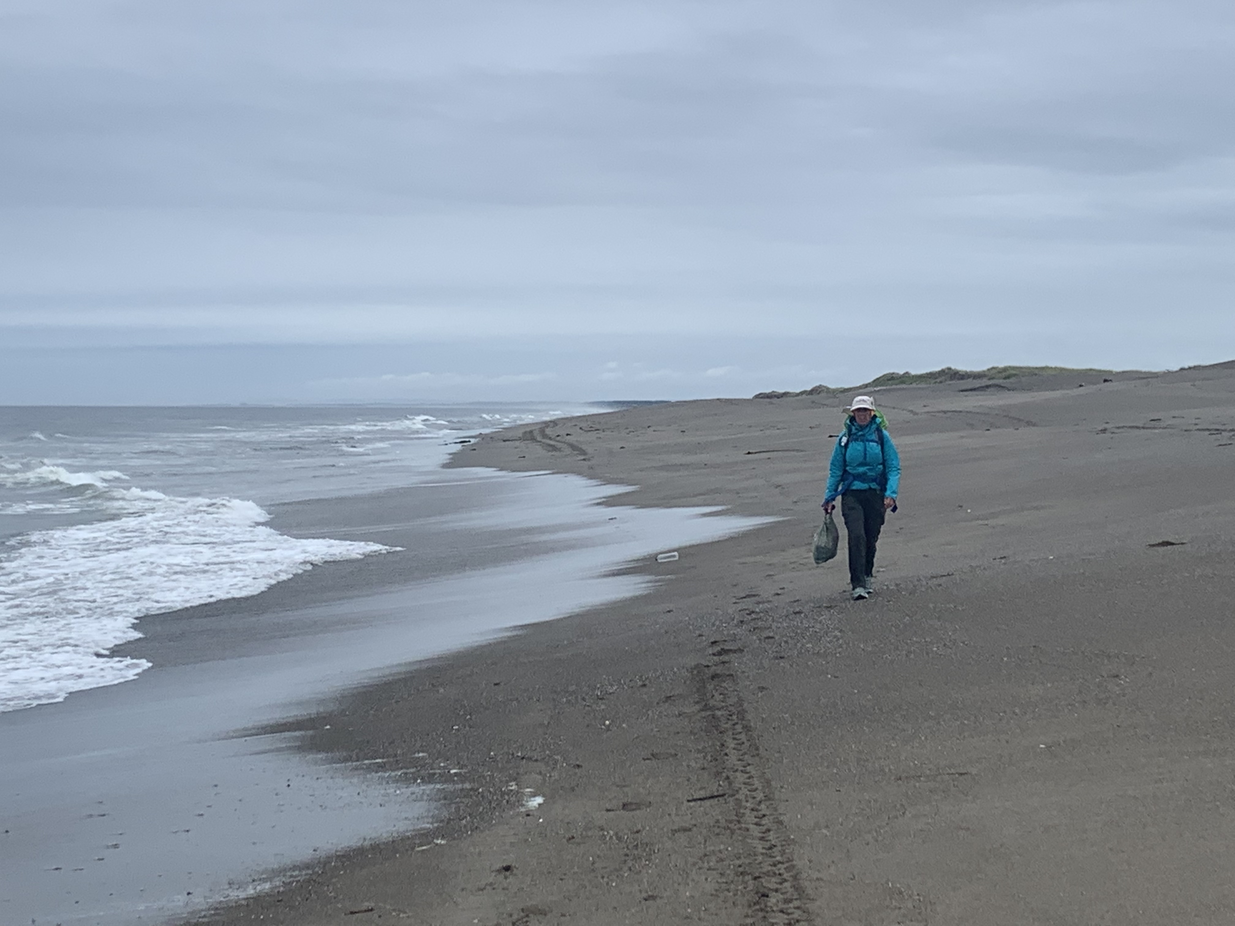
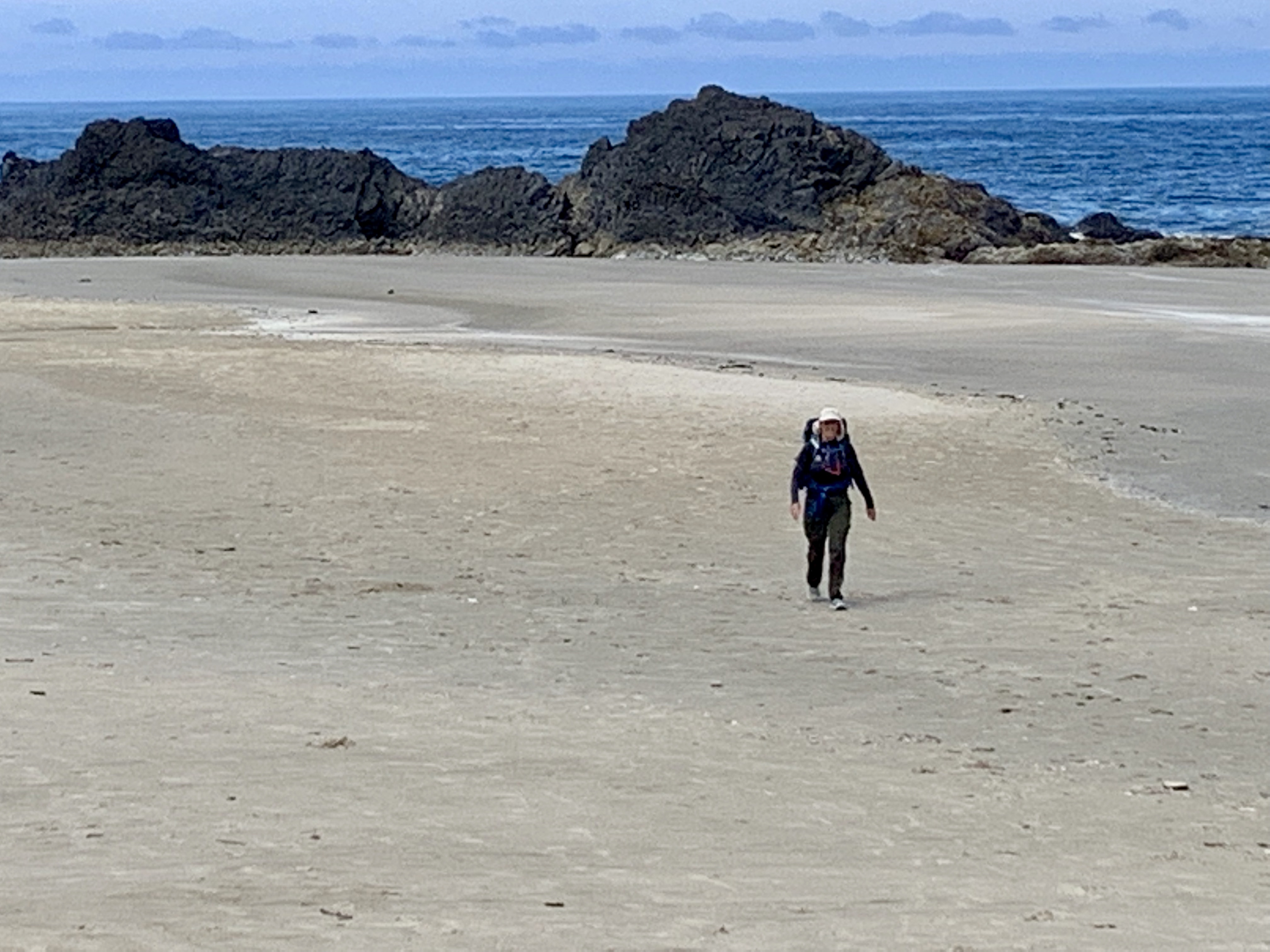
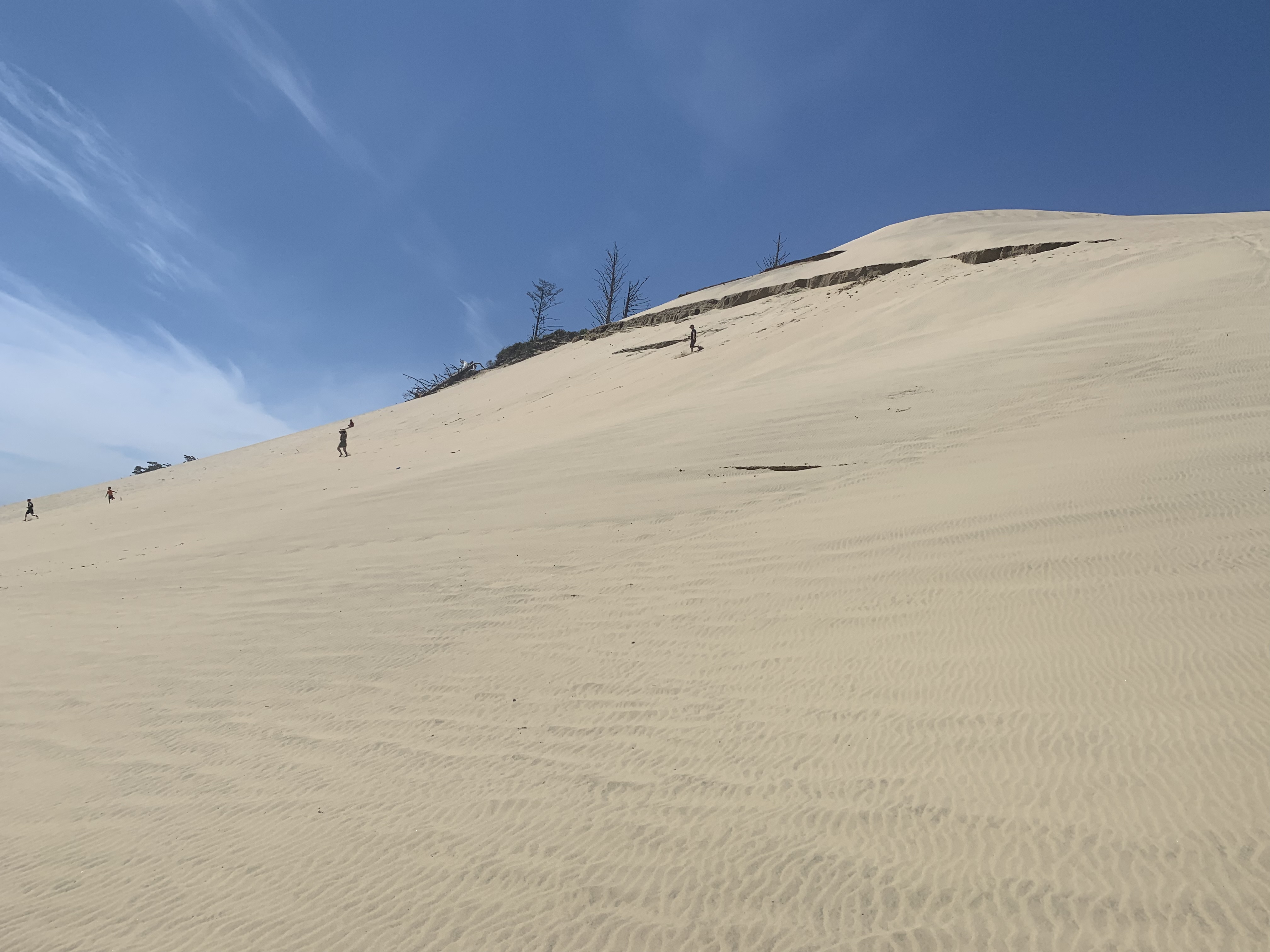
The beach sections are mostly wonderful, with packed sand that makes for great walking. The only really nasty part was from south of the New River to Port Orford, where the sand was grainy and soft, and the slope got steep.  I think the beach was my favorite part of the hike because it was so different than anything we had done. We often walked many miles without seeing another person – it felt like we had these glorious beaches all to ourselves. And they are glorious. 

Roads

The road walks were mostly good and a nice change from the beach and trails. They often went through little towns and neighborhoods with lots to see.  A bonus: you hit little towns and parks almost every day so you don’t have to carry a lot of food or water. We happened to pass through Yachats around noon, so stopped at a little pub with a view of the ocean for lunch.

Trails

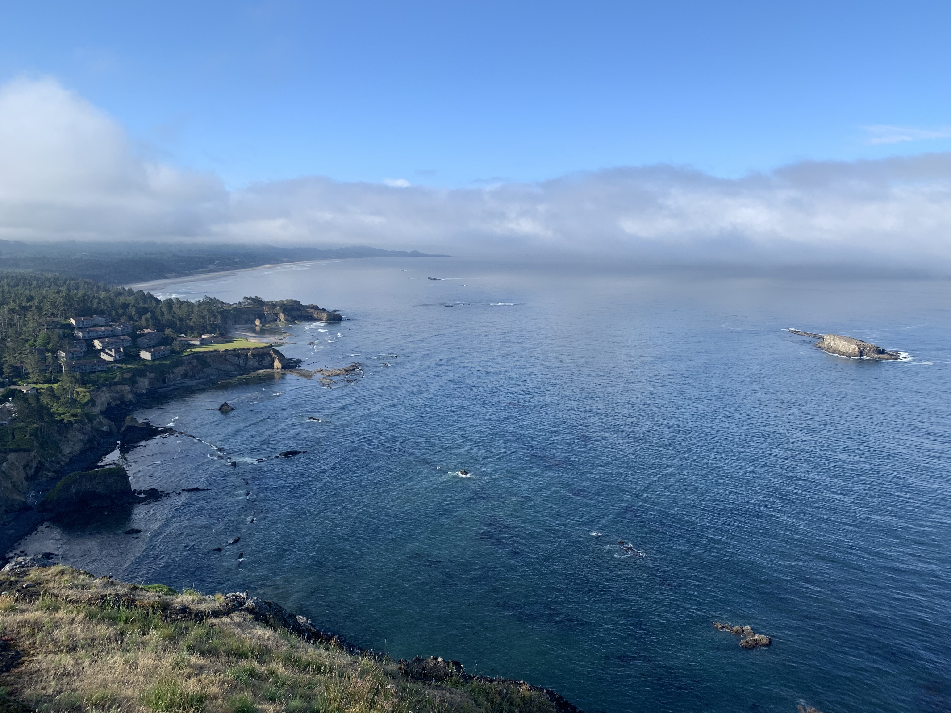
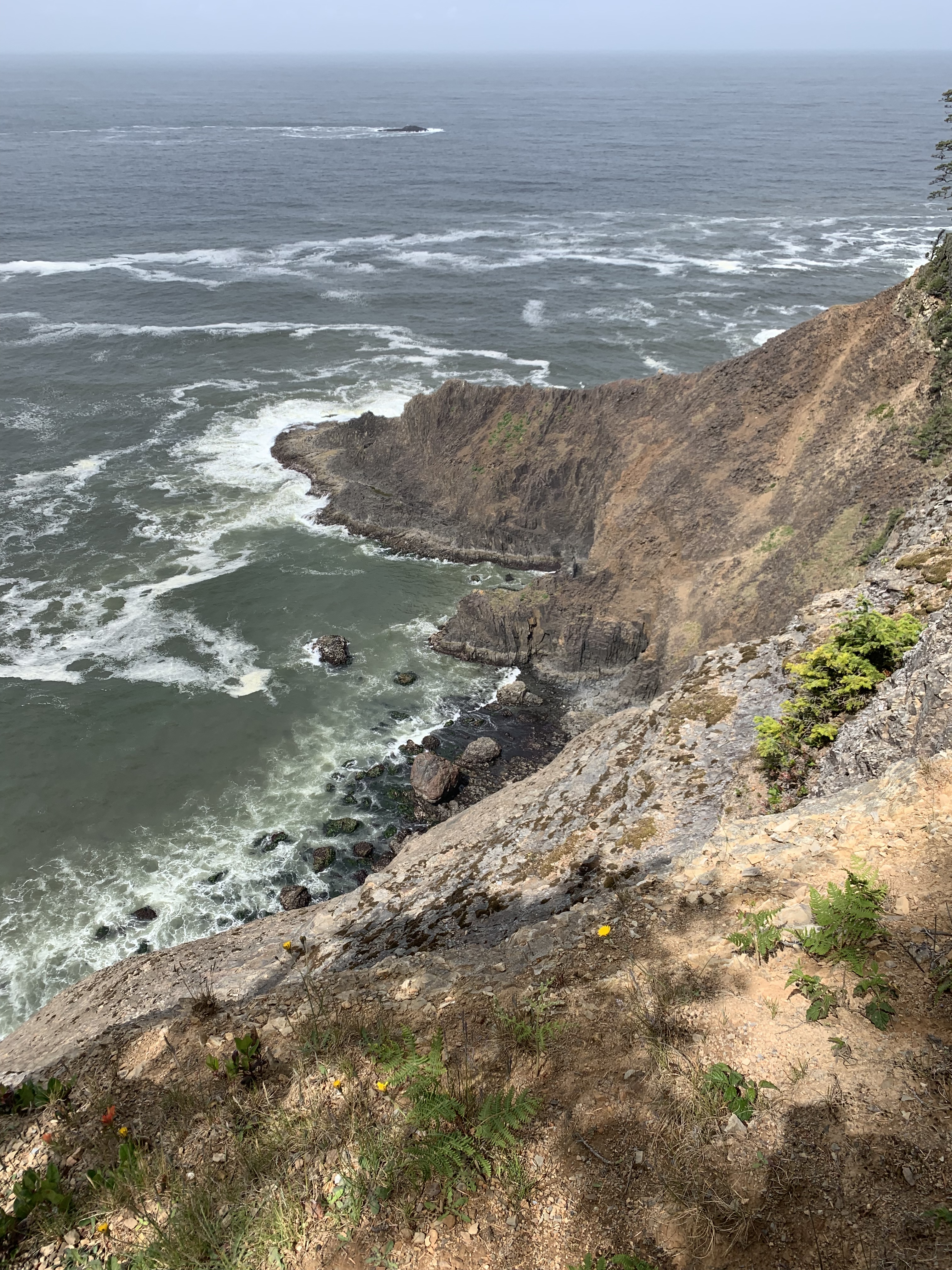
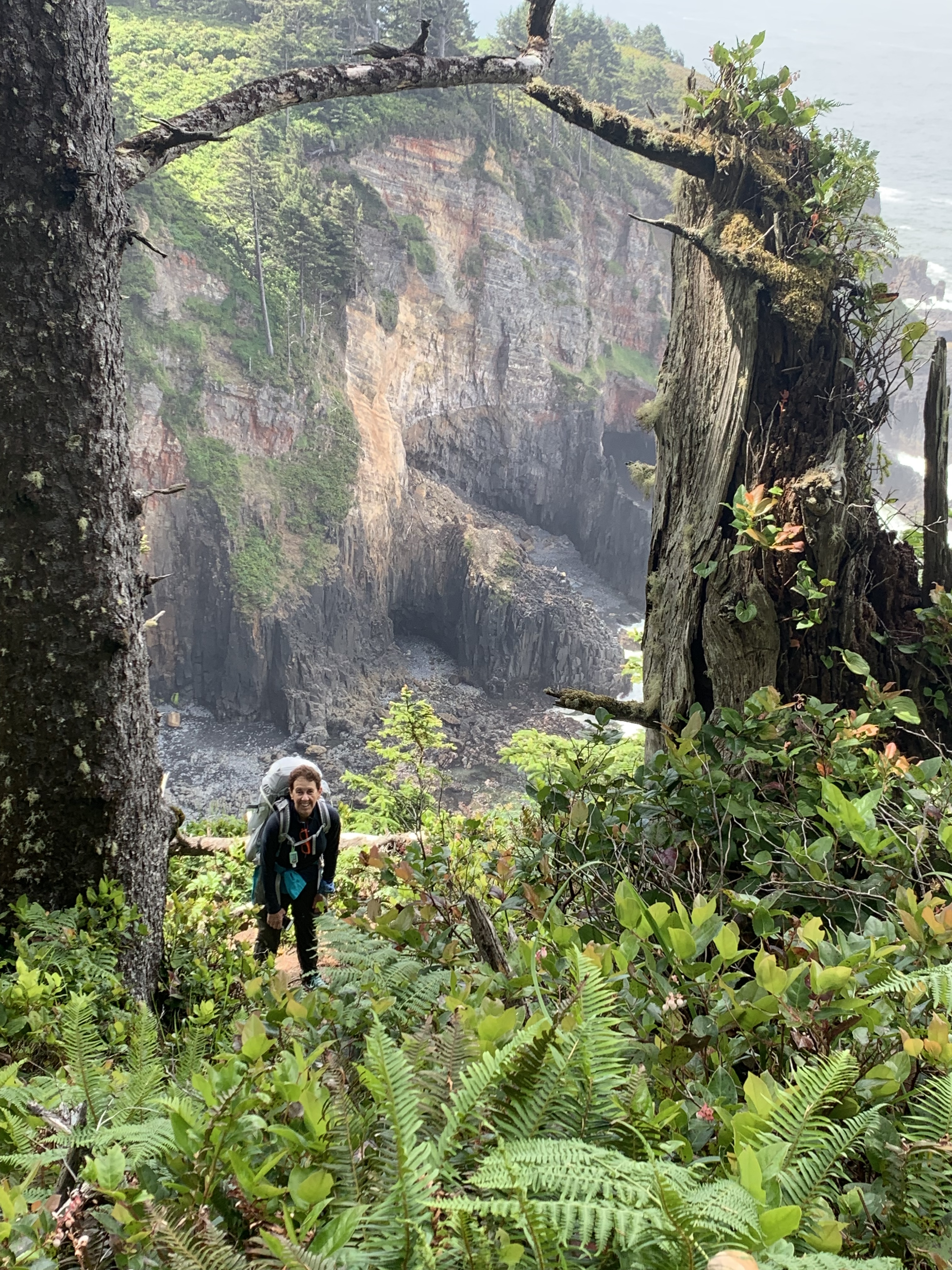
Usually (though not always) the trail sections were the way to get from one beach to the next, over a rocky promontory (e.g. Cascade Head, Cape Sebastian).  These were the source of  the truly stunning views, and some beautiful forests.

The quality of the trails and signs varied dramatically, from well-marked, well-maintained foot paths to poorly maintained, steep, unmarked trails.  You will lose this trail.  We had a pretty decent GAIA route plan, Bonnie Henderson’s guide and blog posts, and we still got off trail four or five times.  Of course you’re never really lost – just not on the trail. It’s all part of the adventure.

Highway 101

Not fun. Ever.  Definitely the worst part of the OCT. The shoulder varies from nice (~ 3 feet) to nonexistent. I strongly recommend wearing a reflective vest, bright clothing and flashing lights (we used bike lights).  We almost always walked facing traffic (except where the other shoulder was better or on a blind corner). Vehicles, including RVs and semis, are often doing 60-65 (speed limit is 55 most places). The road noise makes conversation impossible.  The tunnel, just south of Heceta Head is a nightmare with no shoulder. We could not get a ride so ended up jogging to get through as quickly as possible. 

Because of the highway we quickly gave up the idea of walking every mile. By judicious use of local cabs, hitching and buses we managed to keep our longest 101 stretch to roughly 5 or 6 miles.  We probably eliminated half the highway miles (~25 miles) this way.  It is definitely the worst part of the OCT and our only big criticism of the trail. Our advice is to take advantage of the buses and taxis to stay off the longer highway stretches.

Trail tips

Note the OCT mile points are estimates .

Manzanita 101 Bypass (OCT 50)

The following isn’t mentioned in Henderson’s book but described in her 2019 blog update: 

Another alternative to the official route down the highway: consider just crossing US 101 at the bottom of the road and walking through Neakahnie Estates (a gated community). The gate is usually open, and they don’t seem to mind if people do. If you walk down Meadow Loop and keep turning right, you’ll reach a signed beach trail. Follow it down a steep hill, and keep going west on residential streets to a short path alongside a creek to the beach. You’ll avoid a long highway/road stretch.

We were tired at this point (after having done Neakahnie Mountain) but decided this was a better alternative to the highway. It is. You have to get down to the paved road that parallels the beach in the subdivision next to the beach. We never saw the “signed beach trail,” we just kept going downhill trying to avoid the obvious private areas, until we hit the road. 

Nehalem Bay Crossing (OCT 58)

We made the mistake of listening to a passing park ranger and ended up on the sandy horse path that meant a long slog through soft sand to get to the beach opposite Jetty Fishery.  We definitely don’t recommend this – follow Henderson’s instructions to the “rough little trail along the north jetty.”  It’s got to be better! Seeing a pattern? Listen to Bonnie!

Garibaldi (OCT 65)

For the 1.5 mile walk into Garibaldi the guide suggests  “the highway shoulder is very narrow, so I took my chances with another pair of hikers and walked on the railroad  tracks (without incident).” We definitely agree. The tracks are for an infrequent tourist train (that moves at about 10 mph) and are much preferable to the highway.

Bayocean Spit, Garibaldi (OCT 65)

Definitely take a boat from the marina to cross Tillamook Bay. It is a pretty, 20-minute boat ride that eliminates an 18 mile road/highway walk.  It cost $40 for the two of us.  Just call the marina to set it up.

Cape Meares Trail (OCT 70)

The guide book recommends bypassing this trail and walking Meares Ave then Bayshore Drive because of “deteriorating trail conditions.”  We elected to try the trail and it was good except for the start at the beach.  Our notes:

Catching the Cape Meares trail from the beach is tricky! Look for a large tree trunk sticking out toward the sea, just past that you will see a small stream. Some nice person has rigged a blue rope with knots you can use to pull yourself up onto the high bank through rocks in the creek. After that the trail is good.

Sand Lake (OCT 88)

The guide book recommends attempting the crossing only at low tide. We agree! We waited to within 10 minutes of low tide. This was our toughest wade  – water was nearly up to our waists. If you can’t get across there is a campground on the north side where you can try to get a ride (a guy in a dune buggy told us to stop by and he would give us a ride around the lake if we could not get across).

Cascade Head (OCT 104)

We elected the third option in the guide book (“Via Harts Cove and Cascade Head Preserve”).  To catch the trail at the end of South Beach Drive – walk around the back of the second water tower (follow the fence line). You will see it directly behind the water tower.

The trail up is narrow, muddy (it was raining the day we did it) and unmarked. We lost the trail twice but managed to find it again. Once you hit Harts Cove Trail it gets easy. We did have some views on the way down the Nature Conservancy Trail but it was completely socked in at the top when we were there (and blowing pretty good too).

Leaving Depoe Bay (OCT 130)

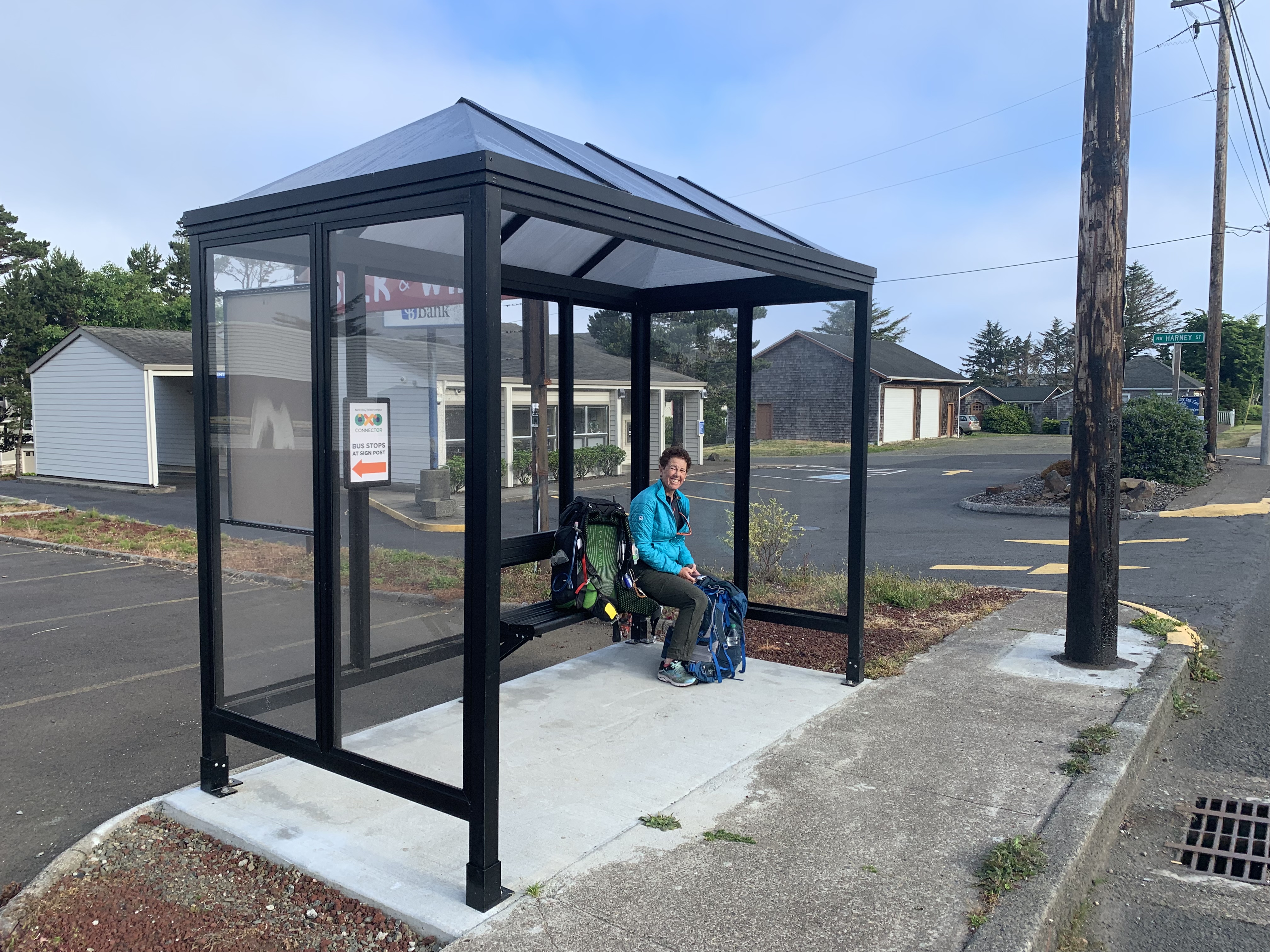
By this point we were starting to hate highway walking. Fortunately there is a bus you can grab heading south from Depoe Bay to eliminate a couple of highway miles (drop off at Rocky Creek Viewpoint) or ~ 4 miles (Otter Creek Viewpoint).  The bus stop is in front of the Depot Bay Mall 101 and we caught it at 7:48 AM – Northwest Connector, North County Route.  It made for a much more pleasant start to our day.

Devils Punch Bowl (OCT 135)

I stashed my pack behind the fence at the top of the trail that leads down to the beach while we walked down to the Devils Punch Bowl viewing area for some pictures. We were only gone a few minutes but someone stole my rain jacket (and wool hat) out of the outside mesh pocket of my pack. Just a heads up. Keep an eye on your stuff! 

Exiting the beach just before Waldport (OCT 160)

Looking at my maps, I foolishly thought there might be a simpler way to get to the Highway 101 Alsea River Bridge from the beach via the Waldport KOA. After scaling a nearly vertical sand cliff and ending up in someone’s backyard we realized there isn’t. Follow Henderson’s directions – they are the best  way to get to the bridge. Lesson: Pretty much every time I thought I knew better than the guide, I was wrong.

Near Agate Creek (OCT ~178)

After walking the highway shoulder for a couple miles (the portion south of Cape Perpetua campgrund) we were supposed to “find a way to squeeze between houses and get back to the beach” (Guide, p. 157).  We tried but found nothing but fences, “no trespassing” and “beware of dog” signs. We even tried getting to the beach at an RV Park (Sea Perch RV) but got rousted by the manager who kicked us out. This turned a highway-beach-highway section into a 5-6 mile highway section. Maybe there is a way to get to the beach but we could not find it. And we hate highway sections. The last 2.5 miles were particularly bad with narrow shoulders.

Heceta Head Tunnel (OCT 186)

The 101 tunnel just south of the Heceta Head lighthouse is, in our opinion, crazy dangerous. In hindsight I think we should have tried harder to hitch a ride through the tunnel. We asked one guy (who said no) and had our thumbs out for 10 minutes or so before deciding to go for it. The tunnel is short, no more than 100 yards. But there is no shoulder, none. Two cars passed us while we were in the tunnel and they both moved over. If there had been a semi or big RV heading the other direction they would not have been able to move over.  I’m not sure what would have happened. OK, I can imagine what would have happened.

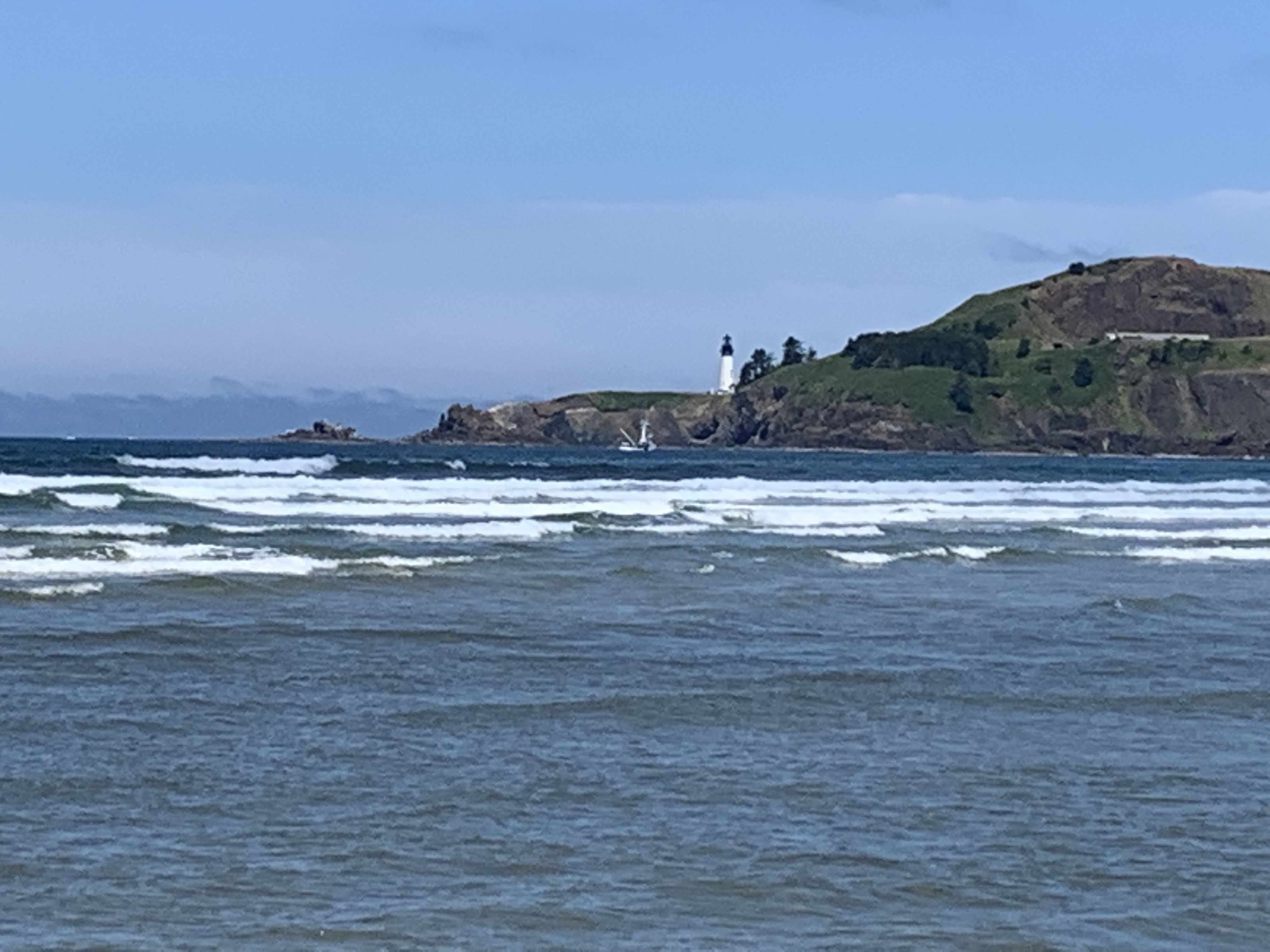
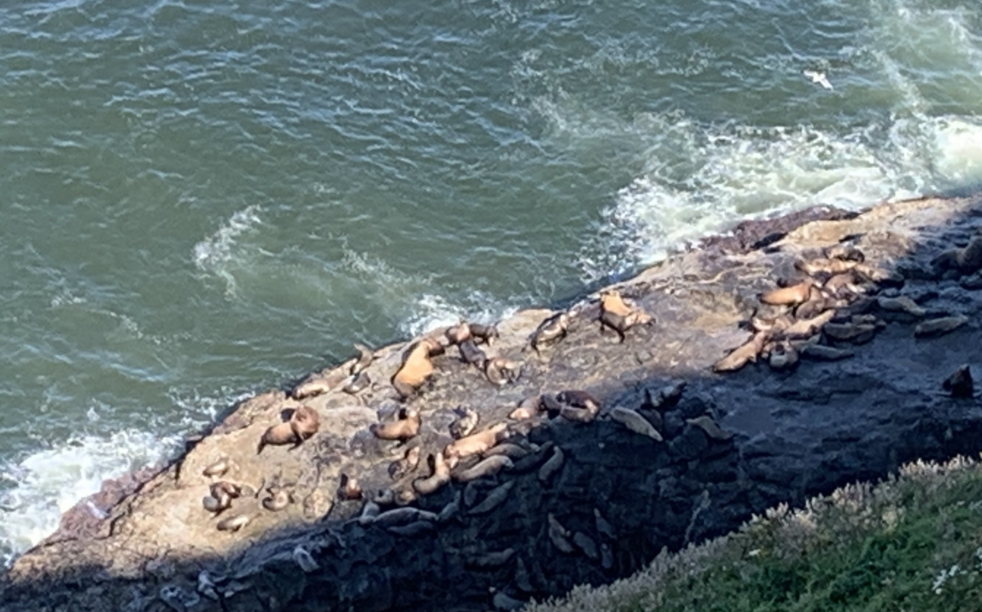
Sea Lion Caves (OCT 187)

We hit this attraction right at opening (9 a.m.) and stopped to do the tourist thing. We recommend it – it was $13 each and we spent 30 fun minutes gawking at the sea lions. 
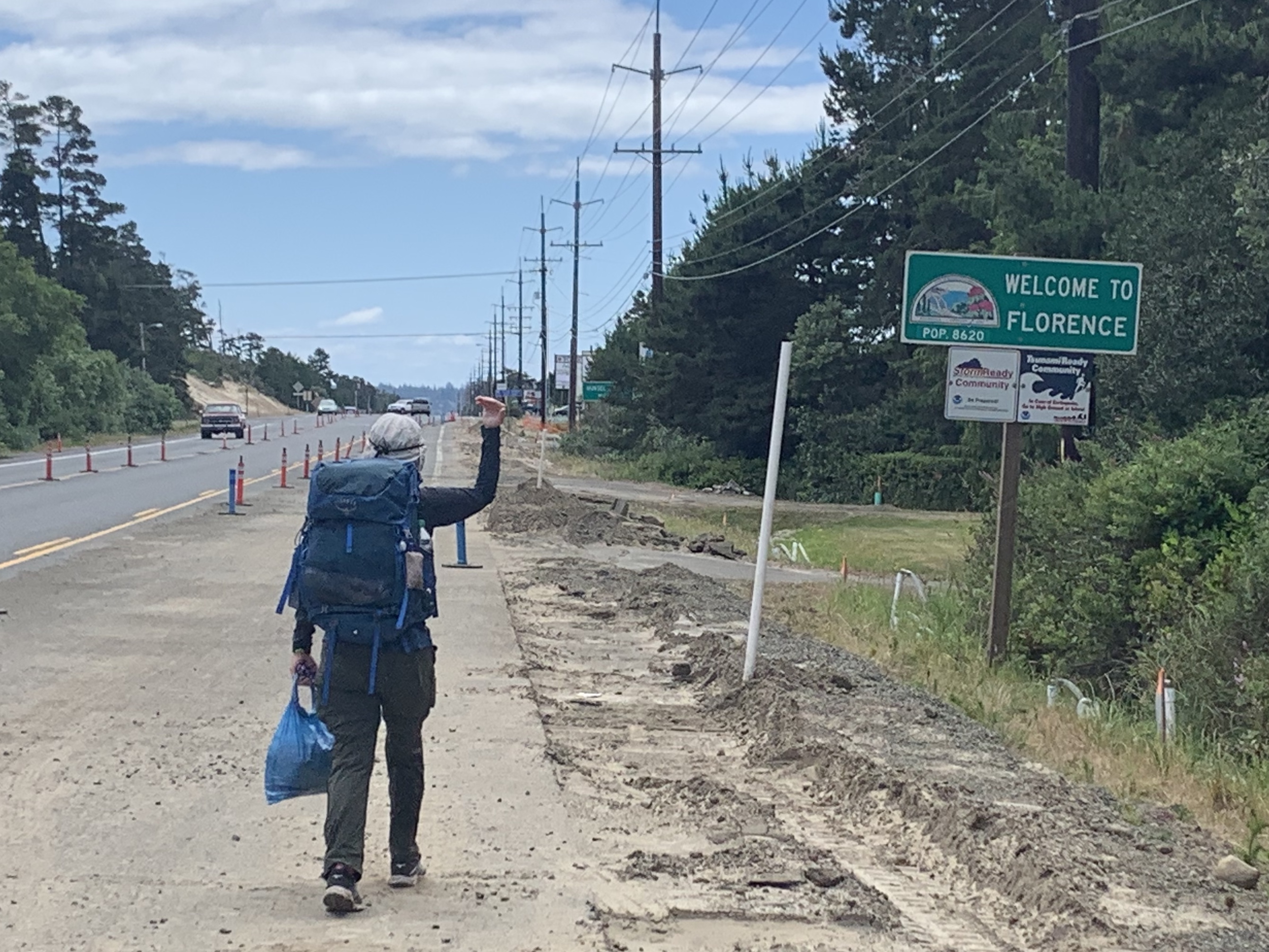
Florence (OCT 204)

We needed supplies, so rather than follow the guide directions into Florence, we exited the beach near Heceta Beach Road which we took east all the way to 101 (about 2 miles north of Florence). Not a lot of shoulder but little traffic so not a bad walking road. There is a Fred Meyers just south of where the Beach Road hits 101. And the local bus (“Rhodi Express”) picks up at the Fred Meyers. For $1 each, we rode into Florence. Sweet! Even if you elect to hike into Florence (which you can do without using the highway) the bus can be used to get back to the Fred Meyers. We took our second rest day here and saw the July 4th fireworks over the river. 

Florence was a great little town but a warning about the laundromat (Green Lightning Laundry). They use a complicated system that involves having to load money onto a special card and then using the card to use the machines.  Someone helped us but not sure we could have figured it out otherwise.  And the laundry soap dispenser was empty; a nice woman gave us some.

Tahkenitch Campground (OCT 220)

If you elect to stay here (we did) it is a tough 2 mile slog through soft sand to the campground  which is right on noisy 101. You have to slog in reverse in the morning to get back to the beach. A nice spot otherwise.

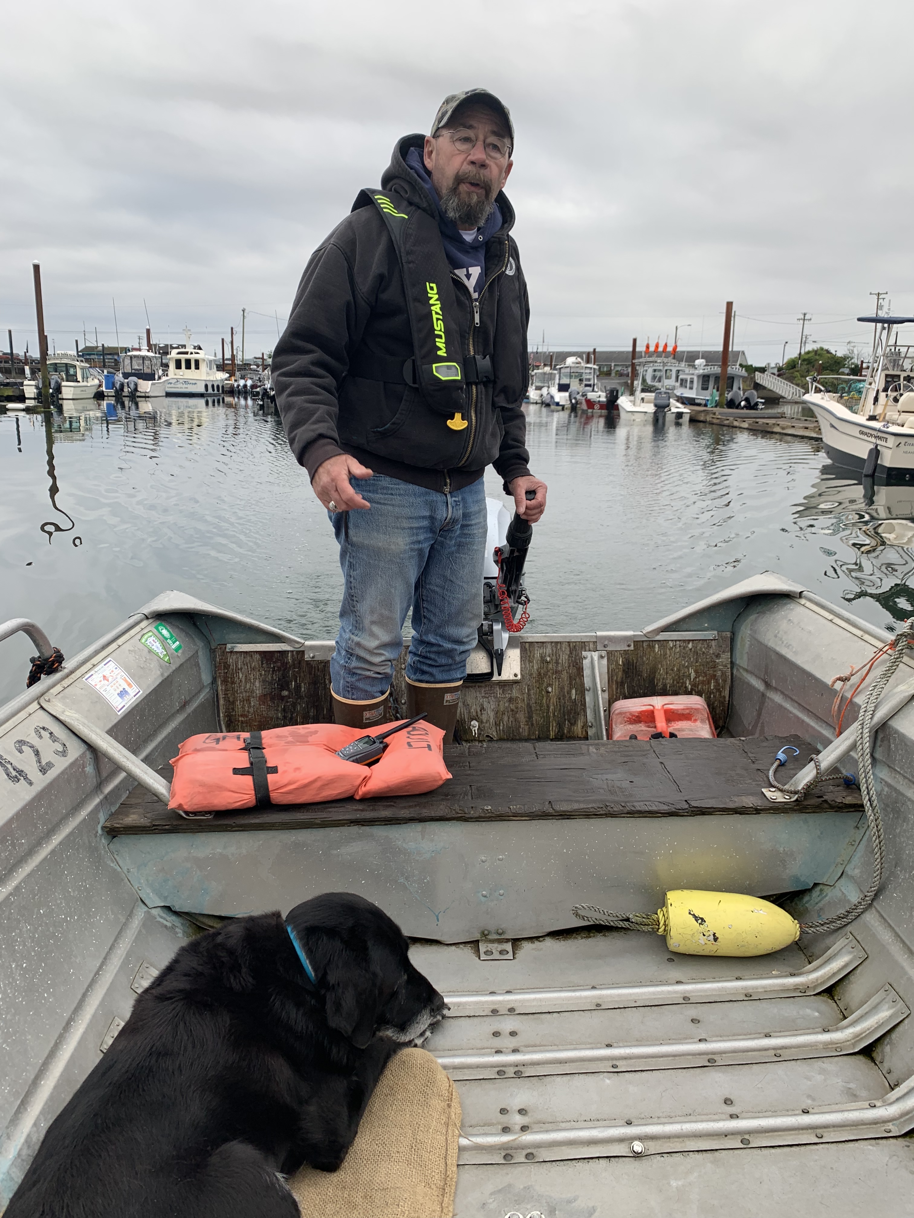
Winchester Bay – Umpqua River Crossing (OCT 225)

We arranged a ferry with Winchester Bay Charters while we where in Florence. We had good cell (T-Mobile) coverage on the spit that forms the north jetty, which is important since you need to call them once you are ready.

From the map I thought we might be able to cut across the spit but this is not possible. You have to hike to the end of the spit (where it meets the jetty) and then take a path that looks like an old jeep track back north along the river side of the spit to get to the sand beach where you can be picked up. You can not walk the jetty – it is too rough.  Nobody said anything about tides but they really cannot pick up at low tide. We ended up waiting an hour or so for higher water to get picked up.

Horsfall Beach (~OCT 230)

The beach from Winchester Bay to the Coos River is a big dune buggy area. We were there on a beautiful weekend day so they were out in force. Things were OK most of the day but as the tide came in we were forced up on to the soft sand broken up by tire tracks. This made for some slow, hard hiking.  And it was noisy.

Coos Bay/Cape Arago (OCT 250)

After exiting Horsfall Beach there is a  long road/highway walk around the bay . It is followed by Cape Arago which, if you elect to hike up, you have to retrace your path because there is currently no trail down the south side.  The most expeditious route (according to the guide) is a ~11 mile road walk to Seven Devils State Park.  Too much road for us. We elected to take a taxi around Coos Bay  (stopping in North Bend at Mom’s for a lovely breakfast) all the way to Seven Devils SP. In hindsight I think hiking at least that portion of Seven Devils Road that is unpaved would have been OK – it has very little traffic.

Five Mile Point (OCT 270)

The guide suggest getting here near low tide – we did and can confirm it would be very hard to get around at high tide. 

New River (OCT 283)

Pretty easy wade at low tide, only up to about our knees.  However, from the New River (or a mile or so south) all the way to Port Orford the sand becomes really hard to walk. Soft and steep. Low tide helps (it gives you more options) but this was a tough part of the trail.

We stayed at Boyce Cope Camp Ground. We only saw two people on this part of the beach but one of them, a bird naturalist,  told us we could get off the beach about a mile north of the campground.  It was right past a Plover keep-out area and led to a packed earth trail just behind the dunes.  It eliminated the last mile of tough sand walking. 

Sixes River (OCT 288)

The guide says this river varies from year to year. We got there about 2 hours before low tide and had an easy wade.

South of Port Orford (OCT 318)

From Humbug Mountain to Nesika Beach there is a lot of highway walking. We elected to take a taxi for most of this (to Honey Bear RV – just opposite the Ophir Rest Area).  We can recommend Honey Bear as a nice place to stay – they have a dedicated tent camping area, a restaurant (only open on the weekends) and a limited store.

Gold Beach (OCT 334)

We stayed at a RV park (Turtle Rock RV) a couple miles south of Gold Beach. Can’t recommend this place – it was very noisy though it did have a good Mexican restaurant right next door. 

Cape Sebastian (OCT 337)

We tried to follow the guide but somewhere between “The trail levels out, passing two OCT posts in a row…” and “the trail emerges into a grassy viewpoint…” we lost it. The overgrown jeep trail narrowed to a single trace and finally forked around a tree. One side had a downed chain with “danger” tape wrapped around it – never a good sign. The other fork dropped into a small creek bed and just stopped.  We looked for a while but could find no sign of a trail.

We backtracked about 200 yards to a trail junction that had a post that said “Highway 0.7 miles”. We took it to 101 then south to the Cape Road which we took to hook back up with trail at the north parking lot. No idea what we did wrong.

North Boardman – OCT Connector Trail (OCT 350)

The guide says this portion of the trail is “narrow and rough, often slumping down the cliff, but it seems to be brushed out yearly…”  We made it about 200 yards before a very poor trail stopped at a solid wall of brambles. The trail was completely impassable without machetes. 

North Boardman Corridor (OCT 350-370)

The trails on the Boardman are mostly nice but there are a lot of them, and they merge and fork with no signs, so be prepared to get off trail a few times. At one point we ended up about 50 feet above a pretty, secluded beach (not Secret Beach). We used at rope someone had placed down a nearly vertical cliff, but saw no way down to the beach. We backtracked.

By the way, there is no legal camping in the corridor so we slack-packed from Brookings. We had a cab pick us up at Arch Rock at the end of the day, spent the night in Brookings, then took a cab back to Arch Rock to walk back to Brookings. Then the final 8 miles or so to the state line and another cab back to Brookings. This worked well – and it made for really light packs.

We had trail problems in the Boardman twice, both leaving beaches.  The north access to the beaches tended to be well travelled, nice trails; the southern exits less so.  The southern end of China Beach has no trail marker. Fortunately a couple of campers on the beach gave us directions: Just north of the main arm of China Creek there is a small (three stone) cairn. If you scramble up the creek bed here you will hit a trail that follows the creek on the north side all the way up to 101. We saw no other trails and we walked all the way to the end of the beach. The trail was steep and washed out in a few places.

Second, exiting the southern end of Whaleshead Beach. There is a tilted trail post above a washed out portion of the bluff. If you scramble up to the post you will find a narrow grass trail that leads up, following several trail posts (which are needed – the trail is not clear). The trail exits the grassy hill into the forest where it gets very steep. This trail had two nasty washouts. If the trail had been wet (it was a dry day) we would not have been able to get by the second.

Grissey Field Welcome Center (OCT 375)

Definitely stop in at the park welcome center if you can. I think they were more excited that we were about us having completed the OCT. They took our pictures and had us sign a log. It was a perfect way to end a wonderful hike.  The woman behind the counter said that about “nine people a month” were finishing the trail.  This explains why, over 27 days, we bumped into only one other thru-hiker.

Previous: California! 375 miles (or thereabouts) on the Oregon Coast Trail

California! 375 miles (or thereabouts) on the Oregon Coast Trail

Leaving Port Orford (day 23) we were looking at a 14 (out of 18) mile highway day so we punted. Took a cab to our next camp site (Honey Bear RV Park) and took a third rest day (after 6 days of hiking).

Leaving Honey Bear on a rainy, foggy morning (day 24) but we were re-energized after our rest day.

The ocean is that way.

Sad seeing a whale on the beach.

Hiking over a small cape on the way to Gold Beach.

Looking north at the cape we crossed over.

Cool tree stump driftwood

Home for night 24 – Turtle Rock RV – NOISY!!

Leaving Turtle Rock RV (Day 25) after a horrible night – this was our noisiest camp site – we had a long day to get to the Samuel Boardman Scenic Corridor portion of the trail. Camping is not allowed all the way to Brookings so our plan was to hike ~18 miles, call a cab to Brookings, then cab out in the morning to finish the ~16 miles to Brookings on the trail.

Turtle Rock!

Cape Sebastian to the south – headed over it..

View north from the top of Cape Sebastian

The beach on the north side of the cape.

And then… 5 miles on Highway 101. No day on the OCT is complete without some 101.

Waiting for cab to Brookings.

Day 26 started with a cab and very light packs from Brookings back to where we stopped the day before. It was a very tough day in the Boardman Corridor –

close to 4,000 feet of climbing. It started foggy but cleared later.

Arch Rock

Leaving the beach…. again.

Pretty lunch spot

Cool beach cave.

The sun finally comes out!

A view north from another cape

Another pretty view coming into Brookings.

Home! Brookings hotel.

Day 27! Final day on the OCT! A short walk through town (5 miles) then on the beach for a final river wade before…. California!

Our last river crossing on highway 101

One last beach walk.

A cool beach arch.

One last river wade.

California!!! We did it!

Two happy, tired hikers/

YES!!!!

Previous: Beach! Lotsa Beach.

Next: Oregon Coast Trail Notes

Beach! Lotsa Beach. 308 miles, Florence to Port Orford (Days 17-22)

The best way to describe the last four days is …. beach. Almost all beach walking (with a little highway thrown in for spice and a few climbs). We left Florence on July 5 (we could see the Florence fireworks from our hotel room).

How far we’ve come… Astoria to Port Orford.

And we are now more than 300 miles on the OCT. A brief note about mileage. The OCT is not like other trails where mileage is well documented. Things are a little loose on the OCT so mileage estimates are just that, estimates.

Break on the beach – leaving Florence.

Seals! On the beach. We saw this several times in this stretch

NIght 17 – Tahkentich campground.

And we have been keeping the pattern of accommodations. This stretch was campground, motel, campground, motel, campground, motel.

Waiting for a boat ….

And we had another ferry crossing – across the Umpqua River.

Someone’s happy! Riding across the Umpqua River.

Leaving Winchester Bay, Day 19

Another holy rock. What is the deal with these?

Lotsa shells but all broken.

Night 19 – buggy Bluebill campground.

To avoid some serious highway walking we took the guide’s advice and cabbed around Coos Bay, stopping for breakfast in North Bend for breakfast.

Mom’s Cafe! Hi Mom!

Five Mile point at low tide – our first obstacle on day 20.

Happy hikers – lovely weather!

Cleaning the feet after a water crossing.

Cool drift stump.

Leaving Bandon on a dreary morning – rain, rain, rain.

And the character of the sand has changed as we moved south. It is coarser and much tougher walking and the beach has gotten steeper.

Steep beach, coarse sand.

Thanks Mary.

We ran into a nice wildlife research lady (Mary) – the only person we saw all day, who told us about another trail to the campground that avoided about a mile of beach slogging. She is part of the Snowy Plover conservation effort.

Blacklock Point.

Putting shoes back on after wading the Sixes River.

The Elk River – our next wade.

Previous: Week two of the OCT.

Next: California! 375 miles (or thereabouts).

Week two of the OCT. Florence, 204 miles and our second rest day!

Day 9 Neskowin to Lincoln City

We left Newskowin in a light drizzle that lasted all day and was sometimes heavy. Our first obstacle was finding the “unmarked” north Cascade Head Tail. After 30 minutes of hunting we finally found it behind a water tower and headed up.

Two wet, cold hikers

Trail was not bad but narrow, rocky and muddy in parts and very steep. The rain came and went all morning but sometimes was heavy and never stopped. We lost the trail twice and spent some time looking for it. Finally made it to the junction with Harts Cove Trail and things got easier.

Partial view from Cascade Head

The weather was really bad at the top of Cascade Head – raining and windy and cold but we managed to get a couple of views on the way down, enough to see it would be stunning on a clear day. Finally made it to the highway at 2:15. Seven hours of hiking with two short breaks to make 11.5 trail miles. And the rain was heavy so we decided to hitch into Lincoln City. A nice fellow stopped and took us to the casino in Lincoln city where we made a reservation at a local hotel. Camping doesn’t sound fun when you’re wet and muddy and it’s raining.

Washing water after hiking Cascade Head!

Day 10 Lincoln City to Depoe

Up and out after our free breakfast and headed to the beach. Absolutely lovely day – sunny and cool (unlike yesterday). After a 4-5 mile beach walk he hit the outlet to Siletz Bay where I hunted around for a boat ride across the bay without success.

The only boat I could find was a canoe!

So we stopped for a break and I had a short talk with a fellow whose son was hiking a section of the OCT. Then we walked up to 101 and started hiking around the bay.

After three miles or so, back on the beach at a pretty little park, Glenedden State Recreation Area, where we stopped for lunch.

Lunch!

Then a couple more beach miles. The sand here was tough for walking so we took off our shoes for a while and finally headed back to 101 a bit early through a private, do not trespass under any circumstances, condo complex. I think I am finally getting Bert into the right attitude. Then three or four miles on 101 to our little hotel (Four Winds). No grocery store in town but the convenience store was pretty good.

Lovely little beach motel

At dinner we saw whales from our bayside view! Very cool.

Day 11, Depoe Bay to Newport

The day started with a ~ 4 mile highway walk so we decided to take the bus to bypass that bit of fun. The bus dropped us off at the Otter Rock viewpoint.

Waiting for our bus.

View from Otter Rock

Walked a couple miles to the Devils Punch Bowl where I stashed my pack while we walked out to the viewpoint.

Devil’s Punchbowl (a collapsed sea cave).

Bert thinks someone saw me and stole my Marmot rain jacket (and Zpacks hat!) here. In any case I did not have them when we arrived at camp. Darn! Loved that hat.

Nice walk down the beach (3 miles or so) then out to the highway. Saw some vultures snacking on what appeared to be a deceased seal… yum!

Morning snack on the beach.

Stopped for a break and snack (not seal). Then 2 miles on the highway over Yaquina Head and then back to the beach.

Looking north at the Yaquina Head Lighthouse

Stopped for lunch after 10 miles or so. Then up and over the Newport Bridge (VERY scary) and a couple miles to the South Beach State Park campground.

The Newport Bridge. Yes, we walked over that thing!

Us on the bridge

After discovering my lost rain jacket we took quick showers then hiked to the Rogue Brew Pub where we called a cab for a round trip to the local sorting goods store. New jacket and hat in hand we went back to the pub for beers and dinner!

Yes!

Day 12, Newport to Waldport

Day started with a beach walk – in fact nearly all the day was on the beach. We walked about 4 miles to our first break (picnic bench!).

Another day on the beach!

Walked another 4 miles or so to our second break as we left the beach for 101 at Seal Rock State Park. Had to pull out our guide to figure how to get off the beach (“a small trail in a ravine”).

Hiker at Seal Rock

Things were OK til we got to a “shortcut”. Ended up climbing a near-vertical sand face to a private house. Guy came out and we said we were lost hikers – he gave us directions to 101 so we didn’t have to backtrack. Then a short mile over the big bridge into Waldport (yes another big bridge!).

Another scary bridge crossing – this one was better.

Made a friend on the bridge.

At the hotel at 1:30 – too early so we went next door for a beer then walked to Big Ray’s Food Store to stock up for the coming two camping days.

Day 13, Waldport to Cape Perpetua

Had our free continental breakfast (nice blueberry muffin) before heading to onto highway 101 for a half mile or so before working our way down to the beach.

Waiting for lunch to wash up on the beach.

Nice spot for a rest.

After shrimp sandwiches and beer (or wine) in Yachats we headed back to 101 to cross over the Yachats River and the start of a short trail section.

Lunch in Yachats

The trail followed 101 for a while before heading inland and a big (1100’ or so) climb up to Cape Perpetua lookout.

Working on my Highway 101 hiking form

Unfortunately the Cape was completely socked in so we did not see anything.

No views today!

Camping next to a lovely creek in Cape Perpetua campground.

Someone brought the vodka!

Day 14, Cape Perpetua to Washburne SP

Short easy day (~10 miles) with some pretty scary highway sections. Rained during the night so the tent was soaked the morning. Hiked the OCT straight from the campground for a couple of trail miles before hitting …. 101! Then what was supposed to be a short two miles before returning to the beach turned into three miles because we could not get to the beach.

On 101 most of today! Why is that woman smiling?

The guide says “squeeze between the houses” but there were just fences, dogs and no trespassing signs everywhere we looked. Tried walking through Sea Perch RV Park but the manager accosted us before we could get to the beach and kicked us back onto 101 for 2.5 VERY harrowing miles (no shoulders in a many places) before finding a rough trail back to the beach.

Lunch at Stonefield Beach

Hiker working hard at drying out our tent at Washburne State Park

Arrived at the hiker/biker campsite by noon so a very short day but Bert was having serious blister issues so a short day was okay.

Day 15, Washburne SP to Florence (Rest Day!)

Very excited – today got us to Florence and our second rest day. I modified the route a bit to hit Florence a couple miles north on 101 and a Fred Meyers so we could resupply.

We’ve seen 17 of these guys. Bert is counting

The day started sunny and cool with a 3 mile climb up to the Heceta Head lighthouse.

Heceta Head lighthouse and view looking south.

Then…. the tunnel. The feared tunnel. Spent 10 minutes or so trying to hitch a ride – even talked to one guy – but no luck. There is absolutely NO shoulder but it’s only about 100 yards long and we were early (~8 AM) so traffic was light. Bert suggested we jog it so….. off we went!

Happy post-tunnel hiker. Note the narrow shoulder. There was NO shoulder in the tunnel.

Then another couple of miles on the highway to the Sea Lion Caves where we stopped for a visit.

Sea Lions!

Then a couple more miles on the highway (with very little shoulder!) to where we could access the beach (Baker Beach).

Baker Beach

Did a couple miles then stopped for a quick lunch.

Nice spot for a break.

Then more beach and finally the road across to 101 and Fred Meyers! Did our shopping then caught the bus the 2.5 miles or so into Old Town Florence, our hotel and….Martini Night! And laundry!

Florence!

Previous: Day 8 – 104 Miles and a Rest Day

Next: Beach! Lotsa Beach. 308 miles (Days 17-22)

Day 8 – 104 Miles and a Rest Day

Taking our first rest day in Neskowin after 7 days of hiking (though yesterday was very short – more on that in a bit). Neskowin is a tiny little place but it has a gourmet grocery, a laundromat, a post office and two restaurants (both serve cocktails – and tonight is Martini Night!).

View from our balcony in Neskowin

We left Garabaldi on day 5 with our second boat ride, this one across the mouth of Tillamook Bay, courtesy of Jeffery at the Garabaldi Marina. Jeffery dropped us off on Bayocean spit without getting our feet wet and we proceeded south on the beach.

Captain Jeffrey and one of his two dogs that accompanied us across Tillamook Bay

After 6 miles or so of beach we headed up and over Cape Meares. After a fairly steep climb we arrived at the lighthouse. On the way we saw an 800 year old Sitka Spruce, the “Octopus Tree” and some stunning views.

Looking south from Cape Meares

The Octopus Tree

Coming down the south side of Cape Meares we hit the beach at the lovely beachside town of Oceanside where we had a fantastic lunch of sea scallops (Bert) and smoked salmon sandwich (Jason). Then back to the beach for a couple of miles to Netarts where we left the beach for a long road walk around the bay (no way to get across on a boat). I met a couple at the boat ramp in Netarts and talked them into driving us the five miles around the bay where we walked the final mile or so to Cape Lookout State Park and our home for the night.

Our campsite at Cape Lookout SP

This was our first experience with the hiker/biker areas of the state parks. You don’t need a reservation and, for $8.00/person, you get a campsite with a table, warmish showers and a place to store your food. It was quite nice. We only met one other hiker but there were four or five bikers.

Day 6 started with a big climb up and over Cape Lookout – another 1,000 foot plus climb. The big obstacle this day was the water crossing at Sand Lake. Bonnie Henderson (the OCT guru) says you MUST be there at low tide to get across and going around is not an option.

Looking back at Cape Lookout that we just walked over.

We got to Sand Lake about an hour before low tide after a little over 8 miles of hiking. It did not look wadeable – it looked over 5′ deep in places. We sat down to wait for low tide and hoped it would get a lot better.

Bert waiting for low tide and our impending near-drowning.

We managed to get across but the water was up to nearly the bottom of our packs at the deepest – very scary. Then it was another four miles to the giant sand dune at the neck of Cape Kiwanda. Up and over to reach the RV park we spent the night.

The giant sand dune at the neck of Cape Kiwanda- yes we walked over this.

Cape Kiwanda was a hopping place – there were hundreds of people on the beach, a lively brewpub and the RV park was full (for RVs – always room for tents!).

We awoke on Day 7 to a light rain and a 5 mile road walk back to the highway. Not a good hiking day – nearly all of it is on roads or highway. Bert is having problems with her pack so we decided to hitch once we reached the highway. Within minutes the coastal bus stopped and picked us up and took us all the way to Neskowin! Trail magic! And more to come.

We decide to try to get to Salem and the closest REI (about 50 miles east). But there are no cabs, and no car rentals. Donna, the desk clerk at the hotel, introduced us to Larry who drove us to Lincoln (about 9 miles south) where we caught the “Coastal Connector” bus to Salem. $3.00/person for seniors! In Salem we Lyfted to REI where Bert got a new pack.

A happy Bert with her new pack at REI

And we managed to talk someone into giving us a ride all the way back to Neskowin (for $100). All in all a very successful adventure.

The Neskowin Ghost Forest – strange rocks on the beach at Neskowin. The one in the middle is VERY unusual.

The Neskowin Ghost Forest is there 2,000 year old remnants of a spruce forest. Highly recommended reading – Neskowin Ghost Forest

Taking the new pack for a test drive on rest day.

Tomorrow starts with another climb (of course) over Cascade Head as we slowly wind our way south toward California.

Previous: Day 4: We Survived Mt Neahkahnie!

Next: Week two of the OCT.

Day 4: We Survived Mt Neahkahnie!

Sitting in a lovely inn in Garabaldi after a wonderful dinner it’s easy to forget that the Oregon Coast Trail nearly killed us yesterday. It took us nearly 9 hours to go the 15 miles or so from Cannon Beach to Manzanita because of two mountains with close to 5,000 feet of ascent over the course of the day.

View looking south from Mount Neahkahnie.

We did have stunning views and saw a black bear (no pictures unfortunately).

Stunning views from day 3.

Today was a relatively easy beach stroll of ~14 miles that included our first boat ride across a bay. On the walk to Nehalem Bay we saw a couple of elk on the beach (too far for a picture). We arrived at the north jetty of Nehalem Bay and called Jetty Fisheries for a boat ride and were told to wait and not disturb the harbor seals.

Harbor seals on the north jetty of Nehalem Bay

In short order Phil arrived and ferried us across the bay. Now, THIS is hiking! After some coffee and a muffin we headed down the train tracks back to the beach. After 5 or six miles of hiking we left the beach making the decision to hike the train tracks the three miles or so into Garabaldi rather than highway 101 because, well, anything is preferable to the highway. And it was actually quite nice with views of Tillamook Bay.

Tillamook Bay from the train tracks on the way into Garabaldi

So here’s what we’ve learned so far on the OCT:

      • They have the best oysters in the world here. Seriously. To die for.
      • It sucks to hike along Highway 101. Any other option is preferable.
      • The scenery is stunning.
      • Tides are important if you don’t want to get wet. Pay attention.
      • Boats are way more fun than hiking.
      • It’s not all flat on the Oregon Coast!

Previous: Day 1: Seaside or bust!

Next: Day 8 – 104 Miles and a Rest Day

Day 1: Seaside or bust!

After spending two lovely days in Astoria at the Clementine B&B we headed out on the Trail this morning (Wed, Jun 19). Our hosts at the B&B (Yvonne and Steve) offered to take us the 12 miles or so to Fort Stevens State Park and the start of the trail.

With our B&B host, Steve, ready to start!

Because we hiked a couple of miles yesterday just to check out the beach we only (only!) had to do 15.5 miles today and it was all flat. The first 13 miles or so were on the beach. A bit chilly to start (55 and windy) but the sun came out after a bit.

Hiking the beach

After a few miles we passed he famous wreck of the Peter Iredale , a four masted British bark that wrecked on the beach in 1906.

The wreck of the Peter Iredale

We saw lots of people clamming and a few fisherman but no other hikers. And cars! This is the only stretch of the coast where cars are allowed and there were quite a few. After 13 miles on the beach we headed inland at Gearhart to get across Neawanna Creek and Seaside.

The dunes at Gearhart

Walking the coast highway (101) for a mile to get into Seaside was the least pleasant part of the trip but getting to the International Hostel in Seaside was definitely nice.

Finally I get to sit down!?!?

Previous: Oregon Coast Trail Plan

Next: Day 4: We Survived Mt Neahkahnie!

Oregon Coast Trail Plan

The trail is unlike anything else we have done (Ouachita Trail, Colorado Trail and PCT). It is entirely along the coast with many days of only beach walking. It also passes through many small beach towns (especially in the northern sections).

Oregon Coast Trail 2019 Plan

Our plan has us doing it the trail in 27 days (including two rest days). We will start on June 19 and finish (hopefully) on July 15. Of the 27 nights we will stay:

    • 13 nights: hotels/hostels
    • 4 nights: RV parks (i.e. showers, laundry)
    • 10 nights: campgrounds  (state or federal parks)

All of my Colorado Trail campsites were undesignated rough sites so this will be  completely different.

The trail is (currently) about 50% along the beach, 25% along trails and the rest along rural roads or highway. Maybe 25-35 miles are along the Oregon Coast Highway and there is at least one narrow tunnel (with little shoulder) we have to get through. Will probably end up hitching some of the highway.

We will average just under 15 miles/day. Our longest day is a 20 miler but there is only one of those and we could shorten that one by hitching out of town.

Navigation

GAIA Plan

The OCT is not on the Guthook navigation app so I have built my own routes using the GAIA online hiking application.

Weather

The spring rains start to let up on the Oregon coast in mid-June. This “dry” season lasts through September and makes July and August the most popular months to hike the OCT.  The average lows (at night) will be in the low 50’s and with highs in the 60-70 range. The prevailing winds are out of the northwest (which is why most people elect to hike south bound).

Average Weather Stats
Cell Coverage

Cell coverage promises to be pretty good with only a few days with little or not coverage.

T-Mobile Cell Coverage

Next: Day 1: Seaside or bust!