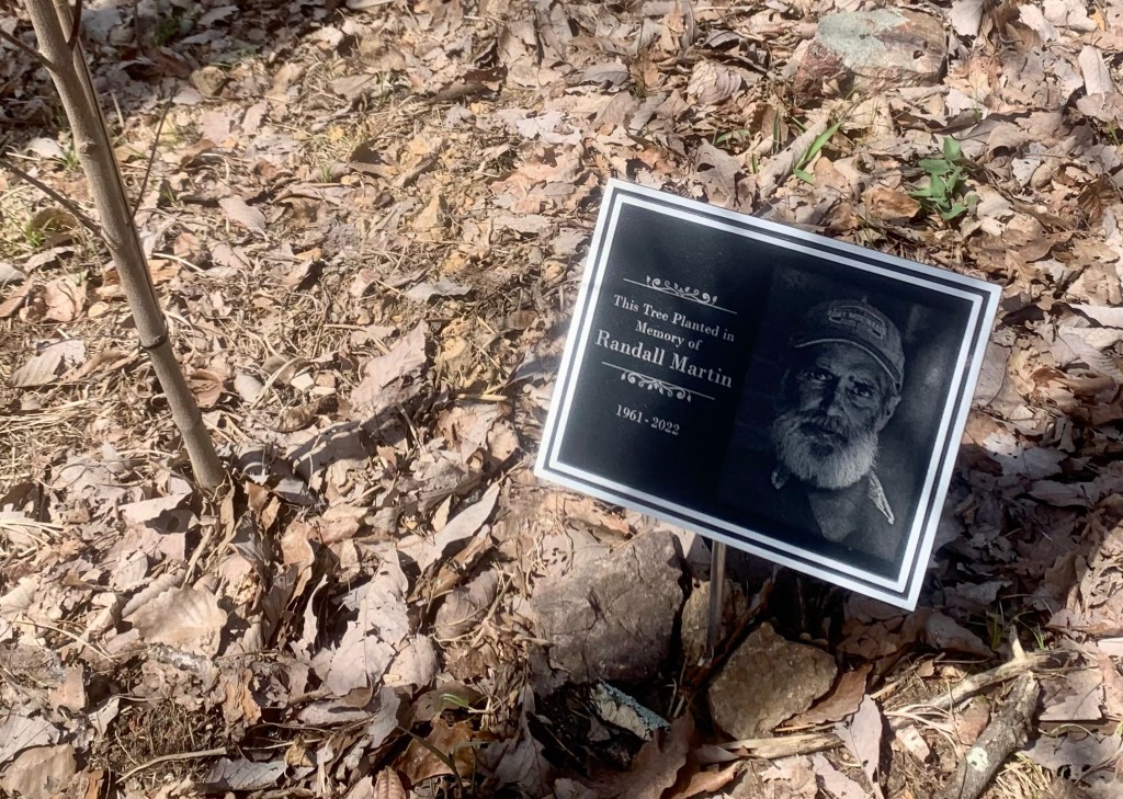
Refuge (10,330’) to Jbel Toubkal (13,665′) to Imlil (6,000′)
Up very early, 3:30 for breakfast at 4:00 and on the trail by 4:30. We start in the dark so everyone has headlamps on.
Steep, cold, slippery and dark.
The trail quickly comes to a snow traverse that is slippery and very steep. Wishing we had crampons! This short traverse was the scariest part of the day for me.
A quick stop in the dark.
After the traverse we began a steep rock scramble that seemed to go on forever. The trail is crowded and we pass several large, slow moving groups.
Sun is starting to come up. Lot of folks ahead of us on the trail.
The trail leveled out a bit as headed up towards the saddle.
Heading toward the saddle.
We reached the saddle around 7:15. Only 300′ to go but it is very rough.
At the saddle!
We never stopped for very long because, with the wind, it is very cold.
Nearly there!
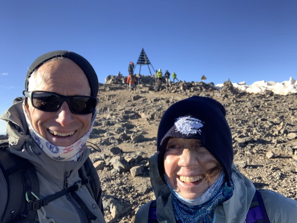
And finally, around 8:15 we reached the top.
At the top!
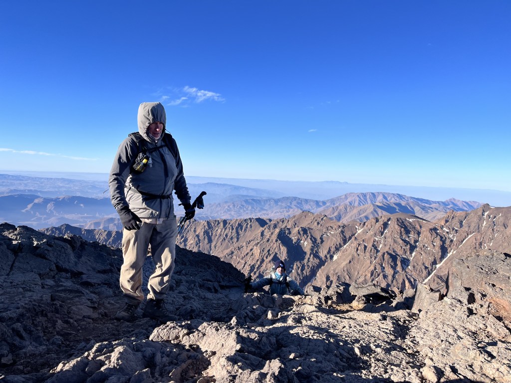
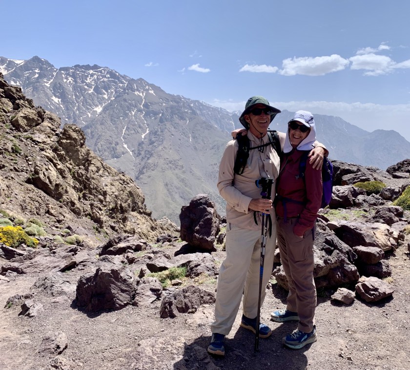
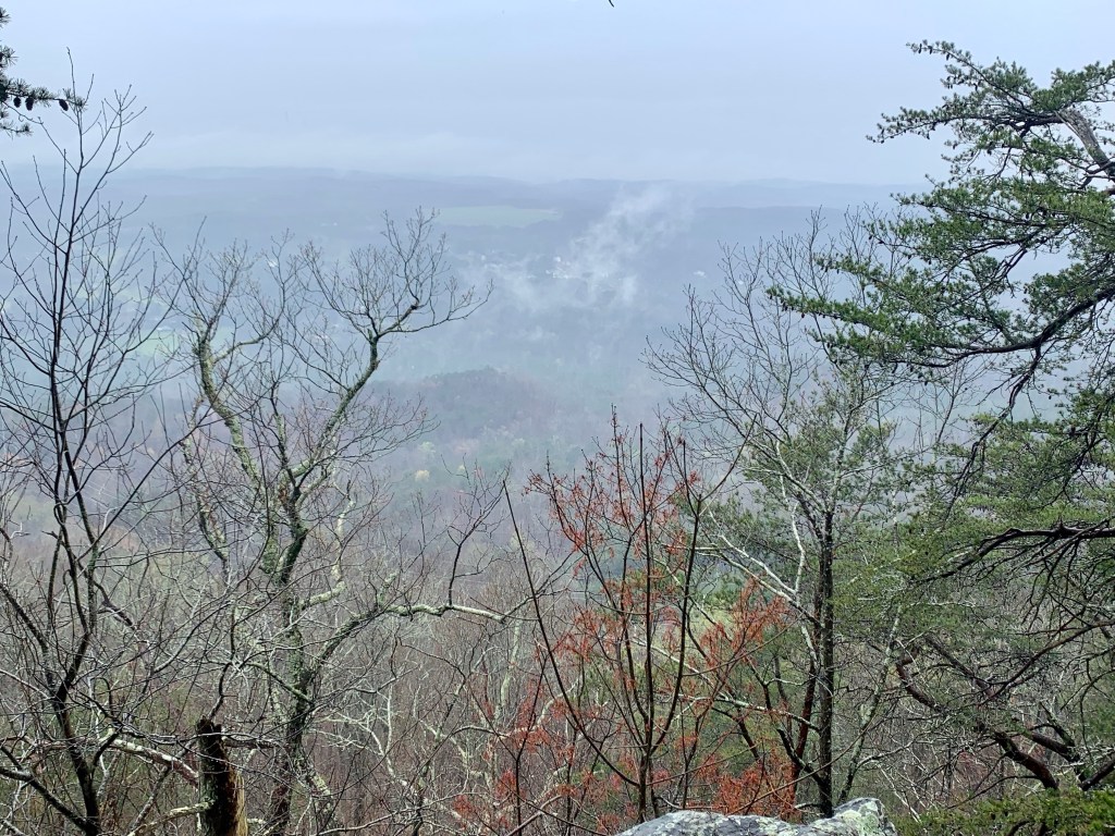
We don’t hang around long at the top because of the cold but the views are stunning.
Summit viewSummit panorama. At the top!
Then we began the long, 7,500′ hike back to Imlil, stopping for an hour at the refuge to pack up our sleeping bags and have a quick lunch.
Heading down.
We got to our hostel in Imlil at 4:30 PM, a 12 hour day.
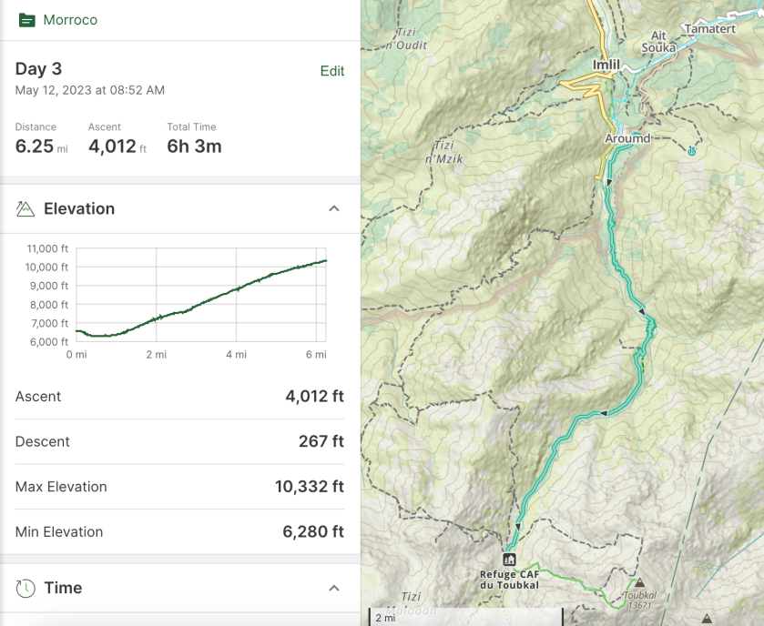
May 12, Arumd (6,600’) to Refuge du Toubkal (10,330’)
Big day as we climb to the refuge for the climb tomorrow to the summit. This is a 4,000′ day. We started at 9:00 with a couple hundred foot drop to the valley floor just south of Imlil then we started up.
Heading up! Toubkal is not visible but it is in those big mountains at the head of the valley.
The trail today is pretty good, rocky but not too steep. We very quickly re-entered the national park.
Back in the park.
We have a view of the big mountains pretty much all day.
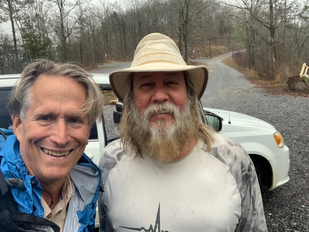
Our guide Ibrahim.
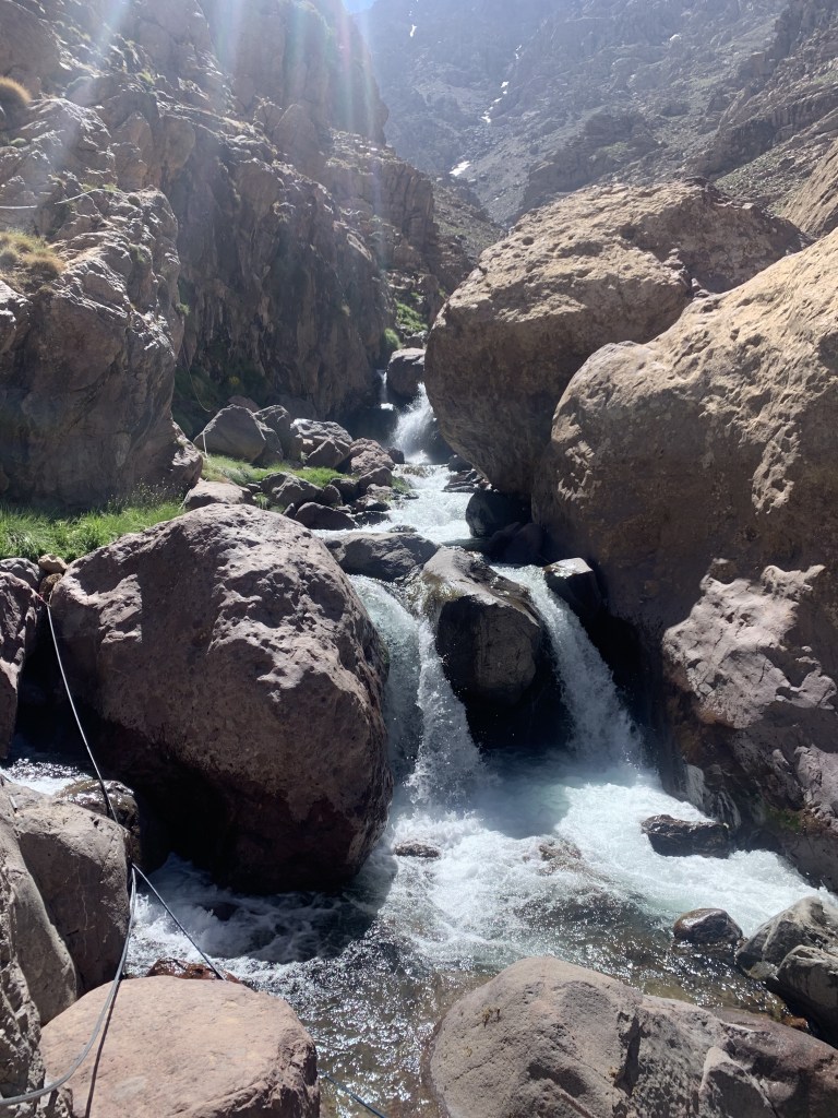
We stopped a couple of times along the way, once at a pretty stream crossing.
The only trail obstacles were the mules. We’ve learned that the mules always have right of way!
Our fellow mammal hikers. Rest stop
At our lunch stop, as we were leaving, Ibrahim realized that one of the hikers coming down had accidently grabbed his pack! He had to race down to catch him. How could somebody not know their own pack?
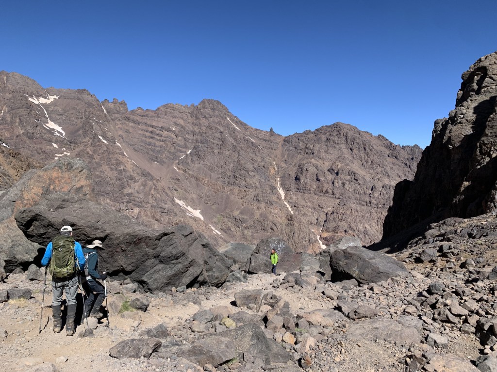
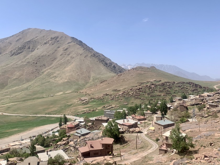
Approaching the refuge (middle of the picture). Toubkal is in the background.
We got to the refuge about 3:00 PM and there were few people there but that changed as the afternoon wore on.
At the refuge!!
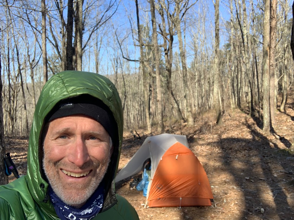
By dinner (6:30) the refuge was packed with hikers. Our guide gave us the option of sleeping in the refuge or in tents and we elected the tents.
Putting up our tents (orange and green ones).And fishing is forbidden! Just in case you were thinking of it.
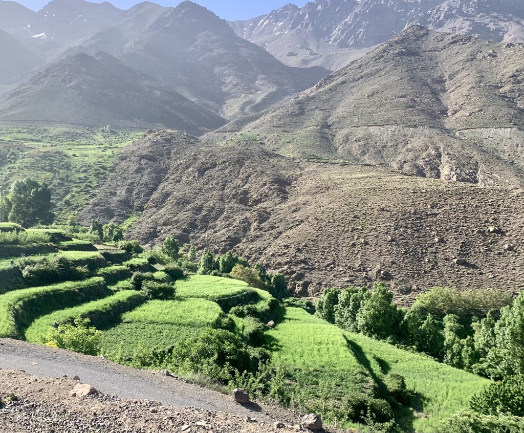
Started with a road walk out of Tacheddirt and then trails/dirt roads the rest of the day heading for our mountain pass of the day.
Hiking down a very pretty river valley
The trail today is much nicer, a nice mix of mountain trails and gravel roads as we move from one mountain valley to the next.
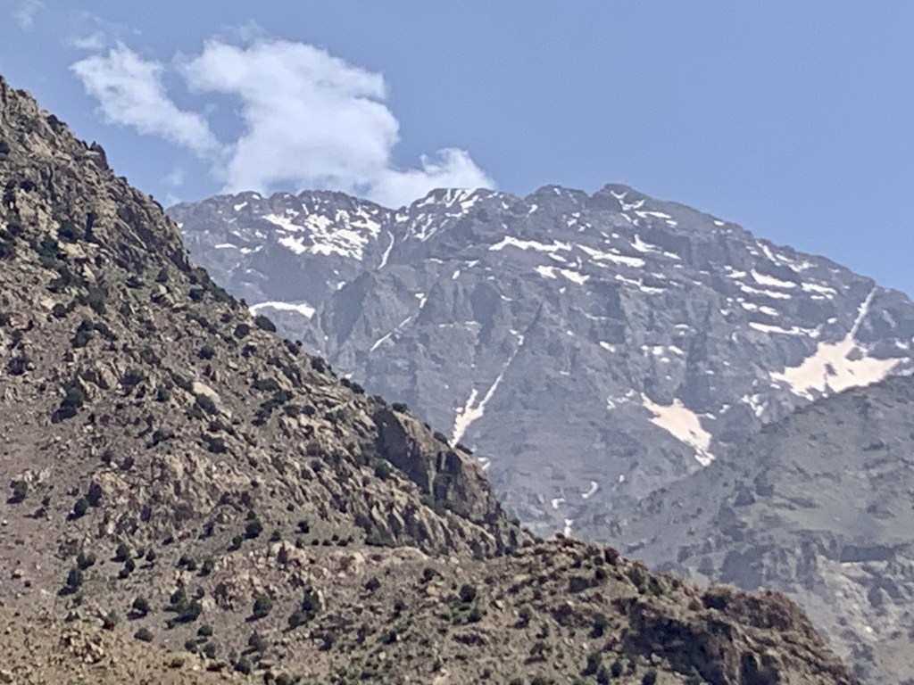
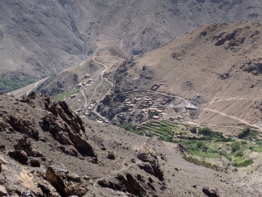
Crossing a stream on a nice wooden bridge.Today’s view of Toubkal… a little closer? Maybe?
We could see Toubkal a few times today and it looks bigger than ever. Arumd is a small town perched on a hill above Imlil. The place is nice but busy with hikers and noisy. We arrive about 3:30 and have our usual tea/popcorn at 5:00 and dinner (the ubiquitous veggie tagine) at 7:30. Joe is paying the price for hiking with vegetarians.
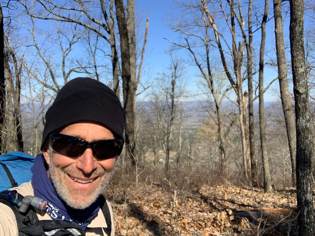
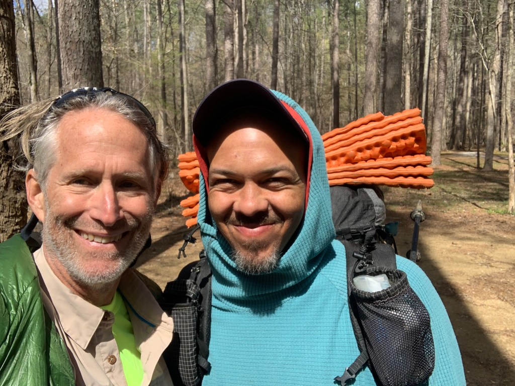
Today’s selfie! Why are these people smiling? There’s a mountain to climb!
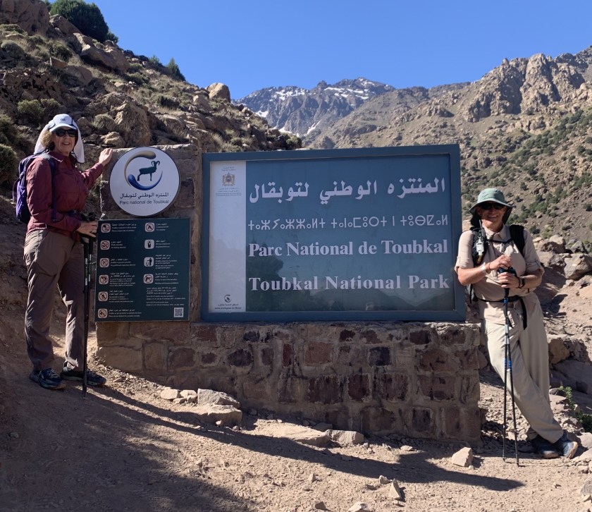
May 10, Oukaimeden (8 ,600’) – Tacheddirt (7,600’)
Mohamed, the tour owner met us at 9:00 at the hotel and helped us load into our shuttle for the ride to the ski resort of Oukaimeden where we would start our trek. After a 90 minute (very curvy) ride we got to Oukaimeden where we met Ibrahim (our guide) and the two Hassan’s (mule drivers, cooks).
Day 1: Oukaimeden to Tacheddirt
We started up out of Oukaimeden about 11:00, circling the ski valley, stopping after a couple of hours for a picnic lunch.
Hiking out of Oukaimeden Hot picnic lunch
We got to the top of today’s pass (just under 10,000′) just before 3:00 after passing the sign saying we were in the national park.
We are in the park.
We are feeling the first day at altitude but everyone is moving well.
High point today. And that mountain over my right shoulder is where we are heading!
After that we began a very steep, rough descent to Tacheddirt.
Steep descent to TacheddirtTacheddirt, our destination for the evening.
We got to our hostel about 4:30, a very quiet place with few other hikers.
View from our hostel
We got a couple of views today of where we are heading and it’s hard to believe we will be up there in a few days.
Mt Toubkal is one of those big peaks behind me. Very exciting!
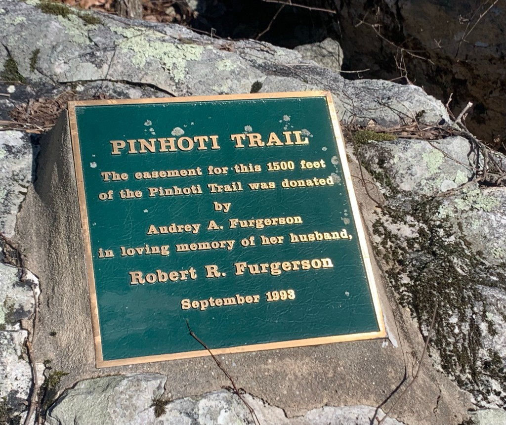
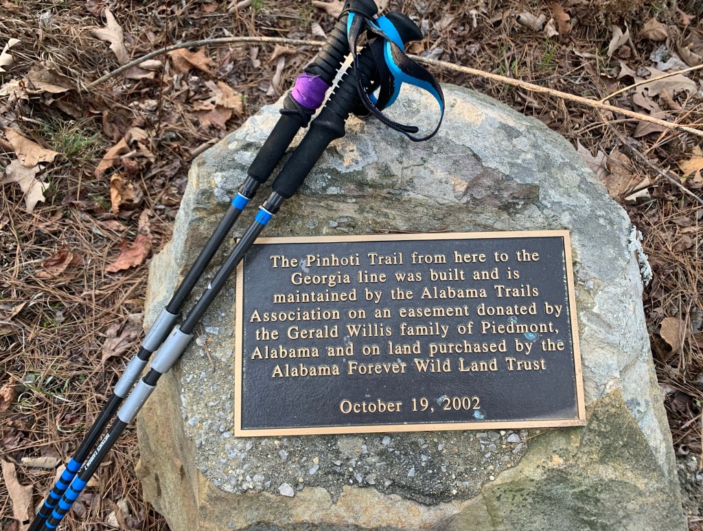
Here are my thoughts on the Pinhoti Trail, fresh from finishing the trail a few days ago
Trail Access, Both Ends
I got to the southern terminus of the PT to start my hike by flying into Birmingham and shuttling to Flagg Mountain, about 75 road miles southeast of Birmingham. I used the Pinhoti Outdoor Center shuttle service. Total price for shuttle and a fuel canister (230g) was $153. They explained that if they were picking up other hikers this would be less. Uber might be a possible option but I doubt if it would be much less.
The northern terminus of the PT is a trail junction with the Benton MacKaye Trail (BMT 72.1). A couple miles north on the BMT is the closest road access, the intersection of Foster Branch Road and FS 22 at Watson Gap. It might be possible to arrange a ride from here, maybe back to Dalton. The problem for me was I needed a major airport. I elected to continue up the BMT to Ducktown where I arranged a shuttle with A Walk in the Woods to the Knoxville airport, about 75 miles. This was very expensive, $350. Multiple hikers would make this less of course.
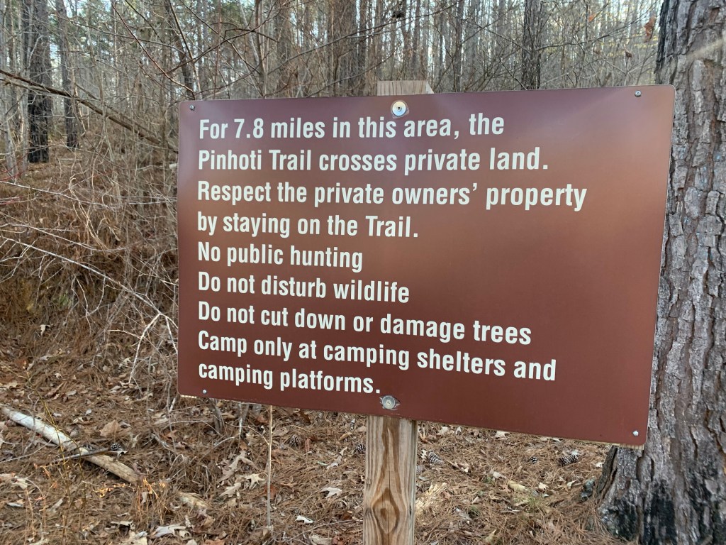
Compared to other trails I have done, the PT trail access was hard and expensive, especially if you don’t live or have friends in the area and are a solo hiker.
Overall Trail Quality
The trail quality was, especially in Alabama, and with a few exceptions, quite good. A nice mix of packed-earth woodland trail, rocky ridges and country and forest service roads. The exceptions:
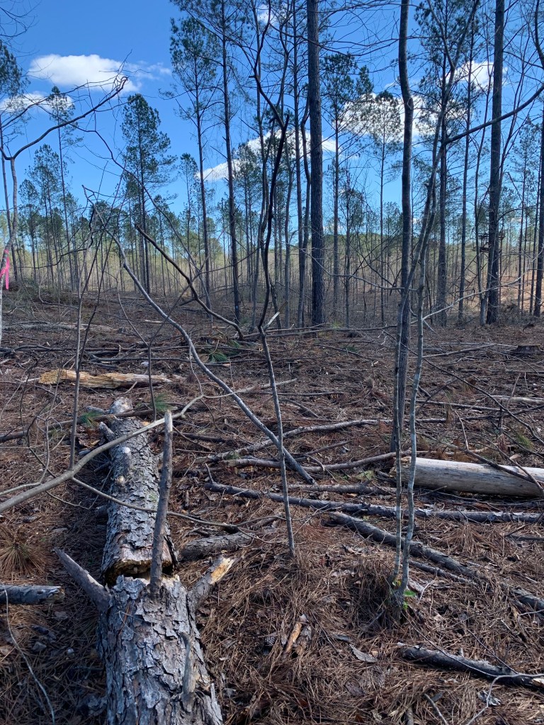
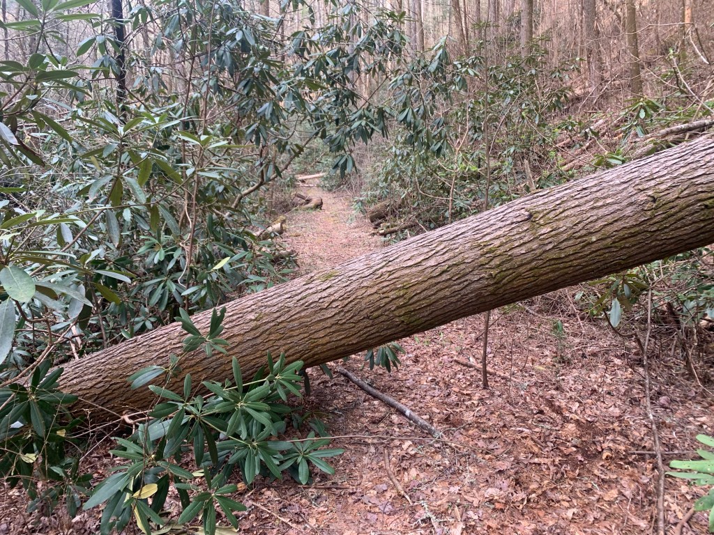
PT 25.5: Leaving Holman’s Crossroads Rd you enter a bulldozed nightmare of a trail for a mile or two. There are blazes on the few remaining trees still standing but there is no trail, just a muddy, branch-strewn, ankle-twisting mess. I would definitely have stayed on the road if I had known how bad it was.
The “trail” near PT 25.5
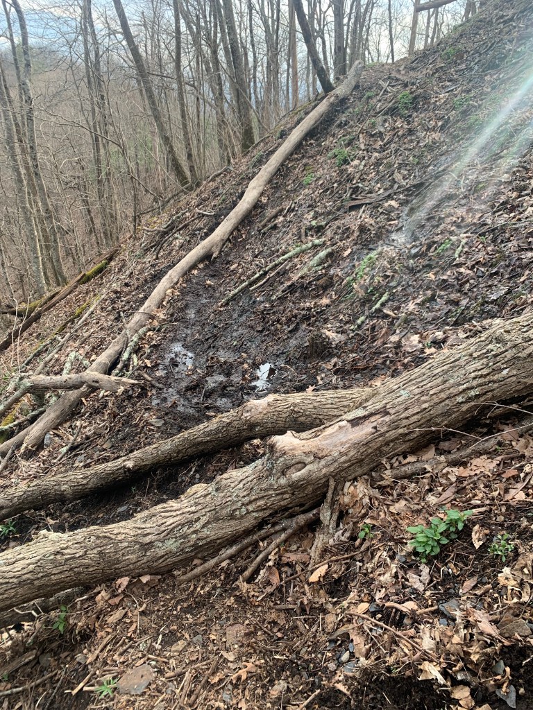
PT 85: In the Cheaha Wilderness, once you get up on the big ridge, there are several sections were the trail deteriorates into an unmarked, very rough, rock scramble.
The “Stairway yto Heaven”
Road Walks
Short (less than 5 miles) road walks can be a nice change from the trail and a way to pick up some easy miles. However, there are two long road walks on the PT. I skipped both of them.
Dalton: Leaving Dalton (PT 285) there is a 25 mile road walk, some of it on very busy roads, to get back to the trail. This is over my limit for busy road walks so I used a taxi (Tony’s Taxi) to get around most of this. I tried Uber first but could not get a driver.
Cave Spring: Leaving Cave Spring (PT 190) there is a 20 mile road walk. I considered walking this since these roads are not too bad, some are busy but most are not. But, again, 20 miles is over my limit and I had an offer of a ride from a trail angel in town (Crispy) so I took it.
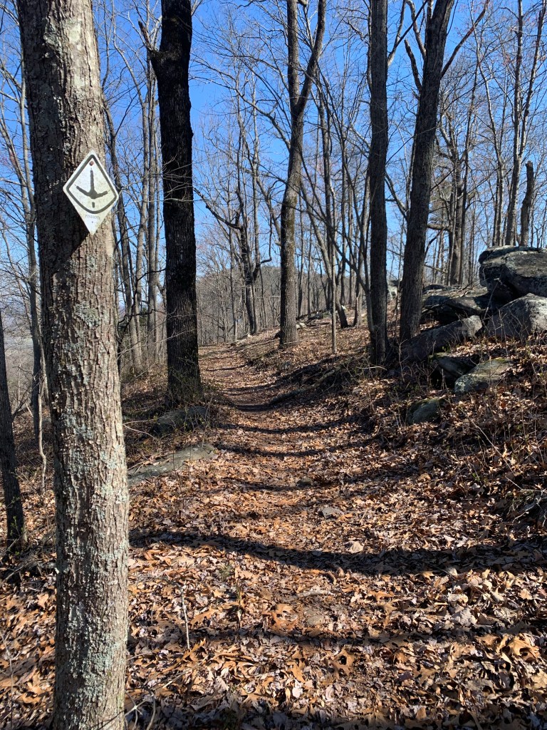
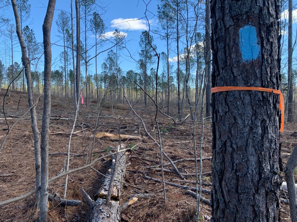
Blazes and Navigation Aids
With the exception of about 10 miles of the Cheaha Wilderness, the trail in Alabama is very well blazed. I seldom had to access FarOut (Guthook) to find the trail. This is not true in Georgia.
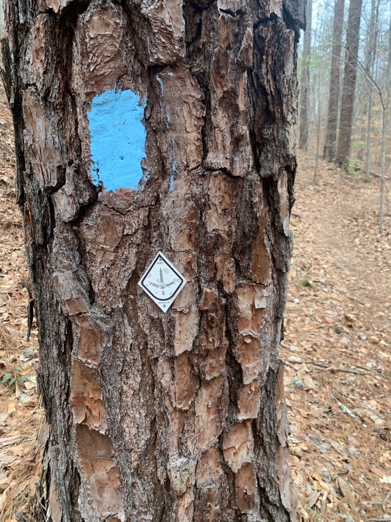
PT Blazes (in Alabama)
The baby-blue rectangular marks were the more common trail blaze in Alabama but there were also, less frequently , the metal diamond medallions.
Once you enter Georgia (PT 179), the blue blazes stop and the diamond medallions become random and infrequent. In Georgia, if you do not have some kind of navigation aid you will definitely lose the trail. There are several trail/road junctions where there are no blazes at all.
Also, at some point, the Great Eastern Trail, which uses a white rectangular blaze, is coincident with the PT and you will sometimes see these blazes.
Resupply, Support and Trail Towns
The trail is pretty good for resupply. Here was my resupply schedule:
PT 60 – Talladega: A nice couple run Next Step Hostel that is close to grocery stores/fast food and they will pick you up and return you to the trail. Very nice.
PT 113 – Heflin: Either a 3.5 mile side trail, a 2 mile road walk/hitch or calling city hall (Tammy) to get a ride make getting to Heflin pretty easy. The town is spread out but has all the necessary hiker needs.
PT 190- Cave Spring: The trail goes through town. The Creekside Inn Motel is closed but the Hern Inn is available and is a great hiker stop. Another great hiker town to meet all your hiker needs.
PT 285- Dalton: Thé trail goes through town. Dalton is big and spread out. Most of the hotels are near the freeway where you enter town. Grocery stores/restaurants are near the highway and the Academy (fuel canister) is 2-3 miles north.
Dogs and Other Wildlife
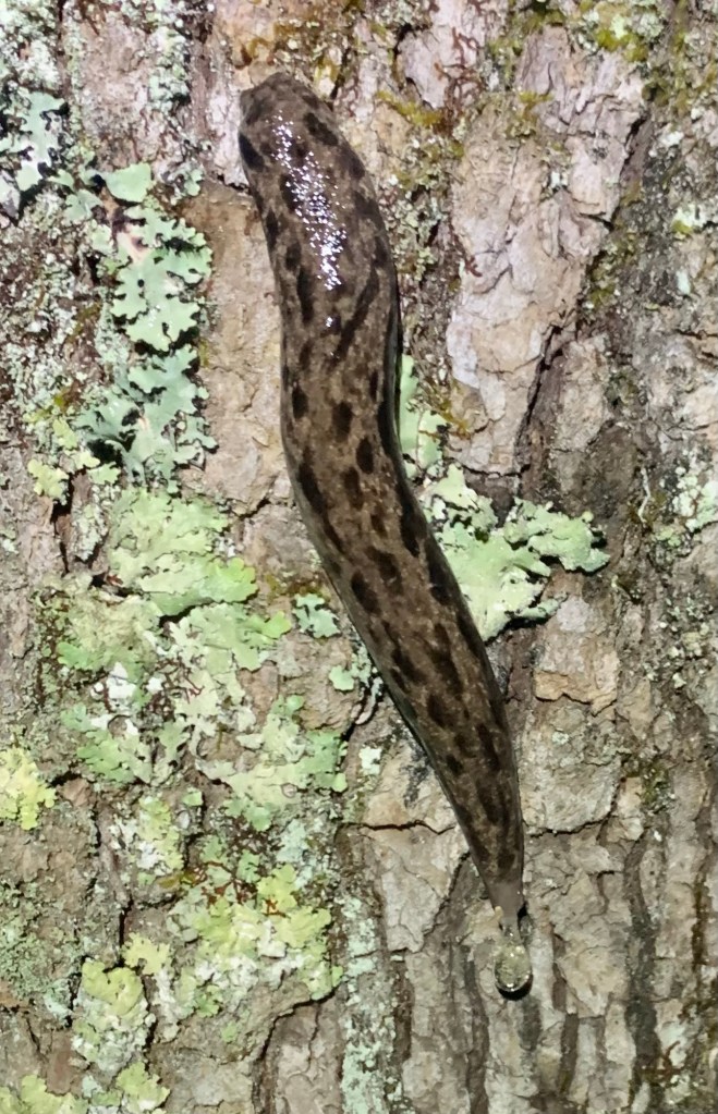
Over the course of my 3-1/2 weeks on the trail I saw 5 deer, a raccoon, a very colorful slug, a couple of lizards and many squirrels
… and dogs. For some reason there are people who believe that their dogs are not their responsibility. I had two run-ins with dogs that came out onto the road and approached me very aggressively. In the first instance, I crossed to the far side of the road but the two dogs followed, causing a car to stop. I finally had to use my pepper spray which was very effective. The second incident was a lone dog who I stopped with dog treats.
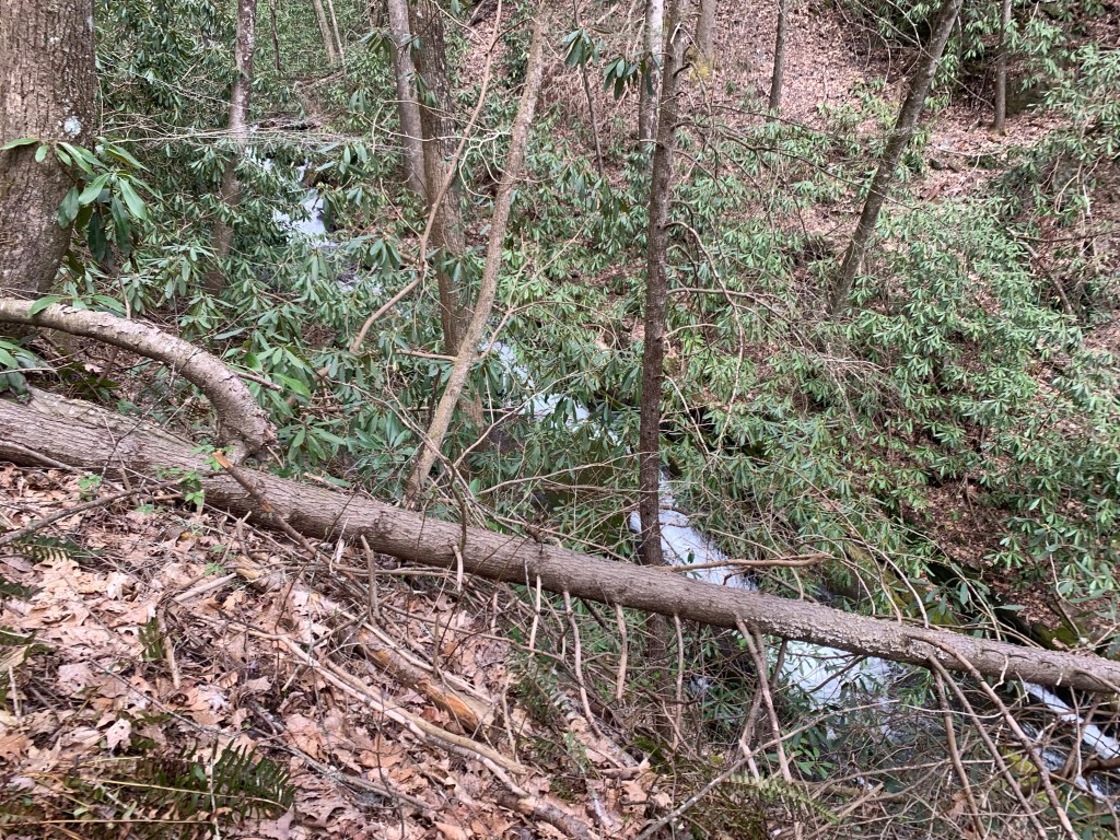
Blowdowns
For the most part the trail obstacles were typical and not difficult to navigate. There were a couple sections where the blowdowns were so frequent you could see four of five down the trail while climbing over one.
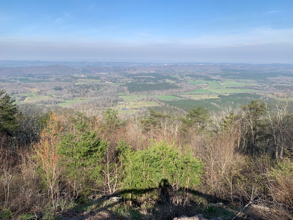
Views
A lot of the trail is along ridges and often, especially in March before the trees have all gotten their leaves, there are some really nice views, which is always a nice reward after a hard climb.
Well, so much for plans. I had a Lyft scheduled to get past the ~20 mile road walk out of Dalton but, as I learned, when you schedule with Uber or Lyft, it really is not scheduled. They just release your request when your time nears and if no driver wants it…no deal. I ended up calling “Tony’s Taxi” and Tony was at my hotel in 10 minutes.
Tony got me to within a couple miles of the trailhead (the road was closed). The good news is that my timing is good – the rain stopped this morning just before I started hiking.
Walking to the trailhead … through the middle of Trumplandia.
This was my biggest climbing day of the hike, more than 4,000 feet and also a big distance day – about 19.5 miles. The clouds disappeared in the afternoon as it warmed up into the 70’s.
The sun comes out!
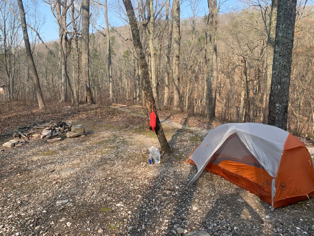
I had planned to stealth camp at a lookout along a major road but when I got there it was just too busy (and noisy) so I continued another 2.5 miles to a small, dry campsite on a ridge.
Camp on a ridge but no views.My dinner companion.
Day 25, Mar 26, PT 328.9
Had my warmest night so far, I don’t think it got below 55°. It’s kind of nice taking the tent down without having to have my gloves on. Today was a shorter day, as planned. A good thing too, my legs really felt that 4000 foot of climbing yesterday.
And it was practically crowded on the trail today. I met a couple of weekend hikers and 6 or 7 bikers. Well, it is a nice Sunday but I have no idea where the trailhead is where these guys are accessing the trail.
The trail was a little rough today, at one point I could see four different blow-downs ahead.
Typical trail obstacles on the PT.
I’m really happy about my campsite. It’s in a little valley between two hills so it’s very protected for the rainstorm that is supposed to come through tonight.
Of course that means no cell coverage and …. I’m only 4.7 miles from the end of the Pinhoti Trail!!!
Day 26, Mar 27, PT 350.2….The End!! And 10 miles on the BMT.
It rained last night as forecast. Started around 10 PM and rained most of the night, but never hard and ot was over by 3 AM. And it is less than 5 miles to the end of the PT.
One more wade…
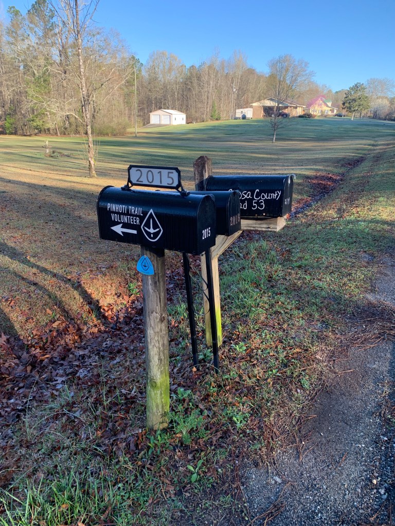
The northern end of the PT is not at a trailhead, but at a junction with the Benton MacKaye Trail (BMT) so it was a bit anticlimactic. There’s nothing there but a small sign. I celebrated with my last Snickers.
The end of the Pinhoti Trail.
But… my hiking is not over. I have to go north 20 plus miles on the BMT to get to a place where I can hitch to Ducktown where my shuttle is scheduled.
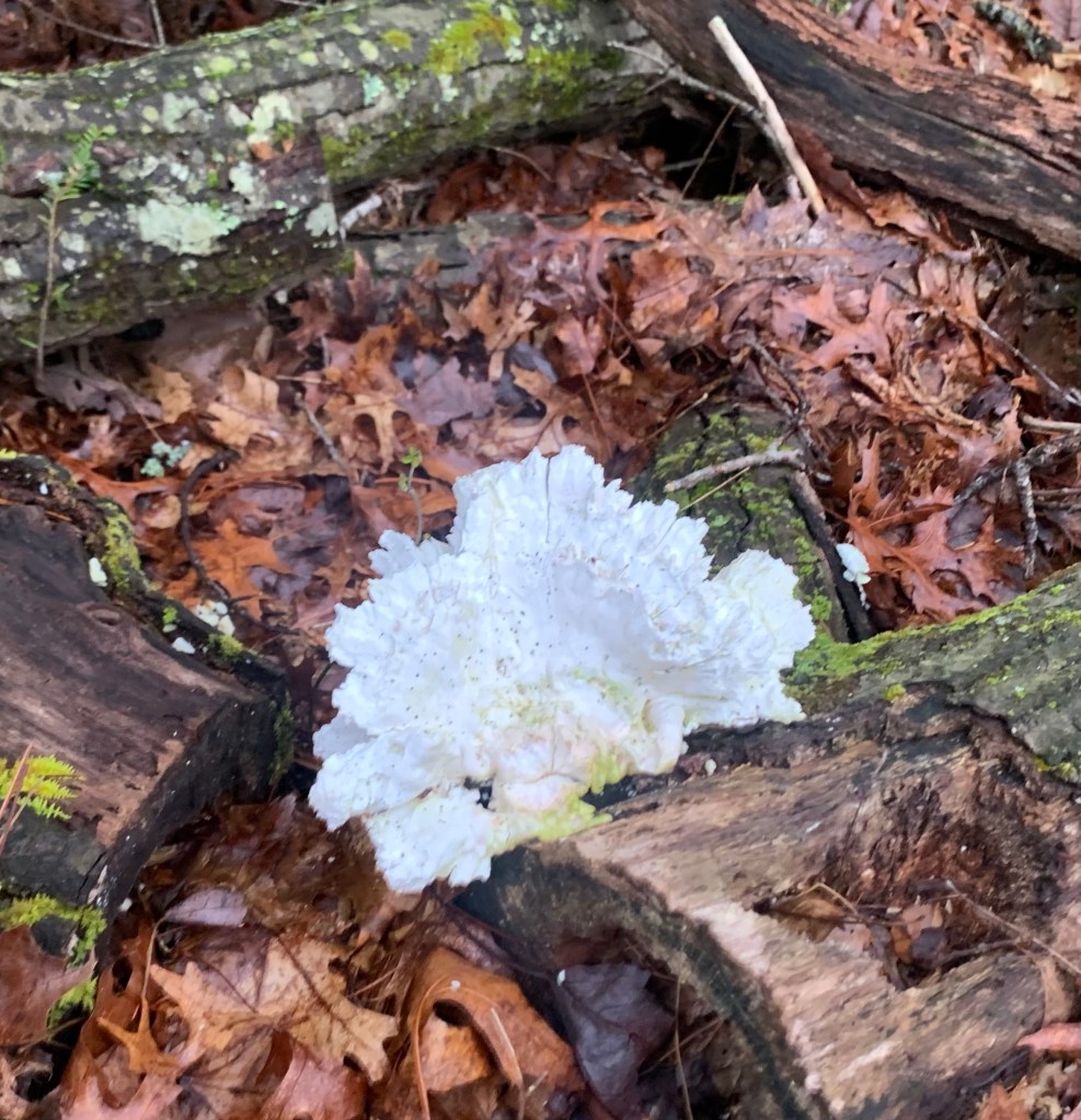
A cool fungus thing.
The BMT is very similar to the PT, lots of steep climbs and blow-downs.
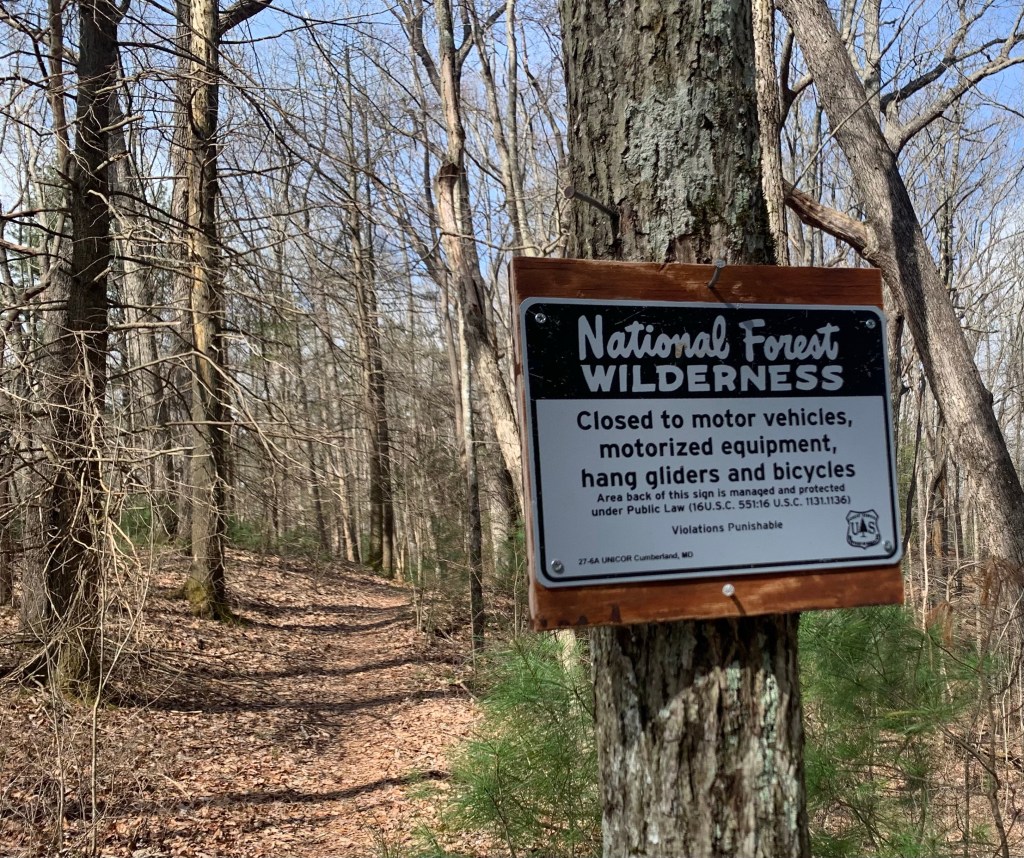
Hang gliders? Really?
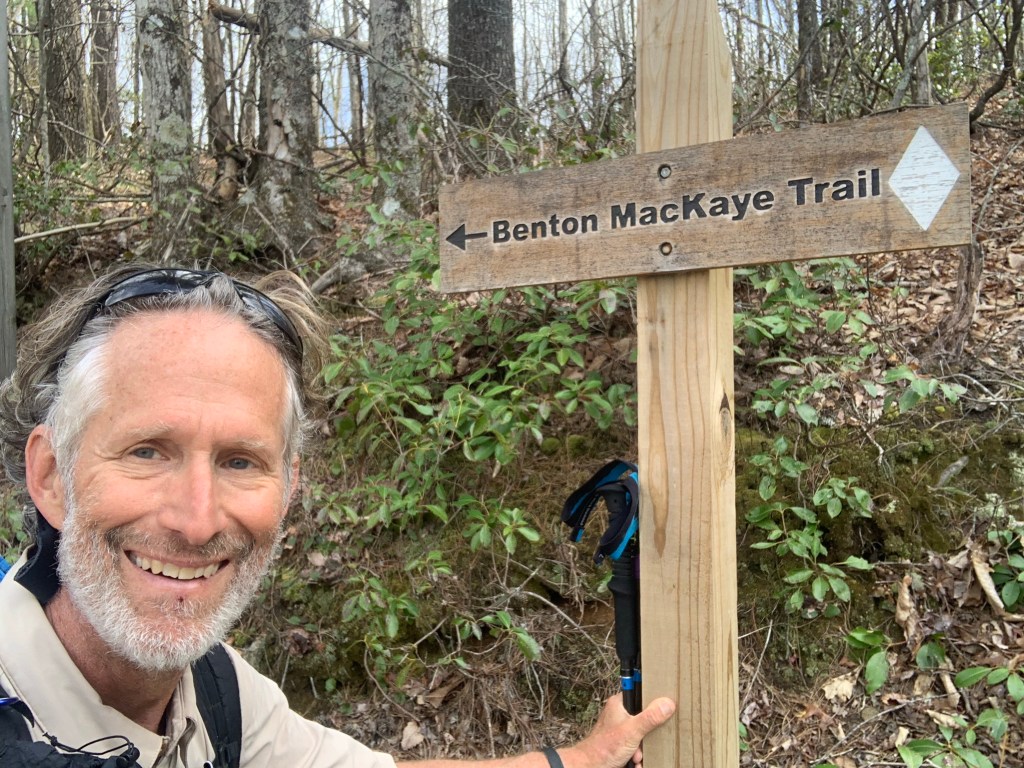
And… a new trail, a new blaze.
Hello BMT!
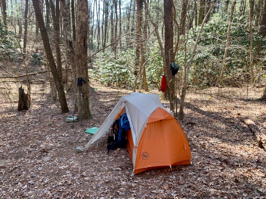
And my third state! I camped at Double Spring Gap (yes, there are two springs) which is on the state line with Tennessee, though there was no sign of any kind.
Double Spring Gap,
Day 27, Mar 28, BMT 93.9, Ducktown, Tenn.
The day started with a killer 1,000 foot plus climb up Big Frog Mountain over about 1.5 miles. Steep and hard, glad it was in the early morning, though I did not see any frogs, big or small.
Climbing Big Frog Mountain.
The trail wasn’t too bad on the way down, with the exception of the impenetrable jungle that the BMT became near a creek. I had to take off my pack and crawl under and over fallen trees, dragging my backpack behind me.
More fun on the BMT!
Overall I made pretty good time and got to the Thunder Rock CG, on the Ocoee River, at 12:30. Most of the spots are open (it is still early in the seasons, I think the CG only opened last week) but I bumped into one guy who asked if I had hiked very far in the direction I was coming from. “About 350 miles..” He just looked at me.
Thunder Rock. CG
As expected there is no cell coverage here. BUT there are showers and an outlet in the shower/bathroom where I am currently charging my extra battery. The shower felt wonderful, I even managed to find some soap! And I rinsed out my hiking clothes in the sink. Luxury!
Over the course of my two days and 20 odd miles on the BMT I saw nary a soul. And this completes my hiking. Of course, I still have to get the 7 miles or so to Ducktown, Tennessee where I have a shuttle scheduled.
In the afternoon I walked the campground and asked a woman who I had seen hiking earlier if she could give me a ride in the morning. Turns out she is with two other women (in the site next to hers) and I explained my situation (three times). Lisa, the last hiker who I talked to said she could give me a ride tomorrow morning! Yeah! No highway walking!
Days 28, Mar 29, Ducktown
It got cold again! It was in the low 30’s this morning. I am packed up and ready for my ride to town when I saw another thru-hiker walk through camp. “Sunshine” was in shorts, which was impressive. She had done the Florida Trail to the BMT and was continuing up the BMT to start the AT. She has over 2,000 miles to go.
Sunshine!
At 9:00 AM I walked down to Lisa’s camp and she was ready for the short drive to Ducktown. I am really glad I did not have to walk the highway this morning.
There is not a lot in Ducktown, a Hardee’s, a small breakfast cafe and a couple of dollar stores. And my motel, the Ocoee River Inn. Not fancy but hot water!
Classy hotel!
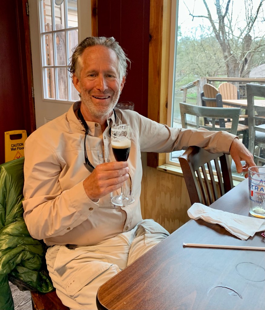
The following morning, Ben with “Walk in the Woods” showed up promptly at 10:00 AM for my shuttle to Knoxville to await my flight home to Houston. But not before having a celebratory martini!
Crispy pick me up this morning at 7:30 and drove me to the Simms Mountain trail head, at PT 210.0. This knocked off about 20 miles of road walking. And I learned how Crispy got her trail name. Seems she hiked Joshua Tree a few summers ago without a sun-shirt and got very sunburned. Ergo.. Crispy.
Crispy and some other hiker guy.
The first 10 miles today were easy walking on an old railroad right-of-way. A little boring, but flat and fast. The morning started cold, below freezing, but it warmed up quickly and was perfect for hiking.
Flat, easy trail for the first 10 miles.
I felt so good today I decided to push past my intended campsite and ended up doing a 21+ mile day, my longest so far. I saw three more deer this morning. I’m assuming these are Whitetail deer because they have these huge white tails.
A little bit of a view.
I ended up stealth camping between a couple of radio towers, right next to what appears to be a cell phone tower at the top of a ridge. This is not an approved campsite, but there isn’t anything for some distance and it’s relatively flat here.
Camp.
It’s supposed to get down to 25° tonight so, once again, I have put my water filter inside my quilt to keep it from freezing.
Day 19, Mar 20, PT 253.1
Another big day, almost 22 miles, my longest so far. That means in the last two days I’ve done a total of 43 miles, which is a record for me. It was very very cold this morning, definitely the coldest start so far. My water tube froze. I’m guessing it was below 25 degrees last night. It was the first time I’ve hiked with my micro-puff. And I kept it on for several hours. It made for a slow start.
Brrrrr!
I had just started hiking when a couple of trucks showed up at the radio towers. Nobody said anything. It turned into a lovely hiking day as it warmed up by the end of the day I was down to one layer and had my short sleeves rolled up.
Much nicer temperature for hiking..
I saw no other hikers today or anyone for that matter. The trail was the usual mix of woodland trails, rocky ridges, and road walking. And I had to wade both East and West Armuchee creeks.
Nice woodland trail.Wading time, East Armuchee Creek
And there were some nice houses on the road walk (and no dogs!).
I wonder if they would mind if I camped here?
I ended up çamping at a flat spot just after wading East Armuchee Creek. Always nice to camp next to water.
Camping next to a nice stream.
Day 20, Mar 21, PT 272.1
Yet another big day, 19 miles. I’ve done 62 miles in three days, something I’ve never done before. In the last section I averaged 16.5 miles a day and so far in this section I am averaging over 20 miles.
Getting warmer!
And the cold snap appears to be breaking, it was a balmy 37 degrees this morning. There was a little bit of road walking today, mostly on dirt Forest Service roads. These can be a nice break from a rocky trail. This was also a ~3,500’ ascent day that started with a 1,000’ climb to the top of John’s Mountain…
… with stunning views at the top.
It was another lovely day. The cold nights aren’t fun but they always seem to be followed by cool, sunny days that are just perfect for hiking.
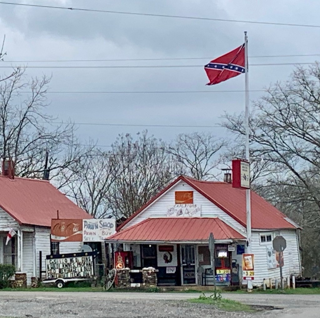
EVERYTHING in these parts is named after some losing rebel.Sights along the trail.
About 4 miles from my camp I met another through hiker, a SOBO (south bound hiker, I am a NOBO)., who started about a week ago. His trail name is Harpo, and he proceeded to demonstrate why.
Harpo and Impy
I camped at the last water source before Dalton, Swamp Creek. This leaves me roughly 13 miles to get to Dalton tomorrow. It looks like pushing it was a good idea because it is supposed to start raining tomorrow (a day earlier than the forecast I had in Cave Spring).
Camp and a hot dinner.
Day 21, Mar 22, PT 195.1 and Dalton!
It wasn’t supposed to rain until tomorrow! Started raining about 3 AM this morning (and rained fairly steadily until late afternoon). I loaded up my pack from inside the tent so the only thing left was the tent to take down in the rain, which was not fun.
The rain here is not like what I am used to in Houston, where a thunderstorm comes through and it rains for an hour or so. It seems to rain all day when it rains here. More like Seattle.
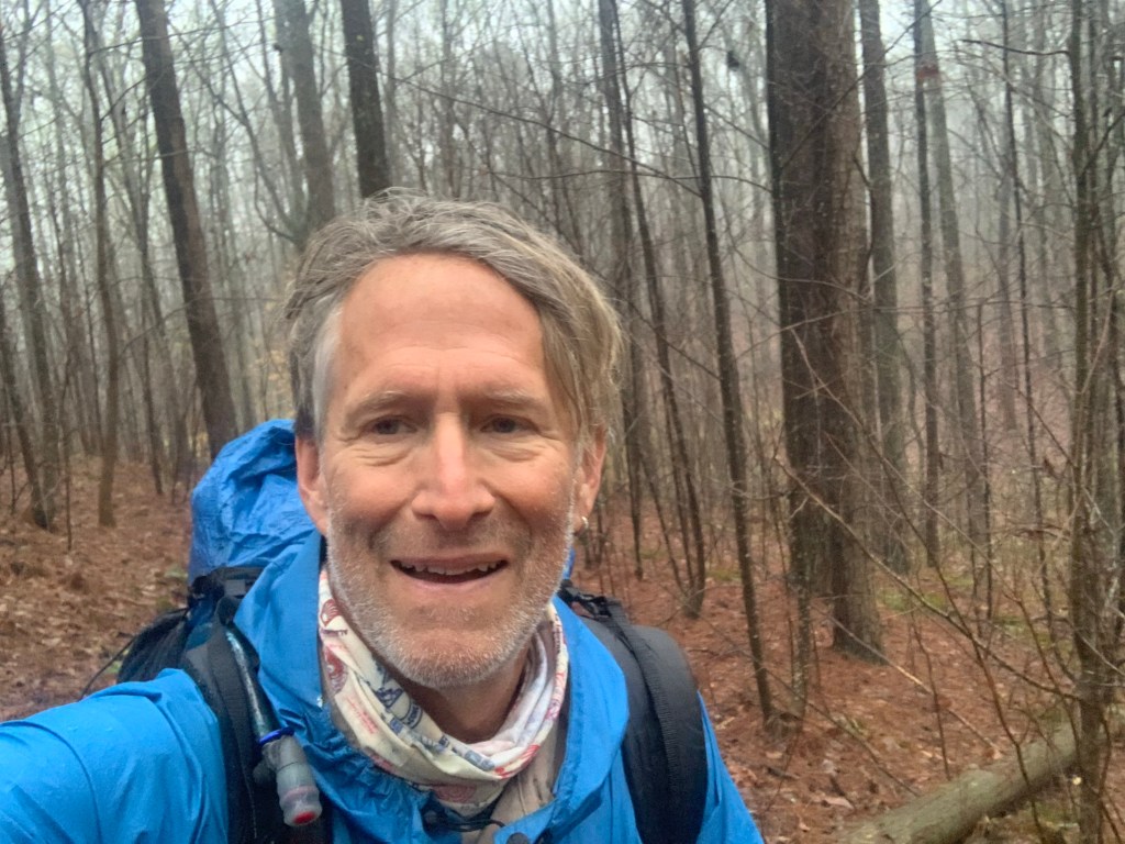
Why is that man smiling?
So it was a slog hiking in the rain all morning ending up on a pretty busy, two lane paved road for the last couple of miles into town.
The last miles into Dalton.
Too bad about the rain because I think there would’ve been some pretty decent views coming down off the ridge into Dalton.
A not-so-great view on a rainy day.
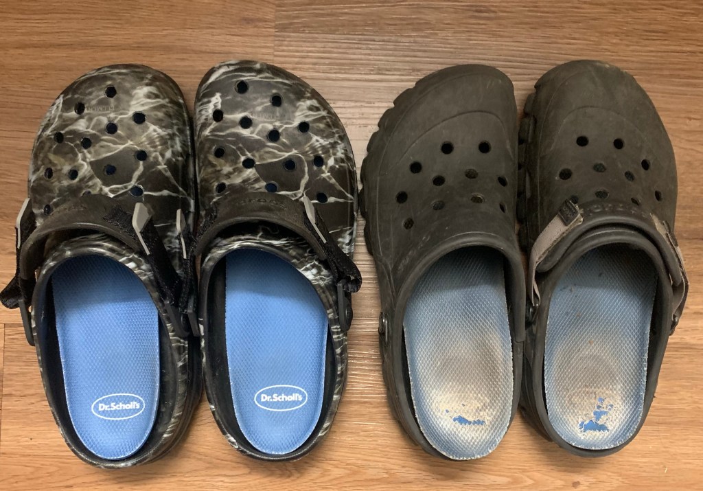
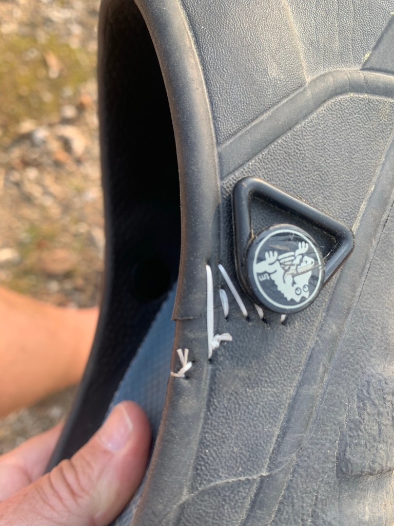
And I blew out my left croc again, my repair from a week or so ago finally failed. I have to decide whether to get new crocs here in Dalton or try to repair them again.
More Civil War history on the road into town. They know they lost right?
Days 22-23, Mar 23-24, PT 285.1, Dalton Zeroes
Dalton is the largest town on the PT, with about 140,000 people in the metro area. So it has all the services a hiker might need but, it is also a typical car-centric American city so everything is spaced out. I am staying at the Red Roof Inn, among about 10 other hotels next to I-75, where I entered town. Grocery stores are fortunately close but the Academy is a 6 mile round trip
New Crocs!!!Very exciting. Thank you Academy!
I’ve decided to do a double-zero here to get back on my schedule. And I can probably use the rest after pushing so hard in the last section. I have only one more section to finish up my hike. I plan to Uber the 25 mile road walk out of Dalton, the second of the two long road walks on the PT. Anything over 5 miles on paved, highway speed, no shoulder roads is too much for me.
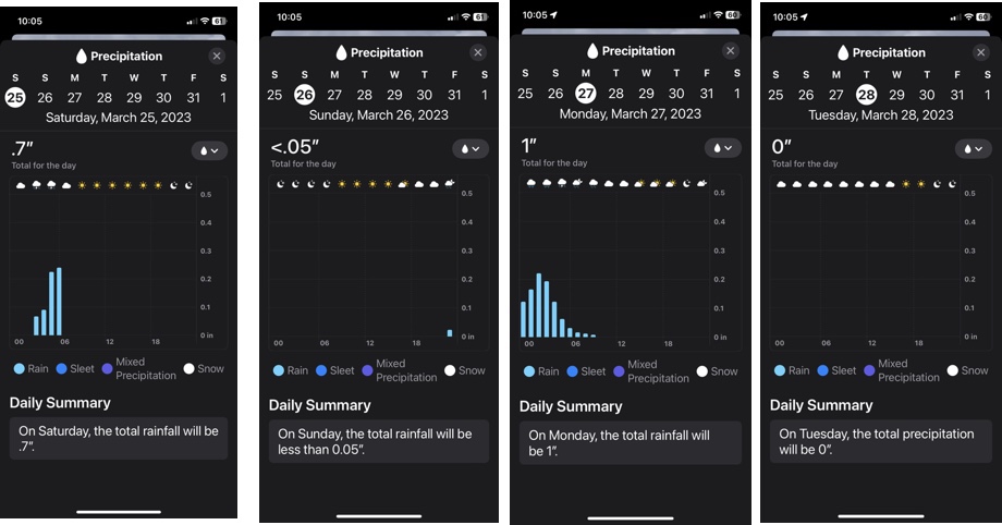
And I am obsessing a bit about the weather – I don’t want to hike all day in the rain again. Looking ahead to the four days of hiking I have left, it looks like it will rain on two of them, but stopping around sunrise both days. We will see.
And I celebrated the 285 miles I have done in typical fashion…
Tammy, the Heflin City Director of Economic Development (and also the main hiker person in Heflin) was a little late picking me up, but that was okay since I had forgotten about daylight savings time. It was still dark at 6:30. She picked me up about 6:50 and I was at the trail head and hiking at 7 AM.
Back on the trail
This was definitely my best day of hiking so far. The trail was a nice, packed earth path and it was a beautiful day, perfect for hiking. The day started about 39°F and slowly warmed into the low 50s.
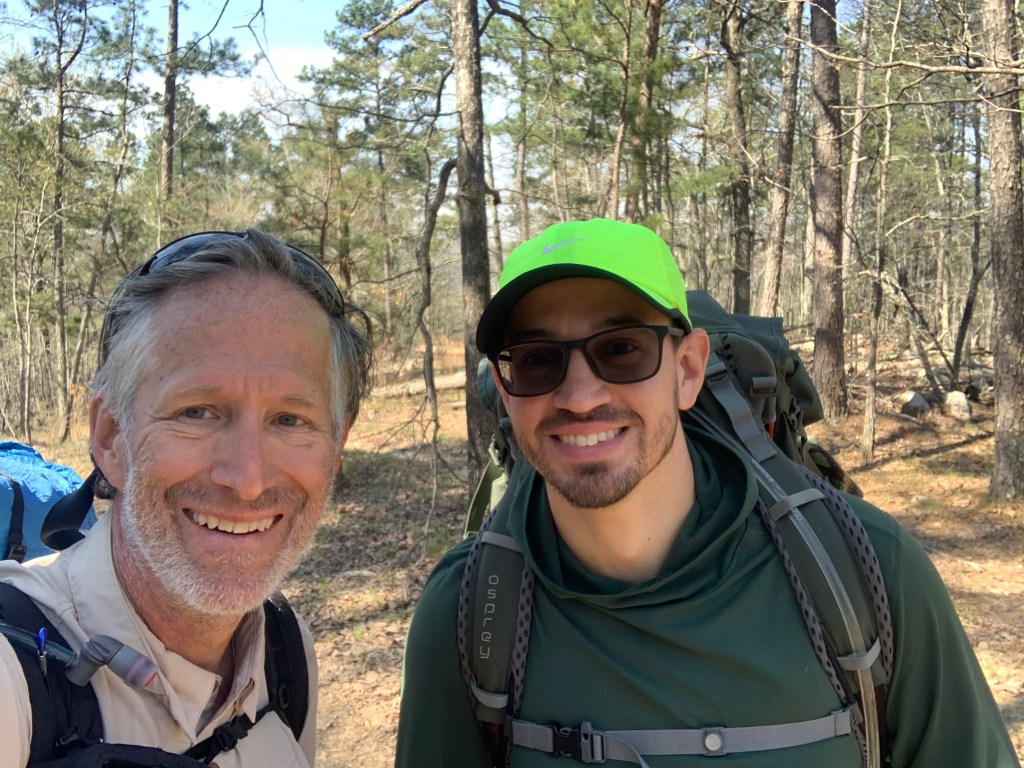
My lunch companion, Aaron.
I met my third hiker of the trail today, Aaron. I ran into him right before the campground where I had intended to have lunch and ended up joining him for lunch. He has done the PCT, the CDT, and while I am stopping at the end of the Pinhoti trail, he is continuing on the AT to Maine. And he is doing about 30 miles today. Out of my league.
Typical PT stream crossing.,
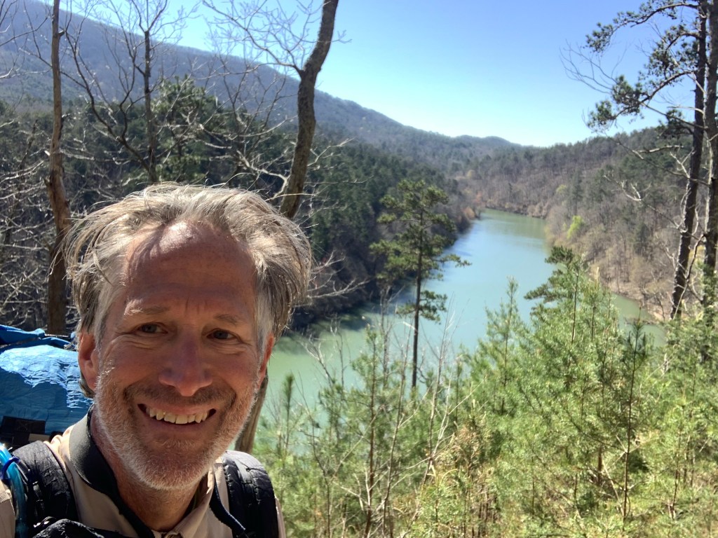
I had some nice views today, passing a High Rock Lake at one point.
Nice view.
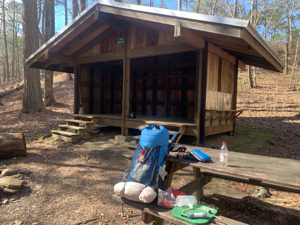
I felt so good today I decided to push on past my intended camp spot which was dry, one and a half miles to the Laurel Shelter, which has water. This is my longest day of the hike, 19 miles.
Home and dinner.
Day 13, Mar 14, PT 147.9
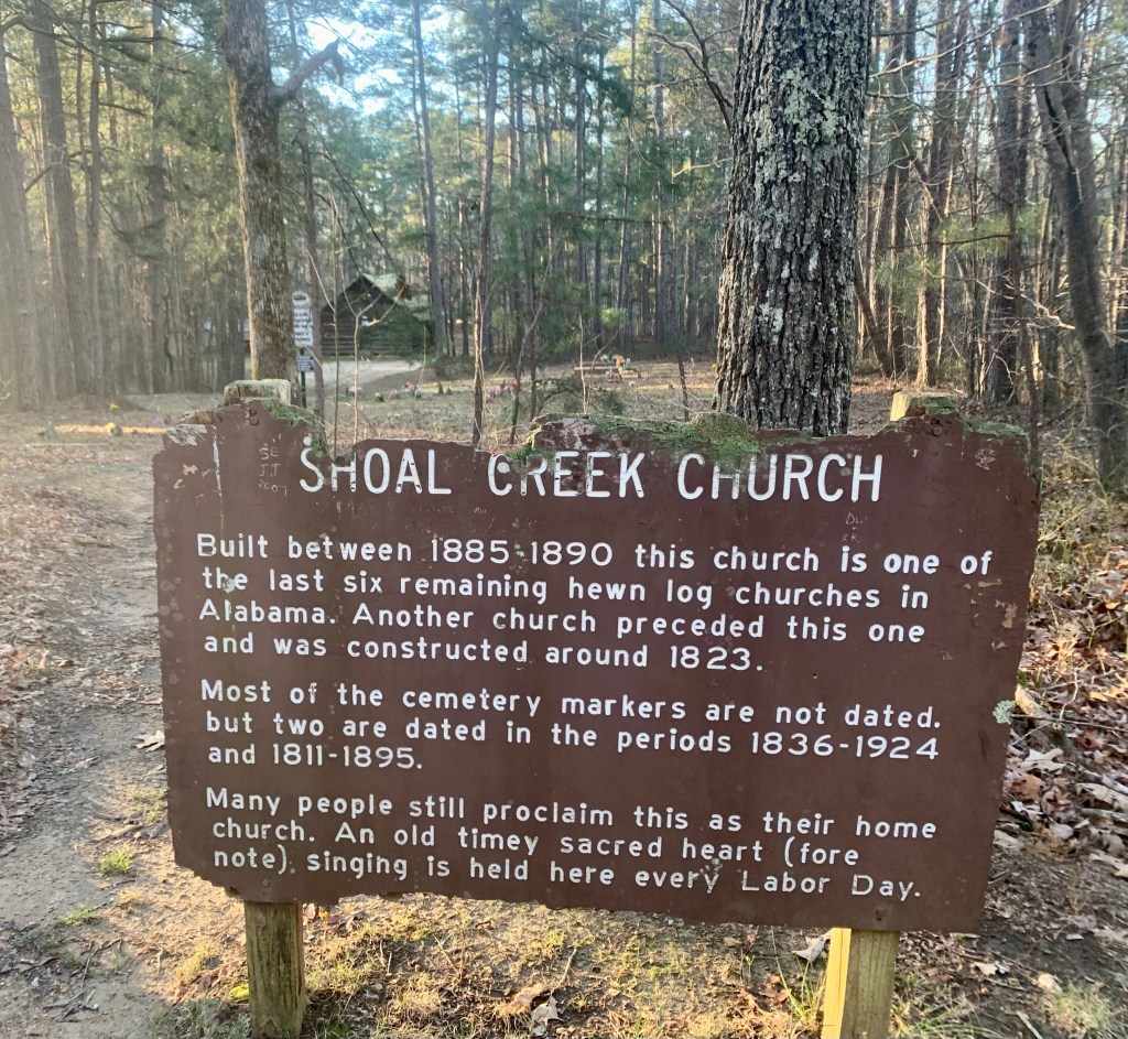
Around 5 o’clock yesterday evening Jared, a local hiker, showed up at the shelter so I had company for the night. He started before me this morning but I caught him around 11: 30 right before lunch at the Chocoloco Shelter.
Shoal Creek Church
It was a cold morning, and of course they were lots of river crossings. Passed Shoal Creek Church early in the day, just off the trail, one of the oldest churches in Alabama.
A bridge! A rare sight on the PT.
I passed three day hikers who were section hiking together and met a lady coming south with two dogs. So a little more activity on the trail today.
A cold night ahead!
I camped at Dugger Gap, which as the name implies is a wind tunnel and it was a cold, windy night. Someone (I later found out it was Jared) walked through my camp about 6:30 but had passed before I could pop out.
Day 14, Mar 15, PT 165.2
Cold, windy night but I was cozy in my tent and 10 degree quilt! And it turned into a beautiful hiking day; clear, sunny and temps in the mid-50’s
What looks like a lake is actually the South Fork of Terrapin Creek.Another pretty waterfall (and creek crossing!)
And more signs…
The day was so nice and I felt so good I pushed passed my intended (dry) campsite to another (dry) campsite.
Another day, another camp site.no water here.
Day 15, Mar 16, PT 180.2
Very exciting day. Today is a three picnic bench day! I stopped at shelters (which always have a picnic bench) for my first break, lunch and my camp. Sweet!
Trail sign.
And I caught up with Jared! Seems we’ve been passing each other without knowing it. He passed up my campsite last night when he saw my tent shivering in the wind. Jared is a hammock camper so was looking for something a bit less exposed.
Jared and some other guy.
We hiked near each other all day but this will be it for Jared – he is stopping at the Georgia state line – he has a job he as to get back to.
Another ridge view.
Another Pinhoti Trail first…. A ladder!
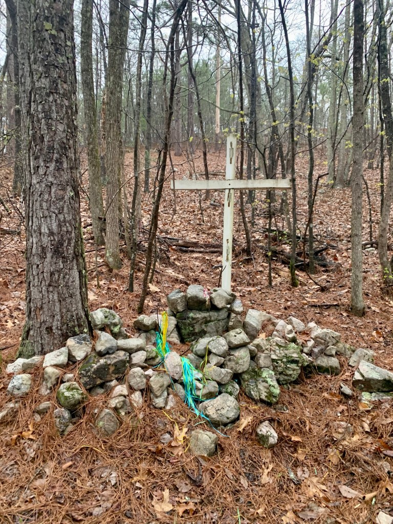
Hmmm… so that’s the trail?ViewNo idea….a hiker who had a bad day?
And a big milestone, I left Alabama and entered Georgia.
Alabama/Georgia state line.
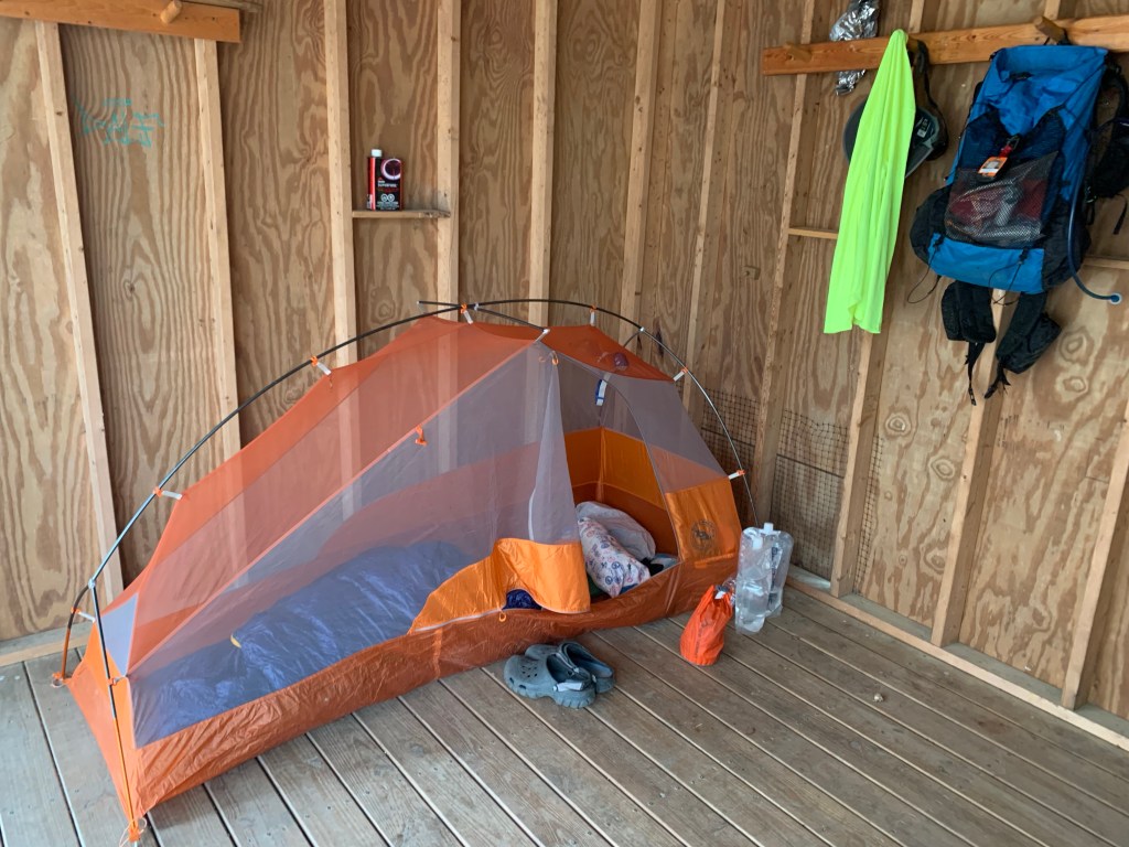
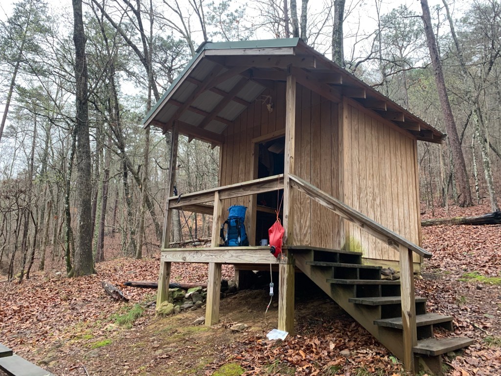
This was a relatively short day (15 miles) because the shelter where I stopped is the last good place to camp before town and it is supposed to rain tonight and tomorrow. Shelters are always preferred on rain days!
Rain shelter for the night.
Day 16, Mar 17, PT 190.2, Cave Spring
It did indeed rain last night, starting about 3:00 AM. The shelters keep you dry but the tin roof tends to amplify the rain noise, making it sound worse that it is.
Wildlife!
I saw more wildlife today, two deer, moving way too fast to get a picture and this guy, who posed for me. Over the past two week I have seen surprisingly little, a couple of wild turkeys and some squirrels. And dogs, of course.
The trail is a little water-logged this morning.
The trail was mostly good but there were some very wet stretches. Fortunately, while it was very wet, it was not cold – temps were in the 50’s.
Maybe, but not in this weather!
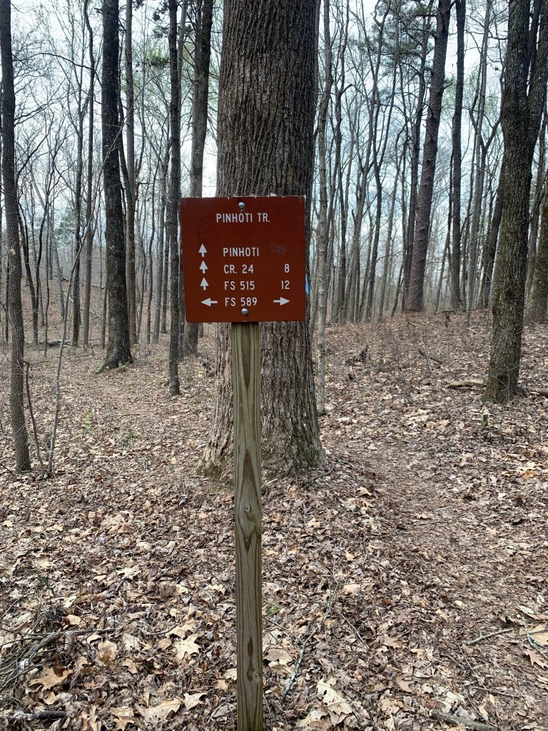
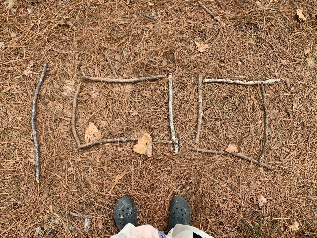
And, in case I was wondering where i was…
Helpful trail directions.
After about 3 hours, I hit the road around 10:30. Oh, yeah, I’m in a different time zone, so the sun is coming up at 7:45 instead of 6:45.
Three mile road walk into Cave Spring. Detection devices?
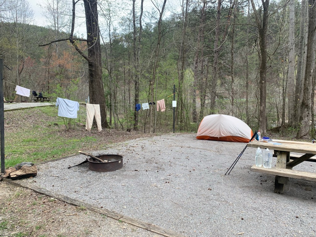
Day 17, Mar 18, PT 190.2, Cave Spring Zero
My home for the next two night.
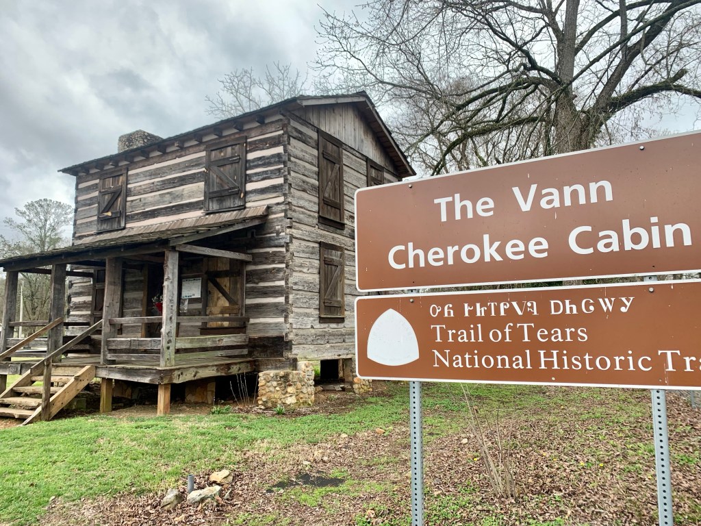
There was no answer when I knocked at the Hearn Inn so I called the number on the sign and a nice lady showed up in 10 minutes to let me in and show me around. I am the only guest and this is a great hiker stop. The inn has a washer/dryer, a full kitchen and is close to the town center.
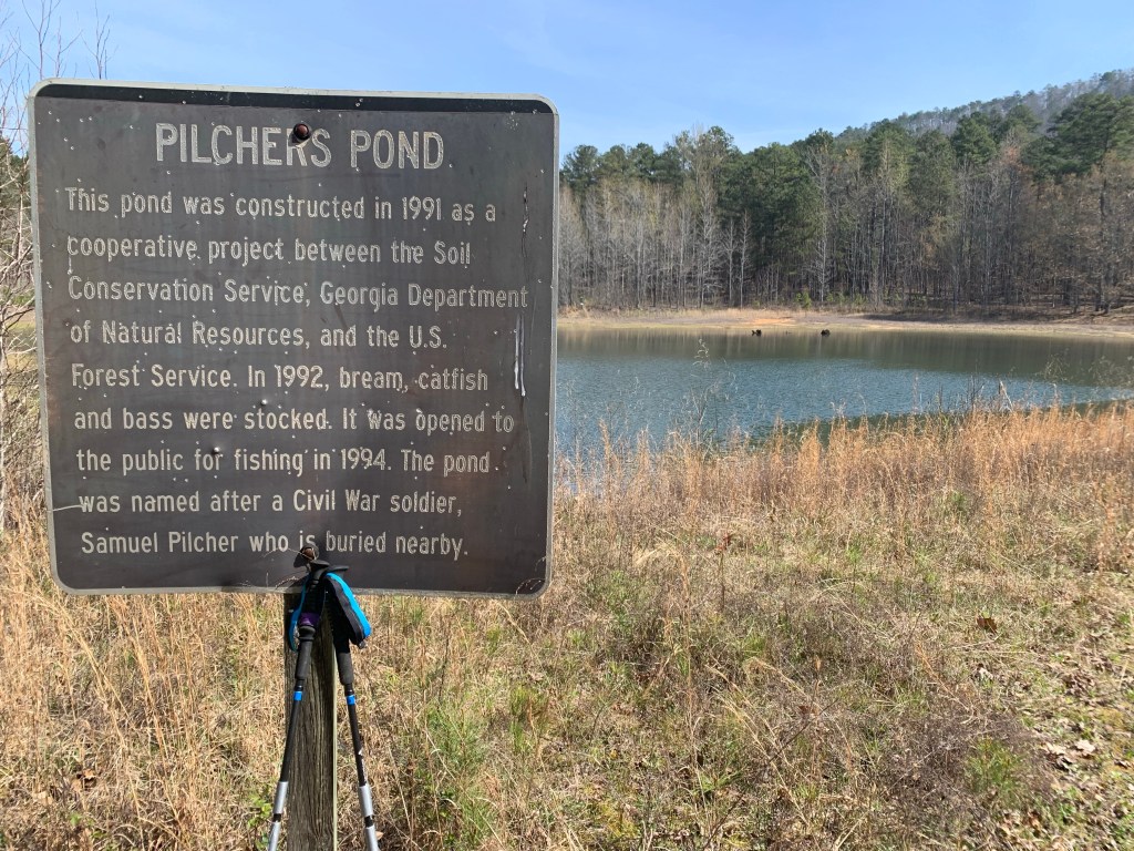
Cave Spring is o the Trail of Tears. A horrific chapter in American history.
Looking forward to a day of rest and planning the next section. Things are getting cold again!
Nancy got me back to the trail about 6:15 and I started hiking. The first 7 miles were a lot of climbing but the trail is in great shape.
Back on the trail!
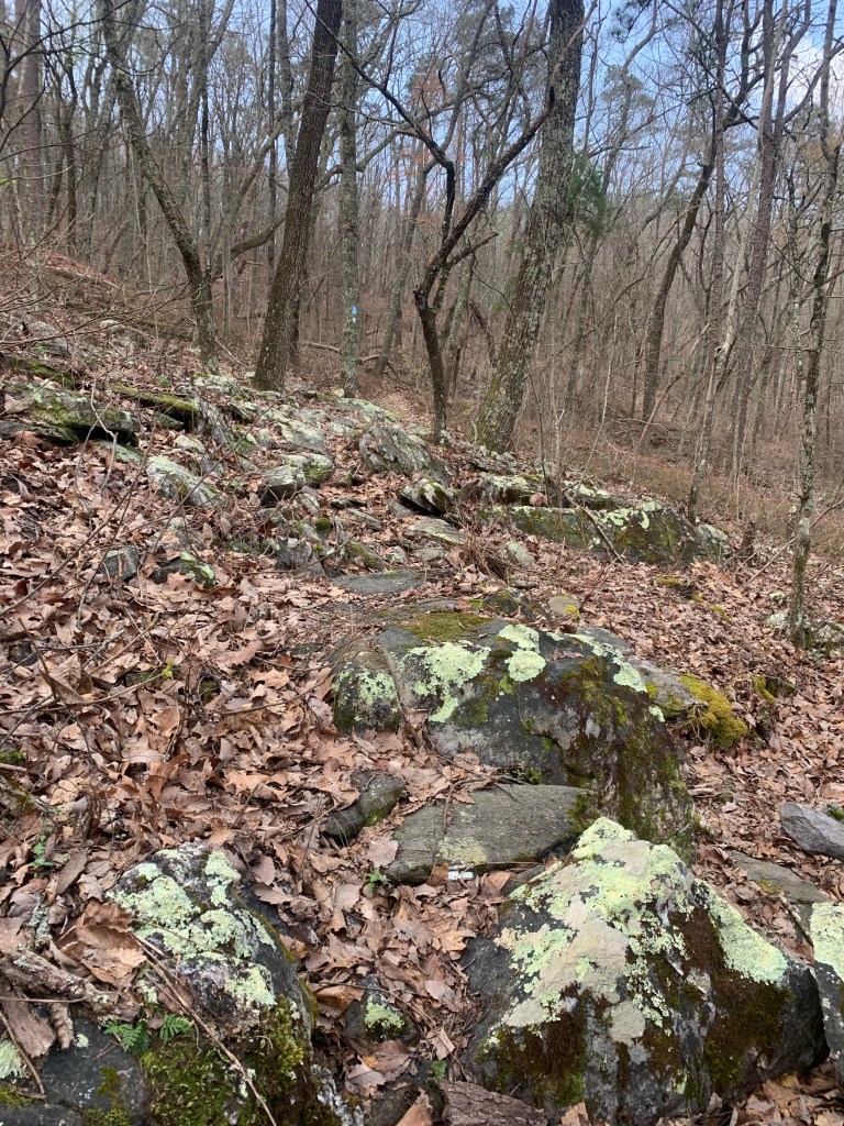
That all stopped when I I hit the “rock garden” at about mile 7 1/2. At that point, and pretty much for the rest of the day, the trail was very rocky, turning into a rock scramble in places.
The Rock Gardern
I ran into another hiker headed south (I am going north). “Butter” and I talked for 15 minutes or so and he warned me the trail is rough in the Cheaha Wilderness (where I am heading). He is doing a section of the Pinhoti Trail and planned to stay at the Next Step Hostel tonight. told him to tell Nancy and Jeff hello for me.
Unfortunately, the 8 miles after I met Butter were pretty bad trail, very rocky and tough hiking. Especially in crocs. I blew out my left croc heel strap, which is not a big deal since I’ve done that before and know how to do a temporary repair, but it wouldn’t have happened if the trail had been in better shape.
I camped at a small campsite near the Skyway trail head with a little stream about a 10th of a mile down a side trail. I am averaging about 15 miles a day which, considering the trail, is pretty good.
Anther lovely camp site on the PT
The overnight stop in Talladega was a good idea. The rest did me good, I didn’t have any stomach problems today and my leg legs felt great. I think as long as I keep it at 15 miles or so I can do this thing.
Day 7, Mar 8, PT 92.0
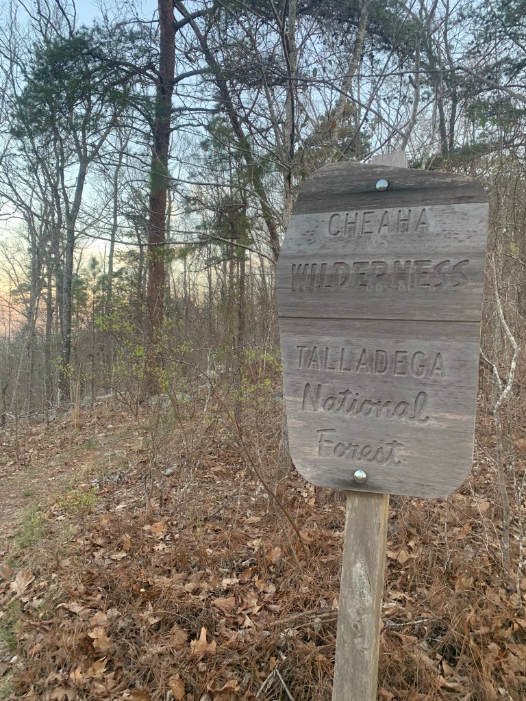
Just when I thought I knew what the PT could throw at me, I have a day like this. A very hard day. I didn’t think it was possible for the trail to get any rougher but it was definitely harder today. I entered the Cheaha Wilderness and the nice blazes and packed earth trail disappeared.
Entering the wilderiness
There were long stretches of rock scrambled where my pace dropped to a crawl and I lost the trail several times.
More rocky trail…. Thanks PT!Tough trail but lots of great views in the Cheaha Wilderness
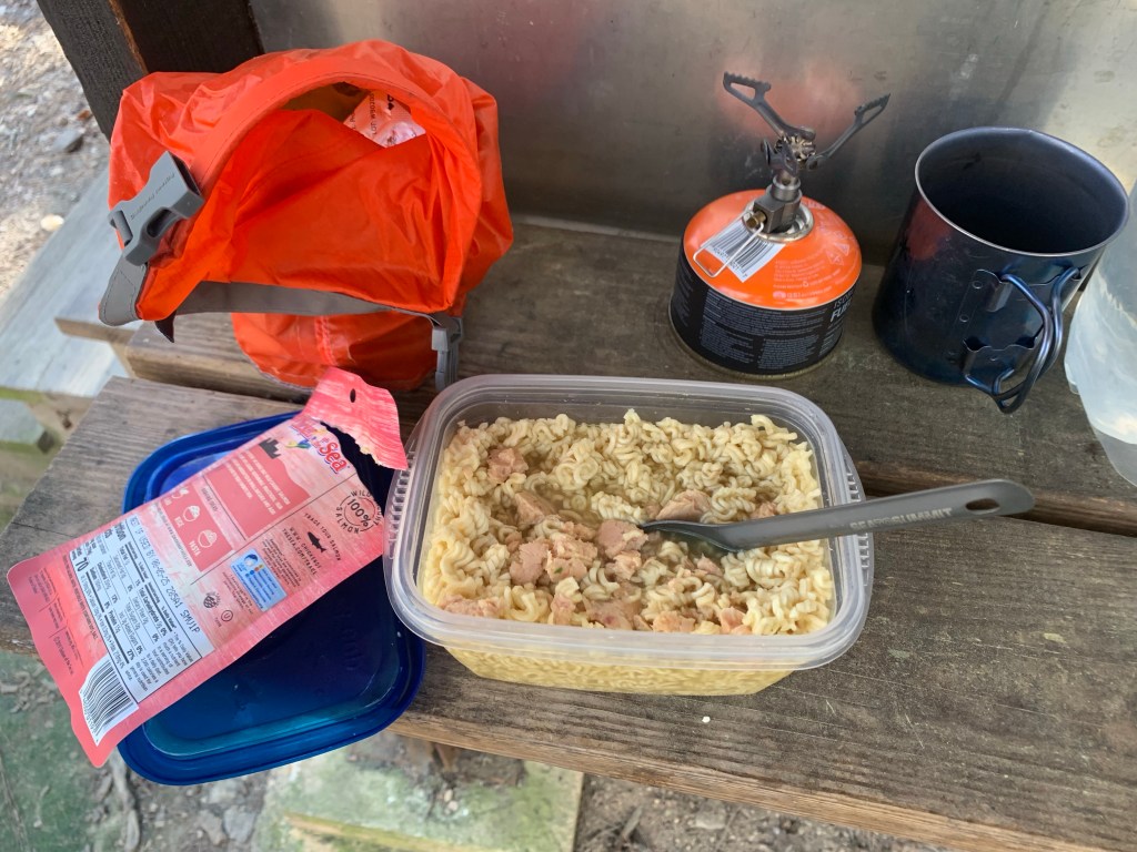
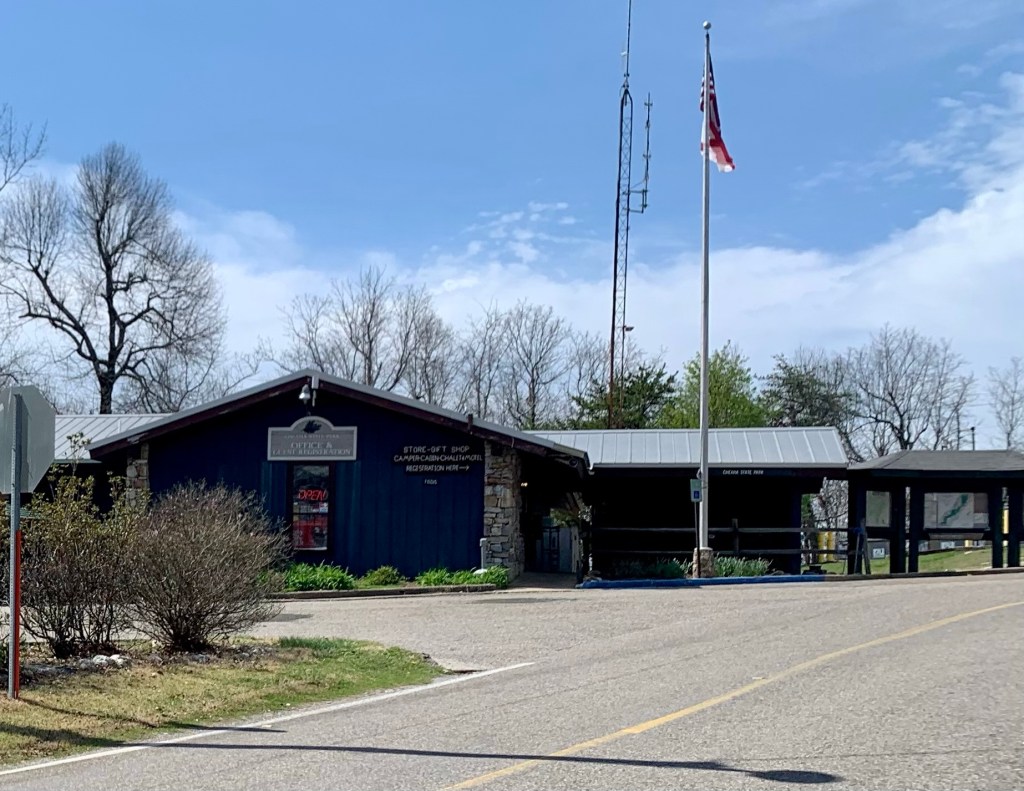
I decided to stop at the Cheaha State Park store for lunch. I arrived at 12:30 which means it took me 6 1/2 hours to do the 11 miles from my camp last night. Stopping there for lunch was a good idea. The store was limited, but they had sandwiches, which was a nice change from my tortilla salmon rolls.
Cheaha State Park
But now that I am out of the Wilderness the trail improves substantially. Still very rocky but the rock scrambles seem to be done.
Day 8, Mar 9, PT 106.4
Much easier day as the trail was actually very nice, packed earth and not a lot of rocks. Of course there were the usual steep climbs but they are short. I had a phone call with Roberta at my first break at about 5 miles. She said martini night went well, and she sounded upbeat.
Nicer trail today!
And today was a big milestone, mile 100!
100 Miles!!!!
I stopped for lunch early at 10:30, 9.3 miles, because it was a really pretty waterfall and it seemed like a nice place to have lunch.
A pretty lunch spot.
Turns out I was right because after about 15 minutes, the rain started and it has rained all afternoon, slowly building to thunderstorms. I hit a campsite near a stream about 2:00 and put up my tent in a small lull in the rain.
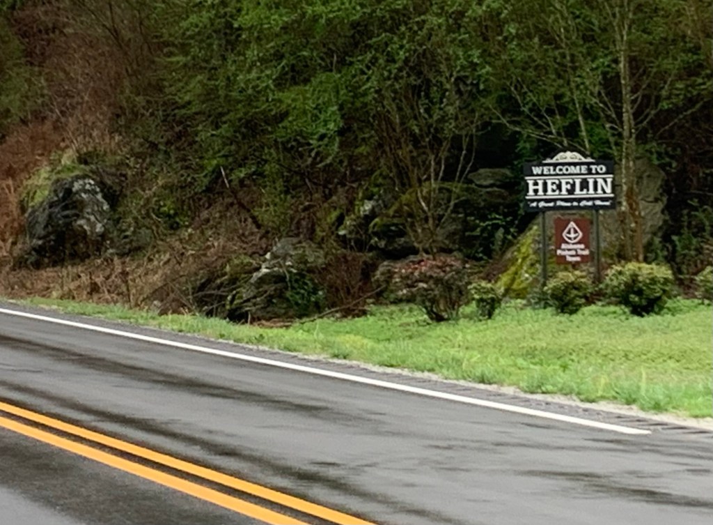
Day 9, Mar 10, PT 113.1 and Heflin
It rained most of the night and was still raining this morning. I got as ready as I could and then during a slight lull in the rain, I made my move. My tent is completely soaked. I made good time even in the rain which never let up and was at the highway overpass around 9 o’clock.
Hiking in the rain.
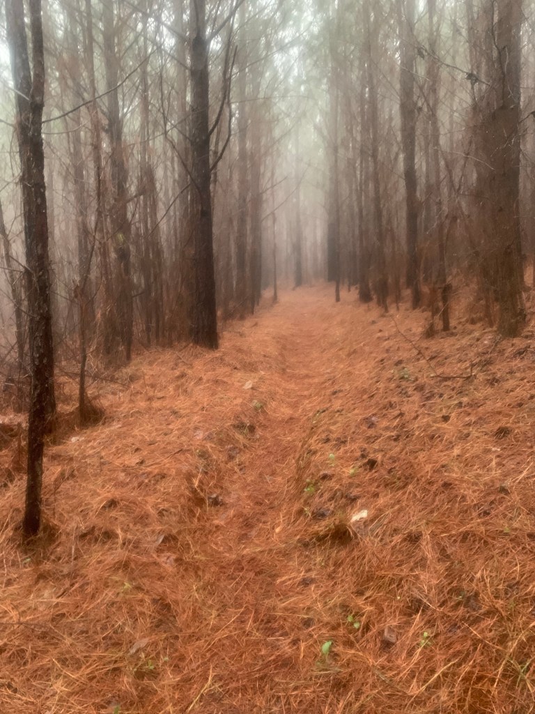
The trail was in pretty good shape.
Trail in the mist
I tried calling Heflin City Hall but cell coverage is very iffy, and I was unable to talk to anyone. so as the rain was finally stopping and no luck hitching (I tried for about 30 minutes) I started walking the three miles into town.
Heflin!
I got to the hotel about 10:30 and they had a room ready so I was able to check in immediately. I spent the next two hours cleaning up my tent and drying out my sleeping bag. Doing the usual town stuff.
Days 10/11, Mar 11/12, A Double Zero
I called City Hall and left a message for Tammy, the hiker contact. They also gave me her direct line, which I finally called around 4 PM. We had a short conversation, but basically I said, I only needed a ride back to the trail Monday morning. And it’s supposed to rain all day Sunday
The reason for my double-zero
Saturday was beautiful, sunny and cool. Hard to believe it’s going to rain all day tomorrow. I spent the day walking to town (it’s about 2 miles from the hotel at the freeway to downtown Heflin).
I also spent the day shopping for supplies for my next section. Heflin has multiple grocery stores so I was able to get everything I needed.
And I was even able to find a place that served cocktails! Though, I did have to explain how to make a martini to the bartender.
The first sign that there might be problems with my plans appeared as the plane from Houston descended towards the Birmingham airport. As we came out of the clouds the plane suddenly pulled up and we re-gained altitude. The Captain announced that we were gong around because “we could not see the airport when we came ouf of the clouds.”.
After retrieving my pack I texted Pinhoti Outdoor Center (POC) about my shuttle to the trail. Chuck showed up about 11:30 and we headed south. He explained on the way that he had planned it pick up another hiker from the Amtrak station but he was running several hours late. We stopped at the POC hostel where I picked up a fuel canister before heading to the Flagg Mt trailhead. And, for the entire 90 minute ride, it was raining, sometimes hard.
Chuck, my POC shuttle driver.
Chuck dropped me off about a mile from the start of the trail about 2:00PM, recommending I give up my plan to hike 10-12 miles and stay dry a the Weogufka Shelter at about 3 miles. When I got to the shelter, it was still raining hard, and the shelter looked so dry….. so…. So much for plans.
My first home o the PT!
About 2 hours later, just as it was starting to get dark my companion for the night showed up. The other hiker that Chuck was scheduled to pick up had finally arrived, “Cruise Control” was from Philadelphia and was nice enough to tell me that I only “snored a little” the next morning. Cruise, young, fit and fast, left just before me and I never saw him again.
Day 2, Mar 3, PT 17.3
I got my first real taste of the PT and it was a wake up call. After a five miles or so I started a 7 mile road walk.
We ain’t in Kansas any more Toto.
Even though the trail is never much over 2,000’ there are lots of steep climbs and they do not seem to have heard about switchbacks here in Alabama. On the plus side, the rain has finally stopped.
The trail is quite well maintained at the start.
By 11:00 I was completely done in – stopping on the climbs which I never do. I decide to stop early at “Kim’s Camp” around 2:30. A nice spot, next to a small stream with a fire ring,
My home for the second night
Day 3, Mar 4, PT 32.5
The sun rises about 6:00 AM and I am hiking by 6:30. My legs are really stiff so I have decided to go short today to give myself a day of recovery. I am on roads for most of the first 10 miles today and I used my pepper spray for the first time. Two big dogs came out into the middle of the road and were very aggressive. All the other dogs just barked and stopped when I yelled but not these two. I finally gave the lead dog a quick blast and that stopped him. Glad I brought it.
Walking roads….
I am now about 10 miles behind my plan so I have decided to just chunk the plan and keep my days under 18 miles this first section to get my trail legs. And I had my first taste of bad trail today. Leaving the road and entering what my guide calls “new trail”, I hit a bulldozed mess. The blue trail blazes were separated by large tracts of muddy dozer tracks. I lost the trail several times and ended up crashing through brambles that tore up my arm.
My first bad section of trail.
But I had another lovely campsite, a bit off the trail but flat and right next to a small stream so lots of water and I could even clean up a little. Unfortunately, tomorrow looks a little problematic. The last water of the day is at about 10 1/2 miles And the first campsite after that is another 5 miles up so I’m going to have to hump 4 L of water to camp.
Day 4, Mar 5, PT 48.3
Beautiful day for hiking. Got an early start at 6:15. And I saw my first other person on the trail this morning. Passing a dry campsite after few miles from my camp I passed someone asleep. He didn’t look like a hiker. He didn’t have a tent, pack or a sleeping bag, just a blanket, and what appeared to be a bag of charcoal. Tough place to be homeless.
Once I did the morning climb, I basically was up on the ridge most of the morning until I hit Bulls Gap.
Nice views from the ridge
The POC had a public water cash at Bull’s Gap which was very nice since this is pretty much the last water for the next 14 or 15 miles. I took 3 1/2 L and started climbing toward today’s camp,
Public water cache, thank POC!
There were no fixed campsites after the climb so I just a found a relatively flat spot and pitched my tent.
After some thought I have decided to change my plans even more. I have five more days to get to Heflin and I don’t think my battery and phone will last. I have cell coverage up at camp so I called Next Step Hostel in Talladega. They do shuttles to and from the trail, have a bunkhouse, showers and laundry. I arranged a pickup for tomorrow.
Day 5, Mar 6, PT 60.0
Earliest start yet – on the trail right at 6:00 AM – I am excited about a town day! I texted Jeff (Next Step Hostel) at about 5 miles in, right before I started coming off the ridge – good thing too – that was the last place I had cell coverage today.
Heading to Porter’s Gap and Talladega
More nice views for the first five miles or so before I started the long drop to Porter’s Gap.
Passed a pretty waterfall on Dry Creek, which, is, well, not dry.
Pretty waterfall
I got to Porter’s Gap and hung out for a while waiting for Nancy and my ride to Talladega. Looking forward to a cold drink on a hot day (it hit 80 today).
Waiting for Godot… or Nancy.
Talladega and Next Step Hostel
The NS Hostel is sweet setup for hikers – bunkhouse with nine beds, lawn to pitch a tent, fridge, microwave, showers (outside), and washer/drier. They they supply everything and do not charge anything. I asked Nancy about this and she said it was their way of “giving back to the hiking community.”
I had a lovely stay and I was the only hiker so I had the place to myself. Definitely a good call making this stop and recharging all my electronics.