Here are my thoughts on the Pinhoti Trail, fresh from finishing the trail a few days ago

Trail Access, Both Ends
I got to the southern terminus of the PT to start my hike by flying into Birmingham and shuttling to Flagg Mountain, about 75 road miles southeast of Birmingham. I used the Pinhoti Outdoor Center shuttle service. Total price for shuttle and a fuel canister (230g) was $153. They explained that if they were picking up other hikers this would be less. Uber might be a possible option but I doubt if it would be much less.
The northern terminus of the PT is a trail junction with the Benton MacKaye Trail (BMT 72.1). A couple miles north on the BMT is the closest road access, the intersection of Foster Branch Road and FS 22 at Watson Gap. It might be possible to arrange a ride from here, maybe back to Dalton. The problem for me was I needed a major airport. I elected to continue up the BMT to Ducktown where I arranged a shuttle with A Walk in the Woods to the Knoxville airport, about 75 miles. This was very expensive, $350. Multiple hikers would make this less of course.
Compared to other trails I have done, the PT trail access was hard and expensive, especially if you don’t live or have friends in the area and are a solo hiker.
Overall Trail Quality
The trail quality was, especially in Alabama, and with a few exceptions, quite good. A nice mix of packed-earth woodland trail, rocky ridges and country and forest service roads. The exceptions:
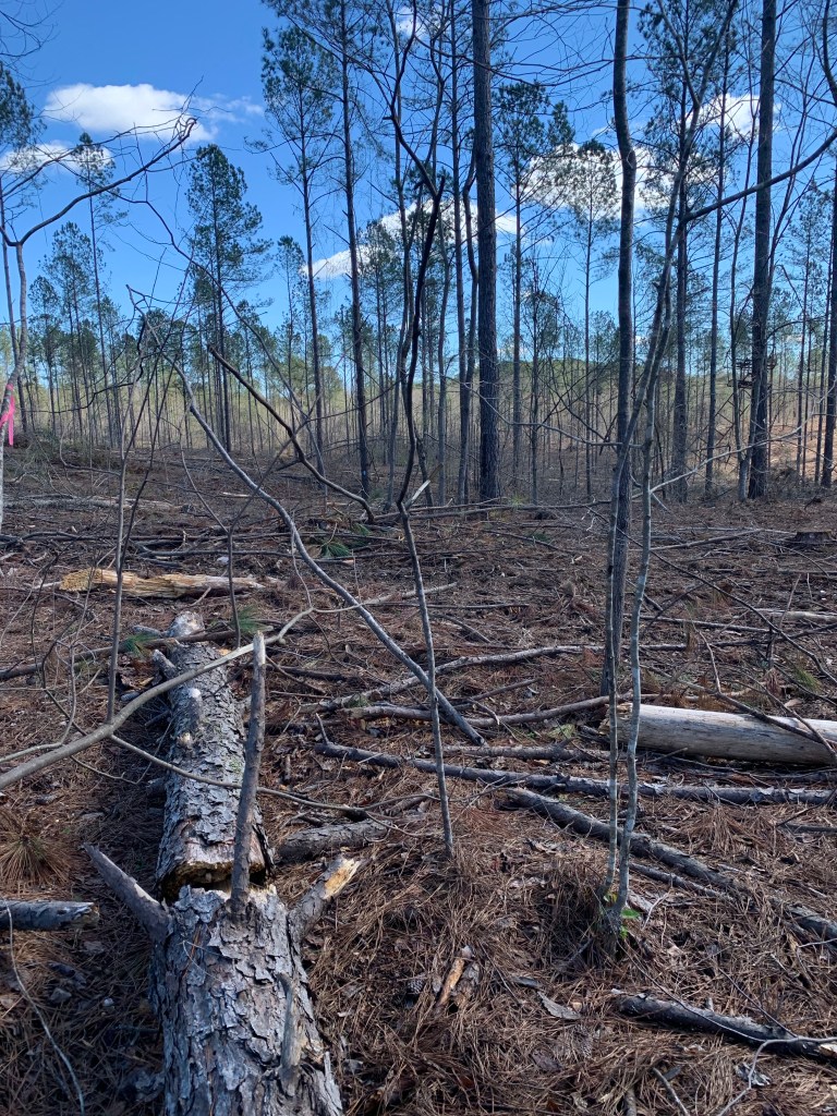
PT 25.5: Leaving Holman’s Crossroads Rd you enter a bulldozed nightmare of a trail for a mile or two. There are blazes on the few remaining trees still standing but there is no trail, just a muddy, branch-strewn, ankle-twisting mess. I would definitely have stayed on the road if I had known how bad it was.
PT 85: In the Cheaha Wilderness, once you get up on the big ridge, there are several sections were the trail deteriorates into an unmarked, very rough, rock scramble.

Road Walks
Short (less than 5 miles) road walks can be a nice change from the trail and a way to pick up some easy miles. However, there are two long road walks on the PT. I skipped both of them.
Dalton: Leaving Dalton (PT 285) there is a 25 mile road walk, some of it on very busy roads, to get back to the trail. This is over my limit for busy road walks so I used a taxi (Tony’s Taxi) to get around most of this. I tried Uber first but could not get a driver.
Cave Spring: Leaving Cave Spring (PT 190) there is a 20 mile road walk. I considered walking this since these roads are not too bad, some are busy but most are not. But, again, 20 miles is over my limit and I had an offer of a ride from a trail angel in town (Crispy) so I took it.
Blazes and Navigation Aids
With the exception of about 10 miles of the Cheaha Wilderness, the trail in Alabama is very well blazed. I seldom had to access FarOut (Guthook) to find the trail. This is not true in Georgia.
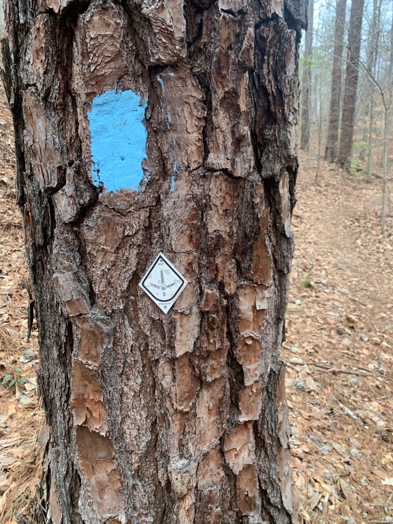
The baby-blue rectangular marks were the more common trail blaze in Alabama but there were also, less frequently , the metal diamond medallions.
Once you enter Georgia (PT 179), the blue blazes stop and the diamond medallions become random and infrequent. In Georgia, if you do not have some kind of navigation aid you will definitely lose the trail. There are several trail/road junctions where there are no blazes at all.
Also, at some point, the Great Eastern Trail, which uses a white rectangular blaze, is coincident with the PT and you will sometimes see these blazes.
Resupply, Support and Trail Towns
The trail is pretty good for resupply. Here was my resupply schedule:
PT 60 – Talladega: A nice couple run Next Step Hostel that is close to grocery stores/fast food and they will pick you up and return you to the trail. Very nice.
PT 113 – Heflin: Either a 3.5 mile side trail, a 2 mile road walk/hitch or calling city hall (Tammy) to get a ride make getting to Heflin pretty easy. The town is spread out but has all the necessary hiker needs.
PT 190- Cave Spring: The trail goes through town. The Creekside Inn Motel is closed but the Hern Inn is available and is a great hiker stop. Another great hiker town to meet all your hiker needs.
PT 285- Dalton: Thé trail goes through town. Dalton is big and spread out. Most of the hotels are near the freeway where you enter town. Grocery stores/restaurants are near the highway and the Academy (fuel canister) is 2-3 miles north.
Dogs and Other Wildlife
Over the course of my 3-1/2 weeks on the trail I saw 5 deer, a raccoon, a very colorful slug, a couple of lizards and many squirrels
… and dogs. For some reason there are people who believe that their dogs are not their responsibility. I had two run-ins with dogs that came out onto the road and approached me very aggressively. In the first instance, I crossed to the far side of the road but the two dogs followed, causing a car to stop. I finally had to use my pepper spray which was very effective. The second incident was a lone dog who I stopped with dog treats.
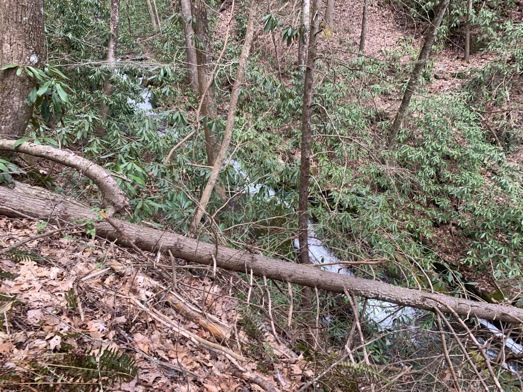
Blowdowns
For the most part the trail obstacles were typical and not difficult to navigate. There were a couple sections where the blowdowns were so frequent you could see four of five down the trail while climbing over one.


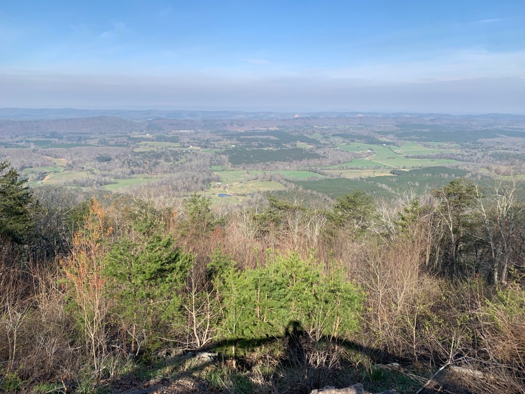
Views
A lot of the trail is along ridges and often, especially in March before the trees have all gotten their leaves, there are some really nice views, which is always a nice reward after a hard climb.