El Chatlen

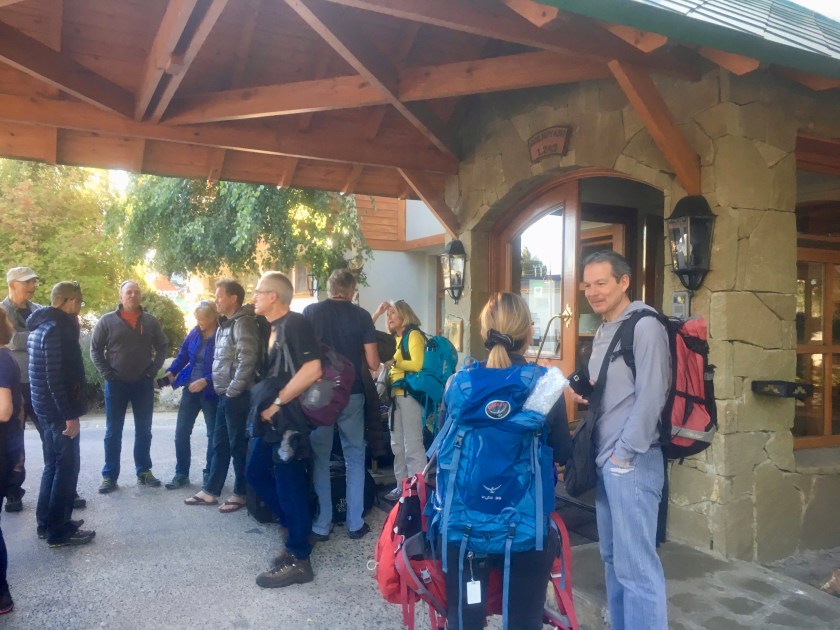
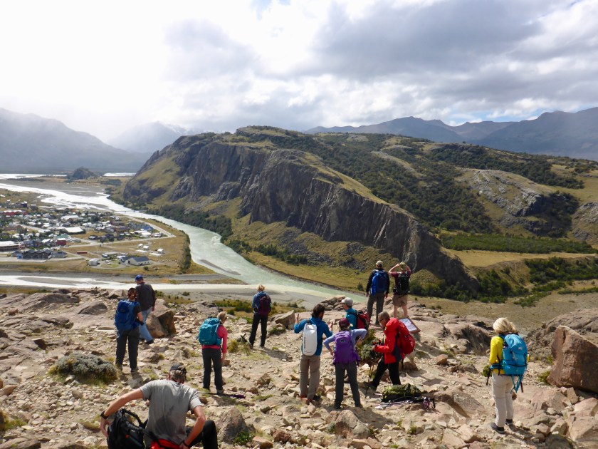
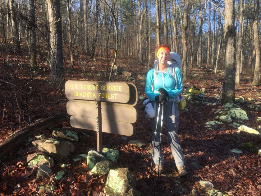
After a brief hike (about 5 miles round trip) to a spot with a view of the town we began three days of hiking in Los Glaciares  National Park, returning each night to our hotel in El Chatlen.

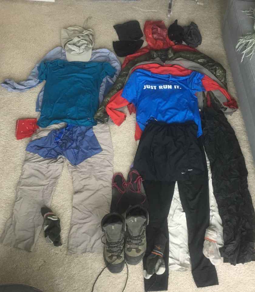
Had to modify my boots – the high tops were bugging me. Thank god for duct tape!

fullsizeoutput_5a9a
New lo-rise boots!

Wed (3/7)

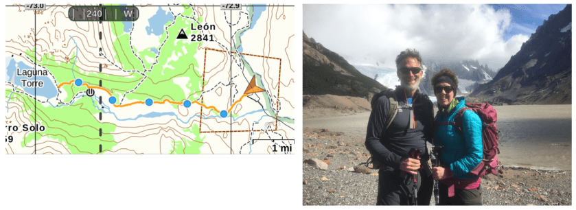
Up for our first big hike to Laguna Torre – ~11 miles round trip (out and back) but pretty flat – 1200 foot of climbing. It was a beautiful day, sunny and not too windy (which is saying something!). Left about 9:00 and back to the hotel by 4:30.  Laguna Torre is a glacier terminus lake.

Screen Shot 2018-03-19 at 7.40.28 AM


fullsizeoutput_5a02
Laguna Torre

Thu  (3/8)

Up earlier – catching a van to take us to the trail head then we hike back. Earlier start – on the van at 8:00 and hiking by 8:30. Long hard day. Two of our group did not to the climb to Laguna de Los Tres. The climb was brutal – well over 1000 feet in less than a mile. 14.5 miles total and well over 3,000 feet. The weather was not great. We ended up putting on all of our rain gear in a shelter just before the climb to the Los Tres. It was rainy and cloudy pretty much all day. Snowing at the top – which was pretty cool.

Screen Shot 2018-03-19 at 8.03.13 AM

Fri  (3/9)

Another early start (8:00). Cold (31 degrees!) but looks to be clearing when we start. Fortunately it cleared and we had sunny and clear weather almost all day but it was very windy at the top. Kept us from doing the final climb to Pliegue Tombado which knocked off about 800 of climbing. Still a long day. At the lookout before the final climb it was blowing 30 mph and cold. So Jose and Rodrigo (our guides) decided we would not go.

3,000 foot day (1200 to 4200 feet) even without the final climb and 15 miles round trip. Left at 8:00 and back by 3:30. Very short lunch at the viewpoint because of the wind

Screen Shot 2018-03-19 at 8.06.37 AM

fullsizeoutput_5a3c
Approaching the top of our hike. Fitz Roy in the background.

We had stunning views of the Fitz Roy massive throughout the day (the first time we have been able to see it).

fullsizeoutput_5a3d
Our view at lunch!

Spanish for “wind”? Patagonia!

After four days  wandering around Buenos Aires we caught our local flight to El Calafate (Monday, Mar 5) and the start of our Alpine Ascents trek. After a brief mixup at the airport (we grabbed a cab to the wrong hotel) we finally hooked up with our guide (Jose Luis) and met the rest of our hiking team.

fullsizeoutput_59be
Our group hanging around the hotel

The drive to El Chalten the next morning (Tuesday) was our first taste of Patagonia. And, unlike all the pictures, most of Patagonia is not snow-capped mountains but rolling plains. And wind. Lots and lots of wind.

fullsizeoutput_59cb
What most of Patagonia look like

And, by the way, those are guanocos in the foreground, our first taste of Patagonian wildlife. They are pretty much ubiquitous. They are related to llamas.

fullsizeoutput_59c7
A guanaco doing what they do…

And on to our first hike… a short afternoon hike from our hotel in El Chalten

fullsizeoutput_59d9
Looking down on El Chalten
fullsizeoutput_59dc
Two wind-blown hikers just before the rain started

It Gets Serious (Day 3)

Sunday, Feb 4.

We started the day early – packed up and hiking by 7:30. It is not light enough to hike much before 7:00 or so. We immediately started the day with a steep climb. The plan for today was 16.6 miles but we quickly realized it might not be possible.

The problem was that we have to at our destination  by 3:30 or 4:00 to get our camp set up, water filtered and dinner made before  it starts getting cold. Decided to go 15 miles today and modified the schedule to keep it around 15 miles. We can still get to Mt Ida in 7 days at that pace.

062192B7-71A7-46DE-BBFD-A1163DA8EE8C
Day 3 Elevatin Profile

We entered the National Forest early in today’s hike. The last 10 miles we skirted private lands between the state park and the national forest.

99B37536-08C2-4DED-AD33-DEDAE26586BD
Entering the Ouachita National Forest

We decided to camp near a pond after 15 miles (44 miles todal). Set up camp around 3:30. Emerson rolled in about 30 minutes later. Started to get cold and the wind picked up.

A Good Start

Our first two days on the Ouachita Trail (which, by the way, I learned I had been mispronouncing – it’s pronounced like “washita”) were hard and cold but lovely.

9B7FAD7D-6F66-496E-B3DB-7F76D726ADD3
The Adventure Begins!

Our Lyft driver fom Little Rock (the trail starts in Pinnacle Mountain State Park, about 20 miles west of  Little Rock) was very talkative – we were her last ride before her weelky rehab session. It was cold (low 30’s) but promised sun and we were excited to be starting.

After a lovely 14.1 miles of slowly warming weather and fairly easy terrain wee “stealth” camped (the “official” campground is a mile off the trail and no water) near a creek.

F6C0E75C-7689-4D6F-BEC9-9343FA7C8496
Our First Camp Site

We continued west around the north side of Lake Maumelle on the second day.

1DDE3B42-1201-46B0-8405-A77395143A32
Lake Maumelle

Another lovely day in nice weather (sunny but still cold – highs in the 40’s) and, after 14.5 miles (and 30 minutes spent finding the trail at one point) we camped near another small creek.

Water was plentiful the first two days so we all carried about 2L for the day and filtered water in camp each evening.

It got cold early though, temperatures dropped precipitously after 4:00 so we were all in our sleeping bags early.

Gear

With two weeks to go before heading out on the trail here is our “final” gear list. My base is a pound higher than I like but most of that is due to the additional winter clothes and the fact that I am carrying a two-man tent. Roberta has a comfortable 14 lbs base.

Screen Shot 2018-01-17 at 2.16.47 PM

Tent:  The Saddle 2 is a new tent I got for Christmas. It is the two person version of the Notch which I used on the PCT and in Big Bend.  I’m hoping we like it as much as I like the Notch.  It weights  bit more (the Notch was under 2 lbs) but it is big enough for two people. It has vestibules on both sides for gear.

Screen Shot 2018-01-17 at 1.59.53 PM

Sleeping Bags:  We are both using our old Marmot 20 degree bags.They weigh 2-3 lbs and should be good down to 10 degrees or so (the tent adds 10 degrees).

Packs:  I’ll be using my old  Exos 58 (which has over 800 trail miles on it now) and Roberta will be using a new pack – an REI Flash 45. My Exos stripped down (removed the top pocket) weighs less than 2.5 lbs. The Flash 45 weighs a little bit more but still under 3 lbs.

Cooking:  The plan is to use the little BRS3000 canister stove I used on the PCT. This is a cool little stove that weighs just under an ounce. IMHO  canister stoves are the only way to go.  Alcohol stoves take forever to cook anything. The plan is for Roberta and I to each carry one small (110g) canister. In my experience you can can easily get 14-18 L of boiled water with a small fuel canister so two small canisters should see us through the whole trek.

Cook kit will consist of a mug, spork, lighter, emergency matches and the stove.

8988_IMG_1103
Cook Kit

Hydration:  We will use a 4L MSR Dromlite bladder (4.2 oz) for dirty water and have two 2-L Playpus collapsible bottles (1.3 oz each) for clean water. That gives me a total capacity of 8 L. Roberta will have her 2.5 L Osprey bladder and two 1L Playpus bottles. We will use a Sawyer Mini filter for water treatment and gravity to supply the filter pressure. I used this system the PCT and it worked well – hang the dirty water bag in a tree and filter water while setting up camp or eating lunch. I also carry a collapsable Nalgene bottle to use as a pee bottle at night (too cold to go out!).

2401_IMG_1169
Water System

First Aid:  We’ll carry the usual assortment of  meds (immodium, aspirin, ibuprofen, etc), antibiotic ointment, moleskin and small needles (for blisters). Bert will also have her contact stuff and her back meds.

Electronics:  My iPhone 6S running Guthooks navigation app will be our primary navigation aid. I used Guthook on the PCT and never looked at my physical maps. My phone will also be my backup compass, flashlight, and E-reader. Which makes power important – so I have upgraded to an Anker Power Core 10000 (6.6 oz). It has great power density (over 1500 mAh/oz) and should give me 5 full additional charges. Roberta will have her 6S and an Echine 5200 (4.4 oz) external battery pack. We will also have a SPOT satellite tracker – it weighs close to 5 oz but with limited expected cell phone coverage it adds a little security. And a bluetooth keyboard for blogging. Of course.

1529_IMG_1191
Jason’s Electronics (minus iP6)

Clothes:  This will be a winter hike so we will be taking an extra layer. This is my pack plan. Head: Wool hat, buff. Hands: Heavy running gloves and waterproof shells. Top: Rain jacket (with hood), micro-puff, fleece, lightweight capilene base, running shirt. Bottom: Houdini wind pants, hiking pants, mid-weight capilene base.

968_IMG_1163
Clothes: Left – worn, Right – Packed

OT: The Detailed Plan

Here is our current hike plan, which has us averaging 15-16 miles a day for two weeks with one zero day (Feb 9)  and one nero day (Feb 14, 6.9 miles).

Water

After doing 800 odd miles of the PCT in souther California (especially during the 2015 drought year) I am a bit paranoid about water. Thru-hiker resources for the OT are primitive (compared to the PCT) and the water info is a good example. The FOT website has a water report ( http://www.friendsot.org/index_htm_files/OT_Water_Sources-rev_2016-12-12.pdf ) but it is not updated very often (the report date says it was last updated in January of 2017!) unlike the PCT water report which is dynamic and updated almost daily, allowing hikers to post new info as they experience the trail. The FOT website suggests stashing water at certain places, which is fine for a 2-4 day section hike but really is impractical for a thru hike.   The plan has a few places where water could be a problem and we will just have to be careful.

Navigation

We plan on using the GutHook navigation app on an iPhone as our principal navigation aid. I used it on the PCT and never looked at the paper maps I had   brought. The trail is supposed to be well blazed (at least for most sections) so keeping to the trail should not be a problem. Of course we will have a compass and electronic maps for backup.

OT: Key Dates

The OT runs from just west of Little Rock to Talihina (Ok).  Our plan has us doing the trail from East to West. There are two main reasons for this – ease of access to the start of the trail and the fact that the eastern end is a little flatter (so we can have a few easier days at the start).  We also would have the advantage that Francis could pick us up after we finish (Talihina is about a 3 hour drive from Norman).

We have purchased our plane tickets to Little Rock so we are committed! Here are some key dates for our planned hike:


OT: General Thoughts

After doing a bit of research looking for  a “longish” hike (2-3 weeks) for early spring (February) as part of our training for Patagonia and also just to get back into the woods, I came up with two possible options: (1) the first 300 miles of the Arizona Trail (AT) from the border to Superior (just East of  Phoenix) or  (2) the Ouichita National Recreation Trail (OT).

The profile comparison (below) shows one of the main reasons for picking the OT – it is both lower in elevation and has fewer big climbs.  This is important for a late-winter hike since the weather at higher elevations can be problematic.

Speaking of weather the February trail averages look pretty good – low 50’s for the highs, high 20’s for the lows. If historic averages hold the weather should be perfect for hiking. Of course a late winter storm could totally change that.