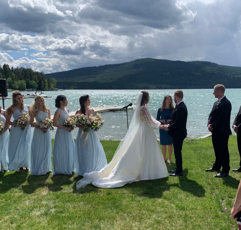
We arrived in Whitefish, Montana on June 3. With the wedding planned for the afternoon of the 5th we have a day to hike in Glacier National Park (GNP), which is only 30 minutes from downtown Whitefish. The wedding (Karyn Mathison and Samir Jerij) will be outside on the shores of Whitefish Lake. Karyn is my old buddy Dave’s only daughter. The wedding had been planned for 2020 but the pandemic caused a one year shift.
Snyder Lake Hike
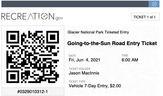
Up early and heading to the park which turned out to be a good thing. You have to have a “Entry Ticket” which is valid for 7 days. I think they are trying to control the number of people coming to the park since it is one of the most popular national parks in the country. Fortunately Dave told us about this so we got our ticket months ago.
Our Entry Ticket
At Dave’s suggestion we decided to do the Snyder Lake hike (9 miles and about 2400 feet of ascent). It’s an out-and-back hike.
After our hike as we drove through the park we saw a bear. Most of the bears I’ve seen in national parks have been from a road. I think they like stuff that grows near roads.
Road Bear
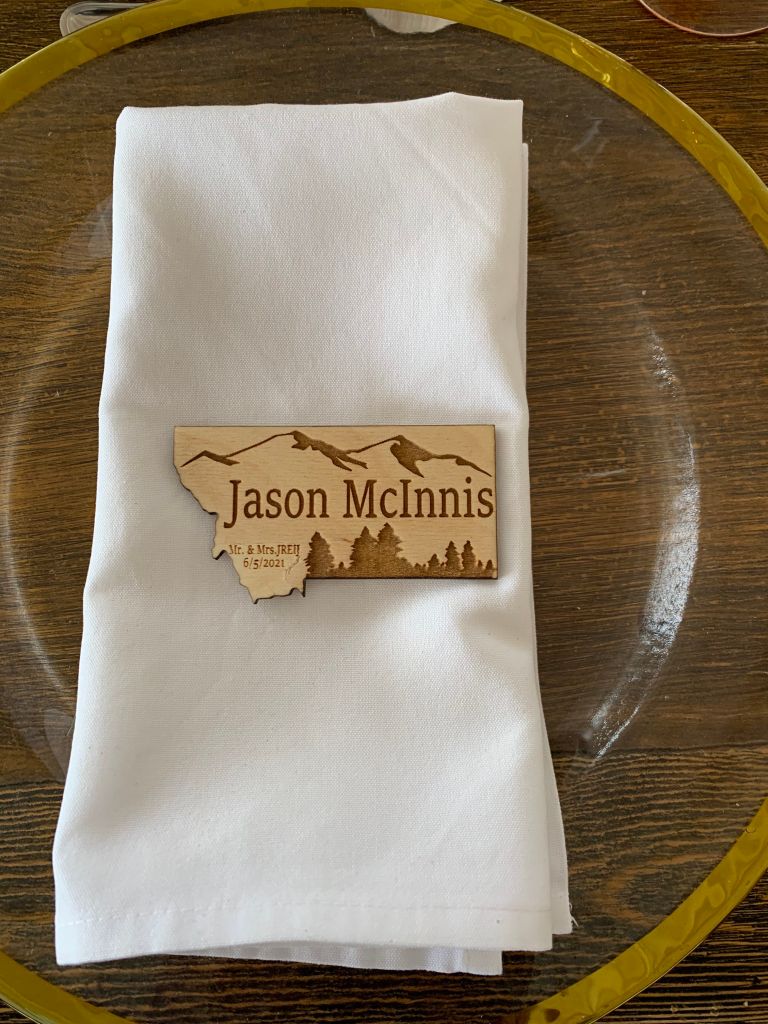
Wedding
After a morning bike ride around Whitefish we put on the fancy duds we brought just for the wedding and caught a shuttle to the lodge on the lake.
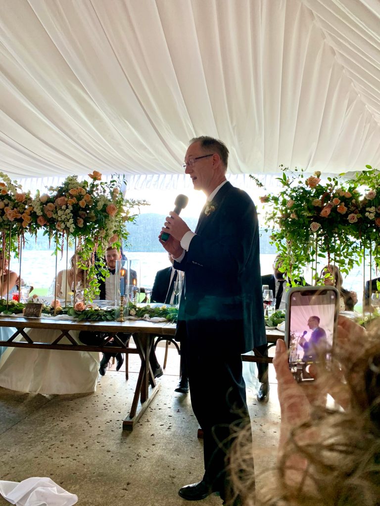
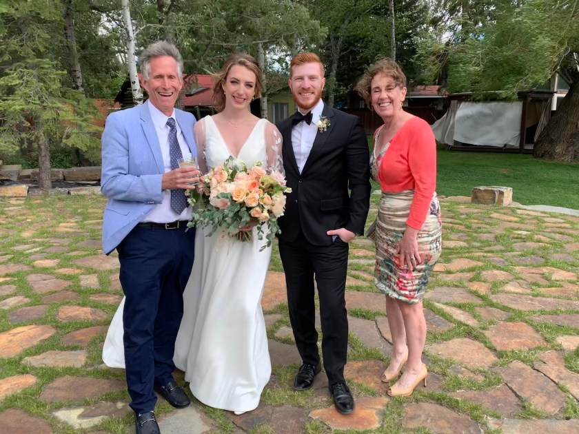
Ooooh …. fancy! And yes… our name is misspelled. The weather is holding…… we hope!Dave does the father-of-the-bride toast – and does it well!The happy couple (and some old people).Crazy, drunk wedding guests. Who invited these people?
We caught the shuttle back to town (and accidently ended up at the after party with the youngsters but pretty quickly realized we were out of our league and headed back to the hotel).
Last Hike in GNP
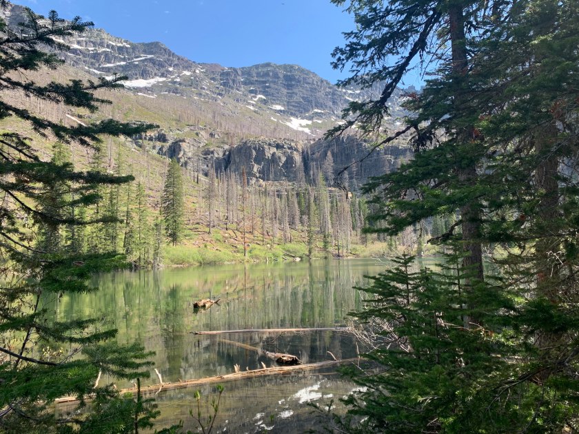
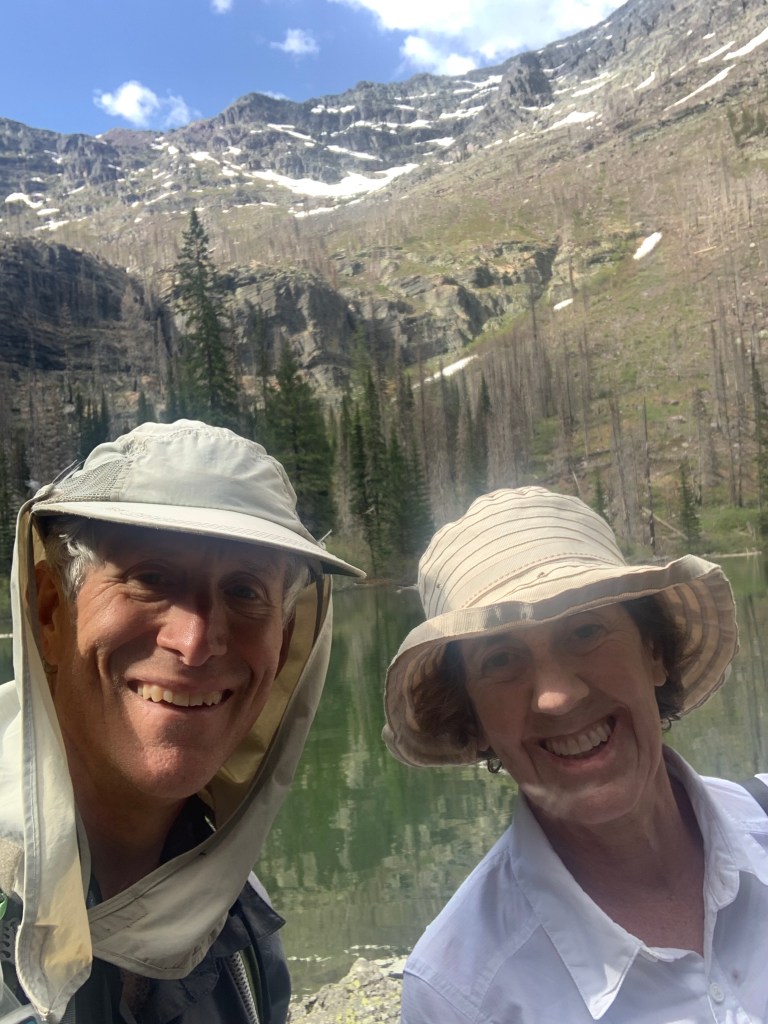
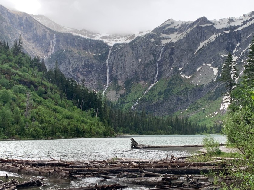
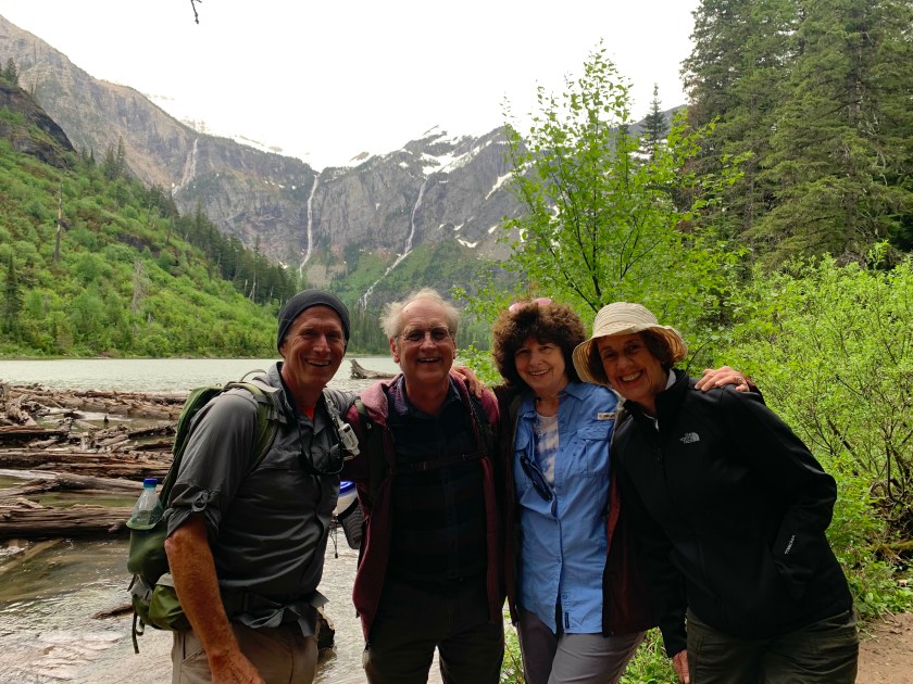
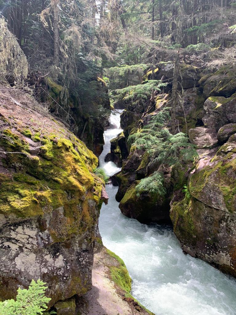
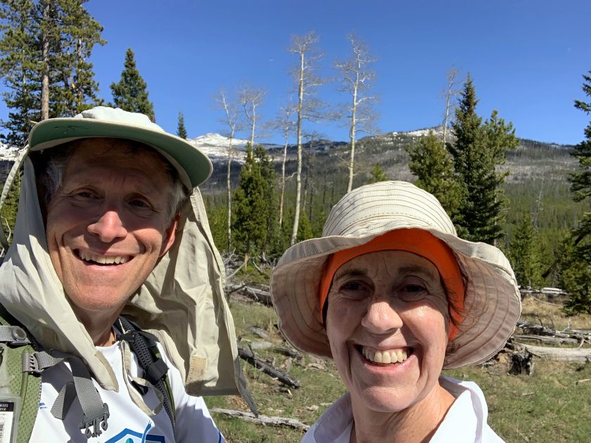
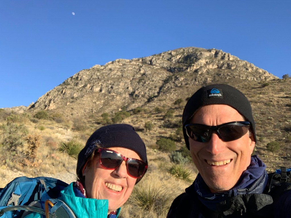
On our last day in Whitefish we hooked up with Emerson and Linda for a last (hangover) hike in GNP. We did one of the prettiest (and most popular) hikes in the park, the Avalanche Lake Trail
Avalanche LakeA little colder today!Avalanche Creek
After three days of fun in Montana we head west on June 7.
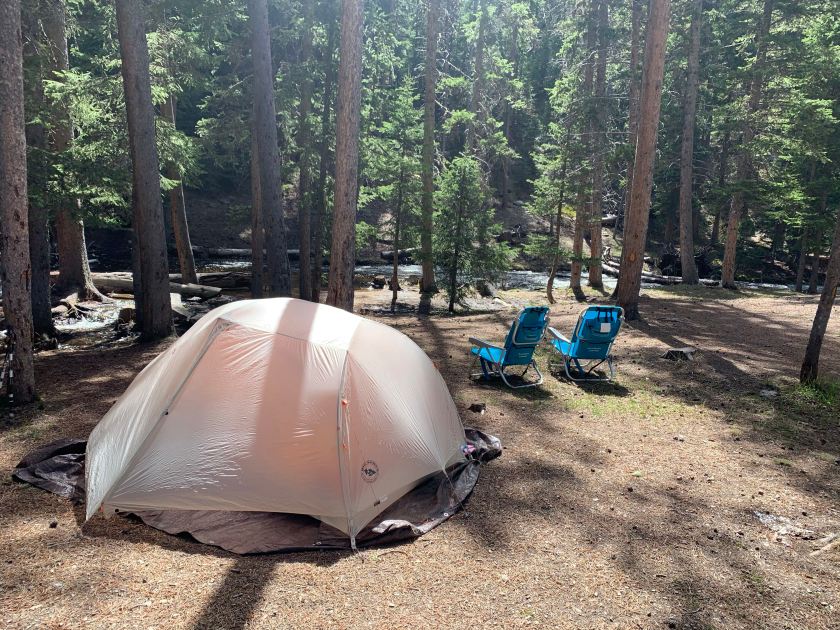
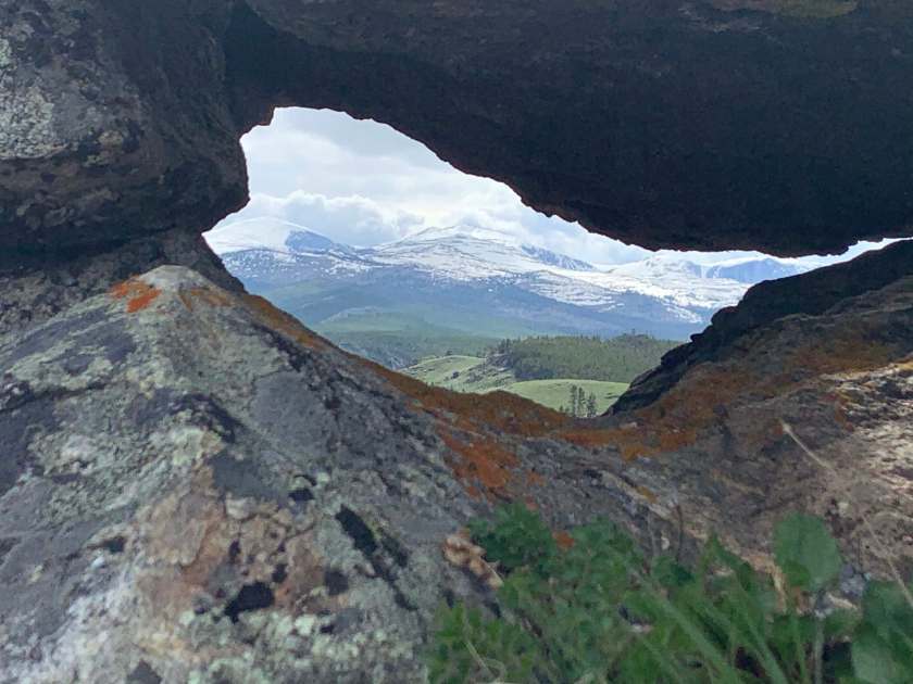
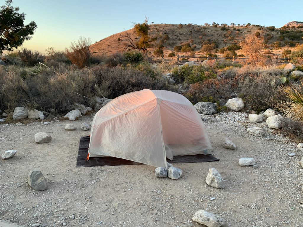
Our first camping/hiking spot on our way to Montana was in the Big Horn National Forest in Wyoming. We had a lovely campsite on a mountain stream.
Lovely first campsite
After we got camp set up I did a short hike up the hill above our camp.
View above our camp
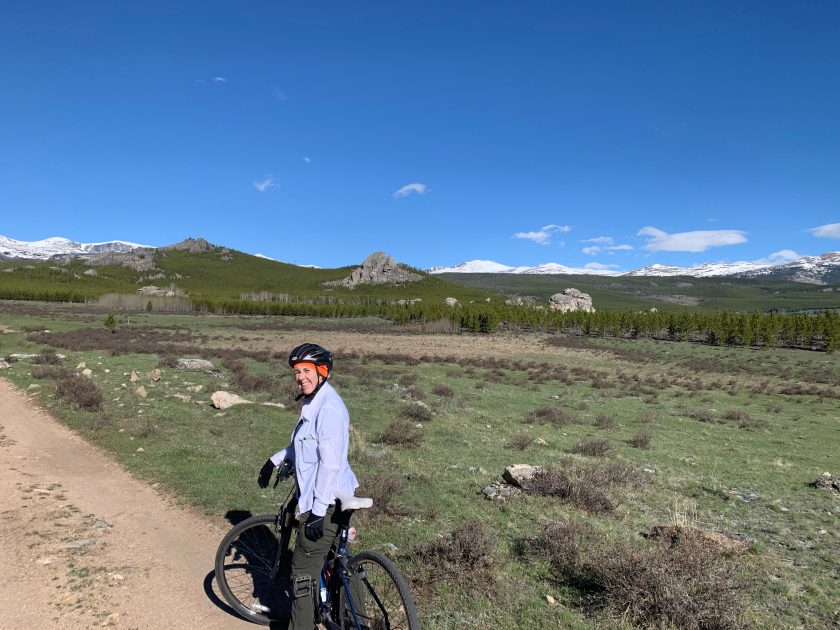
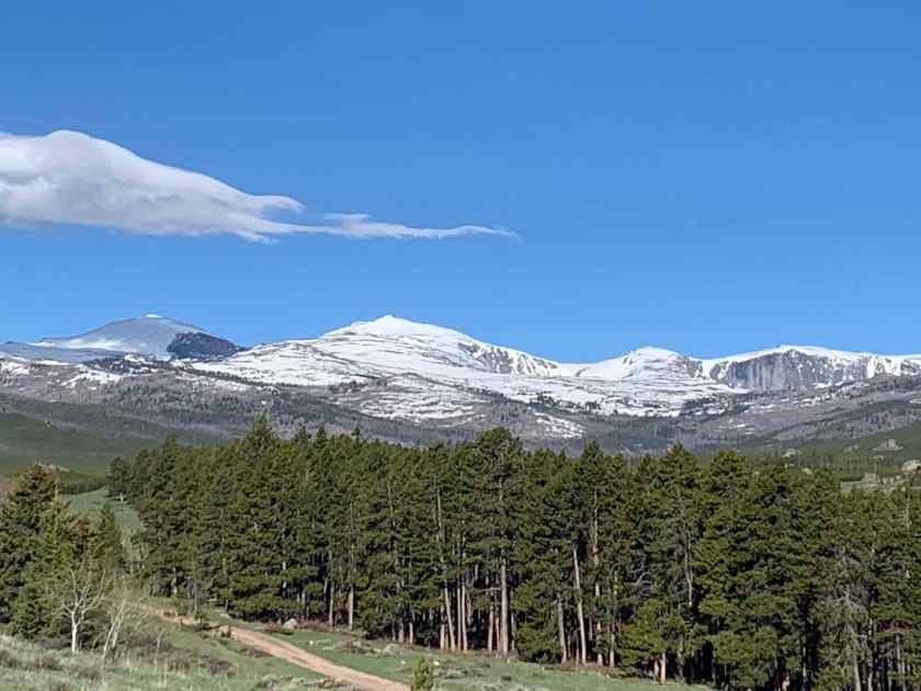
The next morning we did a bike/hike adventure that turned into a bigger adventure (of course) than planned. We didn’t make it to the end of the trail which was okay since it looked to be still snow covered.
Biking in the Big Horn!Stunning views in the Big Horn
We had planned to stay two nights in the Big Horn but after checking our travel time to Montana (more than 10 hours!) we decided to head north a couple hundred miles to make the following day more reasonable. So, we said goodbye to our lovely camp and headed to Billings.
Zero day in Tucson. Spent the morning setting up my next two town stops (Oracle and Kearny). I am feeling pretty good so I plan to continue on toward Superior. I talked to Bert and told her.
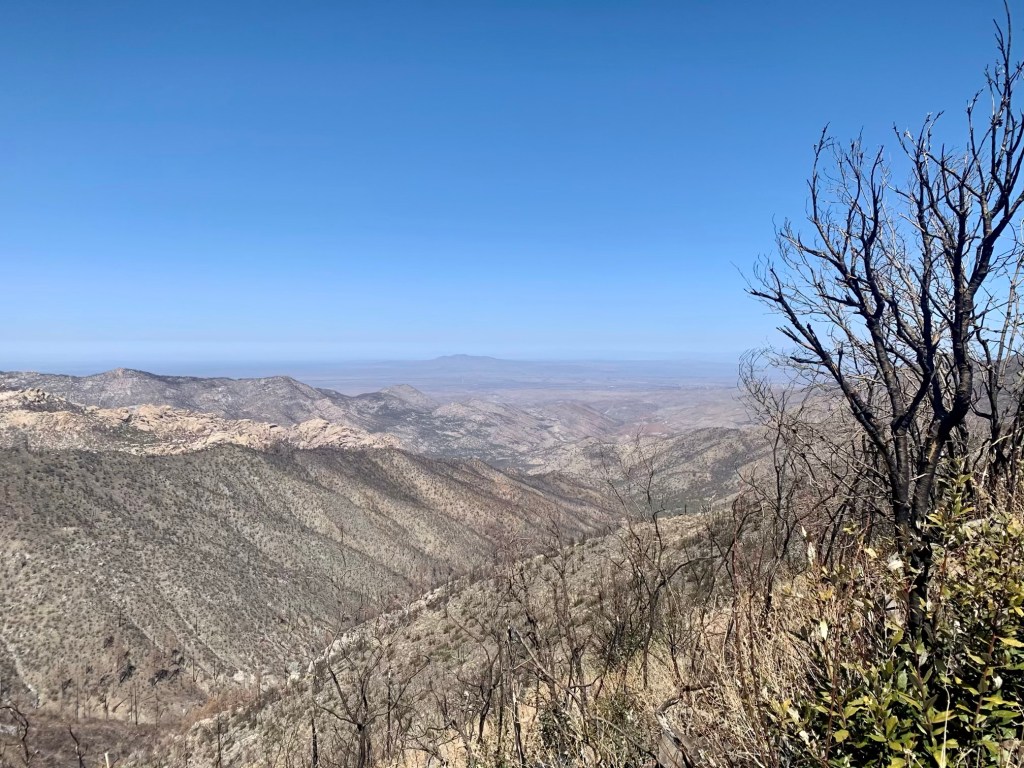
Walked to Safeway (food) and then Big 5 (fuel) this morning. On the way back got a call from El Rancho Robles and confirmed a room for Saturday in Oracle, March 20. I should get there in the morning of the third day out of Tucson so I only need to carry 2-1/2 days food. Which is good because leaving Tucson you have to climb into the Santa Catalina mountains.
The climb out of Tucson – from 4,000 to 8,000 feet.
On the way back from shopping I stopped at a thrift store and got the closest thing I could fine to a martini glass for martini night!
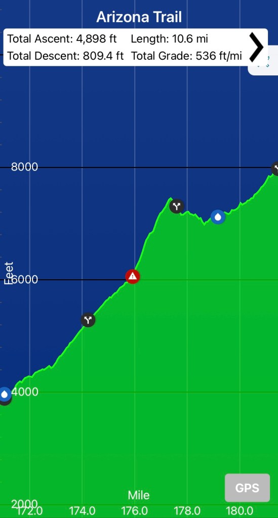
Day 7, Thur, Mar 18, AZT 164 to 179.1, 15.1, 4750’
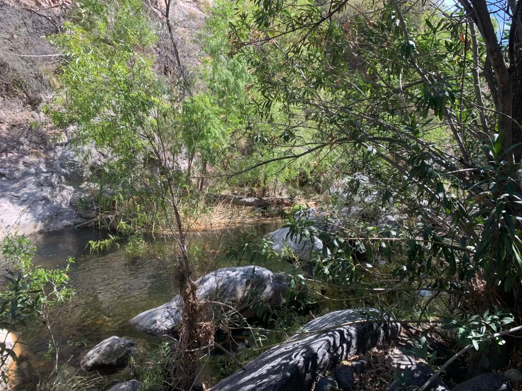
Got dropped off by the Lyft driver right around 7:15 and was hiking by 7:30. Was at Hutch’s pool, the last water for a while, at 10:45. This was my first stop and was about 7 miles into the day.
Hutch’s Pool in the Santa Catalina Mountains
Left the pool at 11:00 with about 3 1/2 L of water. Stopped at noon for lunch at about mile nine. I am 3 miles from my planned campsite and 6 miles from Lemon Creek. Two hikers just passed me as I was finishing up my lunch. Her name was KC, not sure about the guy. They left from Molina campground this morning so they are moving quite a bit faster than me.
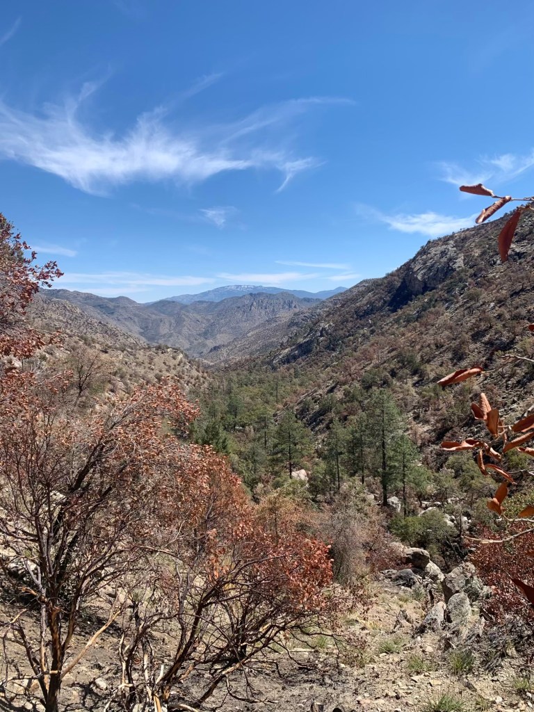
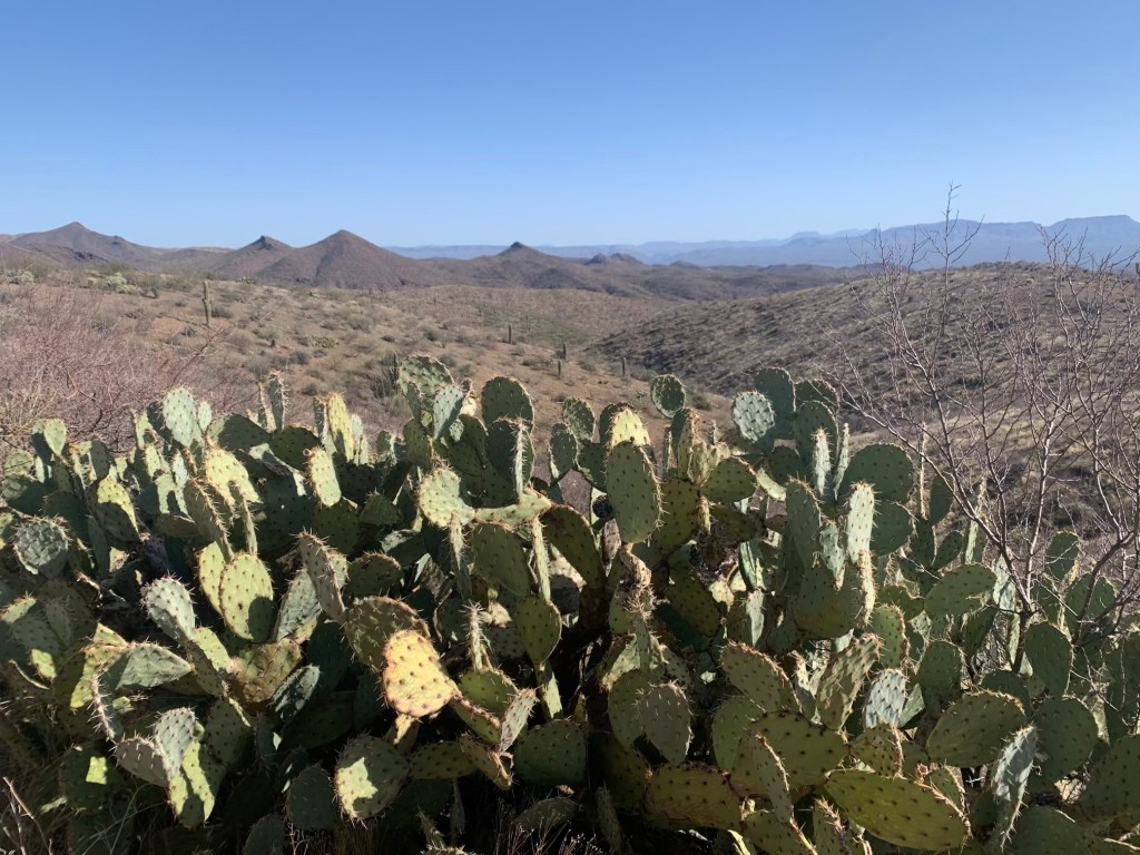
View in the mountainsStill snow on the north slopes of he Catalinas
Damn, what a day! No place to camp at the planned spot so decided to push on to Lemon Creek. 4,750’ day and I am totally wiped! Legs are cramping from the effort so I am using an electrolyte tablet and also took two ibuprofen.
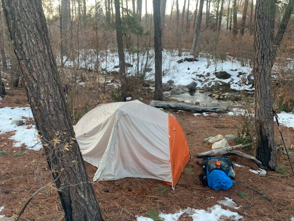
Campsite on Lemon Creek – pretty but cold!
Sumerhaven is at 5 miles tomorrow (but some more climbing- 1200 feet). Restaurant opens at 10:30. Have cell coverage so texted Bert.
Definitely my hardest, longest day so far- got to camp about 4:30 after hiking/Rock scrambling nearly 9 hours.
Denise, Neal and Sampson are my camp buddies. They started from Hutch’s Pool this morning. Denise and Neal are section hiking so have lots of food (Denise gave me a bit of chocolate!). They sort of adopted Sampson when he joined their camp going over Mica Peak. The way he told it he got to Manning Camp (you need a reservation there) and started crying because he didn’t think he could go on and they heard him and invited him to their camp. So now they are hiking together. Sampson and I talked for a bit – he is a PCT veteran and about my age.
The range of experience on the AZT is huge. I have met triple-crowners as well as people doing their first thru-hike. I would not recommend the AZT as a first thru-hike. It’s a tough trail.
Day 8, Fri, Mar 19, AZT 179.1 to 194.7, 15.6, 4,500’
Left camp about 6:45 AM. It was 32° this morning when I woke. First couple miles are pretty tough with a lot of steep sections and I’m still tired from yesterday‘s killer climb. My plan is to be at the restaurant at 10:30 when it open so I can get some breakfast. We’ll see how that goes. Used my micro spikes for the first time on a particularly slippery snowy section and they definitely help.
More snow on the trail
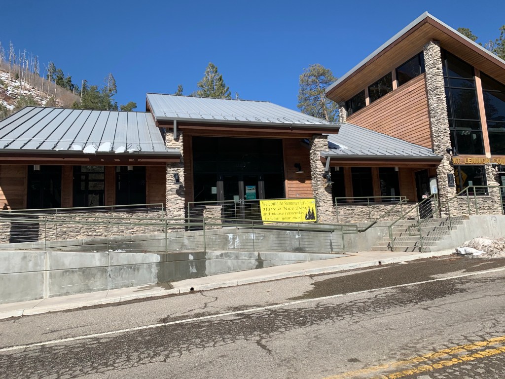
Got to Summerhaven around 9:15 so I had to wait an hour for the restaurant open. I was the only customer while I ate. Unfortunately they didn’t have any breakfast stuff so I got a burger. Drank a lot of water.
The (closed) visitor center in Summerhaven
Was back on the trail about 11:15. Another tough day, I’m still feeling the effects of yesterday‘s big climb. Got to the water tank where I’m camping about 4:30 PM. So that is two 15+ mile days in a row, and over 9,000’ of ascent!
Nice view leaving Summerhaven
Coverage is good here so I called Bert and we talked a little bit. Tomorrow is a short walk into Oracle. I hit the road at about 2 1/2 miles. Last nights low was 32° but tonight should not get much below 50 according to the weather report.
Campsite second night out of Oracle.
Day 9, Sat, Mar 20, AZT 194.7
Around 7:30 PM last night as I was just fixing to stop reading and go to sleep I heard some noises outside my tent. I said hello a few times and got no response so I got up. It was completely dark and I found a hiker looking for water. She was pretty funny. I asked her if she always hiked at night and she said yes because she always got a late start. I showed her where the water was and as I was talking to her two more hikers, obviously with her, showed up. Her name was Isabell.
Heading into Oracle and …. breakfast!
Broke camp and was walking by 6:20 AM. I’m getting pretty good at breaking camp, and the fact that the temperature this morning was in the mid 40s instead of the low 30s certainly helps. Feeling much better this morning, I think I’m getting over the climb out of Tucson. Took the Cody trail to Oracle and was sitting in a little café ordering breakfast by 7:45 AM. Called El Rancho Robles and asked if I could get early check-in. Talked to Laura who also said the best place for groceries was the dollar general.
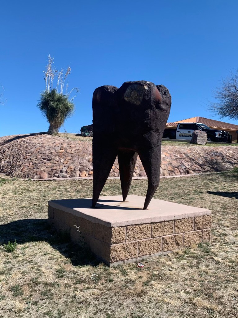
The d’amour Oracle giant iron tooth ?
They have a free guest laundry so after I took my shower I headed for the laundry. Walked to the Dollar General and Circle K about a mile and a half away. They didn’t have everything I wanted but I did OK for my 3 1/2 day next section. On the way back I got a text from Carol. She is taking another hike to the American flag trail head at 7:30 AM and asked if she could take me at the same time. I said sure. I also asked her about driving me to pick up a pizza and she said she would pick up a pizza for five bucks which I said was fine.
Also looking at water in the next section and, of course, it looks tough. Definitely going to have to hit at least one water cache. Having a nice relaxing afternoon since I did everything this morning. FaceTimed with Bert and then afterwards with Francis.
Met Carol when she went to pick up my pizza. She seems very nice. She even left me a bit of fudge. But, of course, I couldn’t eat it because it might’ve had nuts in it. Watched two silly movies on Netflix and then went to bed.
Day 10, Sun, Mar 21, AZT 206.8 to 223.5 , 16,7, 2,000’
The high today in Oracle is supposed to be 69° which is 12° cooler than yesterday, so it seems like I picked a good day to take a Nero. Carol dropped me off at the Tiger Mine trail head at 8 o’clock.
Carol took my picture after dropping me off
Would’ve got there a bit sooner but she had to drop off David at another location before me. I almost immediately twisted my right ankle, fortunately not serious. It is now almost 4 PM and as I write this my ankle feels pretty good. This has been a very dry section. I bypassed Mountain View tank about 3 1/2 miles back assuming I would hit either a public water cat cash or get water from Cowhead tank.
Turns out I was right but I pretty much scored the last of the public water I left about a half a gallon. Tomorrow is even worse. There’s supposed to be water at beehive tank in about 3 miles.
And I will have to carry water from there all day tomorrow and even into the next day. There may be water at the Freeman Road trail head in 11 1/2 miles but I can’t count on that. It sounds like that water cash is not well-maintained. There’s a seasonal stock tank in 17.7 miles but The pump runs on our gas generator and the last report from two days ago was that it was not on.
The desert really doesn’t like me.
Might be water in the trough however. I will check tomorrow during the day if I get cell coverage. I do not have cell coverage now.
But I am doing better than this guy!
At this point it looks like I need to leave beehive well with at least 3 1/2 to 4 L of water. It looks like the only water I might be able to count on is a seasonal wildlife tank nearly 23 miles ahead. So I would not hit it until five or 6 miles into the day after tomorrow.
Did not see a any other thru-hikers today. Did see one group of day hikers. Did not talk to them, just waved. Very strange. Unlike previous days where I saw three or four thru-hikers.
A couple in four-wheel-drive just drove down the wash (it’s about 5 PM). I walked over to talk to them (and ask if they had anything cold to drink). Turns out they own a hotel in Oracle, the one that’s closed. They also are the people that are servicing the water cash where I just got my water. Two nice things about this. They handed me to partially frozen half liter bottles of water. Very nice. They also gave me a heads up on the Freeman TH. They said there was a guy there doing trail magic and I could definitely count on water there. This means I don’t have to hump a ton of water from beehive tank. In fact I may be able to bypass beehive tank! This is really good news for tomorrow. Had a nice talk with them told him I was from Houston. Seem like very nice people.
Popped the blister on my left big toe. Looked at my ankles. My right ankle is a bit swollen, but it doesn’t hurt particularly so I’m not too worried. I took an ibuprofen to help with the swelling.
Day 11, Mon, Mar 22, AZT 223.5 to 234.7
Had a minor catastrophe last night. My sleep pad developed a leak. I spent a good hour trying to find the leak and sealing it. Should not be a surprise since every plant out here has needles. Looks like I succeeded since It did not lose air all night. My right ankle is still a little swollen this morning. But it feels about the same.
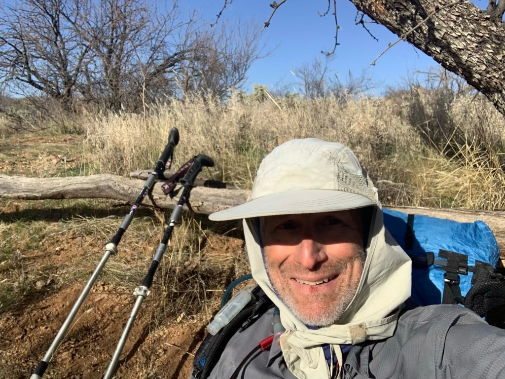
Break on the trail
I have about 2 L of water this morning. Which should get me to the Freeman Road trail head without having to stop at Beehive well.
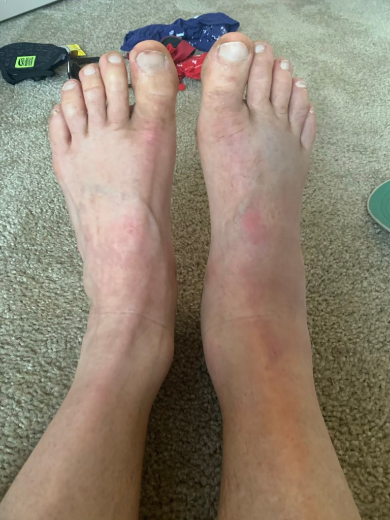
CRRRRRAAAAAAPPPPP!!! About 5-6 miles from the Freeman Road TH I slipped on some gravel and my right foot ended up behind me (I basically did the splits). At first I thought it would be okay, it hurt but not too bad but over the course of a mile it became very painful and my ankle really started to swell. Lookslike my hike is over. By the time I was 2 miles from the TH the pain we really bad. Excruciating. I managed to get in touch with Mary and arrange for her to come get me but I stil had to do the 2 miles. I took 3 extra-strength Excederin and hobbled the last two miles.
Swollen right ankle.
There was trial magic at the TH (Sequouia) and I was able to sit down. I arrived about 1:00 (took me 3 hours to do the five miles!). Once I sat down the pain subsided substationally. Called Bert and told her what was going on. Really bummed. Mary arrived a little before 3:00 and we drove back to her place in Sunrise. CRAP!!!
Well… things did not turn out quite like I had planned… as usual. My modified plan had me hiking roughly 250 miles from Patagonia (where I was chased off the trail in 2020 by the pandemic) to Superior (just eat of Phoenix). So… what happened?
Getting to the Trail: Wed-Thu, Mar 10-11
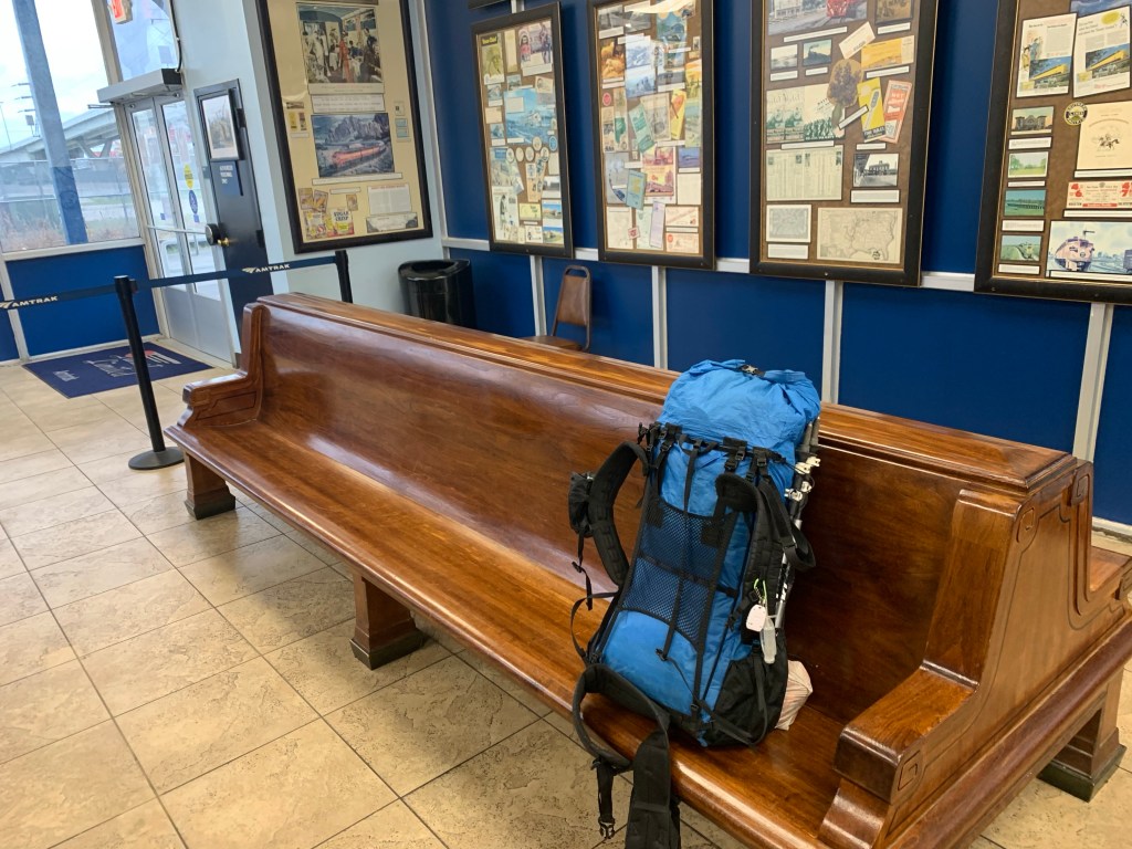
Bert dropped me off at the Amtrak station so I didn’t have to walk there which was nice.
Houston Amtrak station.
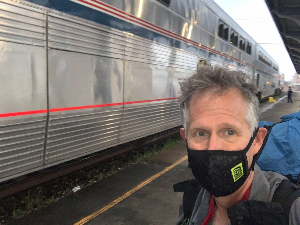
Boarding the train was easier than even taking Greyhound. Just showed the conductor my printed ticket and got on. My “sleepette” is a private 2-person sleeper compartment. Kinda expensive ($375) for one person but not bad for two (meals are included and one free drink!). Room is about 7’ by 4’ with two facing seats that slide together to form a bed. There is also a drop-down upper bunk bed. It’s very nice and clean. There is an attendent who will bring your meals and help you arrange your bed (but, being an engineer, I did it myself of course). The toilets are down the hall and there is even a shower (though I have not checked it out yet).
My train!
Interesting night on the train – a bit noisy when we pass through towns. The Train follows US90 out of Houston and then heads west. When I woke up we were in Del Rio, right on the border. Top speed seems to be 80 mph but we do that rarely and we slow down a lot in towns. We were doing ~20 in Houston.
We hit Tucson about 8:15 PM (about and hour and a half late). Got a Lyft from Steven (from Wisconsin) for the ~$100, 60 mile ride to Patagonia. He regaled me the whole way with stories about how he survived a massive heart attack last May (he’s 58) and almost died. Got to the Stage Stop Inn at 9:30 and they had my key in an envelope at the front desk (I called ahead and told them I would be running late).
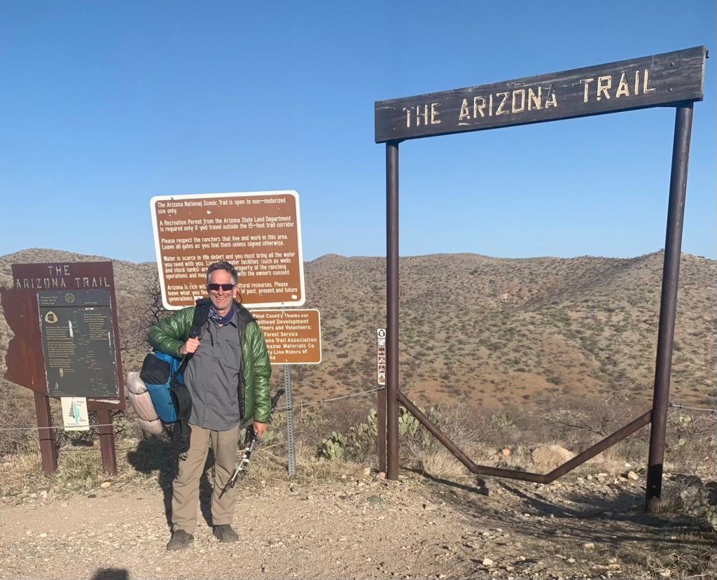
Day 1, Fri, Mar 12, Patagonia to AZT 66.7, 15.6 miles, 3350’
Up at 5:00 and it is COLD! 37 degrees – looks like I might be starting in my puff? Sunrise is at 6:30 so that is when I plan on starting. Leaving with ~2L since water looks pretty good today.
Hiking our of Patagonia – headed north.
Tough first day! Had some Leg cramps near the end. Hiked for a couple hours with Trail Jesus, a young, 27-year-old Hiker from Arkansas who has taken to the trail to kick his meth habit and was down to only three cigarettes a day.
Campsite day 1
Did the planned 15.5 miles today. About 3300 feet of climbing, very tough first day. I am currently at Casa Blanca Canyon, AZT 66.7, Elevation 5767 feet. Nice campsite with pools of water in a creek bed about 50 feet away.
The weather was nice. Started very cold but warmed up in the sun. Temperatures were in the low 50s most of the day, sunny and a little windy. Met a total of six hikers today.
Bill (“Two Pillows” and, yes, he has two pillows) and Deb (”Hot Sauce”, don’t ask, it’s personal) showed up around 3:30 and asked to share my campsite. They met on the trail. Deb is from Flagstaff.
… and the following morning!
Day 2, Sat, Mar 13, AZT 66.7 to 84.1, 17.4, 1,850’
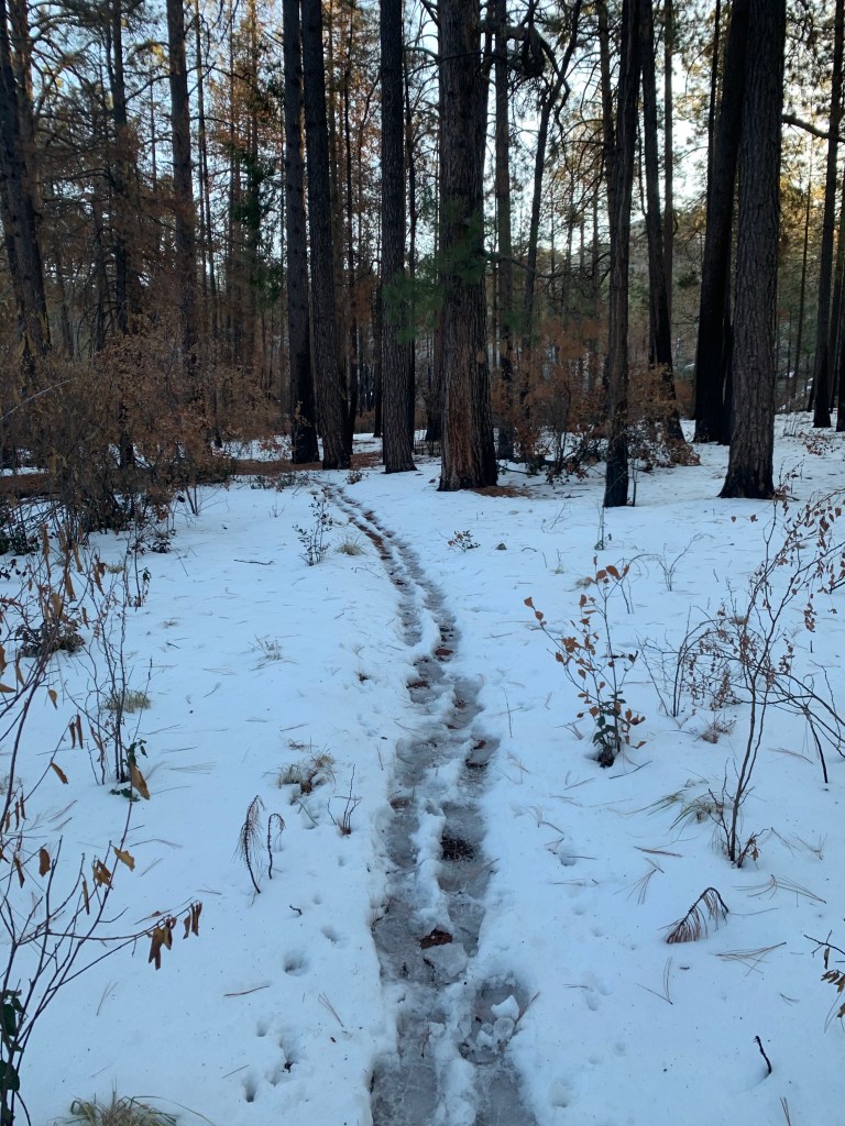
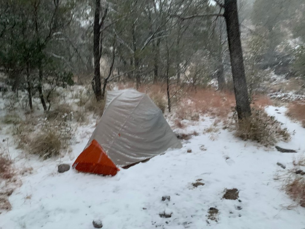
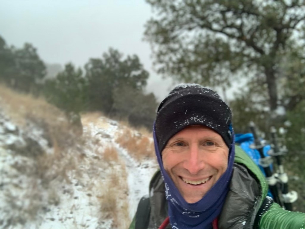
Woke up to a coule of inches of fresh snow and it pretty much snowed all morning. Did not see another hiker all morning – I think everyone else just stayed in their tents!
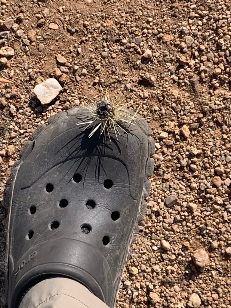
Walking in the snow….One cold cactus!
Made it to Kentucky camp around noon. Was a much needed respite after hiking all morning in the snow and wind. Made coffee and had a nice lunch. A hiker joined me as I was getting ready to leave – Goose. He said he had camped with a fellow who woke up nearly in tears because he had never camped or hiked in snow before. Goose asked him if he needed a hug. He said yes and Goose gave him one.
Kentucky camp – no heat but out of the wind!
Sun came out, finally, in the afternoon but it was still windy. Plan is another 6 miles to camp.
Nice AZT cow gate – camped near here.
Afternoon hiking was much nicer than this morning’s snowstorm. Unfortunately Boden Spring, where I had planned to camp, not only had no water, it was a good half mile off the trail. So … back to the trail and another couple of miles to a trail head where some nice people had left public water. On the way I bumped into my first thru-biker. She had waited out the snowstorm and decided not to bike at all today.
Not the greatest camping spot, it’s basically next to a dirt parking lot and there is a lot of four-wheeler traffic on the road because today is Saturday. And it is very windy. But no snow.
Day 3, Sun, Mar 14, AZT 84.1 to 100.2, 16.1, 1,750’
Note to self. Make sure the tent site is flat! Water is tough today. Only for-sure water is at 2 miles. So my plan is to leave here with 4 L. Should have water tonight, but the sources say the water is” muddy”. About 33° this morning when I woke up and windy but no snow.
Resting the footsies at lunch
Stopped for lunch at 10 miles in a little draw out of the wind. No water this morning anywhere. Goose showed up just as I was getting ready to go. He’s much younger than me and plans to go all the way to the highway today. I think that is another 12 miles from here. I’m counting on either a public water cash or, more likely, a cow pond.
I was able to find water in a small wash so I didn’t have to stop at the “lake” (i.e. a cow pond).
A “good” water source on the AZT – not a cow pond!
I pushed on a couple more miles to Twin Tanks. Fortunately I don’t need any water from the tanks because the water is pretty nasty. “Tank” by the way is an AZT euphemism for a cow pond.
Lovely Twin Tanks and…… my campsite for night #3.
Hot Sauce, Two Pillows and some other folks showed up an hour or so after me.
Other folks at Twin Tanks as I headed out.
Day 4, Mon, Mar 15, AZT 100.2 to 119.2, 19.0, 1,250’
Got an early start, 6:20. It’s a beautiful morning about 38° or 39° and sunny. I’m a little worried about my phone charge. I’m going to have to be careful with phone usage.
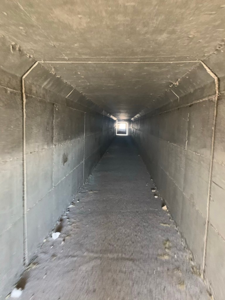
Had a quick lunch at a TH (11;00, 12 miles) just passed where the trail crosses I-10. After talking with some folks I decided to try to make it to Colosal Cave, where they are rumored to allow phone charging.
Tunnel under I-10
It was a relatively flat day so I was able to do 19 trail miles (but well over 20 with the hike into Colossal Cave). Hopscotched with Nolan most of the day – he has a package supposedly arriving at Colossal Cave tomorrow.
We arrived together. Snack shop has beer and not much else but the hiker box is good – scored some Idaho potatoes. And I was able to charge my phone a little (and battery).
One of the Coati that hang out at Colossal Cave
Plan to charge some more in morning since I want to be at Rincon Creek tomorrow and it is only 10 miles. Also supposed to be Trail magic at 122.3.
Day 5, Tue, Mar 16, AZT 119.2
Shared a campsite here at Colossal Cave with Nolan. I am currently in the bathroom of the terrace café trying to stay warm while my battery charges. It is 7:15 AM.
No heat, but no snow or wind.
Nolan‘s package is here but they won’t give it to me. He has to show ID. I had planned to charge for another 15 minutes or so and then head back to camp and then start hiking.
But, of course, it started to snow. Again. The weather report from Vail shows warming trend after today. I am feeling okay though my stomach is a little woozy this morning.
Back in the bathroom. Started back down to the camp but it’s snowing/sleeting pretty hard and very cold. And I don’t have my rain jacket just my puff. So I am hanging out in the bathroom until it gets better.
While waiting for my battery to charge and the snow to stop my stomach really started to act up. Walked back to camp and met Nolan coming up on the way. By the time I get to camp I had pretty decent stomach cramps and not feeling very good. Bad water?
And it’s still snowing. I decided to call an early stop to the section. With all the snow I am concerned about how much snow we will have going over Mica Peak. And also, I am worried about that big 5,000 foot climb tomorrow with my stomach cramping.
So …. new plan! I decide to try to get into Tucson from and take an early zero.
Try talking up one person in the parking lot had no luck so just started hiking toward Vail. It’s only 6 miles and a pretty easy road walk but with my stomach I’m a little worried. About a mile down the road the very first car the passed me (there’s very little traffic on this road), slowed down and asked me if I needed a ride! A couple from California just tooling around Arizona on vacation gave me a ride to Vail. Once there, I tried to get a Lyft from Vail to Tucson with no luck! Not sure why – Tucson is only 10 miles or so west of here.
I needed a place with access to a bathroom and also I was getting a little hungry so I walked to Montgomery‘s Bar and Grill in Vail.
There was no one there but me (it’s only 11 o’clock), and I ended up talking to a lady who later turned out to be the owner. I asked if she knew how I could get to Tucson and she said if I was willing to wait till 1:15 she could give me a ride. More trail magic! Had a beer and a sandwich while I waited for my ride!
Turns out the hotel I’m staying at is only a small detour for the owner so she drop me off in front of the hotel. I was in my hotel by 2 PM taking a shower. Now I have to decide what I’m going to do next. Call Roberta around three and talk to go over with her. With the extra days I have more options on the next section. And then I ordered a pizza.
Getting back to the trail while trying to avoid as much contact with other people is the goal. Because of the pandemic I am uncomfortable flying so I have elected to take Amtrak (Sunset Limited) from Houston to Tucson and then taxi/uber it to Patagonia (where I stopped last year). I am getting a sleeper compartment so I won’t be around other people but it does take 25 hours to go from Houston to Tucson.
So, slower and more expensive but… it’s a train! And train travel is infinitely more civilized than flying.
Trail Closures
As late as a month ago there were two fairy sizeable trail closures because of fires last year. In late February the Bush Fire trail closure (AZT 354 to 387) was lifted. On March 2 the Bighorn Fire trail closure (from AZT 125 to 144) was also lifted. This means the only portion of the trail that is off limits is the 2 miles or so at the southern terminus (thanks to Trump’s wall) but I did that part last year so….. not a problem for me.
Water
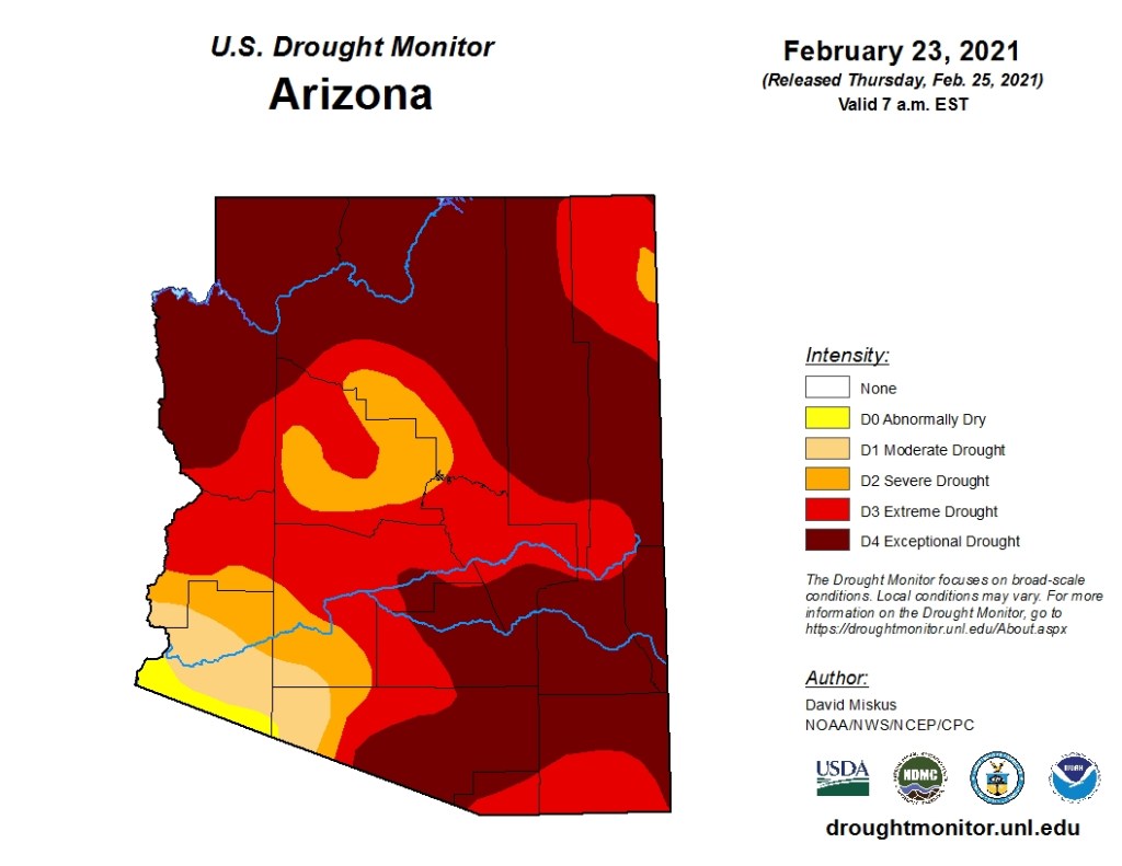
Arizona, and indeed most of the southwest, is in a major drought. So, the normally very dry AZT is even drier.
Change of Plans
I had intended to return and spend 6-7 weeks finishing the trail but, because of Covid, I have compromised and will only be doing 250 miles in two long sections (from Patagonia to Superior, just east of Phoenix).
Well, the plan was to spend 4 days hiking in Guadalupe Mountain National Park, culminating in a climb to the highest point in Texas (Guadalupe Peak) on the last day. So much for plans….
We arrived at the visitor center late in the afternoon of Dec 3 and it was cold… and getting colder. The Ranger who gave us our backcountry permits reminded us that the backcountry campsites were several thousand feet higher than the visitor center (5,800′). Using the old rule of 5 0F per 1,000′, that would be 10 degrees colder than Pine Springs CG (where we were spending our first night).
We quickly set up our tent as the temperature plummeted from the balmy 45 degrees when we arrived. We ate a quick dinner in the car and were in our sleeping bags by 6:00 PM to try to get warm.
Home for the night – Pine Springs CG
By morning our plans had changed. After a night of trying to sleep (wearing everything we had inside our bags) we realized that camping even higher would be a disaster.
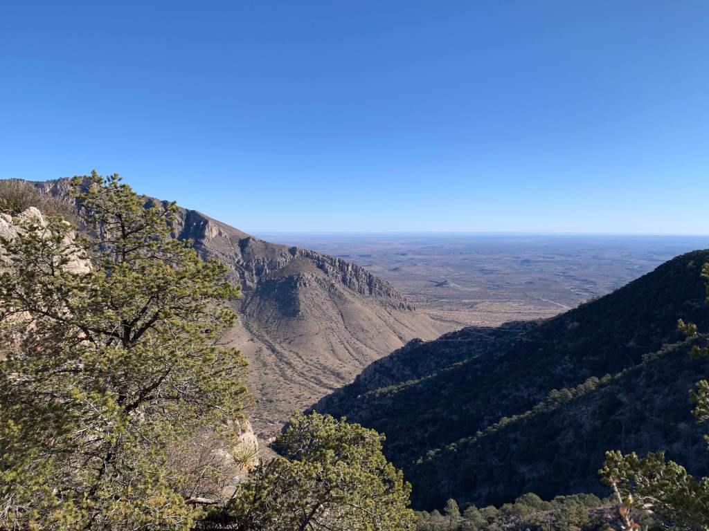
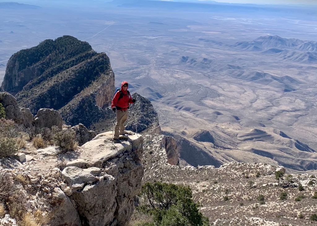
We decided to do the ~8.5 mile (round trip), 3,700′ Guadalupe Peak climb and then skedaddle into town and a warm motel.
Starting up the mountain!
We started up around 7:30 (temperature had warmed up to 30 degrees or so). It is basically a 4 mile, 3,700′ climb that is pretty steep in parts. But the weather was great for hiking and the sun was out!
View from about 1,000′ up.Another nice view.
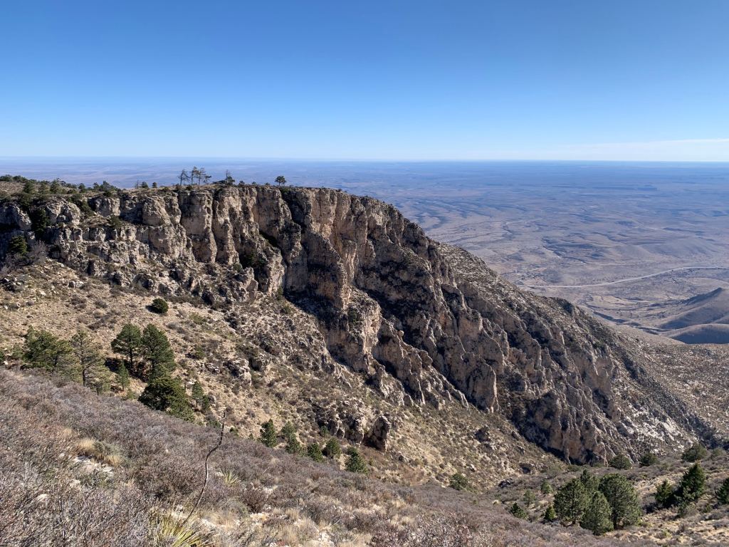
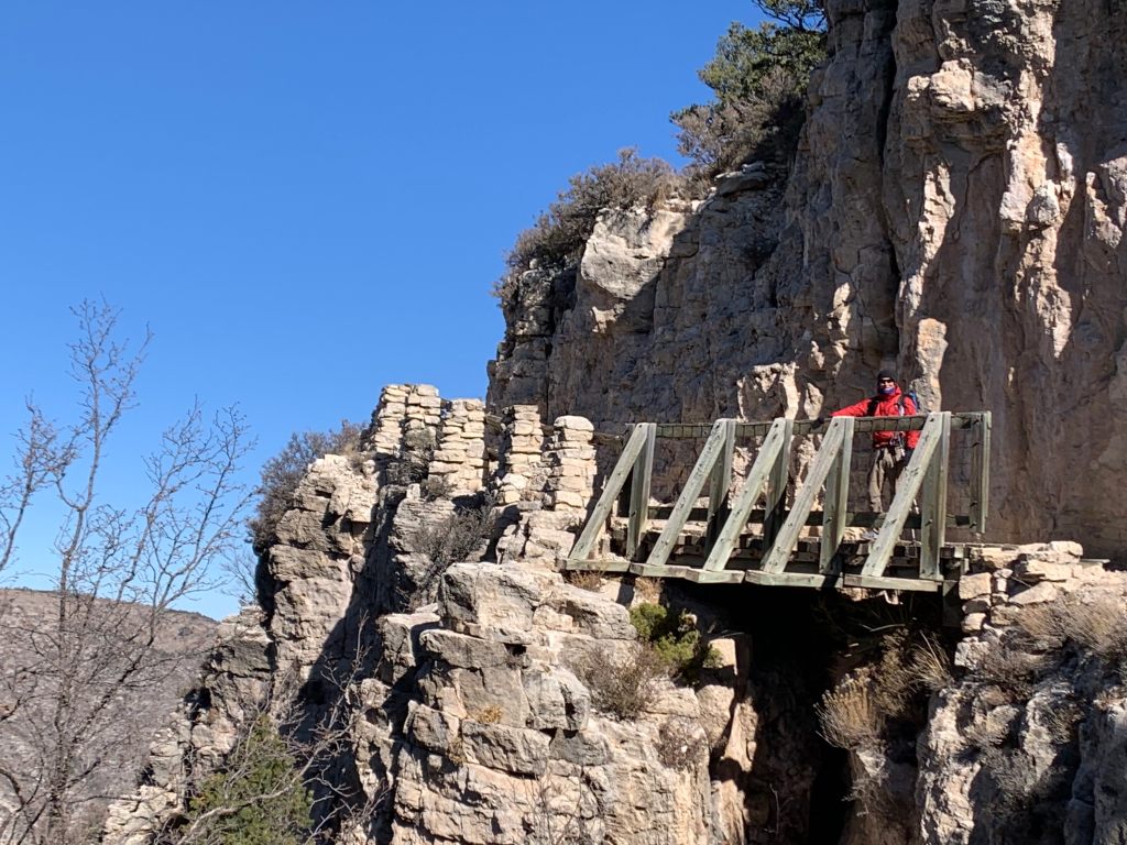
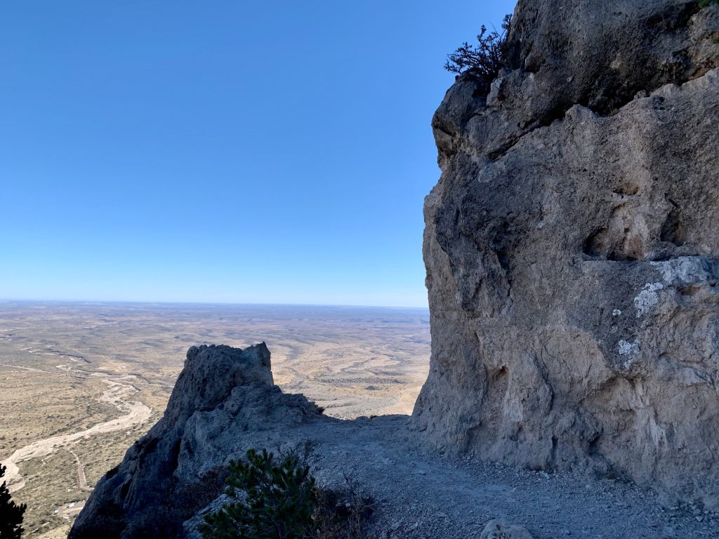
You can’t actually see the peak as you climb – it is always over another ridge. The trail is rocky but in good condition. At one spot there is even a bridge over a small chasm.
Bridge in the sky! Roberta made me go first.Mountain man! Nearing the top.
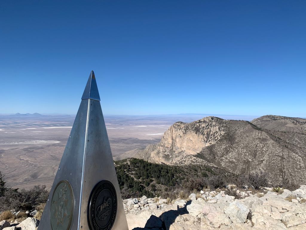
In the visitor center they say to “plan on 8 hours” to climb Guadalupe Peak. We reached the top in 2:45 after passing two couples. Much younger couples. Very satisfying.
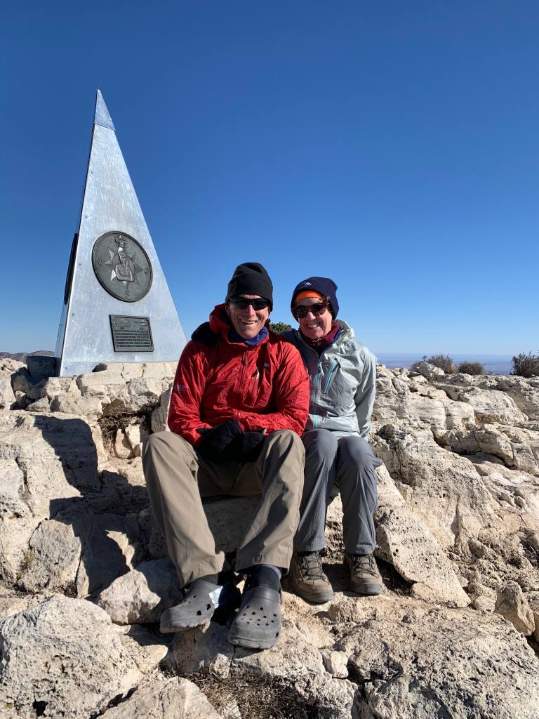
On top – 8,750 feet! The roof of Texas!
There were only a couple of people on the top but more started to arrive so we only stayed for 15 minutes or so before heading down.
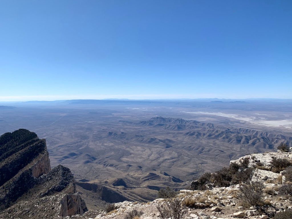
View from the top – looking south. That’s all Texas down there!Another view from the top.
We were back down around 1:00. Thinking of a warm bed and a hot shower.
A short post about the accommodations on our EBC trek. 20 years ago accomodations on the trail were “tea houses”. These still exist. They are basically two room buildings, a kitchen and a bigger main room. Food and tea are served in the main room which is heated by a yak dung stove. Come time to sleep you would lay out your sleeping bag on benches in the same room. If the stove was not well ventilated the room would fill with smoke and was not always pleasant.
These tea houses still exist (we have stopped at several for lunch and tea) but now there are inns. They vary in quality but share some common features.
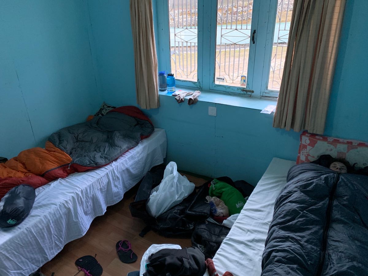
The main room is the restaurant which is still heated by a yak-dung stove (which always has a large pot of water boiling). This is the only heated room in the inn. The rooms are usually private (for one or two people) and are never heated. The toilet is usually a shared affair down the hall – sometimes squat, sometimes seated. In a few of the nicer inns there are private toilets in the rooms but this is rare.
A typical double room in an inn
The quality of the bedding and beds varies so most people use sleeping bags on the mattresses. You don’t spend a lot of time in the room when you are not sleeping because it is so cold. Everyone hangs out in the main room. At night to run to the bathroom we kept our parkas handy.
Not sure how much the inns cost (our tour price included this) but the food is pretty reasonable – 400-800 rupees for a meal.
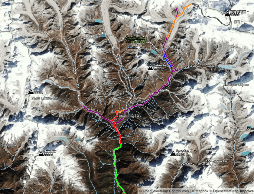
The trek with Alpine Ascents is billed as a 3 week trek but some of that is travel and acclimation. There are 14 actual hiking days and the route is a south-to-north out-and-back course that mostly follows river valleys. The northern terminus of the hike is Everest Base Camp (EBC) at 17,600′. The entire distance is less than 100 miles but there is a lot of elevation gain.
We fly into Katmandu (4590′) on Oct 21 after spending a few days sightseeing in New Delhi. From Katmandu we will be taking a short flight (or possibly helicopter) to Lukla (9400′) on Oct 23. This is also our first day of hiking and it will be an easy one as we begin the acclimation process. The next day we head up Namche Bazaar (11,300′) where we spend the next few days doing easy hikes to get further acclimated.
The Entire Route – Lukla to Everest Base CampRoute from (and return to Lukla) going north.
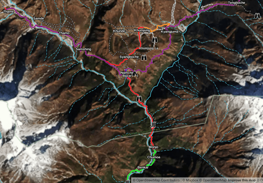
After a few days in Namche Bazaar we head west to the village of Thame (12,400′) where Alpine Ascents has several cultural events planned, including a visit to a Buddhist Monastery.
Route to Namche Bazaar and further north
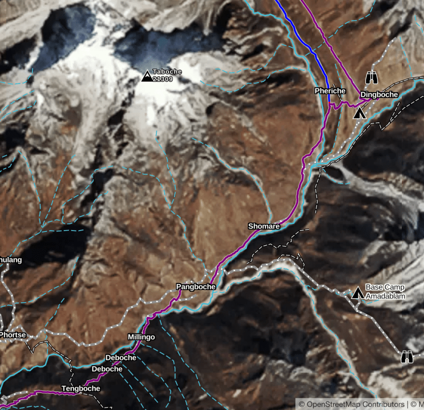
From Thame (Oct 27) we spend the next four days heading East and North, visiting villages and getting further acclimated, reaching the village of Pheriche (13,900′) on October 30.
The route (East and North) to Pheriche
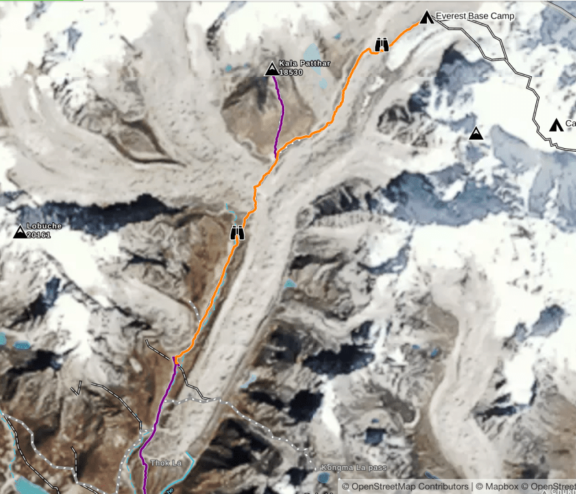
The next two days we really begin to ascend arriving at Gorak Shep (16,900′) on November 1. Weather permitting, we ascend a small peak, Kala Pattar (18,500′) which is high point of the trek and is supposed to have great views of Everest. Gorak Shep is the last village on the way to EBC.
The following day (Nov 2) we trek to Everest Base Camp and the furthest point north on our trek. We do not spend the night, descending to Lobuche (16,200′) for the evening.
Final trek to/from Everest Base Camp
From Labuche we basically retrace our path, taking four days, and arriving back in Lukla on November 6.
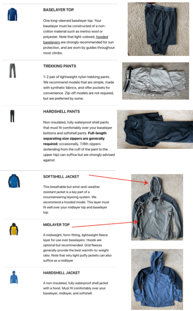
Alpine Ascents gives very detailed instructions about the gear that is required on their climbs/treks. We have learned that, if it’s on the list, you should have it. This, of course, blows up our “only carry-on” travel philosophy. We were able to get everything into two carry-ons and two checked bags.
Everything for 4 weeks in Asia!
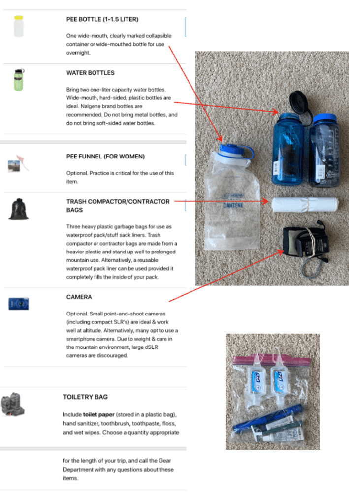
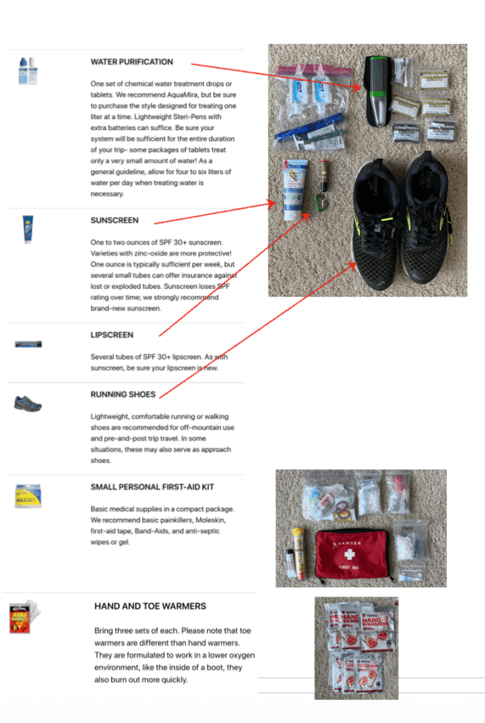
Below is the AA equipment list (on the left) with pictures of my matching equipment. Big thanks to my buddy Jim Thornton for lending us a lot of this!
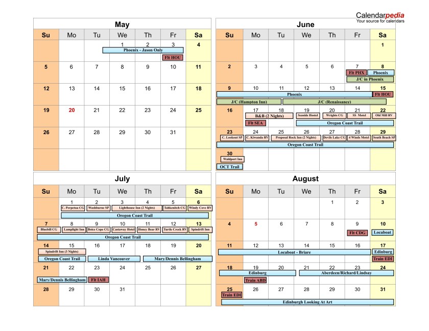
We’ve nailed down most of our travel plans for the rest of 2019. There are three more big trips this year:
Oregon Coast Trail
Starting in mid-June we plan to hike the ~450 mile Oregon Coast Trail. The plan (my next post will discuss the plan) has us hiking for roughly 26 days followed by visits to family in the Northwest, returning to Houston the fourth week of July.
France/Scotland
We will be flying to France to spend a week on a boat that we plan to buy. The boat is currently in rental with Locaboat. It is nearly identical to the boat we rented for the summer of 2017. If all goes well we will take possession of the boat in October with plans to spend next summer on her.
After we leave the boat we will travel to Edinburgh (by train – always wanted to take the “Chunnel”!) to Edinburgh to, hopefully, catch some the Fringe Festival. After a few days we will head to Aberdeen to visit old friends before returning to Edinburgh to join the Houston Looking At Art group for a week looking at local art.
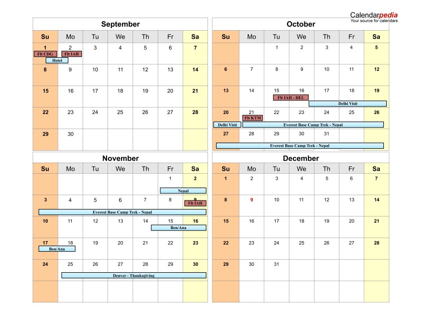
India/Nepal
Finally, in mid-October we head to New Dehli where we will spend a few days sight-seeing before flying to Kathmandu for a three week trek with friends in the Himalaya, reaching Everst Base Camp near the end of the third week.