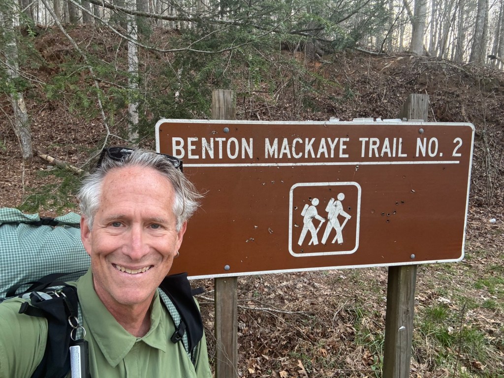
I left Fontana Village on my next section after a nice rest day, crossing over Fontana Dam…
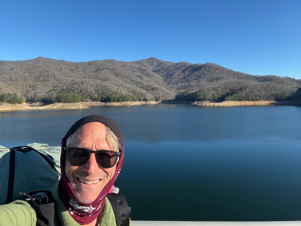
View from Fontana Dam
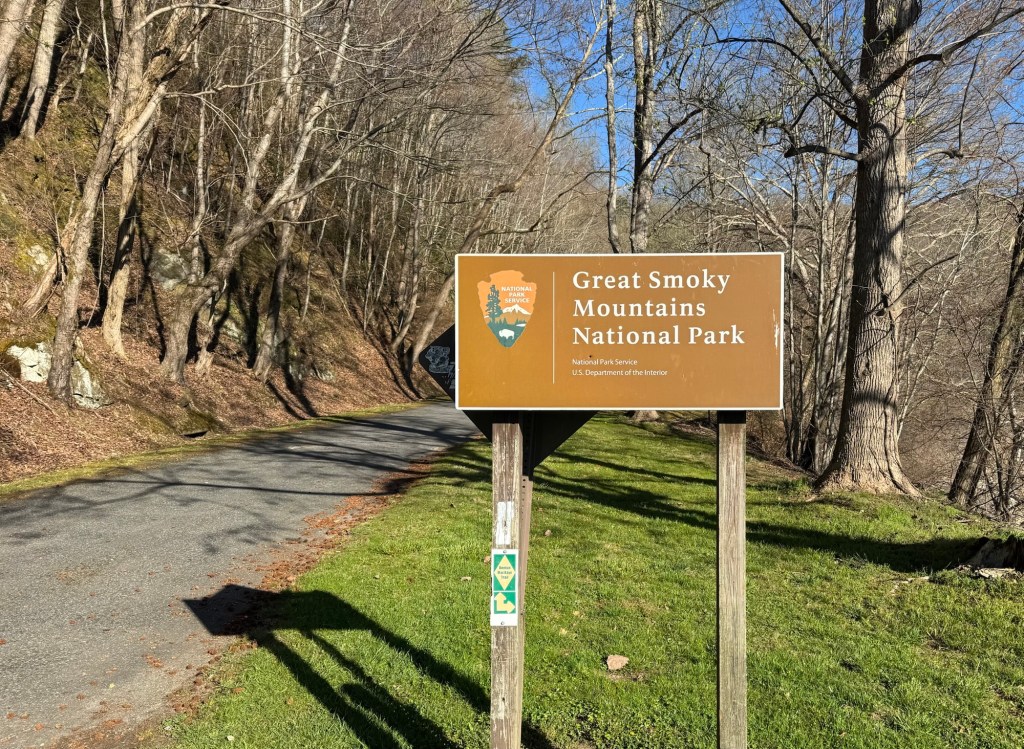
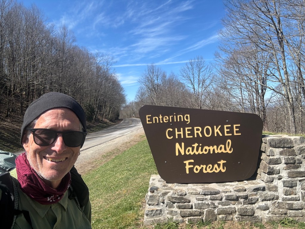
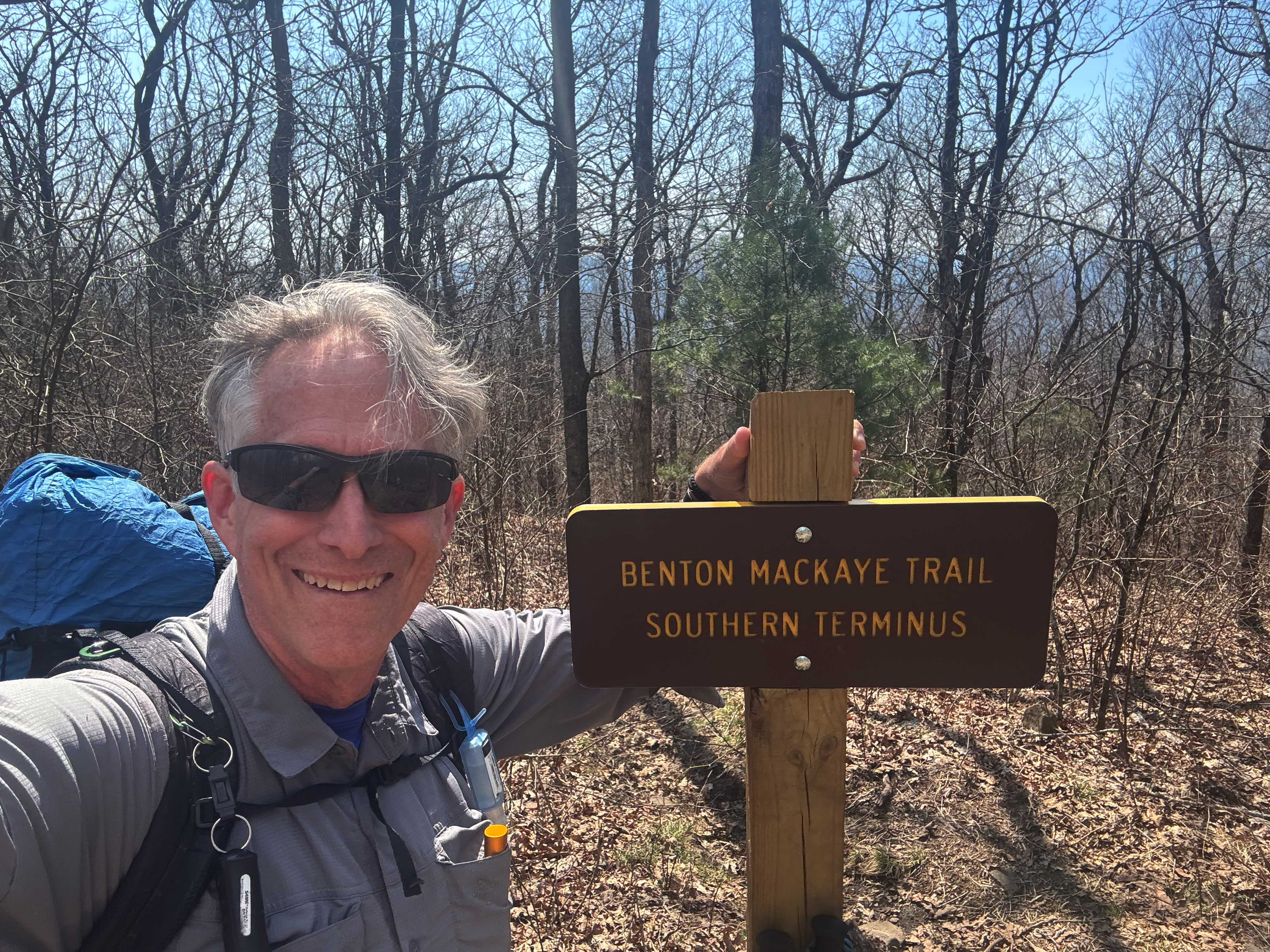
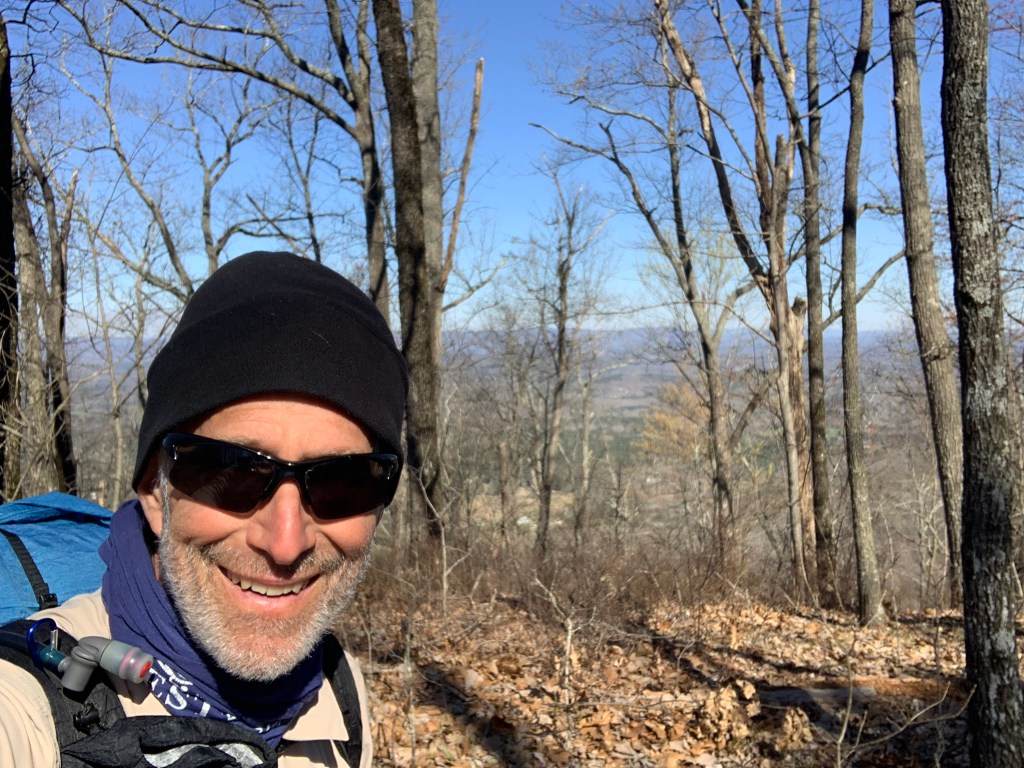
.. and entering (finally!) Smoky Mountain National Park (SMNP).
Entering the Smoky Mountains National Park!
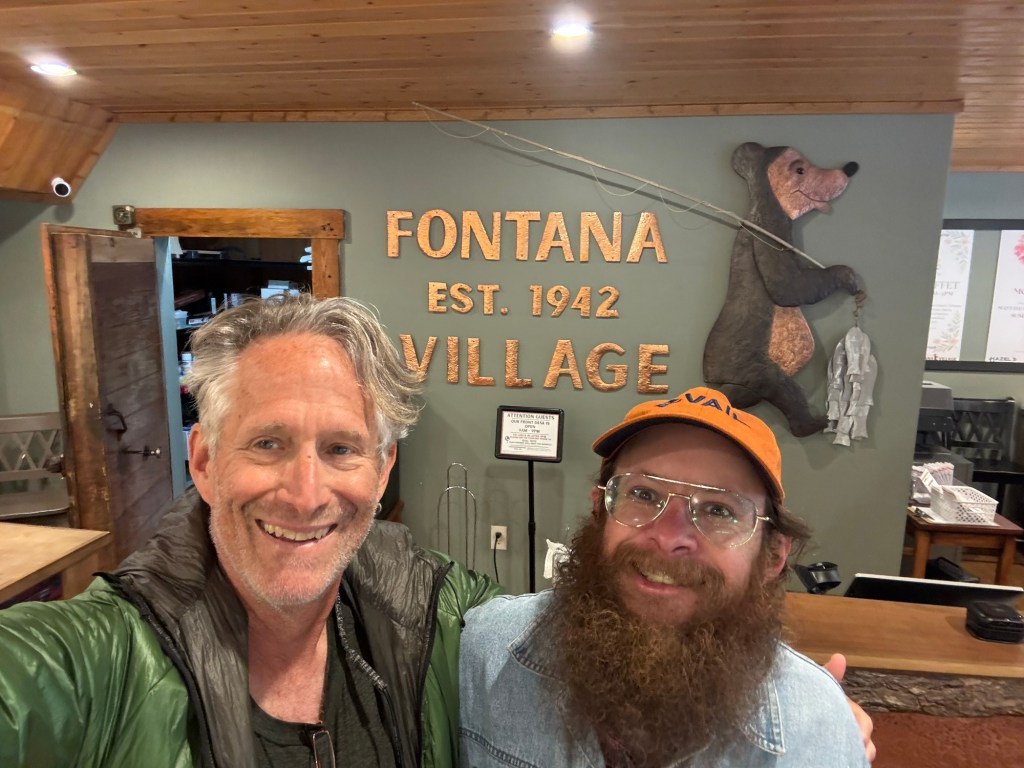
And saw this guy leaving Fontana Village….
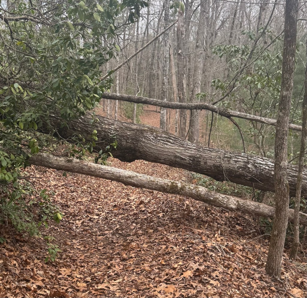
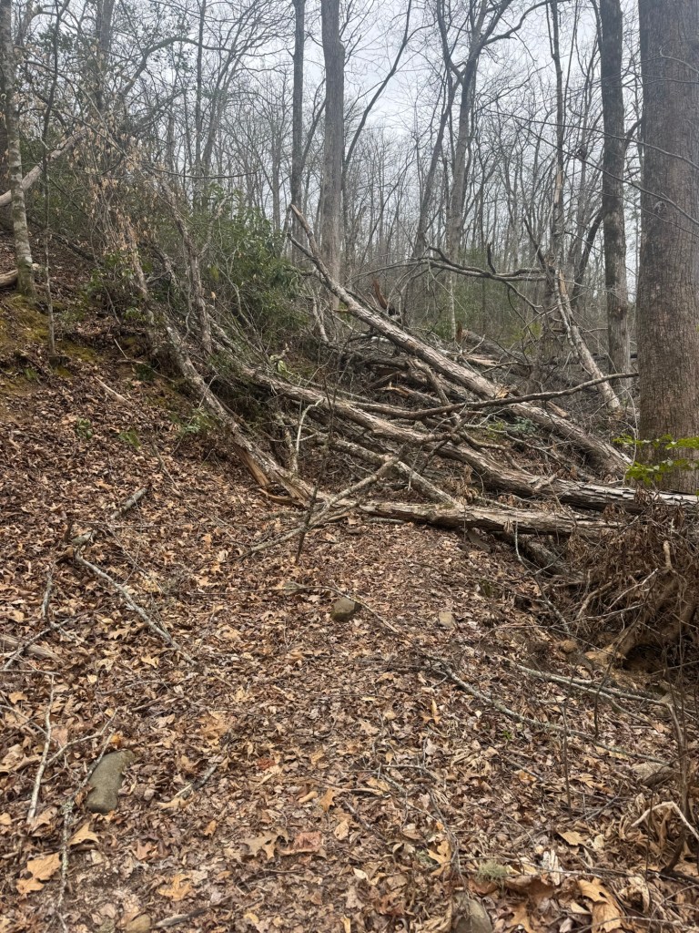
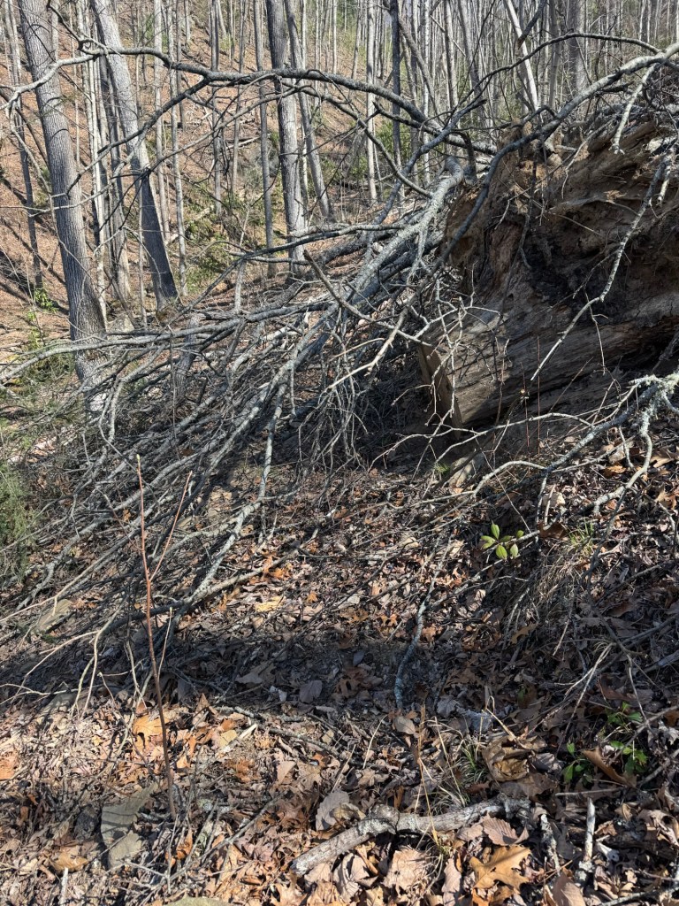
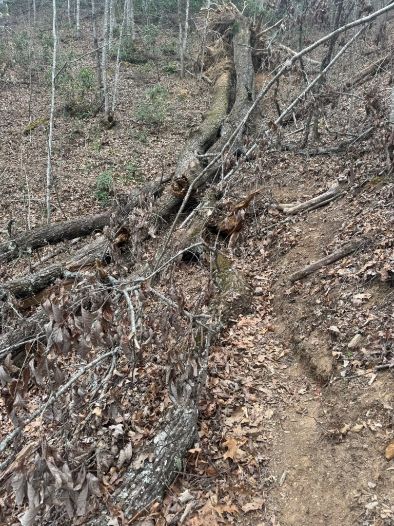
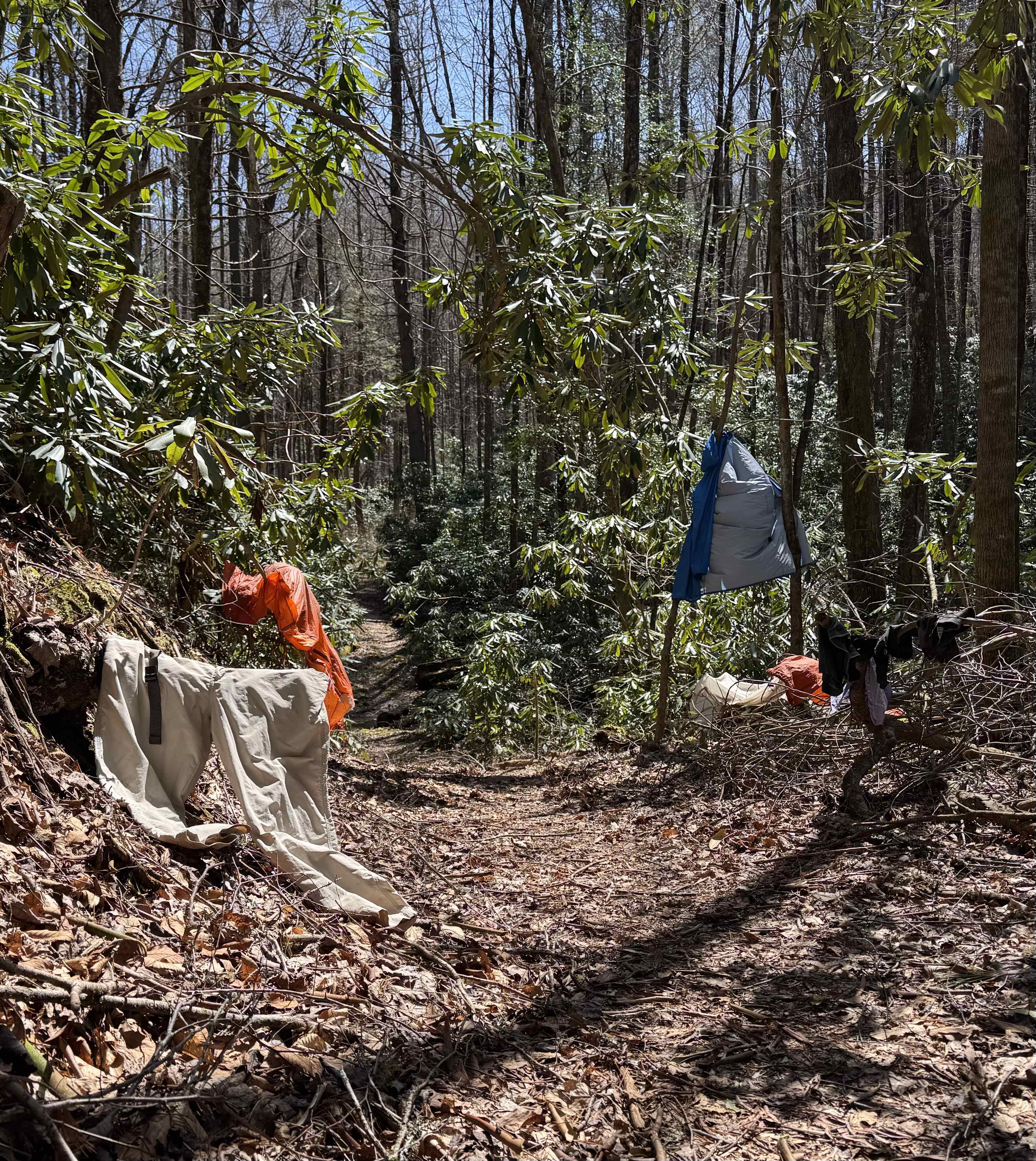
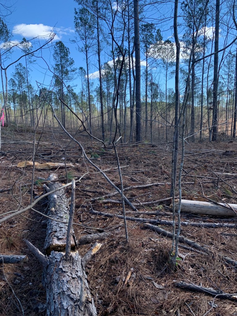
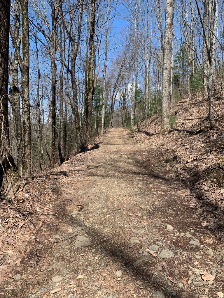
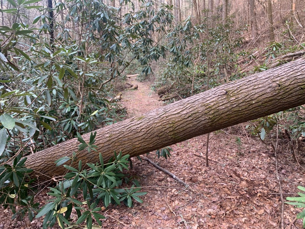
This section (and the next) are entirely in the park and while the trail was pretty good (better than south of here), there were a lot of blow-downs (trees fallen over the trail).
Blow-downs blocking the trail.
As in the first week I was lucky with the weather – no rain and lots of sunshine. This was a five day section but the same distance as my 6 day first section so a few more miles per day.
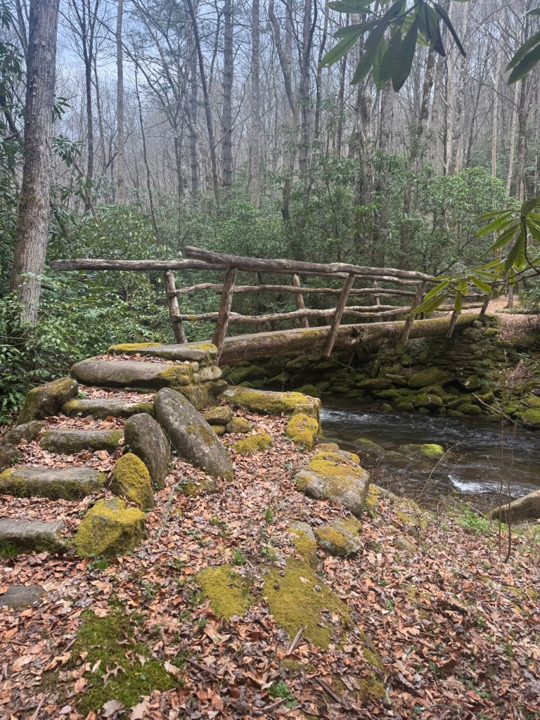
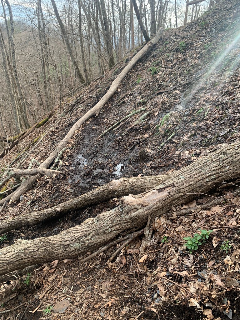
Being in the park this part of the trail seems to have more maintenance. There were a lot of river wades but also these cool tree-bridges.
Cool trail bridge in the park.
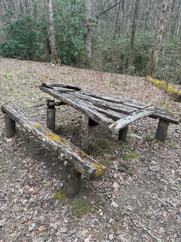
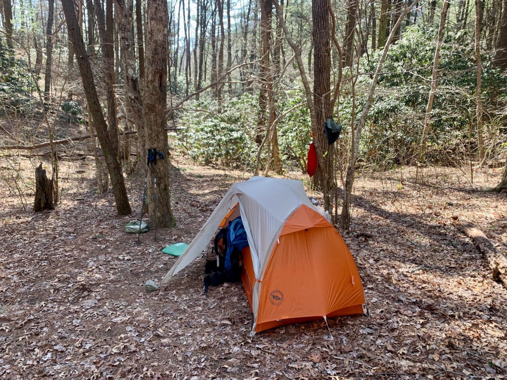
In the park you must camp in designated camp sites and some of them even have picnic benches!
A luxury on the trail – place to sit!
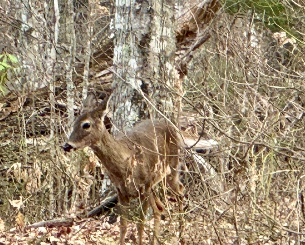
And I saw more wildlife in this section…. Several deer…
Trail friend
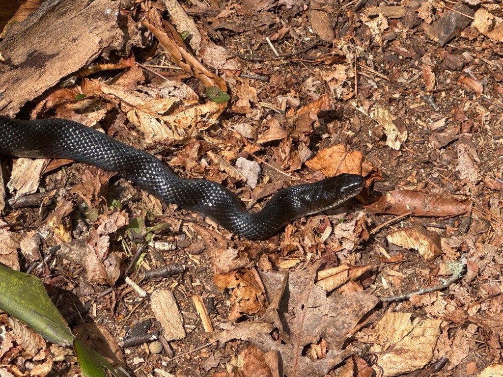
And this weird guy, who never moved while I walked past.
Another friend
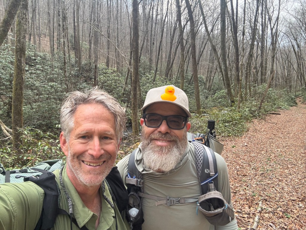
And, unlike the first week where I did not see anyone for 4 days, I saw several groups of section/day hikers and my first Benton MacKaye thru-hiker..
Copper, a southbound BMT thru-hiker.
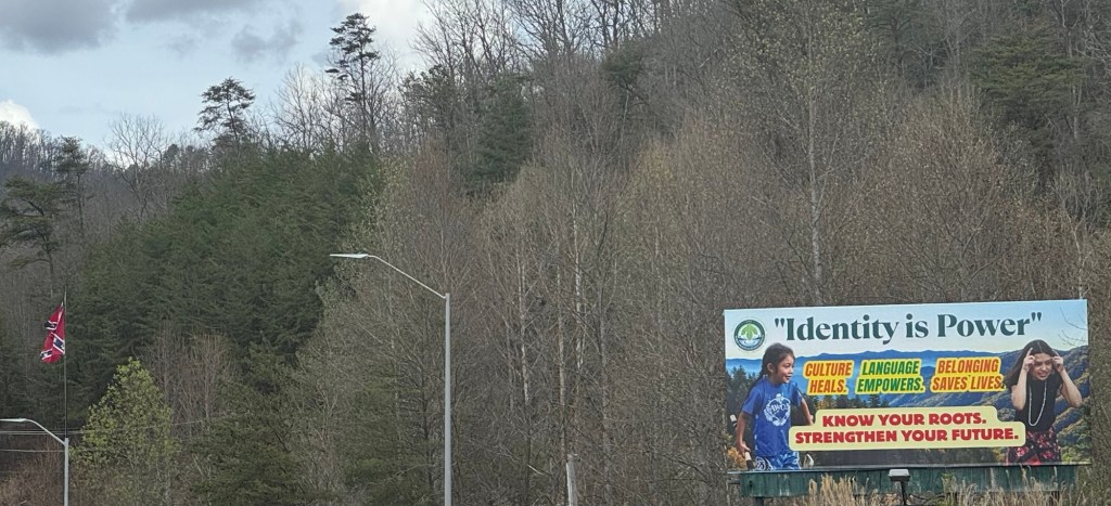
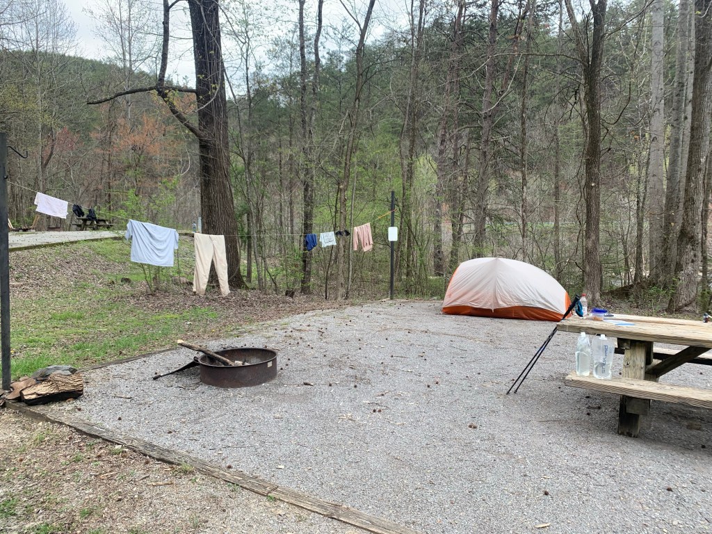
On the fifth day I hit US441 and hitched the 8 miles to Cherokee, NC to resupply and take a rest day. I got picked up by the first car that passed, which was nice.
Roadside in Cherokee, NC
I especially like the Cherokee tribal billboard on the same street as a giant Confederate flag. Ahhhh… the South!
I exited the BMT last spring after 127 miles, forced off the trail by weather and difficulty level of the trail. I came to the BMT expecting to do 15-18 mile days but have learned that this is not possible (for me). These eastern trails are very hard. The climbs and descents are very steep and switchbacks are rare.
Early on Day 1
To return this year I came up with a plan that averages a little over 11 miles and 3,000 ft per day in the first section (6 days) and about 12.5 miles per day after that.
I have completed the first section and am preparing to enter the Smoky Mountains National Park (SMNP) tomorrow morning. I am currently taking a rest day at the Fontana Lodge.
Me and the mayor of Fontana Village!
This first section was six days. During the first four days I did not see another person. On the fifth day I ran into a couple of day hikers and later a couple of Forest Service guys. All very friendly. The other hikers here at the lodge are all AT hikers. I may be the only BMT thru-hiker currently on the trail.
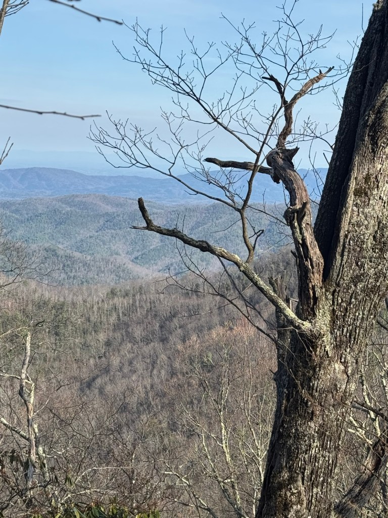
A pretty good viewView from my campsite on Day 4
I had great weather on the first week. No rain and lots of sunshine but not crazy hot. Low 40’s more nights and while it is supposed to rain later this afternoon (a week cold front is coming through), the forecast for the coming week shows no rain.
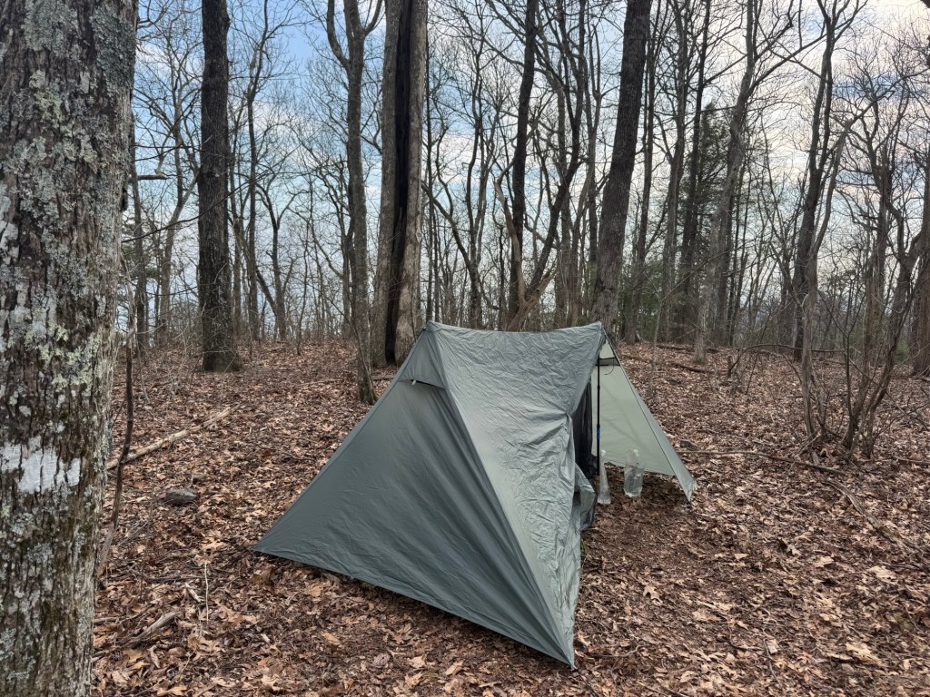
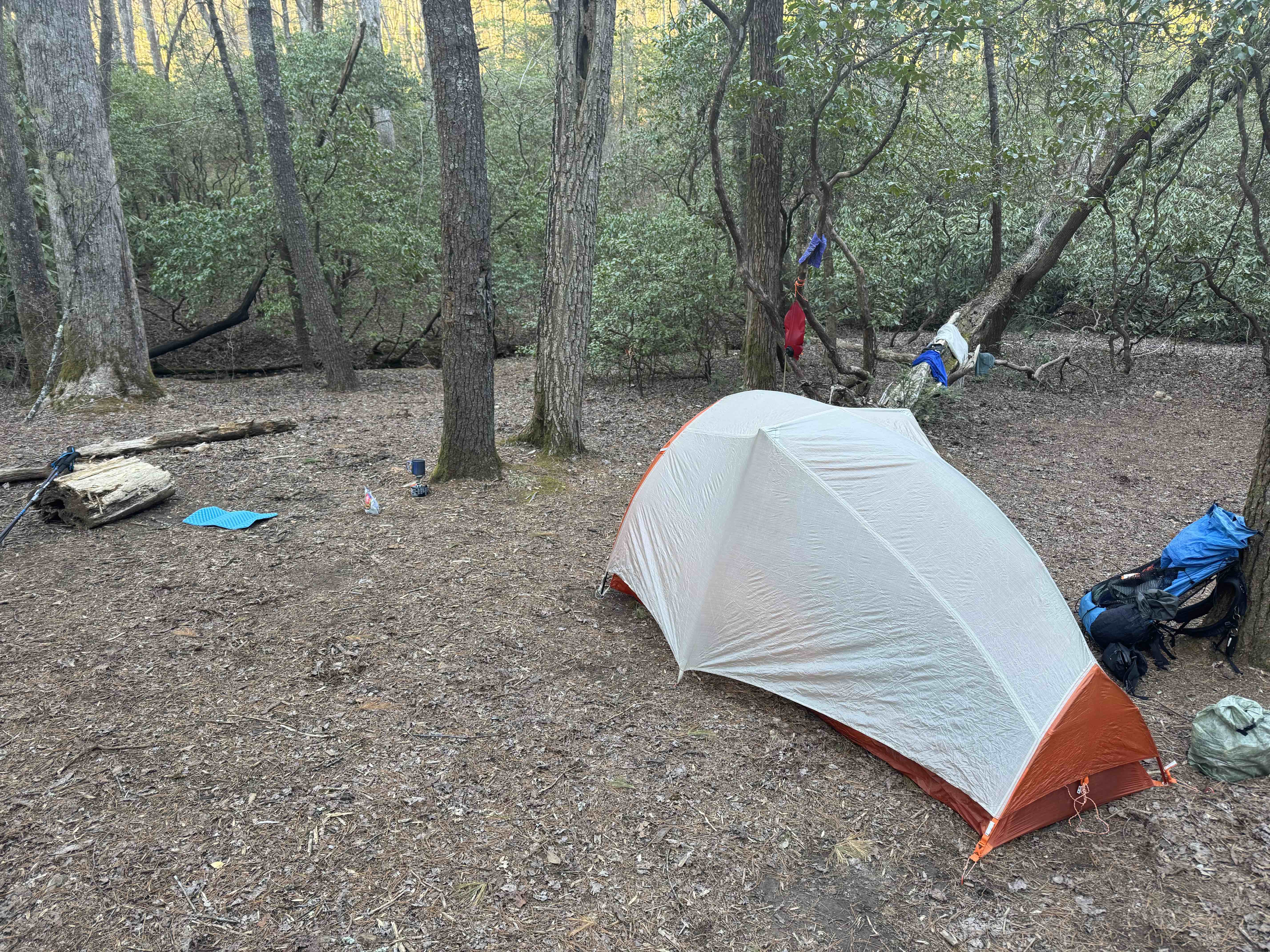
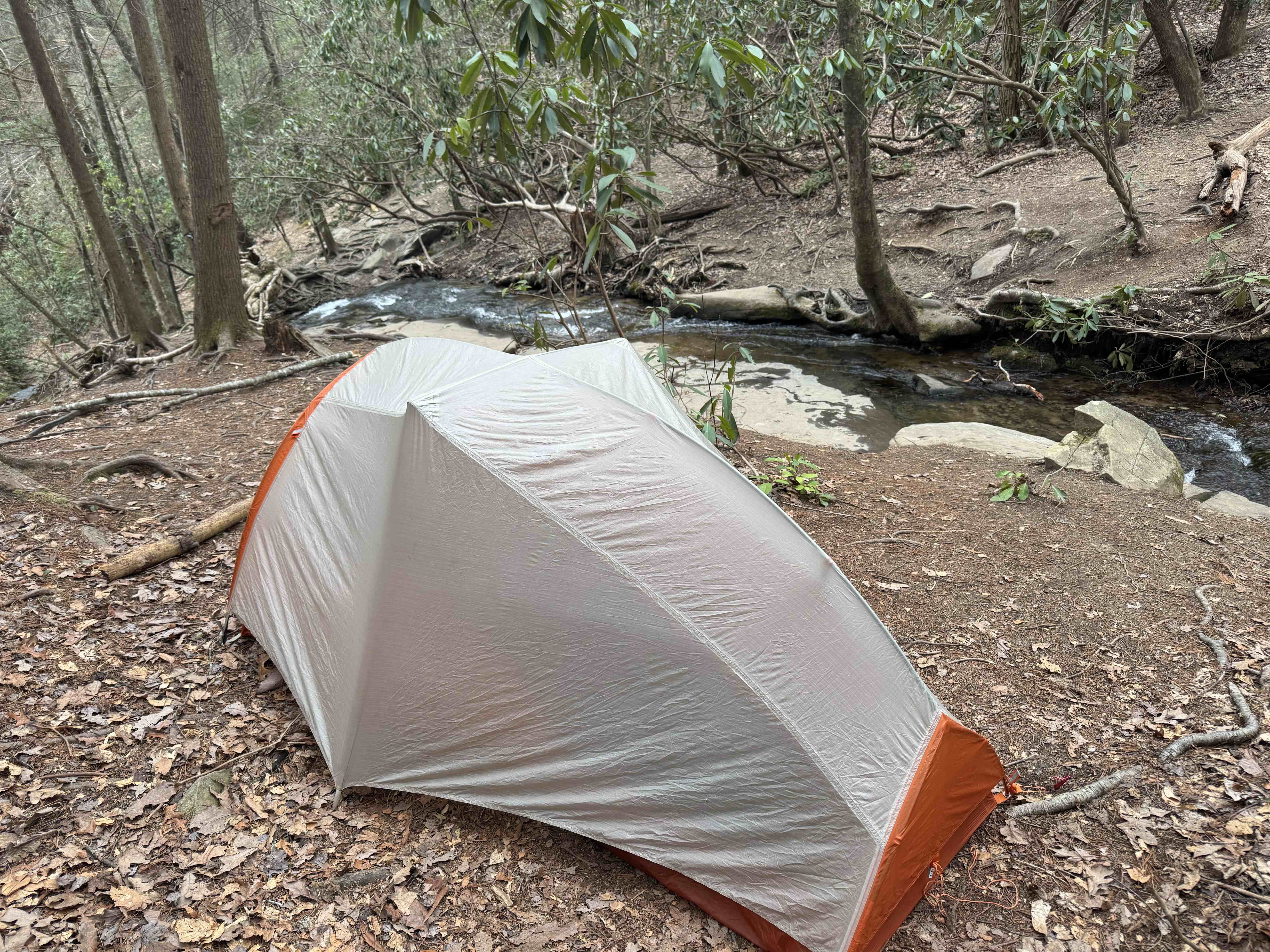
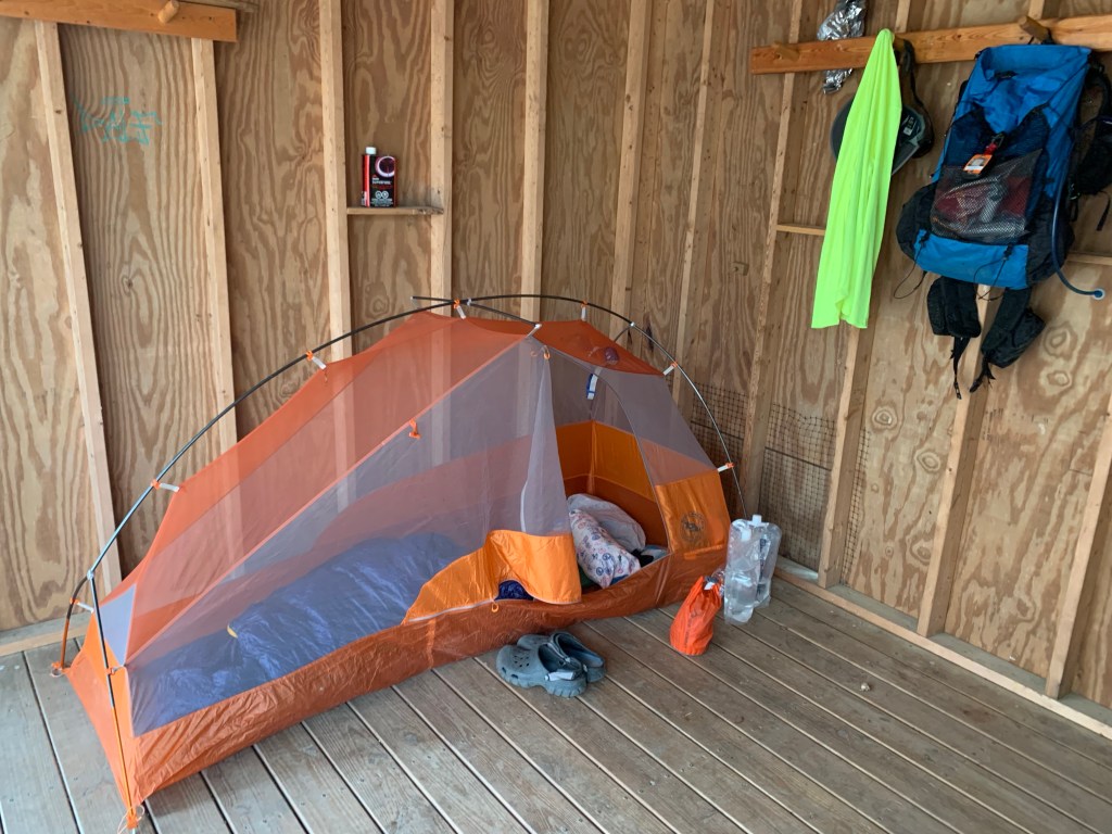
My new tent
I am hiking with a lot of new equipment (tent, pack, poles, water filter) and everything is working well.
So THAT’S where I am!
Looking forward to the Smoky Mountains but a little worried about the longer days. But hopefully I will do better than this guy…..
I exited the trail early. After two days of hiking from Ducktown, with the weather closing in, I decided to drop off the trail. There were two main reasons:
Weather
The next couple of days were supposed to be pretty bad – they are expecting 2.5 of rain the day I left and there are tornadoes and flooding just west of here.
Conditioning
I realized that I was probably not going to finish the trail in time to make my return flight. I was simply not in good enough shape to do what is probably the hardest part of the trail (miles 130-200) in a reasonable time. I hurt my knee training for the LST in January and have still not fully recovered.
My last day on the trail was one of the hardest days of hiking I’ve ever had. It took me eight hours+ to hike 12 miles. The trail was very rough with lots of rock scrambles and steep climbs. It completely wiped me out. To finish this trail I either have to be in much better shape or have a much easier plan, or both.
Spent most of the day travelling from Houston to the trail. Flew to Atlanta, caught the MARTA train to north Atlanta where I was picked up by my shuttle driver (“Bandit”). There were four other hikers in the van, all heading to the AT. I got dropped off at the trailhead around 3:00PM .
I hiked up to the official start of the BMT and then headed north. I saw several other hikers over the first few miles where the two trail cross but after leaving the AT I was pretty much by myself.
My first night was a pretty campsite by a stream and I had company! “Weedeater” showed up just before dark. He is doing a portion of the BMT.
Day 2, Mar 28, BMT 18.7
Today was disappointing. I started in the dark at 7 o’clock with my headlamp, but was able to turn it off within 30 minutes. Today was supposed to be a 4000 foot plus day and I am clearly not ready for a day like that yet. And the trail is VERY HARD.
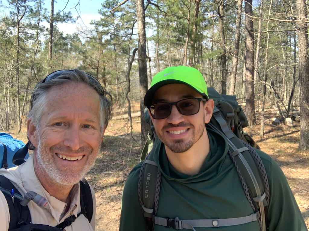
I met a lovely couple from Georgia that had done the Pinhoti trail and then headed south on the BMT. They had done 400 miles so far and we’re planning on doing the AT once they hit Springer Mountain.
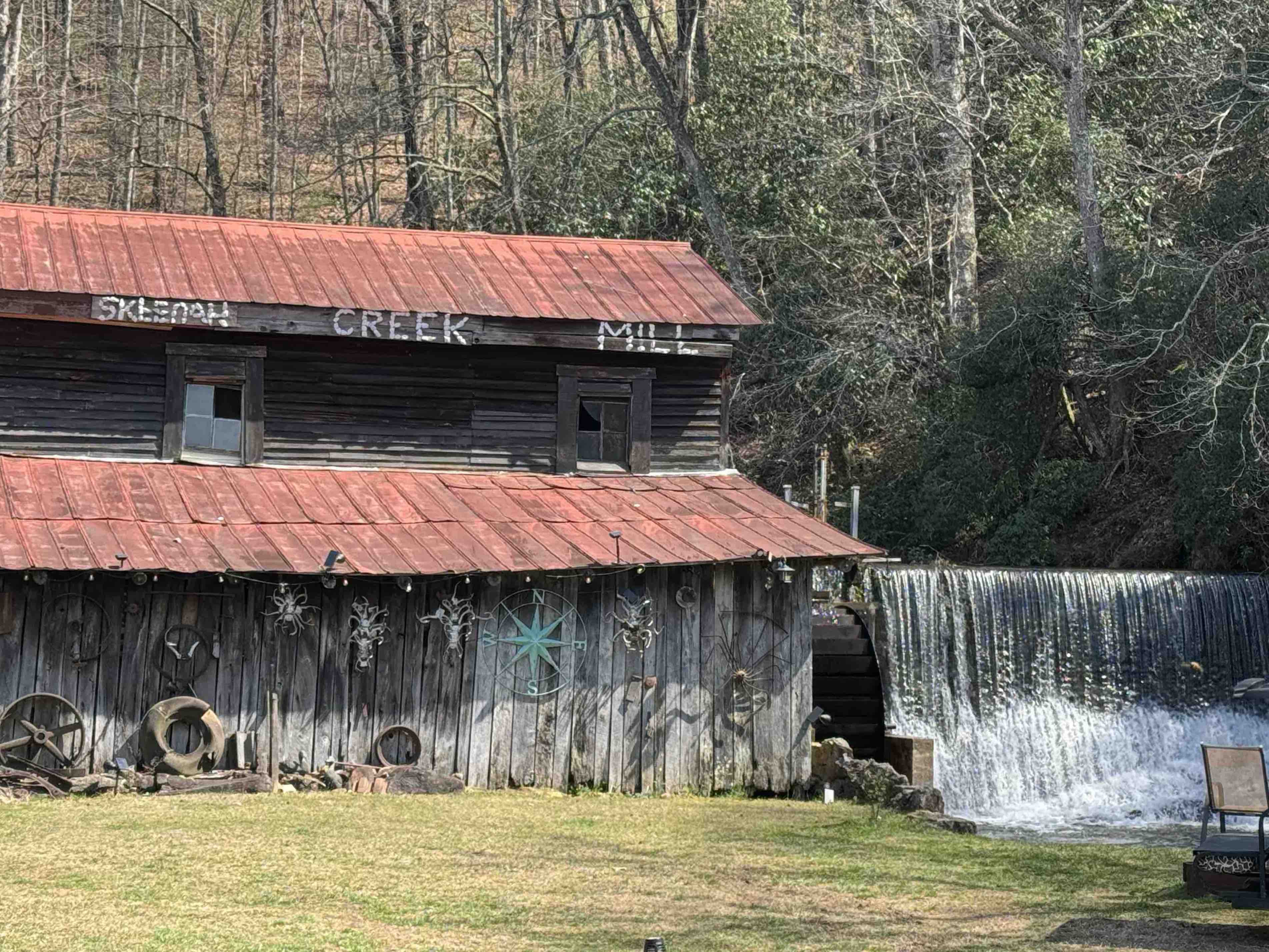
Stopped for lunch just after noon and about 9 miles. Was not feeling that great. I’m having to stop a lot on the climbs which is unusual for me. I decided to stop earlier than my plan – hiking a couple of miles off trail to the Skeenah Creek CG.
At the CG I learned l that the Georgia Death Race is happening tomorrow on the part of the trail I was currently on. I plan to catch the race shuttle from the CG tomorrow to skip the couple of miles that the race will be on.
Day 3, Mar 29, PT 42.0
Today was an interesting. It started when I caught the race shuttle from the campground to where the trail crosses Skeena Creek Road. I was hiking at 8 o’clock or just after. Another hard day with lots of climbing – 3600′ and 17 miles.
I had originally intended to stop short of iron Bridge Cafe, put up my tent and then walk to the cafe for dinner. But I saw no spots on the trail to camp, so I continued onto the café and had an early dinner about 3:30. It was wonderful. Left the café at 4 o’clock for a 4 mile road walk to get to the trail, then hiked up to the Fall Branch Falls and found a place to put at my tent.
Not sure this is a legal spot, but there are no signs saying no camping so… I’m here.
This was a pretty good day. The climbs were tough, but I think I may be getting acclimated to the trail. It’s a Saturday so there were quite a few day hikers on the trails, but I only saw a few thru-hikers going southbound. I signed my name to a trail journal and it looked like the last northbound hiker ahead of me is at least two days ahead of me.
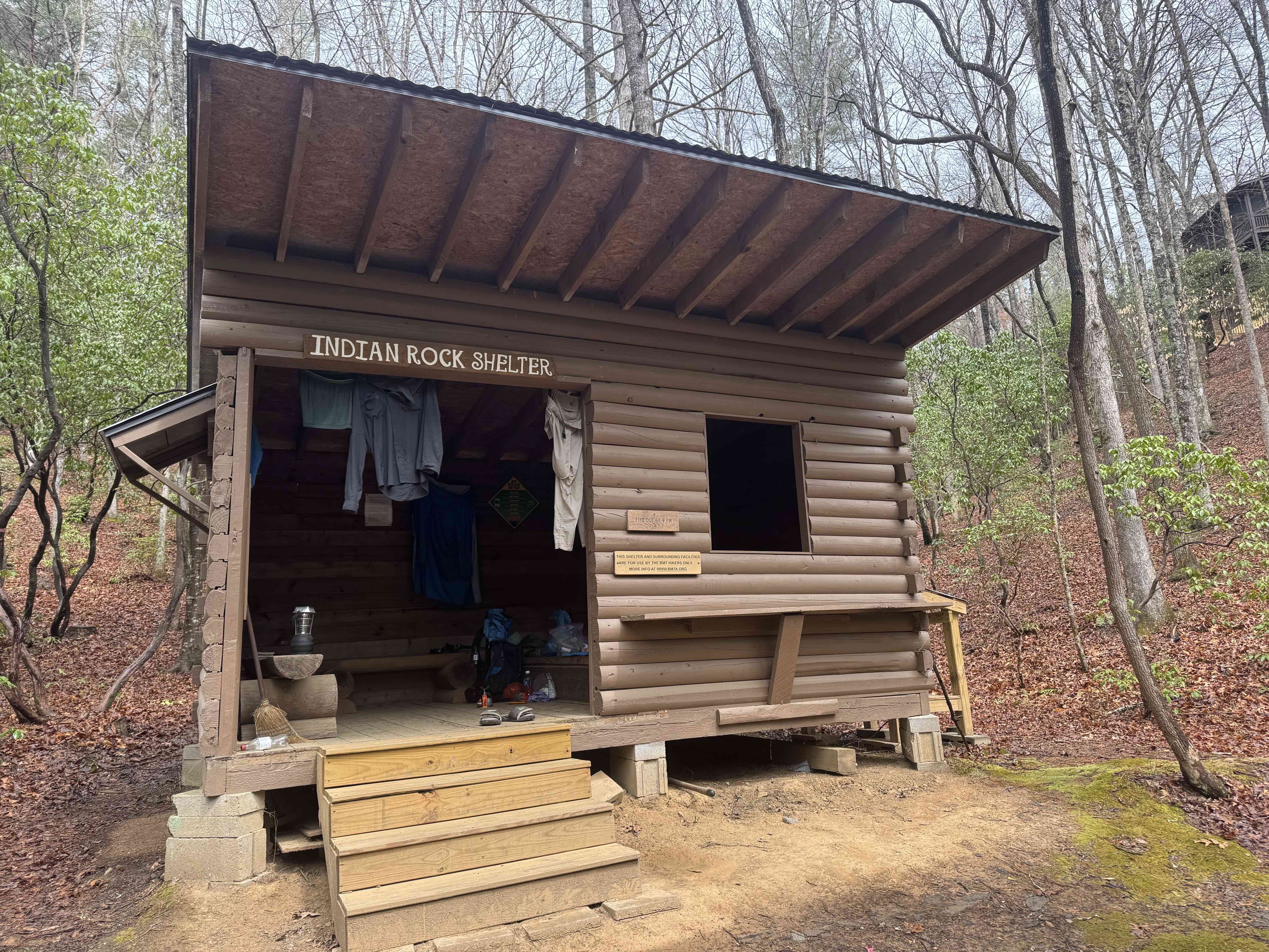
Day 4, Mar 30, BMT 52.4
Broke camp and started walking in a light rain at about 7:30 AM. It rained all morning, never really hard, but often moderate. I made it to Indian rock shelter at 12:45 and had a hot lunch.
The next decent campsite is 10 miles. So I’m spending the night here. Tomorrow is a 4000 foot day so I’m hoping the rest will help. I did not see a single other hiker today day.
Day 5, Mar 31, BMT 66.6
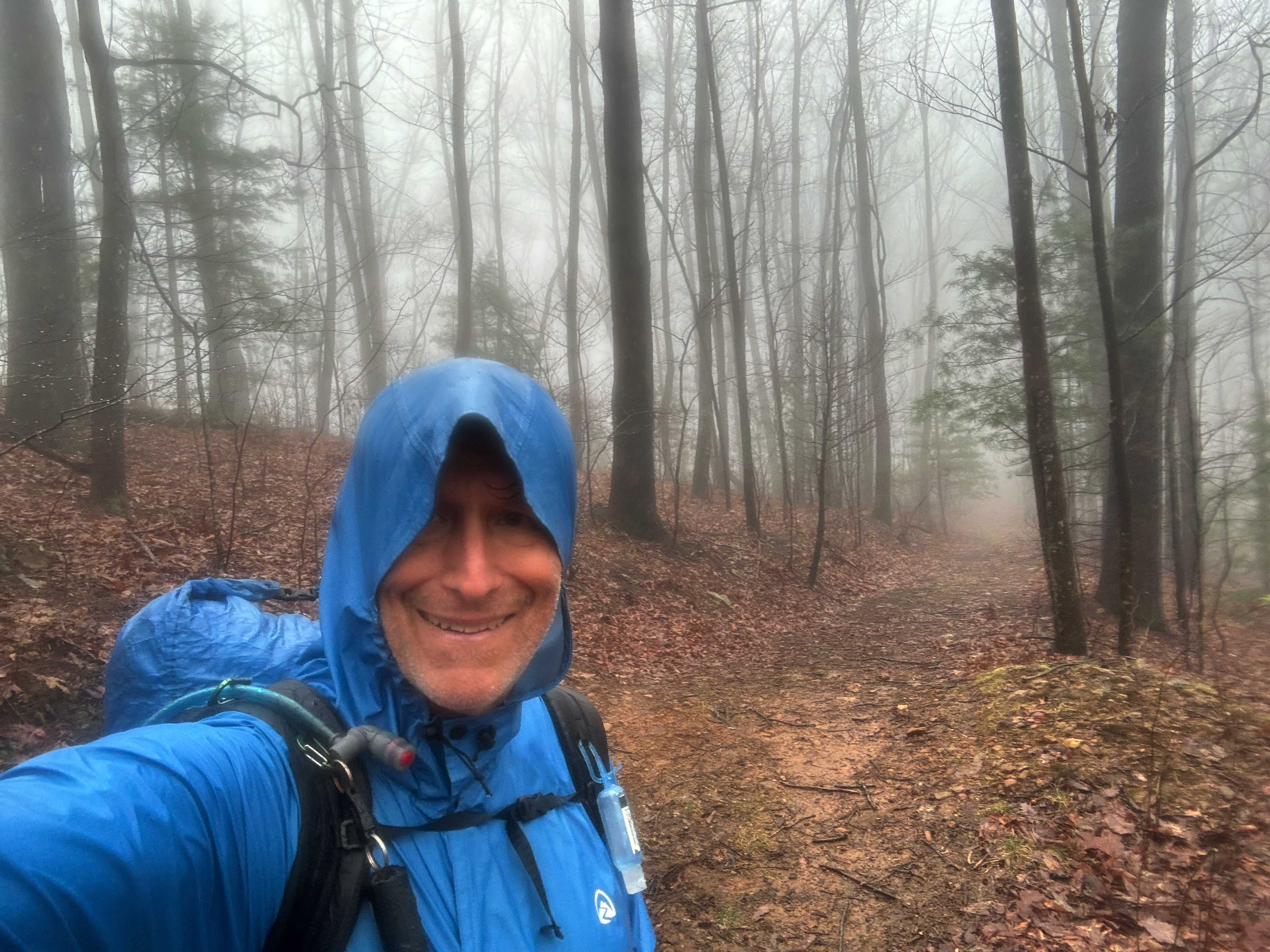
Tough day, only a little over 14 miles but well over 4000 feet of elevation gain. Tomorrow’s hike is over 16 miles but only 3000 feet of elevation game so probably easier.It was raining when I woke up and rained all morning sometimes heavy sometimes light, but it never stopped.
I stopped at noon during a brief lull in the rain on a high ridge to eat some crackers. Did not want to haul out my food bag because the rain could start up at any time. As I was sitting there it slowly got dark. Ominous. I started hiking and the thunderstorm hit. Very heavy rain, lightning and thunder.
It only lasted 15 minutes or so, but it was hard to hike. About 15 minutes after this, another hiker caught up with me. It was Weedeater! He had hopped off the trail yesterday, which is how I was able to pass him since he is much faster. It was nice seeing him again.
I got to Double Hog Pen gap campsite about 3:30 PM. It was not raining so I was able to set up the tent and filter some water.
I have a little bit of cell coverage and was able to get the Weather app to work. It shows a 50% chance of more rain in the next couple hours, but no rain tomorrow! Which is good, since I am rapidly running out of clothes to wear.
Day 6, Apr 1, BMT 82.9
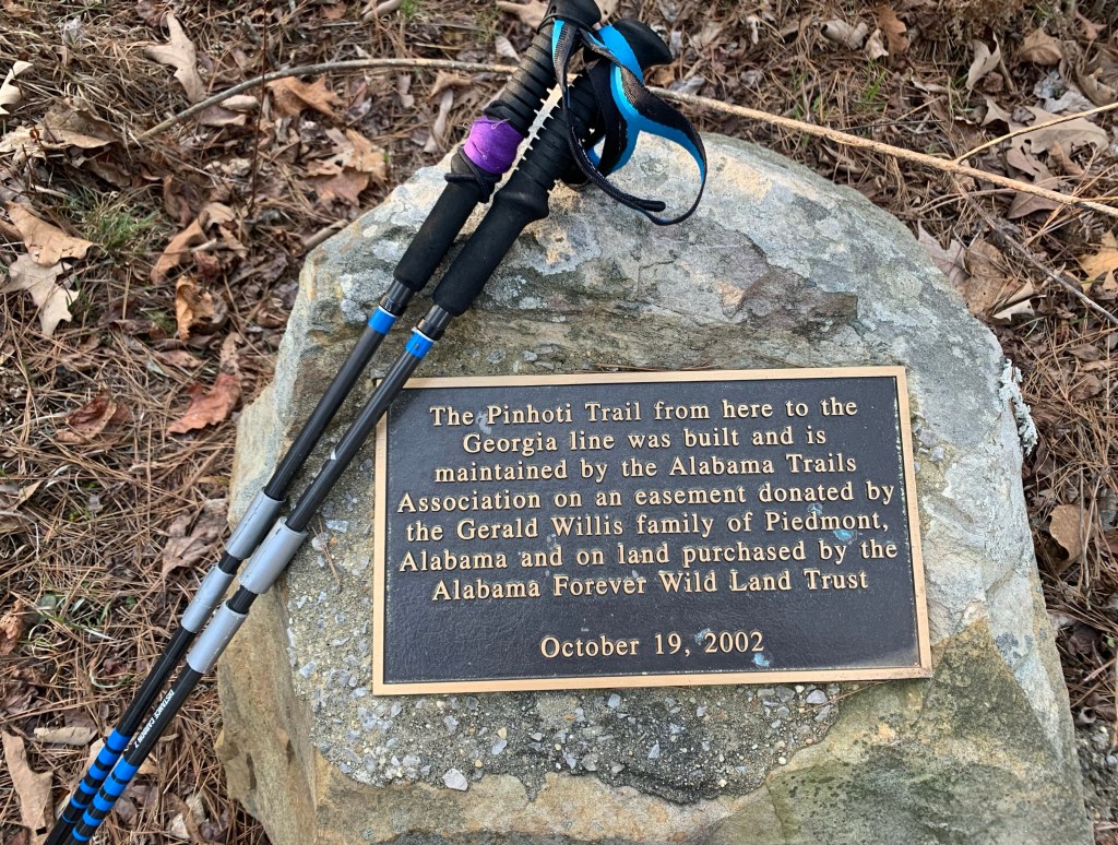
And I thought yesterday was hard! I’m totally wiped. Currently camped at double Spring gap. It was a cold morning, probably in the high 30s when I started hiking around 7:45 AM. But it warmed up nicely and turned into a lovely day, especially in comparison with yesterday’s shit show. I passed the spot where the Pinhoti Trail ends into the BMT.
I got to my campsite just after 5 PM. So it was a very long day (9 hours, a little over 16 miles). I did take a long lunch at least an hour to lay out the tent and my clothes to dry.
Day 7, Apr 2, BMT 93.8
Good news! I got a phone call last night around eight (yes I have limited cell coverage here) from a shuttle driver (Seth). So I have a ride into Ductown, Tenn when I get to the trailhead.
It’s much warmer today, in the mid 50s when I packed up. Started hiking about 7:30 AM and immediately started climbing up Big Frog mountain. It’s a 1000 foot climb over about a mile and took me about an hour.
The wind started picking up as I near the top and by the time I reach the top it was blowing hard. There is a high wind advisory for the area. But it could be worse, there are tornadoes west of us near St. Louis.
Got to Thunder Rock CG about 1:00. Met a day hiker who, of course, offered me a ride into town. Seth arrived about 1:20 and I was at the Mallard Hotel by about 1:30 PM. On the trip I asked Seth if he was available on Friday to take me back to the trail and he said yes.
I was able to resupply at the Dollar General and even got pizza delivered to the hotel so not a bad place for a zero day.
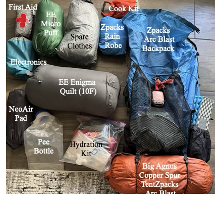
Base weight is everything you carry excluding food, water and fuel. Weight is VERY important. The difference between carrying a 25 lb pack versus a 45 lb pack up a 2,000 foot climb is huge and has gotten even more important as I have aged. And, since I have to fly to the start, I have a travel bag that holds my pack and poles and converts to a pack liner when I arrive.
My base weight is 15.0 lbs so with 10 lbs of food and 2L of water I will still be under 30 lbs when I start a section.
The “Big Three”
This is the pack, tent and sleeping bag and pad. My backpack is on it’s last legs – the material is starting to delaminate but I’m counting on the liner to give me one more big hike before I retire it.
Item
Type
Weight (Lbs)
Backpack
Arc Blast
1.8
Travel Bag/Liner
Zpaks
0.2
Sleep Pad
Therm-a-Rest NeoAir
0.8
Sleep Quilt
EE Enigma (10F)
1.5
Tent
BA Copper Spur UL 1
2.3
6.5
Cooking/Hydration/Toiletries/First Aid
My cook “kit” consists of a titanium mug, a canister stove and a spork. For water I use a Platypus filter, a couple of 2L collapsable bladders and a 4L “dirty” water bag (plus some hoses). Toiletries consists of a toothbrush, a poop kit (trowel, wet-wipes), reading glasses and sunscreen and… that’s about it.
Item
Type
Weight (Lbs)
Cook kit (minus fuel)
0.4
Hydration
Platypus
1.2
Toiletries
1.0
First aid kit
Including Epi-Pen
0.8
3.4
Clothing (not worn)
The weather looks to be mild so I can leave my long johns at home. I always bring emergency clothing (micropuff, rain gear) .
Item
Type
Weight (Lbs)
Hat/gloves
Zpacks beanie
0.4
Rain Gear
Zpacks Rain Robe/wind pants
1.2
Micropuff
EE Torrid Apex Jacket
1.0
Sleep wear
Shorts, t-shirt
0.7
Socks, buffs, etc
Toe socks
0.3
3.6
Electronics/Misc
I am taking two external 10,000 mAHr batteries. Each one should recharge my Iphone 15 twice and keep my headphones and keyboard charged.
The southern terminus of the BMT is about 2 hours north of Atlanta. My plan is to fly into Atlanta on March 27, take the MARTA red line 2o miles or so north to the Sandy Springs Station and then have a shuttle take me (~70 miles, 2 hours) to the Springer Mountain trailhead.
I arrive around 10:30 so am hoping I can get a least a few miles down the trail the first day.
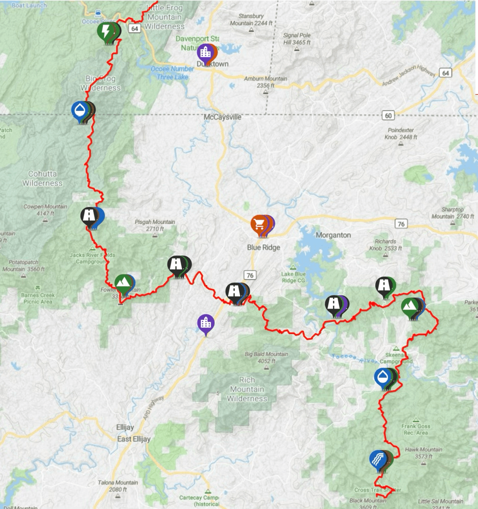
Section 1 (Springer Mountain to Thunder Rock CG, 94 Miles, 6 Days, 23,000 Ft):
The trail starts near Springer Mountain in the Chattahoochee-Oconee National Forest, about 80 miles north of Atlanta. The start of the trail is within a quarter of a mile of the start of the much more famous Appalachian Trail. In fact, the two trails cross several times and basically take a parallel path north.
BMT Section 1
I hope to get 6-8 trail miles on the day arrive so I can complete the remaining 90 miles in the following 6 days. Five of those will be in Georgia, and the last in Tennessee, finishing at Thunder Rock CG on the Ocoee River around noon on April 2. From there I will either hitch or try to find a shuttle for the ~7 miles of highway to Ducktown for my first zero day.
Day
Date
Miles
Climb (ft)
BMT Mile
0
27-Mar
8.0
750
8.0
1
28-Mar
15.0
4,100
23.0
2
29-Mar
14.5
3,300
37.5
3
30-Mar
14.9
2,300
52.4
4
31-Mar
14.2
4,050
66.6
5
01-Apr
16.3
3,250
82.9
6
02-Apr
10.9
1,600
93.8
7
03-Apr
ZERO
Ducktown
Resupply options are limited in Ducktown (just a Dollar General) but there is a real grocery store about 4 miles south in Mackaysville if I can figure out a way to get there.
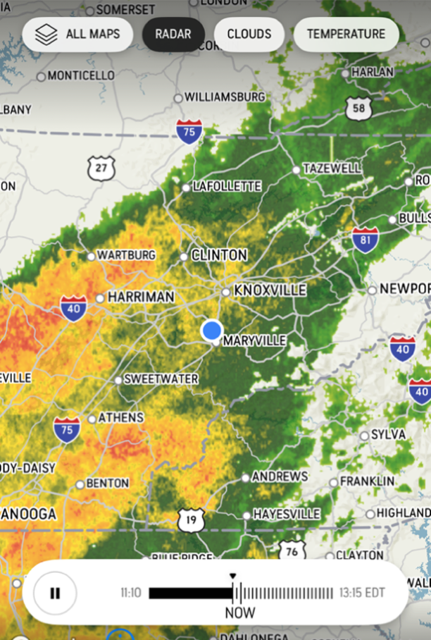
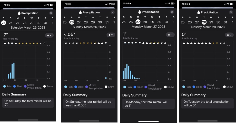
Cell coverage in the first section is pretty good. The figure below shows voice (green) and data (purple) for each day. Importantly it shows voice coverage at the end so I may be able to contact a shuttle.
Elevation profiles and cell coverage in Section 1
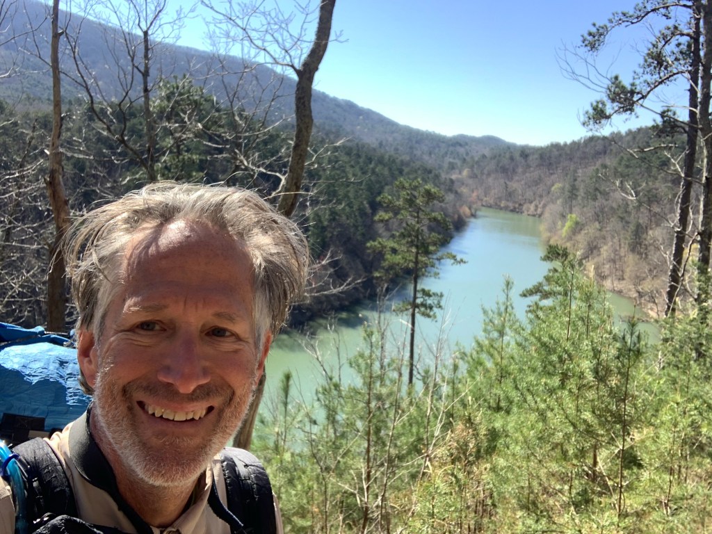
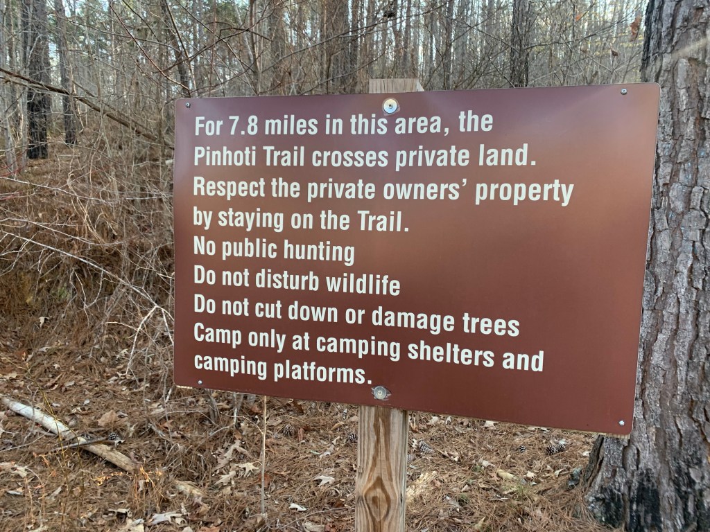
Section 2 (Thunder Rock CG to Fontana Dam, 95 Miles, 6 Days, 25,500 Ft):
The second section winds northeast along the Tennessee/North Carolina border for 95 miles, ending at Fontana Dam, a TVA dam on the Little Tennessee River. The first day on this section is longer than I would like but it allows me to get to a real campground (with running water!).
BMT Section 2
Day
Date
Miles
Climb (ft)
BMT Mile
8
04-Apr
17.5
3,400
111.3
9
05-Apr
15.8
3,560
127.1
10
06-Apr
15.3
4,150
142.4
11
07-Apr
15.0
3,700
157.4
12
08-Apr
16.0
4,600
173.4
13
09-Apr
16.6
3,700
191.5
14
10-Apr
ZERO
Hike Inn
There is a resort complex (lodge, campground, marina), Fontana Village Resort right on the trail as you approach the lake at the end of this section. However, the day I plan to arrive, Wednesday, April 9, the entire resort is booked for a private event (even the campground?). So this very convenient rest stop is not available. And, on top of that, the cell coverage is terrible here.
So….. my plan is stop at the Tapoco Lodge (about 10 miles from the Fontana Village) and arrange a shuttle pickup from The Hike Inn , a hiker-friendly hostel about 9 miles east of the dam.
Elevation profile and cell coverage in Section 2.
Section 3 (Fontana Dam to the End, 99 Miles, 7 Days, 20,250 Ft):
The last section is entirely in the Great Smoky Mountains National Park (GSMNP) where free camping is not available and campsites have to be reserved. I plan on reserving these from The Hike Inn and am hoping that the Giant Orange Turd’s attack on the national park service does not impact my plans.
BMT Section 3
Day
Date
Miles
Climb (ft)
BMT Mile
15
11-Apr
13.2
2,400
207.6
16
12-Apr
15.1
2,200
222.7
17
13-Apr
15.7
3,200
238.4
18
14-Apr
14.7
4,150
253.1
19
15-Apr
14.5
3,100
267.6
20
16-Apr
10.0
4,000
277.7
21
17-Apr
12.0
1,200
289.7
3.0
Hostel
Cell coverage (with T-Mobile) is very poor. I will not have cell coverage at any of my campsites and rarely during the day. But there is coverage near the end so will be able to contact Standing Bear Hostel to arrange a pickup if I don’t want to walk 3 road miles to their place.
Elevation profile and cell coverage in Section 3.
I plan on staying a night at the hostel before shuttling in to Knoxville for my return flight to Houston in April 20.
Here are my thoughts on the Pinhoti Trail, fresh from finishing the trail a few days ago
Trail Access, Both Ends
I got to the southern terminus of the PT to start my hike by flying into Birmingham and shuttling to Flagg Mountain, about 75 road miles southeast of Birmingham. I used the Pinhoti Outdoor Center shuttle service. Total price for shuttle and a fuel canister (230g) was $153. They explained that if they were picking up other hikers this would be less. Uber might be a possible option but I doubt if it would be much less.
The northern terminus of the PT is a trail junction with the Benton MacKaye Trail (BMT 72.1). A couple miles north on the BMT is the closest road access, the intersection of Foster Branch Road and FS 22 at Watson Gap. It might be possible to arrange a ride from here, maybe back to Dalton. The problem for me was I needed a major airport. I elected to continue up the BMT to Ducktown where I arranged a shuttle with A Walk in the Woods to the Knoxville airport, about 75 miles. This was very expensive, $350. Multiple hikers would make this less of course.
Compared to other trails I have done, the PT trail access was hard and expensive, especially if you don’t live or have friends in the area and are a solo hiker.
Overall Trail Quality
The trail quality was, especially in Alabama, and with a few exceptions, quite good. A nice mix of packed-earth woodland trail, rocky ridges and country and forest service roads. The exceptions:
PT 25.5: Leaving Holman’s Crossroads Rd you enter a bulldozed nightmare of a trail for a mile or two. There are blazes on the few remaining trees still standing but there is no trail, just a muddy, branch-strewn, ankle-twisting mess. I would definitely have stayed on the road if I had known how bad it was.
The “trail” near PT 25.5
PT 85: In the Cheaha Wilderness, once you get up on the big ridge, there are several sections were the trail deteriorates into an unmarked, very rough, rock scramble.
The “Stairway yto Heaven”
Road Walks
Short (less than 5 miles) road walks can be a nice change from the trail and a way to pick up some easy miles. However, there are two long road walks on the PT. I skipped both of them.
Dalton: Leaving Dalton (PT 285) there is a 25 mile road walk, some of it on very busy roads, to get back to the trail. This is over my limit for busy road walks so I used a taxi (Tony’s Taxi) to get around most of this. I tried Uber first but could not get a driver.
Cave Spring: Leaving Cave Spring (PT 190) there is a 20 mile road walk. I considered walking this since these roads are not too bad, some are busy but most are not. But, again, 20 miles is over my limit and I had an offer of a ride from a trail angel in town (Crispy) so I took it.
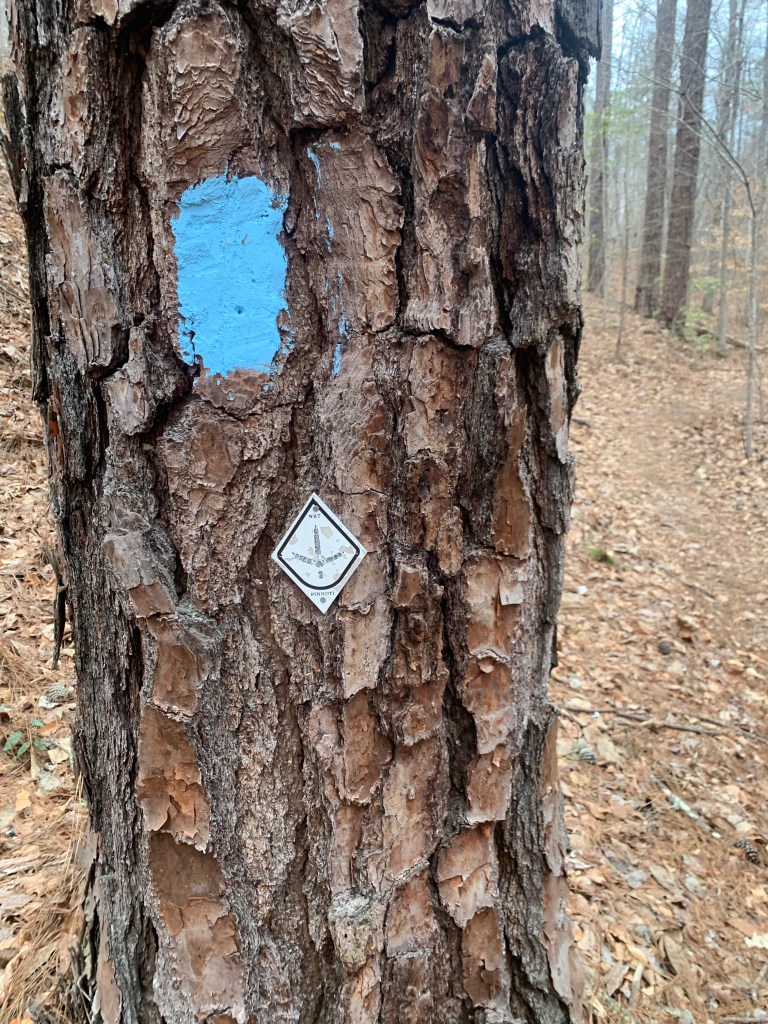
Blazes and Navigation Aids
With the exception of about 10 miles of the Cheaha Wilderness, the trail in Alabama is very well blazed. I seldom had to access FarOut (Guthook) to find the trail. This is not true in Georgia.
PT Blazes (in Alabama)
The baby-blue rectangular marks were the more common trail blaze in Alabama but there were also, less frequently , the metal diamond medallions.
Once you enter Georgia (PT 179), the blue blazes stop and the diamond medallions become random and infrequent. In Georgia, if you do not have some kind of navigation aid you will definitely lose the trail. There are several trail/road junctions where there are no blazes at all.
Also, at some point, the Great Eastern Trail, which uses a white rectangular blaze, is coincident with the PT and you will sometimes see these blazes.
Resupply, Support and Trail Towns
The trail is pretty good for resupply. Here was my resupply schedule:
PT 60 – Talladega: A nice couple run Next Step Hostel that is close to grocery stores/fast food and they will pick you up and return you to the trail. Very nice.
PT 113 – Heflin: Either a 3.5 mile side trail, a 2 mile road walk/hitch or calling city hall (Tammy) to get a ride make getting to Heflin pretty easy. The town is spread out but has all the necessary hiker needs.
PT 190- Cave Spring: The trail goes through town. The Creekside Inn Motel is closed but the Hern Inn is available and is a great hiker stop. Another great hiker town to meet all your hiker needs.
PT 285- Dalton: Thé trail goes through town. Dalton is big and spread out. Most of the hotels are near the freeway where you enter town. Grocery stores/restaurants are near the highway and the Academy (fuel canister) is 2-3 miles north.
Dogs and Other Wildlife
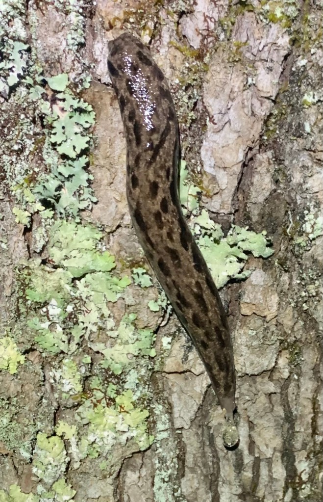
Over the course of my 3-1/2 weeks on the trail I saw 5 deer, a raccoon, a very colorful slug, a couple of lizards and many squirrels
… and dogs. For some reason there are people who believe that their dogs are not their responsibility. I had two run-ins with dogs that came out onto the road and approached me very aggressively. In the first instance, I crossed to the far side of the road but the two dogs followed, causing a car to stop. I finally had to use my pepper spray which was very effective. The second incident was a lone dog who I stopped with dog treats.
Blowdowns
For the most part the trail obstacles were typical and not difficult to navigate. There were a couple sections where the blowdowns were so frequent you could see four of five down the trail while climbing over one.
Views
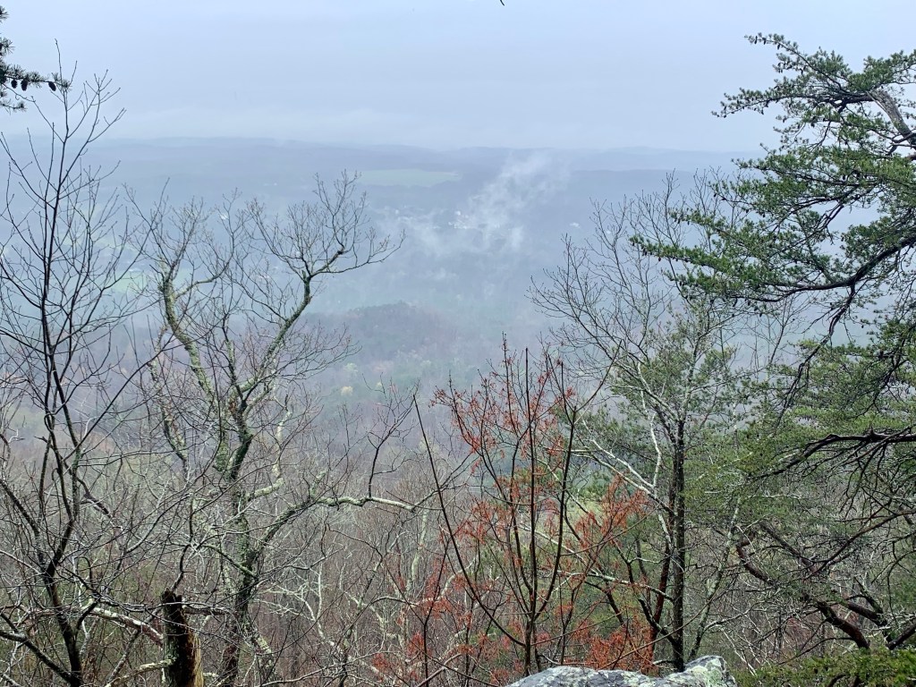
A lot of the trail is along ridges and often, especially in March before the trees have all gotten their leaves, there are some really nice views, which is always a nice reward after a hard climb.
Well, so much for plans. I had a Lyft scheduled to get past the ~20 mile road walk out of Dalton but, as I learned, when you schedule with Uber or Lyft, it really is not scheduled. They just release your request when your time nears and if no driver wants it…no deal. I ended up calling “Tony’s Taxi” and Tony was at my hotel in 10 minutes.
Tony got me to within a couple miles of the trailhead (the road was closed). The good news is that my timing is good – the rain stopped this morning just before I started hiking.
Walking to the trailhead … through the middle of Trumplandia.
This was my biggest climbing day of the hike, more than 4,000 feet and also a big distance day – about 19.5 miles. The clouds disappeared in the afternoon as it warmed up into the 70’s.
The sun comes out!
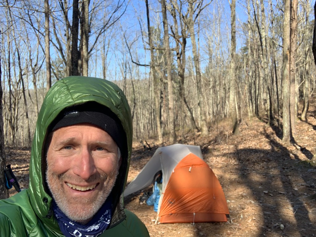
I had planned to stealth camp at a lookout along a major road but when I got there it was just too busy (and noisy) so I continued another 2.5 miles to a small, dry campsite on a ridge.
Camp on a ridge but no views.My dinner companion.
Day 25, Mar 26, PT 328.9
Had my warmest night so far, I don’t think it got below 55°. It’s kind of nice taking the tent down without having to have my gloves on. Today was a shorter day, as planned. A good thing too, my legs really felt that 4000 foot of climbing yesterday.
And it was practically crowded on the trail today. I met a couple of weekend hikers and 6 or 7 bikers. Well, it is a nice Sunday but I have no idea where the trailhead is where these guys are accessing the trail.
The trail was a little rough today, at one point I could see four different blow-downs ahead.
Typical trail obstacles on the PT.
I’m really happy about my campsite. It’s in a little valley between two hills so it’s very protected for the rainstorm that is supposed to come through tonight.
Of course that means no cell coverage and …. I’m only 4.7 miles from the end of the Pinhoti Trail!!!
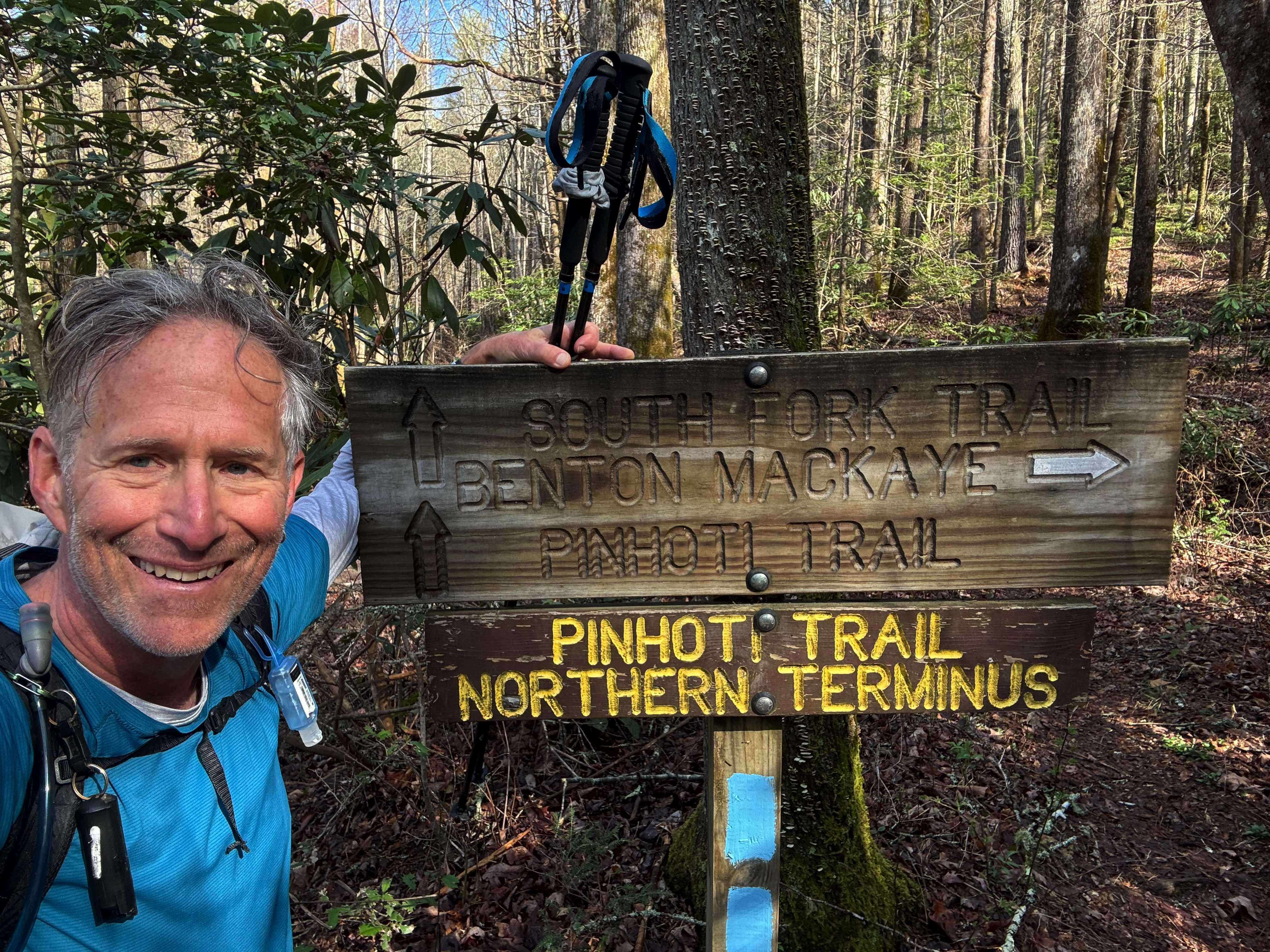
Day 26, Mar 27, PT 350.2….The End!! And 10 miles on the BMT.
It rained last night as forecast. Started around 10 PM and rained most of the night, but never hard and ot was over by 3 AM. And it is less than 5 miles to the end of the PT.
One more wade…
The northern end of the PT is not at a trailhead, but at a junction with the Benton MacKaye Trail (BMT) so it was a bit anticlimactic. There’s nothing there but a small sign. I celebrated with my last Snickers.
The end of the Pinhoti Trail.
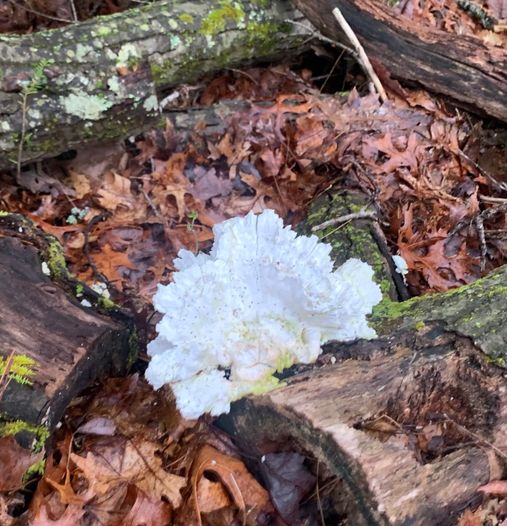
But… my hiking is not over. I have to go north 20 plus miles on the BMT to get to a place where I can hitch to Ducktown where my shuttle is scheduled.
A cool fungus thing.
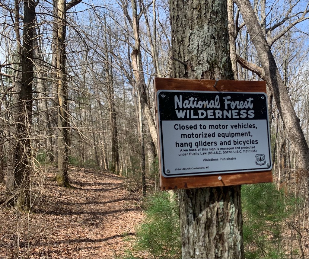
The BMT is very similar to the PT, lots of steep climbs and blow-downs.
Hang gliders? Really?
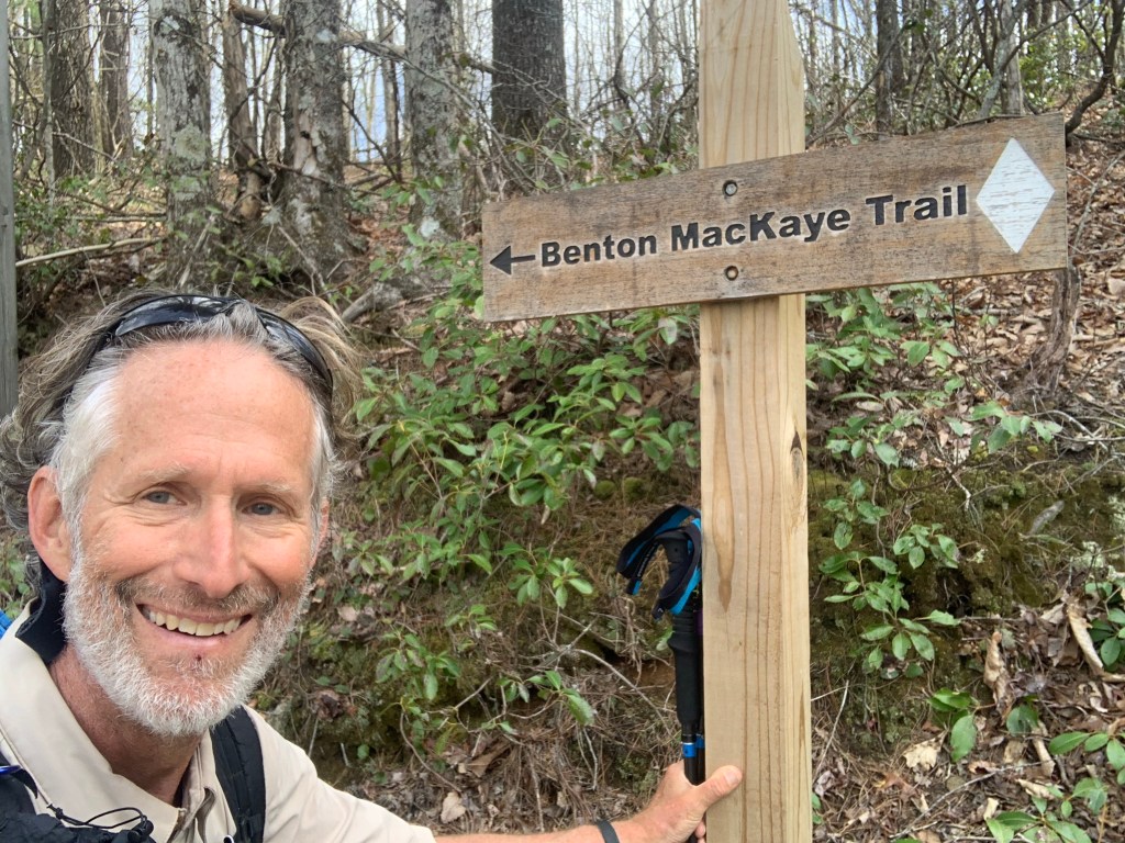
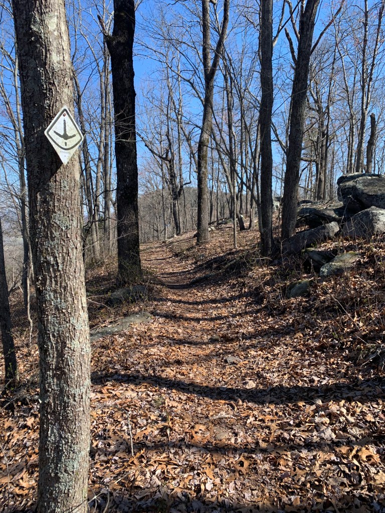
And… a new trail, a new blaze.
Hello BMT!
And my third state! I camped at Double Spring Gap (yes, there are two springs) which is on the state line with Tennessee, though there was no sign of any kind.
Double Spring Gap,
Day 27, Mar 28, BMT 93.9, Ducktown, Tenn.
The day started with a killer 1,000 foot plus climb up Big Frog Mountain over about 1.5 miles. Steep and hard, glad it was in the early morning, though I did not see any frogs, big or small.
Climbing Big Frog Mountain.
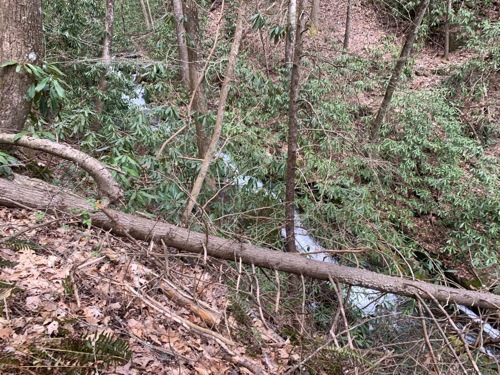
The trail wasn’t too bad on the way down, with the exception of the impenetrable jungle that the BMT became near a creek. I had to take off my pack and crawl under and over fallen trees, dragging my backpack behind me.
More fun on the BMT!
Overall I made pretty good time and got to the Thunder Rock CG, on the Ocoee River, at 12:30. Most of the spots are open (it is still early in the seasons, I think the CG only opened last week) but I bumped into one guy who asked if I had hiked very far in the direction I was coming from. “About 350 miles..” He just looked at me.
Thunder Rock. CG
As expected there is no cell coverage here. BUT there are showers and an outlet in the shower/bathroom where I am currently charging my extra battery. The shower felt wonderful, I even managed to find some soap! And I rinsed out my hiking clothes in the sink. Luxury!
Over the course of my two days and 20 odd miles on the BMT I saw nary a soul. And this completes my hiking. Of course, I still have to get the 7 miles or so to Ducktown, Tennessee where I have a shuttle scheduled.
In the afternoon I walked the campground and asked a woman who I had seen hiking earlier if she could give me a ride in the morning. Turns out she is with two other women (in the site next to hers) and I explained my situation (three times). Lisa, the last hiker who I talked to said she could give me a ride tomorrow morning! Yeah! No highway walking!
Days 28, Mar 29, Ducktown
It got cold again! It was in the low 30’s this morning. I am packed up and ready for my ride to town when I saw another thru-hiker walk through camp. “Sunshine” was in shorts, which was impressive. She had done the Florida Trail to the BMT and was continuing up the BMT to start the AT. She has over 2,000 miles to go.
Sunshine!
At 9:00 AM I walked down to Lisa’s camp and she was ready for the short drive to Ducktown. I am really glad I did not have to walk the highway this morning.
There is not a lot in Ducktown, a Hardee’s, a small breakfast cafe and a couple of dollar stores. And my motel, the Ocoee River Inn. Not fancy but hot water!
Classy hotel!
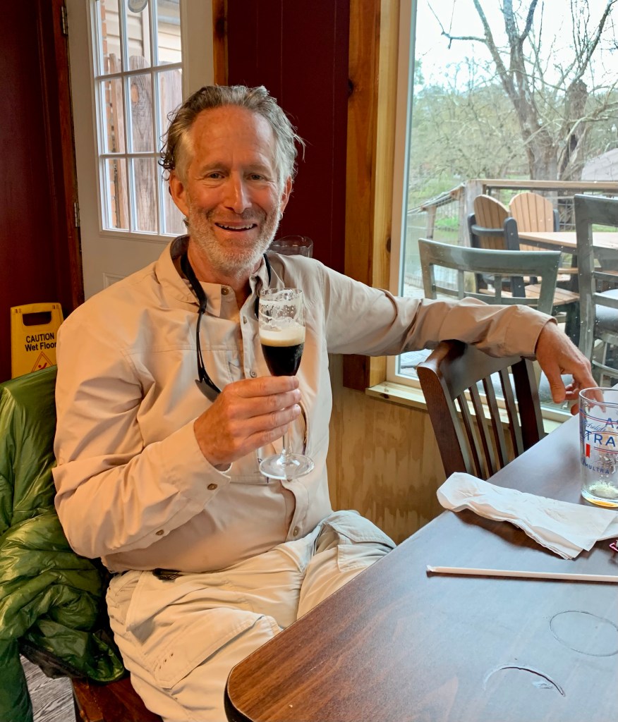
The following morning, Ben with “Walk in the Woods” showed up promptly at 10:00 AM for my shuttle to Knoxville to await my flight home to Houston. But not before having a celebratory martini!
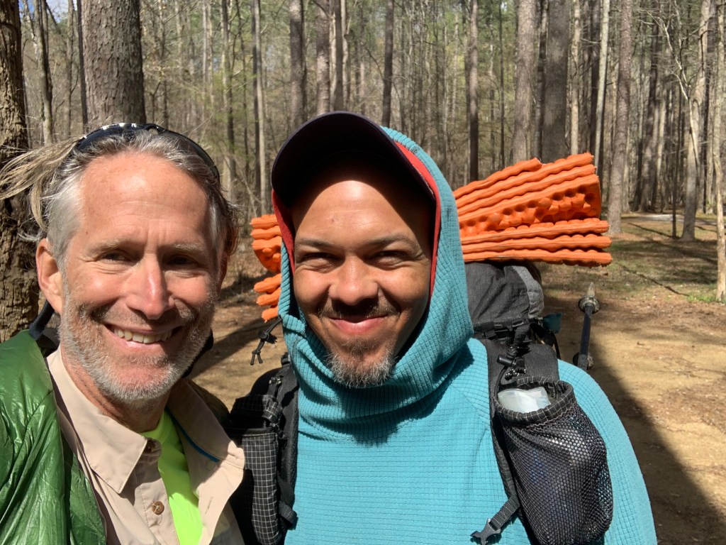
Crispy pick me up this morning at 7:30 and drove me to the Simms Mountain trail head, at PT 210.0. This knocked off about 20 miles of road walking. And I learned how Crispy got her trail name. Seems she hiked Joshua Tree a few summers ago without a sun-shirt and got very sunburned. Ergo.. Crispy.
Crispy and some other hiker guy.
The first 10 miles today were easy walking on an old railroad right-of-way. A little boring, but flat and fast. The morning started cold, below freezing, but it warmed up quickly and was perfect for hiking.
Flat, easy trail for the first 10 miles.
I felt so good today I decided to push past my intended campsite and ended up doing a 21+ mile day, my longest so far. I saw three more deer this morning. I’m assuming these are Whitetail deer because they have these huge white tails.
A little bit of a view.
I ended up stealth camping between a couple of radio towers, right next to what appears to be a cell phone tower at the top of a ridge. This is not an approved campsite, but there isn’t anything for some distance and it’s relatively flat here.
Camp.
It’s supposed to get down to 25° tonight so, once again, I have put my water filter inside my quilt to keep it from freezing.
Day 19, Mar 20, PT 253.1
Another big day, almost 22 miles, my longest so far. That means in the last two days I’ve done a total of 43 miles, which is a record for me. It was very very cold this morning, definitely the coldest start so far. My water tube froze. I’m guessing it was below 25 degrees last night. It was the first time I’ve hiked with my micro-puff. And I kept it on for several hours. It made for a slow start.
Brrrrr!
I had just started hiking when a couple of trucks showed up at the radio towers. Nobody said anything. It turned into a lovely hiking day as it warmed up by the end of the day I was down to one layer and had my short sleeves rolled up.
Much nicer temperature for hiking..
I saw no other hikers today or anyone for that matter. The trail was the usual mix of woodland trails, rocky ridges, and road walking. And I had to wade both East and West Armuchee creeks.
Nice woodland trail.Wading time, East Armuchee Creek
And there were some nice houses on the road walk (and no dogs!).
I wonder if they would mind if I camped here?
I ended up çamping at a flat spot just after wading East Armuchee Creek. Always nice to camp next to water.
Camping next to a nice stream.
Day 20, Mar 21, PT 272.1
Yet another big day, 19 miles. I’ve done 62 miles in three days, something I’ve never done before. In the last section I averaged 16.5 miles a day and so far in this section I am averaging over 20 miles.
Getting warmer!
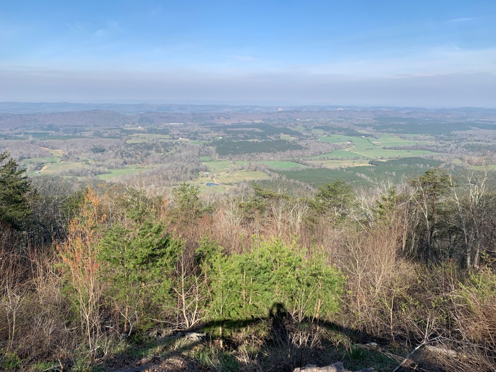
And the cold snap appears to be breaking, it was a balmy 37 degrees this morning. There was a little bit of road walking today, mostly on dirt Forest Service roads. These can be a nice break from a rocky trail. This was also a ~3,500’ ascent day that started with a 1,000’ climb to the top of John’s Mountain…
… with stunning views at the top.
It was another lovely day. The cold nights aren’t fun but they always seem to be followed by cool, sunny days that are just perfect for hiking.
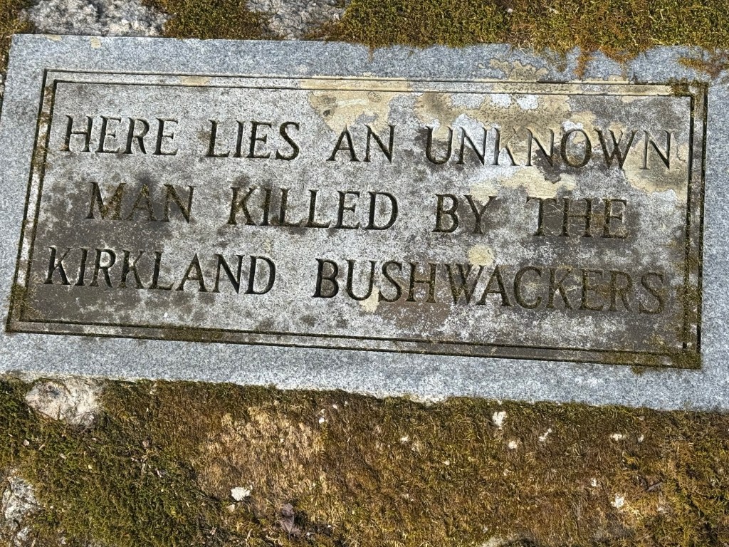
EVERYTHING in these parts is named after some losing rebel.Sights along the trail.
About 4 miles from my camp I met another through hiker, a SOBO (south bound hiker, I am a NOBO)., who started about a week ago. His trail name is Harpo, and he proceeded to demonstrate why.
Harpo and Impy
I camped at the last water source before Dalton, Swamp Creek. This leaves me roughly 13 miles to get to Dalton tomorrow. It looks like pushing it was a good idea because it is supposed to start raining tomorrow (a day earlier than the forecast I had in Cave Spring).
Camp and a hot dinner.
Day 21, Mar 22, PT 195.1 and Dalton!
It wasn’t supposed to rain until tomorrow! Started raining about 3 AM this morning (and rained fairly steadily until late afternoon). I loaded up my pack from inside the tent so the only thing left was the tent to take down in the rain, which was not fun.
The rain here is not like what I am used to in Houston, where a thunderstorm comes through and it rains for an hour or so. It seems to rain all day when it rains here. More like Seattle.
Why is that man smiling?
So it was a slog hiking in the rain all morning ending up on a pretty busy, two lane paved road for the last couple of miles into town.
The last miles into Dalton.
Too bad about the rain because I think there would’ve been some pretty decent views coming down off the ridge into Dalton.
A not-so-great view on a rainy day.
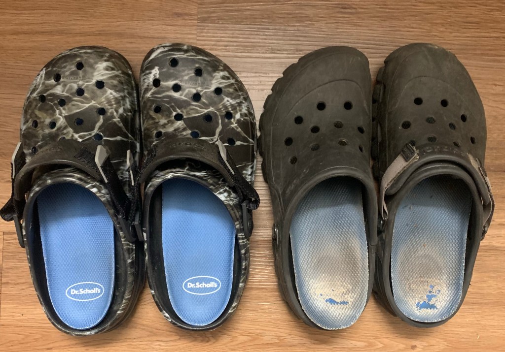
And I blew out my left croc again, my repair from a week or so ago finally failed. I have to decide whether to get new crocs here in Dalton or try to repair them again.
More Civil War history on the road into town. They know they lost right?
Days 22-23, Mar 23-24, PT 285.1, Dalton Zeroes
Dalton is the largest town on the PT, with about 140,000 people in the metro area. So it has all the services a hiker might need but, it is also a typical car-centric American city so everything is spaced out. I am staying at the Red Roof Inn, among about 10 other hotels next to I-75, where I entered town. Grocery stores are fortunately close but the Academy is a 6 mile round trip
New Crocs!!!Very exciting. Thank you Academy!
I’ve decided to do a double-zero here to get back on my schedule. And I can probably use the rest after pushing so hard in the last section. I have only one more section to finish up my hike. I plan to Uber the 25 mile road walk out of Dalton, the second of the two long road walks on the PT. Anything over 5 miles on paved, highway speed, no shoulder roads is too much for me.
And I am obsessing a bit about the weather – I don’t want to hike all day in the rain again. Looking ahead to the four days of hiking I have left, it looks like it will rain on two of them, but stopping around sunrise both days. We will see.
And I celebrated the 285 miles I have done in typical fashion…
Tammy, the Heflin City Director of Economic Development (and also the main hiker person in Heflin) was a little late picking me up, but that was okay since I had forgotten about daylight savings time. It was still dark at 6:30. She picked me up about 6:50 and I was at the trail head and hiking at 7 AM.
Back on the trail
This was definitely my best day of hiking so far. The trail was a nice, packed earth path and it was a beautiful day, perfect for hiking. The day started about 39°F and slowly warmed into the low 50s.
My lunch companion, Aaron.
I met my third hiker of the trail today, Aaron. I ran into him right before the campground where I had intended to have lunch and ended up joining him for lunch. He has done the PCT, the CDT, and while I am stopping at the end of the Pinhoti trail, he is continuing on the AT to Maine. And he is doing about 30 miles today. Out of my league.
Typical PT stream crossing.,
I had some nice views today, passing a High Rock Lake at one point.
Nice view.
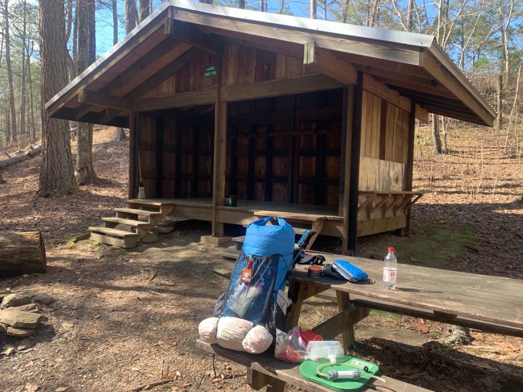
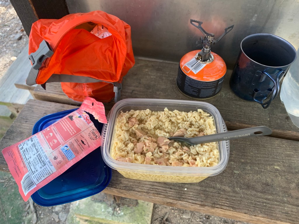
I felt so good today I decided to push on past my intended camp spot which was dry, one and a half miles to the Laurel Shelter, which has water. This is my longest day of the hike, 19 miles.
Home and dinner.
Day 13, Mar 14, PT 147.9
Around 5 o’clock yesterday evening Jared, a local hiker, showed up at the shelter so I had company for the night. He started before me this morning but I caught him around 11: 30 right before lunch at the Chocoloco Shelter.
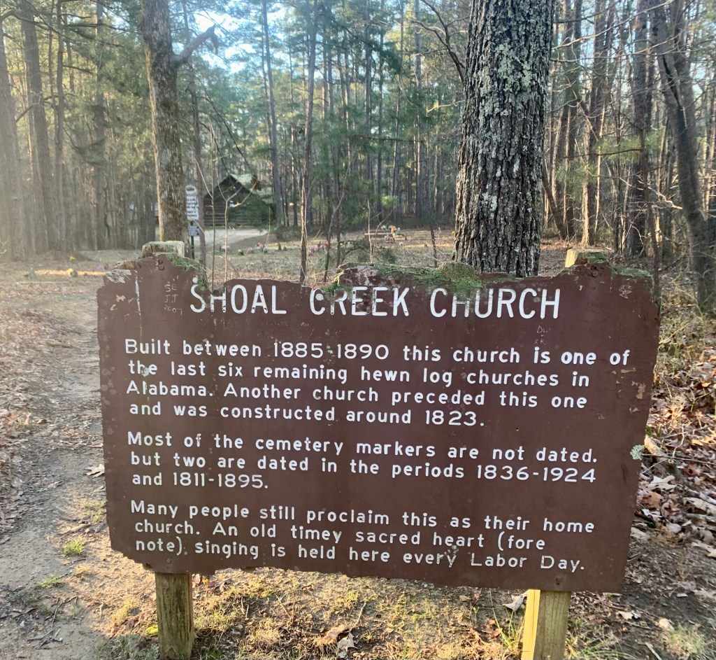
Shoal Creek Church
It was a cold morning, and of course they were lots of river crossings. Passed Shoal Creek Church early in the day, just off the trail, one of the oldest churches in Alabama.
A bridge! A rare sight on the PT.
I passed three day hikers who were section hiking together and met a lady coming south with two dogs. So a little more activity on the trail today.
A cold night ahead!
I camped at Dugger Gap, which as the name implies is a wind tunnel and it was a cold, windy night. Someone (I later found out it was Jared) walked through my camp about 6:30 but had passed before I could pop out.
Day 14, Mar 15, PT 165.2
Cold, windy night but I was cozy in my tent and 10 degree quilt! And it turned into a beautiful hiking day; clear, sunny and temps in the mid-50’s
What looks like a lake is actually the South Fork of Terrapin Creek.Another pretty waterfall (and creek crossing!)
And more signs…
The day was so nice and I felt so good I pushed passed my intended (dry) campsite to another (dry) campsite.
Another day, another camp site.no water here.
Day 15, Mar 16, PT 180.2
Very exciting day. Today is a three picnic bench day! I stopped at shelters (which always have a picnic bench) for my first break, lunch and my camp. Sweet!
Trail sign.
And I caught up with Jared! Seems we’ve been passing each other without knowing it. He passed up my campsite last night when he saw my tent shivering in the wind. Jared is a hammock camper so was looking for something a bit less exposed.
Jared and some other guy.
We hiked near each other all day but this will be it for Jared – he is stopping at the Georgia state line – he has a job he as to get back to.
Another ridge view.
Another Pinhoti Trail first…. A ladder!
Hmmm… so that’s the trail?ViewNo idea….a hiker who had a bad day?
And a big milestone, I left Alabama and entered Georgia.
Alabama/Georgia state line.
This was a relatively short day (15 miles) because the shelter where I stopped is the last good place to camp before town and it is supposed to rain tonight and tomorrow. Shelters are always preferred on rain days!
Rain shelter for the night.
Day 16, Mar 17, PT 190.2, Cave Spring
It did indeed rain last night, starting about 3:00 AM. The shelters keep you dry but the tin roof tends to amplify the rain noise, making it sound worse that it is.
Wildlife!
I saw more wildlife today, two deer, moving way too fast to get a picture and this guy, who posed for me. Over the past two week I have seen surprisingly little, a couple of wild turkeys and some squirrels. And dogs, of course.
The trail is a little water-logged this morning.
The trail was mostly good but there were some very wet stretches. Fortunately, while it was very wet, it was not cold – temps were in the 50’s.
Maybe, but not in this weather!
And, in case I was wondering where i was…
Helpful trail directions.
After about 3 hours, I hit the road around 10:30. Oh, yeah, I’m in a different time zone, so the sun is coming up at 7:45 instead of 6:45.
Three mile road walk into Cave Spring. Detection devices?
Day 17, Mar 18, PT 190.2, Cave Spring Zero
My home for the next two night.
There was no answer when I knocked at the Hearn Inn so I called the number on the sign and a nice lady showed up in 10 minutes to let me in and show me around. I am the only guest and this is a great hiker stop. The inn has a washer/dryer, a full kitchen and is close to the town center.
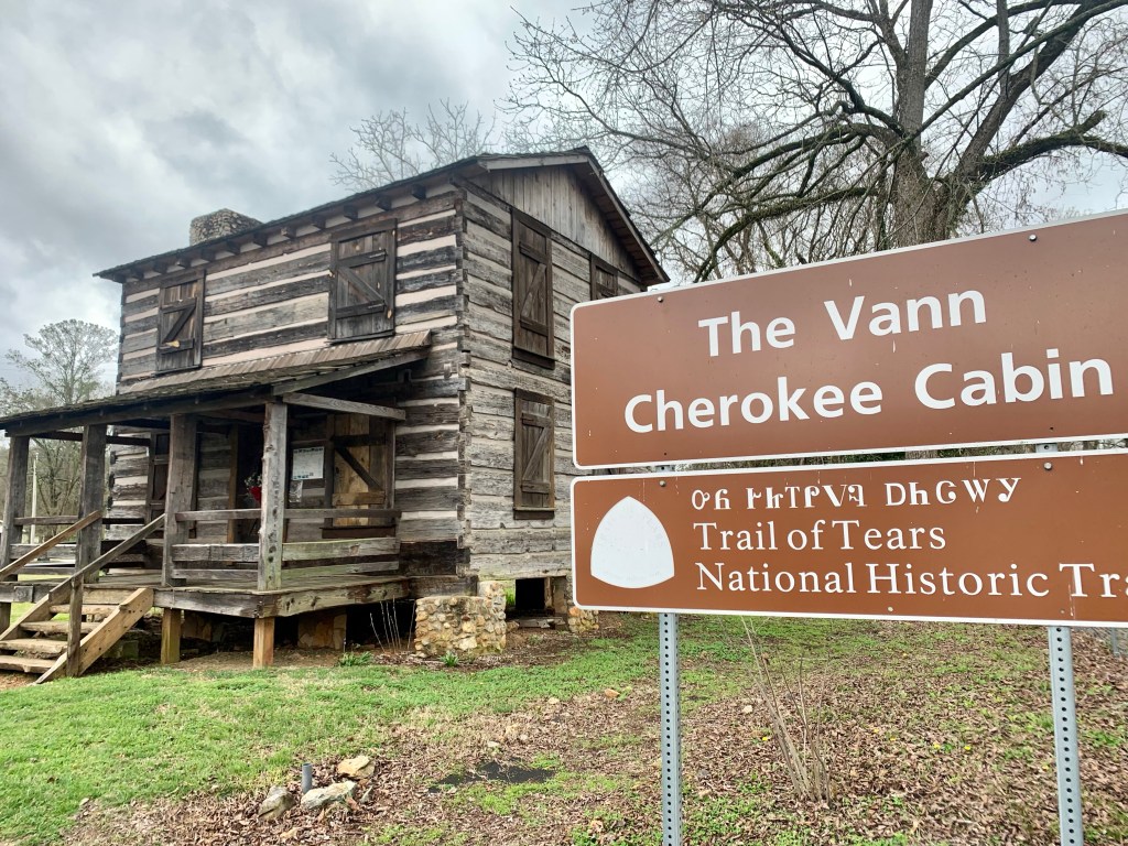
Cave Spring is o the Trail of Tears. A horrific chapter in American history.
Looking forward to a day of rest and planning the next section. Things are getting cold again!