
Getting to the Trail
The southern terminus of the PT is about 60 miles southeast of Birmingham in the Weogufka State Forest. I plan to fly into Birmingham the morning of March 2 and get a shuttle from the fine folks at the Pinhoti Outdoor Center directly to the trail. I want to get the first 10 miles or so of trail done that afternoon.
Section 1 (Flagg Mt to Heflin, 6.5 Days, 113 Miles, 16,200 Feet)
The trail starts in a state forest near Flagg Mountain and wanders northeast passing over Hernandez Peak in the Talladega Mountains, the high point of the Alabama portion of the PT at 2,334′. There is a four mile stretch of paved road on the first afternoon and another seven miles on the second day but it is all trail or dirt roads after that to Heflin.

After the road walk the trail enters the Talladega National Forest (about PT 30) where it will stay for the next 120 miles or so.
In this section all of the days are under 3,000 feet and my longest planned day is a 19 miler to get into Heflin on Day 7. Water is mostly good but there is a potentially 20 mile dry stretch after Shelton Creek (PT 27.1). I plan to take a zero day in Heflin and take stock after my first 100 miles on the trail.
Section 2 (Heflin to Cave Spring, 5 Days, 81 Miles, 11,700 feet):
This will be a shorter section (and my first 20 miler) to get to Cave Spring. There are no paved road walks on this section except for the last couple of miles into Cave Spring (the trail goes through town). My plan is to stay one night here (no zero) and resupply for the next section.

Section 3 (Cave Spring to Dalton, 6.5 Days, 105 Miles, 11,200 Ft):
Heading north out of Cave Spring there is a long (~15 mile) stretch of paved roads before the trail returns to the woods.
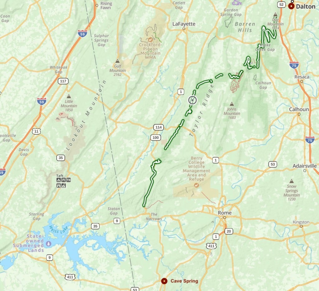
Leaving the paved road s the trail enters a narrow wooded strip (Taylor Ridge) neading northeast. The trail enters Dalton from the west and continues east through town. Dalton is the biggest trail town on my hike and I hope to be able to get a new fuel canister here.
Section 4 (Dalton to Ducktown, 5 Days, 87 Miles, 13,500 Feet):
Leaving Dalton is the longest paved road stretch of the trail, around 25 miles working mostly east to get back to woodlands. I will probably hitch/uber at least part of this. This section ends the Pinhoti Trail where it intersects with the Benton Mackaye Trail at about BMT 72 just south of the Cohutta Wilderness.

I will have to get a ride from Thunder Rock Campground to Ducktown (about 8 miles east). This is where I plan to finish my hike in my updated plan.

My hero….I am exausted just reading the about the trail. Good hiking and I will follow your progress.
LikeLike