Lone Star Trail, Day 3-4

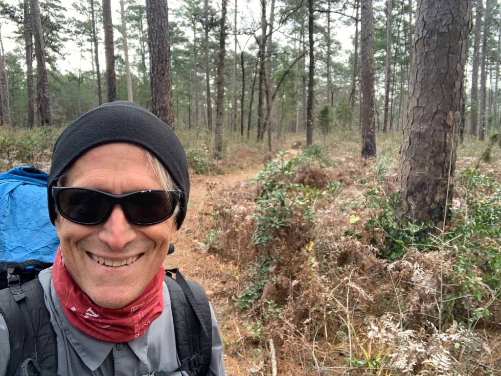
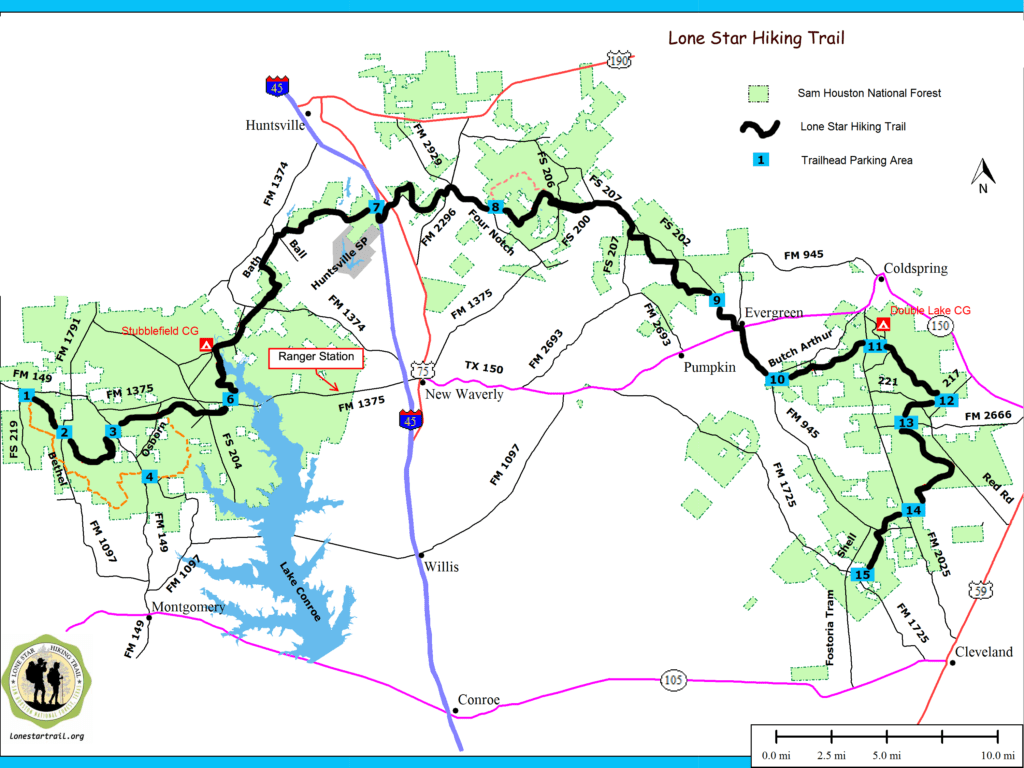
Day 3 – Tue, Jan 25 – LST 51.2

Good karma to start the day! Hiking out of Huntsville State Park a guy stopped and picked me up and took me out to the I-45 feeder. Then a mile or so walk under I-45 to get back on the trail east of TX-75.

Coming up on TX-75
Back on the trail! And no rain!

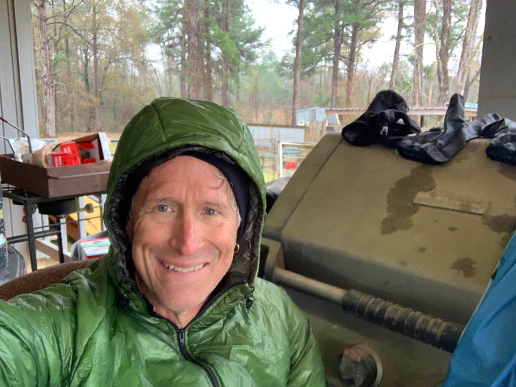
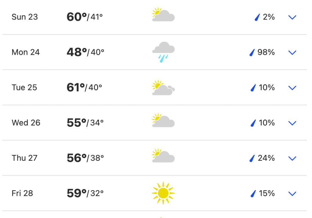
Unfortunately while it isn’t raining today it is overcast so no sun to help dry all my wet stuff.

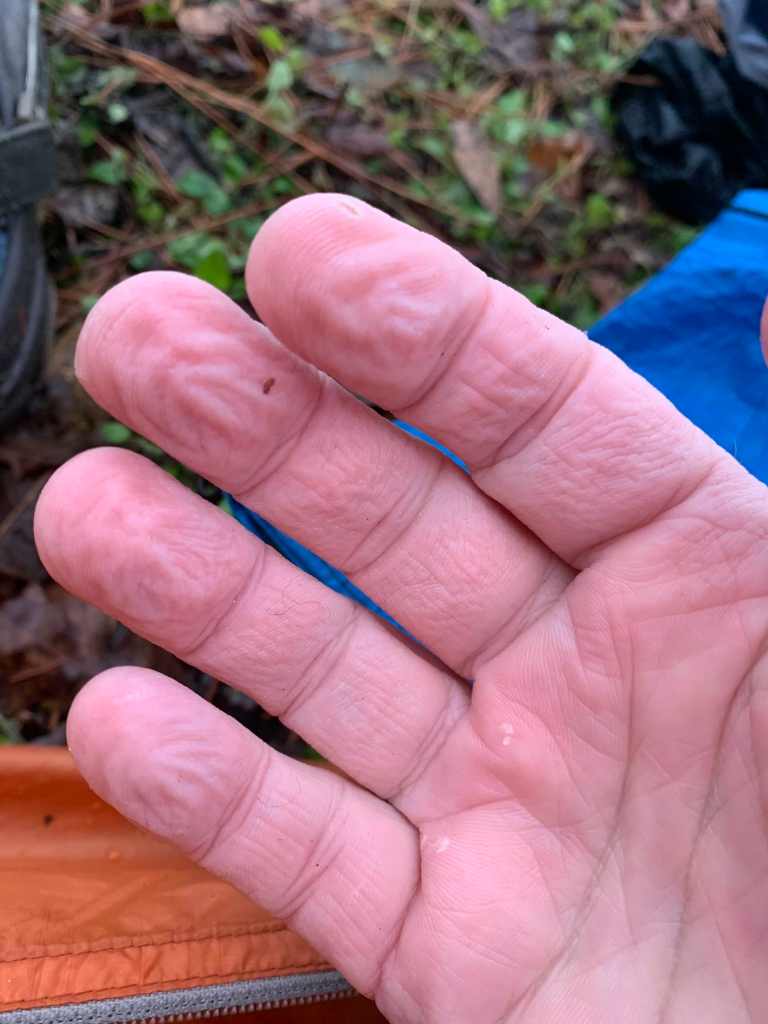
Today was my first run in with dogs. Just what the hell is the deal with these people and their dogs? About 8 miles along I hit FM 2296 and a short road walk when I was serialy attacked by multiple dogs running out from unfenced (or open fenced) yards. I used my pepper spray twice. Crazy.

Stopped for lunch along the trail after 10 miles or so. Still have seen no other hikers since the first day.

Lunch!

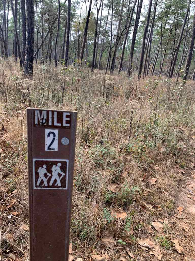
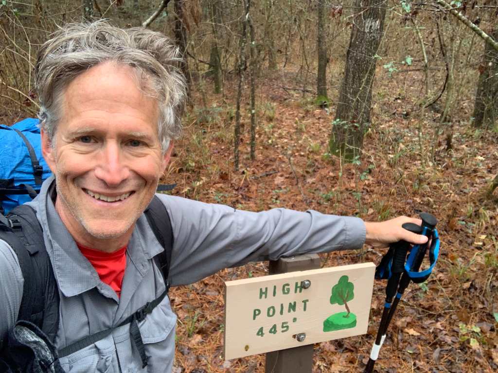
Ran into a hiker just after lunch, the only one i’ve seen for two days. He is doing a west end yo-yo and had just tagged Boswell Creek and was heading back west. And today was milestone day! Highest point and halfway.

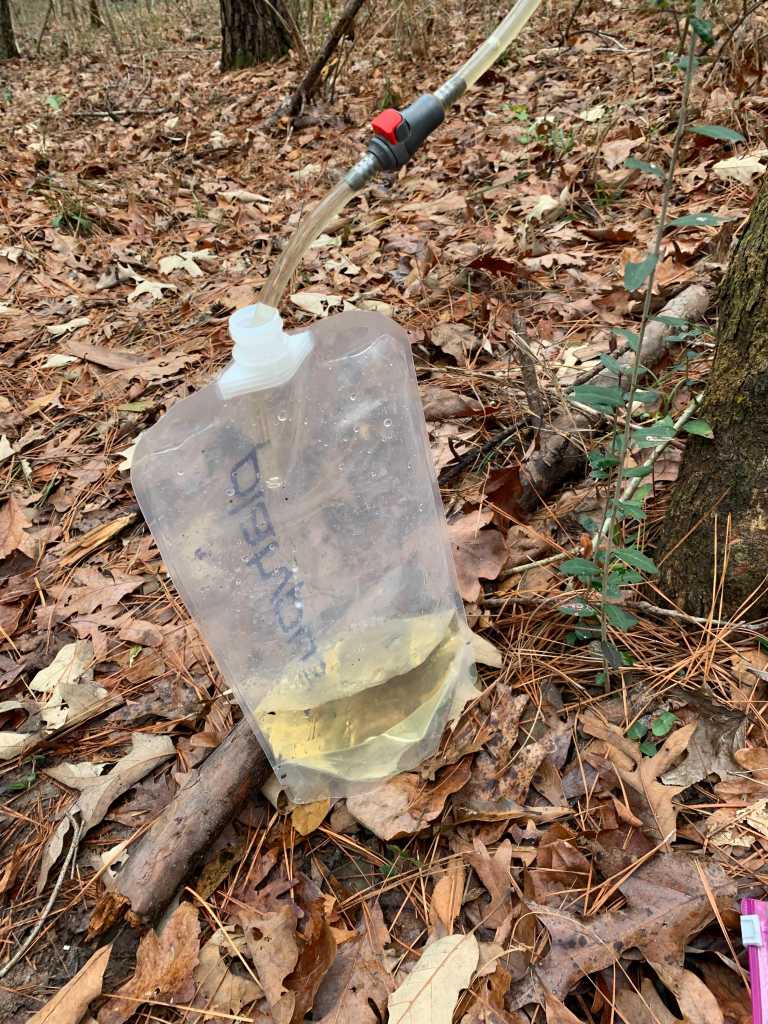
Boswell Creek (just after halfway at LST 48.2) had lots of water. I scooped 4L into my dirty water bag before heading on to camp.

Boswell Creek and the log I used to get across.

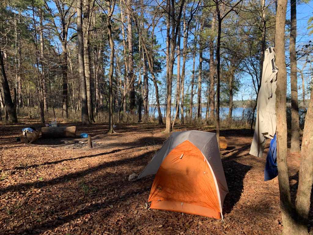
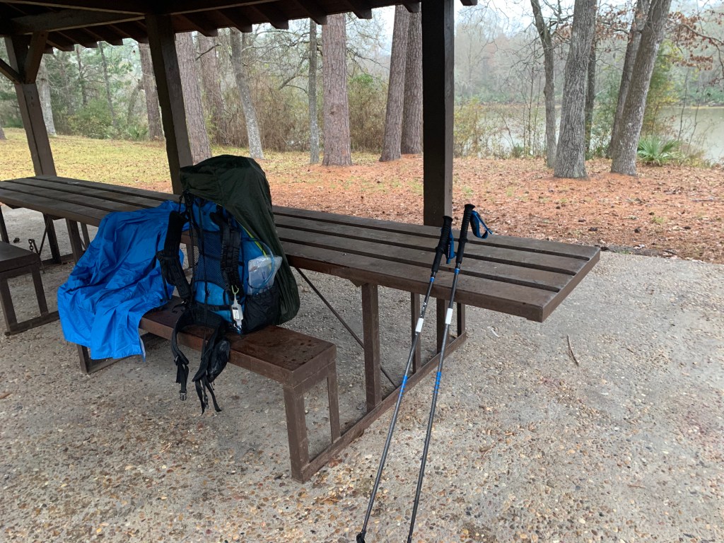
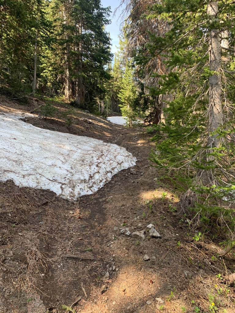
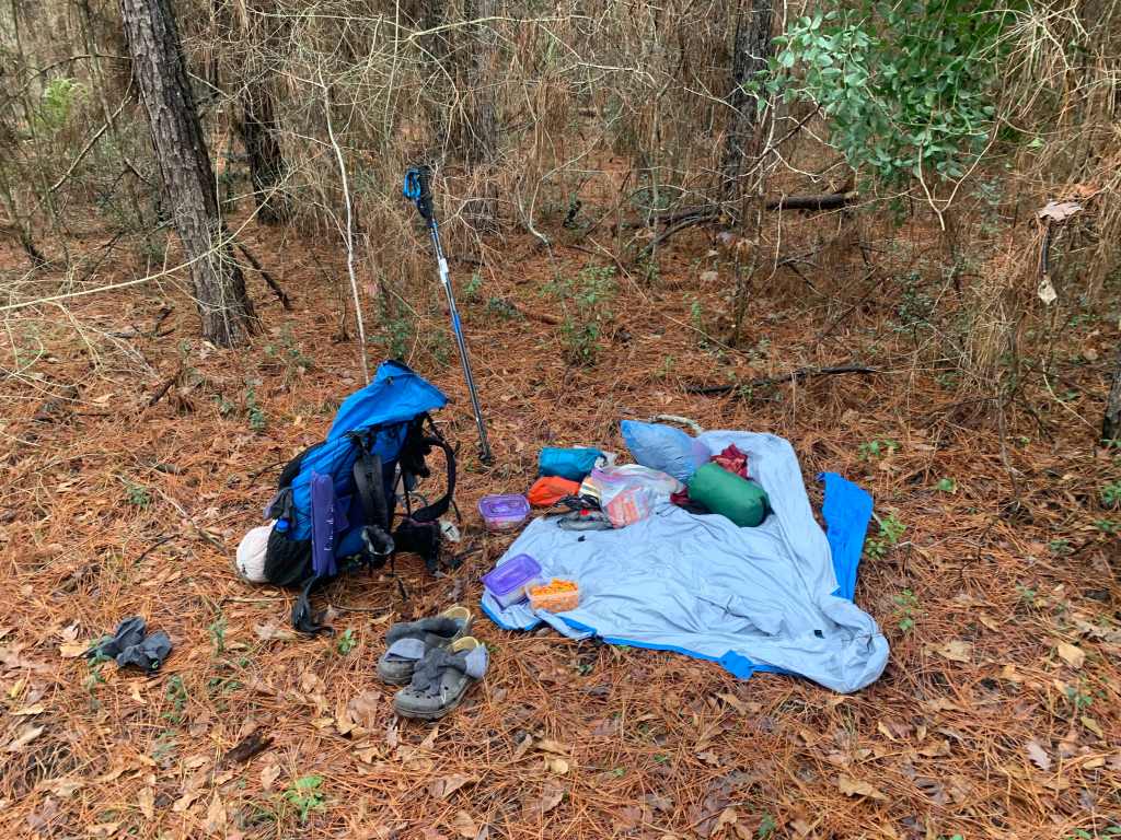
Today was my first designated primitive campsite. I rolled into East Four Notch PCG (LST 51.3) at around 3:00PM, hung my tent and fly out to dry and made some much deserved hot tea.

Tent drying at East Four Notch PCG

The designated primitive campsites (PCGs) are all a bit different. They all have flat tent sites and a fire pit. Some have logs to sit on or even (gasp!) a bench. This one had the bare minimum.

The Boswell Creek water filtered to a lovely yellow color which ,while not looking all that great, tasted okay, especially in tea.

Filtered Boswell Creek water. Tasty!

Day 4 – Wed, Jan 26 – LST 68.5

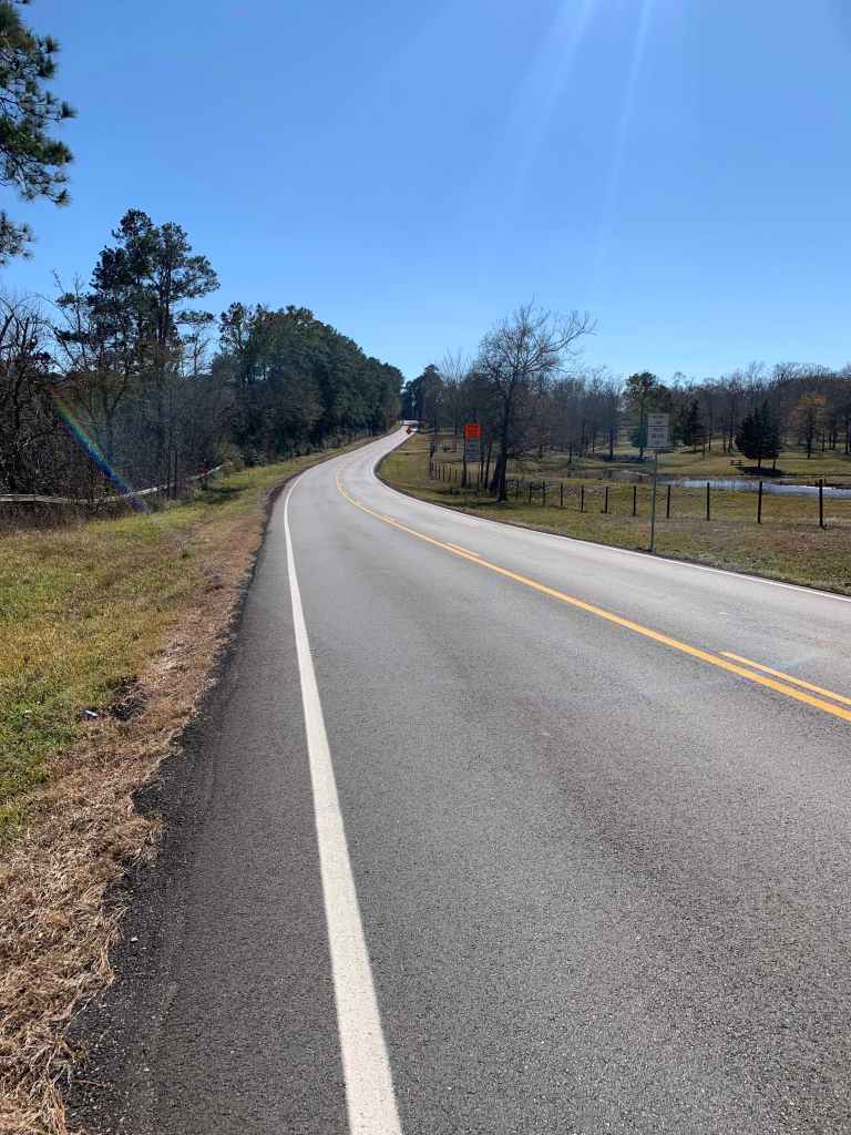
Today was an absolutely gorgeous day, perfect for hiking. It started a bit chilly, 35° or even a little colder. I hiked in my puff for the first two hours while things warmed up. The first 3 miles or so were mostly on roads but did not see a single car.

Starting the day on a road in my micropuff.

It was sunny all day which was a nice change from yesterday’s overcast and the day before with the incessant rain.

Road walking.

At about LST 60 the trail crosses FS 202D. On the other side of the road the trail was very swampy with lots of standing water. I elected to stay on 202D for a hundred yards or so then bushwacked back to the trail to avoid the water.

Swampy trail near LST 60.0

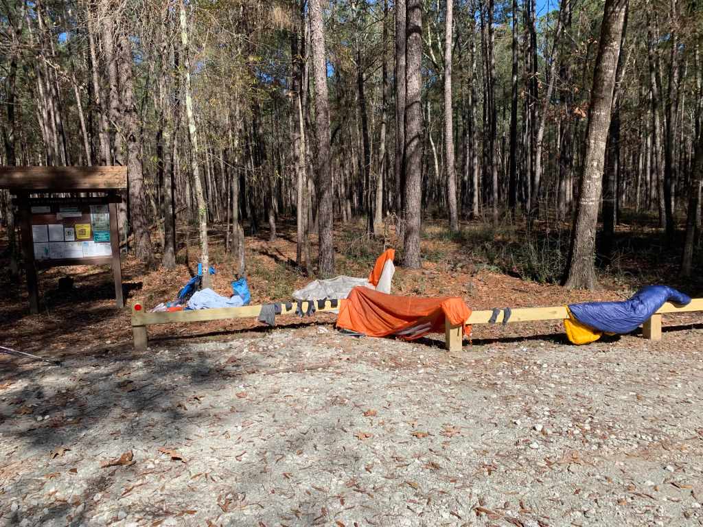
Stopped for lunch at a trailhead just before 12 miles around noon. I laid out the tent, sleeping bag and all of my socks to dry in the sun while I ate lunch. I also called Roberta and we talked which was nice.

Trailhead #9, lunch in the sun drying out.

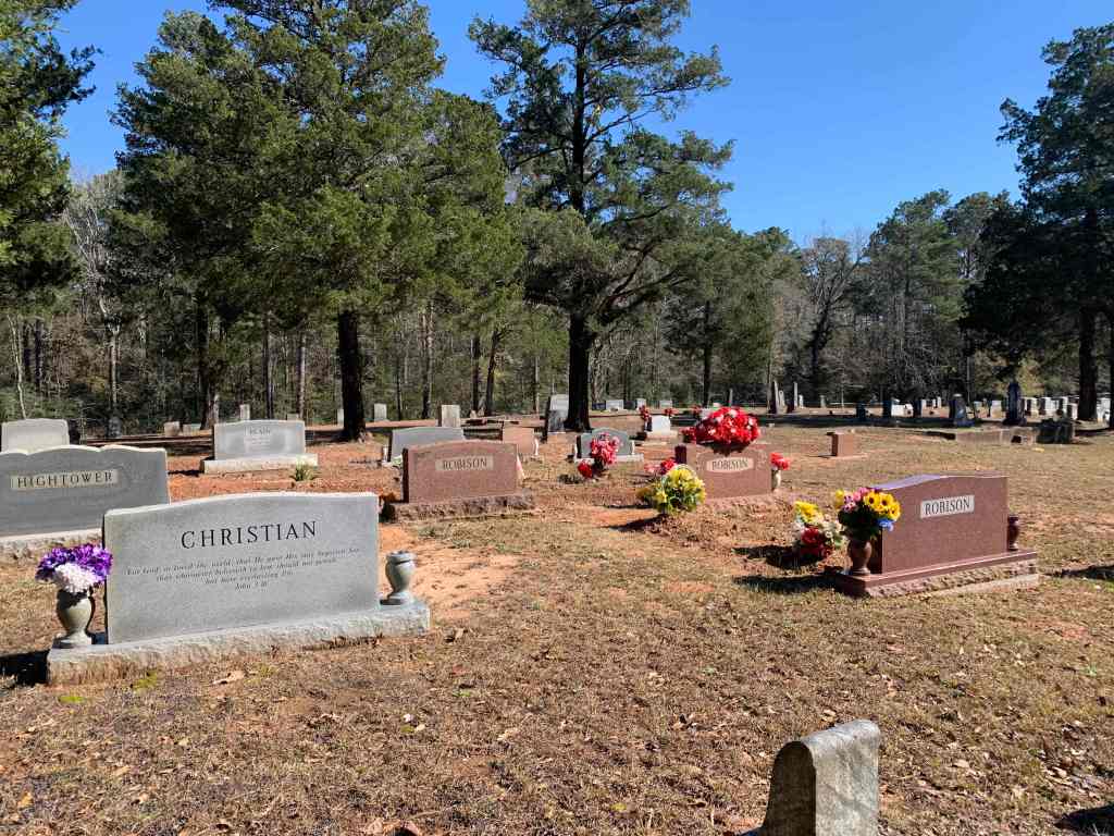
After lunch was a long road walk, starting with 2 miles to Evergreen. As far as I can tell the only things in Evergreen are churches and cemeteries. I stopped at the Baptist Church in Evergreen Park for water per the guide …

Thanks for the water Evergreen Baptist!

…and then continued on for another 3 miles on a really lousy hiking road (FM945), no shoulder and cars going 65. The guide warns about dogs in this area but I only saw a couple and they were on the other side of the road so I did not have to use my pepper spray again.

FM-945: No shoulder and cars doing 65 mph!

I arrived at my second designated PCG (LSHT Camp Site #2, LST 68.5) at my usual time (around 3:00) for my afternoon tea and a little whiskey. No logs to sit on but someone left a sleeping pad which I used for a seat.

Home for the night

Tomorrow is the East Fork of the San Jacinto crossing and I haven’t been able to get any recent information on the crossing.

Lone Star Trail, Day 1-2

Day 1 – Sun, Jan 23 – LST 16.5

Bert dropped me off at the western terminus of the trail (TH #1) at just after 9:00 AM and I was walking by 9:15. It was a beautiful first day – sunny and cool (50’s).

Looking very clean on day 1

The trail is in good shape and there seems to be lots of water. Saw my first (and only) thru hikers of the day at about 2 miles (they were getting water out of a pond). Three guys who I never saw again. Also saw a few day hikers (maybe 6 or 7) over the course of the day. 

Stopped for lunch at 11:30 and then back on the trail at 12:15. Got to Lake Conroe and my first campsite about 3:00.

Lake Conroe

Cell coverage is spotty. I have one bar here (sometimes). Dinner was nice – a freeze dried pasta thing. Supposed to rain tomorrow but who knows? I hit Stubblefield CG at about 4 miles tomorrow so I don’t need more than a liter of water from here. Too bad… there’s lots! A whole lake!

Camp #1

All in all a very nice first day of hiking. My first impression of the LST is very favorable.

Day 2 – Mon, Jan 24 – LST 35

Helluva day! It rained all day – non-stop – for 10 hours. I did not see another hiker all day. The first couple of hours weren’t too bad – my rain gear was keeping me dry and the trail conditions were good.

Early on Day 2 – wet but still cheerful

I got to Stubblefield Campground around 8:30 just before the rain really began to come down so I hung out for 30 minutes or so waiting for a lull before moving on. I crossed over the new bridge heading out of the campground.

In the dry at Stubblefield

By noon I was pretty much soaked. My rain poncho was holding up nicely but my “waterproof” mitten shells and wind pants were soaked through. I was really getting tired of the rain. I had gone about 12 miles and was on Cotton Creek Cemetery road when I noticed a house with a large carport on the south side of the road. I knocked on the door and asked a very nice lady if I could stand in her carport to get out of the rain. She said yes and I ended up eating my lunch there.

My carport refuge!
My scenic lunch view

I didn’t want to leave the carport but I didn’t think the homeowners would let me camp there so I headed back out into the rain around 1:00. I got to the Camelia Lake dam (about mile 15 on the day) around 2:00. Was a little worried about this because of all the rain but it was easy-cheesy, just took off my shoes and socks and walked barefoot across the top.

I had planned to just find a place to camp near Alligator Creek (LST 33.2) but with all the rain I really wanted someplace I could get dry before putting up my tent so…. after looking at my map I decided to take the North Loop trail into Huntsville State Park. What I didn’t notice was that the trail crossed Alligator Creek after about a quarter mile. And with all the rain the creek was overflowing. I ended up fording the stream in my crocs after I took off my socks. I did not fall in. That is the best thing I can say about that. 

I got to the campground after a couple miles (this turned into a 20+ mile day for me) around 3:00 PM, and payed my $34 for an RV site (really?). A nice gentleman gave me a ride to my campsite with access to a dry bathroom.

Camp Day 2, Huntsville State Park

Huntsville State Park is not really set up for hikers or tent campers and it seemed a little pricey for basically a tent space, a picnic table and a flush toilet but I’m not complaining. The bathrooms were out of the rain.

The rain finally stopped around 10 PM. I got up around 1 AM and took the rain fly off my tent and shook it out because drops were falling on my face while I was sleeping. It seemed to help. Hopefully tomorrow will bring some sun…

Lone Star Trail – Preparations

Unlike most thru-hikes the LST, at just under 100 miles, can be done in one 5-6 day section so I don’t have to worry about resupplies.

LoneStar hiking Trail Map
Lone Star Hiking Trail

Trail Access/Plan

The western terminus (LST Trail Head #1) is about 75 miles (90 minutes) from downtown Houston. Roberta will drive me early Sunday morning so I can get a full day of hiking in on the first day. 

DayDistanceLST MileComment
116.616.6Camp at Lake Conroe
216.633.2Alligator Creek
318.151.3Primitive CG
417.368.6Primitive CG
515.883.6Primitive CG
612.896.4Eastern Trail Terminus
Hike Plan

Water

It’s always about the water! The LST trail organization uses a “drop” system. Each water source is assigned a drop number (1-5). Then entire trail is assigned a drop number (currently 1.5) so any source with a drop number larger than that should have water. Water seems to be fairly plentiful (though there are a couple of ~15 mile dry sections) so I will not be caching water.

Weather

The weather forecast for the Conroe area looks pretty good, with one exception, Monday. Possibly heavy rain is forecast. On the plus side that should mean plenty of water to drink. On the down side, besides getting wet, this could make the East Fork of the San Jacinto ford more difficult (the old bridge washed out in Harvey).

LST Weather Forecast

Pack Weight

Even though this is a winter hike I won’t be needing micro-spikes or heavy winter clothes. Fully loaded with 6 days of food and 2 L of water my pack weighs in a just under 30 lbs.

ItemWt (Lbs)
Pack/Tent/Pad/Quilt6.5
Cooking (Stove/Fuel)1.0
Hydration (Bladder/Filter/etc)1.2
Toiletries/First Aid1.7
Clothing (Packed)3.6
Electronics (Battery/SPOT/Cables)1.5
Food (6 days)9.1
Water (2L)4.4
Total29.0
LST Pack Weight

TMB Days 7-9

The complete TMB, walking every mile, is about 110 miles (though this can vary a bit because there are alternate routes). With our guiding company (MT Sobek) we are doing roughly 90 miles. Most of the difference is short road walks that we van around. But the MT Sobek itinerary eliminates one “stage” of the traditional TMB, from La Fouly to Champex, a roughly 10 mile stretch. We were told this day has only so-so views and no good views of Mt Blanc.

Day 7: Champex to Trient (Martigny)

Another relatively easy day. Of course, this is the alps so there was still a relatively steep, 2500′ climb up to the ridge overlooking Martigny.

View looking north toward Martigny

Near the top of the climb we stopped at the Alpage de Bovine, a small restaurant, for lunch. Julien ordered several plates of Rosti for us to share and it was delicious. Basically potatoes and cheese so you can’t go wrong. And this was also one of our first stops on the Haute Route back in 2017.

Lunch a the Alpage de Bovine

From here it was a relatively gentle (by Alp standards) descent to the Col de Forclaz where Fabrizio was waiting to take us to our hotel in Martigny. We had an early day (at the hotel by 4:00) so some of us elected to go into town to see the Caillebotte exhibit.

Then we walked to a recommended italian restaurant, crossing over the Rhone river (it’s a lot smaller here!) on the way.

Rhone River in Martigny

Day 8: Trient to Argentiere

A big climb day but we are finally adapted to the altitude and feeling fit so this was a great day of hiking.

The day started along a steep, old smugglers path through the forest up to the Col du Balme (7,200′) and the border with France. Back in France!

Heading up to the Col du Balme. The Challet is visible at the top.
Over the Col du Balme! Looking south into France with Mt Blanc in the distance. We are back on the West side of the mountain.

From the Col de Balme we hiked up another couple hundred feet to the Tete de Balme.

View looking northeast from the Tete de Balme. Lac de Catogne in the foreground and the dam forming Lac d’Emasson across the valley in the back.

Then another three miles along the ridge to the Aiguilliette des Posettes (7,100′) for more stunning views of the Chamonix valley and Mt Blanc.

gAiguilliette des Posettes. Mt Blanc in the distance.

Then….. down, down, down 2,500′ to the Vallorcine Valley east of Chamonix and Argentière (4,100′) and our last hotel before Chamonix. And as we wind our way down we can see tomorrow’s start across the valley.

The zig-zag path across the valley is tomorrow’s start.

Day 9: Argentière to Chamonix

Last day! And we are feeling great! Beautiful weather and feeling a little sad that it will all soon be over. A very short, 6 mile day but… still 3,000′ of ascent over the first three mile. Ahhh…. Les Alpes.

The cool kids…. Fabrizio and Bert.

After a short transfer from our hotel to Le Col De Montets (4,800′) we began our hike…

Getting started – you can see the trail in the background.

2,500 feet up to Les Cheserys (7,130′) hiking past several alpine lakes in the last mile.

View of Mt Blanc on the way up.
Guide Julien, AKA Legalus.

It was very pretty but… it being Saturday and close to Chamonix, was very crowded compared to the other days on the trail. We stopped at one of the first lakes for lunch to avoid the crowd.

View from our lunch stop
Lunch at Lac de Chéserys

The climb to the final lakes involved ladders….

….. up to the last lake, Lac Blanc.

Lac Blanc, 7,750′
Crowds around Lac Blanc

Because of the number of people we did not stay long and headed down toward the gondola that would take us back to Chamonix.

Heading down.
On the gondola….. no more hiking!

Back to the hotel we started at nine days ago, Grand Hôtel des Alpes.

View of Mt Blanc from Chamonx
Celebratory cocktails.

TMB Days 4-6

Our hiking day typically started with an early breakfast (usually around 7:00 AM) followed by a trip to the lunch spread where we picked our snack and lunch food for the day. Danny and Julien did a nice job selecting local fresh food and we never had problems sticking to our pescatarian diet.

Fabrizio and Danny and our lunch spread

Day 4: Vallée des Glaciers to Courmayeur

Day 4 started with a van ride to the tiny Ville des Glaciers up the Vallée des Glaciers which eliminated a ~2 mile road walk.

The bustling Ville des Glaciers

Julien led us from the van to a small farm that makes Beaufort cheese. Beaufort is “produced in the Savoie region of France. The cheese is prepared using 11 liters (2.9 U.S. gal) of milk for every 1 kg (2.2 lb) of cheese desired. The milk used in one variety comes from the Tarine or Abondance cows that graze in the Alps.” And it tastes really good. The ~80 lb cheese wheels are wiped with brine and turned every few days, for at least 6 months.

Today was supposed to be a “relatively easy hike over the Col de
la Seigne (8,245′)” but, of course, we were with “A” team so did a much harder (though very pretty) route that turned this into another 4,000′ plus day.

From Ville des Glaciers we hiked to the Refuge de Rocher where we started a steep climb out of the Vallée des Glaciers.

Looking back south down the Valee des Glaciers. Refuge de Rocher (where the climb started) is visible in the right center of the picture

After about 4 miles and 2400′ we reached the Col de la Seigne at 8200′ and the border with Italy. At this point we could have headed down the valley into Italy but….. being the “A” team we elected to go up the ridge on our right, eventually getting to just over 9,000′.

Heading up the ridge rather than down into the valley …. of course.

The weather turned briefly stormy and we got our rain gear on for one of the few times.

Alpine lakes on the way to the Col de Baracon
At the (windy) Col de Baracon, 9,000′
Happy at the top….. now we have to go down…down…down.
Nice view of glaciers across the valley

This was definitely our longest day and by the time we started the steep, 3,000 foot down climb we were all pretty tired.

Coming down! Bert, Ed and Julien are in the picture – can you find them?

The day ended with a mile road walk to where Fabrizio could pick us up and then to our hotel in Courmayeur. We will stay here for two nights – we reverse the direction of the next day’s hike to finish again in Courmayeur.

View from our hotel (Hotel Berthod) in Courmayeur

Day 5: La Vachey to Courmayeur

After two really tough days this was a relatively easy day (still close to 3,000′ of climbing but only 9 miles long). We did this section in the reverse direction to be able to finish in Courmayeur.

Fabrizio dropped us off up the Aosta Valley, Italy for the nine mile walk back to Courmayeur

Hiking southeast up the Aosta Valley back to Courmayeur. Mt Blanc is visible in the upper right.
Our group hiking up the valley
A break at a refugio …. and a cafe. And yes, that is my shirt drying on the line.
Nice view of Mt Blanc across the valley.

And, as usual, we ended the day with a 2500 foot descent, walking back to town and the hotel.

Ahhhh…. home!
Okay… we drank a little wine.

Day 6: La Vachey to La Fouly

Another relatively easy day …… only 3,000 feet of ascent! Which I really needed after eating too much pizza and drinking too much wine at dinner last night. And today we hike into Switzerland!

But, this being the Alps, we start the day with a steep 3 mile, 2500′ climb up to the Col de Ferret, the high point of the day at 8,300′ and the border between Italy and Switzerland. Mount Dolent (on the border between France, Switzerland and Italy) is visible to the Northwest.

Mt Dolent (middle peak) and Rifugio Elena, where we stopped for a cafe on the way up to the Col de Ferret.
Hiking up…..up….up!
Hiking to the Col de Ferret up ahead (saddle in the top middle of the picture)
Switzerland! A very windy Col de Ferret (8,300′)
Ed pointing at the pass we came over two days ago.

We dropped down the far side of the col to get out of the wind for lunch before heading down the Val Ferret toward La Fouly.

Lunch in Switzerland.

Then down, down, down the Val Ferret toward La Fouly, where dependable Fabrizio and his van were waiting to take us the short ride to our hotel in Chapex. But we had time to stop at Gîte Alpage de La Peule for a quick beer on the way down.

Heading down the Val Ferret toward La Fouly

At the hotel, this being Wednesday I attempted to explain what a Martini was to the nice lady bartender. We basically ended up with glasses of vodka and ice with a few olives. Good enough!

Swiss “Martinis”!

TMB Days 0-3

We joined part of our Tour du Mount Blanc (TMB) trekking group Wednesday, Aug 11 at the Geneva airport for the ~30 minute van ride to Chamonix. Everyone else is jet-lagged but, since we have been in France for the past week, we are feeling pretty good. Met the rest of our group and our two guides for dinner. Tomorrow is a short training hike above Chamonix.

Day 0: Chamonix

We took the cog railway up to the Mer de Glace glacier. Bert and I have done this before (when we did  The Haute Route   back in 2017) but it is a new experience for everyone else. We spent the day hiking up above Chamonix with amazing views.

Mer de Glace Glacier

Some folks did the 1,000 foot hike down to the glacier to see the ice cave but we elected to sit at the terrace cafe and enjoy a drink since we had already done this. Unfortunately we had our first casualty of the hike when John, a doctor from Denver, fell on some stairs and cut his shin badly enough to require stitches.

We ended up on the Grand Balcon trail descending to the rustic Chalet Caillet where we had a lovely dinner with more views. Unfortunately what was supposed to be a leisurely hike back to town turned exciting when a thunderstorm moved in suddenly. We ended up walking down, in the dark (using our cell phone lights), in the pouring rain. A great bonding experience!

Dinner at the Chalet Caillet – before the rain!

Day 1: Chamonix to Les Houches

Our first day of hiking the TMB was relatively easy – we split into two groups – the “fast” hikers and the “slow” hikers. Somehow Bert and I got in with the faster hikers which meant a longer hike. We did not do the traditional TMB route for this stage but did a higher alternate that had great views of the Chamonix valley and Les Houches.

Day One

We ate lunch at the Aquillete de Les Houches.

Lunch on Day 1
The Pensive Guide Surveys the Valley

For those of us on the “A” team, today was a ~10 mile, 3500 foot ascent day. We arrived at our hotel in Les Houches around 4:00 so had time to rinse out clothes and take a quick nap before dinner.

And this was the day that Danny (our guide) convinced me to put me hand in and ant hill, collect some ants and then lick an ant’s butt. To taste the formic acid. Tasted just like vinegar.

Day 2: Les Houches to Les Contamines

Another tough day in the alps – very warm. I had some problems on the last climb of the day, a steep 700 foot ascent. I just could not catch my breath near the top of the climb and had to stop for a bit. Think it might’ve been the altitude. But…. after a rest and a drink felt better for the hike into town (Les Contamines).

Had beautiful views all day and lunch on a glacier stream we could rest our feet in was pretty sweet. Another 3,000 foot day!

Another Stunning View!

Day 3: Les Contamines to Les Chapieux

A very tough day, over 4,000 feet of ascent today. Hike started along an old Roman road that rises to the Plan des Dames. From there we climbed up to the Col du Bonhomme (7,641′) and Croix du Bonhomme (8,100′).

We had lunch at the high point today – the Croix du Bonhomme.

Bert and Ed on the Roman Road
At the Col du Bonhomme
Lunch time! At the Croix du Bonhomme
What goes up must come down. Heading down to the valley in the upper right.

After a long hike down to the valley to Les Chapieux, Fabrizio (our van driver) took us to a much needed shower and bed in Bourg Saint Maurice.

Back in France!

After almost two years we finally made it back to France last week. Very strange flying again….. and this time with masks the entire way! We almost missed our connection at Dulles but United held our flight so we arrived bright and early at Charles de Gaulle last Wednesday to begin a four hour train journey to St-Jean-de-Losne. 26 hours after leaving the house we stepped off the train in St Jean to an empty station and no taxis.

Waiting for a train… somewhere in France!
Trains are fast in France!

After walking about half a mile in a mild drizzle (not complaining – temperature is a wonderful 65 degrees!) a nice lady on vacation from Morocco offered us a ride to our B&B, Les Charmilles. Beatrice, the owner, said we were the first Americans she has had since the pandemic started.

We hooked up with the shipyard manager on Friday and he took us to the drydock where they were working on Decize. She still needs a lot of fiberglass repair before the painting starts. Phillippe says it should all be done well before next year’s cruising season starts in the spring. Fingers crossed!

After meeting with Phillippe we met with the marina manager, Vasily, to discuss where our slip would be. H2O has two marinas on the Saone, here at St-Jean and about 30 kms north in Auxonne. We prefer St-Jean since it has more facilities and Vasily said that would not be a problem.

St-Jean H2O Marina
Marina Captainerie

And then we spent the next few days exploring St-Jean and checking out the restaurants on the quai. St-Jean is a lovely French town of maybe 5,000 people located on the Saône river.

Palo Duro Canyon

After a short, 10 day visit with Emilie and Francis in Colorado Springs mostly playing board games and day-drinking… we began the last leg of the trip ….

Fun times in the Springs!

… to Palo Duro Canyon! We had planned to camp in the Canyon but decided to grab a hotel in Canyon which is only 15 minutes from the park.

We decided to do the Lighthouse Trail Loop as it includes the most iconic peak in the park. So…. up early and headed for the Canyon.

The Lighthouse Trail Loop

The trail starts on the Givens, Spicer, Lowry Trail and joins the Lighthouse Trail after about 3 miles. The trail skirts the bottom edge of the canyon and is reasonably flat most of the way.

Stunning views along the Givens, Spicer, Lowry Trail
Hiking buddy!

We were very fortunate because the normal temperature in the canyon in late June is in the low 90’s but we had overcast skies, a light drizzle and mid-70’s. Not so good for pictures but much better for hiking.

More cool views.
Nearing the “Lighthouse” formation and the final climb.
Bert scales the escarpment up to the plateau between the two peaks.
On top!

It started to drizzle when we hit the top and the scramble to the top is very steep so we did not spend a lot of time on the top but the views were great.

And…. that pretty much finished off our grand tour of the northwest…. 5600 miles, lots of great hikes and some stunning scenery. All that remained was a 9 hour drive to Houston and…. Martini Night!

Utah, More Camping, More Heat and More Friends!

Up early (June 15) to beat the heat and headed to the Spiral Jetty and the Great Salt Lake.

The Spiral Jetty on the shores of the Great Salt Lake

Then we walked the mile or so out to the current shoreline (the water has been high enough in the past to completely cover the jetty).

Weirdly beautiful – all the salt you an eat!
Guessing this plant wishes he had sprouted somewhere else…

We left the Great Salt Lake just as it was starting to get uncomfortably warm (about 8:30) and drove to our campsite just east of Salt Lake City (near the Alta Ski Resort in the Wasatch Mountains).

Our campsite in Spruces Canyon

We were a bit worried because the temperatures kept rising through the afternoon, reaching the upper 90’s in town. But our campsite is 2,000 feet above SLC and the temperature was consistently 20-25 degrees cooler.

After setting up camp, doing a short hike and getting cleaned up we put on our best campwear and headed back down the mountains. A high school friend of mine (Linda Burr) who I had not seen since high school contacted me via facebook and invited us to dinner – their place is only 30 minutes from our camp.

High school friends.

We had a lovely time and drank too much of course. Next morning we were up bright and early for a little 8 mile, 3,000 foot hike up into the Wasatch Mountains.

Heading up…
Still a little snow up above 10,000 feet.
A moose on the trail!
Near the top (or as close as we got).
Lovely view

And, as luck would have it, Clifford Pugh and his husband John were staying the next canyon over in Park City (though not in a tent) and invited us over for dinner.

Dinner (actually drinks) with Clifford and John.

So, after two nights of lovely camping and wonderful dinners with friends we left Utah heading toward Colorado.

Heading South!

After three mostly lovely days in Neskowin we headed back south and east on June 12. Neskowin, after nearly 3,000 miles, was the end of our outbound journey. Next stop is the Malheur National Forest in eastern Oregon.

Campsite for the night!

Had another lovely campsite next to a mountain stream. Nice cool night in the 40’s, perfect for sleeping but Bert’s back is giving her problems so we elect to get a room for the following night. Found a little 4-room lodge along the Payette River in the Boise National Forest. Management of the hotel is a bit iffy but we have our own private hot-springs fed tub out the back!

Weather is definitely different in Idaho! And this is at 8,000 feet!

Except for the folks in one of the other rooms celebrating a 50th birthday accidently walking into our room in the middle of the night we had a nice stay. Walked to the river where the hot springs run down the side of the hill to merge with the cold river water. But it is very hot so we cut the hike short.

Hot springs run into the Payette River. Very hot or very cold!

Up early the next morning to get a short hike in before the heat kicks up. Rode our bikes a couple miles to the Kirkham Ridge trailhead and started up! The Trail climbs the mountains on the north side of the Payette River valley.

Starting the hike!
View down the valley.

After the hike we packed up and headed towards Utah. We realized last night (after pizza and beer) that we actually have an extra day before our campsite reservations near Salt Lake so we have two easy days of travel and, at Bert’s urging, we added the Spiral Jetty to the itinerary.

We also decided to ignore Google and headed west on the river road (Ponderosa Pine Scenic Route) hoping it would be more scenic and we were not disappointed.

View of the Sawtooth Mountains from the road.

After a short stop in Ketchum (Sun Valley) for lunch and to pay our respects to Ernest….

Lunch in Ketchum.
RIP Ernest.

… we headed on to the Western Inn in Tremonton, Utah.