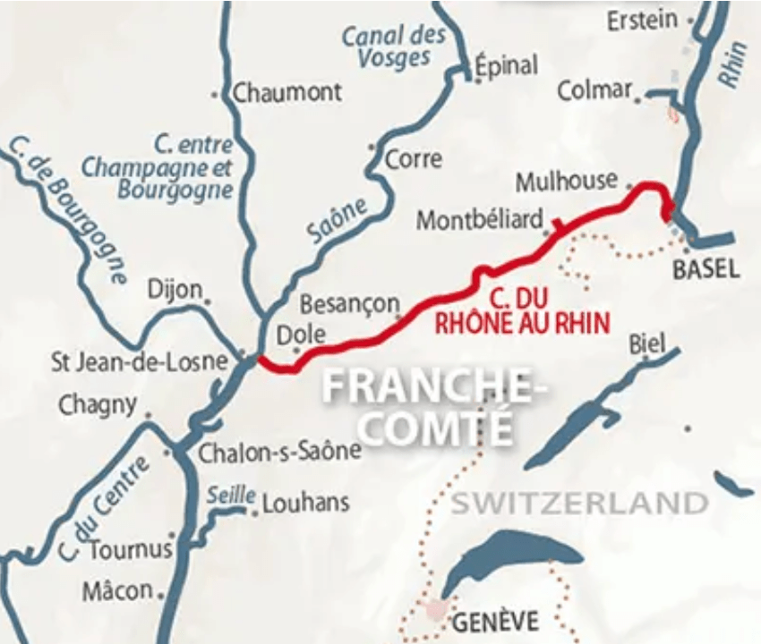
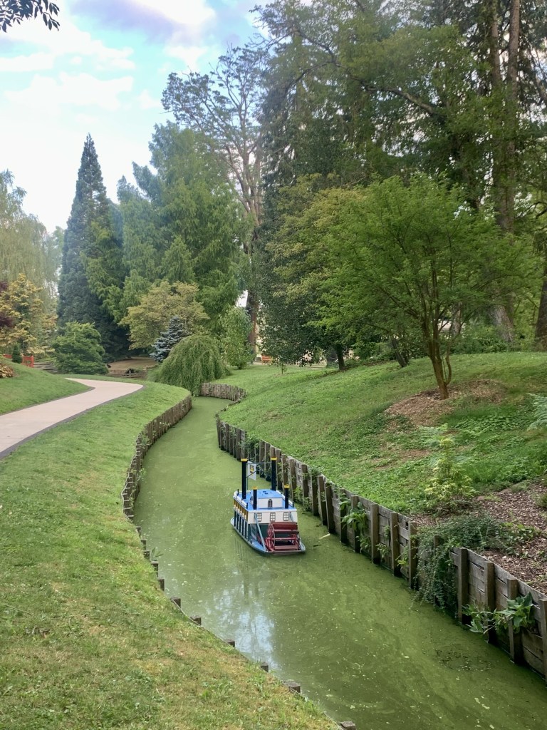
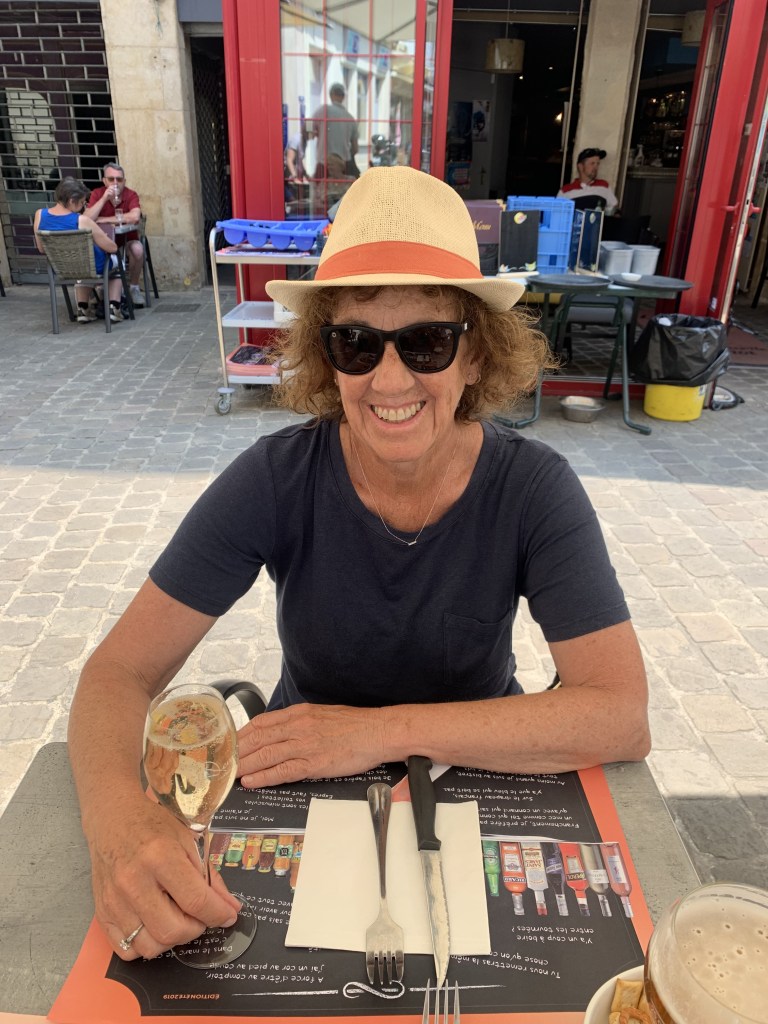
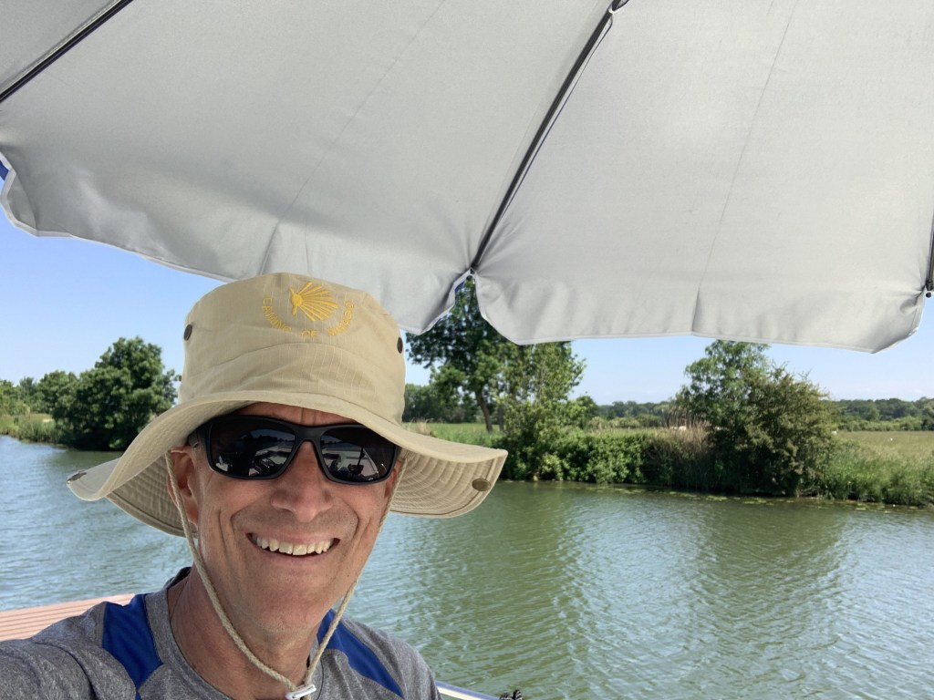
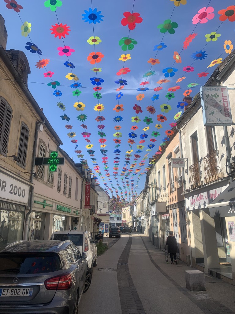
My brother, John, his wife, Christin, and their two children, Connor and Sofey, arrived on July 2. We decided to take them up one of our new favorite canals (Canal du Rhône au Rhin). The first 100Km or so of the waterway moves in and out of the Doubs River and is quite lovely.
Dole
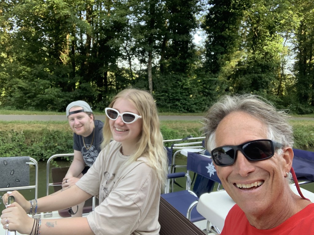
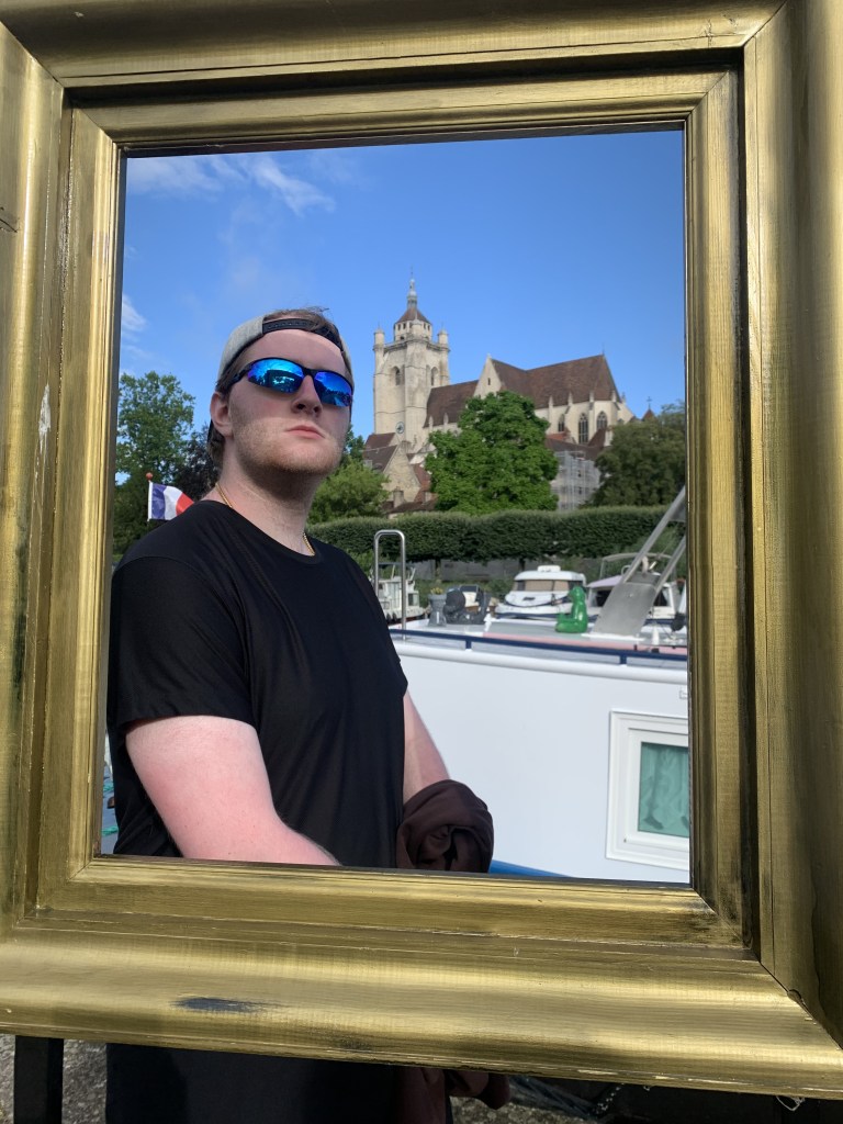
Dole is one of our favorite places these days and only one day cruising from St Jean. This was the first time we had a full house, six people on the boat so it was cozy. We spent a day visiting Dole before heading north again.
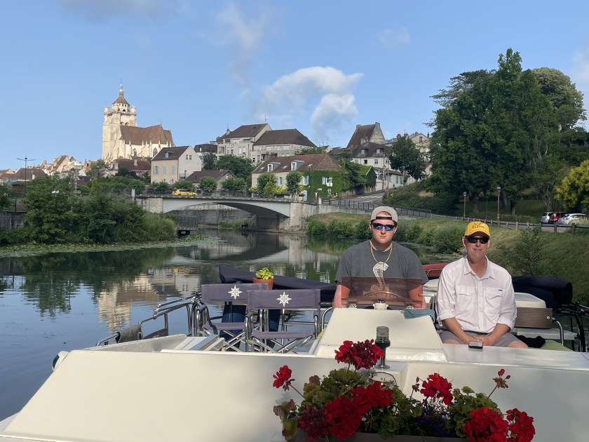
Leaving Dole
Onward to Besançon
The next leg of our sail was a two-day cruise to Besancon, stopping at the little town of Ranchot the first night. It was hot, in the low 90s ,which was a bit of a shock for our Alaskan family.
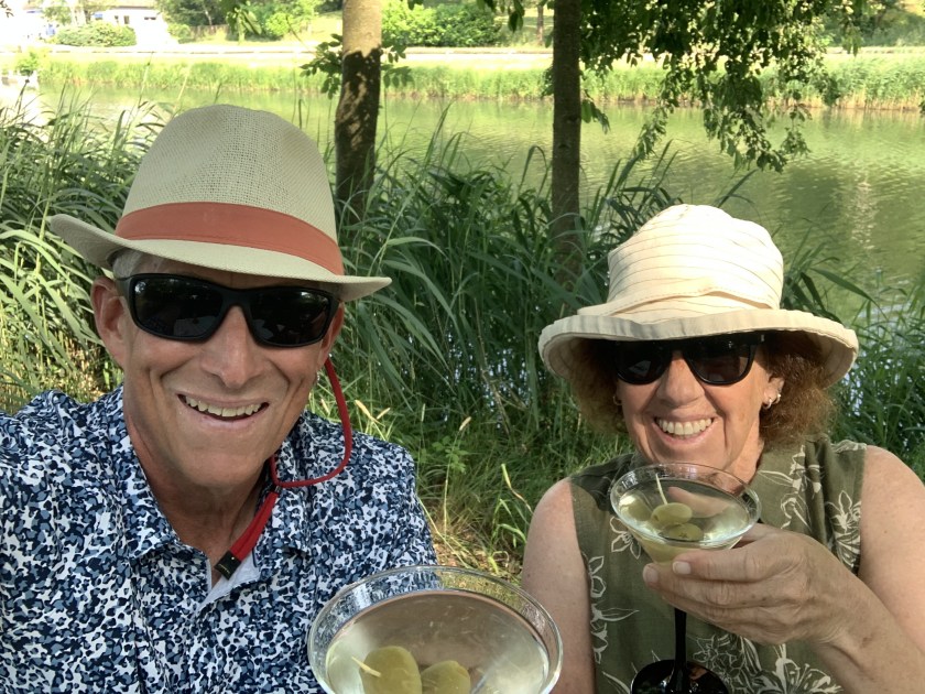
Martini Night under a bridge in Ranchot
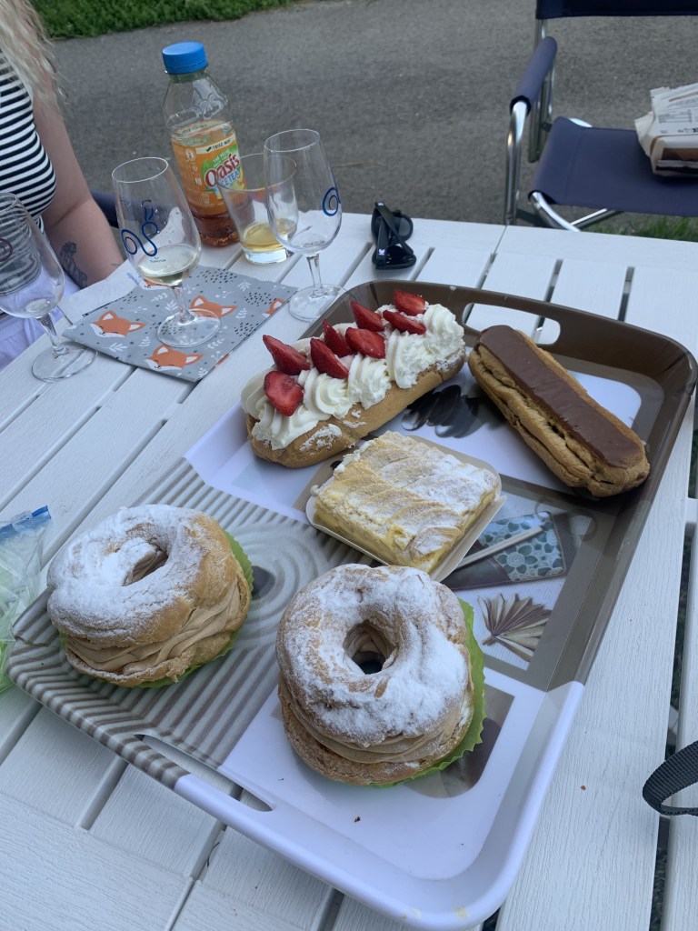
We found a bit of shade off the boat in Ranchot to celebrate Martini Night. And a boulangerie for a special dessert.
Dessert!
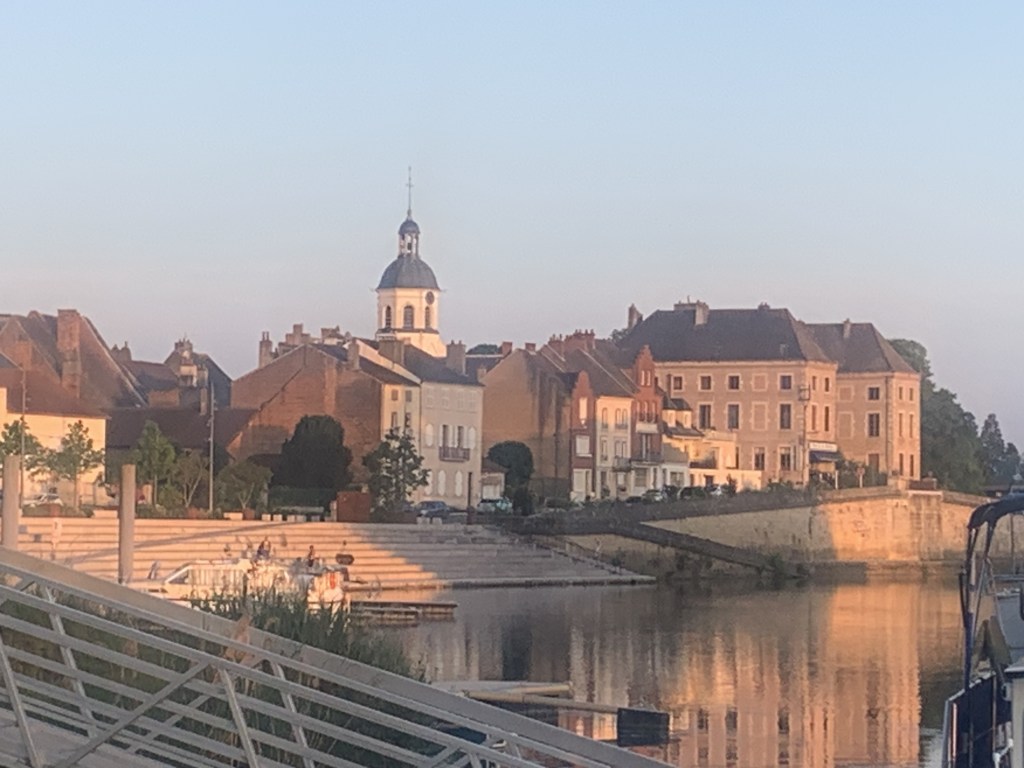
The next day was a long one, almost seven hours of cruising, to get to Besançon. We also stayed a day here to visit the Citadel and the Victor Hugo museum (and hit the market).
View of the Doubs River from the Citadel, the way we entered Besançon
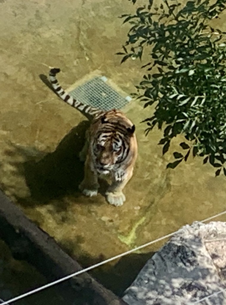
Sofey, Connor and I visited the municipal zoo which is housed in the Citadel while the adults did the museum thing.
Non-native Besaconian
And it was even hotter in Besançon so we found a spot off the boat to set up chairs for our evening cocktails and dinner.
Connor explaining something to me…. again.
Uncharted Territory …. heading to Montbéliard
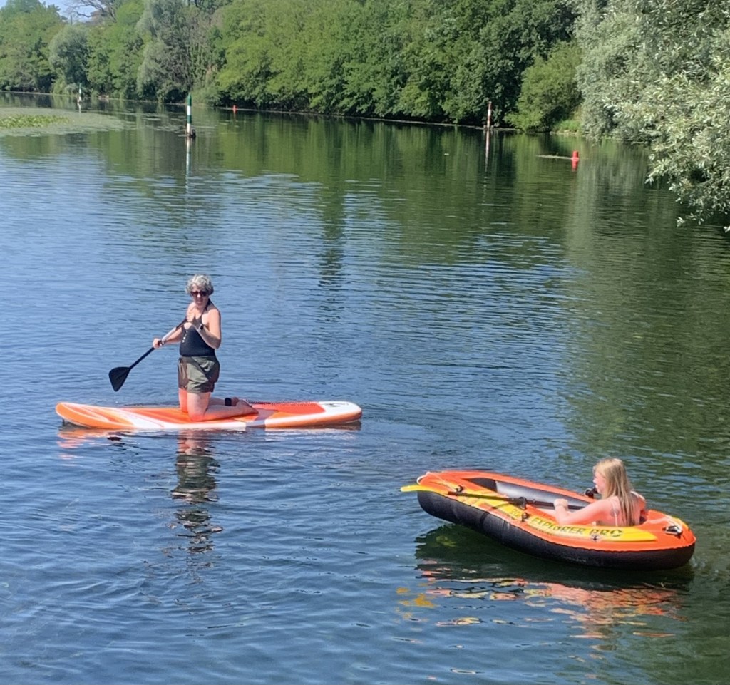
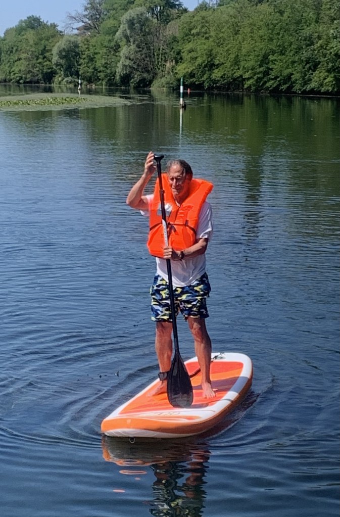
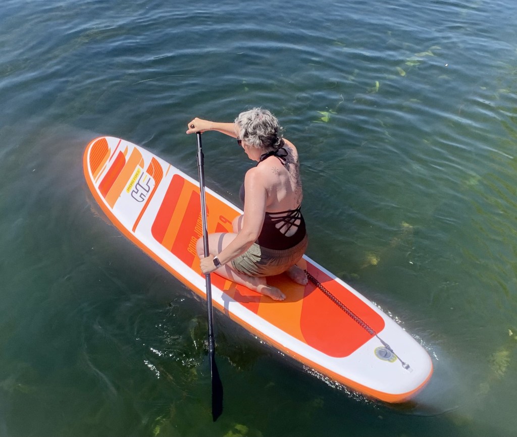
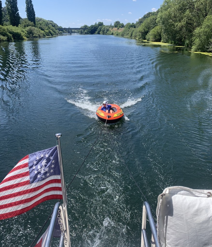
Leaving Besançon and heading north was new ground for us since Besançon was the farthest we had been on the Canal du Rhône au Rhin. This was a four-day cruise. It was still hot so we stopped a couple of times to play with our new boat toys… an inflatable dinghy and a paddleboard.
One of our moorings was a little town of about 500 people, De Luz, where they were having a town festival (the French are festival crazy in the summer) with a two-man gaelic band.
At the De Luz festival…. they have wine!!!
The band plays on…
And just when we thought we understood what was going on…
Run away! Run away!
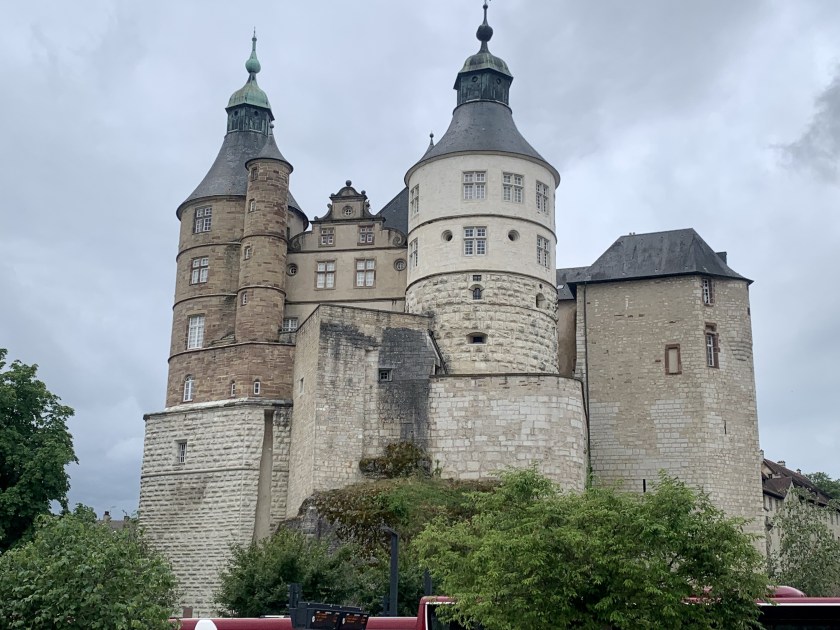
When we finally cruised into Montbéliard, it quickly became one of our new favorite places. Lovely parks, lots of restaurants and a really big castley thing (also known as the Château des ducs de Württemberg ). We finally took pity on the Alaskans and booked a hotel for our last night before hopping a train to Paris with them.
Sorry I haven’t posted for awhile. We’ve been battling a weedy canal (i.e. repeated prop foul), recalcitrant locks and, for several exciting days, a boat that would not go in reverse (reverse being a handy feature when piloting your 34-foot vessel into a concrete space 15 feet wide and 100 feet long). Cheers!
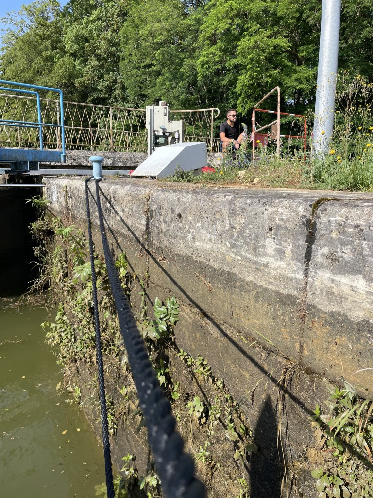
Bored VNF lock keeper who we called Hercules because he had to operate everything manually including pulling the doors open and shut.Champagne in Champagne!
Besides a lot of cranky locks we also got to transit a 5 Km long tunnel. At our speed it takes about 50 minutes to complete. Fortunately traffic is quite light on this canal so we did not have to wait. The tunnel passes completely under the village of Balesmes-sur-Marne.
Tunnel de Balesmes
We stopped our northern sojourn at Langres where we spent two days exploring. The woman at the Captainerie was surprised when we said we were from the US. In all her time there we are only the second US boat to visit.
Strange looking weeds in the canal – and bad for the propeller.
And while the weeds were pretty bad, we had some nature moorings with lovely views.
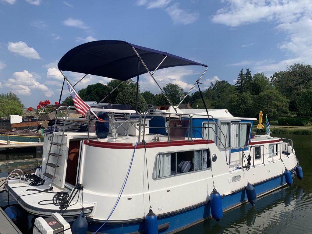
After dropping off our guests we headed back north on the Saône from SJL towards the Locaboat base in Scey-sur-Saône. Last summer, while cruising, we noticed a few Locaboat rentals with biminis so we contacted Locaboat. €2,010 seemed a bit steep but we knew it would fit and we desperately needed one so we ordered it. Now it was time to pick it up (after replacing the bow thruster control panel on the flybridge – yes, it is never ending)!
Another lovely nature mooring
Rather than stay in marinas we did “nature moorings” all three nights on the way to Scey. This involved finding a place along the river that was deep enough to get to, brush cleared away to allow getting off the boat (and no nettles!) and shade in the afternoon.
View from our mooring.Cocktails!!!
We made good time (the season is still early so the boat traffic is light). And we managed to pick spots that allowed us get a few short runs in (we have vowed that THIS year will be different – we will continue to run through the summer).
Short morning run.
Arriving in the marina in Scey-sur-Saone we managed to push our rub rail out (isn’t a rub rail supposed to rub?). I could not slide it back in place by hand so had the idea of drilling a hole, attaching a line from the rail to the dock and backing the boat up and…. it worked!
My engineered solutionPooched out rubrail
Of course no one was here when we arrived but in the early afternoon a Locaboat technician showed up and gave us our bimini. And, after several hours (in the sun) figuring out how the thing goes together (the ENTIRE set of instructions: “We recommend using professional installers.”) we have a bimini!
Our new bimini!
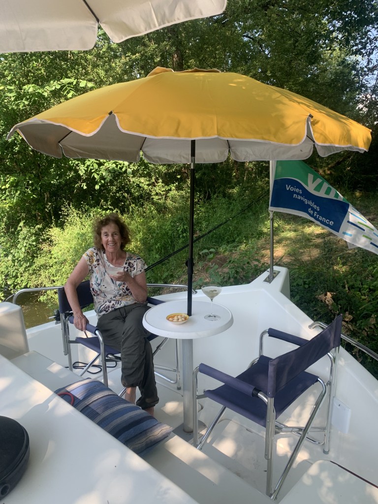
We celebrated (and it was Martini Night) with cocktails.
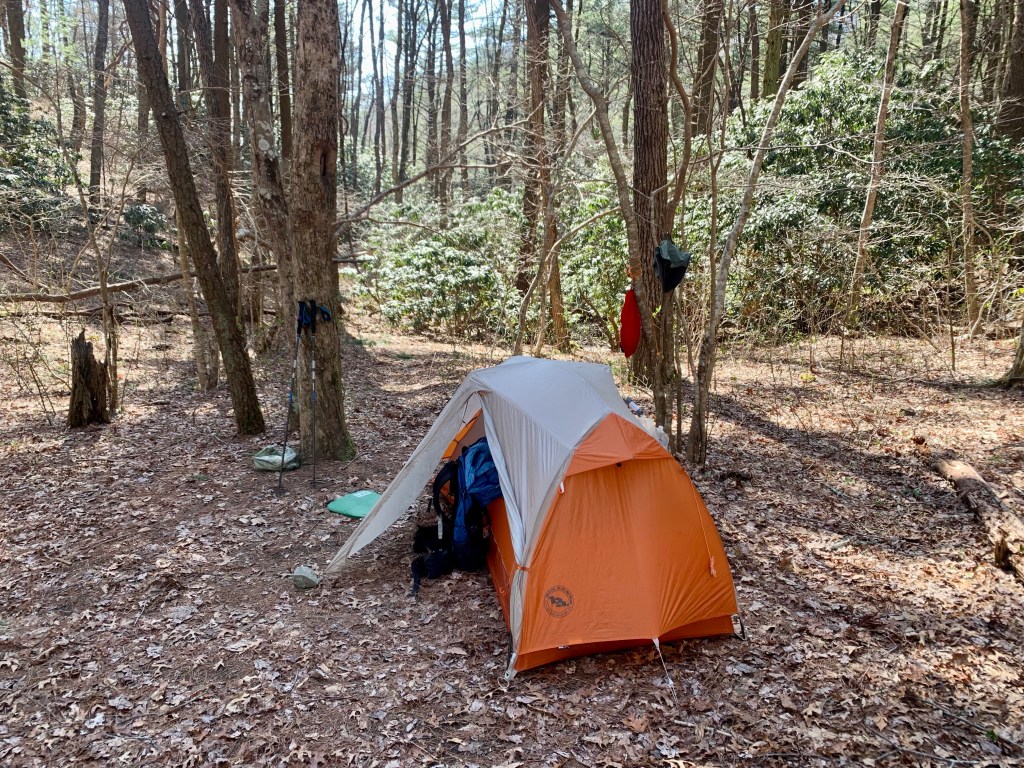
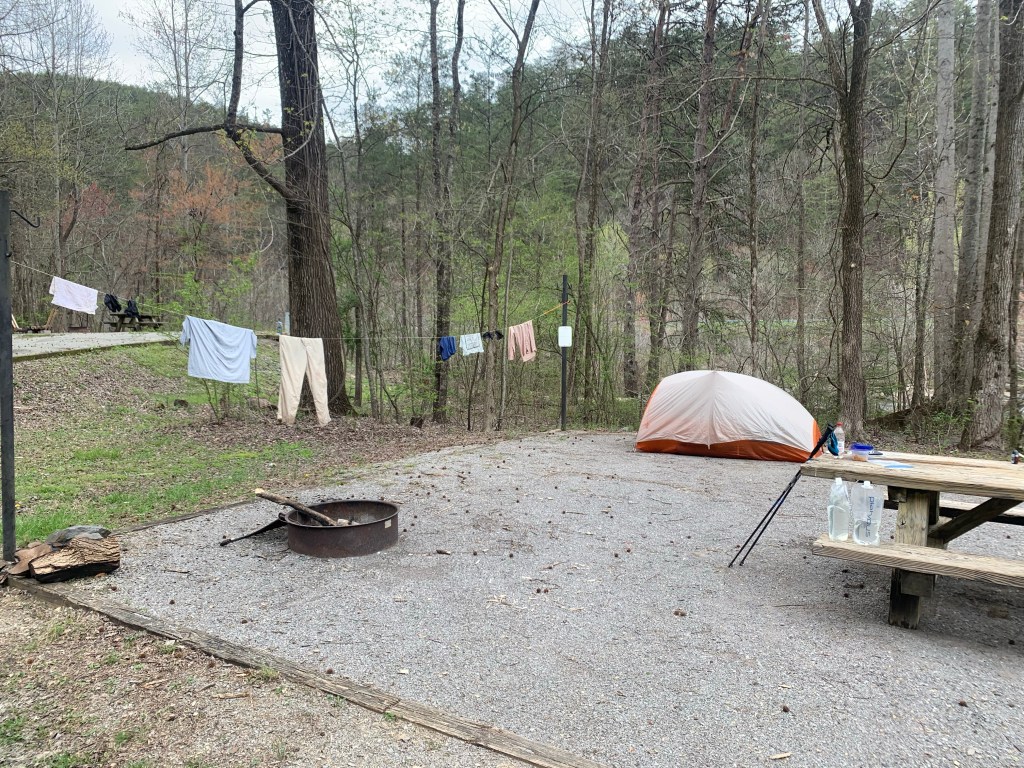
We arrived back in Saint Jean de Losne (SJL) on May 19 hoping things would go better this year. Last year, as you might remember, we spent 3-1/2 weeks getting issues settled before we could begin cruising.
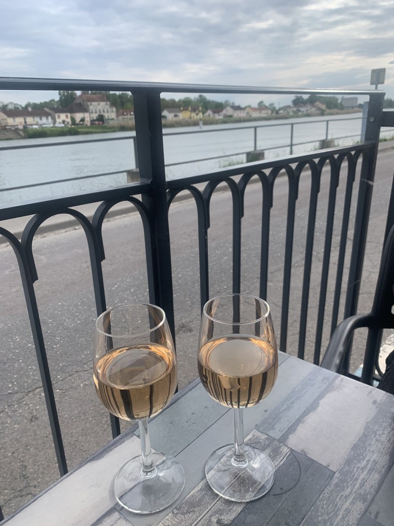
We arrived back in SJL via a taxi from Dijon (the train from Dijon to SJL was suspended for repairs) which was actually quite nice since we did not have to lug our luggage from the SJL gare to our boat (about 2 km). We immediately headed to Brasserie du Port for our welcome home glasses of rosé.
We checked into our favorite place to stay in SJL (not counting our boat), Les Charmilles, a B&B located very close to our marina. The idea is to spend a few nights here while we get the boat provisioned and checked out. Then…. to the boat!
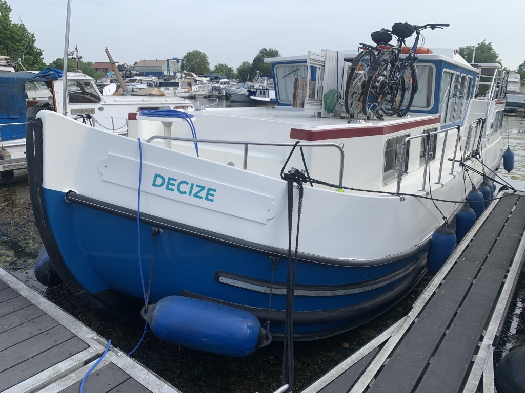
Decize looking good in 2023!
Saint Jean de Losne (May 20)
Spent all day checking boat systems:
Started engine – started first try
Checked bow thruster – seems to be working
Turned on freshwater pump
Checked cabin heater
After some work – got the the hot water heater working
Cleaned the fridge – turned it on – taking a while for it to cool down?
Pumped up the bike tires (all were flat).
The fridge is moldy …. did we really leave a 1/2 bottle of wine? We cleaned it and reset the breaker and that should be it right?
Saint Jean de Losne (May 21)
Got an email from the H2O workshop manager (Phillippe) saying the control module on our bow thruster is broken but they can bypass it?? Seemed to be working yesterday – not sure what is going on there but…big news is our refrigerator is not working and is non-repairable. Bad news because, God knows, we need ice for cocktails!
In the meantime I installed a new shore power connector with an LED indicator showing when power was on. This made my inner-engineer very happy.
New shore power connector – nice huh?
We can do without a lot of things but… a refrigerator? We start looking with the help of Vassily, the H2O equipment guy.
Saint Jean de Losne (May 22)
We found a refrigerator online that MIGHT work … for €1,850 and probably two weeks to get! No choice so we order it… then we hear from Vassily that H2O has a AC refrigerator that they got for another customer who changed his mind so for €200 we can have it. It’s not a marine refrigerator (12V DC) but I can wire another AC circuit. Question is whether our inverter can handle the load…. I do some quick calculations and think it will work so… we cancel the marine fridge order (they probably didn’t have it in stock anyway) and we tell Vassily we want the H2O fridge.
Saint Jean de Losne (May 23)
Spent the morning running to the hardware store (Bricomarché where I have a loyalty card!) getting wire, an outlet and a breaker for the new fridge. In the afternoon a young guy shows up with a box (the fridge is brand new). I had expected two guys to carry the fridge. Turns out I am the second guy.
Our new fridge!
It seems to work but the real test will be when we are not connected to shore power.
Saint Jean de Losne (May 24)
So now we can leave? … no. We still have to provision the boat…. Spend all day running to shops buying food (which we could not do before we had a fridge). Had a lovely dinner on the boat in the Marina …. we leave tomorrow morning on our shakedown cruise!
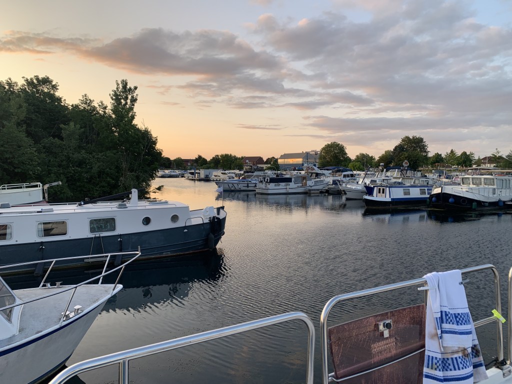
Sunset in our marina
Saint Jean de Losne to Seurre (May 25)
Ready to head south on the Saône on a four day test cruise but…. no. While attempting to leave the dock in the morning the bow thruster stopped working. Turns out Phillippe was right and the controller unit is fried. After a quick text exchange Phillippe promises to have an electrician bypass the controller this afternoon… which actually happens and we leave around 2:30 heading south!
On the river…. finally!
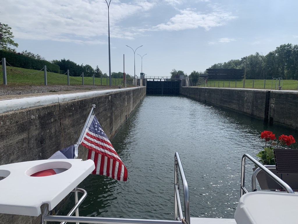
We arrive in Seurre after 2.5 hours of cruising and one big lock. The locks between SJL and Lyon (where the Saone empties into the Rhone) are the big, 180+ meter, commercial locks.
Our little boat in the big Seurre lock. The lock control tower is in the distance. View of Seurre from our mooring.
Seurre to Verdun-sur-le-Doubs (May 26)
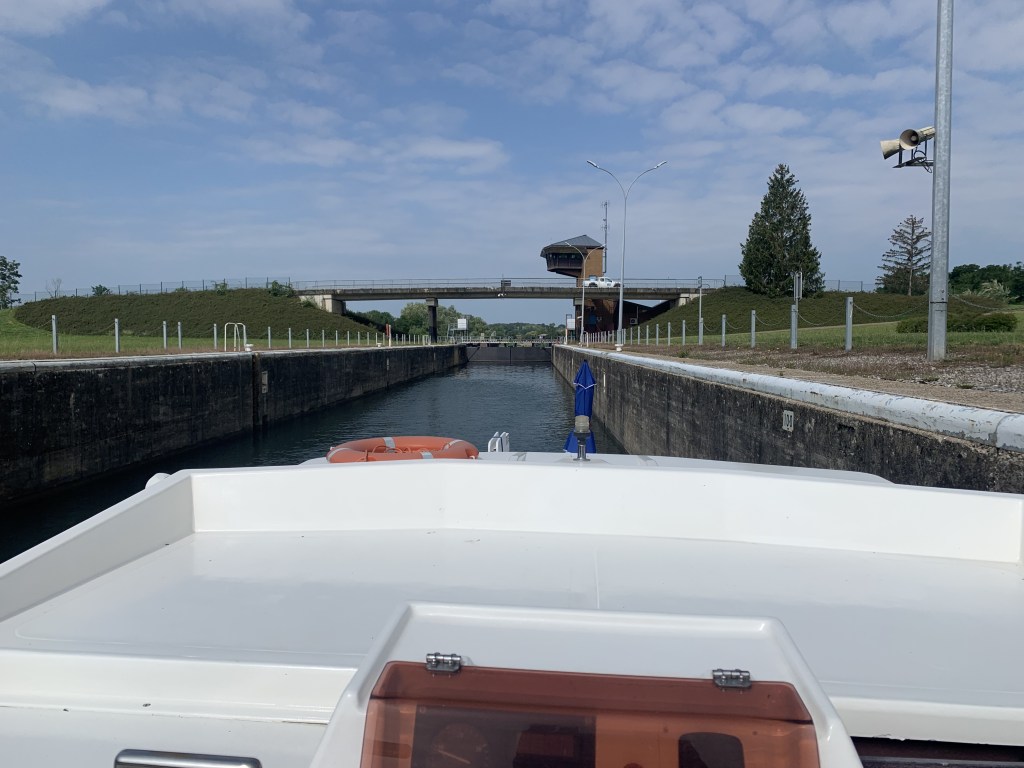
Another short day running the engine (and waiting for something to break…. this is a shakedown cruise after all) continuing south on the Saone. Everything seems to be working well. We had to pass through another of the big Saone locks.
Looking back in the lock …… and looking forward.
Verdun is a little town at the junction of the Doubs and Saone rivers and has a nice visitor dock. And the Captainerie serves ice cream and wine!
Decize at her mooring in Verdun-sur-le-Doubs
Verdun-sur-le-Doubs to Seurre to SJL (May 27,28)
And with that we turned around and headed back to Saint Jean to prepare the boat for our first guests of the summer (Jackie, David and their 9-year old daughter, Emory).
We explored Seurre a bit more on the return trip and it is a lively little town with lots of restaurants and shops.
Main street in Seurre
And, it being Wednesday (i.e. Martini Night), we had to celebrate…
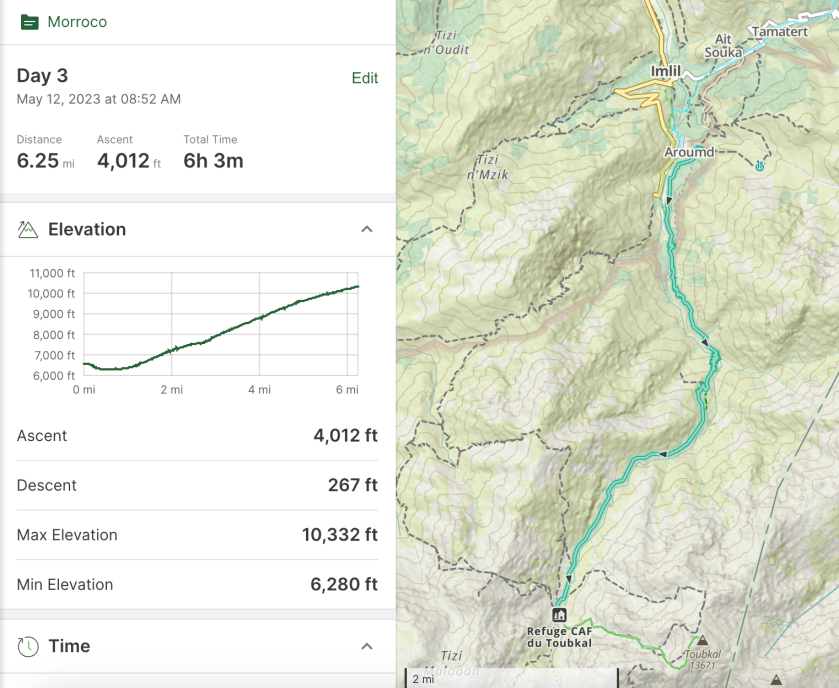
Refuge (10,330’) to Jbel Toubkal (13,665′) to Imlil (6,000′)
Up very early, 3:30 for breakfast at 4:00 and on the trail by 4:30. We start in the dark so everyone has headlamps on.
Steep, cold, slippery and dark.
The trail quickly comes to a snow traverse that is slippery and very steep. Wishing we had crampons! This short traverse was the scariest part of the day for me.
A quick stop in the dark.
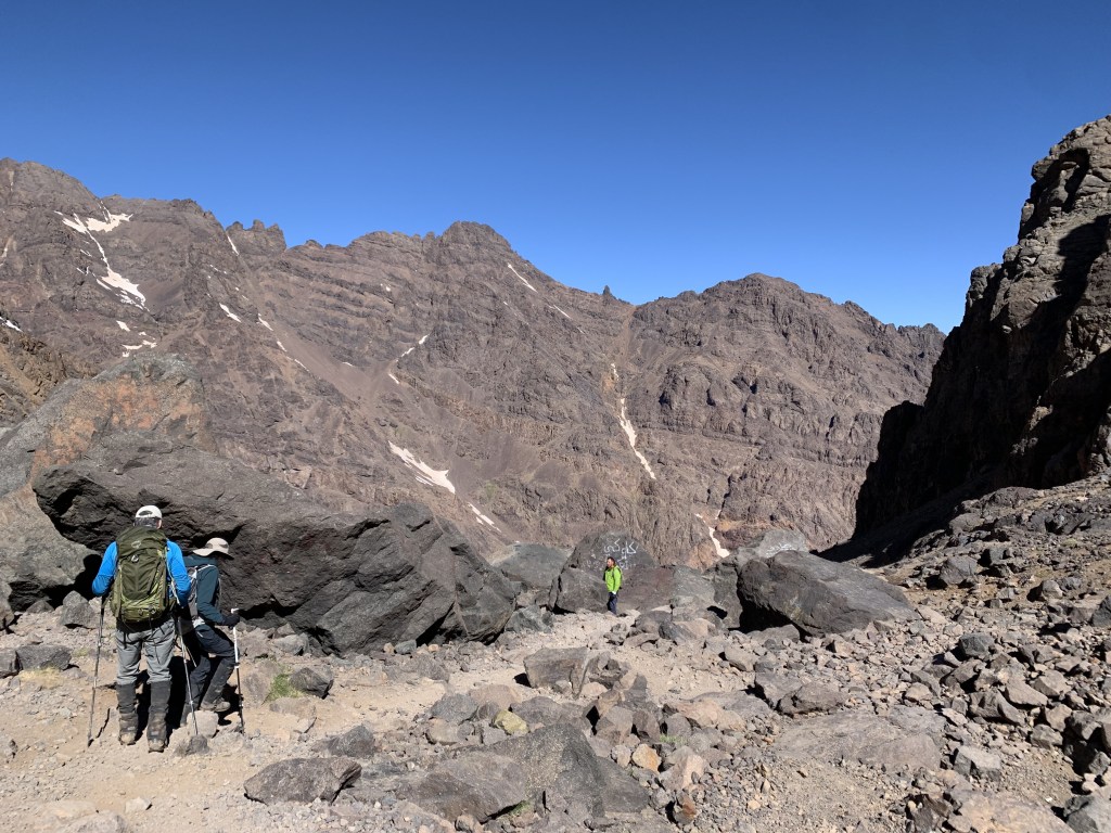
After the traverse we began a steep rock scramble that seemed to go on forever. The trail is crowded and we pass several large, slow moving groups.
Sun is starting to come up. Lot of folks ahead of us on the trail.
The trail leveled out a bit as headed up towards the saddle.
Heading toward the saddle.
We reached the saddle around 7:15. Only 300′ to go but it is very rough.
At the saddle!
We never stopped for very long because, with the wind, it is very cold.
Nearly there!
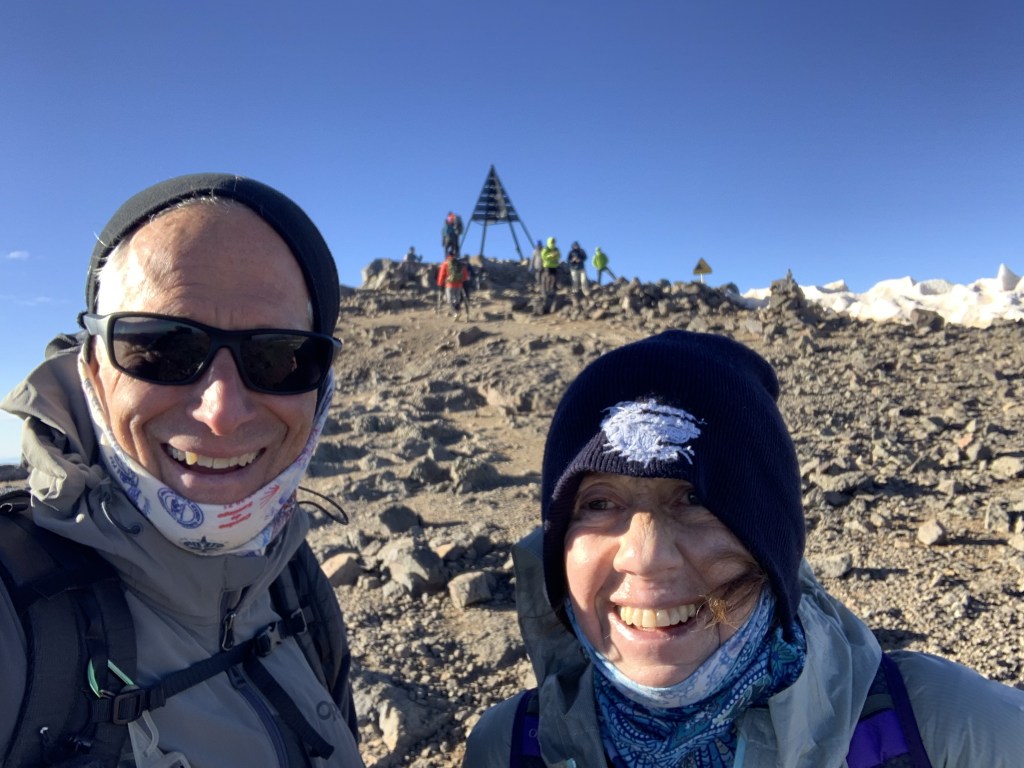
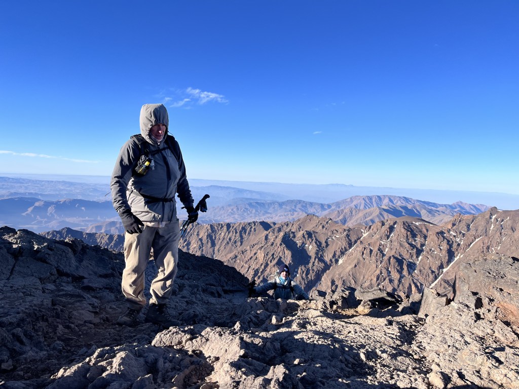
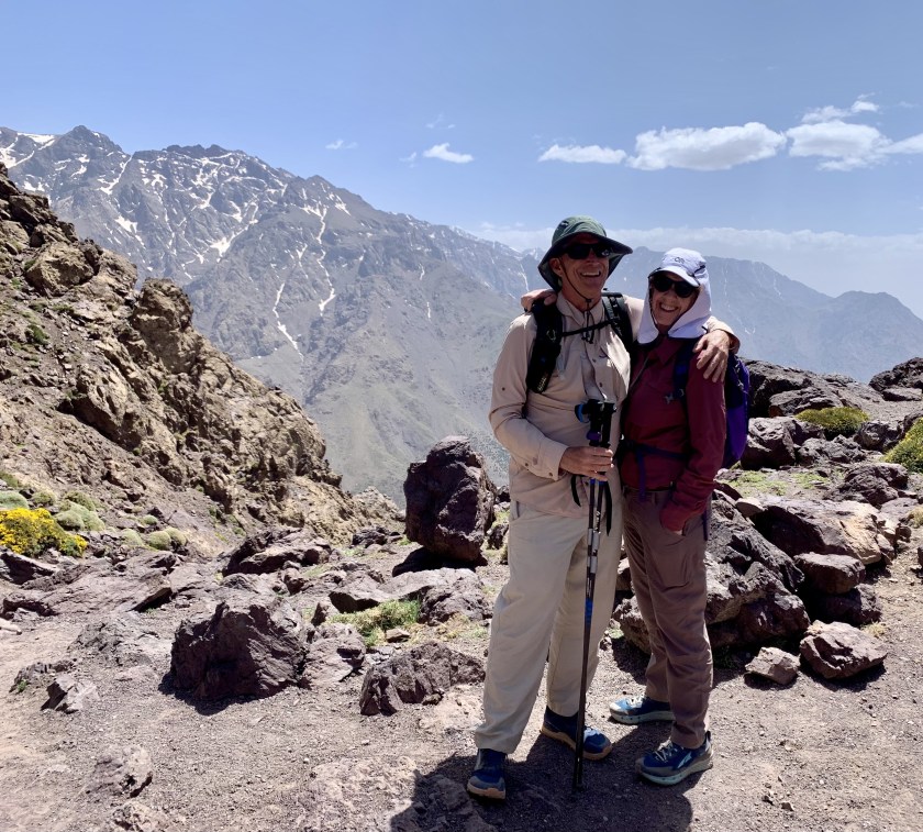
And finally, around 8:15 we reached the top.
At the top!
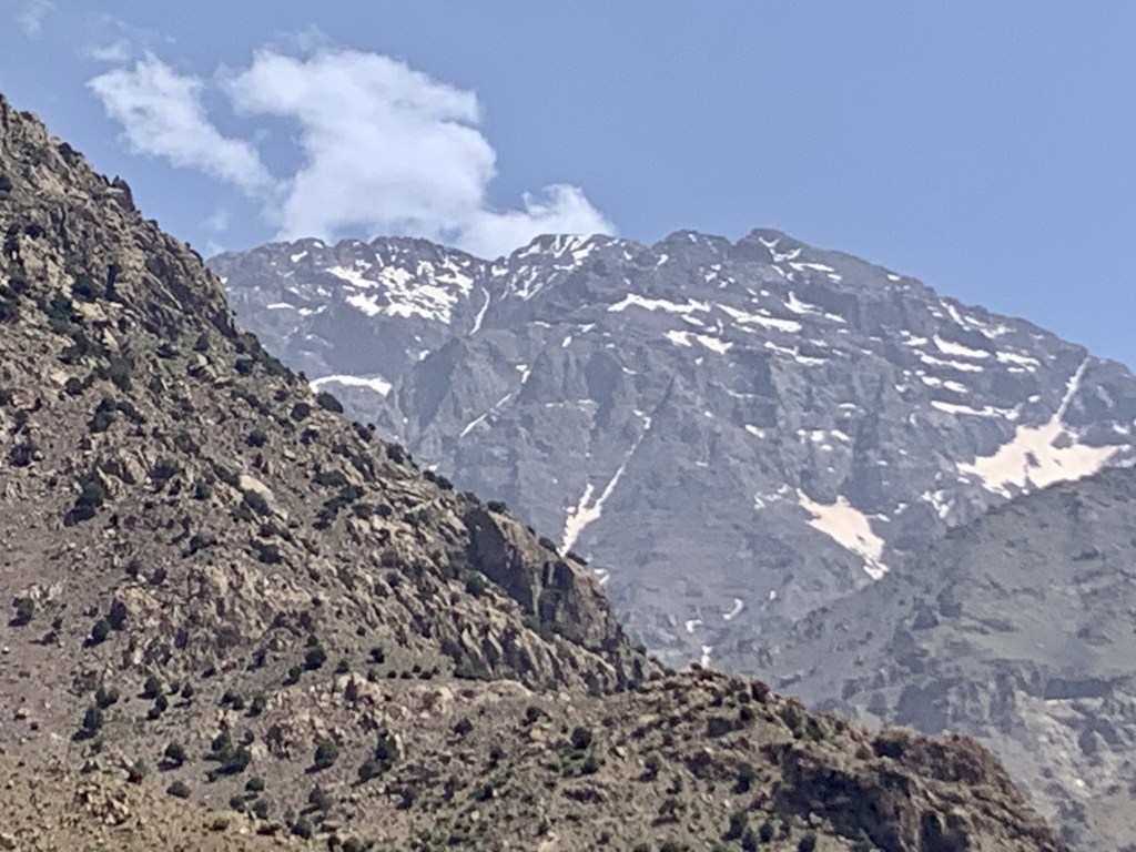
We don’t hang around long at the top because of the cold but the views are stunning.
Summit viewSummit panorama. At the top!
Then we began the long, 7,500′ hike back to Imlil, stopping for an hour at the refuge to pack up our sleeping bags and have a quick lunch.
Heading down.
We got to our hostel in Imlil at 4:30 PM, a 12 hour day.
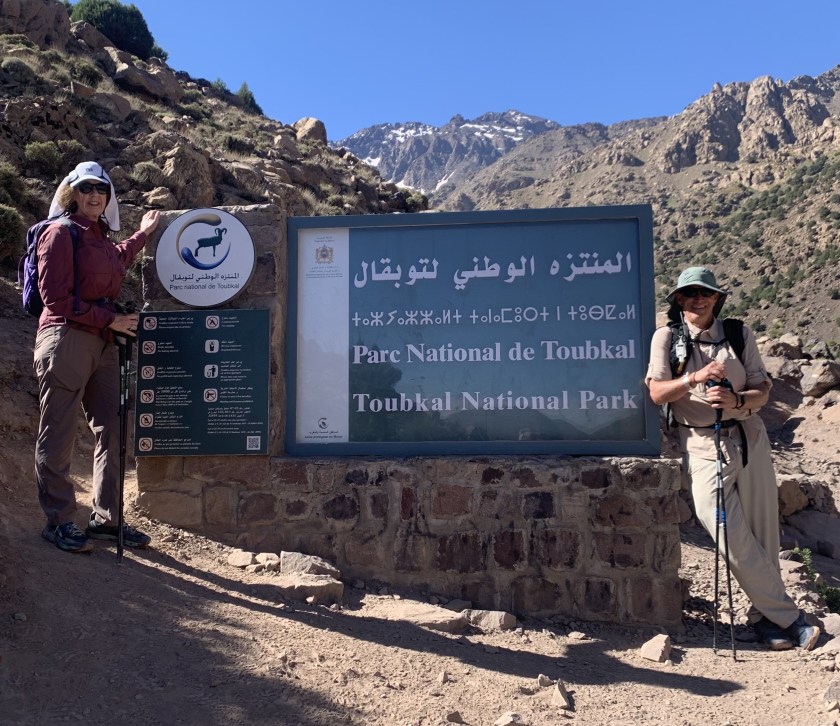
May 12, Arumd (6,600’) to Refuge du Toubkal (10,330’)
Big day as we climb to the refuge for the climb tomorrow to the summit. This is a 4,000′ day. We started at 9:00 with a couple hundred foot drop to the valley floor just south of Imlil then we started up.
Heading up! Toubkal is not visible but it is in those big mountains at the head of the valley.
The trail today is pretty good, rocky but not too steep. We very quickly re-entered the national park.
Back in the park.
We have a view of the big mountains pretty much all day.
Our guide Ibrahim.
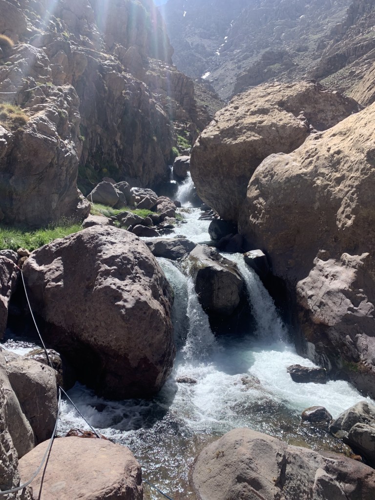
We stopped a couple of times along the way, once at a pretty stream crossing.
The only trail obstacles were the mules. We’ve learned that the mules always have right of way!
Our fellow mammal hikers. Rest stop
At our lunch stop, as we were leaving, Ibrahim realized that one of the hikers coming down had accidently grabbed his pack! He had to race down to catch him. How could somebody not know their own pack?
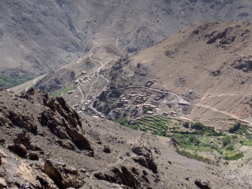
Approaching the refuge (middle of the picture). Toubkal is in the background.
We got to the refuge about 3:00 PM and there were few people there but that changed as the afternoon wore on.
At the refuge!!
By dinner (6:30) the refuge was packed with hikers. Our guide gave us the option of sleeping in the refuge or in tents and we elected the tents.
Putting up our tents (orange and green ones).And fishing is forbidden! Just in case you were thinking of it.
Started with a road walk out of Tacheddirt and then trails/dirt roads the rest of the day heading for our mountain pass of the day.
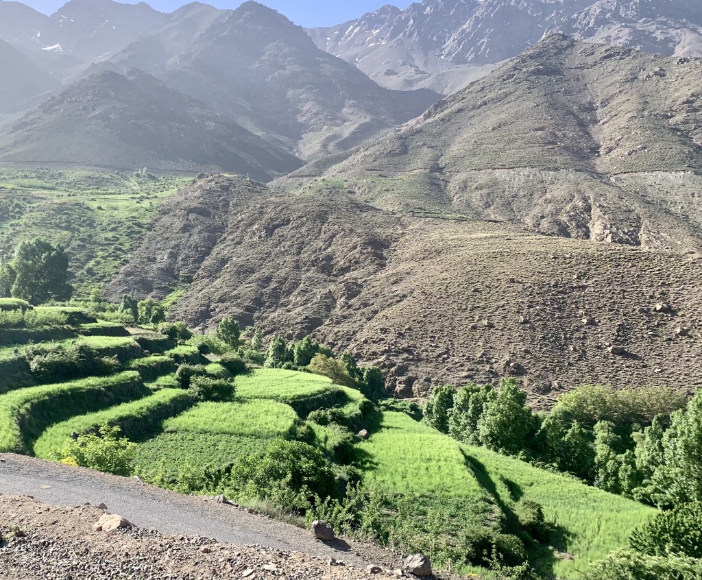
Hiking down a very pretty river valley
The trail today is much nicer, a nice mix of mountain trails and gravel roads as we move from one mountain valley to the next.
Crossing a stream on a nice wooden bridge.Today’s view of Toubkal… a little closer? Maybe?
We could see Toubkal a few times today and it looks bigger than ever. Arumd is a small town perched on a hill above Imlil. The place is nice but busy with hikers and noisy. We arrive about 3:30 and have our usual tea/popcorn at 5:00 and dinner (the ubiquitous veggie tagine) at 7:30. Joe is paying the price for hiking with vegetarians.
Today’s selfie! Why are these people smiling? There’s a mountain to climb!
May 10, Oukaimeden (8 ,600’) – Tacheddirt (7,600’)
Mohamed, the tour owner met us at 9:00 at the hotel and helped us load into our shuttle for the ride to the ski resort of Oukaimeden where we would start our trek. After a 90 minute (very curvy) ride we got to Oukaimeden where we met Ibrahim (our guide) and the two Hassan’s (mule drivers, cooks).
Day 1: Oukaimeden to Tacheddirt
We started up out of Oukaimeden about 11:00, circling the ski valley, stopping after a couple of hours for a picnic lunch.
Hiking out of Oukaimeden Hot picnic lunch
We got to the top of today’s pass (just under 10,000′) just before 3:00 after passing the sign saying we were in the national park.
We are in the park.
We are feeling the first day at altitude but everyone is moving well.
High point today. And that mountain over my right shoulder is where we are heading!
After that we began a very steep, rough descent to Tacheddirt.
Steep descent to TacheddirtTacheddirt, our destination for the evening.
We got to our hostel about 4:30, a very quiet place with few other hikers.
View from our hostel
We got a couple of views today of where we are heading and it’s hard to believe we will be up there in a few days.
Mt Toubkal is one of those big peaks behind me. Very exciting!
Here are my thoughts on the Pinhoti Trail, fresh from finishing the trail a few days ago
Trail Access, Both Ends
I got to the southern terminus of the PT to start my hike by flying into Birmingham and shuttling to Flagg Mountain, about 75 road miles southeast of Birmingham. I used the Pinhoti Outdoor Center shuttle service. Total price for shuttle and a fuel canister (230g) was $153. They explained that if they were picking up other hikers this would be less. Uber might be a possible option but I doubt if it would be much less.
The northern terminus of the PT is a trail junction with the Benton MacKaye Trail (BMT 72.1). A couple miles north on the BMT is the closest road access, the intersection of Foster Branch Road and FS 22 at Watson Gap. It might be possible to arrange a ride from here, maybe back to Dalton. The problem for me was I needed a major airport. I elected to continue up the BMT to Ducktown where I arranged a shuttle with A Walk in the Woods to the Knoxville airport, about 75 miles. This was very expensive, $350. Multiple hikers would make this less of course.
Compared to other trails I have done, the PT trail access was hard and expensive, especially if you don’t live or have friends in the area and are a solo hiker.
Overall Trail Quality
The trail quality was, especially in Alabama, and with a few exceptions, quite good. A nice mix of packed-earth woodland trail, rocky ridges and country and forest service roads. The exceptions:
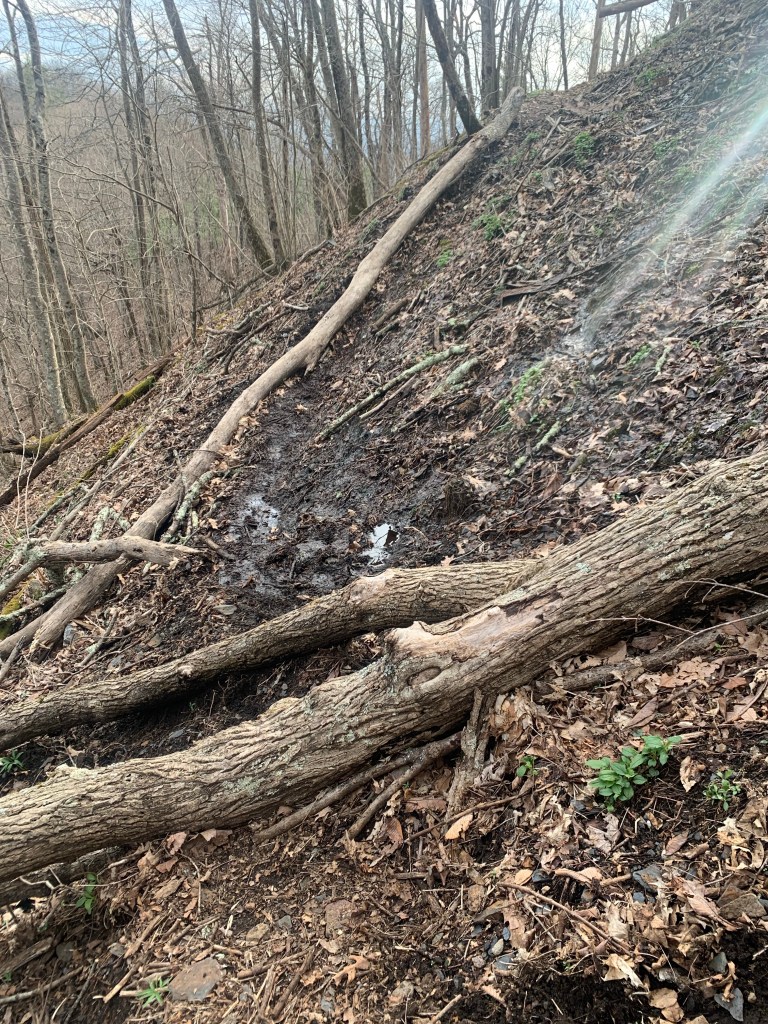
PT 25.5: Leaving Holman’s Crossroads Rd you enter a bulldozed nightmare of a trail for a mile or two. There are blazes on the few remaining trees still standing but there is no trail, just a muddy, branch-strewn, ankle-twisting mess. I would definitely have stayed on the road if I had known how bad it was.
The “trail” near PT 25.5
PT 85: In the Cheaha Wilderness, once you get up on the big ridge, there are several sections were the trail deteriorates into an unmarked, very rough, rock scramble.
The “Stairway yto Heaven”
Road Walks
Short (less than 5 miles) road walks can be a nice change from the trail and a way to pick up some easy miles. However, there are two long road walks on the PT. I skipped both of them.
Dalton: Leaving Dalton (PT 285) there is a 25 mile road walk, some of it on very busy roads, to get back to the trail. This is over my limit for busy road walks so I used a taxi (Tony’s Taxi) to get around most of this. I tried Uber first but could not get a driver.
Cave Spring: Leaving Cave Spring (PT 190) there is a 20 mile road walk. I considered walking this since these roads are not too bad, some are busy but most are not. But, again, 20 miles is over my limit and I had an offer of a ride from a trail angel in town (Crispy) so I took it.
Blazes and Navigation Aids
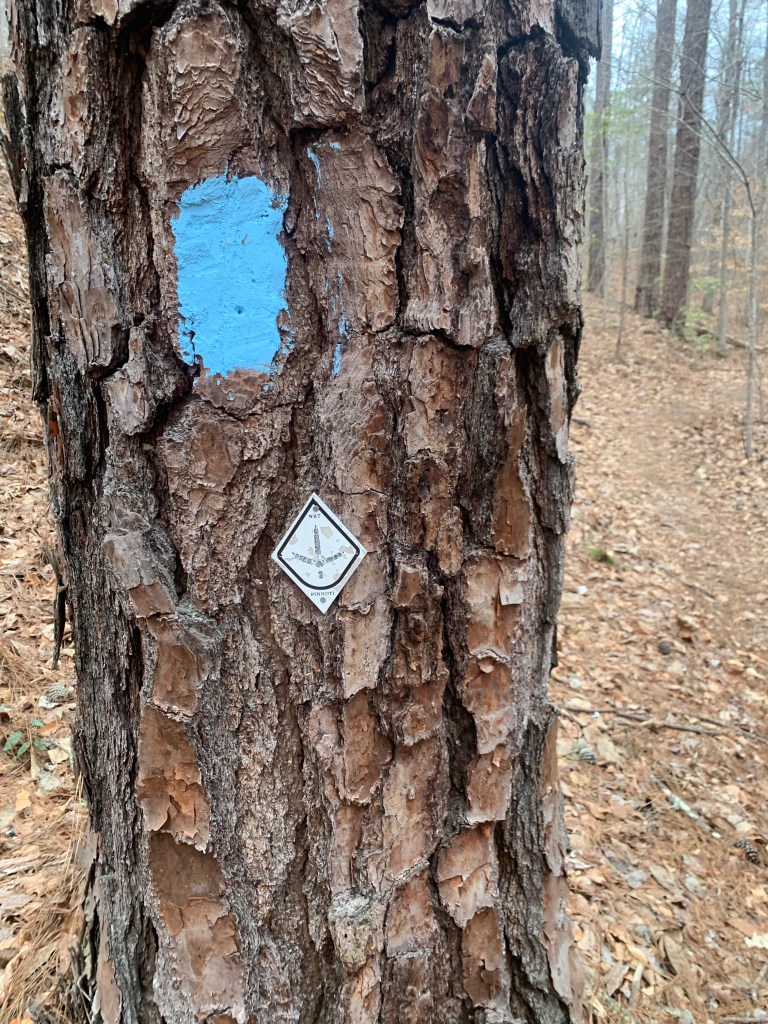
With the exception of about 10 miles of the Cheaha Wilderness, the trail in Alabama is very well blazed. I seldom had to access FarOut (Guthook) to find the trail. This is not true in Georgia.
PT Blazes (in Alabama)
The baby-blue rectangular marks were the more common trail blaze in Alabama but there were also, less frequently , the metal diamond medallions.
Once you enter Georgia (PT 179), the blue blazes stop and the diamond medallions become random and infrequent. In Georgia, if you do not have some kind of navigation aid you will definitely lose the trail. There are several trail/road junctions where there are no blazes at all.
Also, at some point, the Great Eastern Trail, which uses a white rectangular blaze, is coincident with the PT and you will sometimes see these blazes.
Resupply, Support and Trail Towns
The trail is pretty good for resupply. Here was my resupply schedule:
PT 60 – Talladega: A nice couple run Next Step Hostel that is close to grocery stores/fast food and they will pick you up and return you to the trail. Very nice.
PT 113 – Heflin: Either a 3.5 mile side trail, a 2 mile road walk/hitch or calling city hall (Tammy) to get a ride make getting to Heflin pretty easy. The town is spread out but has all the necessary hiker needs.
PT 190- Cave Spring: The trail goes through town. The Creekside Inn Motel is closed but the Hern Inn is available and is a great hiker stop. Another great hiker town to meet all your hiker needs.
PT 285- Dalton: Thé trail goes through town. Dalton is big and spread out. Most of the hotels are near the freeway where you enter town. Grocery stores/restaurants are near the highway and the Academy (fuel canister) is 2-3 miles north.
Dogs and Other Wildlife
Over the course of my 3-1/2 weeks on the trail I saw 5 deer, a raccoon, a very colorful slug, a couple of lizards and many squirrels
… and dogs. For some reason there are people who believe that their dogs are not their responsibility. I had two run-ins with dogs that came out onto the road and approached me very aggressively. In the first instance, I crossed to the far side of the road but the two dogs followed, causing a car to stop. I finally had to use my pepper spray which was very effective. The second incident was a lone dog who I stopped with dog treats.
Blowdowns
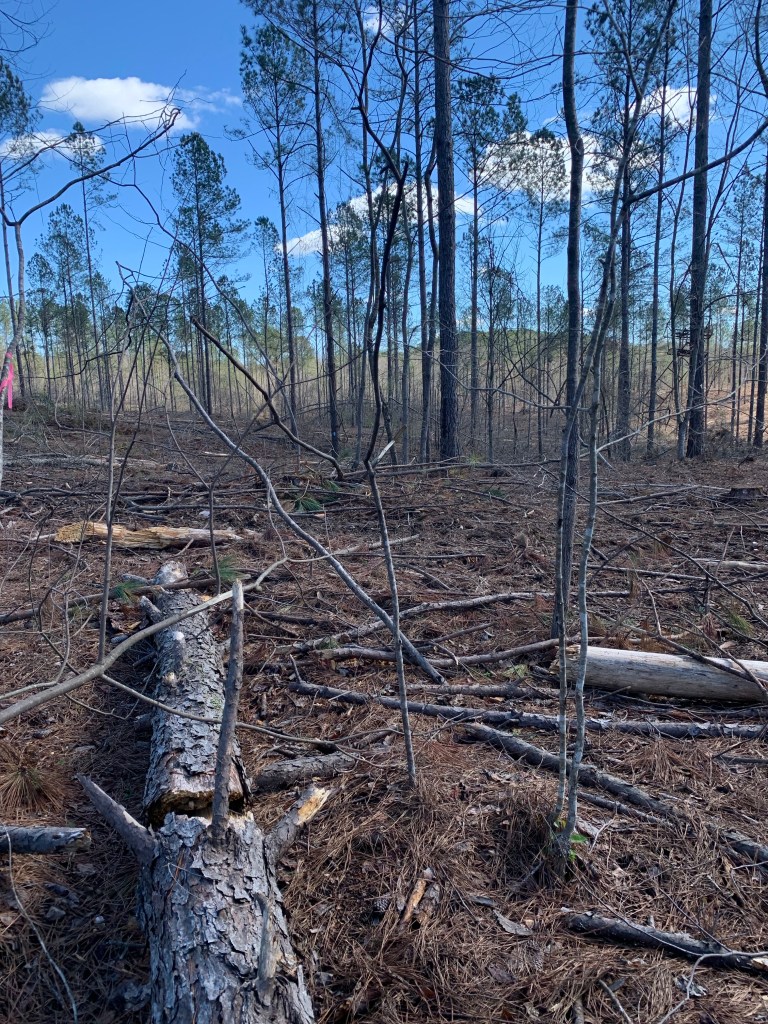
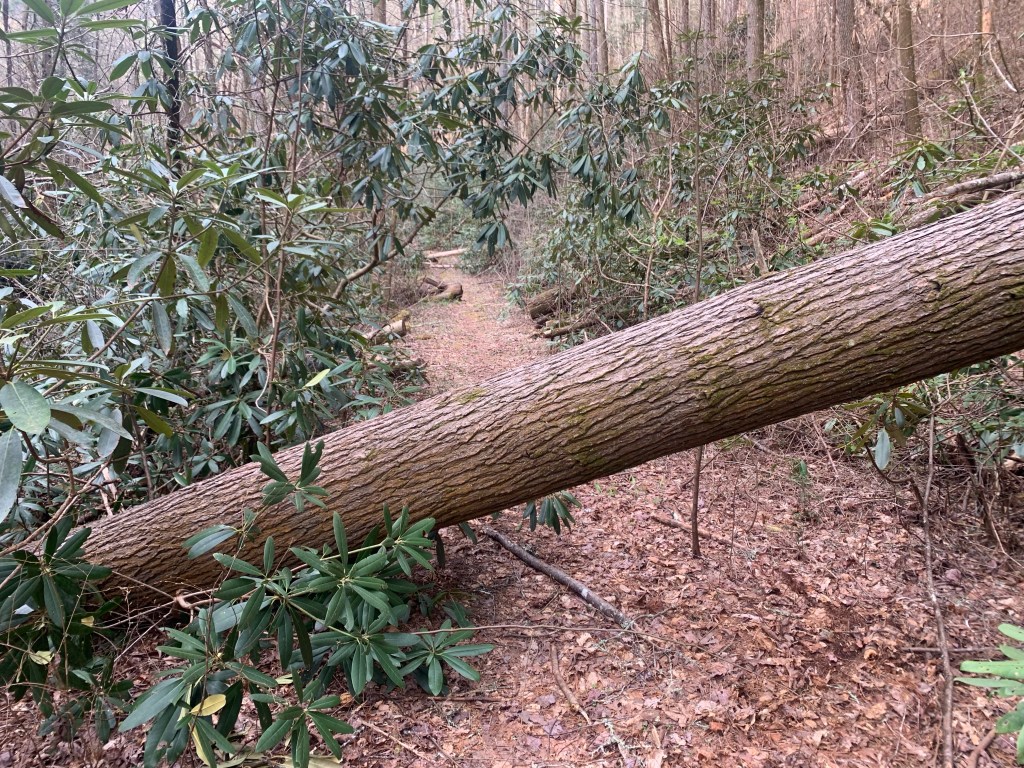
For the most part the trail obstacles were typical and not difficult to navigate. There were a couple sections where the blowdowns were so frequent you could see four of five down the trail while climbing over one.
Views
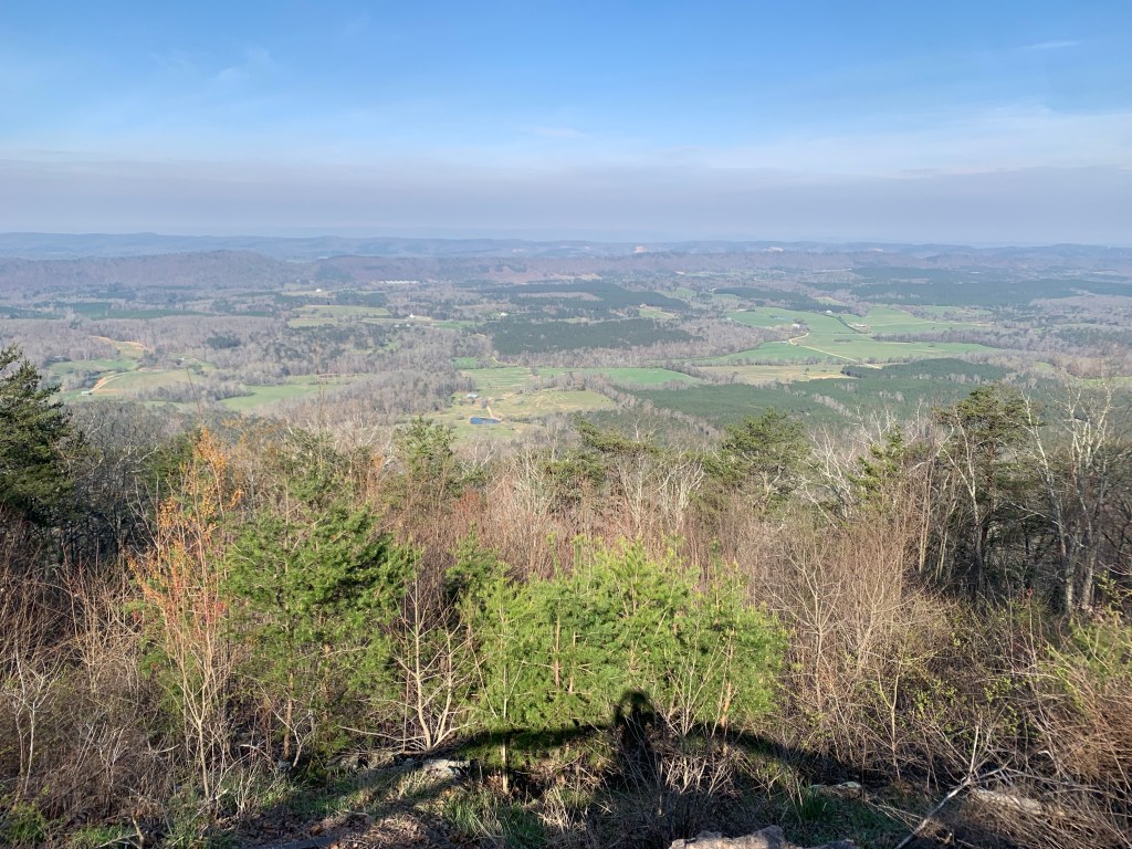
A lot of the trail is along ridges and often, especially in March before the trees have all gotten their leaves, there are some really nice views, which is always a nice reward after a hard climb.
Well, so much for plans. I had a Lyft scheduled to get past the ~20 mile road walk out of Dalton but, as I learned, when you schedule with Uber or Lyft, it really is not scheduled. They just release your request when your time nears and if no driver wants it…no deal. I ended up calling “Tony’s Taxi” and Tony was at my hotel in 10 minutes.
Tony got me to within a couple miles of the trailhead (the road was closed). The good news is that my timing is good – the rain stopped this morning just before I started hiking.
Walking to the trailhead … through the middle of Trumplandia.
This was my biggest climbing day of the hike, more than 4,000 feet and also a big distance day – about 19.5 miles. The clouds disappeared in the afternoon as it warmed up into the 70’s.
The sun comes out!
I had planned to stealth camp at a lookout along a major road but when I got there it was just too busy (and noisy) so I continued another 2.5 miles to a small, dry campsite on a ridge.
Camp on a ridge but no views.My dinner companion.
Day 25, Mar 26, PT 328.9
Had my warmest night so far, I don’t think it got below 55°. It’s kind of nice taking the tent down without having to have my gloves on. Today was a shorter day, as planned. A good thing too, my legs really felt that 4000 foot of climbing yesterday.
And it was practically crowded on the trail today. I met a couple of weekend hikers and 6 or 7 bikers. Well, it is a nice Sunday but I have no idea where the trailhead is where these guys are accessing the trail.
The trail was a little rough today, at one point I could see four different blow-downs ahead.
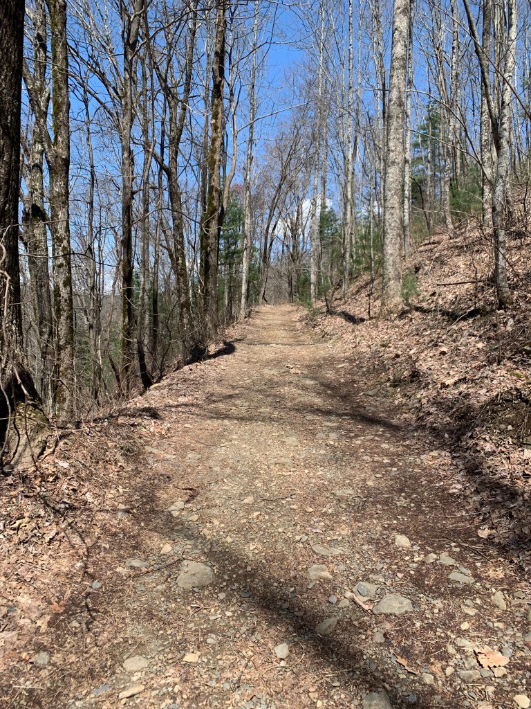
Typical trail obstacles on the PT.
I’m really happy about my campsite. It’s in a little valley between two hills so it’s very protected for the rainstorm that is supposed to come through tonight.
Of course that means no cell coverage and …. I’m only 4.7 miles from the end of the Pinhoti Trail!!!
Day 26, Mar 27, PT 350.2….The End!! And 10 miles on the BMT.
It rained last night as forecast. Started around 10 PM and rained most of the night, but never hard and ot was over by 3 AM. And it is less than 5 miles to the end of the PT.
One more wade…
The northern end of the PT is not at a trailhead, but at a junction with the Benton MacKaye Trail (BMT) so it was a bit anticlimactic. There’s nothing there but a small sign. I celebrated with my last Snickers.
The end of the Pinhoti Trail.
But… my hiking is not over. I have to go north 20 plus miles on the BMT to get to a place where I can hitch to Ducktown where my shuttle is scheduled.
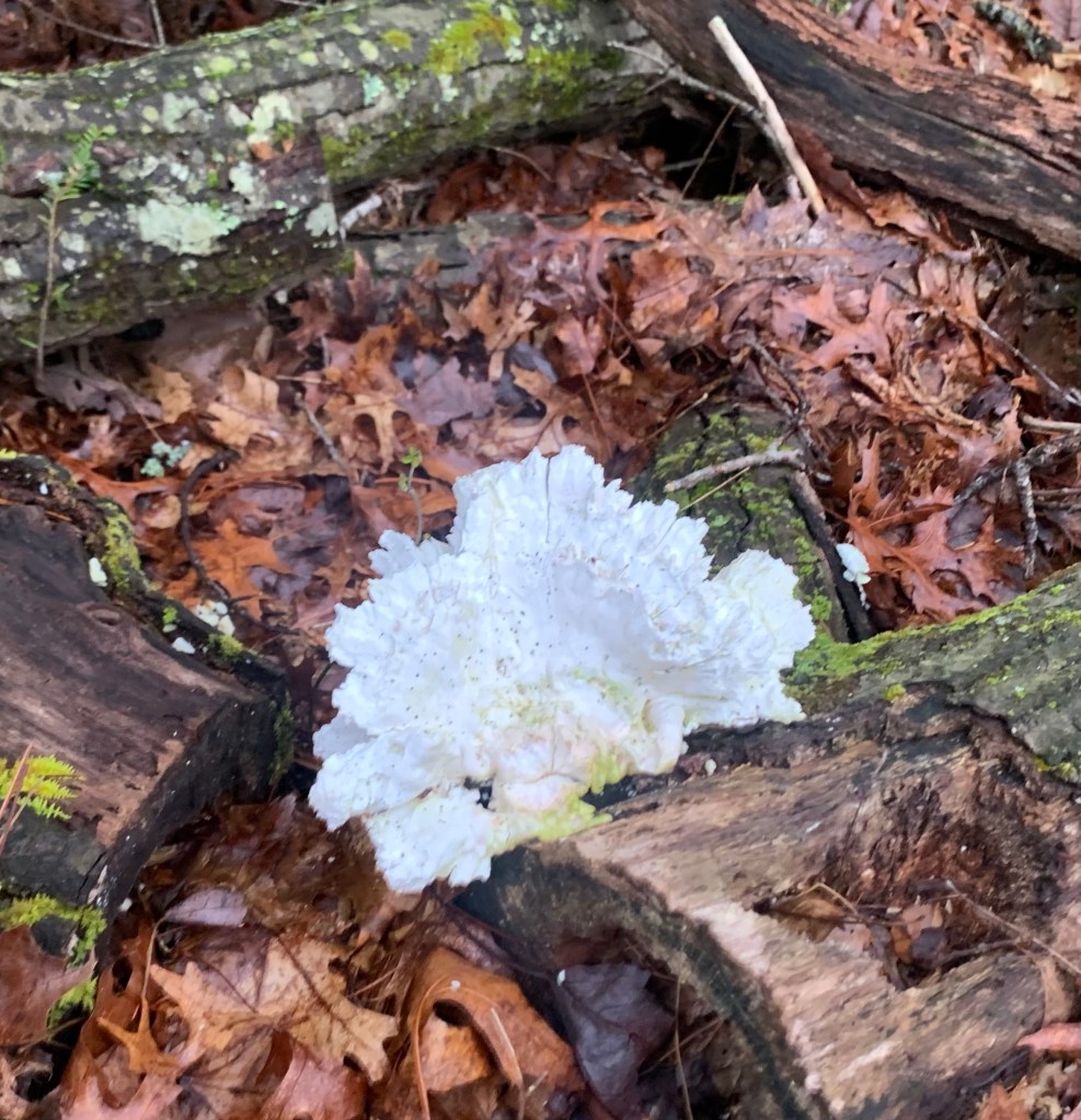
A cool fungus thing.
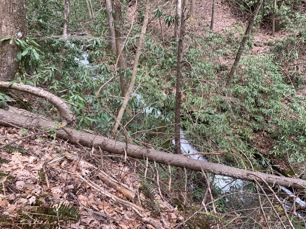
The BMT is very similar to the PT, lots of steep climbs and blow-downs.
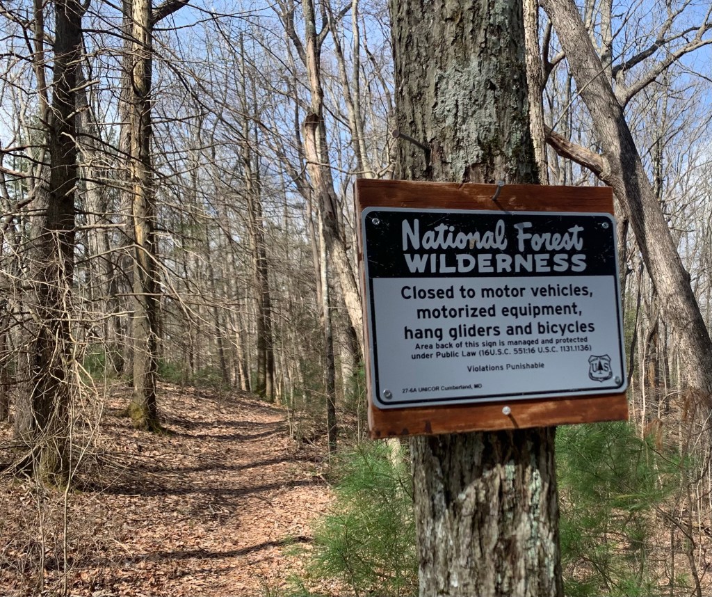
Hang gliders? Really?
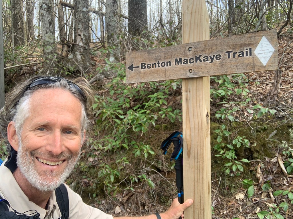
And… a new trail, a new blaze.
Hello BMT!
And my third state! I camped at Double Spring Gap (yes, there are two springs) which is on the state line with Tennessee, though there was no sign of any kind.
Double Spring Gap,
Day 27, Mar 28, BMT 93.9, Ducktown, Tenn.
The day started with a killer 1,000 foot plus climb up Big Frog Mountain over about 1.5 miles. Steep and hard, glad it was in the early morning, though I did not see any frogs, big or small.
Climbing Big Frog Mountain.
The trail wasn’t too bad on the way down, with the exception of the impenetrable jungle that the BMT became near a creek. I had to take off my pack and crawl under and over fallen trees, dragging my backpack behind me.
More fun on the BMT!
Overall I made pretty good time and got to the Thunder Rock CG, on the Ocoee River, at 12:30. Most of the spots are open (it is still early in the seasons, I think the CG only opened last week) but I bumped into one guy who asked if I had hiked very far in the direction I was coming from. “About 350 miles..” He just looked at me.
Thunder Rock. CG
As expected there is no cell coverage here. BUT there are showers and an outlet in the shower/bathroom where I am currently charging my extra battery. The shower felt wonderful, I even managed to find some soap! And I rinsed out my hiking clothes in the sink. Luxury!
Over the course of my two days and 20 odd miles on the BMT I saw nary a soul. And this completes my hiking. Of course, I still have to get the 7 miles or so to Ducktown, Tennessee where I have a shuttle scheduled.
In the afternoon I walked the campground and asked a woman who I had seen hiking earlier if she could give me a ride in the morning. Turns out she is with two other women (in the site next to hers) and I explained my situation (three times). Lisa, the last hiker who I talked to said she could give me a ride tomorrow morning! Yeah! No highway walking!
Days 28, Mar 29, Ducktown
It got cold again! It was in the low 30’s this morning. I am packed up and ready for my ride to town when I saw another thru-hiker walk through camp. “Sunshine” was in shorts, which was impressive. She had done the Florida Trail to the BMT and was continuing up the BMT to start the AT. She has over 2,000 miles to go.
Sunshine!
At 9:00 AM I walked down to Lisa’s camp and she was ready for the short drive to Ducktown. I am really glad I did not have to walk the highway this morning.
There is not a lot in Ducktown, a Hardee’s, a small breakfast cafe and a couple of dollar stores. And my motel, the Ocoee River Inn. Not fancy but hot water!
Classy hotel!
The following morning, Ben with “Walk in the Woods” showed up promptly at 10:00 AM for my shuttle to Knoxville to await my flight home to Houston. But not before having a celebratory martini!