I exited the trail early. After two days of hiking from Ducktown, with the weather closing in, I decided to drop off the trail. There were two main reasons:
Weather
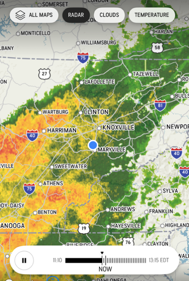
The next couple of days were supposed to be pretty bad – they are expecting 2.5 of rain the day I left and there are tornadoes and flooding just west of here.
Conditioning
I realized that I was probably not going to finish the trail in time to make my return flight. I was simply not in good enough shape to do what is probably the hardest part of the trail (miles 130-200) in a reasonable time. I hurt my knee training for the LST in January and have still not fully recovered.
My last day on the trail was one of the hardest days of hiking I’ve ever had. It took me eight hours+ to hike 12 miles. The trail was very rough with lots of rock scrambles and steep climbs. It completely wiped me out. To finish this trail I either have to be in much better shape or have a much easier plan, or both.
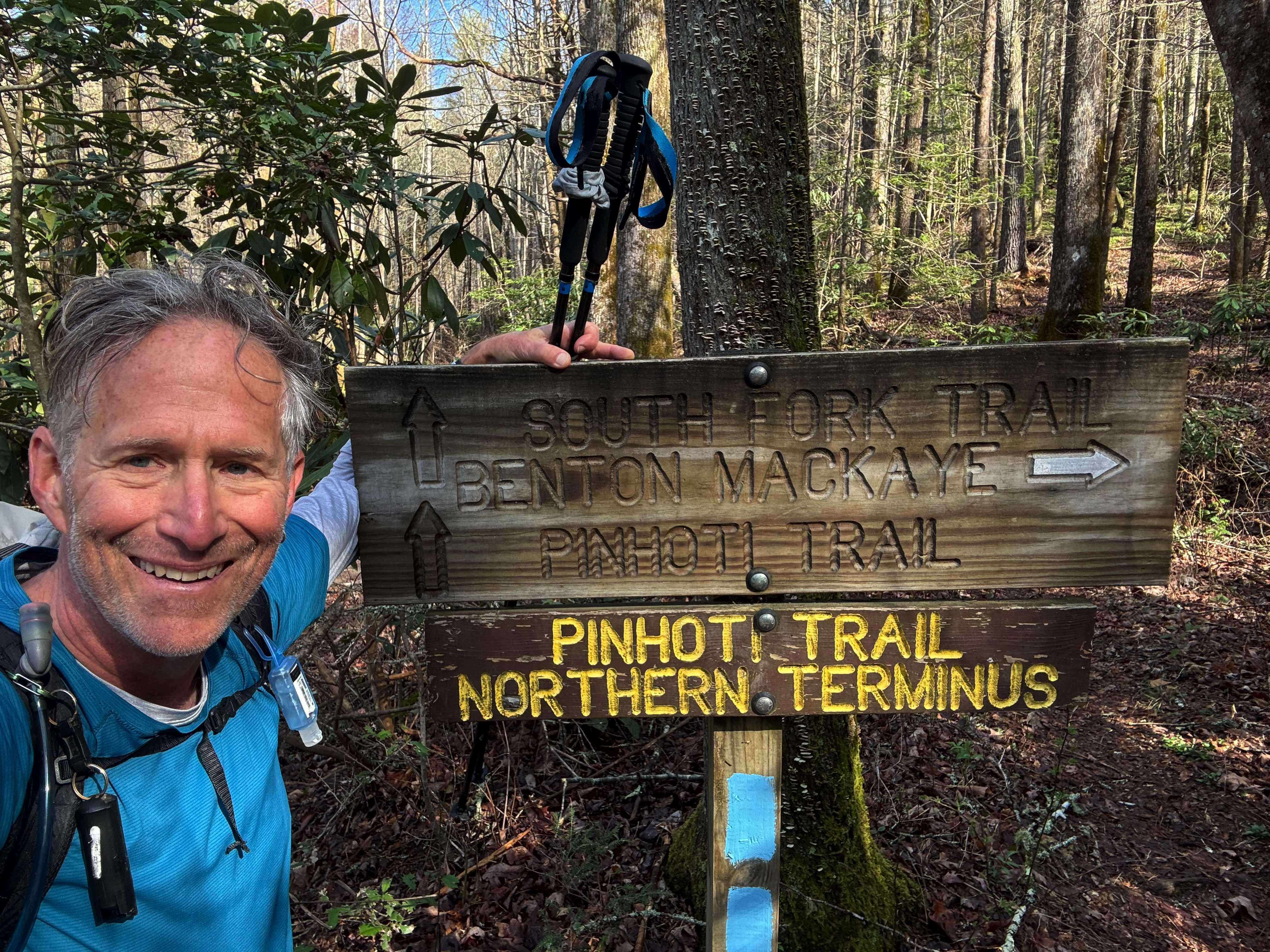
Spent most of the day travelling from Houston to the trail. Flew to Atlanta, caught the MARTA train to north Atlanta where I was picked up by my shuttle driver (“Bandit”). There were four other hikers in the van, all heading to the AT. I got dropped off at the trailhead around 3:00PM .
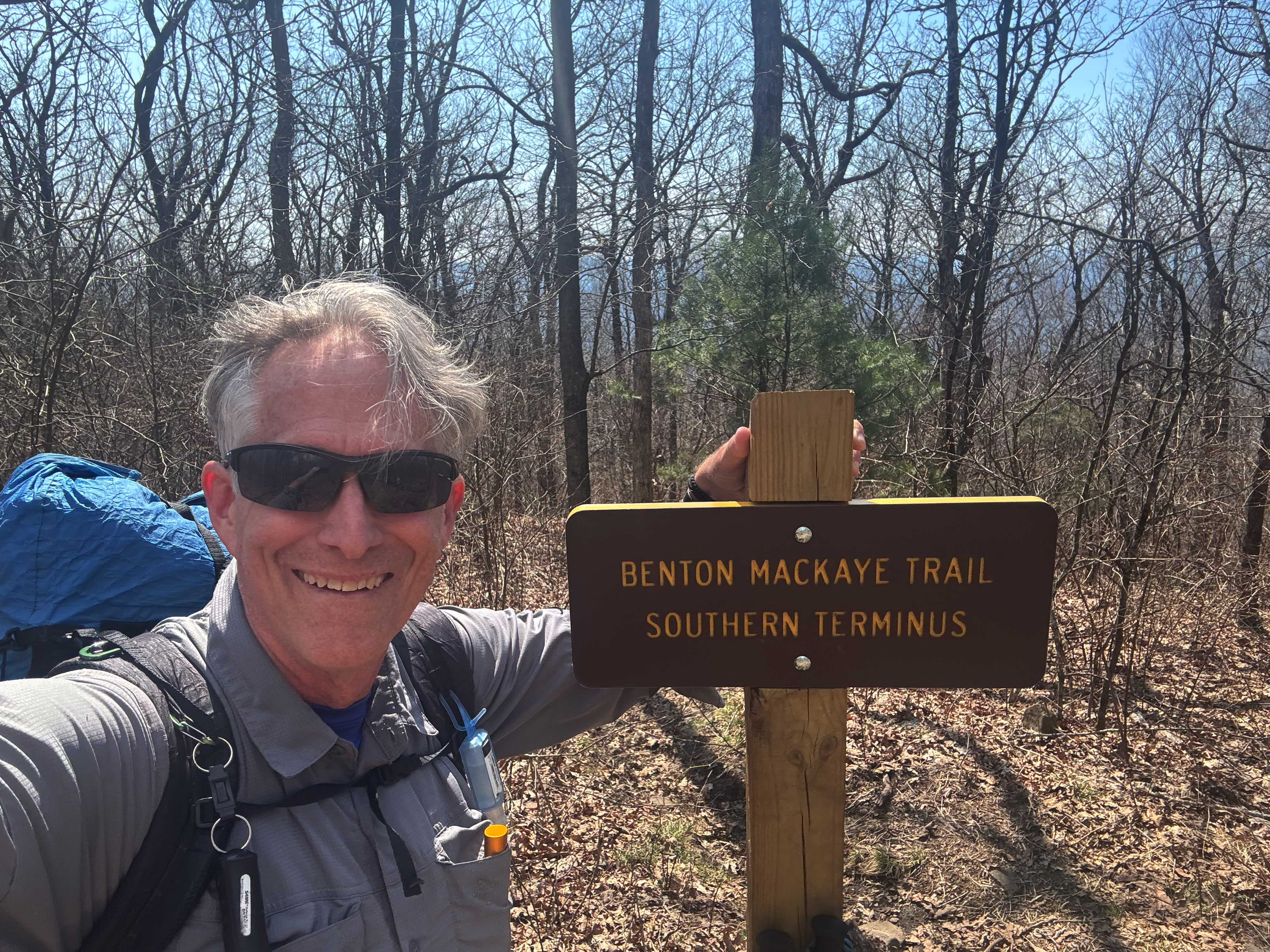
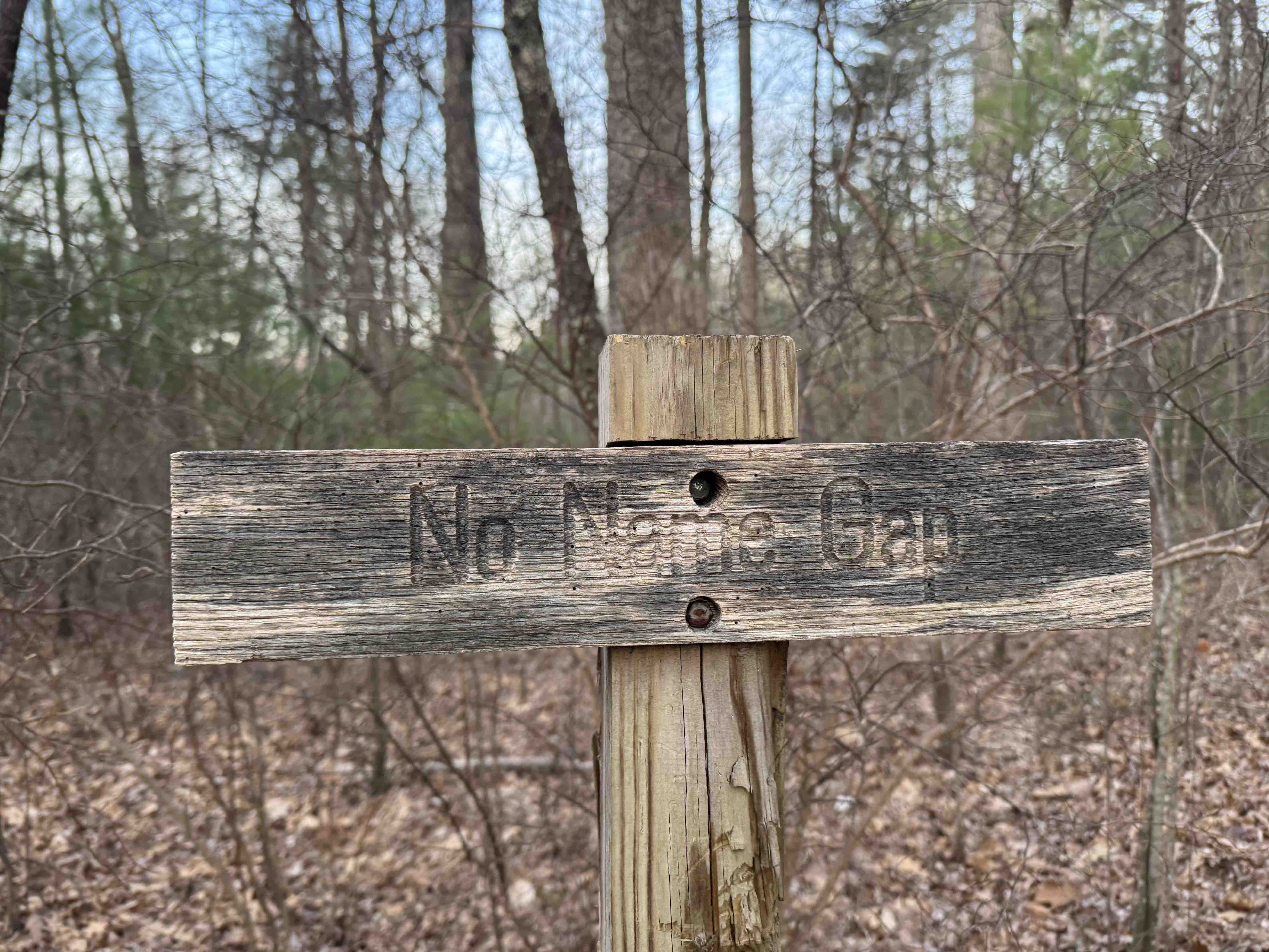
I hiked up to the official start of the BMT and then headed north. I saw several other hikers over the first few miles where the two trail cross but after leaving the AT I was pretty much by myself.
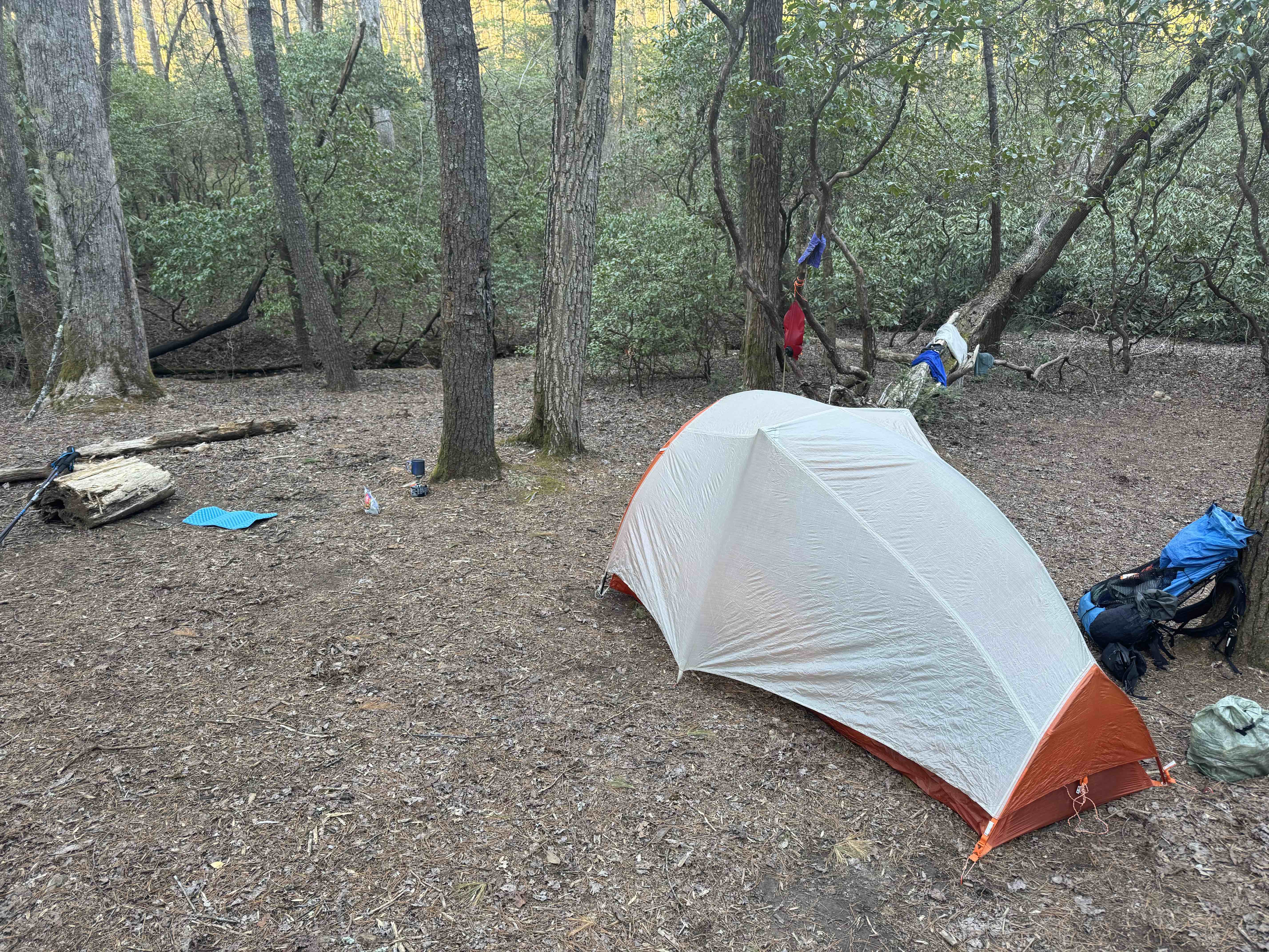
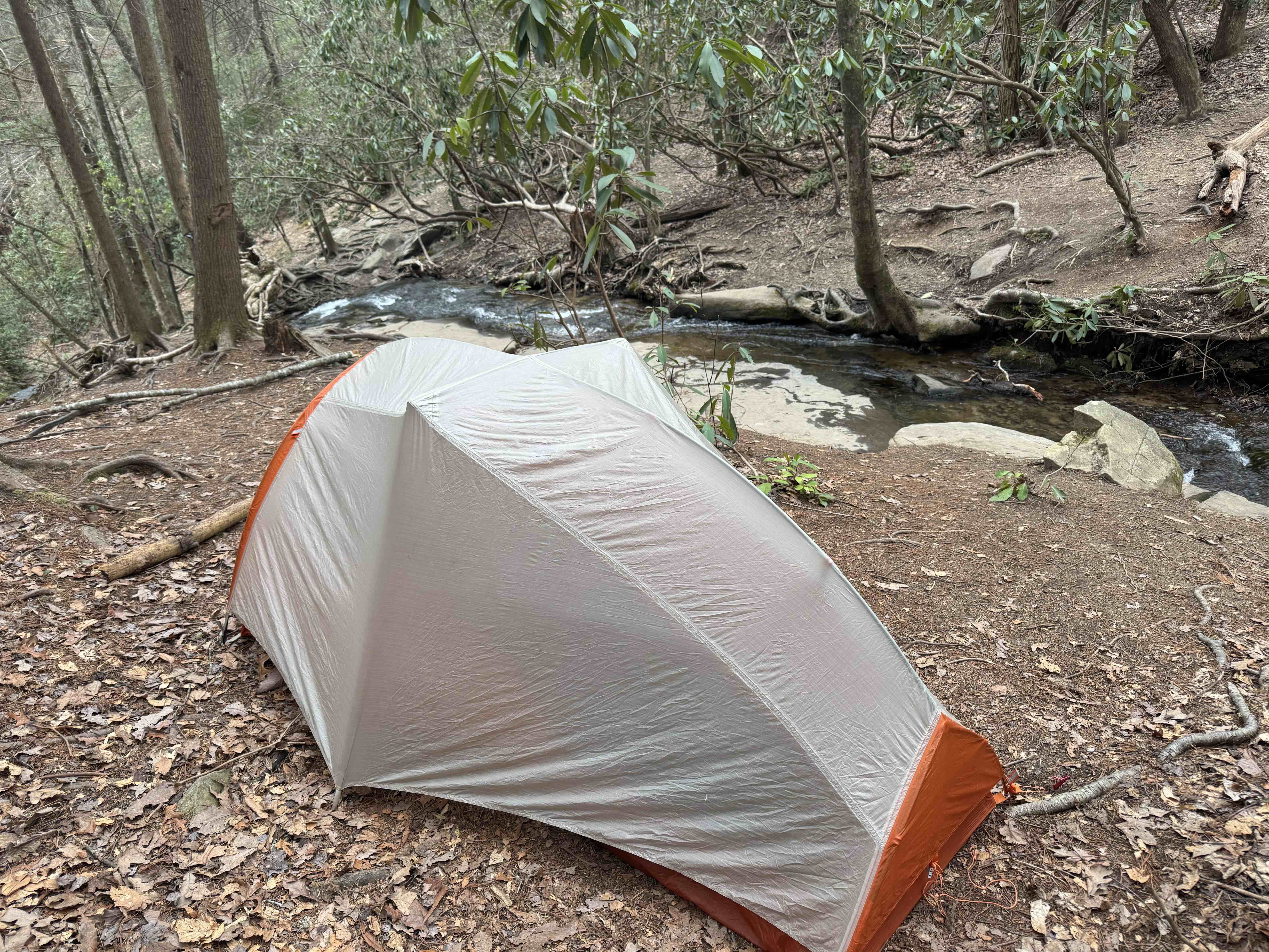
My first night was a pretty campsite by a stream and I had company! “Weedeater” showed up just before dark. He is doing a portion of the BMT.
Day 2, Mar 28, BMT 18.7
Today was disappointing. I started in the dark at 7 o’clock with my headlamp, but was able to turn it off within 30 minutes. Today was supposed to be a 4000 foot plus day and I am clearly not ready for a day like that yet. And the trail is VERY HARD.
I met a lovely couple from Georgia that had done the Pinhoti trail and then headed south on the BMT. They had done 400 miles so far and we’re planning on doing the AT once they hit Springer Mountain.
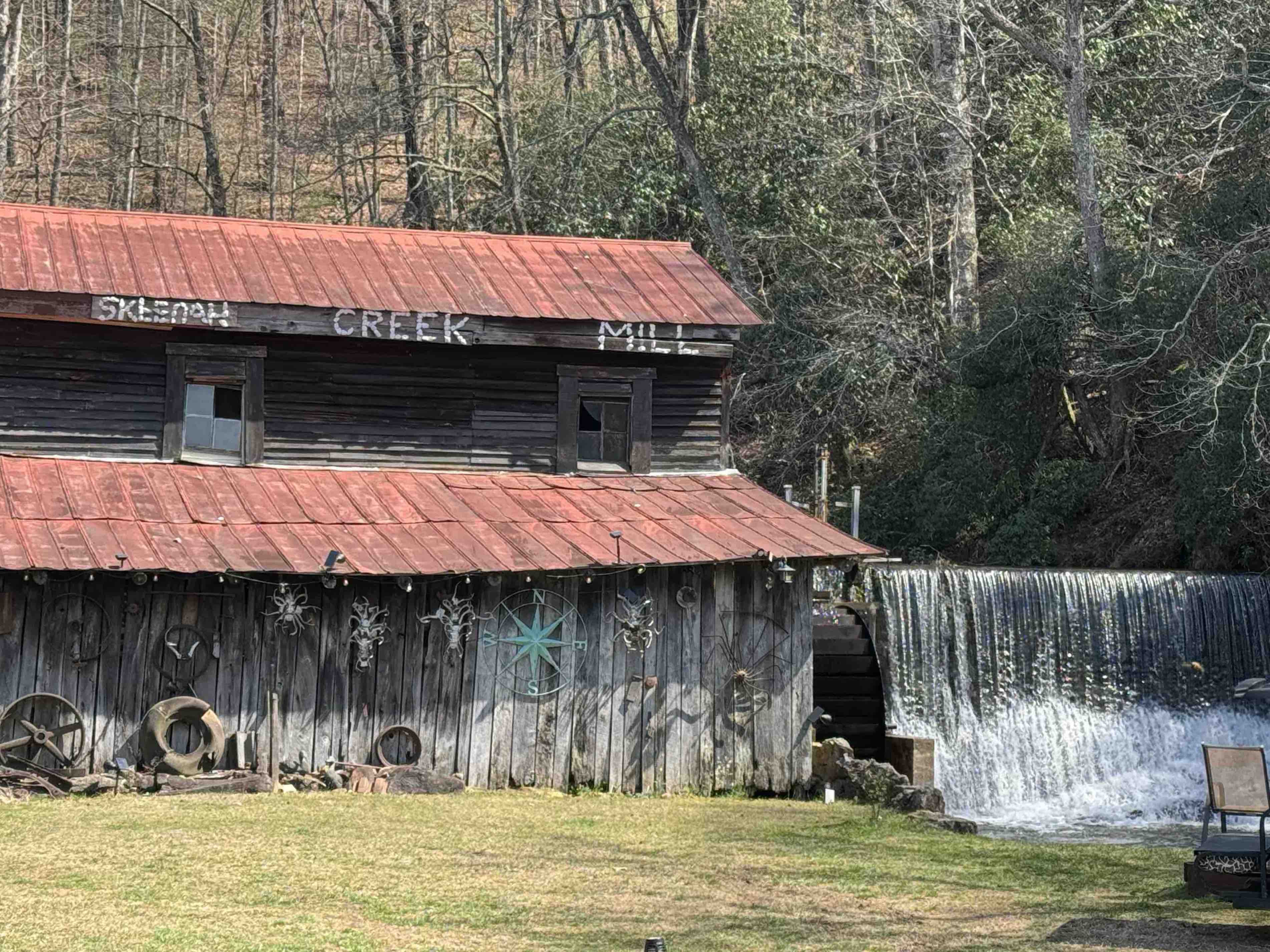
Stopped for lunch just after noon and about 9 miles. Was not feeling that great. I’m having to stop a lot on the climbs which is unusual for me. I decided to stop earlier than my plan – hiking a couple of miles off trail to the Skeenah Creek CG.
At the CG I learned l that the Georgia Death Race is happening tomorrow on the part of the trail I was currently on. I plan to catch the race shuttle from the CG tomorrow to skip the couple of miles that the race will be on.
Day 3, Mar 29, PT 42.0
Today was an interesting. It started when I caught the race shuttle from the campground to where the trail crosses Skeena Creek Road. I was hiking at 8 o’clock or just after. Another hard day with lots of climbing – 3600′ and 17 miles.
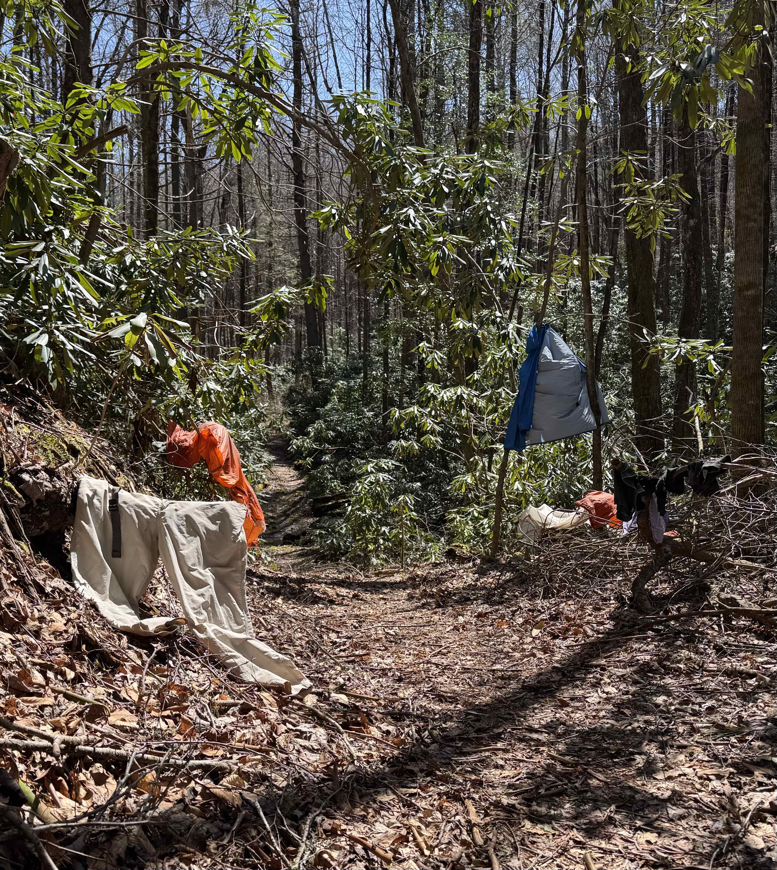
I had originally intended to stop short of iron Bridge Cafe, put up my tent and then walk to the cafe for dinner. But I saw no spots on the trail to camp, so I continued onto the café and had an early dinner about 3:30. It was wonderful. Left the café at 4 o’clock for a 4 mile road walk to get to the trail, then hiked up to the Fall Branch Falls and found a place to put at my tent.
Not sure this is a legal spot, but there are no signs saying no camping so… I’m here.
This was a pretty good day. The climbs were tough, but I think I may be getting acclimated to the trail. It’s a Saturday so there were quite a few day hikers on the trails, but I only saw a few thru-hikers going southbound. I signed my name to a trail journal and it looked like the last northbound hiker ahead of me is at least two days ahead of me.
Day 4, Mar 30, BMT 52.4
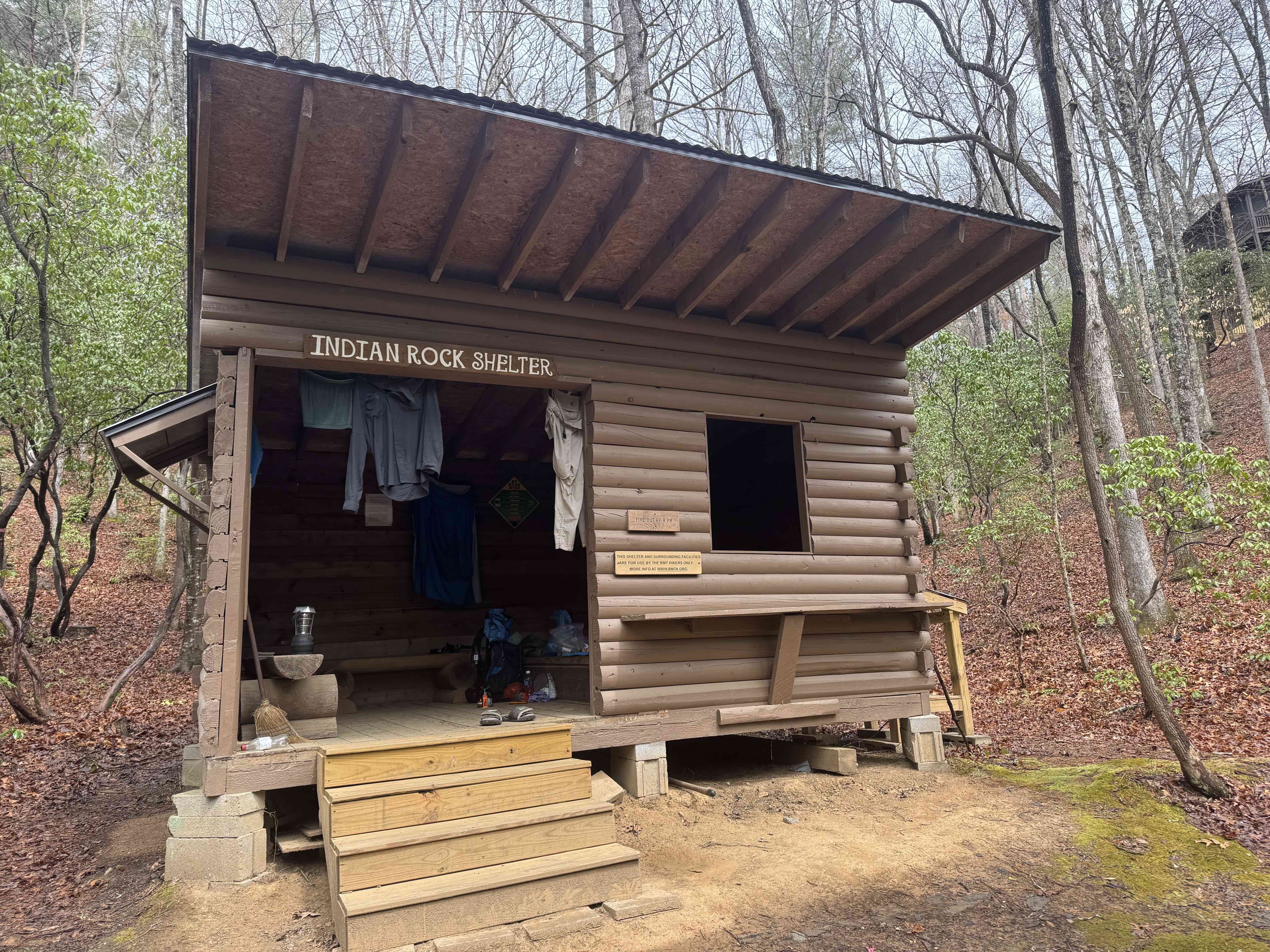
Broke camp and started walking in a light rain at about 7:30 AM. It rained all morning, never really hard, but often moderate. I made it to Indian rock shelter at 12:45 and had a hot lunch.
The next decent campsite is 10 miles. So I’m spending the night here. Tomorrow is a 4000 foot day so I’m hoping the rest will help. I did not see a single other hiker today day.
Day 5, Mar 31, BMT 66.6
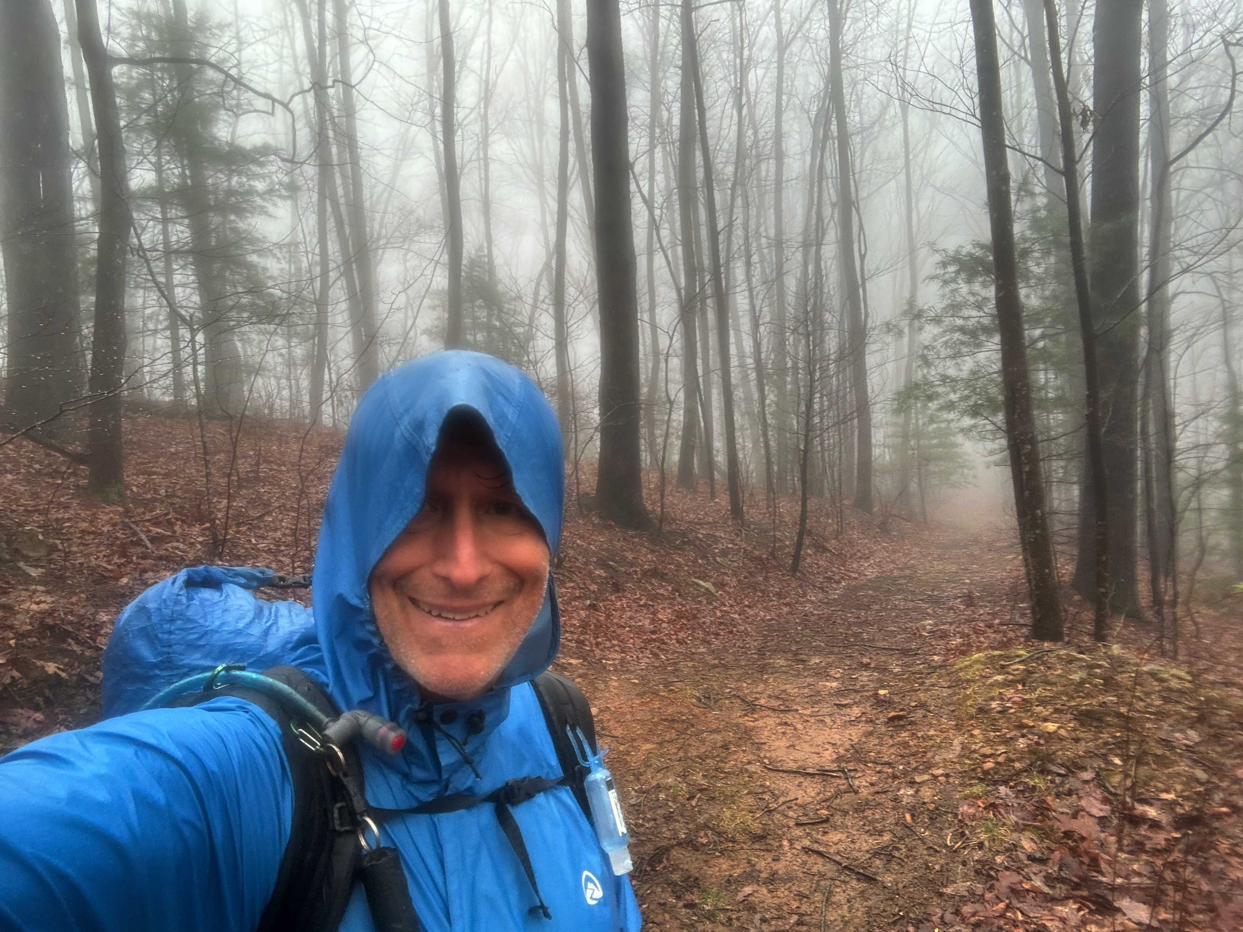
Tough day, only a little over 14 miles but well over 4000 feet of elevation gain. Tomorrow’s hike is over 16 miles but only 3000 feet of elevation game so probably easier.It was raining when I woke up and rained all morning sometimes heavy sometimes light, but it never stopped.
I stopped at noon during a brief lull in the rain on a high ridge to eat some crackers. Did not want to haul out my food bag because the rain could start up at any time. As I was sitting there it slowly got dark. Ominous. I started hiking and the thunderstorm hit. Very heavy rain, lightning and thunder.
It only lasted 15 minutes or so, but it was hard to hike. About 15 minutes after this, another hiker caught up with me. It was Weedeater! He had hopped off the trail yesterday, which is how I was able to pass him since he is much faster. It was nice seeing him again.
I got to Double Hog Pen gap campsite about 3:30 PM. It was not raining so I was able to set up the tent and filter some water.
I have a little bit of cell coverage and was able to get the Weather app to work. It shows a 50% chance of more rain in the next couple hours, but no rain tomorrow! Which is good, since I am rapidly running out of clothes to wear.
Day 6, Apr 1, BMT 82.9
And I thought yesterday was hard! I’m totally wiped. Currently camped at double Spring gap. It was a cold morning, probably in the high 30s when I started hiking around 7:45 AM. But it warmed up nicely and turned into a lovely day, especially in comparison with yesterday’s shit show. I passed the spot where the Pinhoti Trail ends into the BMT.
I got to my campsite just after 5 PM. So it was a very long day (9 hours, a little over 16 miles). I did take a long lunch at least an hour to lay out the tent and my clothes to dry.
Day 7, Apr 2, BMT 93.8
Good news! I got a phone call last night around eight (yes I have limited cell coverage here) from a shuttle driver (Seth). So I have a ride into Ductown, Tenn when I get to the trailhead.
It’s much warmer today, in the mid 50s when I packed up. Started hiking about 7:30 AM and immediately started climbing up Big Frog mountain. It’s a 1000 foot climb over about a mile and took me about an hour.
The wind started picking up as I near the top and by the time I reach the top it was blowing hard. There is a high wind advisory for the area. But it could be worse, there are tornadoes west of us near St. Louis.
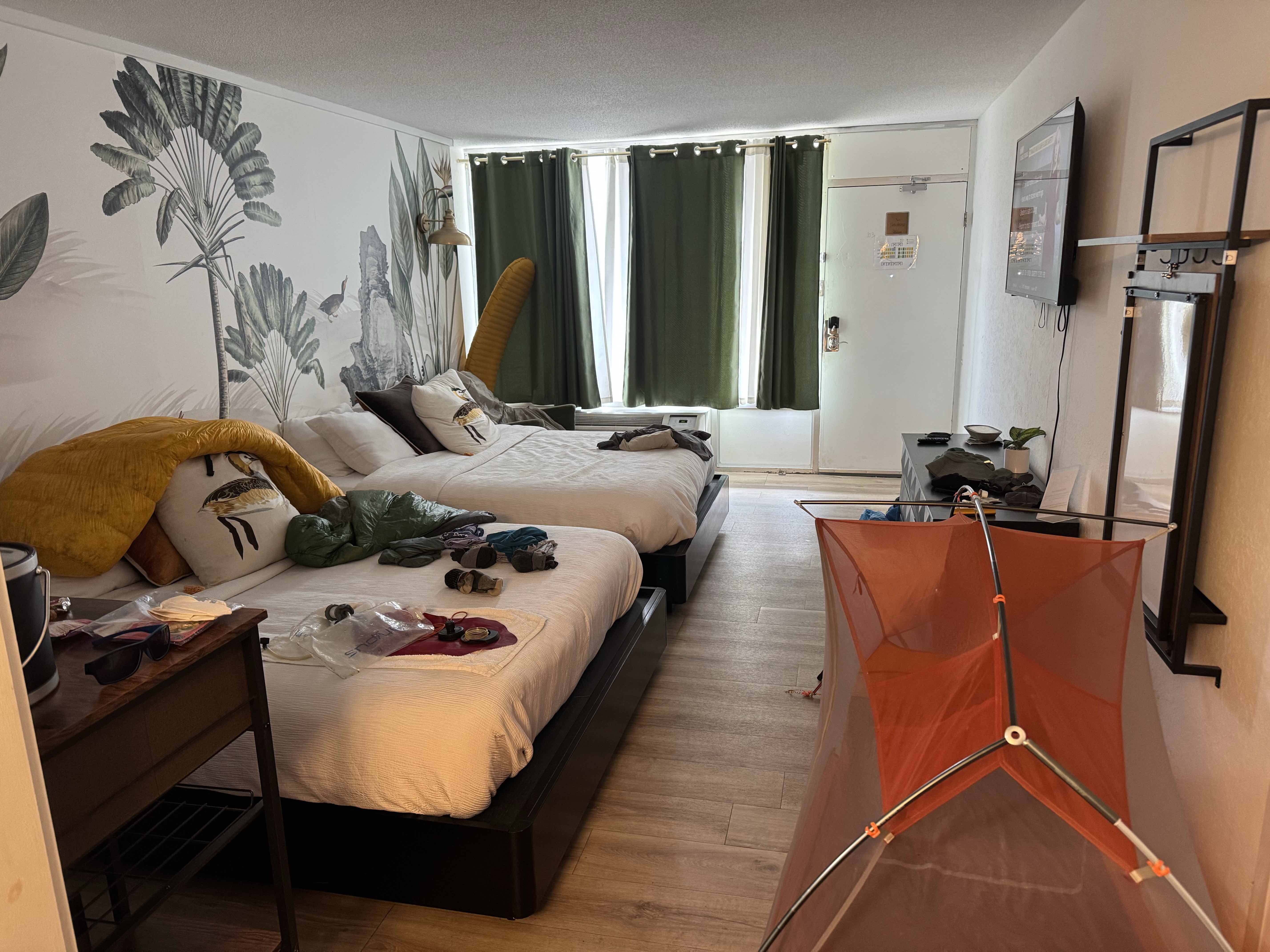
Got to Thunder Rock CG about 1:00. Met a day hiker who, of course, offered me a ride into town. Seth arrived about 1:20 and I was at the Mallard Hotel by about 1:30 PM. On the trip I asked Seth if he was available on Friday to take me back to the trail and he said yes.
I was able to resupply at the Dollar General and even got pizza delivered to the hotel so not a bad place for a zero day.
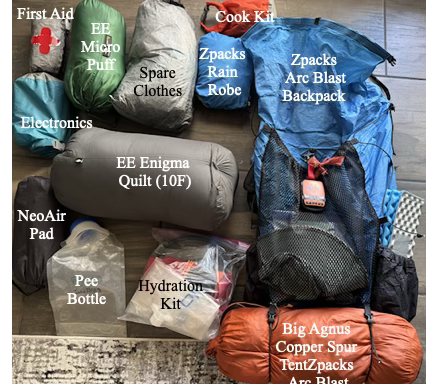
Base weight is everything you carry excluding food, water and fuel. Weight is VERY important. The difference between carrying a 25 lb pack versus a 45 lb pack up a 2,000 foot climb is huge and has gotten even more important as I have aged. And, since I have to fly to the start, I have a travel bag that holds my pack and poles and converts to a pack liner when I arrive.
My base weight is 15.0 lbs so with 10 lbs of food and 2L of water I will still be under 30 lbs when I start a section.
The “Big Three”
This is the pack, tent and sleeping bag and pad. My backpack is on it’s last legs – the material is starting to delaminate but I’m counting on the liner to give me one more big hike before I retire it.
Item
Type
Weight (Lbs)
Backpack
Arc Blast
1.8
Travel Bag/Liner
Zpaks
0.2
Sleep Pad
Therm-a-Rest NeoAir
0.8
Sleep Quilt
EE Enigma (10F)
1.5
Tent
BA Copper Spur UL 1
2.3
6.5
Cooking/Hydration/Toiletries/First Aid
My cook “kit” consists of a titanium mug, a canister stove and a spork. For water I use a Platypus filter, a couple of 2L collapsable bladders and a 4L “dirty” water bag (plus some hoses). Toiletries consists of a toothbrush, a poop kit (trowel, wet-wipes), reading glasses and sunscreen and… that’s about it.
Item
Type
Weight (Lbs)
Cook kit (minus fuel)
0.4
Hydration
Platypus
1.2
Toiletries
1.0
First aid kit
Including Epi-Pen
0.8
3.4
Clothing (not worn)
The weather looks to be mild so I can leave my long johns at home. I always bring emergency clothing (micropuff, rain gear) .
Item
Type
Weight (Lbs)
Hat/gloves
Zpacks beanie
0.4
Rain Gear
Zpacks Rain Robe/wind pants
1.2
Micropuff
EE Torrid Apex Jacket
1.0
Sleep wear
Shorts, t-shirt
0.7
Socks, buffs, etc
Toe socks
0.3
3.6
Electronics/Misc
I am taking two external 10,000 mAHr batteries. Each one should recharge my Iphone 15 twice and keep my headphones and keyboard charged.
The southern terminus of the BMT is about 2 hours north of Atlanta. My plan is to fly into Atlanta on March 27, take the MARTA red line 2o miles or so north to the Sandy Springs Station and then have a shuttle take me (~70 miles, 2 hours) to the Springer Mountain trailhead.
I arrive around 10:30 so am hoping I can get a least a few miles down the trail the first day.
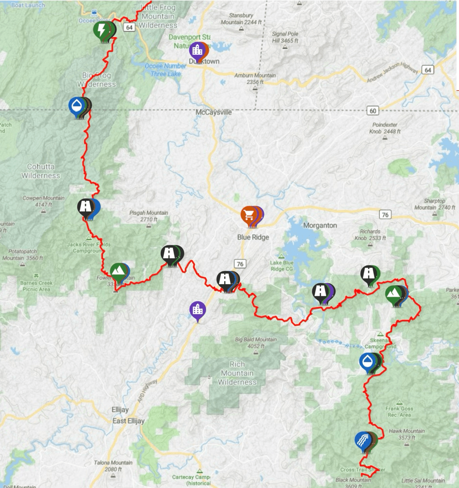
Section 1 (Springer Mountain to Thunder Rock CG, 94 Miles, 6 Days, 23,000 Ft):
The trail starts near Springer Mountain in the Chattahoochee-Oconee National Forest, about 80 miles north of Atlanta. The start of the trail is within a quarter of a mile of the start of the much more famous Appalachian Trail. In fact, the two trails cross several times and basically take a parallel path north.
BMT Section 1
I hope to get 6-8 trail miles on the day arrive so I can complete the remaining 90 miles in the following 6 days. Five of those will be in Georgia, and the last in Tennessee, finishing at Thunder Rock CG on the Ocoee River around noon on April 2. From there I will either hitch or try to find a shuttle for the ~7 miles of highway to Ducktown for my first zero day.
Day
Date
Miles
Climb (ft)
BMT Mile
0
27-Mar
8.0
750
8.0
1
28-Mar
15.0
4,100
23.0
2
29-Mar
14.5
3,300
37.5
3
30-Mar
14.9
2,300
52.4
4
31-Mar
14.2
4,050
66.6
5
01-Apr
16.3
3,250
82.9
6
02-Apr
10.9
1,600
93.8
7
03-Apr
ZERO
Ducktown
Resupply options are limited in Ducktown (just a Dollar General) but there is a real grocery store about 4 miles south in Mackaysville if I can figure out a way to get there.
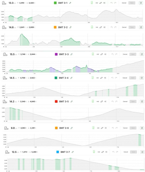
Cell coverage in the first section is pretty good. The figure below shows voice (green) and data (purple) for each day. Importantly it shows voice coverage at the end so I may be able to contact a shuttle.
Elevation profiles and cell coverage in Section 1
Section 2 (Thunder Rock CG to Fontana Dam, 95 Miles, 6 Days, 25,500 Ft):
The second section winds northeast along the Tennessee/North Carolina border for 95 miles, ending at Fontana Dam, a TVA dam on the Little Tennessee River. The first day on this section is longer than I would like but it allows me to get to a real campground (with running water!).
BMT Section 2
Day
Date
Miles
Climb (ft)
BMT Mile
8
04-Apr
17.5
3,400
111.3
9
05-Apr
15.8
3,560
127.1
10
06-Apr
15.3
4,150
142.4
11
07-Apr
15.0
3,700
157.4
12
08-Apr
16.0
4,600
173.4
13
09-Apr
16.6
3,700
191.5
14
10-Apr
ZERO
Hike Inn
There is a resort complex (lodge, campground, marina), Fontana Village Resort right on the trail as you approach the lake at the end of this section. However, the day I plan to arrive, Wednesday, April 9, the entire resort is booked for a private event (even the campground?). So this very convenient rest stop is not available. And, on top of that, the cell coverage is terrible here.
So….. my plan is stop at the Tapoco Lodge (about 10 miles from the Fontana Village) and arrange a shuttle pickup from The Hike Inn , a hiker-friendly hostel about 9 miles east of the dam.
Elevation profile and cell coverage in Section 2.
Section 3 (Fontana Dam to the End, 99 Miles, 7 Days, 20,250 Ft):
The last section is entirely in the Great Smoky Mountains National Park (GSMNP) where free camping is not available and campsites have to be reserved. I plan on reserving these from The Hike Inn and am hoping that the Giant Orange Turd’s attack on the national park service does not impact my plans.
BMT Section 3
Day
Date
Miles
Climb (ft)
BMT Mile
15
11-Apr
13.2
2,400
207.6
16
12-Apr
15.1
2,200
222.7
17
13-Apr
15.7
3,200
238.4
18
14-Apr
14.7
4,150
253.1
19
15-Apr
14.5
3,100
267.6
20
16-Apr
10.0
4,000
277.7
21
17-Apr
12.0
1,200
289.7
3.0
Hostel
Cell coverage (with T-Mobile) is very poor. I will not have cell coverage at any of my campsites and rarely during the day. But there is coverage near the end so will be able to contact Standing Bear Hostel to arrange a pickup if I don’t want to walk 3 road miles to their place.
Elevation profile and cell coverage in Section 3.
I plan on staying a night at the hostel before shuttling in to Knoxville for my return flight to Houston in April 20.
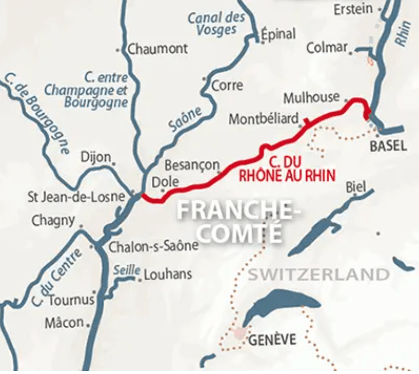
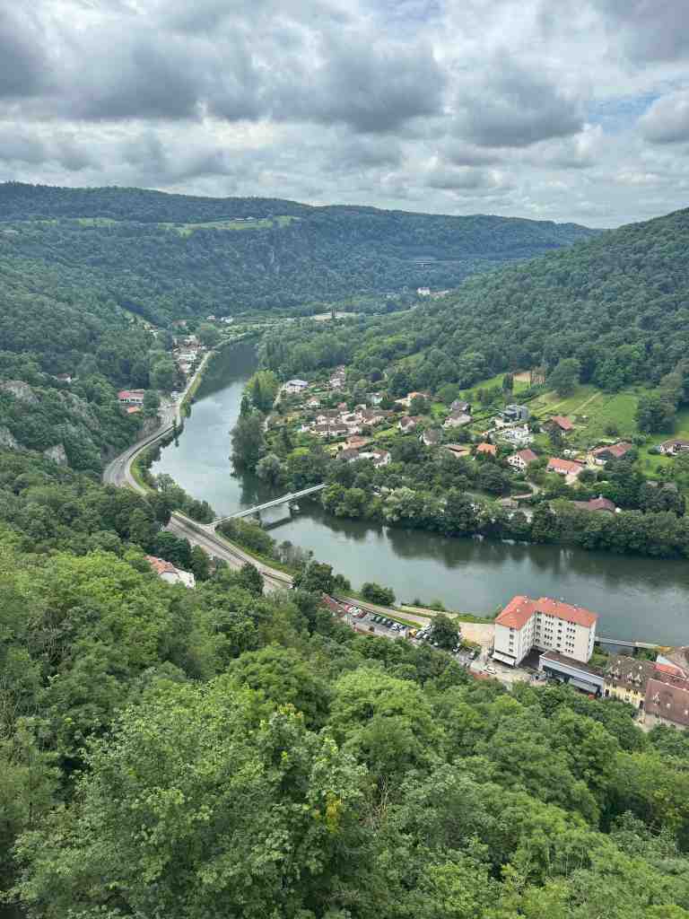
The Canal du Rhône au Rhin is a 237 km long canal that connects the Rhone River with the Rhine River. It is one of the popular routes for boats transiting from the Mediterranean Sea to the North Sea. We saw numerous sailboats on the canal that were transiting. We spent a couple weeks this past July travelling the length of the canal.
From west to east the canal starts on the Saône river just north of our home base of St-Jean-de-Losne, heading east-northeast to finally terminate about 13 km from the Rhine in the city of Mulhouse. To enter the Rhine you have to take the short Huningue Canal to the Niffer lock.
Locking up… from the Saône to Montreaux-Chateau
Leaving the Saône just north of our home port of St-Jean-de-Losne the canal rises through 75 locks to top out 175 km later and 160m higher in the little town of Montreaux-Chateau. For this part to of the canal lock operation is “automatic” with the use of remote that was given to us at the first lock entering the canal from the Saône.
Our itenary for this section:
From
To
Dist (Km)
# Locks
Time (Hrs)
St-Jean
Dole
21
7
4.5
Dole
Ranchon
20
7
4.5
Ranchon
Besancon
35
11
8.2
Besancon
Fourbanne
29
8
5.9
Fourbanne
L’Isle-sur-le-Doubs
37
15
7.9
L’Isle
Montbeliard
24
12
5.3
Montbeliard
Montreaux
22
12
4.9
Dole
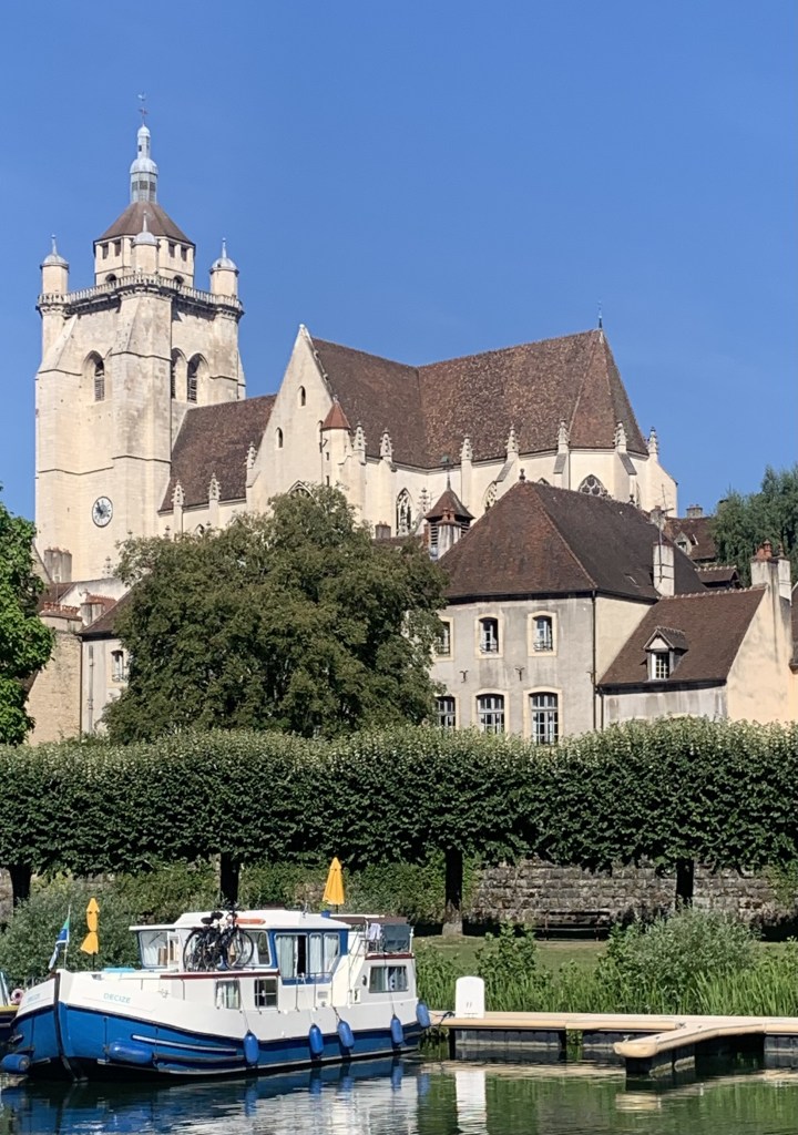
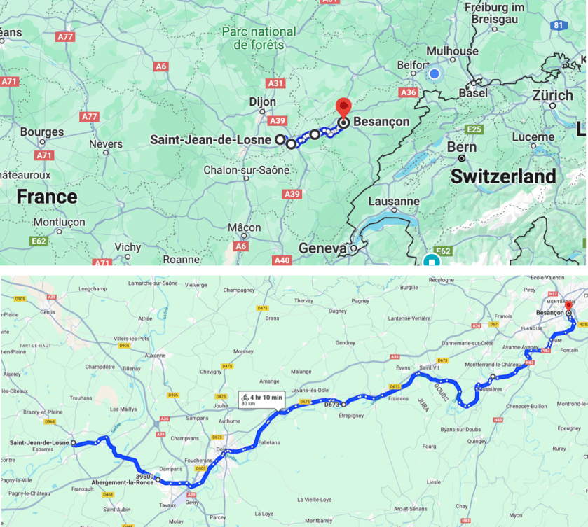
The three day cruise from St Jean to Besancon has become one our favorite short trips for visiting friends. Dole is a lovely town with an the city mooring is near the city center.
Dole from the city mooring
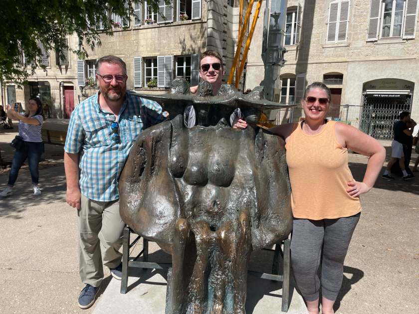
And you can’t miss the Pasteur museum (Louis was born here and they are very proud of the fact).
Louis Pasteur (well, his head anyway)
From the Saône to Dole is almost entirely in the canal and there is one ~5Km stretch through an “industrial zone” (a chemical plant of some kind). But there are some very pretty parts and the section as you leave Dole is particularly attractive.
Leaving Dole on the Canal du Rhone au Rhine
Besancon
The Citadel of Besancon as you approach the city.
The approach to the city of Besancon is one of the most dramatic on the entire French canal system. The view of “The Citadel” from the river is amazing. The stretch from Dole to Besancon is mostly in the Doubs, the river that supplies most of the water for the canal.
Besancon has a long storied past reaching back to the Roman era and there are Roman ruins scattered throughout the city. You have the choice on entering Besancon of taking the tunnel under the Citadel or staying in the river and doing La Boucle around the old city.
The walk up to the Citadel is steep but the views are amazing. The Citadel (designed by Vauban in 1684) is now a museum and zoo and definitely worth a visit.
The Doubs from the Citadel
Montbellaird
Three or four days of cruising brings you to the next major stop on the canal, Montbeliard (though there are several lovely little towns on the way). This is also where you have to contact the VNF if you are continuing east.
Montbeliard is a big city with great restaurants and excellent train service (for visiting guests). There is really lovely park near the marina and the city center is a short walk away. And the walk into town takes you right past the Musée du Château des Ducs de Wurtemberg.
Musée du Château des Ducs de Wurtemberg
Montreux-Chateau
One easy day from Montbeliard takes you to the top of the Canal, 160 meters above the Saône. Leaving Montbelliard you pass through the industrial town of Sochaux. And just past Sochaux you pass over the Allan river on a canal bridge.
Passing over the Allan River
There is not a lot in Montreaux (not even the ruins of a chateau, just a hill where it used to be) but it is a good place to rest up for the lock chains to come.
Storks!The “Chateau”
Locking Down to Mulhouse
We started the day from Montreau by dropping off our lock remote at the first lock of the day (#2) and meeting our itinerant lock-keeper. From here to Mulhouse (34 KM) all 37 locks are manually operated by a VNF eclusier who accompanies you all day.
Lots of Locks! Looking back up the first lock chain.
From
To
Dist (Km)
# Locks
Time (Hrs)
Montreux
Dannemarie
10
15
4.0
Dannemarie
Mulhouse
23
23
7.0
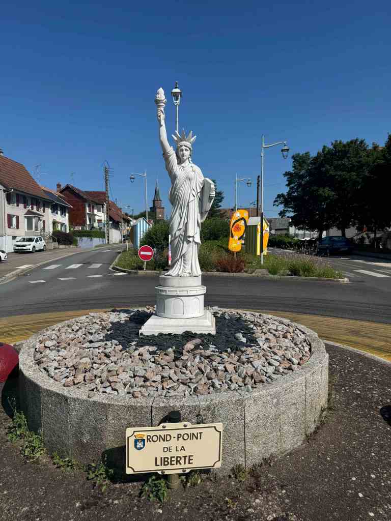
The first 10 locks are all in 2 Km before they start to spread out a bit. We were told when we arrived in Dannemarie that we would have to wait a day to proceed as they were “full”. Since each boat (or two boats travelling together) requires a lock-keeper, they can only handle so many boats a day.
The Dannemarie Statue of Liberty
Fortunately Dannemarie has a few restaurants and a decent supermarket and we lucked into a free concert on the canal.
Wine and music!
Mulhouse and the Rhine
Another long day of locking with a friendly lock-keeper and you arrive in the city of Mulhouse. The locks are spaced a bit farther apart and there is one swing bridge.
The swing bridge just past Lock #34
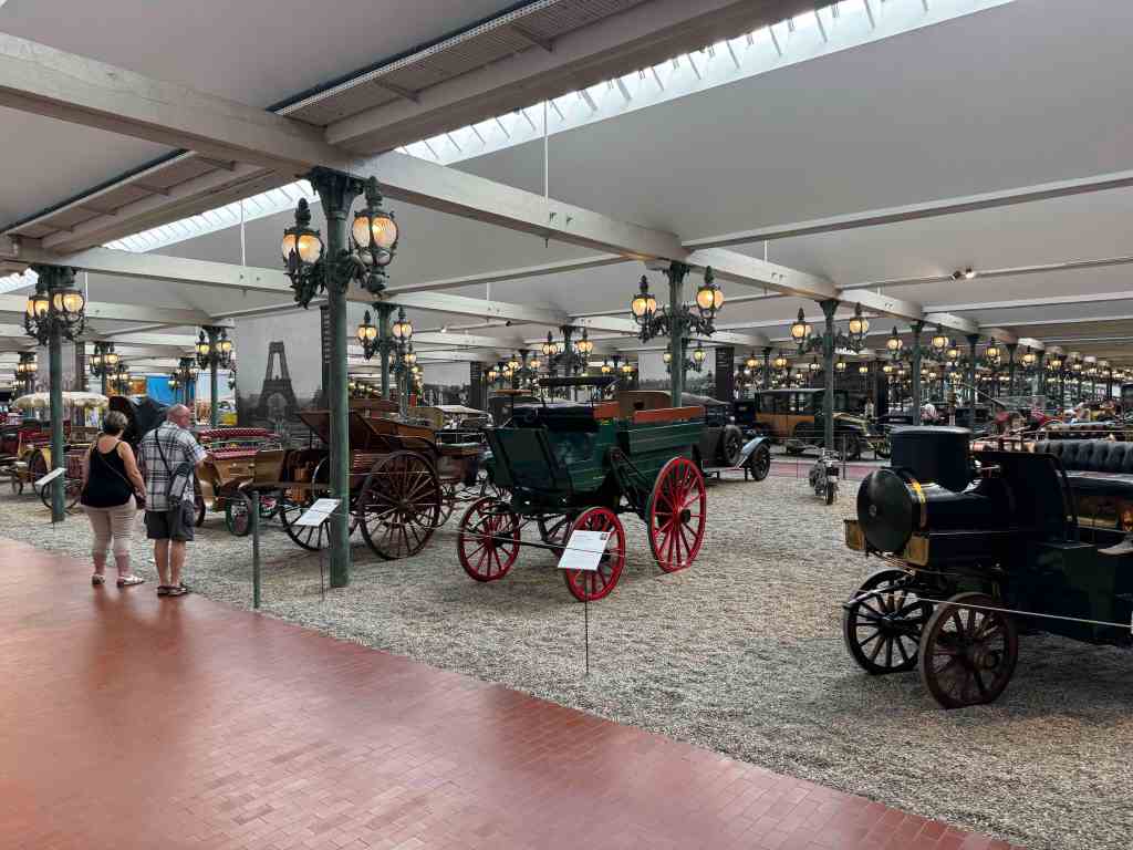
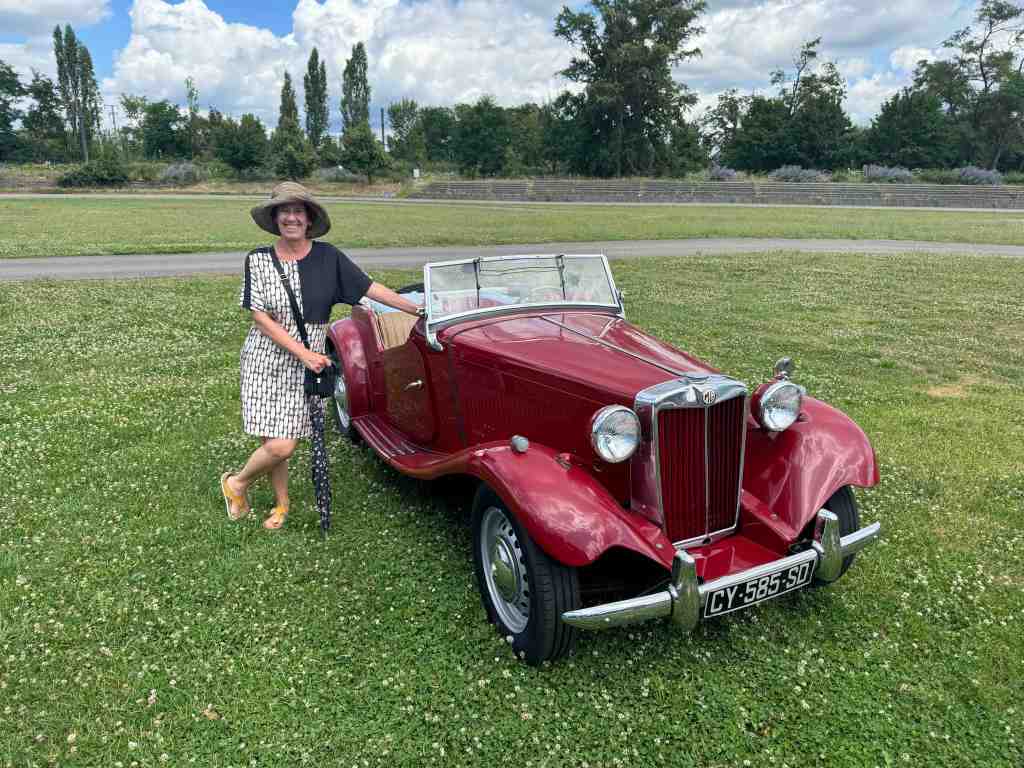
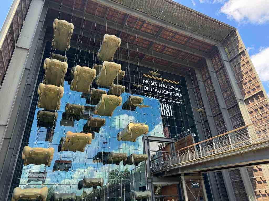
Mulhouse has a great old downtown area, lots of shopping and the national auto museum of France (a must see). And, as usual, the city marina is right in the middle of the old city.
The very impressive Temple Sainte-Etienne in Mulhouse
To reach the Rhine river from Mulhouse is an easy 13 Km on the Canal de Huningue where it joins the Grand Canal d’Alsace (the canalized Rhine River). No time this year to go further but next year we plan on a grand loop that will take us from Mulhouse up to Strasbourg.
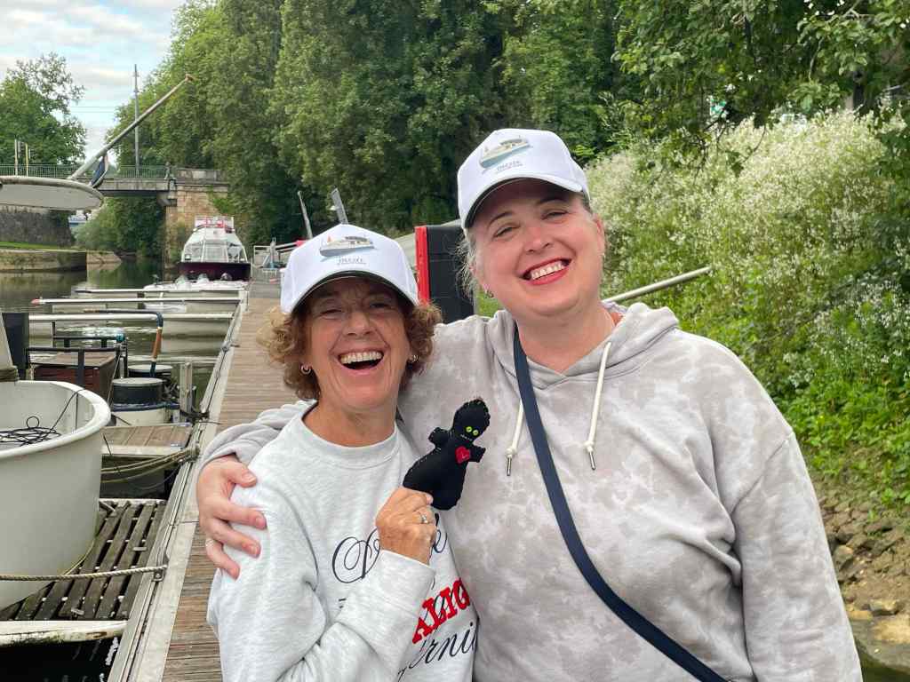
Whenever one of their children graduates from high school my niece Danielle and her husband Perry take them on a European tour. This year it was Abel’s turn. In addition to Scotland, Spain and Greece they carved out a week on Decize.
Saint Jean to Besançon
They arrived a day late (thank you EasyJet!) and we took them out to one of our favorite restaurants in St Jean, Bistrot La Cotinière.
First night in Saint-Jean-de-Losne
Cruising to Dole
The next day we headed out on one of hour favorite short routes, SJL to Besançon. First stop…. Dole.
After a warm day seeing the sights in Dole we had dinner at Demi-Lune where Perry and Abel did battle with a serious fondue.
We have met the fondue and he is ours!
Then on to Ranchot, a tiny little town on the way to Besancon.
The canal leaving Dole
We arrived in Ranchon and, after mooring and walking around a bit, set up for a picnic dinner on the side of the canal.
Cruising with wine!Danielle’s new beauGin 1, Abel 0
On to Besançon
Then on to one of our favorite cities in France, Besançon (birthplace of Victor Hugo). After a long day of cruising in and out of the Doubs we entered La Boucle de Besançon (the part of the river that circles the city).
The Citadel, fortress overlooking Besançon
We spend our day here visiting the Citadel, the Museum of Time and the Victor Hugo museum…. and drinking.
View of the Doubs from the CitadelDefender of the Realm!Yes… he really is that tall.Voodoo queens!A nice cocktail. Abel poses with a new friend.
And before we knew it the week was over and were walking our friends to the train station.
We delayed our return from Turkey, staying a day in Dijon and then getting an AirBnB in St Jean for a couple of nights to give the H2O workshop a bit more time to finish up the work they were doing.
In Dijon we stayed at our favorite hotel (ibis Styles Dijon Central). In St Jean our favorite place to stay (Les Charmilles) was booked so we tried a new place (La Marina). It was right on the river with views and a ful kitchen which was nice.
View from our B&B in St Jean
Covid!
But.. as we were moving back onto the boat I started feeling a bit off Friday (June 19) and by Sunday was sure I was sick. Got some Covid tests from the pharmacy and confirmed that, yes, after four years, I finally managed to catch Covid-19. Felt like a moderately bad flu.
Gray and back…
After of week I finally tested negative and we set out on a little shakedown cruise ahead of the arrival of our second set of guests of the season (my niece Danielle, her husband Perry and their recently graduation son, Abel). We headed up the Saone toward Gray.
AuxonnePost-Covid CocktailHotel Barge
We have had a lot of rain this summer and the Saone is running much faster than normal and is up quite a bit. The Canal du Nivernais (which we had planned to do this year) is closed and looks to be that way for a while.
Debris on the Saone, flowing fast!
We had planned to stay a few days in Gray but got to talking with another boater (Peter, from England) and he suspected the dock we were at would be flooded in the next few days so we headed back south to St Jean to get the boat ready for our guests.
Martini Night!
Sure enough… the docks in Gray were flooded the next day so we made a good call.
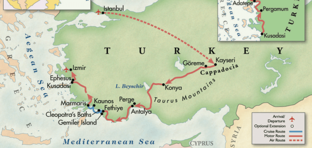
We interrupted this year’s French floating fun to spend three weeks with friends on an Overseas Adventure Travel excursion in Turkey. We had been (briefly) in Istanbul 10 years ago on our way back from Africa but that was just a taste.
Istanbul and Cappadocia
We arrived in Istanbul on June 1 and spent a few days touring the usual sites (along with a lot of other tourists) before flying to Cappadocia.
We toured the Blue Mosque, the Hagia Sophia and Topkapi Palace and saw lots and lots of cats. They really love cats here.
MeowA run along the Sea of MarmaraHere!Swimming in the Sea of MarmaraThe throne in Topkapi Palace
We managed to get in a couple of early morning runs (it gets hot pretty quickly) and I jumped into the Sea of Marmara after one of them. Not exactly Lord Byron swimming the Hellespont but very refreshing.
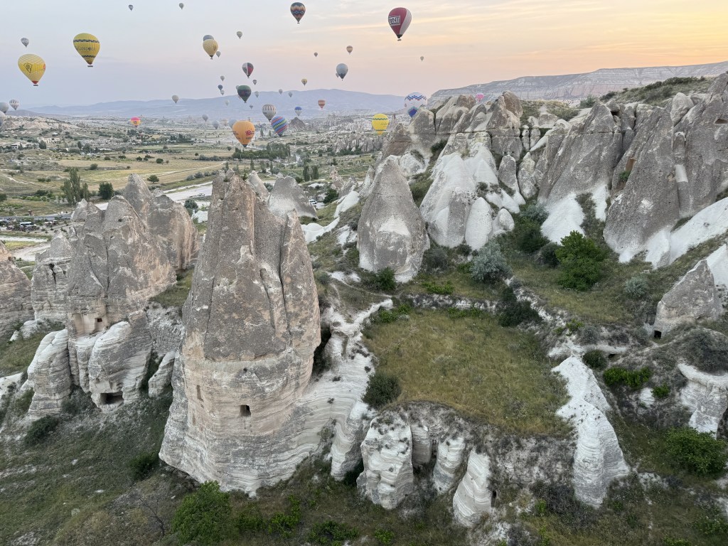
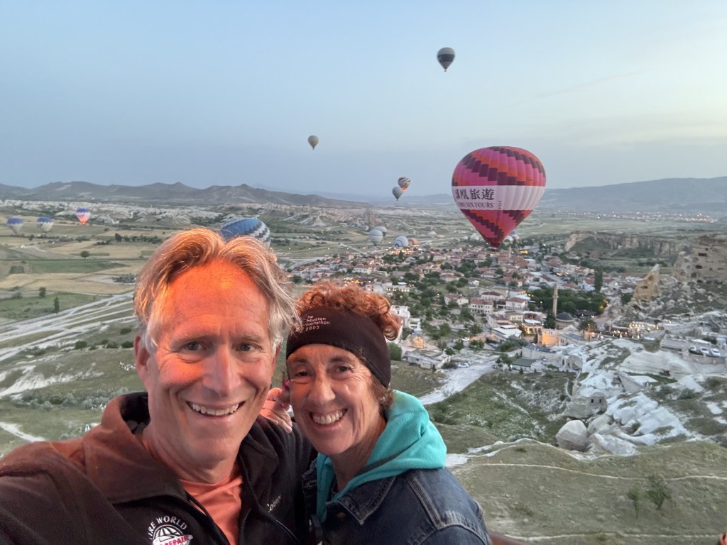
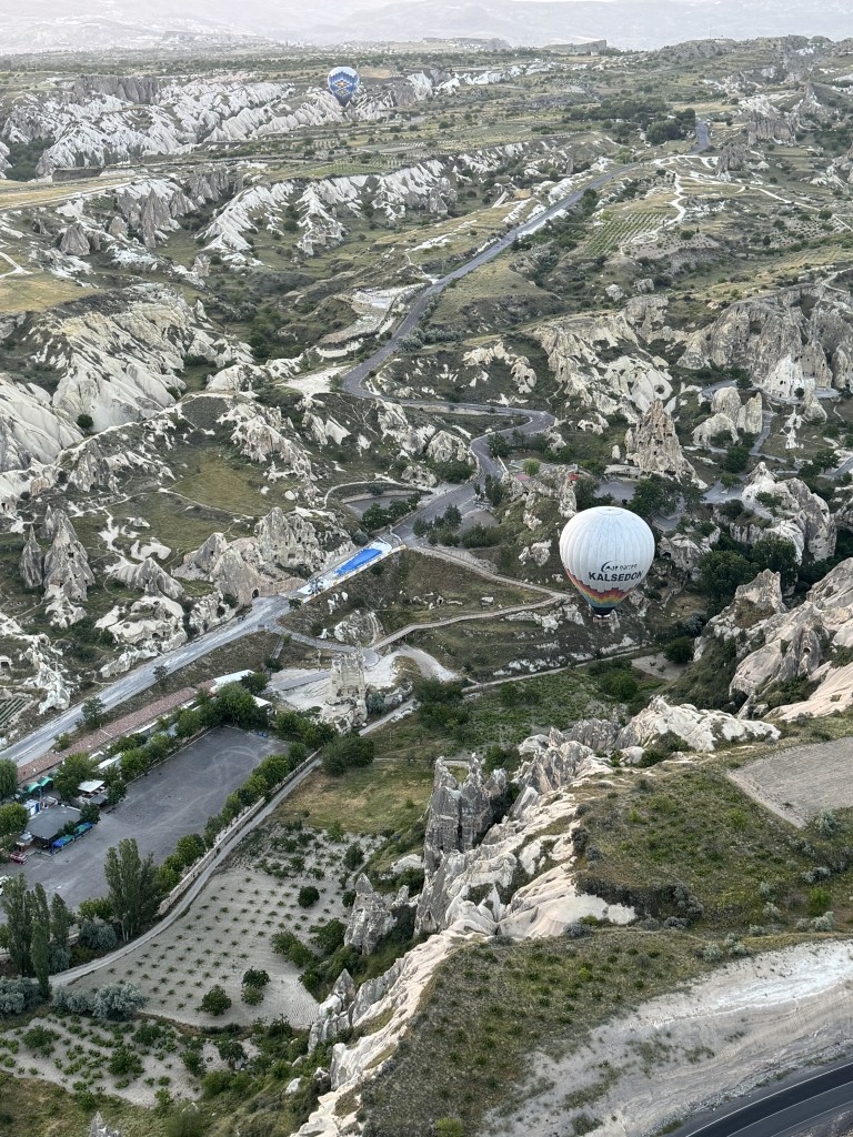
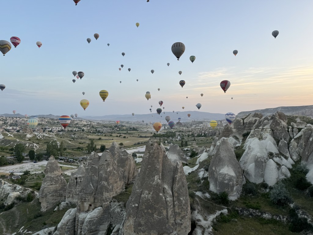
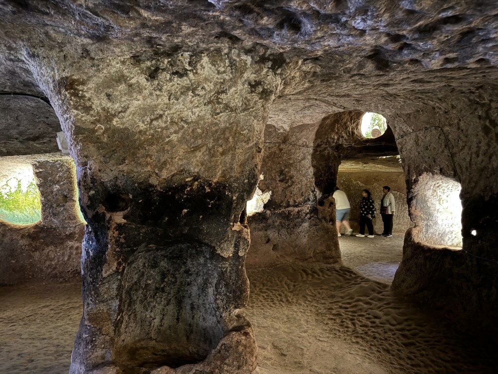
After a few days in Istanbul our group hopped a plane to Kayseri in Cappadocia with its famous cave dwellings and underground cities. Our first morning in Urgup we did a sunrise balloon ride.
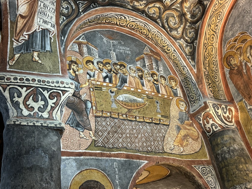
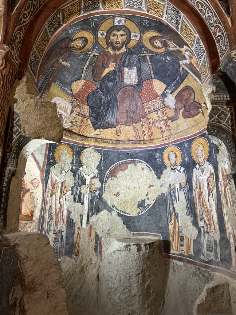
Cave church frescoGöreme open-air museum
One evening we went to a demonstration of the Sufi mystic practice of meditative dancing (Whirling Dervishes).
Whirling Dervishes
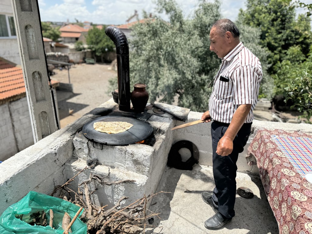
OAT makes a point on their tours of interacting with the local cultures. We had lunch with a family in a small town near Kayseri and then dinner with a family in Antalya.
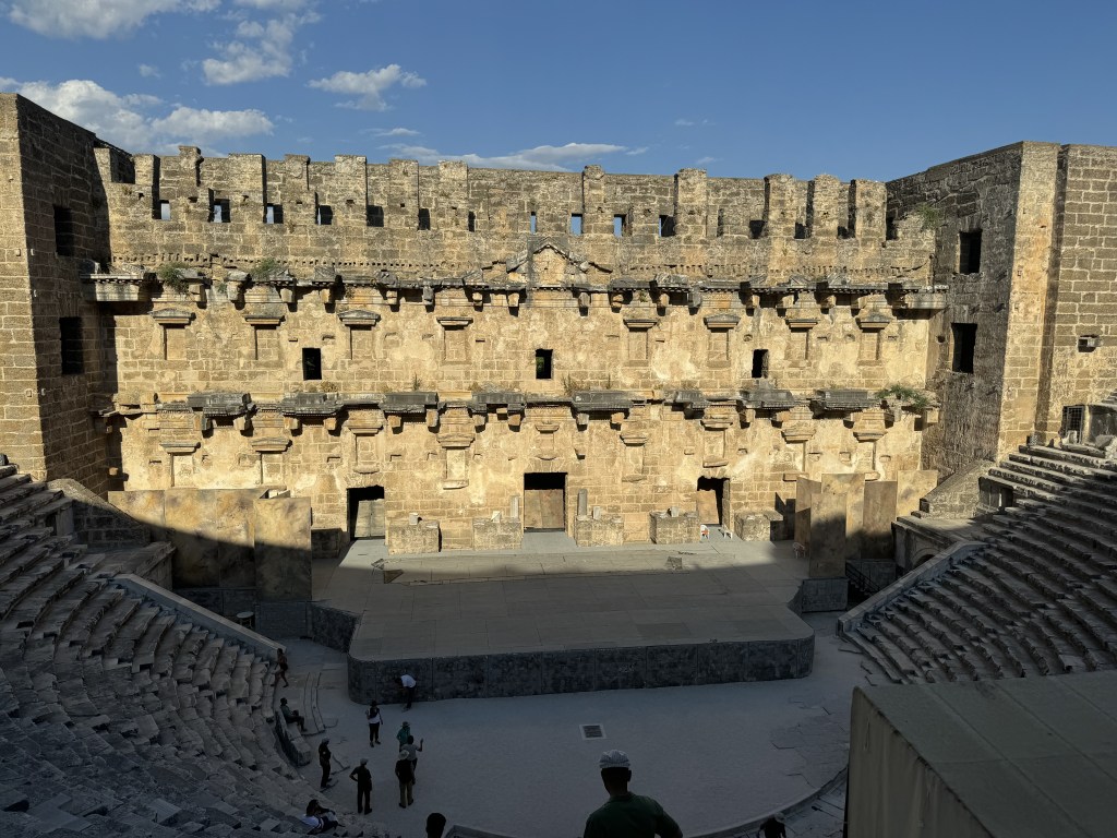
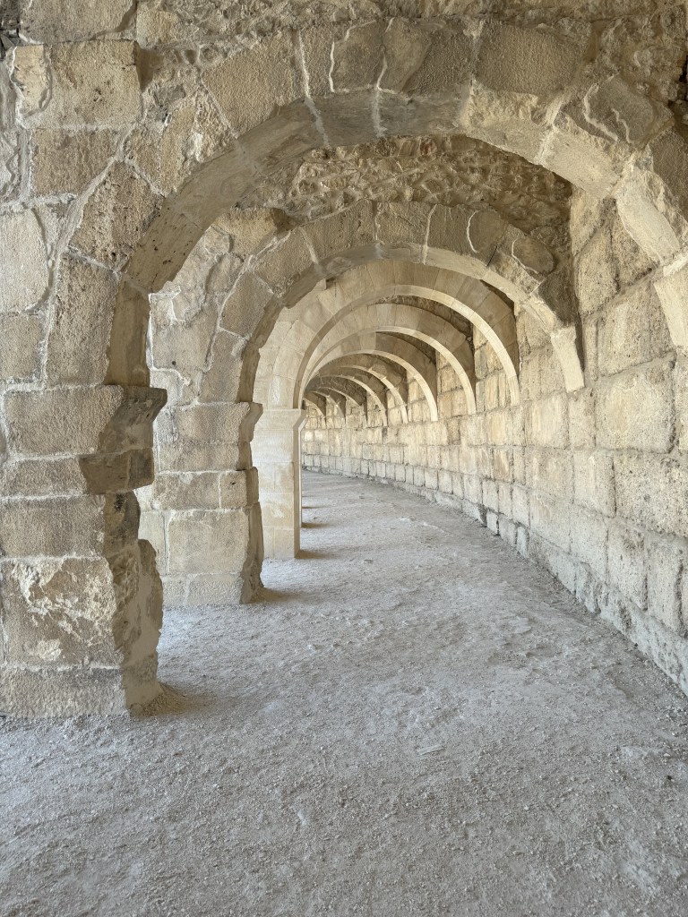
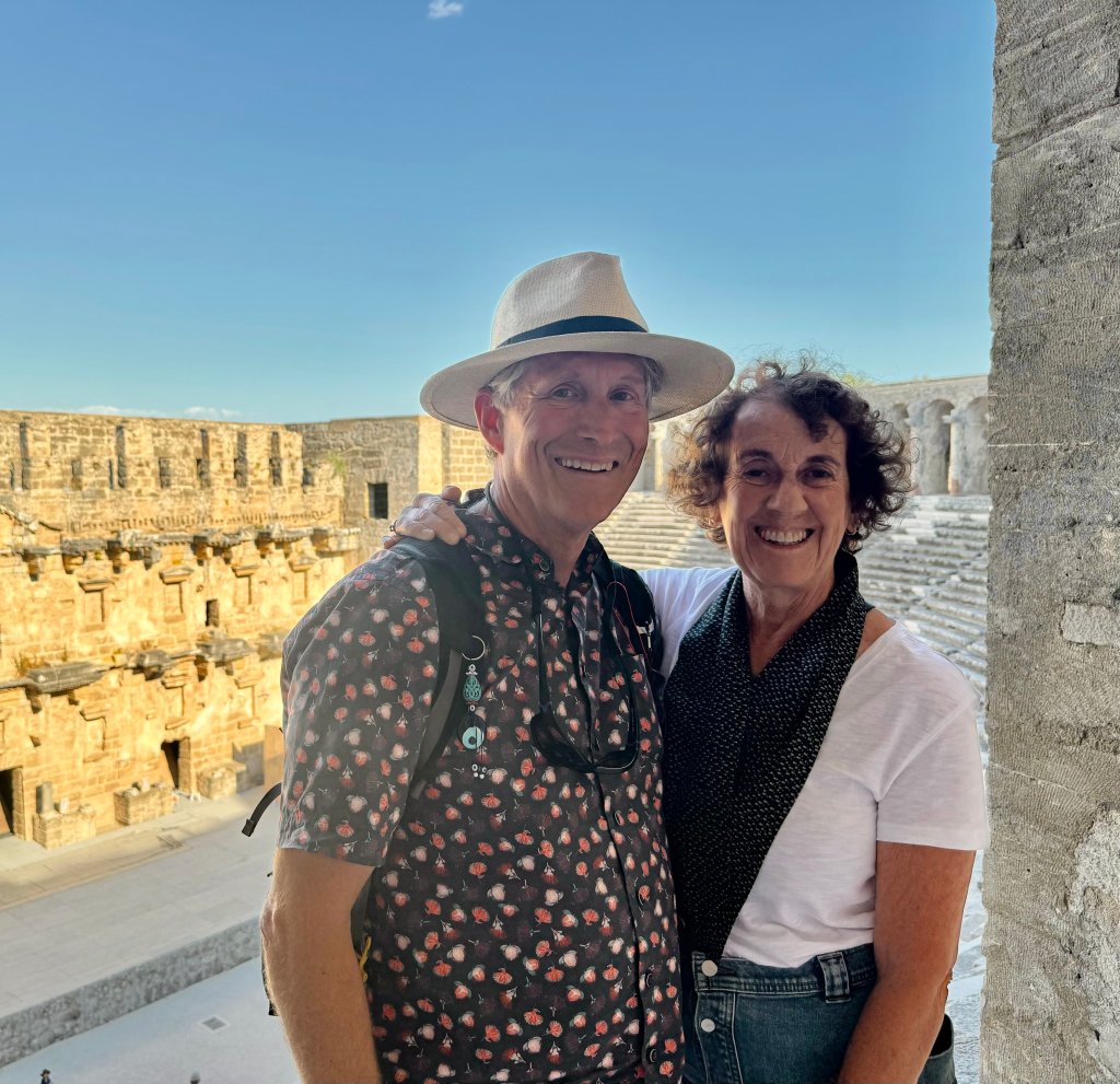
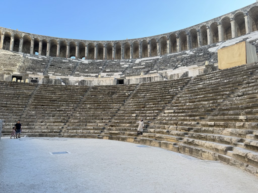
On our long bus ride to Antalya we made a brief detour to see the ancient Greek/Roman theater of Aspendos. One of the best preserved ancient theaters in Turkey, and it’s still in use.
Aspendos Theater
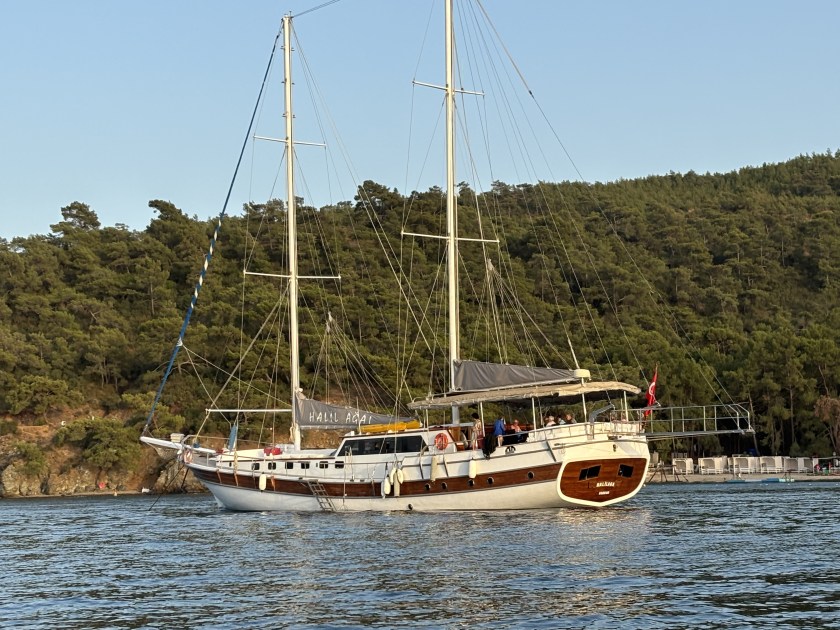
The Gulet
From Antalya we travelled to Fetihye where we boarded a traditional Turkish Gulet (the “Halil Aga I”) for four days of coastal cruising.
Our Gulet
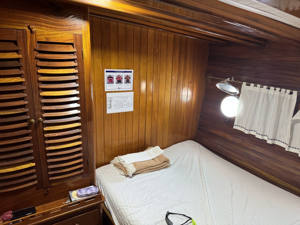
She was about 60 feet long with 8 staterooms, each with a private bath. The beds were comfortable but we never slept in them – because of the heat we slept on deck. There was a captain and a crew of three (cook, first mate and a helper).
They never put up the sails which was a little disappointing.
One of our pretty mooring spots.
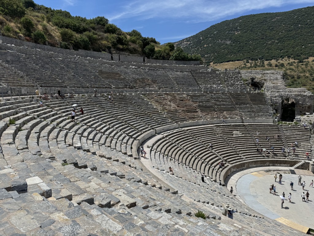
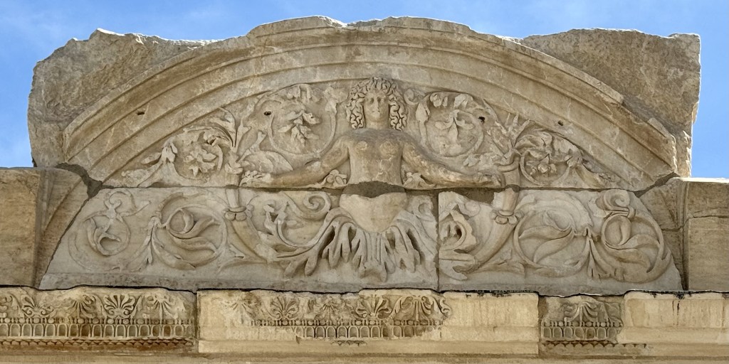
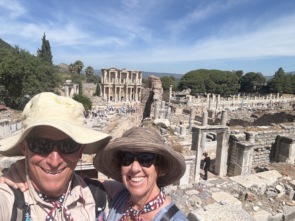
Ephesus
Our last adventure was a tour of Ephesus and the Ephesus Museum. Ephesus is on the big cruise ship route so there were a lot of people but it was still fascinating.
Library at Ephesus
And always remember to use the correct pose for photographing ancient Turkish ruins..
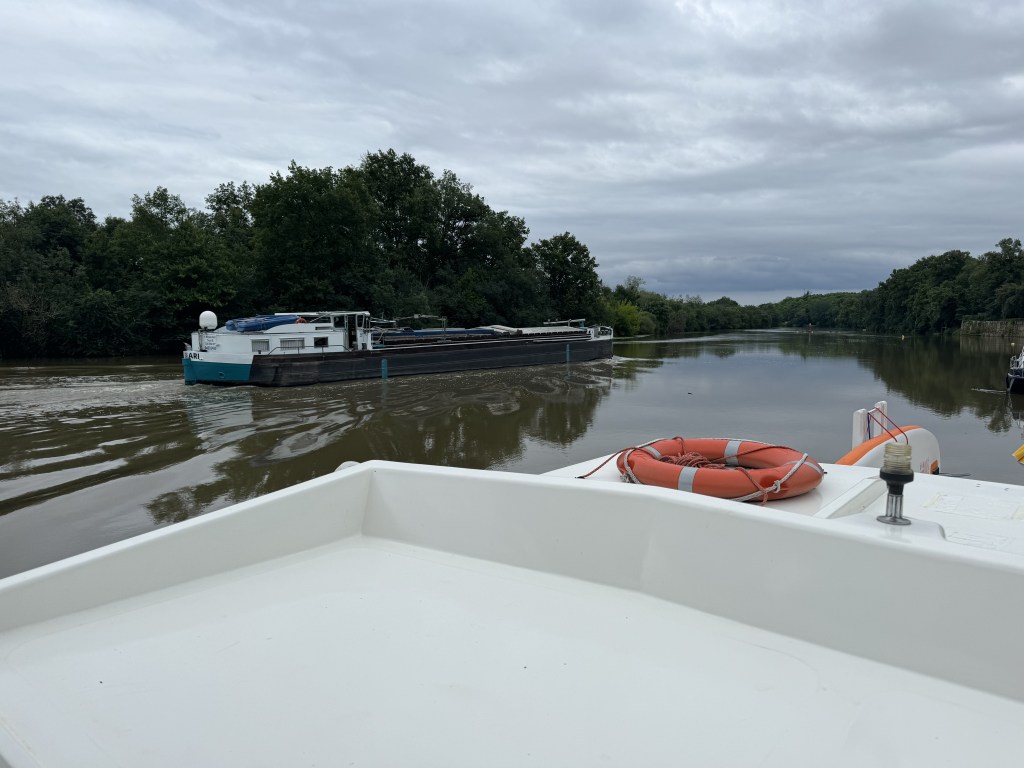
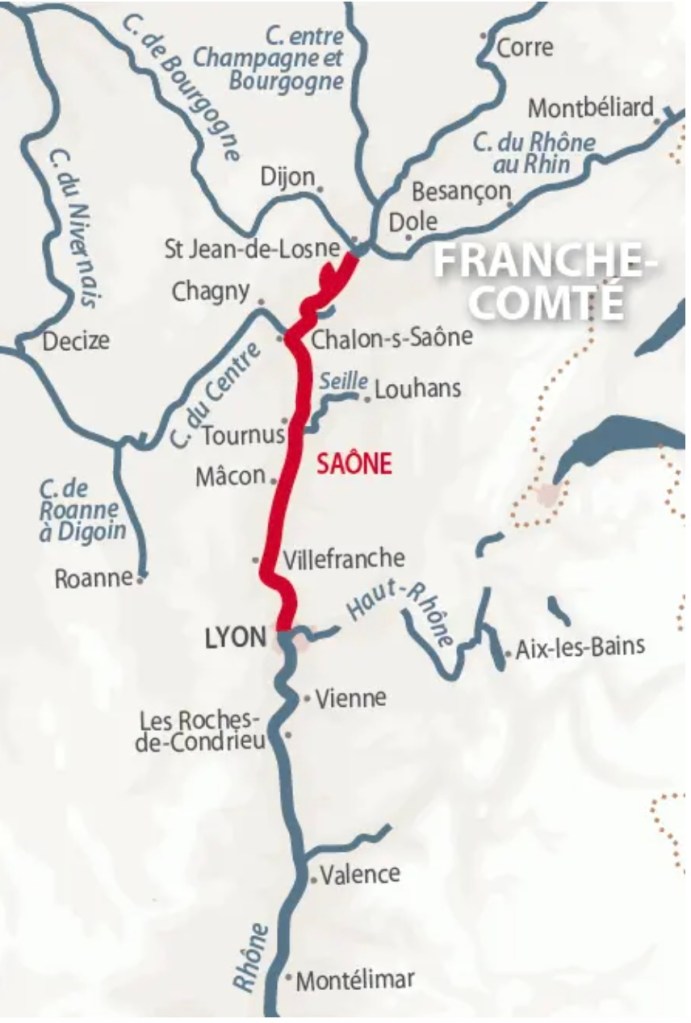
In the “Grande Saone”, from our home port of St-Jean-de-Losne to Lyon where the Saone joins the Rhone, there is commercial traffic. The four locks in this portion of the Saone (covering 215 km) are big. Really big: 190 meters (620 feet) long by 12 meters (39 feet) wide. They can comfortably fit 25-30 boats the size of Decize.
Barge on the Grande Saone
We will typically see one or two of these guys every day. It gets really exciting when you have to follow one into the lock (yes, we will sometimes follow one of these into a lock – sometimes with more than one pleasure boat).
We also see hotel barges from the Rhone that make it all the way up to St Jean.
Hotel Barge
There is usually no problem being on the river with these bigger boats. They move quite a bit faster than us but you geet used to looking back every so often to make sure one isn’t coming up from behind. This guy passed us as we headed out of Chalon-sur-Saone this morning: